
Matthew70
-
Posts
1,301 -
Joined
-
Last visited
Content Type
Profiles
Blogs
Forums
American Weather
Media Demo
Store
Gallery
Everything posted by Matthew70
-
I’ll say this. The GFS is going down with the ship that the low stays south.
-
I’m going to be sick. If that happens it will be a true disaster. With the cold behind this system means it gets really dangerous for many & good grief and the busted pipes. Sigh.
-
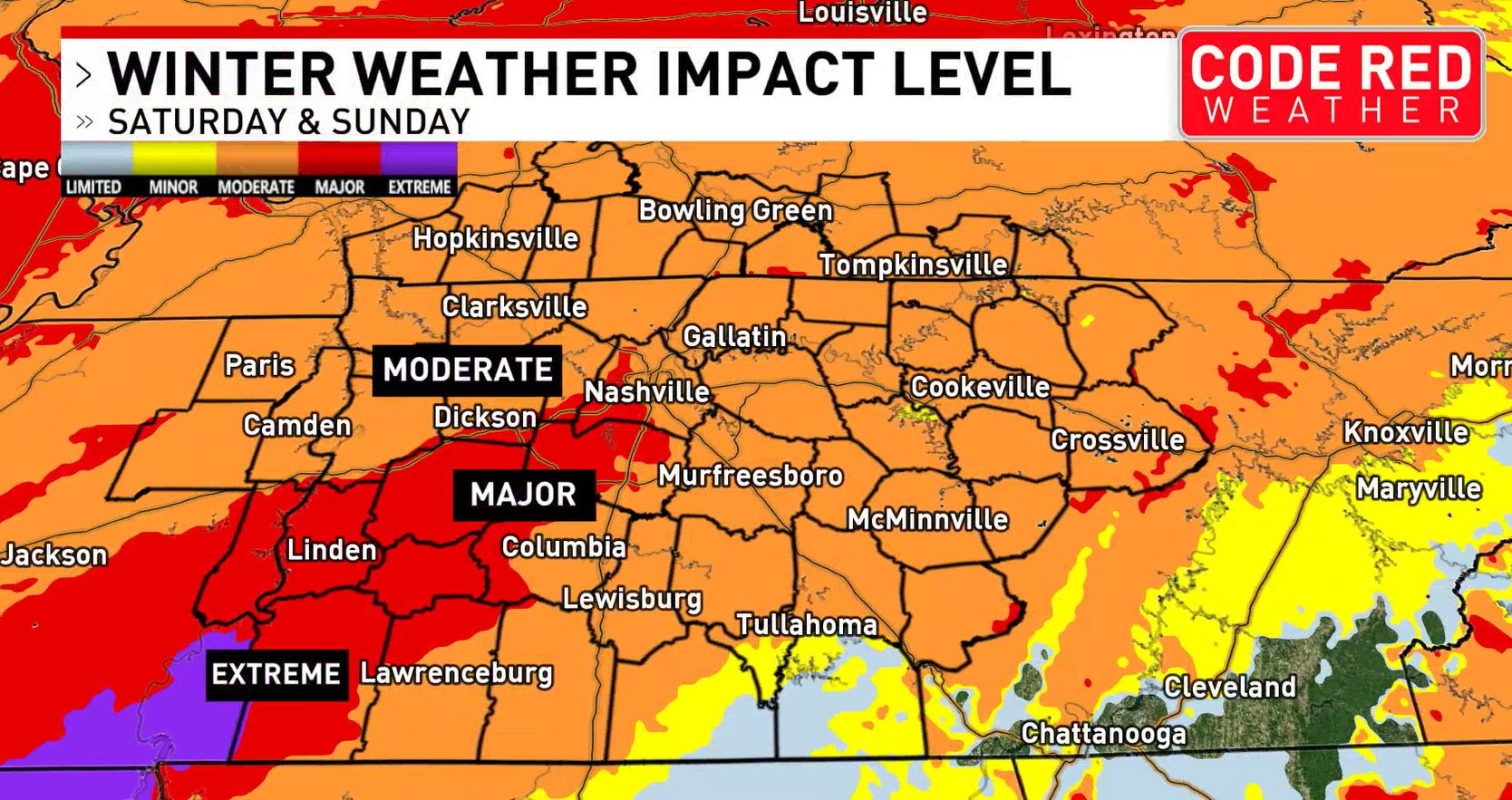
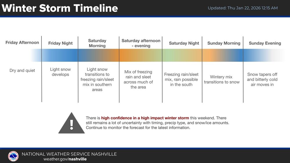
Nashville is now included in a major impact.

-
Would that not be awesome. Even the 18z euro trended south.
-
Might be a lot of people don’t like me after this if they don’t have electricity for a while. Lol.
-
Oh heck no. Thankfully it’s the GFS
-
Ouch
-
-
Thank you!
-
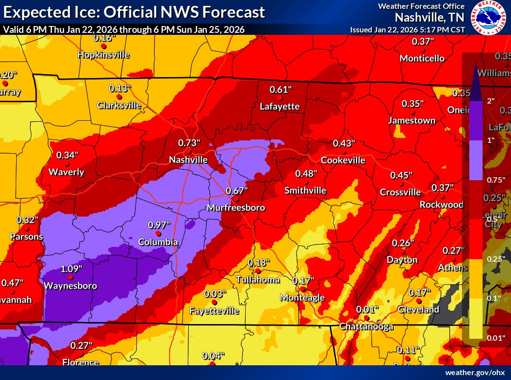
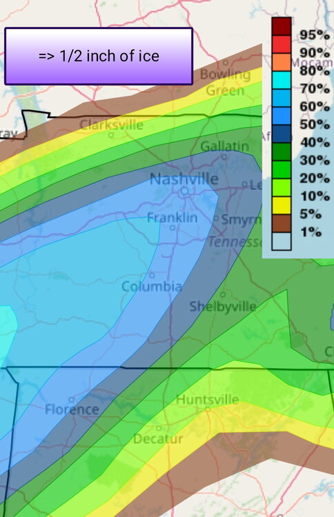
Not sure what I’m looking at.
-
Less ice is always a good sign. Only issue is it’s the crazy uncle.
-
Hopefully the Lucy avatar is paying off!
-
Not sure where he works but seems to be Nashville based.
-
Does the GFS finally break up with us all or does it still love us all.
-
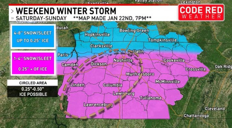
Boyd 01z H-triple-R at midnight Saturday night as depicted in images. Forecast OHX sounding may have enough depth to the lower cold layer to turn liquid to ice pellets before reaching the surface, but freezing rain is looking likely Saturday night here in Nashville and in general Middle Tennesse. Keep in mind that freezing rain is a 1:1 ratio. 1 inch of liquid rain equals 1 inch of ice (glaze). To have a system of this magnitude to come through Middle Tennessee and not produce 1 to 2 inches of liquid QPF would be unusual. I can see latent heat becoming a big player in this event. When water freezes, it gives up heat energy to the environment. Latent heat. #TNwx #KYwx #ALwx
-
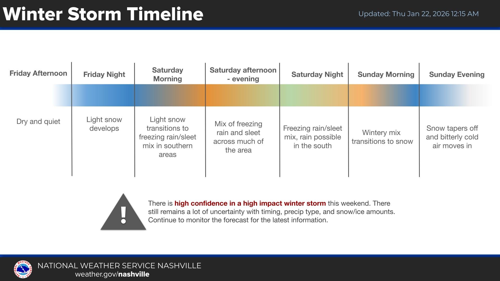
It seems this is growing as a long drawn out multi day winter storm. I know it was already going to be but I expected it to be outta here by Sunday afternoon.
-
Dang. This is setting up to be bad here.

-
For the last few hours I’ve seen several forecasters saying it’s slowing down. So what does that mean for the downstream effects.
-
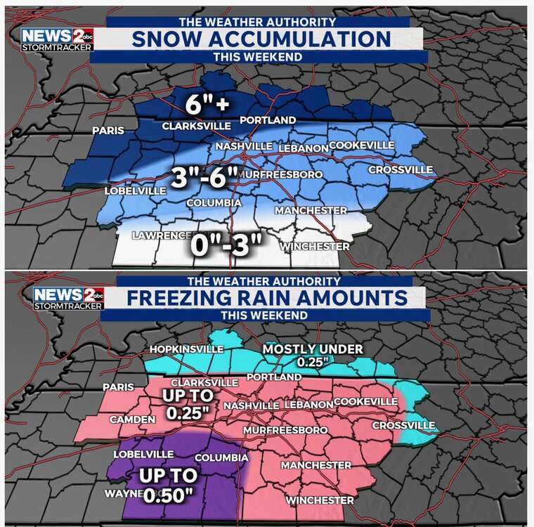
PLEASE SHARE: We are expecting snow, sleet, freezing rain, & rain. As of now, here’s what our team is thinking as far as snow & ice accum. The biggest takeaway is that travel will not only be dangerous but nearly impossible at times. Power outages are expected. Watch @WKRN!
-
No worries.
-
Seems I remember not to long ago in the Midwest it was posted where there were severe thunderstorms warnings & blizzard warnings simultaneously. They were overlapping one another.
-
That’s not for this upcoming system that is a past winter storm.
-
Davis Nolan
-
21z H-triple-R showing forecast for midnight Saturday night. As for Nashville, we should be seeing a mix of sleet...freezing rain at that time that continues through the overnight into Sunday. QPF amounts are at least 1 inch through Sunday morning, and i'm being conservative. Let's pray that much of it is in the form of sleet. If it's ice accretion or even a good part, we'll have major issues here in Nashville and surrounding areas. Heavier ice accretion looks be over southwest Middle Tennessee. . Boyd