the_other_guy
-
Posts
2,918 -
Joined
-
Last visited
Content Type
Profiles
Blogs
Forums
American Weather
Media Demo
Store
Gallery
Everything posted by the_other_guy
-

Refresher snow & obs between ~midnight and Noon Sat Feb 17 2024
the_other_guy replied to wdrag's topic in New York City Metro
Nice 2-3 inch event in Westchester. Freshen things up.
-
Refresher snow & obs between ~midnight and Noon Sat Feb 17 2024
the_other_guy replied to wdrag's topic in New York City Metro
That’s fine. There seems to be a concerted effort here to make 38° sound like it’s a normal overnight temp in February and cold enough for snow. The snow is gonna have to start falling and the temperature is gonna have to cool down. And all that has to happen in an urban environment. And that will affect total accumulations. That’s all I’m saying. -
Refresher snow & obs between ~midnight and Noon Sat Feb 17 2024
the_other_guy replied to wdrag's topic in New York City Metro
I never said it wasnt. I said temps would be marginal to start. And here is a newsflash for those reinventing the wheel: 38F at 10pm is a marginal for the start of a snow storm -
Refresher snow & obs between ~midnight and Noon Sat Feb 17 2024
the_other_guy replied to wdrag's topic in New York City Metro
Called this situation this afternoon. Marginal temps in city -
Refresher snow & obs between ~midnight and Noon Sat Feb 17 2024
the_other_guy replied to wdrag's topic in New York City Metro
It is 40 right now in CPK. I love your optimism, but it will take a while to cool down tonight in city -
Refresher snow & obs between ~midnight and Noon Sat Feb 17 2024
the_other_guy replied to wdrag's topic in New York City Metro
I think you’re asking the wrong question. I think the right question to ask is what is the probability of Central Park getting the lowest amount of snow in the region again? And I think that’s actually likely. Again, a marginal temperature situation in a marginal winter in an urban environment. If this keeps trending north, I wouldn’t be surprised to see Northern suburbs get more snow than central Park even though Central Park has more precip than the northern suburbs. And that’s what happened this past week. Most of us still have snow on the ground… The Central Park have any left? -
Refresher snow & obs between ~midnight and Noon Sat Feb 17 2024
the_other_guy replied to wdrag's topic in New York City Metro
What is the HRRR say Overnight is key for the city with temps in the 30s -
Wow its windy out! Wasnt expecting that this morning.
-
Great. No offense, I need more than that.
-
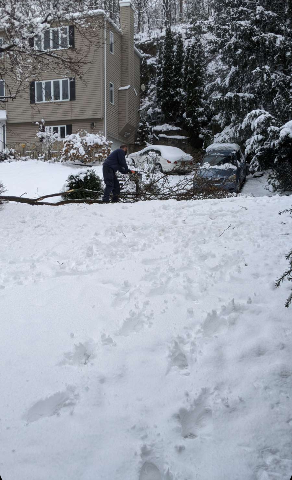
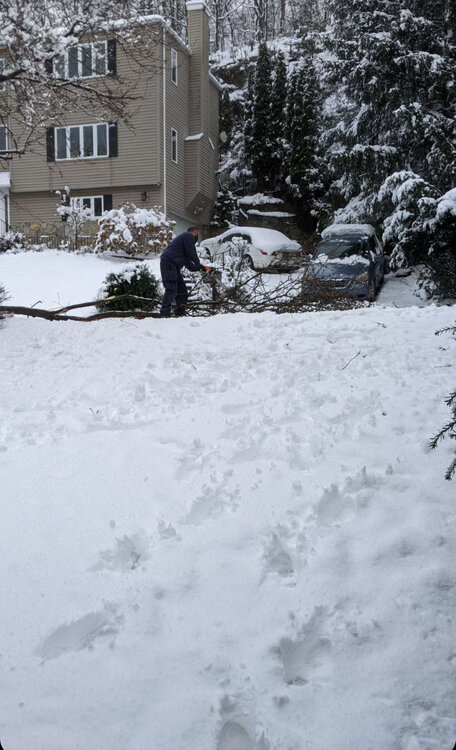
Lost part of a tree. But with my sky high taxes, the chain saw gang was right behind the plow. Im impressed
-
You and Don did an excellent job. Early Spring type snow event
-
We don’t know that they do measure low. It is a narrative on this site. If it was really that bad at one of the Marquis weather sites in the country (because of location) it would be fixed. The fact that it isnt tells me it isnt as bad or off as many on this site claim it to be. More of a folklore with a little grain of truth gone wild.
-
Even snow cant make thar place look nice. Geez
-
This is typical north/west does better in these warm type events. They always do better because it’s too warm in an urban environment for snow this winter. You are overcoming A LOT with cement and 35F.
-
El Nino One and Done. Very common. This is the one for the season for the city. Enjoy it
-
I can count like 3 or 4 in my adult life. The most famous being the Xmas Day Storm with 20 people in my parents house
-
This!
-
I’m not getting into debate on global warming. It’s ridiculous. Like the 5th winter in a row of significant warmth. Frankly, Im dont care. But I dont deny reality.
-
I have an early January bday and up until recently always had snow on ground or falling within 24 hours of it. As someone else said, February was always best for snow, but it has warmed so much its all out the window
-
It really isnt. It is a 287 North/West event plus or minus a few miles. The further south of that you are, the less significant it becomes. This will be the fourth snow event like this this season
-
This whole thing has gotten so ridiculous. It is fucking science. If you want snow in marginal air you need grass trees and natural surfaces that cool rapidly . The whole winter has become a March snow event. Its too warm, theres too much cement, there is 12 feet of elevation. Daytime, anything but heavy…you are done. Getting mad at NW people or pretending it is a non event is literally getting angry at science and climate. It is bizzare
-
i’m walking the dog right now in shorts. It’s become a regular thing this winter at 287. Forget the city
-
I love the whiplash emotions on this forum. For reference, I posted AccuWeather 1 to 2 inch call several days ago. They have been spot on all year. And I love how rocksteady they have been run after run after run after run of models and the whiplashing emotions on this page. Let me tell you what’s gonna happen next in case you haven’t watched this show before. the models are gonna go south again and all these guys that want snow in the city are going to jump on board thinking it’s finally gonna happen. …And it wont. And some lawn either side of 287 will get a 2 inch snow fall. The reason that it will happen like that is because the city is running 5° above normal this winter. And it’s too warm to snow in an urban environment with temps like that The end What a winter on this forum!
-
given that early voters are generally Democrat, but South shore voters are generally republican, should balance no?
-
You always say 84 tho. Thats why people tune you out and call you a troll, which isnt nice. Last time you said 84 as I was shoveling 30 miles south of 84.