the_other_guy
-
Posts
2,918 -
Joined
-
Last visited
Content Type
Profiles
Blogs
Forums
American Weather
Media Demo
Store
Gallery
Everything posted by the_other_guy
-
what a rare day. Cooler and drier as the day goes on under clear skies in the summer. Very rarely gets to turn off the air condition as the day goes on in the summer. It was quite warm still this morning
-
I cant even imagine. Was on boat in Sound. Stiff south wind the whole time
-
I cant believe it went north again! every single storm has missed me by a couple of miles north or south!!
-
A drop and not much else as storm went south towards Yonkers
-
It’s 50 and humid in December now Give me the long days!!
-
Still not a drop of rain. Hopefully today
-
I’ve been waiting all day in Westchester. Not even a drop. Let’s see if this line approaching the Hudson holds.
-
One thing you have to appreciate is the stability of our new weather regime since the super El Niño. The highest departures to our north is a very common theme. It’s been incredibly stable summer and winter in these types of set ups.
-
Love cool crisp mornings after a cold front in summer. Quite a few this June! 58F this morning
-
Im in buffalo waiting for my ground delay to turn into a ground stop
-
I always chalked it up to God or nature being able to “water” much better than man can. Your 10-15 mins of water is nothing compared to a 10 minute downpour simply because you are watering a patch of grass but all the plants alongside that patch are pulling water from the soil with their roots
-
You guys crying for rain make me laugh. If it didnt rain a drop for the month, we would still be well ahead for the year. May you never know a real drought like out west.
-
This pattern has been especially noticeable in the winter in the last seven years
-
The population center got it today
-
Man that line from 78 had staying power!!
-
I dont know. I keep reading about these storms on here. In Westchester, the event was totally underwhelming. Even the last line at 12 am totally dissipated. That tornado in Lancaster was very cool to look at. but at least on here, I think a lot of guys in the New York City Metro are reaching for calling this some severe outbreak for us. Most of our storms were just heavy downpours. Yawn
-
Too much moisture in air. Cant cool down at night. Kinda holds you in a constant sticky airmass thru summer. There is a reason Florida rarely goes above 97/98 or below 70. You now have that airmass almost year round in NYC. It plays out as 40s/50s and dreary from Nov thru April and a miserable sticky summer from May thru the end of September. That is why your AC or Heat are on almost year round back to back. Very sad state of affairs and one not predicted for all the Warming talk 30 years ago. MOISTURE rules the day
- 1,603 replies
-
- 1
-

-
- spring
- cool temps
- (and 3 more)
-
What a line to wake up to! All by its lonesome. Next line is over Pittsburgh
-
I hear that storm just to our north in Westchester. Real monster. I just put the sprinkler on. I don’t think we’re getting much out of this round
-
Record was only 2 years old What a fucking mess we are in…do do do
-
Im with you. This is a long shit slog of rain from Nov thru spring with temps in 40s and 50s. Then a summer of bugs and humidity. It is terrible. Mentally, it is getting to be like the Pacific NW. Not good. Worth a move out west to a sunny dry type climate (Denver/SLC) if you can swing it
- 1,603 replies
-
- 3
-
-
- spring
- cool temps
- (and 3 more)
-
So is my 50 person communion party inside or out tomorrow? Really could use some help with this call
-
This!
-
Been a long time! But I was a bulls fan haha Back to the weather is there any chance of over performing tomorrow in terms of temperature?
-

Severe Weather 5-6 through 5-9-24
the_other_guy replied to cheese007's topic in Central/Western States
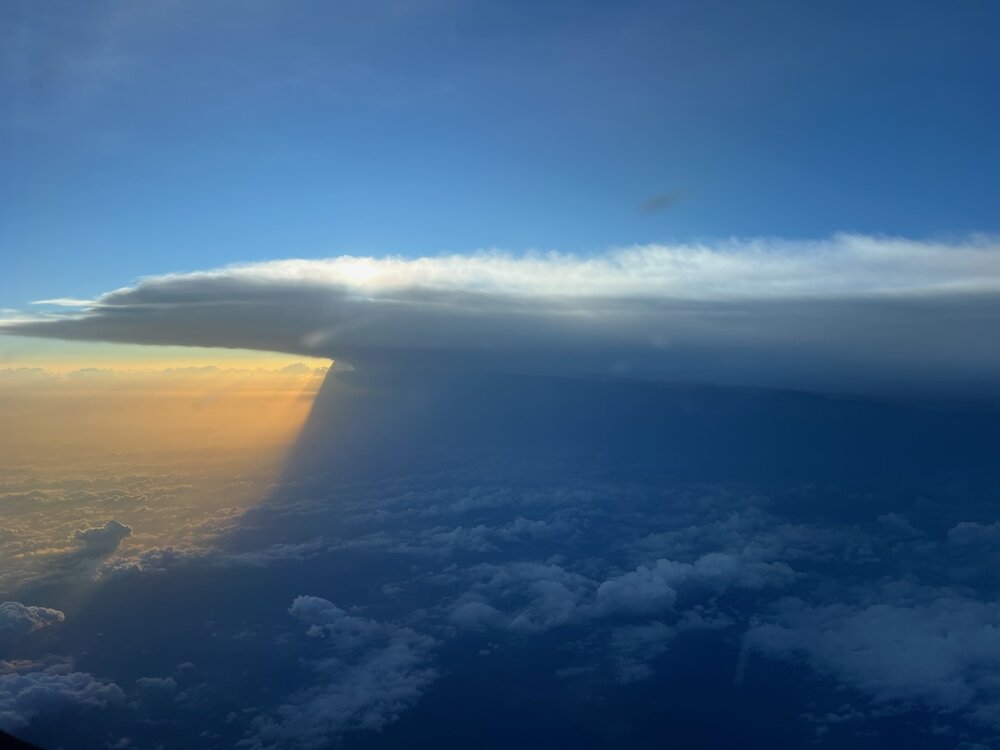
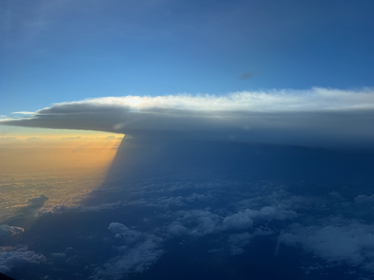
Taken from 34,000 feet this afternoon