

Chicago Storm
-
Posts
19,240 -
Joined
-
Last visited
Content Type
Profiles
Blogs
Forums
American Weather
Media Demo
Store
Gallery
Everything posted by Chicago Storm
-
we welcome you. .
-

Winter 2022/23 Medium/Long Range Discussion
Chicago Storm replied to Chicago Storm's topic in Lakes/Ohio Valley
not that it matters, but that's not a bowling ball.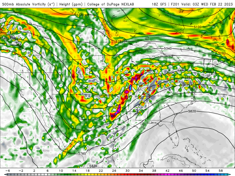
-
most ens are weak/se and fairly uneventful, so there's that for ya.
-
the super bowl ending was a disappointment. .
-
Winter 2022/23 Medium/Long Range Discussion
Chicago Storm replied to Chicago Storm's topic in Lakes/Ohio Valley
East will translate to weaker, less phased and more sheared. . -
Winter 2022/23 Medium/Long Range Discussion
Chicago Storm replied to Chicago Storm's topic in Lakes/Ohio Valley
GFS with the fantasy 40-50” blizzard SE of MSP next week. . -
Winter 2022/23 Medium/Long Range Discussion
Chicago Storm replied to Chicago Storm's topic in Lakes/Ohio Valley
pulling for a continued trend nw, to get us into the 60’s and a severe wx op. . -
February 8-9 Should There Be a Thread For This Storm
Chicago Storm replied to Hoosier's topic in Lakes/Ohio Valley
. -
We'll make it to mid-month with only a T at least.
-
tropical was one.
-
that's his og username.
-
tth. .
-

-
Winter 2022/23 Medium/Long Range Discussion
Chicago Storm replied to Chicago Storm's topic in Lakes/Ohio Valley
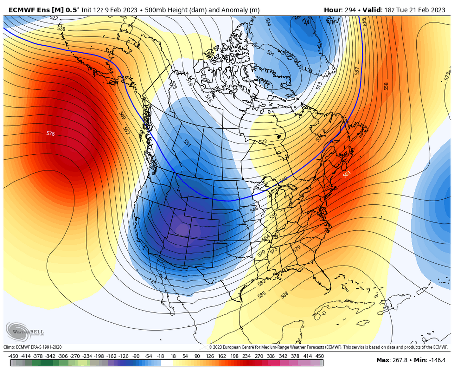
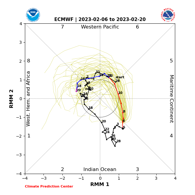
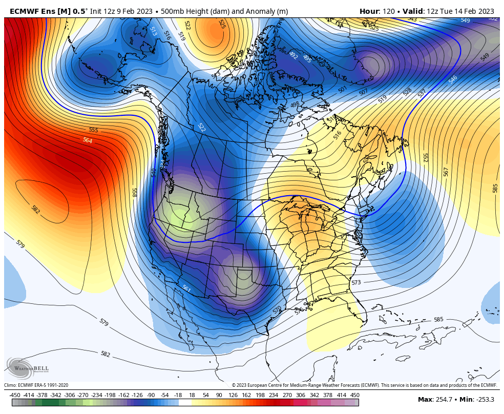
Things have panned out as anticipated for the first 1/3rd of February, with most things looking on track for what was expected as we head into the middle 1/3rd of February as well. We will indeed be shifting into a pattern dominated by a -PNA, with SE ridging flexing quite a bit from time to time as well. It appears we will have more of a neutral-ish EPO, with rolling ridges instead of a strong/significant firmly entrenched. The lower atmosphere PV lobe will continued to be centered north, across Northern Canada, north of the Hudson generally. Across the CONUS, the look of this pattern is what you'd expect to see with the MJO swinging through phases 4-5-6, as it is doing so. This will once again lead to the best chances for cool temps/snow to be across MN/WI/MI, with thread the needle potential needed elsewhere and mild temps more often than not. The one thing to watch will be the continued disruption of the SPV as we move forward. This, along with a few other factors, will aide in cold air rebuilding a bit across Canada. So it would not be surprising to get a shot brief shot of colder temps across more of the sub-forum if we can get a decent storm system to roll through the region (See the current Euro for that fantasy outcome). As we head into the final 1/3rd of February, it appears a similar pattern will continue to start, with a -PNA/SE flexing ridge, though possibly with more of a -EPO developing by then. This idea is very much supported by the ENS and the continued MJO movement from phases 5-6-7 by then. As we head deeper into the final 1/3rd of February, I do expect we see the pattern take another shift though. More on that down the road...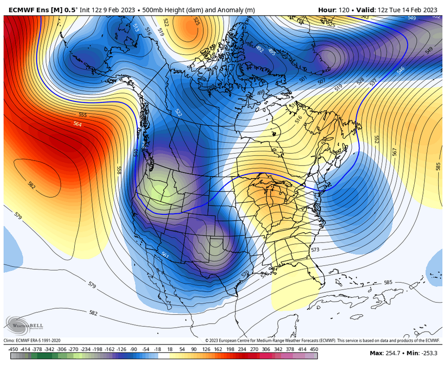
.thumb.png.af7f89619ea78f1c5a573070c078aaf8.png)
-
February 8-9 Should There Be a Thread For This Storm
Chicago Storm replied to Hoosier's topic in Lakes/Ohio Valley
At the time it was the only report anywhere over 5", but now there are numerous 5-9" reports in a narrow corridor from DBQ up to MSN. Talk about threading the needle. -
February 8-9 Should There Be a Thread For This Storm
Chicago Storm replied to Hoosier's topic in Lakes/Ohio Valley
I’m guessing that 9” report is an error. . -
MSP is +23.1" on the season, has had a snow depth of at least 6" since Dec 20th and a snow depth of at least 1" since Nov 30th. Edit: Add in 11 days with sub-zero temps. total misery.
-
February 8-9 Should There Be a Thread For This Storm
Chicago Storm replied to Hoosier's topic in Lakes/Ohio Valley
most winter folks are on here to track accumulating snow, not snow cover. -
it’s interesting that the guy who says we’ve had endless palm weather has his cooped up in his basement, instead of outdoors enjoying said palm weather. .
-
Winter 2022/23 Short/Medium Range Discussion
Chicago Storm replied to Chicago Storm's topic in Lakes/Ohio Valley
nice grasp job in here. -
February 8-9 Should There Be a Thread For This Storm
Chicago Storm replied to Hoosier's topic in Lakes/Ohio Valley
zzz . -
Winter 2022/23 Medium/Long Range Discussion
Chicago Storm replied to Chicago Storm's topic in Lakes/Ohio Valley
mmhmm...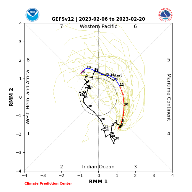
-
-44/-103 on Mount Washington currently.
-
Winter 2022/23 Short/Medium Range Discussion
Chicago Storm replied to Chicago Storm's topic in Lakes/Ohio Valley
fakest rant ever. -


.png.f688aa6ff8185b2c0979c362de1d6c54.png)
