

ldub23
-
Posts
2,284 -
Joined
-
Last visited
Content Type
Profiles
Blogs
Forums
American Weather
Media Demo
Store
Gallery
Posts posted by ldub23
-
-
46 minutes ago, cptcatz said:
I hate to pull an ldub here but I'm itching to see something else on the long range models. Strange that all models now reach to the end of August and there's still nothing on the horizon after Ernesto. This season is definitely impressive with assuming Ernesto makes MH, we'd be at 5/3/2 by mid August, but I'm still not seeing the upper 20's named storms as many predicted.
We are in peak season during a season that was supposed to be super duper and the hurricane season from Hell and the models cant even come up with a fantasy cane. Has to be too much dry air. I doubt the season will be rip roaring in Oct.
-
 1
1
-
 1
1
-
-
10 minutes ago, jbenedet said:
Surprising seeing consensus to miss Puerto Rico, given current position and trajectory.
Next 6 hours will be interesting, not just for Puerto Rico, but a direct hit; however unlikely, would have important implications to intensity and therefore track...
I think it can still hit New England. Just will need a few adjustments. Also the first of many east coast threats.
-
1
-
-
1 hour ago, CurlyHeadBarrett said:
rate the new cone

8.479 out of 10
-
GFS says rare NE hit
-
1
-
-
On 8/7/2024 at 9:03 AM, TheDreamTraveler said:
It wouldn't be hurricane season without him cancelling the season before it even really starts.
GFS shows 1 storm then nothing else thru AUG25. Thats 2 in AUG.
-
 1
1
-
-
- Late August: Favorable conditions will shift eastward, maintaining high activity across the Atlantic.
Maintain high activity? I would be happy if the ATL could maintain any activity. 2 things stand out here for me. Its a perfect set up for a continued conveyor belt of dust into the ATL. Also, we have now shifted back to the pattern of the last 3 years with a trof in the central ATL and low pressure anchored in the NW Atlantic. While CSU says we have above normal odds of canes and majors hitting the US the rest of the season this pattern says the NW Carib isnt going to be favorable, the coast is protected, and landfalls will be sparse unless the pattern reverses.

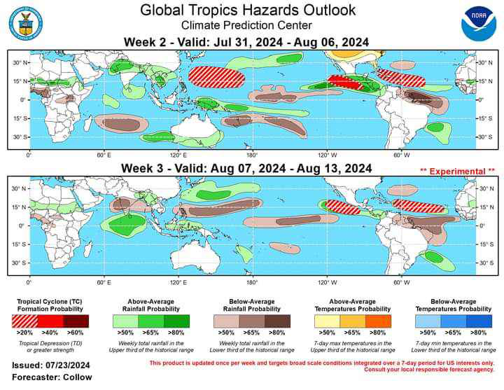
For some reason you have to click twice on the itty bitty picture
-
1
-
1
-
If the GFS is right and there is nothing to AUG22, which means it will be at least another week for a storm to develop CSU must really really think sept*Oct will be super charged. Coming down to 14/7/3 would make more sense. 10/5/2 the rest of the way
-
1
-
1
-
-
3 minutes ago, CurlyHeadBarrett said:
Do you really think this season would be like 2022/2013 jfl
2004/05/1933 its not going to be.
-
26 minutes ago, Ed, snow and hurricane fan said:
I think the 12Z GFS is wrong, but check out about hour 180 or 204.
I saw but it seems unlikely. 25 named storms? Lets say Aug has 2. We need 10 in sept and 10 in OCT. Aug has to be busy to get to 25 and nothing now says busy. Eric Webb says the MJO is Favorable now and wont be in Sept. The season so far is 2 tropical storms hitting the US with the only reason they got to a cat1 was interaction with land. We all saw how all the forecasters were saying how super favorable the tropics were this season. Im not seeing it. Once again the Mdr is choked with dust, dry as a desert, with sinking air added in. Beryl was a butterfly effect thing where somehow it managed to do the impossible but that isnt going to keep on happening.
We arent even getting a sniff of anything developing in the subtropics this season. I have no idea what has to happen to get moisture into the Atlantic again but el nino, la nina, anything inbetween and we end up with a dead MDR.

-
Debby struggled all the way across just to have convection. Still looks very dry and loaded with sinking air.

-
Jinxed. GFS is hilarious. Stalls then flies west like a bat out of Hell. All the way to Alabama now at 144. SE VA north the same daily rain we have been getting for 2 months
-
6 minutes ago, MN Transplant said:
Trough misses it. Interesting solution in that the front that comes down with the trough to us on Wednesday just kind of hangs out, with an onshore flow for the rest of the week. Certainly would help with temps.
clouds rain and an east wind is far better than 98 and sun. Future Debby is a threat here in SE VA
-
4 hours ago, Weather Will said:
WB 6Z EPS thru Day 6

 Seems like the faster solutions have a trough taking it out to sea. If it misses the first trough then things could get interesting further North later next week.
12 Euro is quite a bit different
-
16 minutes ago, CurlyHeadBarrett said:
Is that WXman57
Yes. He isnt one for hype and is rather level headed so it may mean more coming from him. 57 is focusing on the right area while the dunce on TWC was focused on a tiny area on visible that if it did develop was just going to go into the south carib and be shredded
-
1
-
-
3 minutes ago, CurlyHeadBarrett said:
I wouldn’t put too much emphasis on long range models
Perhaps you are right, but just in case the GFS is right then its going to take awhile after aug 09 for even a disturbance to develop that might end up getting a name. Maybe tomorrow Knabbs abrupt turn to super favorable will happen and it will show 3 storms. Just wait and see but if the GFS is right it will be well past 09aug before the season gets going.

-
 1
1
-
-
11 hours ago, CurlyHeadBarrett said:
Isnt a 20-40% of at least a depression between 07-13 aug just climatology? GFS now up to 09aug with nothing.
-
2
-
-
2 hours ago, cptcatz said:
Sticking with what I said here. I don't see getting past like 16-17 named storms.
That might be too high. How in the heck there was a major hurricane in this pattern is rather amazing. Hyperactive is not happening now. Dr Knabb was talking yesterday about an ABRUPT ramp up in early Aug then posted a scare map of Aug 2004. 2 for aug seems a better bet than 8 at this point. The really cool thing is aug/sept 2004 had much less favorable SST's in the east pac and ATL than now showing SST'S, especially in the ATL are not as meaningful as advertised. Dry stable air hasnt been easy to dislodge for years now. If there was going to be an abrupt increase in activity in early aug the distrubances that need to grow would be showing up now and the GFS thru aug 05 doesnt even show an abrupt wave.
-
2
-
1
-
-
Final amendment 21/11/5
-
Amending my forecast to 20/7/3.
-
-
2 hours ago, wasnow215 said:
And looks like another 3-4” of rain this Wed night into Thursday.
Yea, another flood coming.
-
1
-
-
rain mixed with snow in April

-
1
-
-
Nothing like rain mixed with snow after summer in March

-
3 hours ago, RVAman said:
No chance in hell that happens haha.
Lots of 42 and rain though


2024 Atlantic Hurricane Season
in Tropical Headquarters
Posted
Perhaps. Euro shows very little out to 4 weeks but it does show the shift to a winterlike pattern. CSU and others forecasts of a big US landfall season seem unlikely.