

ldub23
-
Posts
1,914 -
Joined
-
Last visited
Content Type
Profiles
Blogs
Forums
American Weather
Media Demo
Store
Gallery
Posts posted by ldub23
-
-
2 hours ago, RIC Airport said:
Unless somehow that shortwave around the 28th-1st turns into something (which is a long shot for us this far south), it's still looking like ~2/10 and later for any significant chance of snow opportunities.
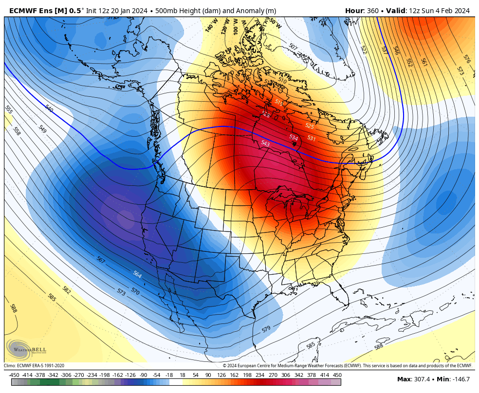
Below are the H5 maps from today's 12Z GEFS (hour 384) and EPS (hour 360). After the storm around the 28th-1st moves away, a couple days of cold follow it before there is ridging building back into the east, and we moderate.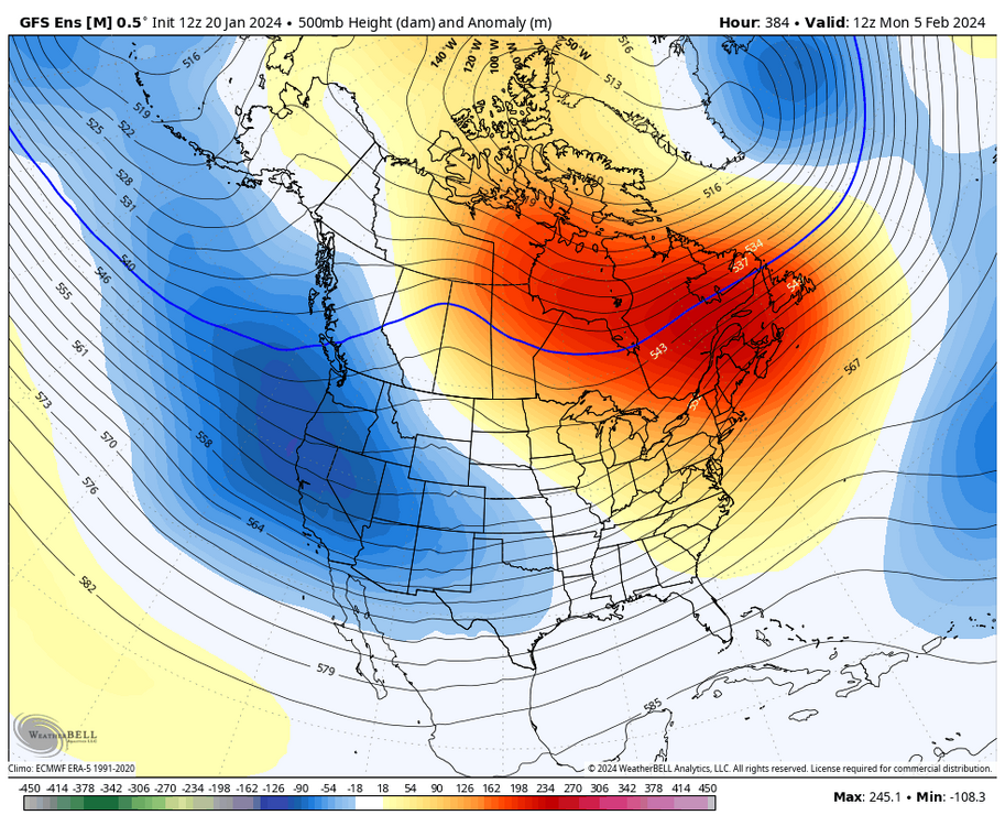

_______________________________________________________________________________
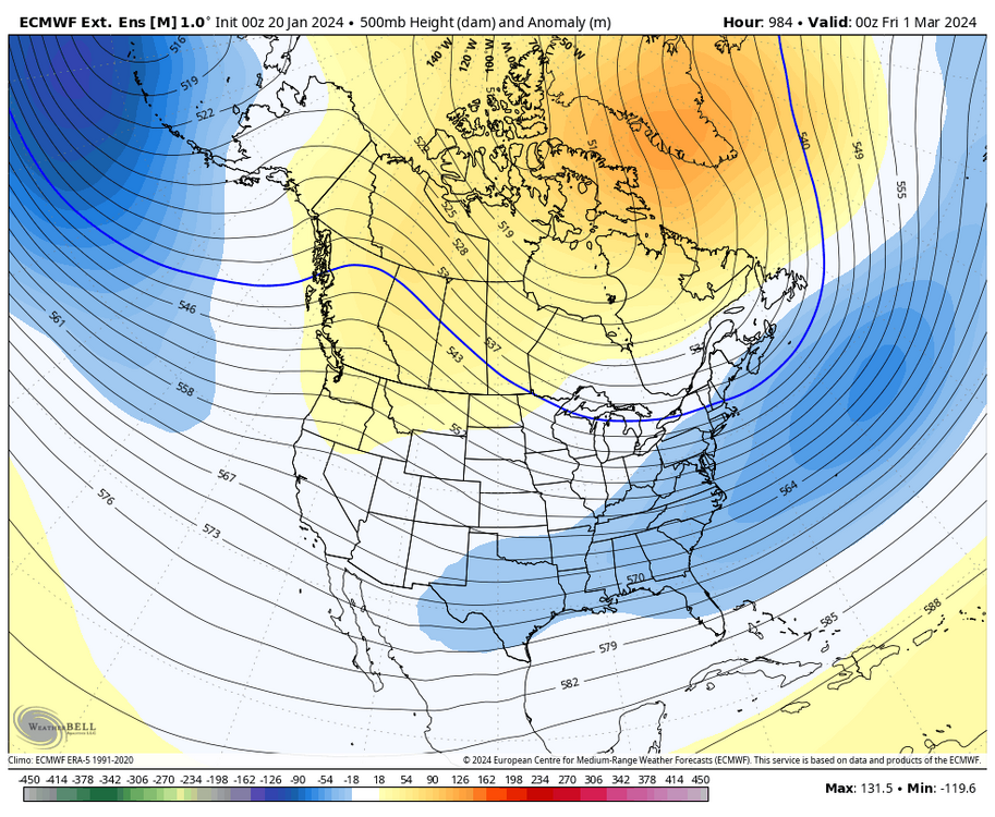
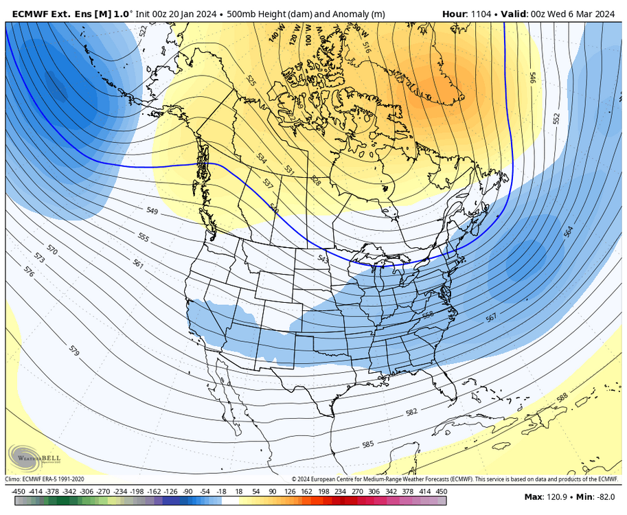
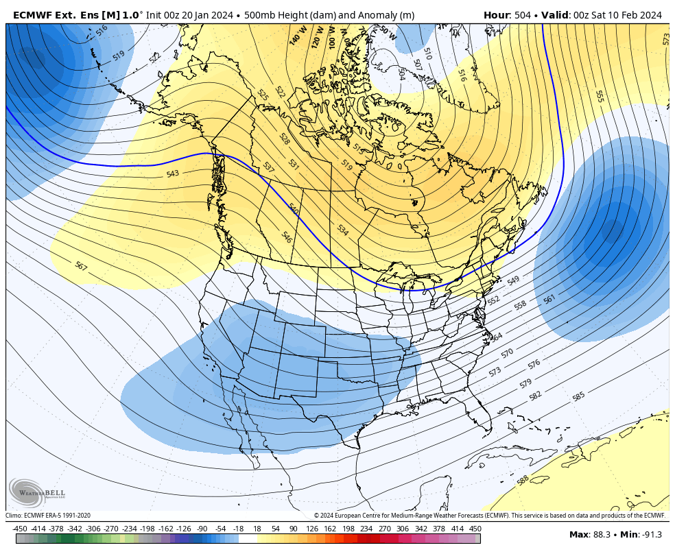
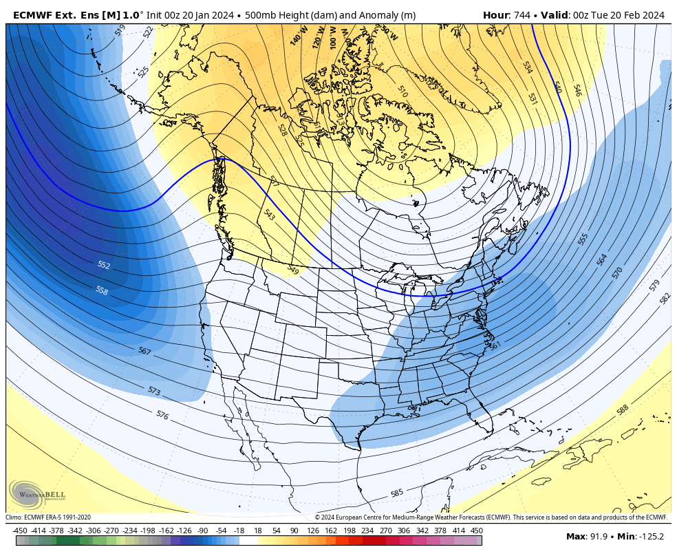
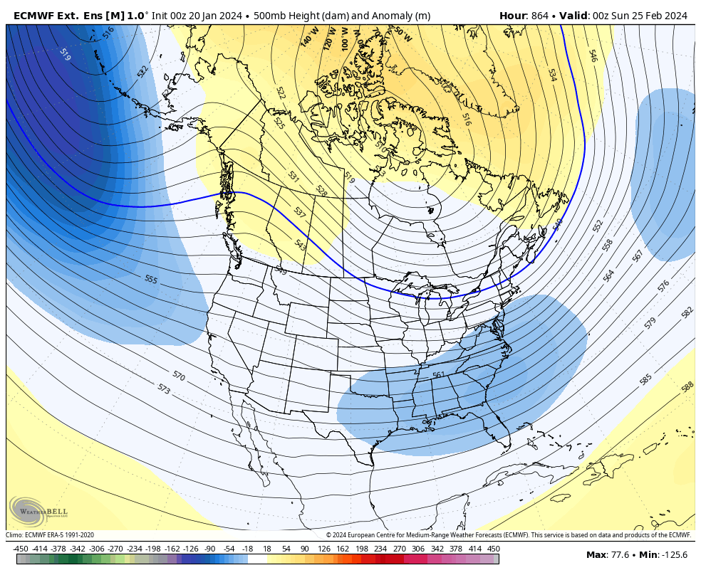
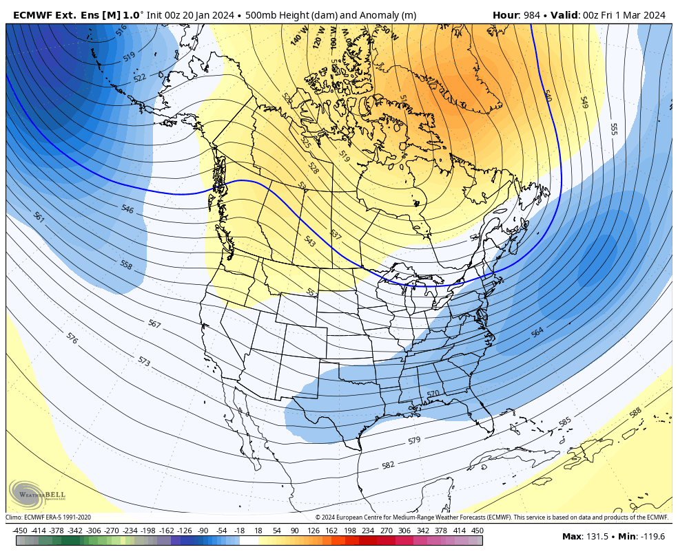
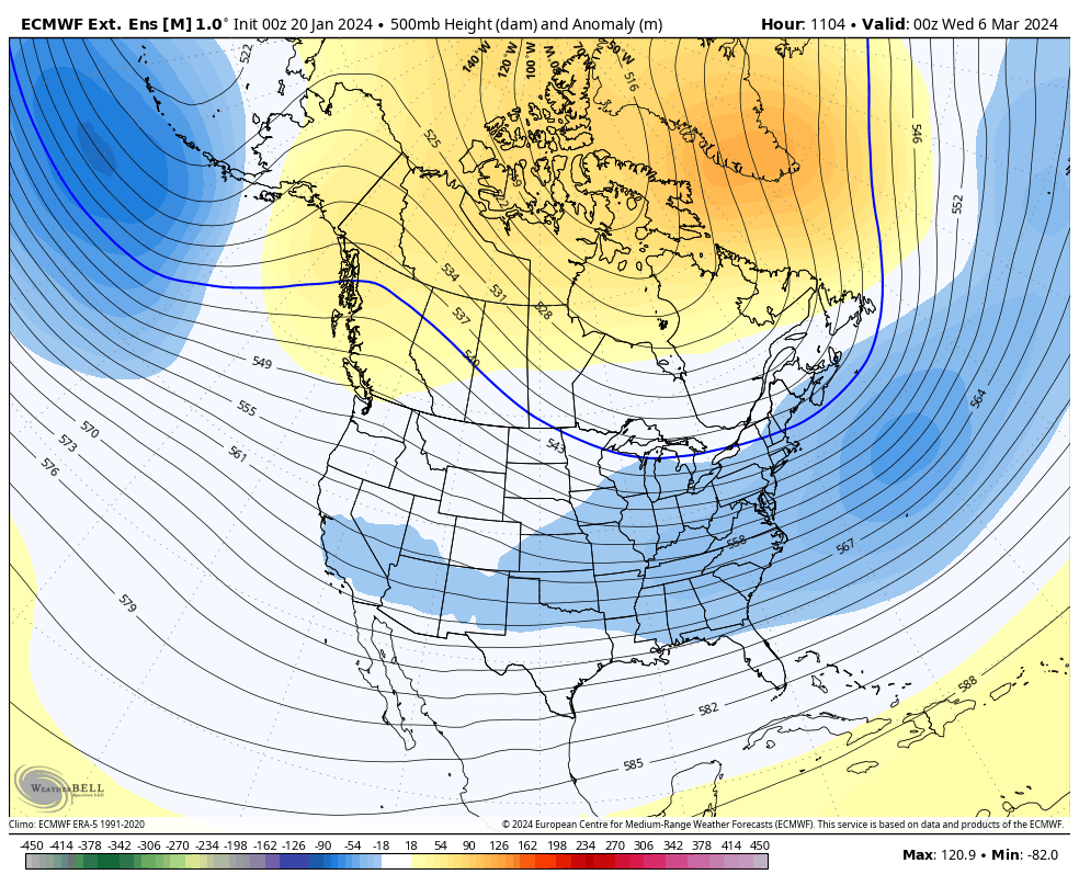
Today's Euro weeklies show the change around the 10th. Here is the look on 10 FEB as the trough is beginning to move back toward the east coast with increasing heights in the EPO, AO, NAO domains. The only teleconnection that doesn't look great continues to be the PNA (lack of a west ridge), but the euro weeklies do show it neutral to slightly positive.
FEB 10th

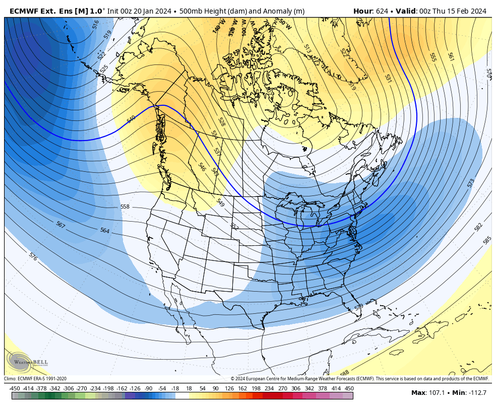
FEB 15th

FEB 20th

FEB 25th

MAR 1st
MAR 6th
_______________________________________________________________________________
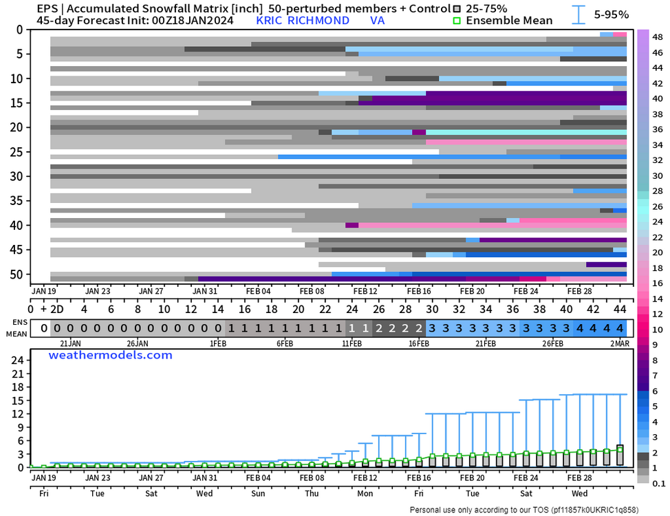
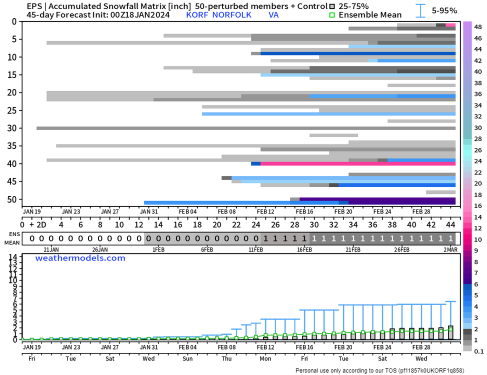
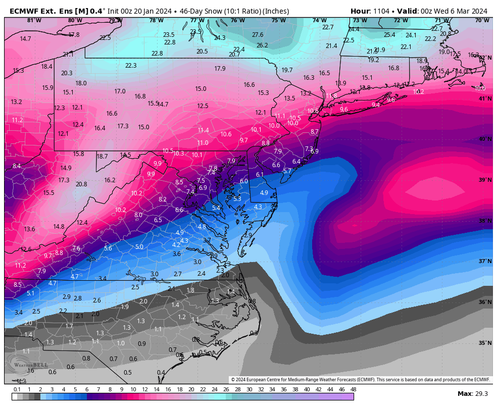
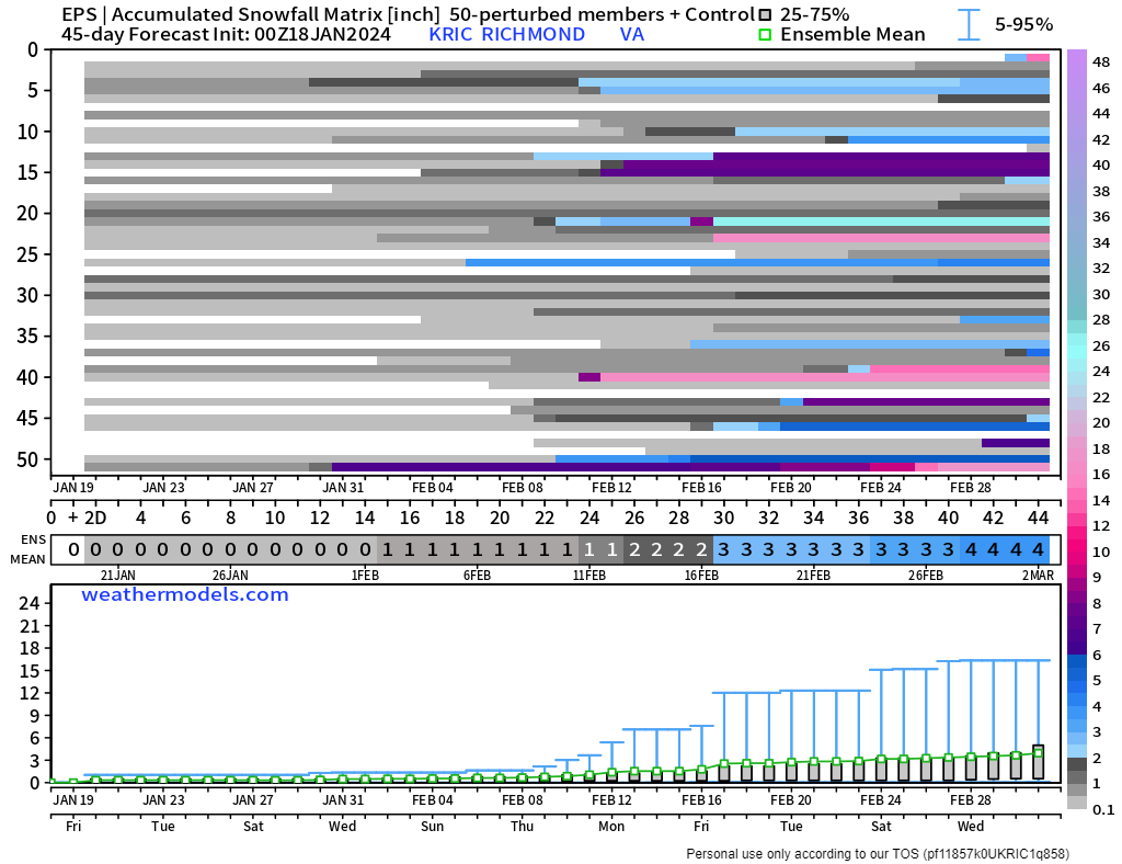
After the 10th is when the snowfall mean begins to increase, with the period from about the 15th to March 1st being the highest.

_______________________________________________________________________________
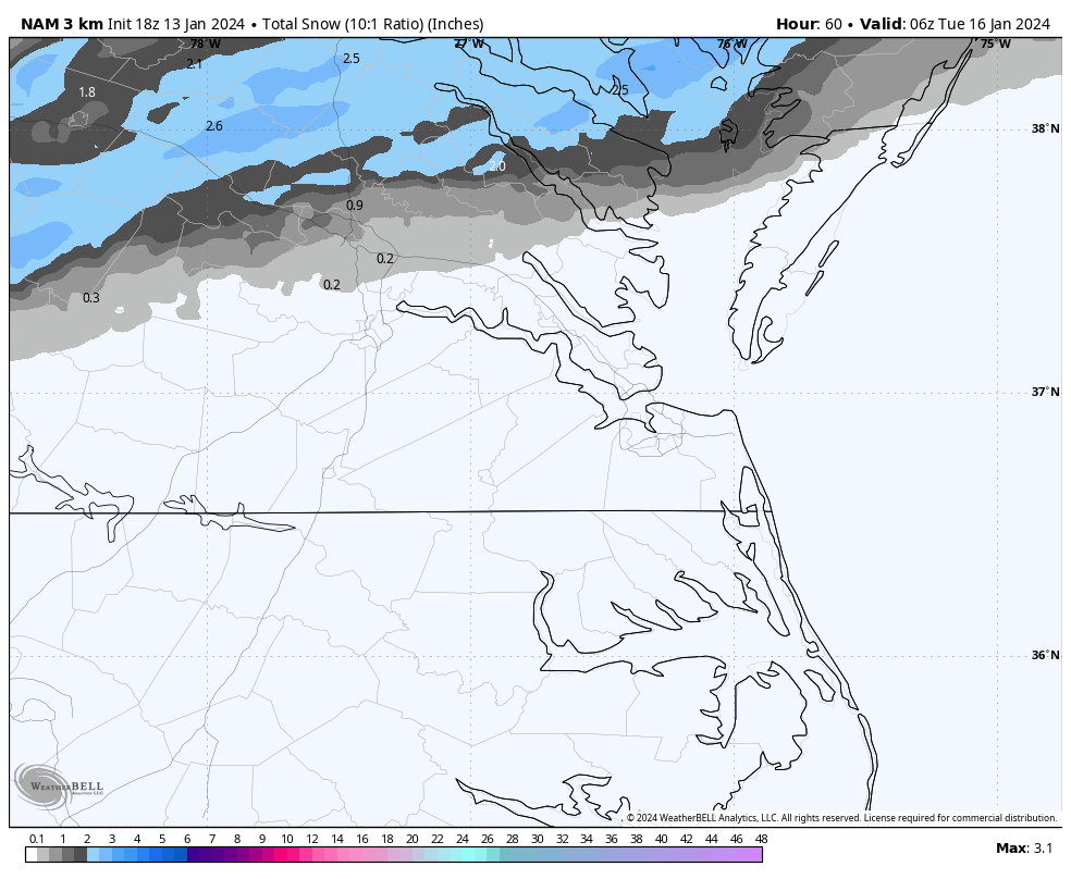
The snow below snow charts take longer to update, but these are from the run two days ago, and you can see snow hits begin to increase in earnest after about the 10/12th at Richmond and Norfolk.
We can still hope
-
 1
1
-
-
06 GFS not as bleak as earlier runs

-
1
-
-
5 minutes ago, RIC Airport said:
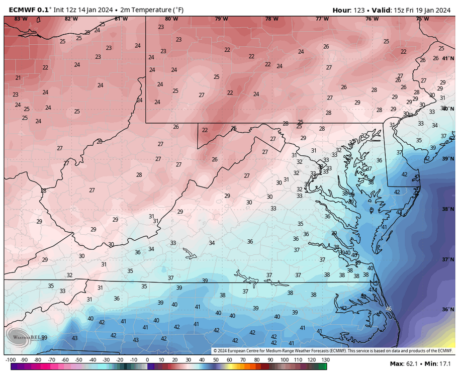
Yeah, seems to have waned some, too. But we won't escape the cold. Below are the Euro temps for 3pm tomorrow. Almost all stations are below freezing.
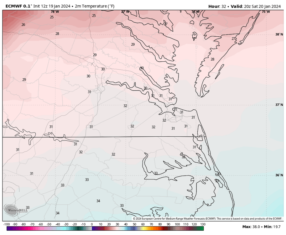
But, if the Euro is correct, we are torching a week later with widespread 70s next Saturday at 1pm. This pattern change will be brutal, hopefully, we don't verify that warm and we get back to cold and snow. We get 70°F+ most of the year.
")

With Alaska so brutally cold then we will have to have summer in Feb. Im going to make a really bold prediction. Late march thu most of may will be well below normal with alot of rain and the low tracks will be perfect for snowstorms if it were jan/feb.
Future radar shows no snow flurry here today
-
Looks like its moving more east than se.
-
1
-
-
More rain here. Maybe a flurry later but Alaska has gone into the freezer so a big warm-up is coming here.
This is fairbanks and they are way below normal. We need a real pattern change if anything is going to happen in Feb
TodayFlurries after 3pm. Mostly sunny, with a high near -9. North wind around 5 mph becoming calm.TonightFlurries. Partly cloudy, with a low around -22. Calm wind becoming north around 5 mph after midnight.SaturdayFlurries. Mostly sunny, with a high near -20. Wind chill values as low as -45. Northeast wind around 10 mph.Saturday NightFlurries before 9pm. Mostly clear, with a low around -33. Wind chill values as low as -50. Northeast wind 5 to 10 mph.SundaySunny, with a high near -32. Northeast wind around 5 mph becoming calm in the morning.Sunday NightPatchy freezing fog after 3am. Partly cloudy, with a low around -41.MondayPatchy freezing fog before 3pm. Mostly sunny, with a high near -32.Monday NightPartly cloudy, with a low around -37.TuesdayPartly sunny, with a high near -31.Tuesday NightA slight chance of snow after 3am. Mostly cloudy, with a low around -33.WednesdayA slight chance of snow. Mostly cloudy, with a high near -27.Wednesday NightA slight chance of snow. Mostly cloudy, with a low around -38.ThursdayA slight chance of snow. Mostly cloudy, with a high near -30. -
06 gfs doesnt even have a snow flurry for se va on friday. Hopefully by feb 28 2025 we will have an accumulating snow
12Z nada
-
18Z euro was a bit interesting for friday
-
1 hour ago, RIC Airport said:
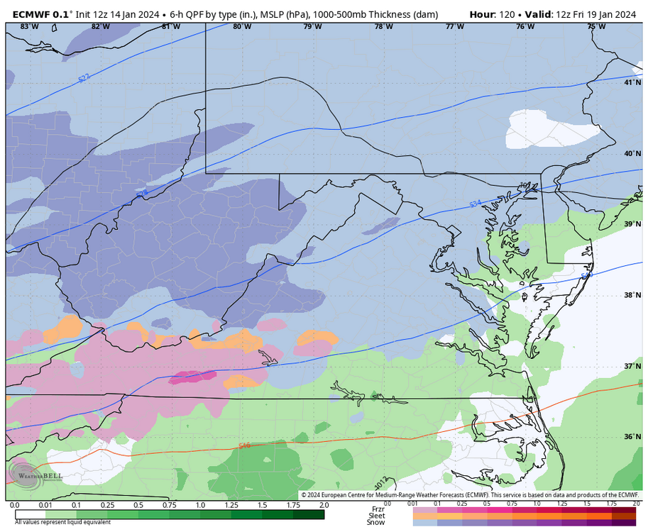
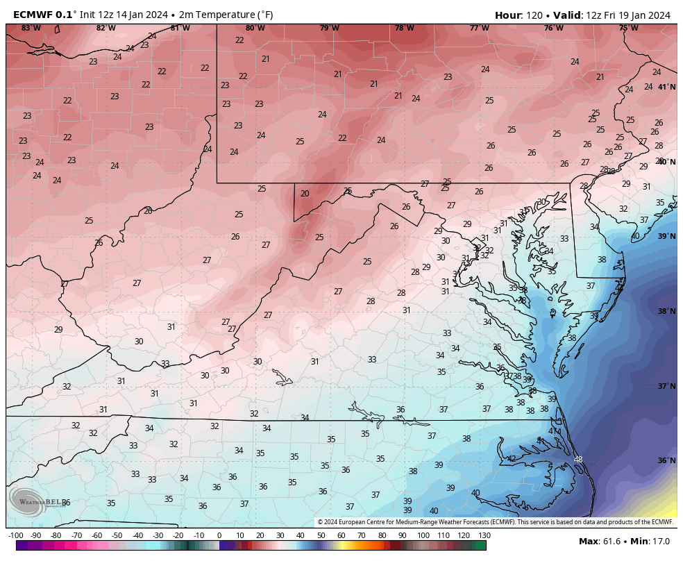
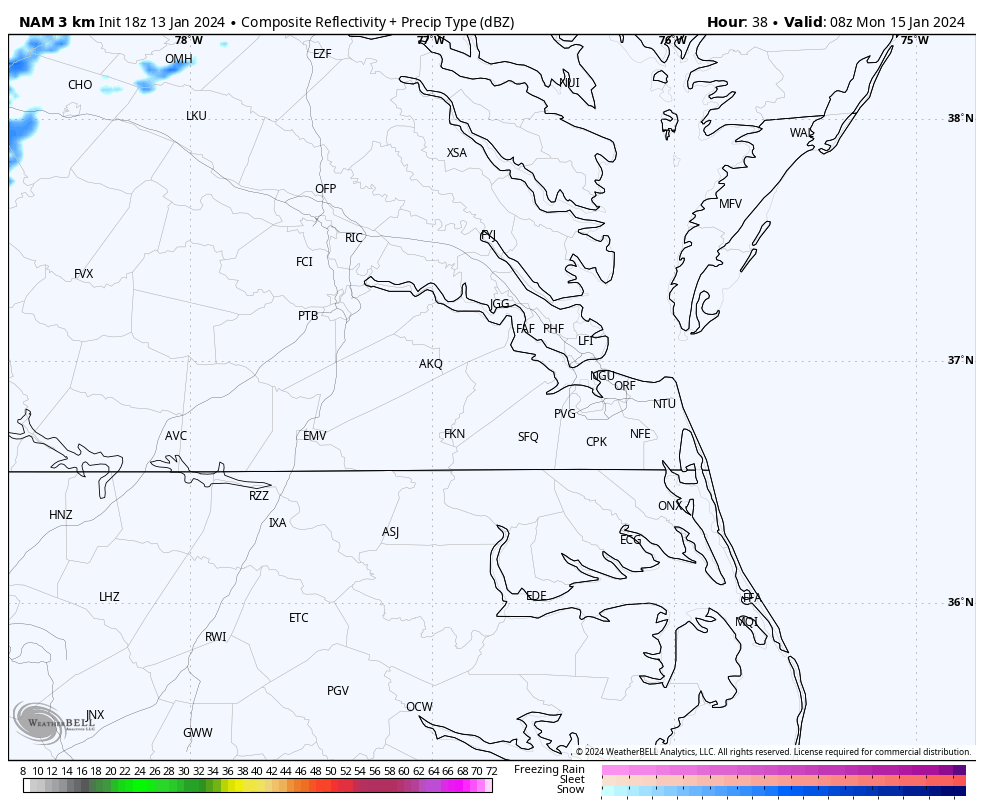
Frozen precip chances look better on the 00z GFS for areas east and SE of RIC. The challenge for Hampton Roads will be surface temperatures and fighting warm air aloft at 850MB. Both eventually fall as the afternoon progresses, but I wonder whether anything will be meaningful there.
The GFS has RIC rising to 33°F by 1am (it's 31°F at 11pm), rising to 35 by 6am, and remaining above freezing until 2pm. So unlike the 00Z HRRR and 3K NAM I showed, it keeps any frozen precip confined to areas north of RIC until about 1pm when both surface and 850mb temps fall below freezing. 850s cool to 0°F at Norfolk by 4pm, but surface temperatures throughout Hampton Roads are still in the mid-upper 30s. Norfolk does not even drop to freezing on the GFS until 9pm. The model does try to accumulate snow between Richmond and Williamsburg and up to the Northern Neck.This is just one model depiction, as we know things can and probably will change.


I have given up on accumulating snow till next winter. Just hoping for a flurry now.
-
1
-
-
GFS is more aggressive with the changeover than 18z

-
1
-
-
Nothing here of course, but still ok in RIC
-
1 hour ago, RIC Airport said:
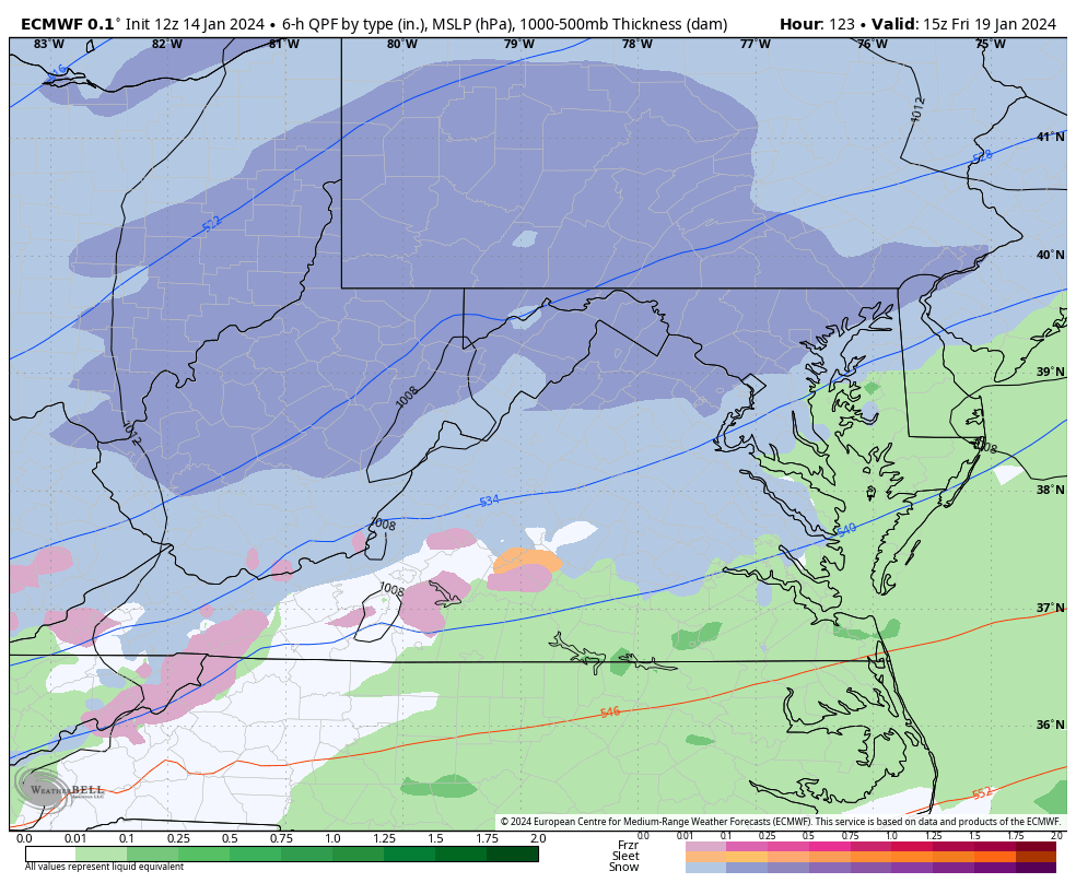
@Conway7305, @ldub23Friday's storm was basically a snowstorm for 40N, although it does have a portion of C VA, starting off as snow between about 4am to 10am Friday morning before changing to rain. We are on the southern fringe of the entire thing. Still something to monitor in the coming days, I guess. Would be wonderful to get TWO accumulating events within a week.


I will wait and see what the 18z gfs shows if anything. One thing is certain, there is going to be a warm up after the snowless cold in se va. Im glad it looks like RIC will get at least several inches. I was really hoping for 1 last cold snowy winter in Newport News as i have no idea the time i have left, lol
A the end of the gfs the cold comes back but will it matter if it does?

-
Still holding out hope for a miracle on 06 GFS

-
1
-
-
11 minutes ago, RIC Airport said:
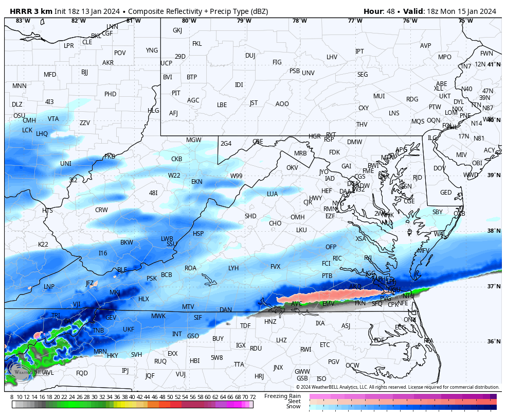
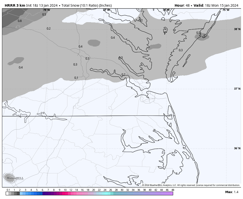
The short-term models are getting further within range, and so far, the 3K NAM is developing and pushing that initial band farther north of Richmond while everyone S and E see little, if anything.

Meanwhile, the HRRR was a little farther south. Both of these are at the end of their ranges, so I don't know if I'd take them too seriously for now, but something to watch in later runs.

The trend is still good enough in the HRRR
-
This reminds me of a situation back around 1971 but my memory fails a bit. Then we had an arctic boundary that stalled to the SE and for a week we had cold with occasional snow showers but little accumulation. Then an upper low came over and dumps 2.5 inches just after school started. Lots of similarities to the upcoming week.
-
I like this look. There is plenty of Actual cold air around this time.

-
1
-
-
06 GFS better with several snow chances
102

162

This at 204

-
2
-
-
ITS been a few years since we had a cold winter pattern and there is still no sign we will have one this winter. 2 or 3 days of cold isnt a pattern change and th warm is coming back

-
06GFS still looks good for RIC

-
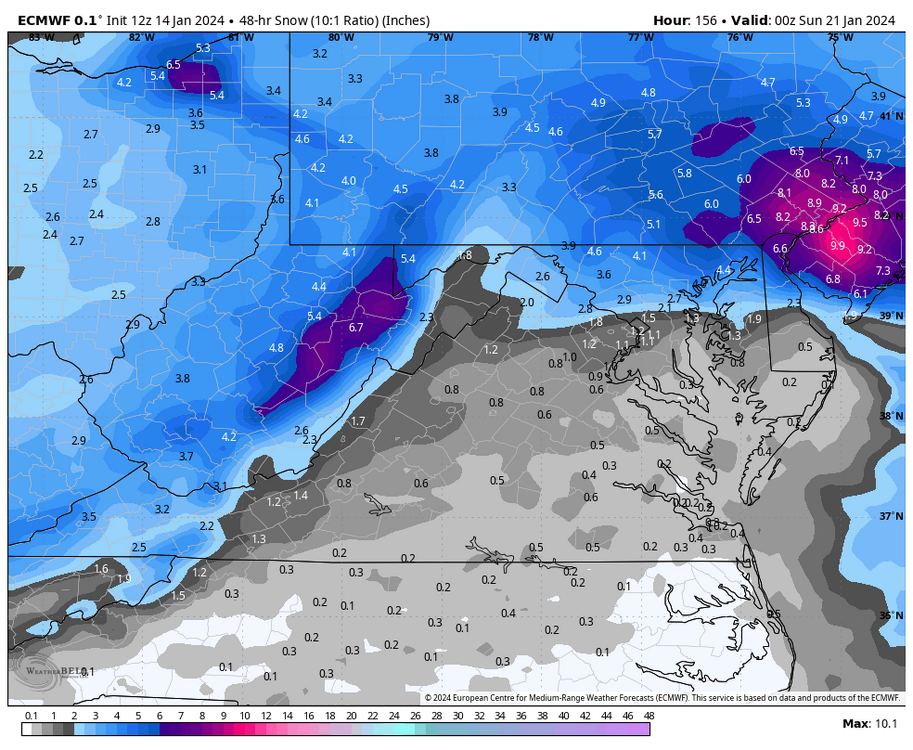
In se va we will get the worst weather possible. Bitter cold and nothing to show for it. Good Ric will get snow.
RIC may end up with a foot+ thru 16 days

-
Looks like central va will get a good snow.
More snow!!

-
1
-
 1
1
-
-
Hopefully the trend will be good today

-
18 GFS has several opportunities for inland areas and ends like this


-
2
-
-
After a few days of cold and dry its right back to rain and warm. We get far more tornado watches in Jan/feb than winter advisories now, lol

-
Soon it will be February. Hard to believe we will have 1000+days without an inch of snow.
-
 1
1
-


Richmond Metro/Hampton Roads Area Discussion
in Mid Atlantic
Posted
I wish that was right. On the other hand these are the temps at 384hrs at midnight i think. Very warm. Feb 07 is when normals start rising.
The low that did have a little promise as some snow is now just way too warm