ldub23
-
Posts
1,914 -
Joined
-
Last visited
Content Type
Profiles
Blogs
Forums
American Weather
Media Demo
Store
Gallery
Posts posted by ldub23
-
-
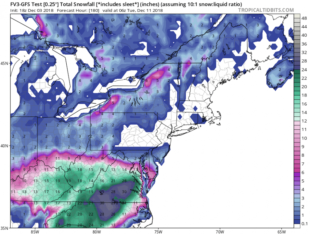
I am quite skeptical of this new GFS. I would expect to see alot of that snow not to occur in the east and se parts of the snow coverage shown on the map. We will see. I certainly havent been terribly impressed with it since it was unveiled.
-
 1
1
-
-
I cant imagine much if anything for se va, including richmond. It seems we will be on the northern extent of the precip and i doubt it will precip hard enough to be snow.
-
2 minutes ago, olafminesaw said:
Don't blame the model, blame the algorithm on that site. Sometimes I think we'd be better without snow maps altogether. The micro details they present distract from big picture trends.
Im in se va and there is no way im getting 6-10 inches. All rain here.
-
 1
1
-
-
-
Friday could be very similar to 1998 Bonnie here.
-
Its just odd that they arent seeing what TWC is seeing
-
Just checked Wakefield and they are only saying a few snow showers are possible in NE forecast area Tues.
.LONG TERM /MONDAY NIGHT THROUGH FRIDAY/...
Low confidence forecast beyond Monday as 12z/11 suite of models
are having a difficult time in resolving differences wrt
handling of a strong upper trough/closed low digging across the
Great Lakes/Northeast next week. Will lean toward a blend of the
12z GFS/GEFS/CMC which all seem to be in reasonable agreement
with the aforementioned trough/closed low pivoting SE to a
centralized position over Lake Erie by 12z Tues. From there,
this feature slowly lifts NE into New England by 12z Thurs. In
doing so, it will force a cold front through the local area on
Tues with high pressure returning next Wed/Thu. What remains to
be seen as whether or not the front produces any pcpn as it
passes on Tues, as it would probably be cold enough aloft to
generate some snow showers (at least NE of the I-64 corridor).
Have placed some low PoPs in these areas. Otherwise, next week
is looking dry and chilly. Highs Monday from the mid 30s N to
low 40s S. Highs Tuesday from the mid 30s N to the mid 40s
south. Highs next Wed/Thu in the 30s. Lows through the period
primarily in the teens and 20s.
Thats from the afternoon disco
-
Hope the temps start dropping.
-
1 hour ago, EverythingisEverything said:
Just watched Jeremy Wheeler on Wavy TV 10, he ran their in house model and said well it basically took the snow away after a brief mix, but said he doesn't think it's right. He seemed unsure of the forecast but went ultimately with 2 to 4 for SEVA with mixing in the beginning.
Yea, looked pretty pathetic here with nothing just west of the coast. He also showed gfs and euro accumulations and they werent much either. I guess he just decided to assume NWS was right to issue a watch.
-
No need for complaints. Many people in the SE have already had more snow than normal for winter.


December 8-10, 2018 Winter Storm
in Southeastern States
Posted
That is certainly faulty in SE VA. 1-4 in norfolk and vab? no snow there at all.