CoalCityWxMan
-
Posts
677 -
Joined
-
Last visited
Content Type
Profiles
Blogs
Forums
American Weather
Media Demo
Store
Gallery
Everything posted by CoalCityWxMan
-
Late January-Early February Clipper Train
CoalCityWxMan replied to Hoosier's topic in Lakes/Ohio Valley
Funny you mention that, I DO vaguely remember the Valentine’s Day storm as a kid. At the time I remember the snow seemed higher than me -
It’ll be interesting to see what GEFS members do. My guess is they move north but will be interested to see if there’s still a large spread
-
Late January-Early February Clipper Train
CoalCityWxMan replied to Hoosier's topic in Lakes/Ohio Valley
Not looking good, especially only for 4 o’clock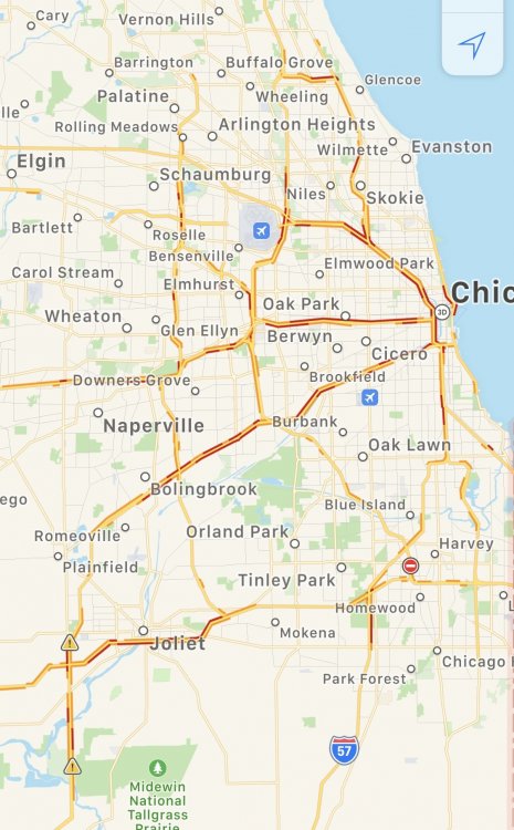
-
Incase anyone was wondering, the 18z ICON shifted south
-
Late January-Early February Clipper Train
CoalCityWxMan replied to Hoosier's topic in Lakes/Ohio Valley
I was only 9 at the time so makes sense I don’t remember that lol -
Looks like 18z NAM may be coming in a tad south but we’ll see EDIT: nevermind
-
Late January-Early February Clipper Train
CoalCityWxMan replied to Hoosier's topic in Lakes/Ohio Valley
Just talked to a friend about this actually, people expect the salt to be working like it should be, a lot of people don’t get that salt is basically useless when it’s this cold. So they think a little snow = no problem when in reality little snows like this can be the worst for driving -
Late January-Early February Clipper Train
CoalCityWxMan replied to Hoosier's topic in Lakes/Ohio Valley
Has been snowing for 20 minutes in DKB and (well salted) roads are already snow covered. Even though amounts will be in the 1-3” range in the area it could be an awful evening commute. -
Late January-Early February Clipper Train
CoalCityWxMan replied to Hoosier's topic in Lakes/Ohio Valley
Snowing at -2 in DKB. Not sure I’ve seen that before -
Yeah, GEFS is a good deal south of the op run
-
Just when you thought the GFS couldn’t get worse
-
Late January-Early February Clipper Train
CoalCityWxMan replied to Hoosier's topic in Lakes/Ohio Valley
GFS has it much more south now -
How the heck is anyone supposed to go anywhere with it being that dangerously cold for that long??
-
Fingers crossed it stays south
-
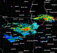
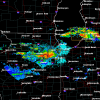
Nice returns coming in from the west
-
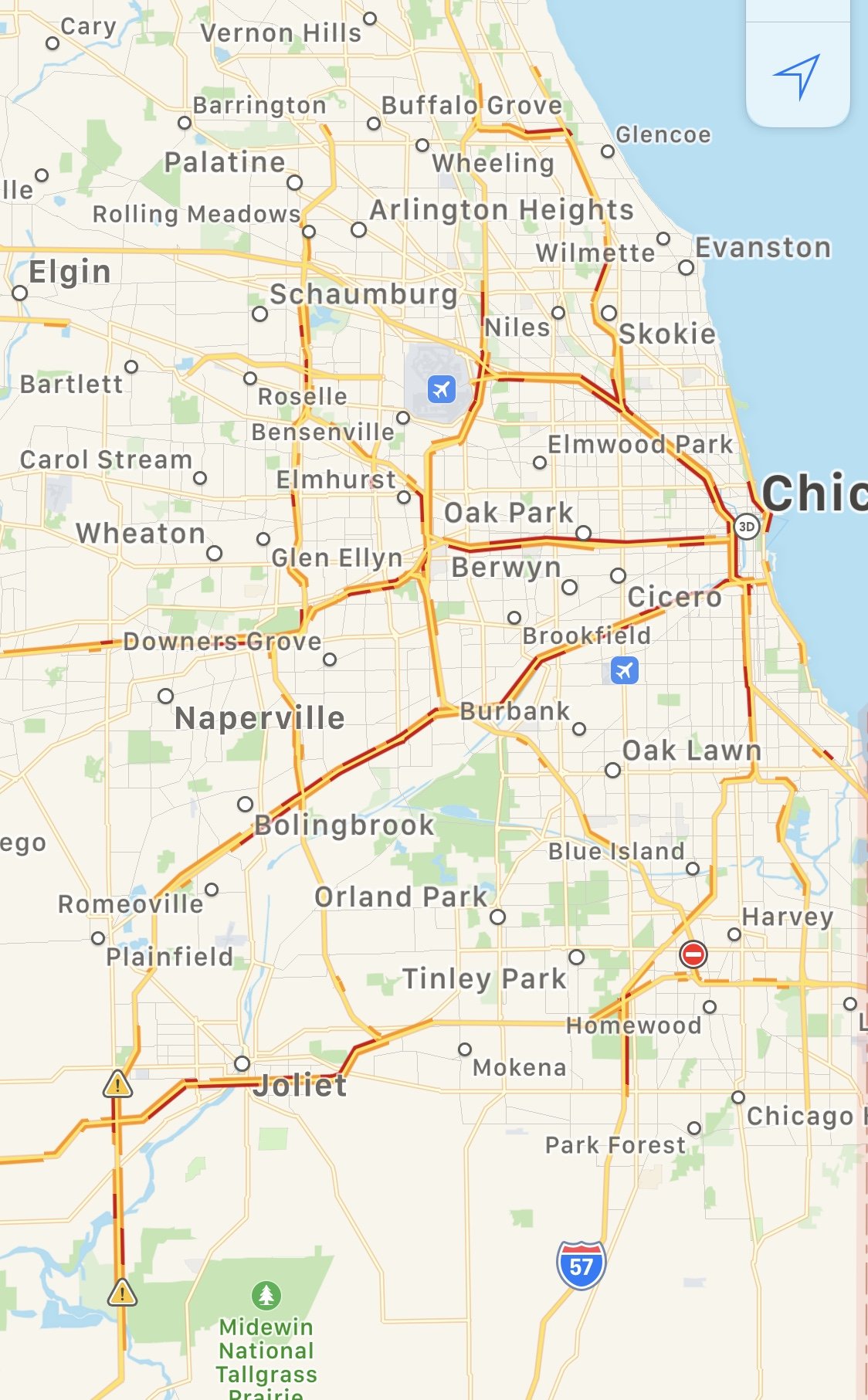
Not sure what to expect in the Dekalb/Sycamore area. Cutoff should be right around here, could easily us getting >1” but could also see us getting 3-4”. LOT is going with 3-5”
-
27 still in DKB. Everything but main roads are nasty
-
Everything’s already a thin sheet of ice in Sycamore, even salted sidewalks are slippery
-
FWIW the ICON is south too and looks similar to the NAM, just not as far SE
-
That’s awful. Looks like the long range GFS
-
Looks like it’ll be a pretty good run for N IL. Narrow but impressive band of snow
-
With the way things have been trending it’ll hopefully set up just south. I mean 12 hours ago the freezing line was modeled to be in southern Wisconsin at that point so we take what we can get lol. The 12z NAM should be interesting
-
Good to know, thank you for the info, always very much appreciated. If the trend continues you’ll be the one seeing the 0.25”+ of ice...or heck maybe even JOT will be
-
Also interesting to note that each run of the hrrr has been coming in slightly south of the previous run since about 19z
-
Wonder how far it’ll go. Wouldn’t take much more of a shift to include more of the northern parts of the area in an area of possibly significant snow, would really be interesting if it keeps trending