CoalCityWxMan
-
Posts
677 -
Joined
-
Last visited
Content Type
Profiles
Blogs
Forums
American Weather
Media Demo
Store
Gallery
Everything posted by CoalCityWxMan
-
Here comes winter -- October 28-November 1 Snowstorm Potential
CoalCityWxMan replied to Hoosier's topic in Lakes/Ohio Valley
Mother of god...if only. -
Here comes winter -- October 28-November 1 Snowstorm Potential
CoalCityWxMan replied to Hoosier's topic in Lakes/Ohio Valley
Mind sharing a snow map? -
2019 Short/Medium Range Severe Weather Thread
CoalCityWxMan replied to snowlover2's topic in Lakes/Ohio Valley
IKK just gusted to 57mph under one of those cells -
2019 Short/Medium Range Severe Weather Thread
CoalCityWxMan replied to snowlover2's topic in Lakes/Ohio Valley
There we go
-
2019 Short/Medium Range Severe Weather Thread
CoalCityWxMan replied to snowlover2's topic in Lakes/Ohio Valley
Quite a significant one at that
-
2019 Short/Medium Range Severe Weather Thread
CoalCityWxMan replied to snowlover2's topic in Lakes/Ohio Valley
The hrrr doesn’t have a clue. Completely dissipates the mcs in Wisconsin in the next hour -
2019 Short/Medium Range Severe Weather Thread
CoalCityWxMan replied to snowlover2's topic in Lakes/Ohio Valley
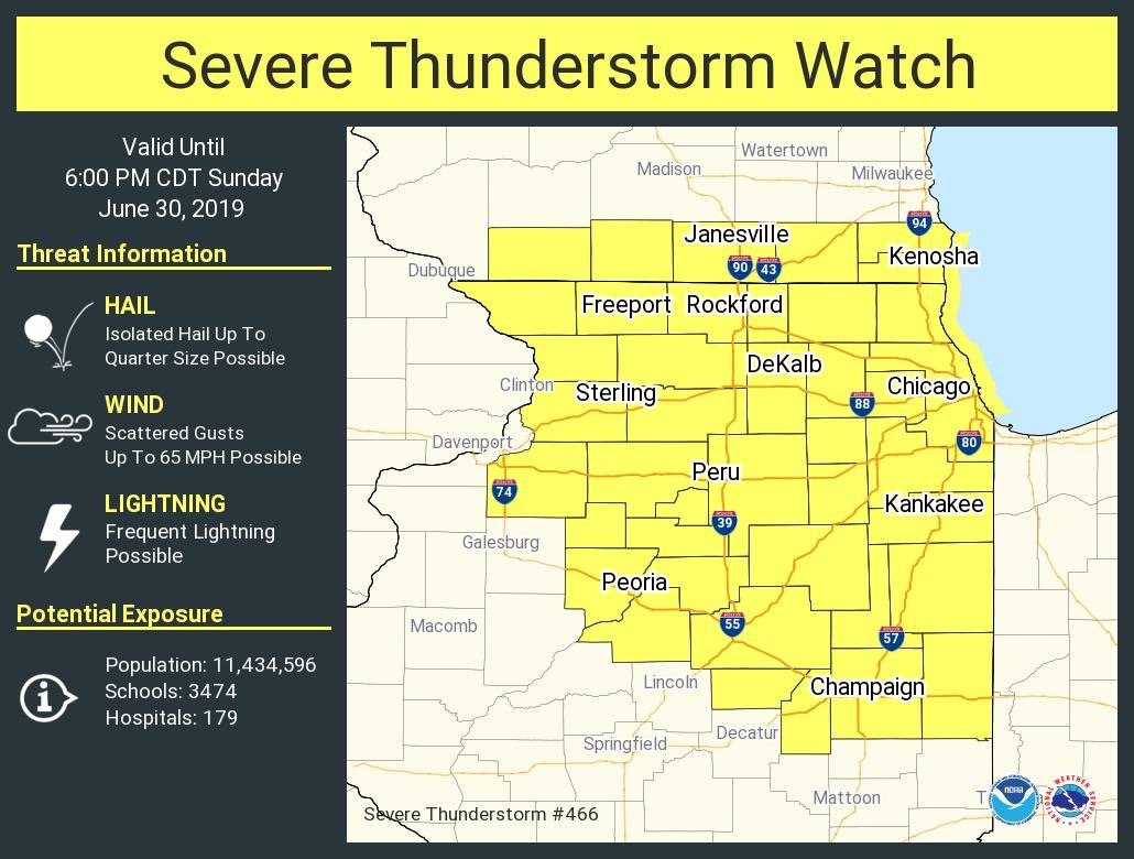
Slight risk extended further south with new update -
2019 Short/Medium Range Severe Weather Thread
CoalCityWxMan replied to snowlover2's topic in Lakes/Ohio Valley
Warning does mention possible tornado -
2019 Short/Medium Range Severe Weather Thread
CoalCityWxMan replied to snowlover2's topic in Lakes/Ohio Valley
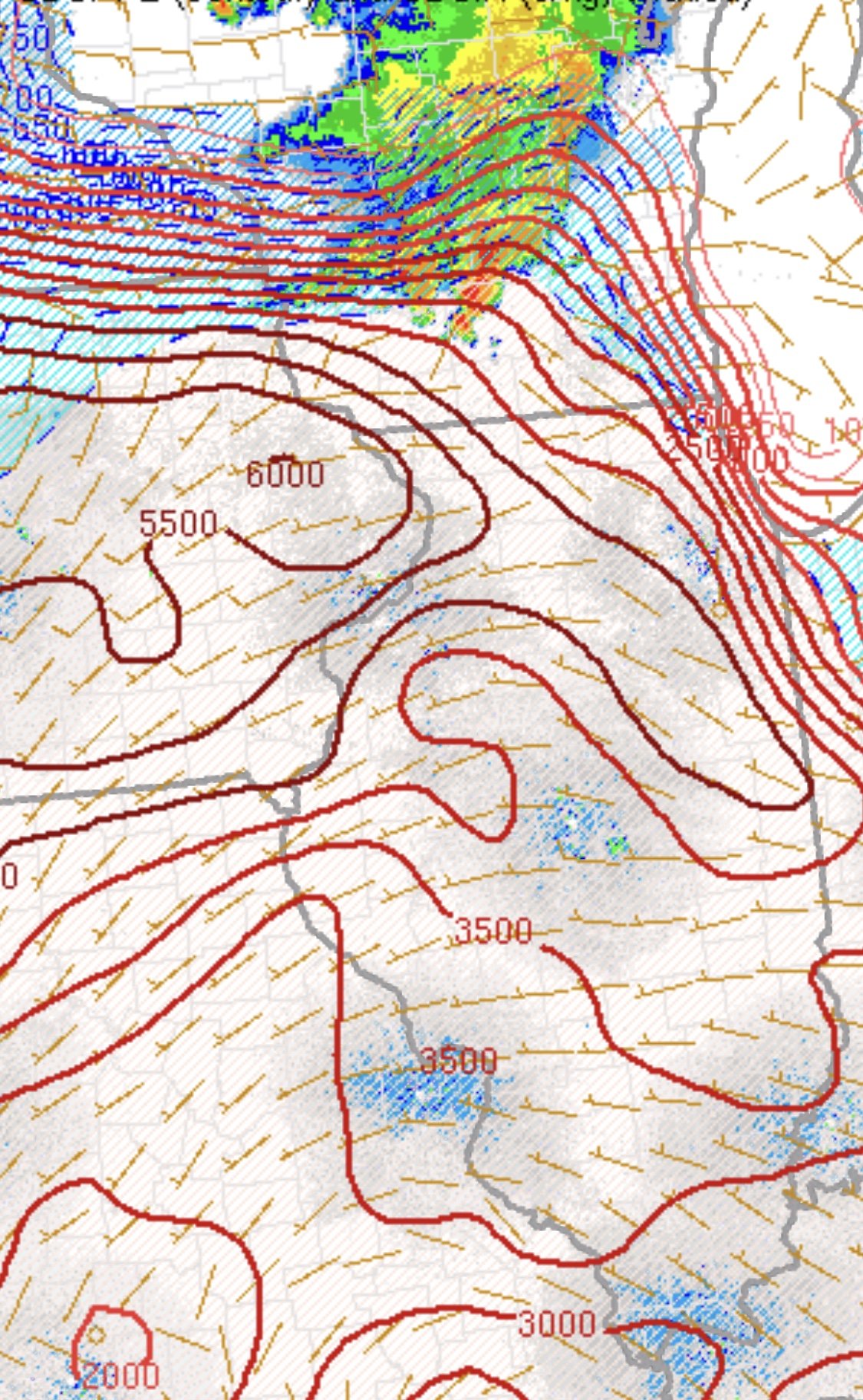
That cluster that just blew up near the Quad Cities looks like it *could* grow upscale into some sort of MCS as time passes -
2019 Short/Medium Range Severe Weather Thread
CoalCityWxMan replied to snowlover2's topic in Lakes/Ohio Valley
Storm with a pretty healthy hail core moving into the center of the metro -
2019 Short/Medium Range Severe Weather Thread
CoalCityWxMan replied to snowlover2's topic in Lakes/Ohio Valley
Yikes. Hope everyone in Iowa city is taking cover. -
2019 Short/Medium Range Severe Weather Thread
CoalCityWxMan replied to snowlover2's topic in Lakes/Ohio Valley
Yup, highest dews of the year so far. Feels kinda nice. Has that “juicy” feel to it where this morning it felt chilly. -
2019 Short/Medium Range Severe Weather Thread
CoalCityWxMan replied to snowlover2's topic in Lakes/Ohio Valley
nervous for Lewistown. -
2019 Short/Medium Range Severe Weather Thread
CoalCityWxMan replied to snowlover2's topic in Lakes/Ohio Valley
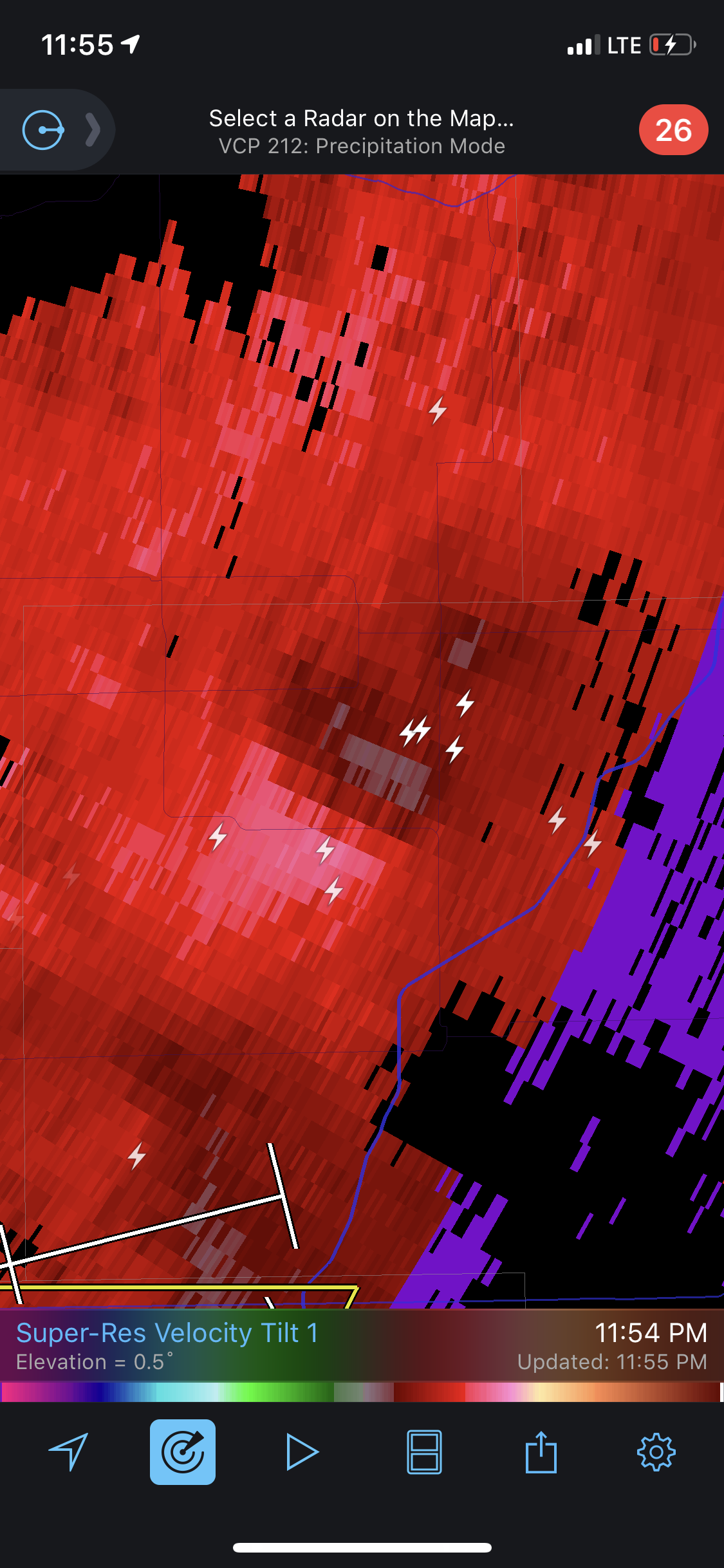
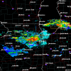
There are some weird mini meso low type things that have been embedded in this complex, paying close attention to radar features/velocity. Have had 2 of such features pass through here tonight, measured a gust to 56 just about 20 minutes ago. This is what the one that came through earlier looked like on velocity.
-
Reconsider majoring in meteorology!
CoalCityWxMan replied to stormguy80's topic in Weather Forecasting and Discussion
So I just stumbled across this thread, I’m going to Northern IL University in a month for meteorology and I keep seeing things like this that really want to make me reconsider. I know this was posted 8 years ago so I’m sure things have changed but if anyone has any insight into this I’d love to hear it, giving myself some other options just Incase sounds like the best bet to me right now but I’d love to hear any advice anyone may have.