
CoalCityWxMan
-
Posts
677 -
Joined
-
Last visited
About CoalCityWxMan

Recent Profile Visitors
2,987 profile views


-
I think you have to be to thoroughly (obsessively) enjoy weather like we do
-
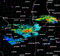
6" that fell in Aurora the other day has solidified down to a galicerious 4". Wonder what snow depth will be after this one
-
-PLRASN at ORD. yuck
-
snain
-
Slopfest at ORD. Literally slush falling from the sky. Hopefully it can flip to all snow once better returns move over as we're in a lull right now, but hopes aren't too high
-
Things are changin....still time for those near the transition zone big south shift from 12z NAM
-
Details aside, it sure is nice to have winter weather to track again. Last winter was largely a bust, 2022 was alright but would've been unremarkable if it weren't for the early Feb storm. Seems like Feb '21 was the last time we had a period of back-to-back systems to track like this, let's keep it rolling.
-
I was going to ask if you were confusing '21 with '22, I had to go back and look today because I thought the big storm in Feb '22 was actually '21. Had 13" at my place from that.
-
At my local caseys they have a tape line about 4’ away from the counter, the cashier asks you to put your items on the counter & step back behind the line. He/she then scans them and then tells you your total, steps back, and then you’re able to pay using only card. They’re not accepting cash at this time
-
Stores are still packed, as many have mentioned above. I guarantee if they didn’t close restaurants people would still be going. I really think they need to just do a total lockdown for a little while and close non essential businesses. Just get it over with
-
Illinois is probably next. Most schools already have announced some sort of change (extended spring break, planning to go online) even without the state mandating it.
-
Not sure about the details on this one, but a friend coming back from University of Kentucky said they were not allowed to fill gas tanks all the way. Haven’t heard of any other such occurrences yet but still. either way, normal life has never been anywhere near this disrupted in my lifetime. Kind of crazy to see all this stuff happening when a week ago I didn’t think any of this was possible
-
Reconsider majoring in meteorology!
CoalCityWxMan replied to stormguy80's topic in Weather Forecasting and Discussion
So I just stumbled across this thread, I’m going to Northern IL University in a month for meteorology and I keep seeing things like this that really want to make me reconsider. I know this was posted 8 years ago so I’m sure things have changed but if anyone has any insight into this I’d love to hear it, giving myself some other options just Incase sounds like the best bet to me right now but I’d love to hear any advice anyone may have.

