
TriPol
-
Posts
2,098 -
Joined
-
Last visited
Content Type
Profiles
Blogs
Forums
American Weather
Media Demo
Store
Gallery
Everything posted by TriPol
-
Reminds me of December 1988. MacArthur airport reported a blizzard while NYC barely got flurries.
-
The crosswalks not getting shoveled is bad. In Jersey City, you need to walk onto the actual rails for the light rail to be able to walk safely at Exchange Place.
-
We just had a foot of snow. The Hudson River is almost frozen over. And Don is doing a pbp of the 84 hour NAM. Are we this desperate? Should we be looking at the JMA which scored a coup 20 years ago?
-
At least the NY Post is in RJ's corner.
-
And risk Weather Geek's wrath? I think not.
-
https://nypost.com/2026/01/28/us-news/deadly-bomb-cyclone-headed-straight-for-nyc-and-could-batter-northeast-with-even-more-snow-even-colder-temps/ Deadly bomb cyclone headed straight for NYC — and could batter Northeast with even more snow, colder temps
-
I love your optimism. I truly wonder though... why do we chase storms on here to just stare at different radars to look at echos and DBZ? Does anybody in here just go outside and enjoy the snow when it falls?
-
I heard something about the Polar Vortex coming in hot due to SSW. The usual suspects. I'm looking outside at the icy Hudson right now and wondering how much lower we can go in temperatures. Soon we're going to need icebreakers. I don't see a day above freezing in the 10 day outlook at all.
-
Maybe a thread shouldn't have been started a week out. Probably jinxed us.
-
It's been 15 years. My memory from back then isn't the best.
-
You're saying the Boxing Day Blizzard was depicted on both the EURO and GFS as being over 150 miles southeast for days and then, within 48 hours, the models just started to show it move northwest and it eventually hit us?
-
I have never seen a storm this far south and west of us on computer models just suddenly come back and hit us, which would be about 150+ mile shift west.
-
Stick a fork in it?
-
NYC ferry service just announced that it’s suspending all ferries due to ice buildup in the East River.
-
Do you think we get a western movement?
-
Honestly? I'm ok with this. Let's move to Spring. If we're not going to get blasted with a 30+ inch storm, bring on the 60s!
-
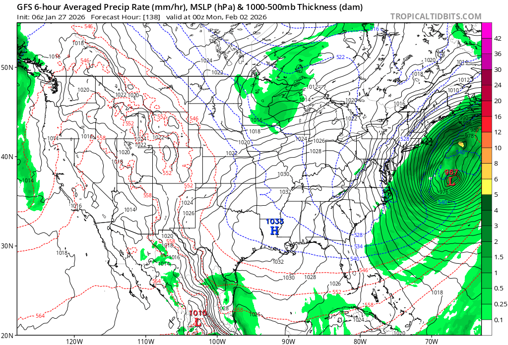
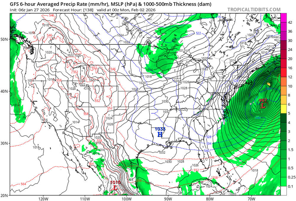
Swing and a miss again. OTS.
-
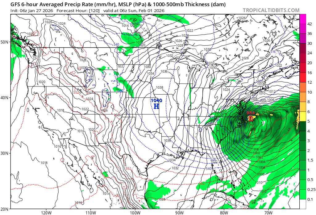
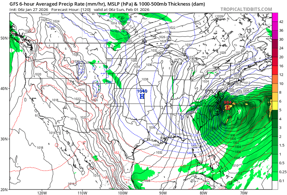
Hmmm.... this looks different.
-
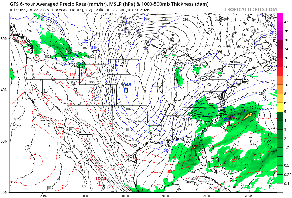
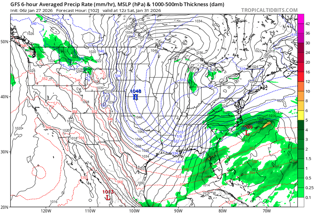
Out to 102 hours. A weak low off of the Carolinas.
-
06z GFS is running. Out to 72.
-
Great. Sandy without the hurricane.
-
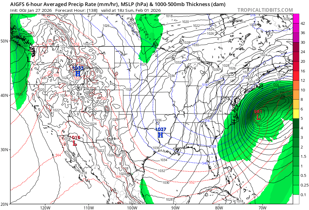
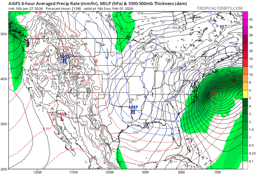
Storm cancel. Bermuda gets whalloped at this rate. GFS AI is even more west.
-
Careful or I'll give you the weenie ring.
-
Oh just wait until Friday.
-
The amount of damage that would do to Long Island beaches would take years to recover from.