NJwx85
-
Posts
19,676 -
Joined
-
Last visited
Content Type
Profiles
Blogs
Forums
American Weather
Media Demo
Store
Gallery
Everything posted by NJwx85
-
I wonder if that band is going to make it here or if this it. Stuck under subsidence.
-
Only about a foot here in Clarkstown. I expected to wake up to more than this. I must have just missed that death band. Just flurrying here.
-
Extreme NW NJ, just NW of Sparta is in subsidence now.
-
And you were worried. You do this with every storm.
-
It’s over me now. Heaviest snow so far.
-
Wind has picked up. My big Magnolia on my back patio is swaying. It looks stressed with all the snow on the smaller branches.
-
Looks like the sharp cutoff will be near the Warren County line in NJ. Near Clinton.
-
Nothing is being reported in Rockland yet. About 331 in Westchester.
-
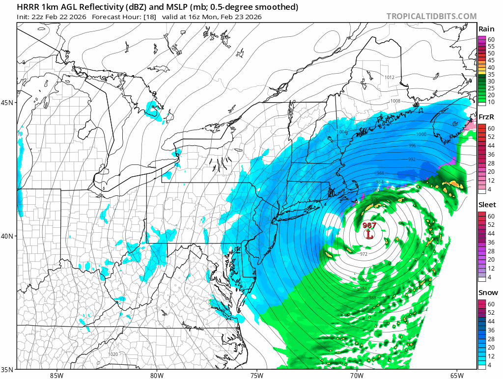
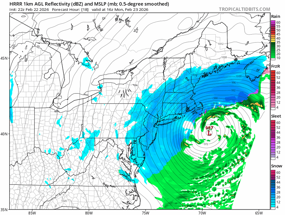
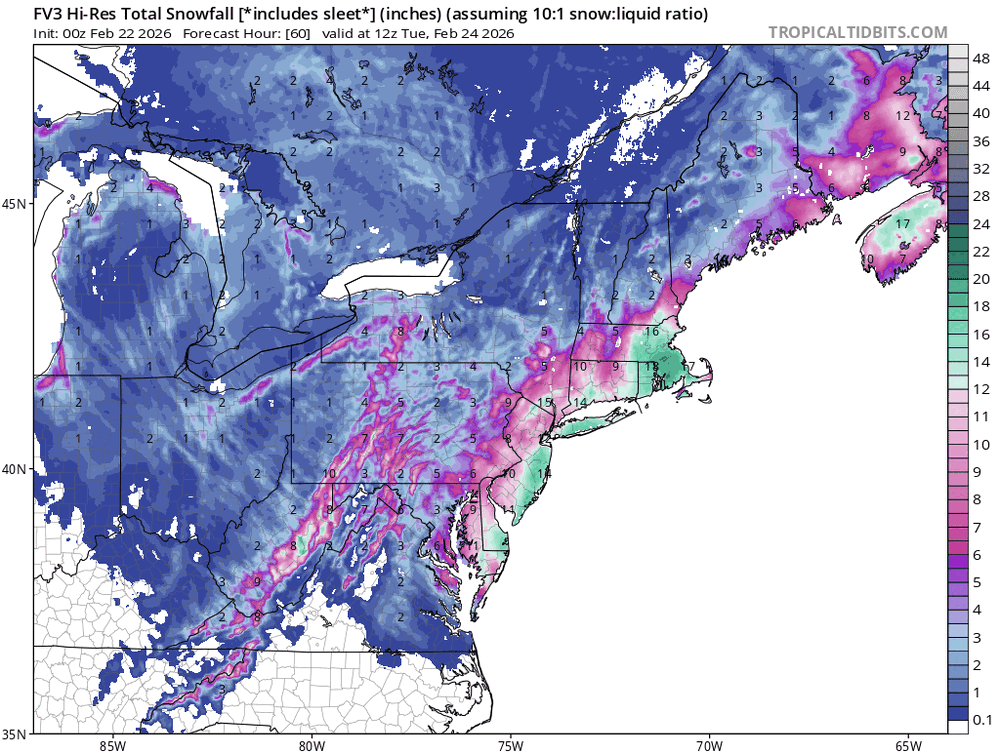
For those asking, based on latest HRRR, snow should start winding down from West to East around Noon tomorrow. So we have about 18 hours of this to go. After that, bands will persist in some areas well into the afternoon but the heaviest will be over.
-
Your trolling today has been particularly insufferable.
-
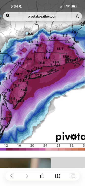
Storms like this only happen once or twice a decade if we’re lucky. I had 22” from the storm in January but that was due to many hours of moderate snow with no wind. This one is truly special. Can’t recall ever seeing blizzard warnings this far inland.
-
Still snowing 18hrs from now.
-
The HRRR has a band over western areas that persists well into tomorrow afternoon. This is 15z.
-
I fixed it
-
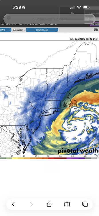
21z HRRR Kutchera and still snowing.
-
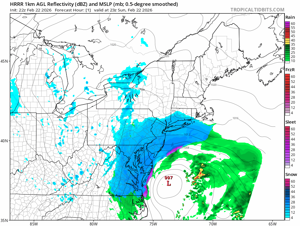
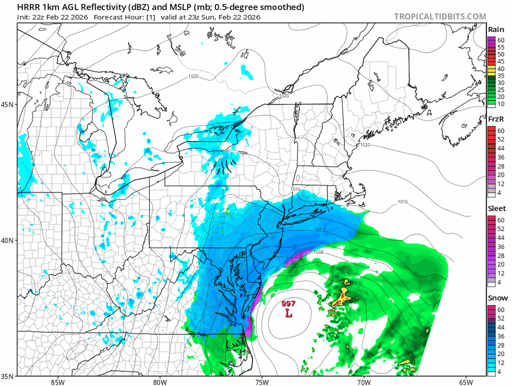
Why are people looking at a global model instead of radar and mesos? If the HRRR suddenly jumped 50 miles East for tonight that would get my attention. The rest is just noise.
-
Still light white rain here. Bands are crawling North.
-
Yup just noticed it.
-
Nice uptick
-
Nothing here yet after a brief burst of white rain.
-
Anyone East or the DE River is in great shape. Even West of there will be decent. The cutoff won’t be as sharp as Boxing Day.
-
He’s been trolling all morning. There’s no dry slot coming. The mid level lows never get close enough.
-
Boxing Day had 2-4” per hour rates under the heaviest banding. This should be in the same neighborhood.
-
She was very close to where Jimmy Leads intersects with Pomona Rd. Enjoy the storm. Certainly very historic for that part of NJ.
-
My Grandmother lived in Pomona. About 3 miles from Stockton. Spent many Summers down there.