Cary_Snow95
-
Posts
361 -
Joined
-
Last visited
About Cary_Snow95

Recent Profile Visitors
3,825 profile views


-

Mid to Long Range Discussion ~ 2023
Cary_Snow95 replied to buckeyefan1's topic in Southeastern States
Euro control run is very active around 2/3 time frame -
2022 Atlantic Hurricane season
Cary_Snow95 replied to StormchaserChuck!'s topic in Tropical Headquarters
It’s moving into a harsh environment with high shear soon and dry air is already having its way. -
2022 Atlantic Hurricane season
Cary_Snow95 replied to StormchaserChuck!'s topic in Tropical Headquarters
End of Euro continues to advertise major outbreaks of dry air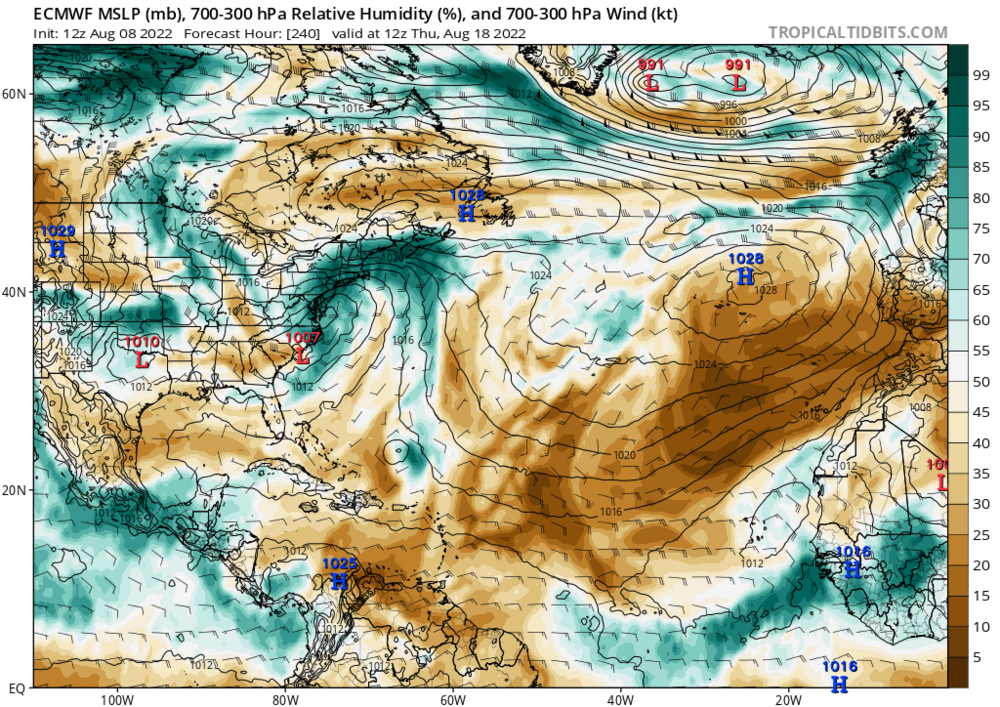
-
2022 Atlantic Hurricane season
Cary_Snow95 replied to StormchaserChuck!'s topic in Tropical Headquarters
As expected GFS is trending towards other guidance with a weaker system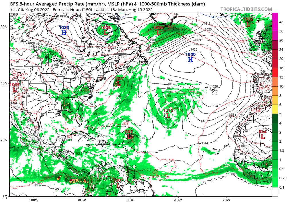
-
2022 Atlantic Hurricane season
Cary_Snow95 replied to StormchaserChuck!'s topic in Tropical Headquarters
GFS coming in much weaker and more realistic imo. Think we will see euro and gfs begin to agree on a weak TD -
2022 Atlantic Hurricane season
Cary_Snow95 replied to StormchaserChuck!'s topic in Tropical Headquarters
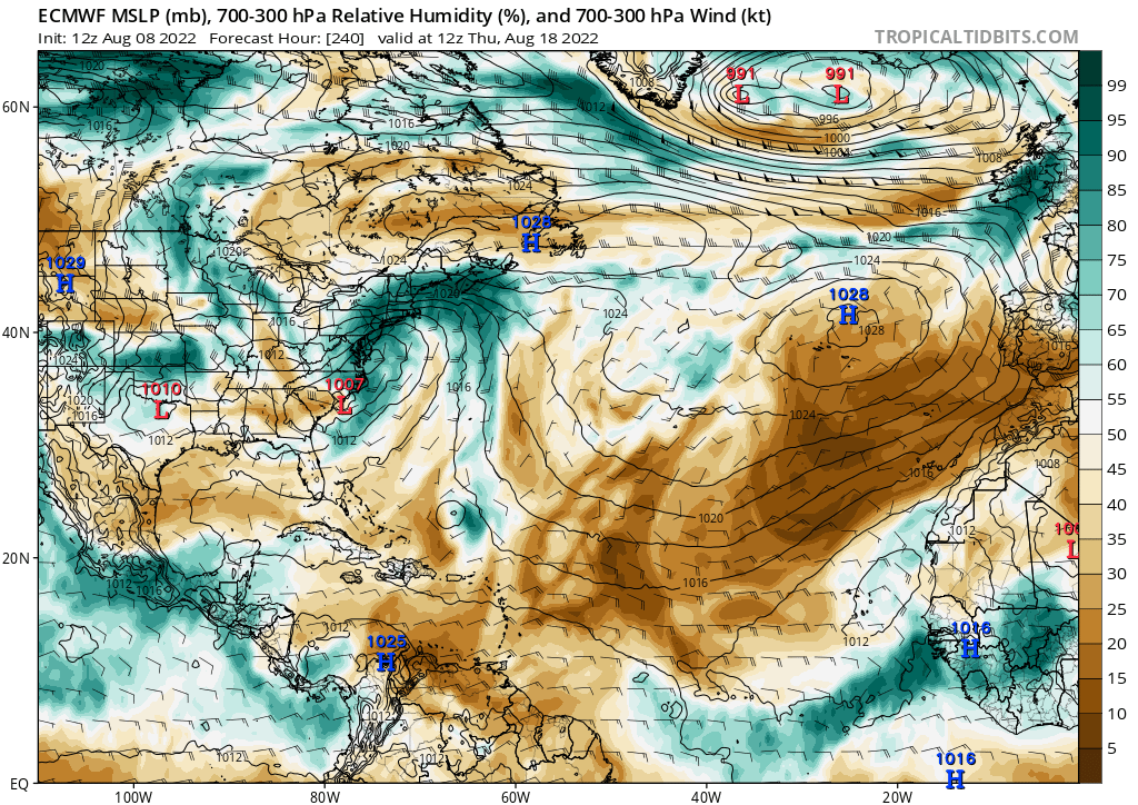
Wave breaking continues to wreak havoc on the MDR. Mid Latitude dry air is being consistently driven into the MDR. Latest Euro further strengthens the sub tropical low sending a surge of dry air south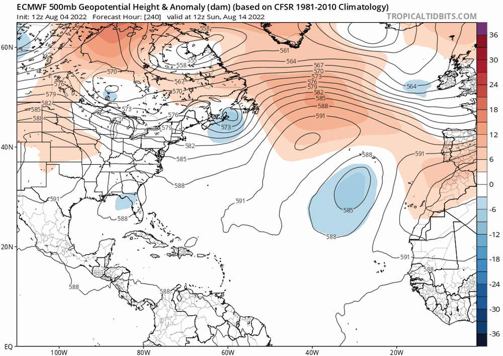
-
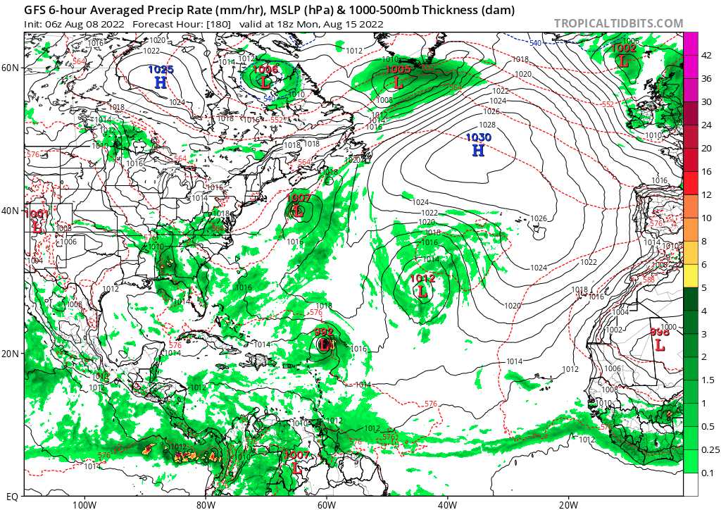
18z HWRF is into the Central GOM fwiw
-
GEFS continues to speed it up pretty drastically
-
2021 Atlantic Hurricane season
Cary_Snow95 replied to StormchaserChuck!'s topic in Tropical Headquarters
With this kind of 500mb look is a GOM threat favored? With a lifting trough and a building high I feel like getting anything up the east coast would be hard. I could be completely wrong tho -
Euro still looked fine and is a few minor tweaks from a major. Gfs sucks but is on an island compared to the euro, icon, and cmc
-
4-6 across the area. And temps afterwards are extremely cold for multiple days. Snow would be around a while. Perfect setup on the 12z. And looking at the H5 maps, it was close to a monster
-
Does it continue its idea of a low further off the coast?
-
The 0z is continuing the idea of keeping the low further of the coast
-
It's on TT and pivotal