Frog Town
-
Posts
1,029 -
Joined
-
Last visited
Content Type
Profiles
Blogs
Forums
American Weather
Media Demo
Store
Gallery
Everything posted by Frog Town
-

Winter 2024-25 Medium/Long Range Discussion
Frog Town replied to michsnowfreak's topic in Lakes/Ohio Valley
We just need to be patient until Mid December when the mean trough repositions itself to benefit our sub forum. We've waited like 7 years(2017 was last time we had this) so two weeks of a clipper pattern could be worse. Common people! -
Winter 2024-25 Medium/Long Range Discussion
Frog Town replied to michsnowfreak's topic in Lakes/Ohio Valley
It's November and it's cold! Adderall anyone?? -
Winter 2024-25 Medium/Long Range Discussion
Frog Town replied to michsnowfreak's topic in Lakes/Ohio Valley
Exactly! We get Canada good and we don't need to count on a cross polar flow or crazy blocking to get cold enough weather for snow. -
Winter 2024-25 Medium/Long Range Discussion
Frog Town replied to michsnowfreak's topic in Lakes/Ohio Valley
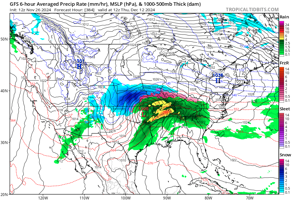
Here's the set we need come mid December! Big'ol banana high to the north. This would be a crusher!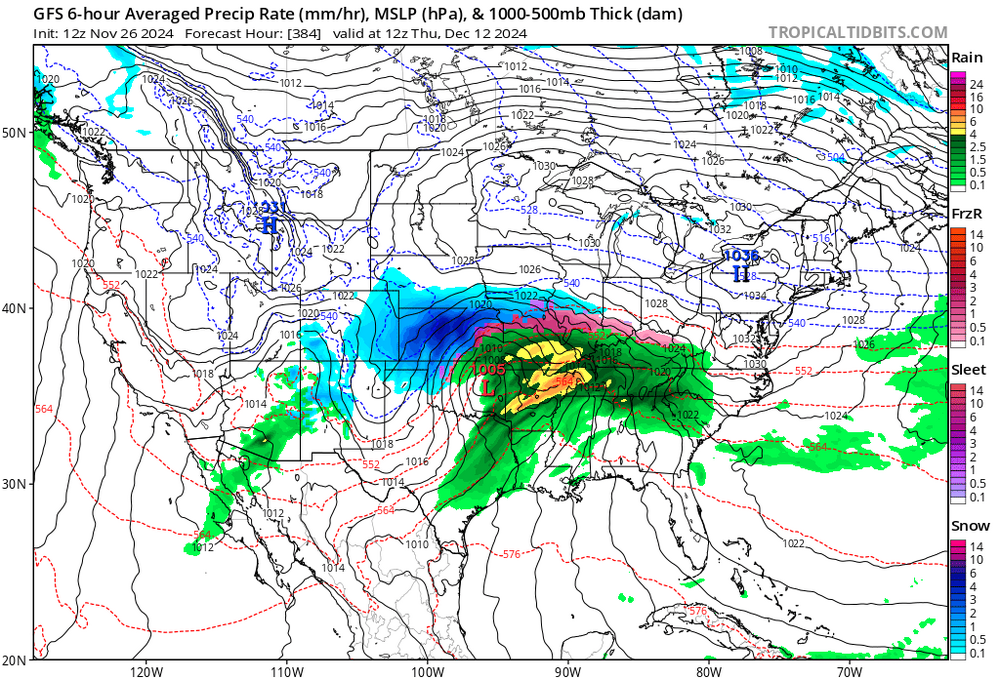
-
Winter 2024-25 Medium/Long Range Discussion
Frog Town replied to michsnowfreak's topic in Lakes/Ohio Valley
While we may not get much snow, yet. It's nice to see a pattern that can sustain cold, especially early. The past 4 years it's been a roller coaster whiplash. -
Winter 2024-25 Medium/Long Range Discussion
Frog Town replied to michsnowfreak's topic in Lakes/Ohio Valley
I would agree fellow Toledo'n. Although I'm just a skirt north of you in Sylvania. -
Winter 2024-25 Medium/Long Range Discussion
Frog Town replied to michsnowfreak's topic in Lakes/Ohio Valley
Ok, Ok, I know it's the 84 hour Nam, but if you extrapolate it out a bit, I think it's further North with the low this week for Turkey day. Thoughts? -
Winter 2024-25 Medium/Long Range Discussion
Frog Town replied to michsnowfreak's topic in Lakes/Ohio Valley
Remember with the system this past week when the GFS trended towards the Euro bombing out over Detroit which continued trending west over towards Wisconsin. Just wait for it. This will become a northern Illinois/southern Wisconsin crusher soon enough. -
Winter 2024-25 Medium/Long Range Discussion
Frog Town replied to michsnowfreak's topic in Lakes/Ohio Valley
This pattern is turning out very December 2000ish.. That was a crazy cold and snowy December that quickly turned into a mild January/Feb. I believe we had 15+" on the ground for for Christmas that year in Toledo. -
Pattern looks pretty sweet for the OV late next week. Always worry about too much suppression in these set ups, but not sure about the SE Ridge flexing in these set ups. Would love to see a spread the wealth system but it's a weird time of year to get something like that..
-
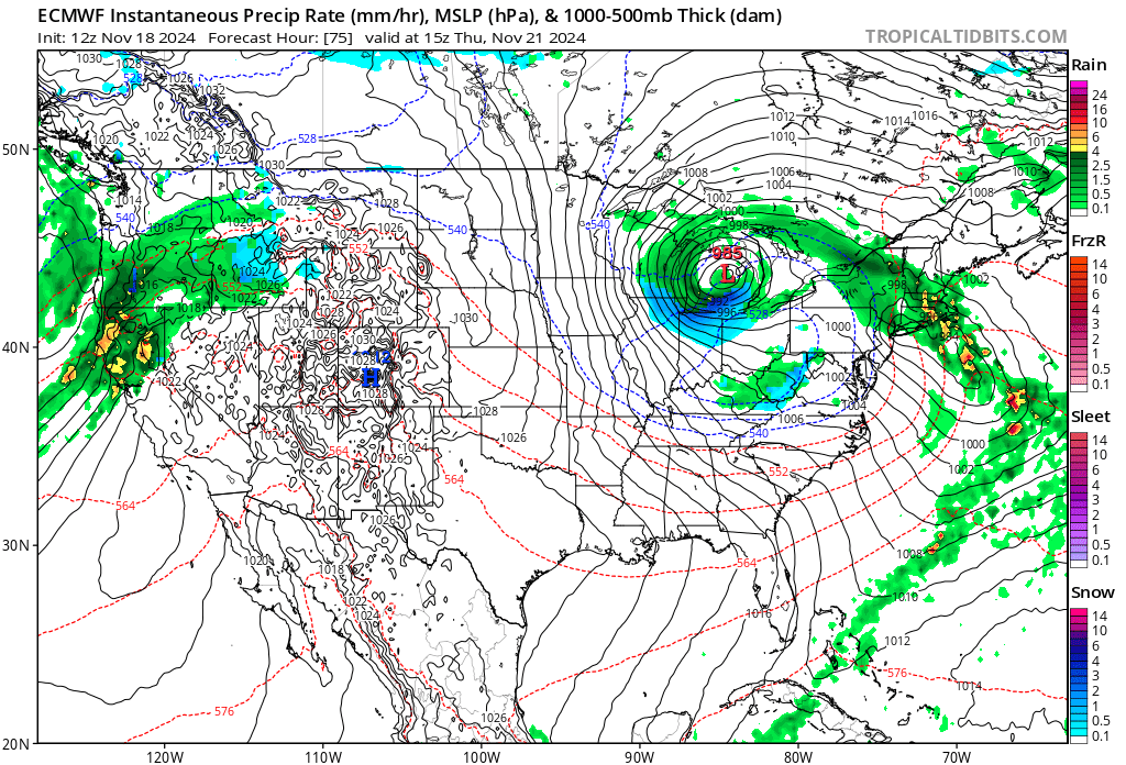
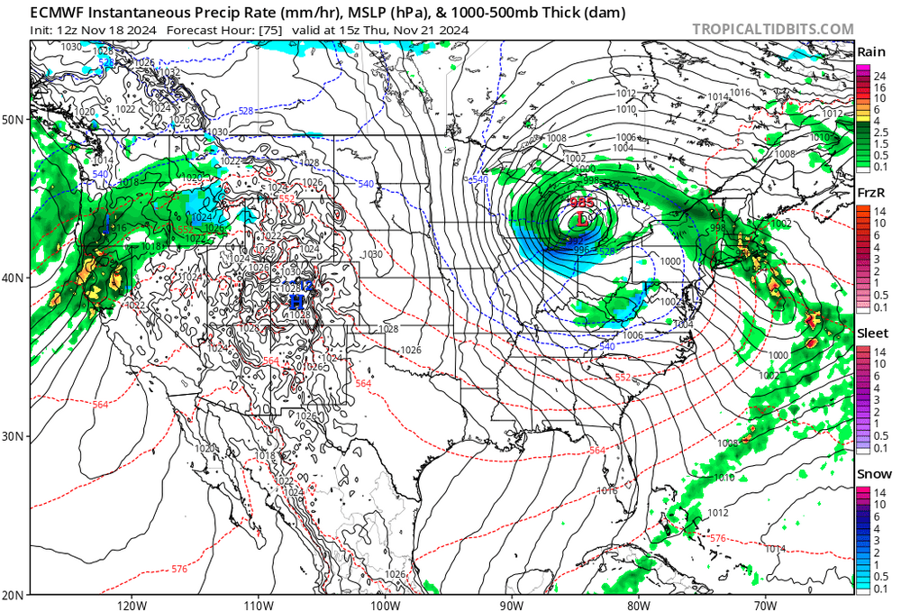
Not often you see a dry slot and warm tongue with this orientation!!
-
November 2024 General Discussion
Frog Town replied to SchaumburgStormer's topic in Lakes/Ohio Valley
It's back and 12Z was a juicy run.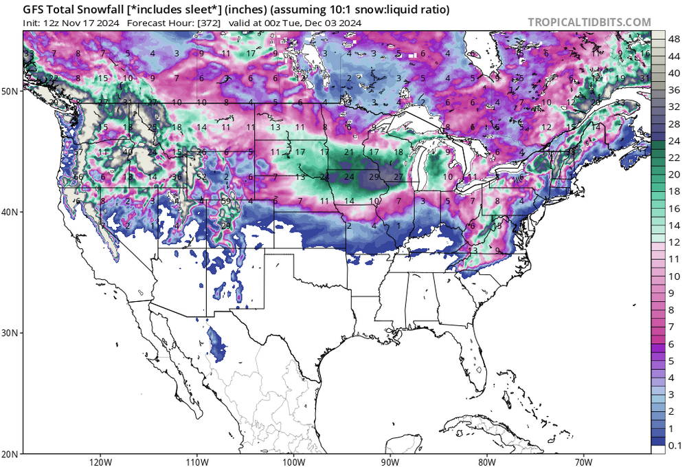
-
0Z and 12Z Euro's are almost carbon copy's, weird.
-
Must be the new upgrade! I'll take it.
-
November 2024 General Discussion
Frog Town replied to SchaumburgStormer's topic in Lakes/Ohio Valley
More like whatever drug the GFS is on. 11 days out...lock it in. -
November 2024 General Discussion
Frog Town replied to SchaumburgStormer's topic in Lakes/Ohio Valley
If I'm not mistaken, the following Winter was epic, I believe. I know 76'-77' was one of the coldest, but I can't remember is 75'-76' was as cold. -
Hmmm, so logically, if we are in a cool phase but warm, then we will cool when we head into a warm phase. Sounds pretty straight forward. In all seriousness though, a few years back, maybe 2019-20 or '18/'19, all the local Mets sounded the alarm that things were lining up for a very cold and snowy Winter. I think it was end of November/early December which is a pretty safe time to make a Winter call. I've never seen Toledo Mets put it all on the line like this and it was pretty unanimous. Which ever winter it was, it ended being a bust. All this to say, I'm not overly concerned with the warm signals we are getting. If anything, it brings comfort knowing that I won't be disappointed.
-
Looking at the pacific currently, November is gonna be chilly. Almost a complete replication of November 2013. Not saying it's gonna stick like 2013-2014, but that sure would be nice.
-
Fall/Winter '24 Banter and Complaints Go Here
Frog Town replied to IWXwx's topic in Lakes/Ohio Valley
I know it's early but it's hard to ignore how similar the pacific is currently, along with the recurving typhoons, to the fall of 2013....Just sayin. -
It's starting to get very frustrating as we enter another neutral ENSO during the wrong time of the year. Here in the Midwest we've had a cooler than normal Summer only for it to flip during the fall/Winter and average above average with La Nina. It's been since the 2013-2014 that this has been the case. Here's your shitty Winter Forecast, early and for free.
-
~2" here in Toledo..so far
-
Same! Really indescribable and surreal.
-
Yup
-
Storms and Cold back on the docket for the last week in March with potential big dog stuff. Curious if it will stick, or just smoke and mirrors...
-
I remember reading and researching climate change/global warming as a kid. The one thing that has stuck with me was the talk of drastic/wild temperature swings much like we are seeing. Is it really even a debate anymore?? I think the wild extremists that talked of oceans rising 10ft and ridiculous temps muddled the waters and created a bunch of skeptics and conspiracy theorists. Which are now grown adults with very loud Social Media speakers.. Probably the wrong thread but Winter's is over for the foreseeable future.