Frog Town
-
Posts
1,029 -
Joined
-
Last visited
Content Type
Profiles
Blogs
Forums
American Weather
Media Demo
Store
Gallery
Everything posted by Frog Town
-
You don't see this that often so things can, and have, been worse.
-
I think a lot of use are suffering from PTSD and a very skeptical despite what all the models are saying. '16-'17 was a year that we chased SSW and blocking all season long for it to end up somewhere else.
-
Outside of the lake affect-NW Ohioian here-do you think the more southerly track of the AI models has any merit with regards to the synoptic event. They've done pretty well this Summer and Fall.
-
Curious to see if these new AI models, and their more southern tracks, win out on this one?? Very consistent and did well this Summer and Fall...
-
What's the problem with a 7.69% accuracy rate??
-
One trend I've noticed in the past 20 years is we just can't hold a neutral enso, which is ultimately what we all want for winter in this sub. Just when we thought it was gonna happen, La shit head pops back up to give a screaming pacific jet for the late fall/early winter weather. Just sucks. La Nina/El Nino have always been a thing, but the frequency has definitely changed. Curious.
-
Curious if the pattern is trying to tell us something for the upcoming Winter? When was the last time Summer ended this cool? Obviously more questions than answers but getting a little excited with how things are setting up.
-
Can we get a Winter thread going already!? The withdrawal symptoms are killing me..
-
Wrong thread and all the other crap, I know, but I'm just gonna leave this right here... It's never too early in my book and I know most of you are as nutty as me! lol. https://www.facebook.com/share/p/1Hdk5E2Wr6/
-
I know you're a stats guy but this is consistent with what's happened the past few years with this set-up. End's cooler vs. warmer.
-
Battery expansion. Need a new battery, fellow Toledo'n
-

Winter 2024-25 Medium/Long Range Discussion
Frog Town replied to michsnowfreak's topic in Lakes/Ohio Valley
I have a feeling that the system next week 3/5 and 3/6 is going to surprise a lot of people on the cold snowy side The following week we torch. -
Winter 2024-25 Medium/Long Range Discussion
Frog Town replied to michsnowfreak's topic in Lakes/Ohio Valley
At this point I say bring it. -
Winter 2024-25 Medium/Long Range Discussion
Frog Town replied to michsnowfreak's topic in Lakes/Ohio Valley
Thank you! I thought you might know. -
Winter 2024-25 Medium/Long Range Discussion
Frog Town replied to michsnowfreak's topic in Lakes/Ohio Valley
Some historian can correct me if I'm wrong but our biggest snow storm in recorded history for NW OH was in early March some time in the early 1900's after a very similar winter to what we currently in. It was something like 20"+. Not that I want that crap in March only to watch it melt away in a few days. -
Winter 2024-25 Medium/Long Range Discussion
Frog Town replied to michsnowfreak's topic in Lakes/Ohio Valley
None of this even comes close to verifying so I wouldn't feel too ripped off. -
While I'd love a north trend with this, the TPV will keep it south.
-
This will be the one that explodes and surprises everyone. It's kind of fun going into it not knowing what to expect. Definitely interesting watching the local TV Mets riding the line of that "not sure exactly what to expect" look.
-
Duration and uncertainty give pause. Maybe this afternoon if trends continue. Seems more like a long duration WAA.
-
Once thing is clear; this thing has a ton of moisture.
-
I just like that we have these two big hitters analyzing this stuff. That means it's legit.
-
Amazing how different all the models are within 36 hours of this event. Throwing darts really. Did DOGE get to the model suits??
-
Detroit crew reeling this one back in. Like the good ole' 2010's
-
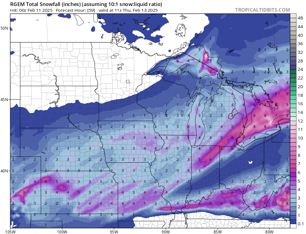
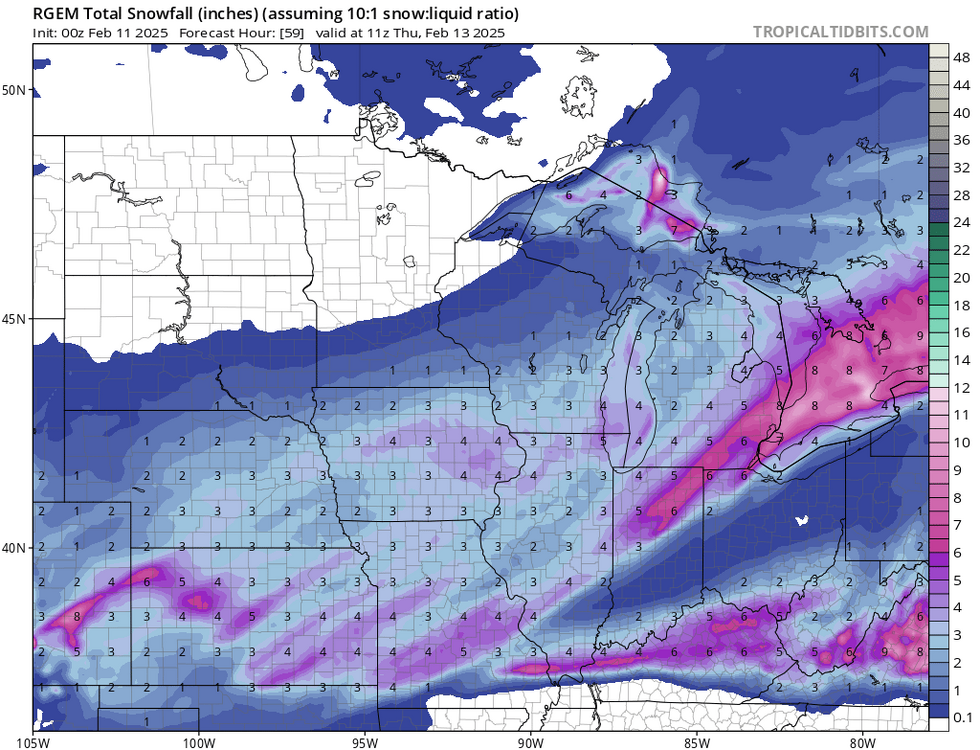
Our two Hi-RES(At least the ones I have access two, NAM/RGEM) models are at both end of the spectrums. Nice.
-
What I trust is seasonal trends, which have been flatter/weaker/se. Haven't had an amped system yet this season, at least with Arctic air in place.