MattPetrulli
-
Posts
1,736 -
Joined
-
Last visited
Content Type
Profiles
Blogs
Forums
American Weather
Media Demo
Store
Gallery
Everything posted by MattPetrulli
-
Thought so too, but NHC is still using the catastrophic wind wording which is used for category 4+ only so I think it's just the forecast point.
-
Kinda getting Ida vibes. Ida kinda struggled/gradually intensified throughout the day before LF with dry air I believe (though this dry air is more significant I think) then exploded over like a 12 hour period. Granted, Ida was smaller than what Helene is/will be, thus exacerbating the rate of intensification. Also Helene has more time than what Ida did at this time.
-
First sign of meaningful intensification all afternoon. May finally be go time, and also while constructing a more proper eyewall, maybe it can construct a CDO.
-
81 knot FL on last pass. We got a hurricane more than likely.
-
78 knot FL would support a 65 knot even 70 knot upgrade.
-
Ah yes, the classic 979 MB tropical storm.
-
Quite the PRE event modeled on GFS for NC/TN/GA. Can't post the GIF but I feel like the flood threat so far inland is going under the radar no pun intended.
-
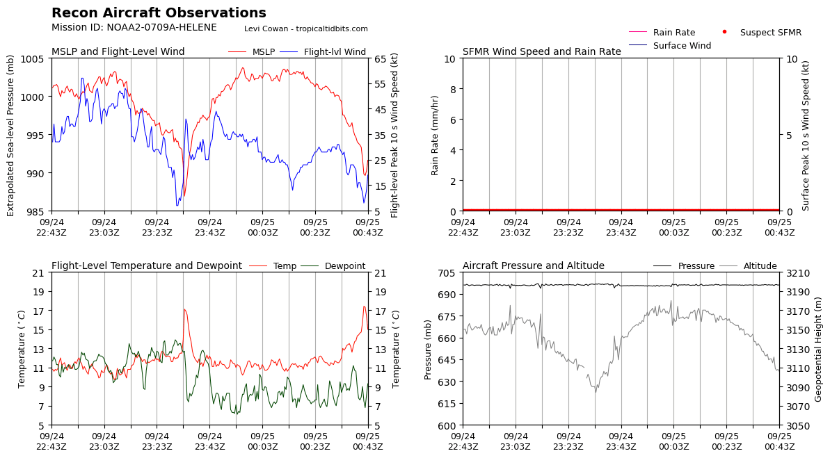
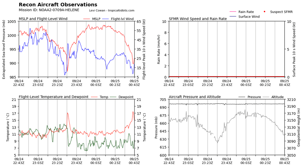
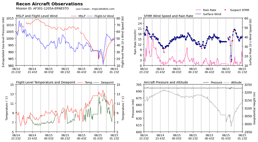
986 pass earlier probably just from a mesovort. Pressure came up a bit, but this is probably the beginning of core construction given the temperature spike present.
-
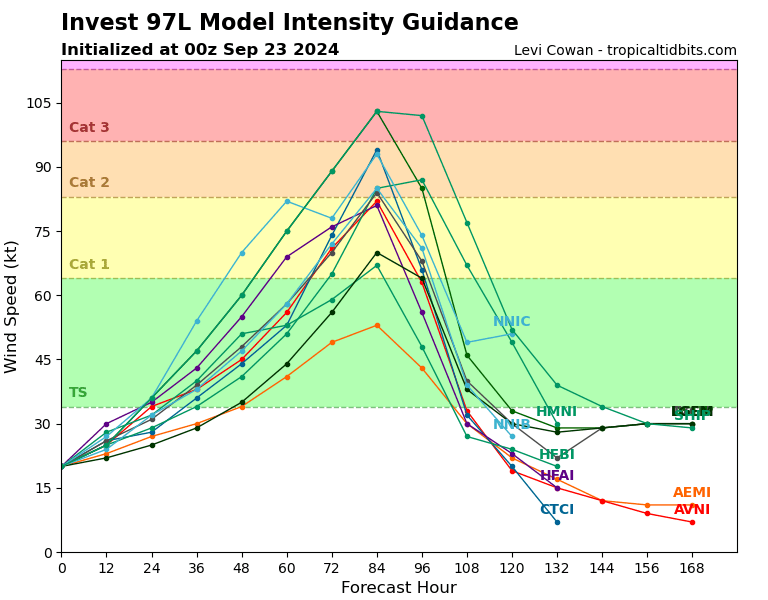
Still forecasts a major at LF The official intensity forecast is similar to the previous one and lies between the statistical-dynamical model guidance and the purely dynamical model predictions. It should be noted that the 72-hour forecast allows for a little weakening after moving inland, so the cyclone is still expected to be at major hurricane strength at landfall.
-
https://x.com/MarkMeyerWx/status/1838381014676091068
-
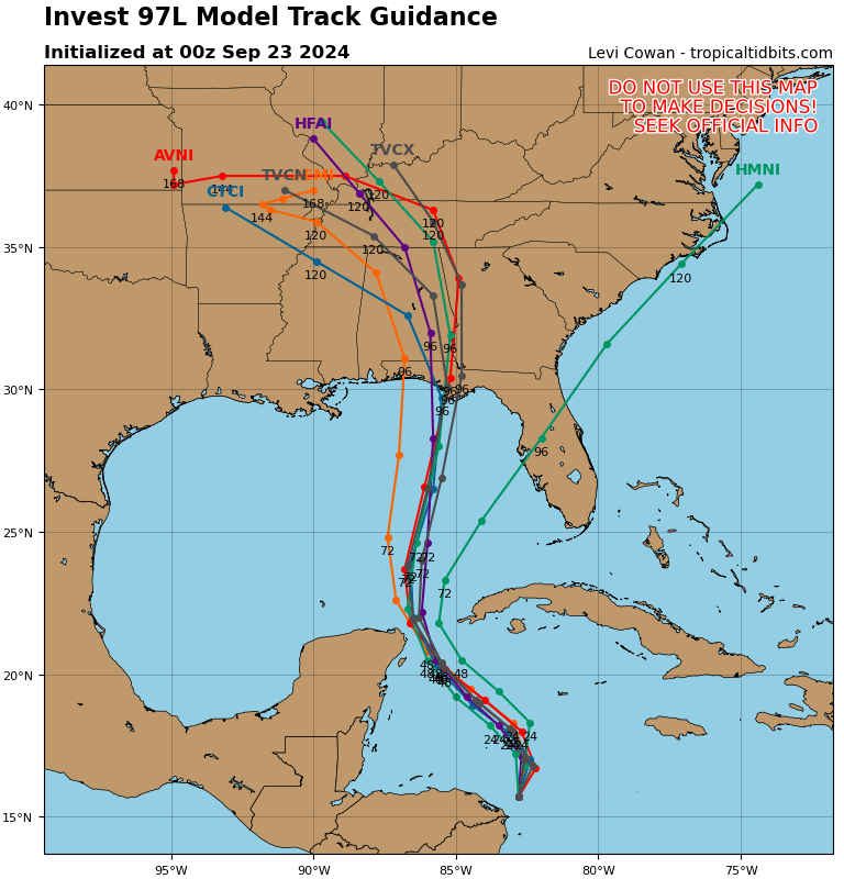
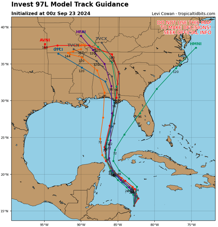
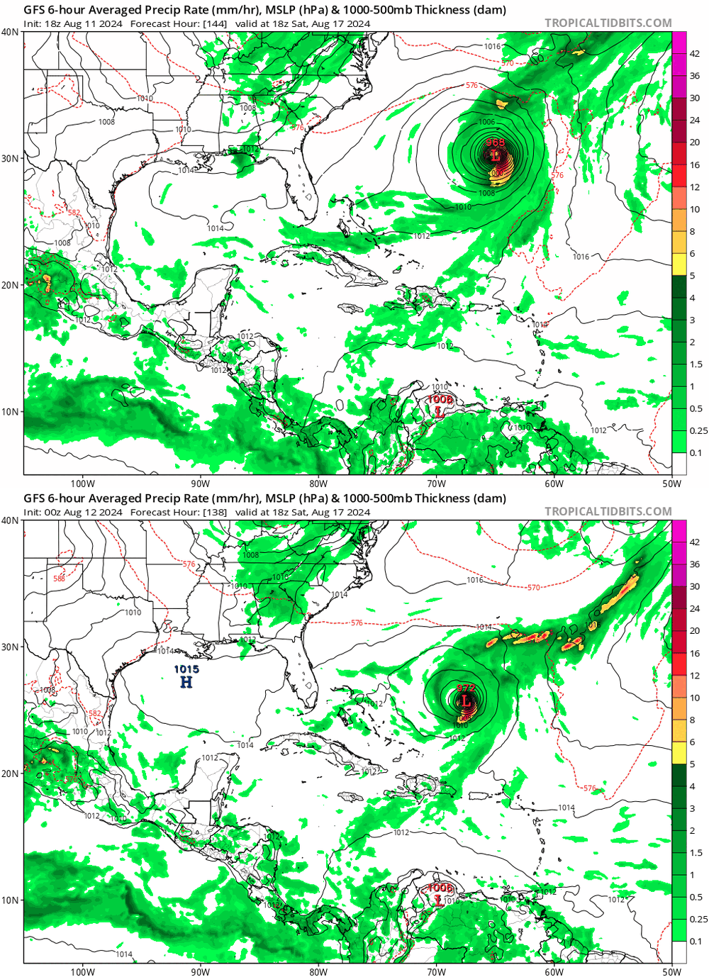
Maybe windshield wiper back to the west a bit on 00z spaghettis?
-
-
CDO has warmed some and pressure has come up a bit in latest pass. Probably temporary, however.
-
Slight shift
-
First FFE of Debby in the Carolinas
-
Slowly but steadily getting more convection near the center. Still looks hollowed out to infinity but it's over water now so we'll see what happens. NHC has it getting to 50 knots again, I personally would be kinda surprised if that happens.
-
I like how detailed NWS Charleston is getting in their warnings. Very specific details for certain rivers and such * At 425 PM EDT, Doppler radar indicated light to moderate rain extending across much of the Charleston, Berkeley, Dorchester and Beaufort Counties. As much as 6 to 13 inches of rain has fallen so far and additional 1 to 2 inches could fall through this evening. Flash flooding is occurring in parts of West Ashley, Downtown Charleston and the Oakbrook area in southern Dorchester County. HAZARD...Life threatening flash flooding. Heavy rain producing flash flooding. SOURCE...Radar indicated. IMPACT...Life threatening flash flooding of creeks and streams, urban areas, highways, streets and underpasses. * Some locations that will experience flash flooding include... North Charleston, Mount Pleasant, Summerville, Goose Creek, Hanahan, Walterboro, Saint George, Edisto Beach, Givhans Ferry State Park and Ladson. Water levels on Saw Mill Branch continue to rise. Dorchester County Emergency Management is strongly encouraging residents in low-lying or flood-prone areas to evacuate to a shelter. Water levels along Ireland Creek at Walterboro stopped rising, however water could still approach or flood some businesses along Ivanhoe Road. Heed any evacuation advice from local officials. Flash flooding is likely ongoing along Church Creek in West Ashley.
-
"The flags aren't even moving", it's almost like the main hazard that has been advertised this entire storm is rain and flooding lol
- 909 replies
-
- 11
-

-

-
Nasty firehose getting setup in the Charleston Metro. Unfortunately, likely the start of catastrophic flooding reminiscent of Joaquin 2015, etc.
-
Not a significant difference, at least applicable to this scenario.
-
Running a fair bit east of forecast. May get over water sooner if this continues Yesterday's cone vs today's showing the east shift and forward motion being sped up.
-
2024 Atlantic Hurricane Season
MattPetrulli replied to Stormchaserchuck1's topic in Tropical Headquarters
2k posts of nothing but trolling and stupidity for years, I hope you get the help you need my brother. -
Now recon support for a hurricane
-
Nevermind, we won't know because of cheapness of our government and tools breaking.
-
Pretty confident we got a hurricane now. Northern eyewall velocities continue to tick higher and higher with each scan, they're about to do a pass through it so we'll see for sure in a few minutes.