MattPetrulli
-
Posts
1,734 -
Joined
-
Last visited
Content Type
Profiles
Blogs
Forums
American Weather
Media Demo
Store
Gallery
Everything posted by MattPetrulli
-
Was already projected 4-7 ft of surge so.
-
18z Euro may bring it back over the Atlantic lol
-
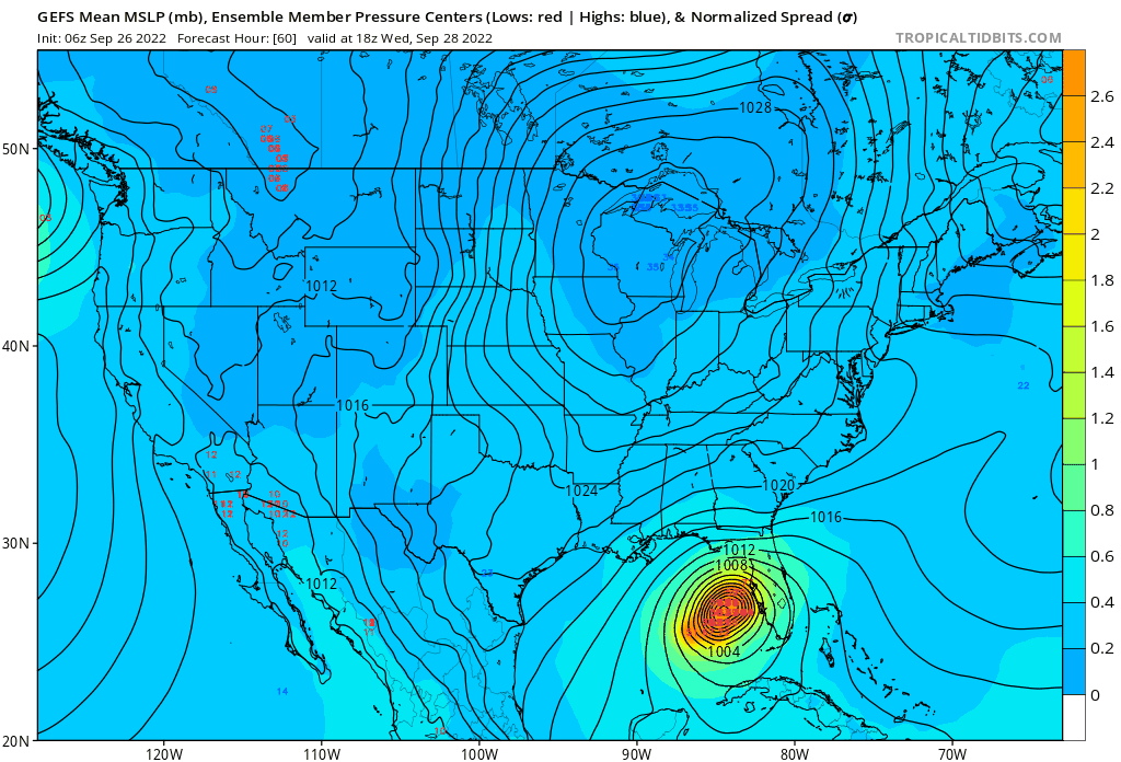
Something that shouldn’t be forgotten, GFS Euro and HMON all show an expansive wind field approaching the coast. It correlates with tropical storm watches issued for other areas of West Coast. That area near Ft Myers is really surge prone and has a projected 4-7 ft of surge which is enough to do a lot of damage
-
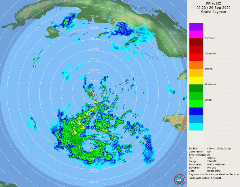
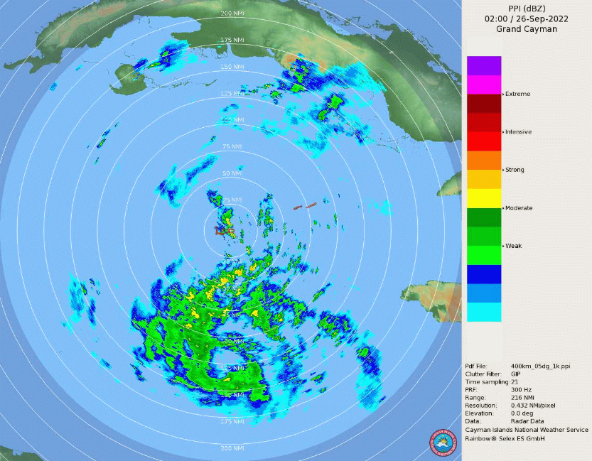
Could distance away from radar and/or radar quality, but the inner core looks quite ragged currently.
-
Recon making a center pass so about to find out
-
GEFS east some too

-
This would be 4th system in 8 years that goes up the Florida coast and threatens some of the core coming ashore, (Dorian, Matthew, Isaias). Just funny because I don't recall that in 2000s/90s, could be wrong though
-
Just parks over Tampa through 00z Friday lmao
-
Also gives tropical storm conditions to most of the Florida West Coast which I was skeptical of, even though there's warnings and watches out.
-
12z GFS maybe a tad east, but stronger and bigger
-
Recon a decent ways away from the center and still getting TS force SFMRs
-
GFS sizably west
-
Ian is GOING TO WORK, this is not a 60 MPH tropical storm anymore
-
May be there sooner than later. Satellite also looks increasingly better
-
https://www.weather.gov.ky/radar Radar from Grand Cayman to use has Ian's center in range
-
Recon found the center again, along with a temperature spike indicating core formation in progress
-
Yes, could be right about this
-
More ensembles on 18z going towards peninsula + showing the stall along with more W Florida landfalls. Just off the pure eye. The mean itself may be deviated by the members which go in west of PC, which probably won't happen.
-
18z GEFS goes east
-
18z Euro a little west, but stronger
-
I think they may have missed the true center due to the hot tower to the north of it. Could be incorrect though
-
60 MPH and 991 MB at 8 PM