

gymengineer
-
Posts
3,242 -
Joined
-
Last visited
Content Type
Profiles
Blogs
Forums
American Weather
Media Demo
Store
Gallery
Posts posted by gymengineer
-
-
Sidewalk and side street covered here in North Bethesda.
-
 1
1
-
-
Snow mixed in now in North Bethesda.
-
1
-
-
57 minutes ago, chris21 said:
The November 1995 cold front is the one that stands out the most for me in Bethesda. I remember high winds, thunder and a dramatic temp drop with 1.5 inches of paste. It was early November (the 8th maybe), I actually lost power for the night.
I was in Potomac, MD, for the event. It was on 11/11/95, and like you, I lost power. We lost power during the severe thunderstorm part of the event pre front clearance, but power came back during the snow. 2” accumulated where I was.
3/8/05 was another such type of frontal passage where a Severe Thunderstorm Warning preceded a rapid change to snow that covered the grass.
2/14/15 was the ultimate flash freeze frontal passage, but wasn’t preceded by actual severe weather.
We do much better with the ENE oriented strong cold front passages with the following wave. Those have been WSW events for us. Just in March, we saw those events 3/8/96, 3/3/14, 3/5/15, etc. -
23 minutes ago, Maestrobjwa said:
I had the blizzard of '96 in mind...but I see I was off by a couple days--so Jan 6th! But I picked that date because that was the earliest in January we had ever gotten a big hit (I think)--kinda unusual (usually our hits come from mid-January through President's day, and the occasional March hit).
Without going too far back, DC also had notable (WSW criteria) snowstorms 12/31-1/1/71, 1/4-5/80, and 1/8/88. 1/77 had a 3-day sequence early in the month that would total WSW as well but they weren’t all one storm.
-
9 minutes ago, Maestrobjwa said:
Not sure I wanna get sucked into this "potential"... Last week of December is a historically bad time for us to get good snow (more than a couple inches). If you look at our snow history...I don't recall seeing any dates between Dec 26th and Jan. 9th where we got WSW level stuff at BWI/DCA (anybody got any record on that?) I'm not sure whether it's just coincidence or what...but for some reason we don't seem to get warning level snows during that time period. Would love for this trend to suddenly break this year though...It's 2020, so why not? Lol
Are you sure you meant to go all the way to January 9th?
-
1
-
 1
1
-
-
17 minutes ago, WxUSAF said:
Top two analogs for the CPC D11 super ensemble are both KUs...3rd is in January 1987.
https://www.cpc.ncep.noaa.gov/products/predictions/814day/814analog.off.gif
Top analog was 12” at IAD and the second one was DCA’s highest Christmas Day snow depth of 7”, eventually tied by 12/09.
-
1
-
-
For those who like looking back at snow maps, 850 and 500 mb analyses, etc from past events, just a reminder that Ray Martin’s winter storm page covers a lot of the events we experienced from 1993-2013. His is NJ centered, but most of our events are there: http://www.raymondcmartinjr.com/weather/
-
Mobile Regional Airport: another 90+ gust, now well east of the center.
-
1
-
-
1 minute ago, dan11295 said:
I figured SW MS would gettting some strong winds being in the SE quad, especially once it intensified. With the fast movement this is going to be a fairly significant inland wind event as well ( as has been talked about).
And add Biloxi to the list. A Cat 1 hurricane would not likely be generating 90+ mph gusts in numerous sites 4 hours after landfall across a west to east swath of coastline. Yes, the strengthening was key.
-
3
-
-
Both Waveland and Gulfport MS gusting over 90 mph— not something many would have predicted this morning.
-
Orleans parish at 70% outage now. Once again (happened with Delta too), a rainless south side of a halfacane delivers on the winds.
-
 1
1
-
-
11 minutes ago, MN Transplant said:
Gust to 71 on the left side at MSY. Not shabby.
And FOX8 just recorded 90 mph on the rainless back side.
-
New Iberia/Arcadiana Regional Airport has been reporting 80+ mph gusts at the top of the hour for three straight hours now, including two without any precipitation. Other locations have also reported hurricane force gusts without any precipitation.
This half-a-cane has a transport mechanism for pockets of upper level winds to reach the ground even without any precip.
-
1
-
-
14 minutes ago, BombsAway1288 said:
Ummm you mean 6 weeks apart and a cat 2 and cat 4?
That poster was referring to Frances and Jeanne in 2004, and like only 2 miles apart in landfall location.
-
1
-
-
Actually Delta has laid a pretty big footprint of recorded hurricane force gusts stretching from eastern TX through central LA. KBPT (Beaumont/Port Arthur) gusted above 80 mph as did KARA (Arcadiana Regional Airport), and plenty of sites in between.
-
Just now, Moderately Unstable said:
That comparison is a bit misleading. Looking at the "predictions", all of those observing sites near the coast "predict" ZERO flooding. That is incongruent with the storm surge forecast. That seems like the "no storm" prediction to me, so I don't think the water levels are 4' higher than the storm surge warning indicates. Still, a good link with good data.
MU
The “predict” numbers are the baseline, no water rise values that simply show the daily high tide/low tide water heights. You can see “forecast guidance” is a different category in the graph. When you click on the difference between observed and predicted, it’s showing how much higher the water is than where it “should” be. It’s not being compared to any forecast.
-
Observed minus predicted water levels are already more than 4’ from Sabine Pass, TX to Eugene Island, LA. Already more than 6’ at Freshwater Canal Locks in LA.
https://tidesandcurrents.noaa.gov/inundationdb/storm/Delta.html-
1
-
-
1 hour ago, Baltimorewx said:
Lol China reporting +1 new cases today. That country is a joke and should be blown up
Unless you really mean that an entire country should be blown up, why say so?
-
1
-
-
1 hour ago, psuhoffman said:
Amateurs....

Upstairs for convenience
And the answers include 107 teenagers, a 5 and 2 year old, Phin, Mersky, Vice intelligence hiatus, mdecoy, rva, and that kid in Delaware who should still do his Fing homework and no I don’t want to drive there and fight you!
It’s not a competition, fellow school system instructional specialist
") But I didn’t show what’s already in the cabinet underneath in my previous post.
But I didn’t show what’s already in the cabinet underneath in my previous post.

-
3
-
-
8 minutes ago, psuhoffman said:
There was a May snowstorm that affected the higher elevations in VA and NC when I was a kid. Would have been around then. But I remember some higher totals very high up, places above 4000 feet in SW VA and NC. I also thought it was later in May, almost Memorial Day but my memory might be off it was a loooong time ago and where I was in NJ it was just a miserable weekend with temps around 50 with rain.
This one? http://climate.ncsu.edu/climate/winter/event_details?e=618
It wasn’t late in the month but it’s the first one that comes to mind. 30” at Mt. Mitchell.
-
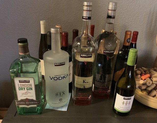
We realized we could get Instacart liquor delivery from Costco two days ago. That’s a game changer for us as the liquor store was worse than anywhere else we’ve been in terms of people being able to maintain distance inside.
We taste tested the two types of vodkas, the gin, and the wine. Kirkland brands will do fine for us, and now we can cross off the liquor store as the last remaining destination.
-
2
-
-
38 minutes ago, Eskimo Joe said:
Anyone in the Gaithersburg or Olney/Sandy Spring area have a measured rainfall report?
Is KGAI data not useable?
-
3 minutes ago, nw baltimore wx said:
The covid thread is better with Jaws in it.
It’s terrible. We all know where the people who post incessantly in it stand. I think earlier on, it represented more of the 80/20 divide in the country.
Now it’s just everything must be reacted to all the time. It’s a useless thread for communicating.
-
4
-
-
17 minutes ago, OSUmetstud said:
I think some of this might be a function of fatalities from days previous being recorded for that day. So you end up seeing deaths lag longer than the modeling thinks they should.
But then the total should be ultimately close to correct if it’s just about a lag. In other words, the reality reflecting a lag should have a lower peak (because deaths are going to counted later) than the original model projection. Italy’s already gone over what was the upper bound *final* total of the uncertainty range from the model’s projection a few days ago.
Here’s a pretty clear twitter thread about the symmetrical “forcing” in the IHME model and how it’s not working past peak for Italy, Spain, and New York:
https://mobile.twitter.com/CT_Bergstrom/status/1250304069119275009
January Storm Term Threat Discussions (Day 3 - Day 7)
in Mid Atlantic
Posted
For those of you trying to remember how the model runs in the lead up to 1/2016 looked, this forecast review article from the CWG has links to their articles starting from 8 days before the storm. There are quite a few individual model runs referenced throughout:
https://www.washingtonpost.com/news/capital-weather-gang/wp/2016/01/25/the-forecast-for-snowzilla-was-stellar-in-almost-every-way/