Phelps
-
Posts
97 -
Joined
-
Last visited
Content Type
Profiles
Blogs
Forums
American Weather
Media Demo
Store
Gallery
Everything posted by Phelps
-
Banner Elk is 3700'. It's a perfectly fine spot for snow but in some setups the difference between there and 4500+ is still pretty noticeable. I love Beech but I hunker down on the weekends. The ski traffic can be just brutal though it does ebb and flow throughout the day. Banner Elk is better for getting out and about, especially if you are close enough to walk. Enjoy!
-
Yeah I don’t think any humans would be forecasting 8-12 for Boone right now. Not saying it’s impossible, but certainly doesn’t appear to be the most likely outcome as of now.
-
Someone cancelling a trip because they are worried about what the weather will be in the NC mountains 17 days in advance is certainly... a choice.
-

February 19-20 Major Winter Storm Threat
Phelps replied to NorthHillsWx's topic in Southeastern States
Marginal temps, NAM barely onboard, Eric Webb tweeting about warm noses… what’s not to love! I’m sure we will get cancelled school and no snow. Whoops is this not the sanitarium? -
I'm a little late here and I know all eyes are on tomorrow but yesterday was a beautiful morning on Beech . The event didn't really play out as I was expecting (ended up being less sunday PM, more monday AM) but in the end we got probably 3-4 inches. https://imgur.com/a/aQgmwQU
-
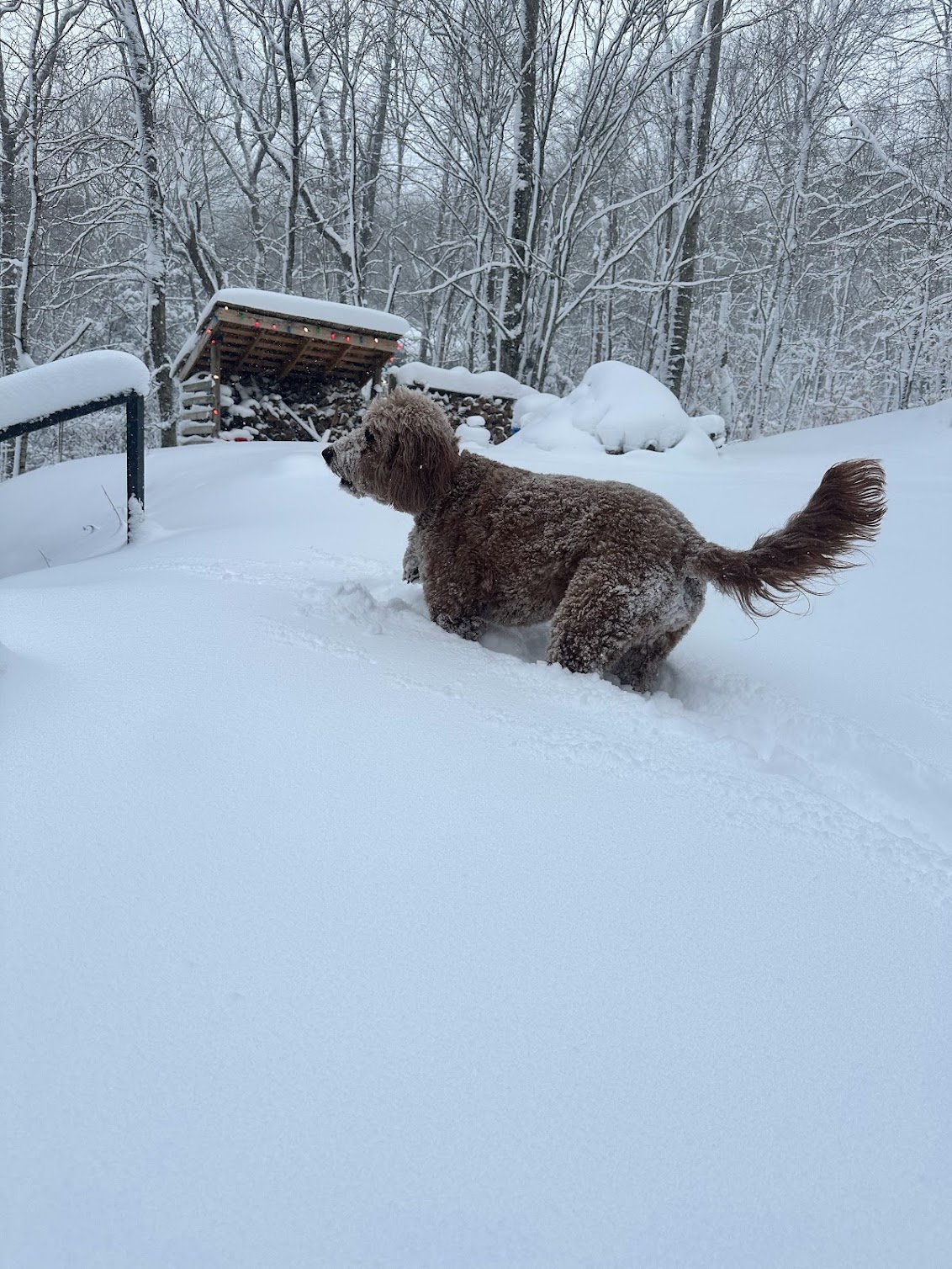
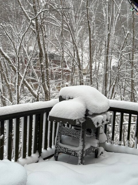
Started snowing around noon on Beech. Snowed pretty good all day and I thought we were winding down when I went to sleep but I was wrong. We got several more inches overnight. It's 2 degrees and gorgeous.
-
Brad loves snow. It’s his job to tell reliably people if it’s going to snow or not and most of the time it’s not. You can tell he’s basically just worn out from having to answer for clown maps that break containment.
-
Maybe the NAM won't be right next time but the one showing the biggest warm nose will be. I hate to sound whiny but it's just been that way over and over for Charlotte. It's disheartening.
-
Closer to town, we've got something on the spectrum between a heavy flurry and a snow shower.
-
Someone had a manifesto back in the old days and part of it was something like "take the warmest model and assume it will be warmer"...
-
This was indeed correct. Hammertime on Beech.
-
I'd love if we could get a decent little thump of snow Wednesday. It's going to be frigid late week so might as well have some snow on the ground. Some model runs are showing it but others not so much. I know the mountains will have our chances, it's just back to life, back to reality for me after the first week of Jan.
-
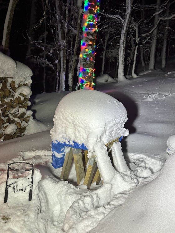
21 and steady snow on Beech. I feel like we're already at the upper end of my expectations with lots of time left. And it's November!
-
I just drove that. It's quiet up here. There's a flagger on Beech Mountain Parkway because they are working on the shoulder but it's quick to get through. I imagine that work will stop when it starts snowing. Ski resort opens next week so people are coming one way or another. Come on up and spend a couple bucks at Freds. Hopefully we get a nice little event out of this.
-
I really don't mean to contribute to any kind of back and forth on the topic but I can tell you that what I'm seeing on the news (MSM) are stories of devastation in the area, stories of amazing acts of courage and bravery and service by those that live in there, and an outpouring of support from outside the area in terms of donations. This is a catastrophe, people need help, and the death toll will rise. I've not seen anyone say or imply those facts are a conspiracy. I'm sure there is more help needed and it's needed faster than it's coming. I hope that happens.
-
Dewpoints are in the 50s today. I think I'd take this over almost any air temp with DPs in the 70s. (of course that is coming back soon enough)
-
Kind of a repeat today. No hail thankfully but it was just a wall of water leaving Ashville early this afternoon.
-
If the models show a good look but you just assume everything will be bad 1.)you are most likely right BUT 2.) why are you here? We all commiserate when things don't work out for us (and they haven't been working out) but if "winter is over" then this forum is of no use to you.
-
2023-2024 Fall/Winter Mountain Thread
Phelps replied to The Alchemist's topic in Southeastern States
Definitely think you'll see more than a couple inches. Enjoy! I'll be sitting this one out in Charlotte. -
2023-2024 Fall/Winter Mountain Thread
Phelps replied to The Alchemist's topic in Southeastern States
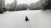
Had to come back up to Beech to experience this. It's deep. I am not sure if it is more than December 18 but it doesn't really matter. When you get this much snow the difference between 15 or 18 or 20 isn't the point. Days like today are why we do it.
-
2023-2024 Fall/Winter Mountain Thread
Phelps replied to The Alchemist's topic in Southeastern States
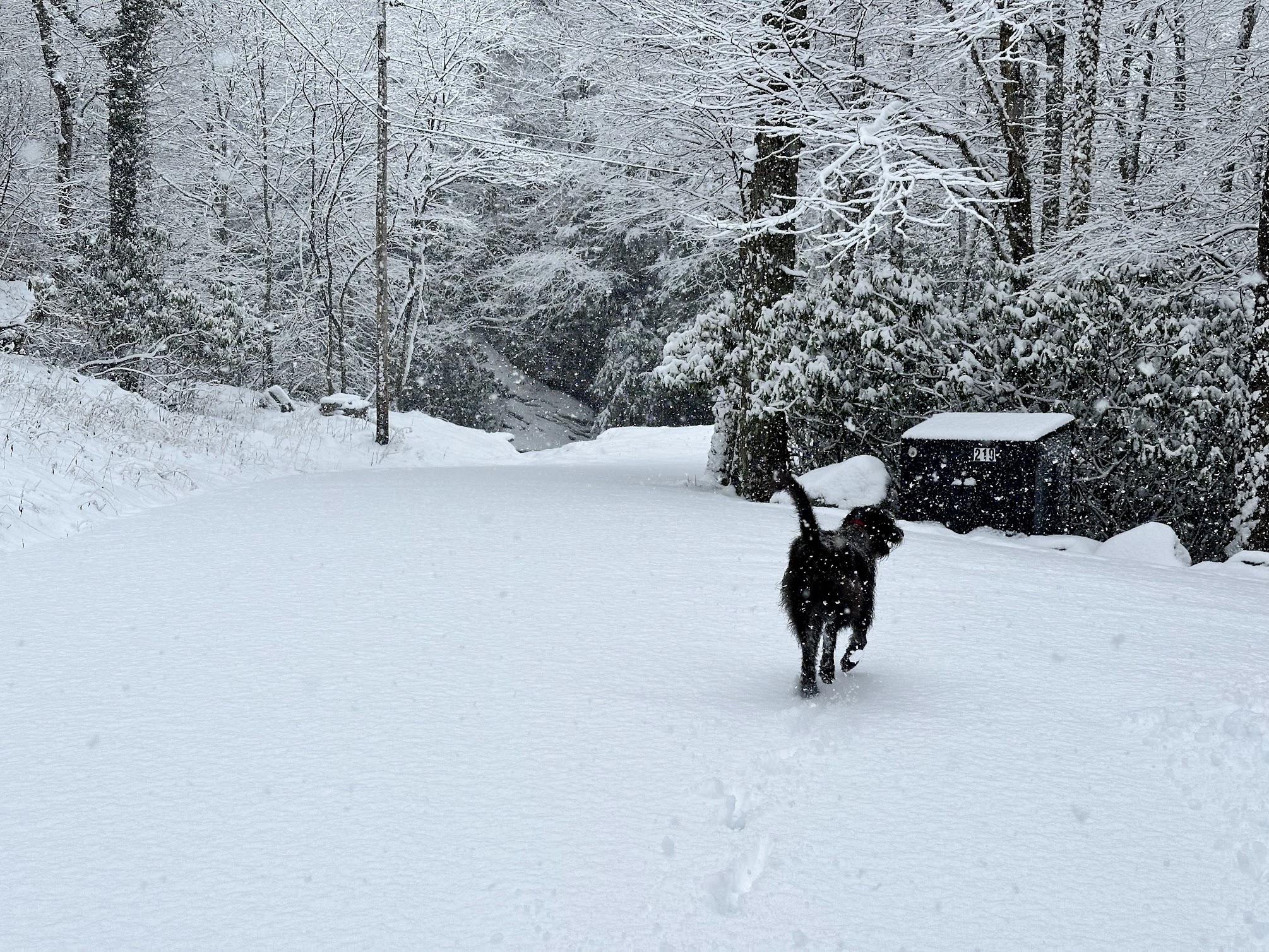
I am having intense FOMO based on what I am seeing on my cameras on Beech. Looks to be snowing very hard. -
2023-2024 Fall/Winter Mountain Thread
Phelps replied to The Alchemist's topic in Southeastern States
But otherwise today was awesome!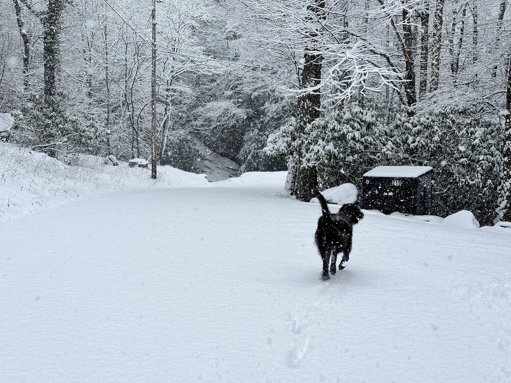
-
2023-2024 Fall/Winter Mountain Thread
Phelps replied to The Alchemist's topic in Southeastern States
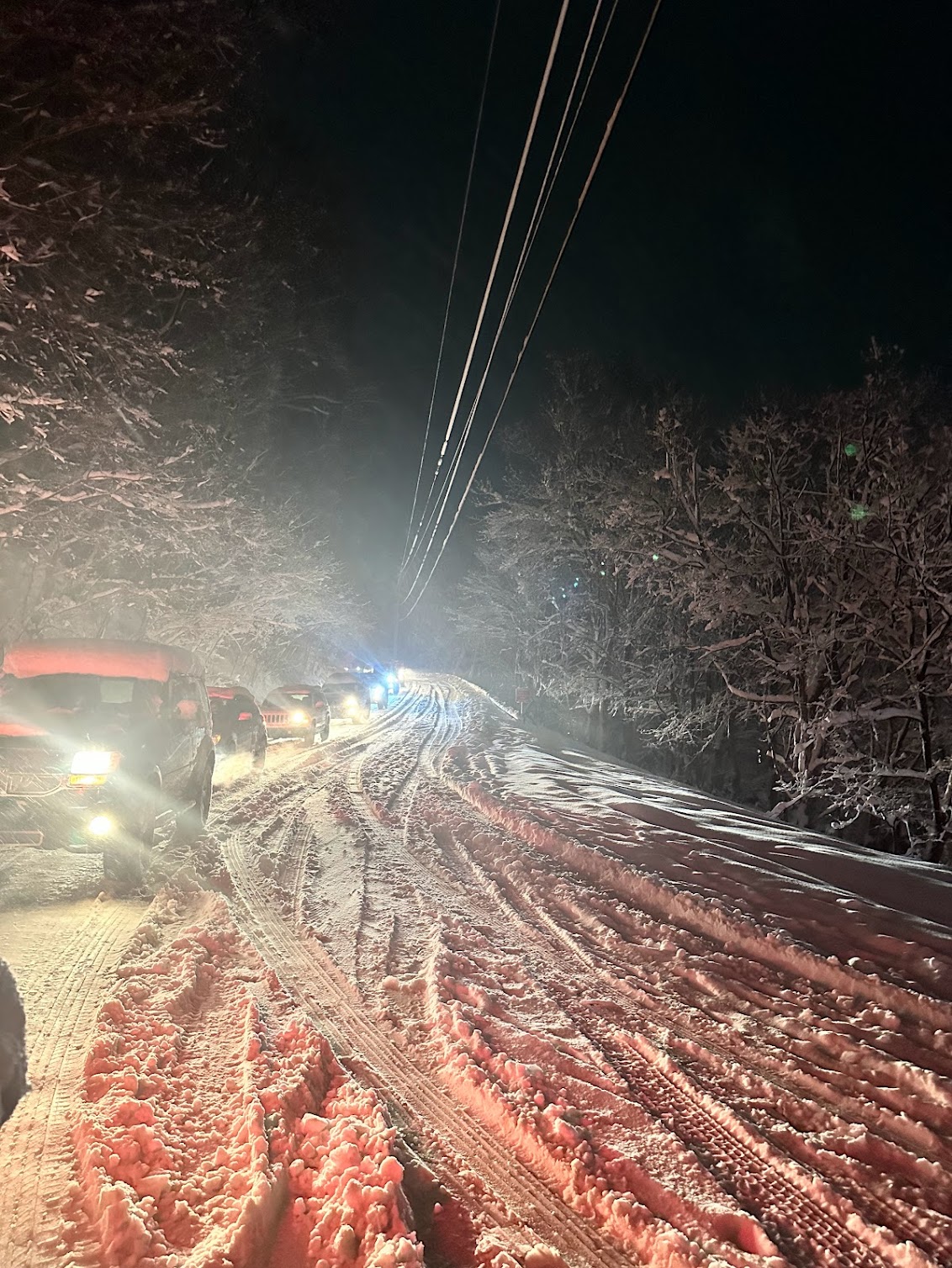
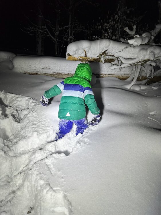
It took me approximately 6 hours to get from my house on Beech to Tyncastle. Relentlessly snowing and I think everything in the area was so backed up they couldn't get the salt trucks out to us. I think everything was fine until the skiers all left and the intensity of the snow picked up. Would have turned around and gone back but that didn't feel like an option either. I re-learned the lesson of when not to be on the roads up there.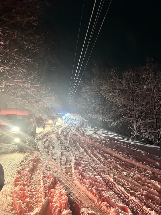
-
2023-2024 Fall/Winter Mountain Thread
Phelps replied to The Alchemist's topic in Southeastern States
It is, and has been, absolutely hammering snow on beech mountain. Big sticky flakes. This report is being brought to you live from the Beech Mountain Parkway. Where I have been sitting for 2+ hours. -
2023-2024 Fall/Winter Mountain Thread
Phelps replied to The Alchemist's topic in Southeastern States
33 here where I am on Beech. Didn't think temps would be an issue after being in the deep freeze all weekend. Curious how this plays out. We're right on the edge of temps and precip shield but still think we should do ok.