

snowman19
-
Posts
7,529 -
Joined
Content Type
Profiles
Blogs
Forums
American Weather
Media Demo
Store
Gallery
Posts posted by snowman19
-
-
16 minutes ago, Brian5671 said:
Agree. And it was not even a true arctic airmass. Once this became slower and drier we were in trouble. By the time precip gets here we are warmer with south winds
This is clearly headed to a mostly all rain event even N and W of the city, if these trends continue it will be less than an inch of snow to all rain Saturday even N and W
-
2 hours ago, SnowGoose69 said:
The south winds are a big problem. That isn’t always the case because sometimes you can have a high in this location and an approaching system from the same area but the system is weaker and hence the gradient is light. In mid to late January we could survive on a 5-7kt south flow and snow for awhile but not on a 15-25kt one.
This was always a 1-3 inch to all rain event for the metro area on Saturday, I’m not sure why it was hyped by some into anything more than that
-
 3
3
-
-
19 minutes ago, Snow88 said:
The airmass before the storm is really cold
It’s cold but it’s not unmodified arctic, the boundary layer is going to warm rather quickly when the winds flip. This is starting to look like a 1-3 event for the metro area
-
 3
3
-
-
1 minute ago, SnoSki14 said:
As it stands it would be foolish to dismiss the frozen threat. Models clearly show a cold surface/mid levels until the end.
Very strong initial high with very low dews ahead of this thing with high trending stronger due to Thursdays system trending stronger and acting like a transient 50/50 low.
This doesn't guarantee anything and a lot could change but that's what I'm seeing right now. Some semblance of last year's November storm.
This setup is absolutely nothing at all like November, 2018
-
 2
2
-
-
Just now, Snow88 said:
What are your thoughts?
All rain ?
Not all rain but it is going to turn to rain across the entire metro area after the initial snow/sleet push. Every model has this going to all rain. Once again, we are posting grossly overdone 10:1 ratio snowmaps that count sleet and freezing rain as snow. Those pretty maps aren’t going to verify. When you have a primary parent low over Lake Ontario, you get a strong mid-level warm push, which models always underestimate until the last minute, we’ve seen this over and over again
-
2
-
-
4 minutes ago, Zelocita Weather said:
Wow, basically a complete snowstorm for the entire region on the GFS with VERY COLD air in place. Not even sure much mix would enter the picture per that run.
It turns to rain on the GFS: https://www.tropicaltidbits.com/analysis/models/?model=gfs®ion=neus&pkg=mslp_pcpn_frzn&runtime=2020011312&fh=138
-
1
-
1
-
-
3 hours ago, HeadInTheClouds said:
Not everybody on this board lives in NYC and Long Island. NWS Albany discussion below:
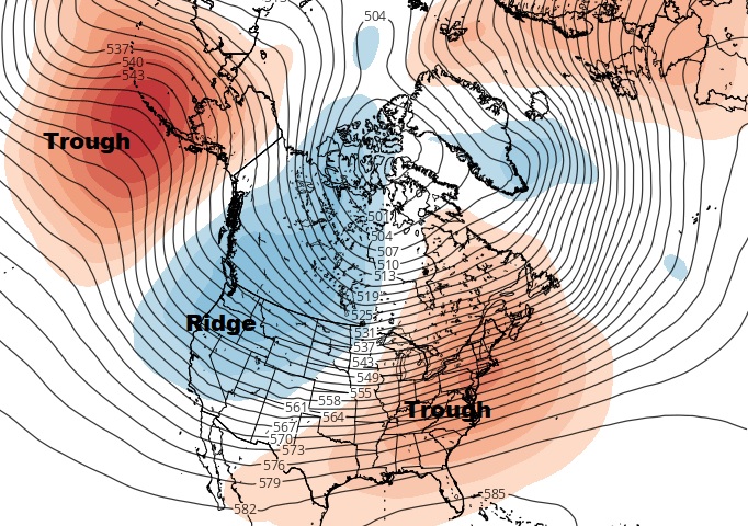
By Saturday morning, the high sets up in a prime position across
Quebec. An upper-level trough and surface low forms across the
Plains and heads eastward. The current track of the surface low is
across the Upper Great Lakes on Saturday before the energy transfers
to a coastal low late Saturday into Sunday. Cold and very dry air
ahead of this system raises confidence that wet-bulb effects would
lead to a nearly all snow event. It is possible that warm air aloft
brings a brief transition to sleet/freezing rain and/or rain from
near the Capital Region south; however, confidence on this is low.
While this is several days out, good ensemble agreement led to
raising the PoPs to likely. A plowable snow is possible.
The area NWS Albany covers is not part of this subforum
-
1
-
1
-
-
Upton is not buying snow for Saturday, no CAD evident, new disco:
Temperatures will be remaining above normal through Thursday, then
return to more normal levels Thursday night into Sunday as Arctic
high pressure builds toward the region.

Any precipitation with the waves will be mainly in the form of rain.
For the system next weekend there is some uncertainty as to how long
a period of light snow will occur before a transition to all rain
Saturday afternoon. This will be dependent on how quickly the cold
air is scoured out as high pressure moves east. At this time there
is no cold air damming evident and the flow does remain progressive.
Also there is uncertainty with temperature profiles with the ECMWF
warmer than the GFS. With these uncertainties will keep the
probabilities at chance.
-
3 minutes ago, winterwx21 said:
Too early to say it looks like an all out snowstorm. GFS is a nice snowstorm, but other models aren't as impressive and show just a light snow accumulation getting washed away by rain. 12z EURO is just a 1 to 2 inch snowfall for NYC and nearby areas, and then rain. You have to go well to the NW to get a 3 to 5 inch snowfall according to today's EURO. But we have a long way to go, so hopefully it'll improve. It's very likely going to change to rain, but strength and position of the high to the north will determine whether it's a light accumulation washed away by plenty of rain or a more significant accumulation that won't be totally washed away by some rain towards the end.
Saturday never was/is a snowstorm setup south of New England. When the GFS is the only model showing a snowstorm, something is wrong.....
-
2
-
-
47 minutes ago, Snow88 said:
What?
Every model shows a front end. Euro has been way too amped all winter.
Next weekend’s setup sucks south of New England still, don’t worry, the NYC metro area will get their chance post 1/20, be patient
-
1
-
-
11 minutes ago, ineedsnow said:
18z GFS big hit next weekend
The cold biased op GFS at day 7, what could possibly go wrong??.....
-
5 minutes ago, Ralph Wiggum said:
I can clearly see a way we quickly exit the workable pattern and return to the late Dec->mid Jan look. Base states almost always find a way to gain their grip back.
There wouldn’t be a worse scenario, if we go back into 4/5 in early-mid February, it’ll be time to start thinking about next winter
-
2
-
-
2 hours ago, forkyfork said:
that euro plot shows COD with a re emergence into 4/5
If it actually does that you can kiss most of February goodbye
-
3
-
1
-
-
10 hours ago, PB-99 said:
You typically don`t run " 6 straight weeks of cold " and I wouldn`t expect that either.
But when you total up Jan 20 - March 20 , you may likely find that was your winter.
I can’t disagree with you here really. I think the models may be rushing it a bit and overdoing the cold and blocking at the beginning to an extent but yes, I think when we look back at this winter, the period from 2/1 - 3/20 will be a lot more memorable for winter weather than 12/1 - 1/31
-
2
-
-
3 hours ago, White Gorilla said:
Yeah I remember in late January 2011 JB screaming "Winter in the Eastern US is over AS WE KNOW EET!"
That was actually a very memorable call by JB. He was one of the lone voices saying winter was over by February at this time back in 2011. No one believed him, they kept saying the high latitude blocking was coming right back. He ended up being dead right, the Niña became very west-based, the NAM (AO, NAO) went super positive and that was all she wrote for that winter by the beginning of February, right through the end of March, goodbye snow, goodbye cold and it never came back again
-
1
-
-
3 minutes ago, Brian5671 said:
Weeklies have been horrid last 2 years, so I would toss them even if it showed a 95-96 pattern. Last year it showed that every run for the LR and it never came.
Based on how the pattern has been progressing since November, just my opinion, I have a hard time believing that we lock in a real cold, blocked up pattern for 6 weeks straight (2/1 - 3/15). Could I be wrong? Yep and stranger things have happened but I definitely would not bet on such a scenario happening given where we just came from
-
1
-
-
1 hour ago, bluewave said:
The GEFS has one of the most amplified phase 4-7 transits that we have seen in January. Gets over to phase 7 around January 20th. So a more -EPO gradient pattern potentially emerging between the 20th and 24th. Would probably be around February 1st that the MJO gets closer to phase 8.

Looks like I was too slow with my thoughts on the colder regime. Post 1/20 looks good for colder and yea, assuming the models are correct and the MJO propagates into phase 8 come 2/1 or thereabouts, I think the question then becomes is this a “locked in” (all of February to mid-March 40+ day) change to colder and blocked or is it back to a mild regime, a la the Euro weeklies?
-
1
-
1
-
-
36 minutes ago, Snow88 said:
The pattern gets better on all the models. Who ever canceled this winter especially this month will look foolish.
If it does get colder on 1/20, that doesn’t cancel out the previous 3 weeks of warmth for this month. The last week of January won’t salvage this month lol
-
1
-
1
-
-
1 minute ago, forkyfork said:
that is not a good pattern. any storm that amplifies is going to cut
Yea, I was confused as to why it was being called a good pattern. It’s strong -PNA/RNA, +AO, +NAO, neutral EPO
-
2
-
1
-
2
-
-
5 minutes ago, bluewave said:
Near record jet streak to our north with such an extreme temperature gradient.


It would appear the people who said the the models were too quick with the change to colder yesterday, were correct, they have backed down from what they were showing yesterday. Looks like a slower, post 1/21 change now..
-
5 minutes ago, PB-99 said:
You will not erase 20 to 25 days of big anomalies. The cold will not just barrel in, you will def step if the progression is 7 into 8 etc.
The real cold would show up in Feb and could stay a while.
But Jan is/ has been cooked and no one is trying to deny that.
The issue is when do you start to step down, after the 20th or after the 25th etc
I honestly have not seen anyone deny that January is a total lost cause. I think everyone has conceded. I agree that the change comes in February, assuming the propagation into 7, 8, 1 really happens at the beginning of February. Question is, is this a sustained cold change into mid-March or is it a quick hit of colder, then back to warmer than normal? I don’t think that can be answered definitively until we get into early February
-
1
-
-
6 minutes ago, Allsnow said:
Looks like on those maps the mjo is on the border of 6/7 on the 29th (which might indicate it slows down in p6) then by feb 3 P8-1? And forcing in the western pac? If I’m correct, then that matches the Vp maps well. I also like the substance forming in the warm phases.
Assuming it finally does actually propagate and goes 8-1 in early February, the change probably would not be felt here until mid-February with the lag correct? I’m thinking the colder period is something like 2/15 - 3/15
-
1
-
 1
1
-
1
-
-
15 minutes ago, donsutherland1 said:
The extended range of the 12z GEFS is almost the opposite of what one would want to see if one is looking for sustained cold. More than likely, one is dealing with what will be a slow transition toward sustained cold (probably taking place during the last week of January). I've labeled what one would like to see as opposed to what the GEFS shows.
It looks like a change to colder isn’t coming until early to mid February, the question then becomes, is it a sustained (through mid-March) period of colder or is it in and out? I’m favoring mid-February, I can see a period of colder, something like 2/15 - 3/15. Once you get past 3/15, deep winter goes on life support south of New England
-
27 minutes ago, Zelocita Weather said:
GFS well westand a nice little event, NAM west as well
It has less than half an inch of snow total: https://www.tropicaltidbits.com/analysis/models/?model=gfs®ion=neus&pkg=asnowd&runtime=2020010606&fh=84 And the NAM did not come west, this is bad info: https://www.tropicaltidbits.com/analysis/models/?model=namconus®ion=neus&pkg=asnowd&runtime=2020010606&fh=84

Wintry mix potential weekend of Jan 18-19, 2020
in New York City Metro
Posted
This is a quick snow/sleet to start then over to all rain rather quickly. IMO most areas in the metro see less than an inch even N & W