-
Posts
9,095 -
Joined
-
Last visited
Content Type
Profiles
Blogs
Forums
American Weather
Media Demo
Store
Gallery
Everything posted by EastonSN+
-
Believe it or not our area was above 10 inches in 11/12 (when you factor in the October snowstorm). 11.5 was my total.
-
I know it's not completely over, however it's not look great for more snowfall. That would put this decade at 3 below average snowfall winters, only better than last years total. Average this decade before this winter was 19.6 and will take a hit when this year is ultimately added.
-
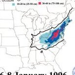
Check these temps out from the blizzard of 96. Wow. Courtesy of Rays winter Storm archive (I really wish it was still being updated).
-
What I find interesting is the fact that both coasts are the only locations to increase snowfall - even down to coastal North Carolina!! I may be over simplifying, however, this must be due to higher moisture and proximity to events which are continually increasing in intensity.
-
Thank Don. Also, during the larger storm the intense banding just missed CPK, a little west and perhaps up to 25 inches. I agree with you on how warming is affecting our snowfall. I do not think we hit a snow wall after 2018 and we will struggle to hit 50% of current average moving forward, but rather a slow steady decline as a backdrop to normal cyclical patters. I am not as aggressive as you are however, as I believe the decline will be relatively slow due to volatility/potential for historic events. An example would be if NYC is the new Philly from 1996, where Philly was closer to the moisture and received over 30 inches during the blizzard while NYC started with virga due to the temps in the teens at the start and low dew points (resulting in 20.5 I believe). Our latitude and closer proximity to the water would fuel such extreme events similar to 2016. I do have a question, if we were to have a repeat of 70 through 85, which was at times extremely cold and suppressed, wouldn't we see an increase of snowfall due to higher fees and less suppression from the PV? Just contemplating.
-
The 80s only averaged 19.74, which is crazy to think about.
-
That's the only complaint, number of intermittent measurements. It's not always important but is on occasion, especially in small snowfall events. An extreme event IMBY was early March 2018. All day it snowed and due to the temperature being at 34/35, I was stuck at approx 3 inches. Then late night it became extremely heavy, I walked outside not expecting much and was shocked to see a wall of snow, measured a bit over 10 inches! The snow became only moderate and in 2 hours I was down to 7.5 inches!! Temps jumped back to 35. A few hours later in the morning it was a sloppy 5.
-
Definitely worse north. I think DC is still above or close to average for this date! I only grade on snowfall.
-
Thanks Don. Here is a snip of this decade so far for CPK. Our average is going to take a big hit.
-

Refresher snow & obs between ~midnight and Noon Sat Feb 17 2024
EastonSN+ replied to wdrag's topic in New York City Metro
Yeah fluff bombs do not have much staying power. We need another March 2017 with heavy snow followed by thundersleet. -
Even if it ended today, for myself personally, I have reached 50% of average annual snowfall at 15.5. I went in honestly thinking 97/98 was possible, so from an expectations perspective I am ok.
-
Will be late in the game, however still a possibility.
-
Looking like the change to a warmer pattern is still on track for the 26th.
-
I just want CPK to reach 10.
-
Weeklies so entertainment for now.
-

Refresher snow & obs between ~midnight and Noon Sat Feb 17 2024
EastonSN+ replied to wdrag's topic in New York City Metro
Beautiful with the snow showers passing through and breaks of sun. Can't believe I made it to 50% of average annual snowfall. This century 6th lowest snowfall. -
Would need to be explosive/high rates to overcome temps.
-
A bit too far east / late this run..
-
Crazy how CPK stayed out of the heavy stuff on both storms.
-
Still at a D. I do not track temps just snowfall. Another 4.5 to get me to 20 would bring it up to a C.
-
Both good patterns produced. Both January and February.
-

Saturday February 16th - Another CT/ Cape special?
EastonSN+ replied to Sey-Mour Snow's topic in New England
3.0 Easton CT. 15.5 on the season. -

Refresher snow & obs between ~midnight and Noon Sat Feb 17 2024
EastonSN+ replied to wdrag's topic in New York City Metro
3 inches total Easton CT. 15.5 on the season. -
This is the one to watch. Temps will be marginal.


