EastonSN+
-
Posts
9,110 -
Joined
-
Last visited
Content Type
Profiles
Blogs
Forums
American Weather
Media Demo
Store
Gallery
Everything posted by EastonSN+
-
-
Not sure that is the case. Why wouldn't a deep east based trough work the same as January.
-
How can you get a cutter if the trough is far enough east? Also if the flow is fast enough a storm won't be able to amplify enough to cut. We have had MANY snow events without blocking. 2013/2014 is a great example. Not sure why it has to be KU or nothing
-
Or trough positioned correctly with a direct tap to cold air (-WPO, -EPO). Not talking KU just accumulating snow.
-
Thanks. I also agree with the category 2 NESIS rating.
-
-
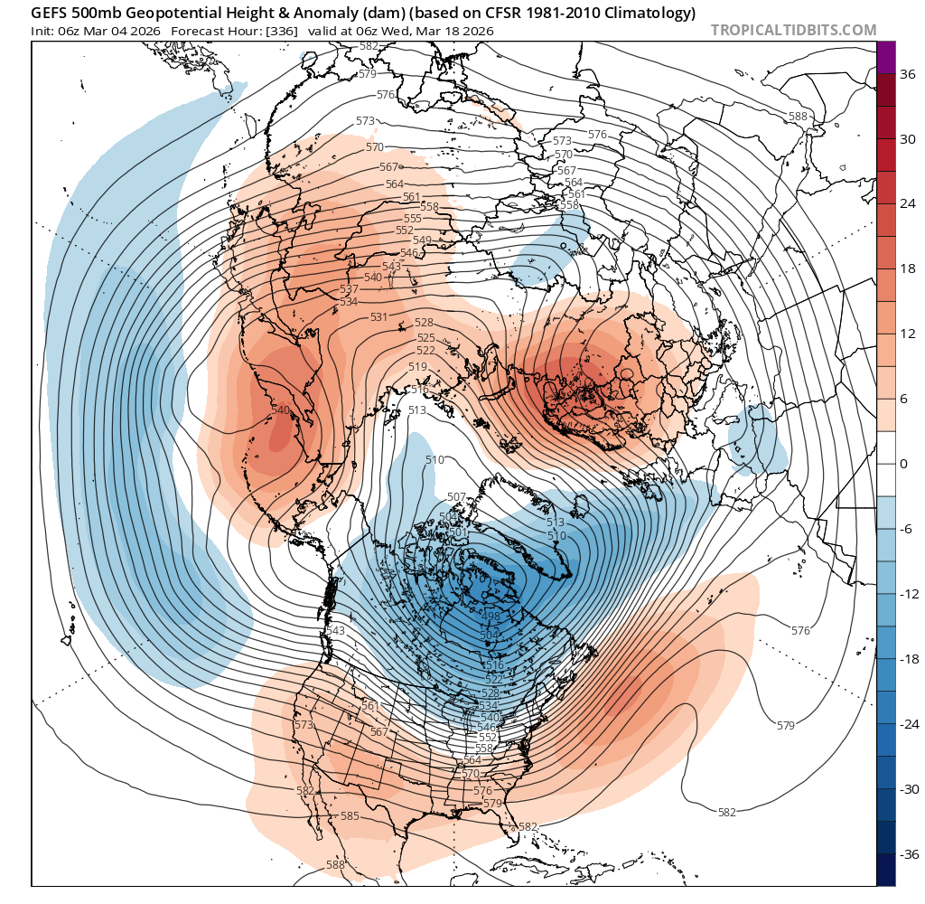
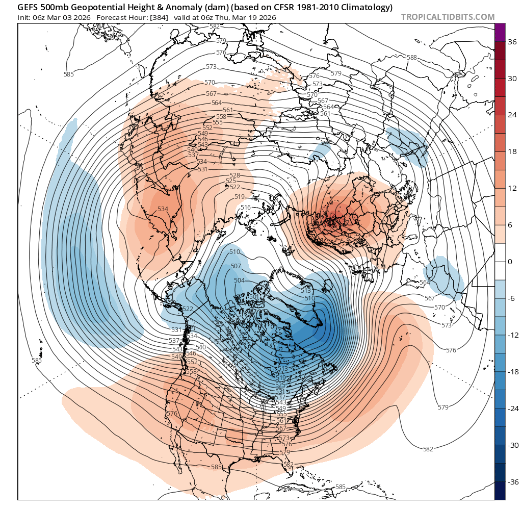
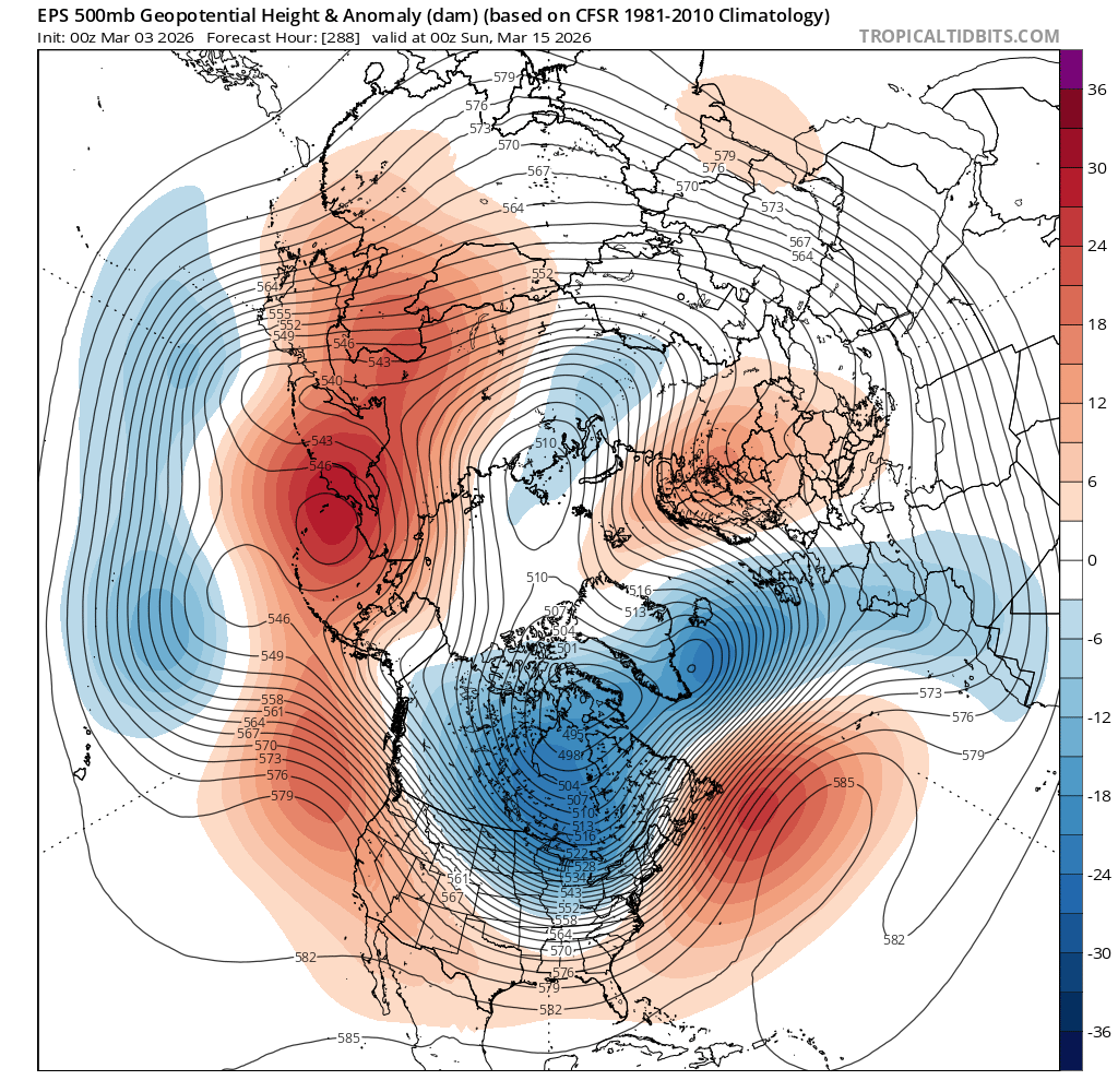
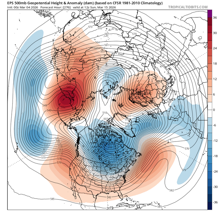
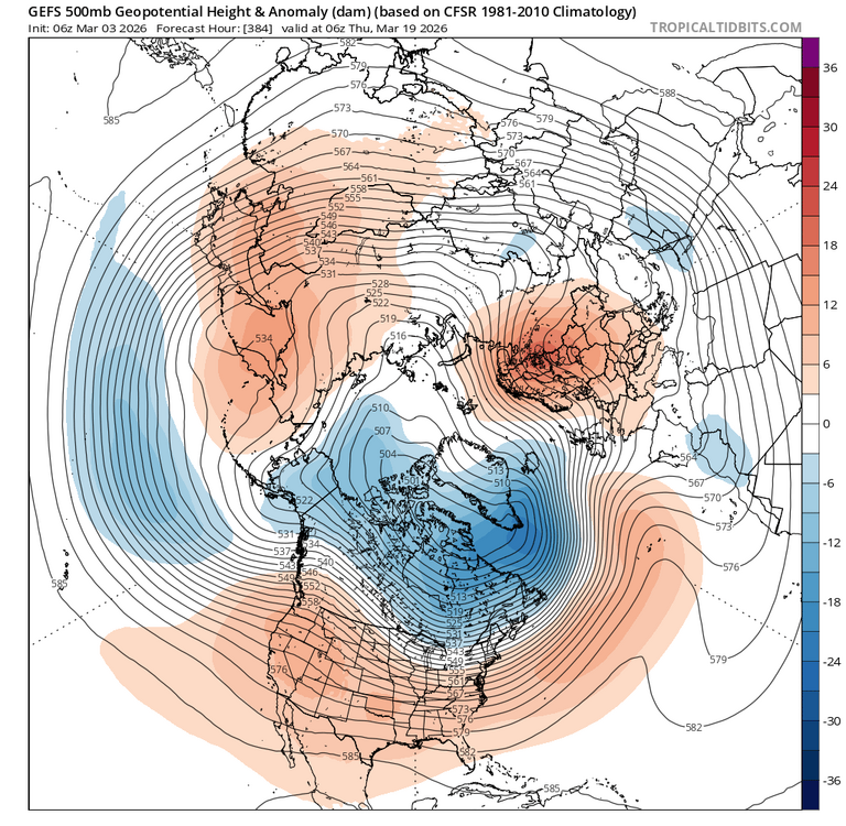
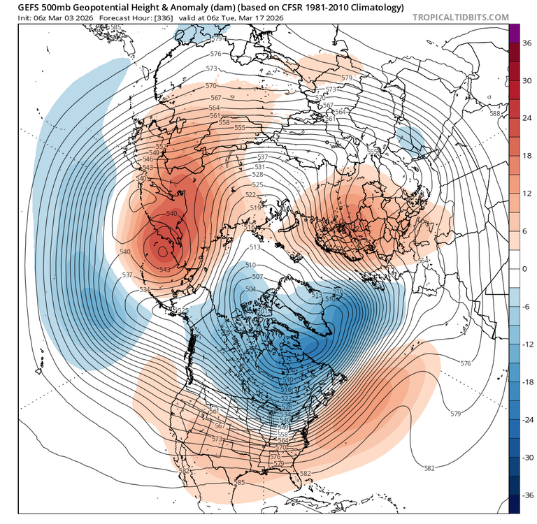
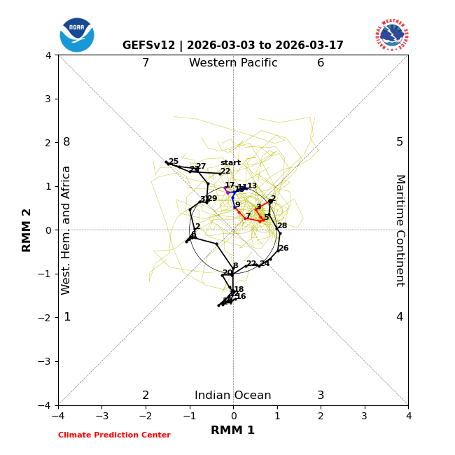
Gefs is 3 days later.
-
EPS has not changed the start time of the next window.
-
Its all in good fun. Snow maps make me happy even if they have little chance of verifying.
-
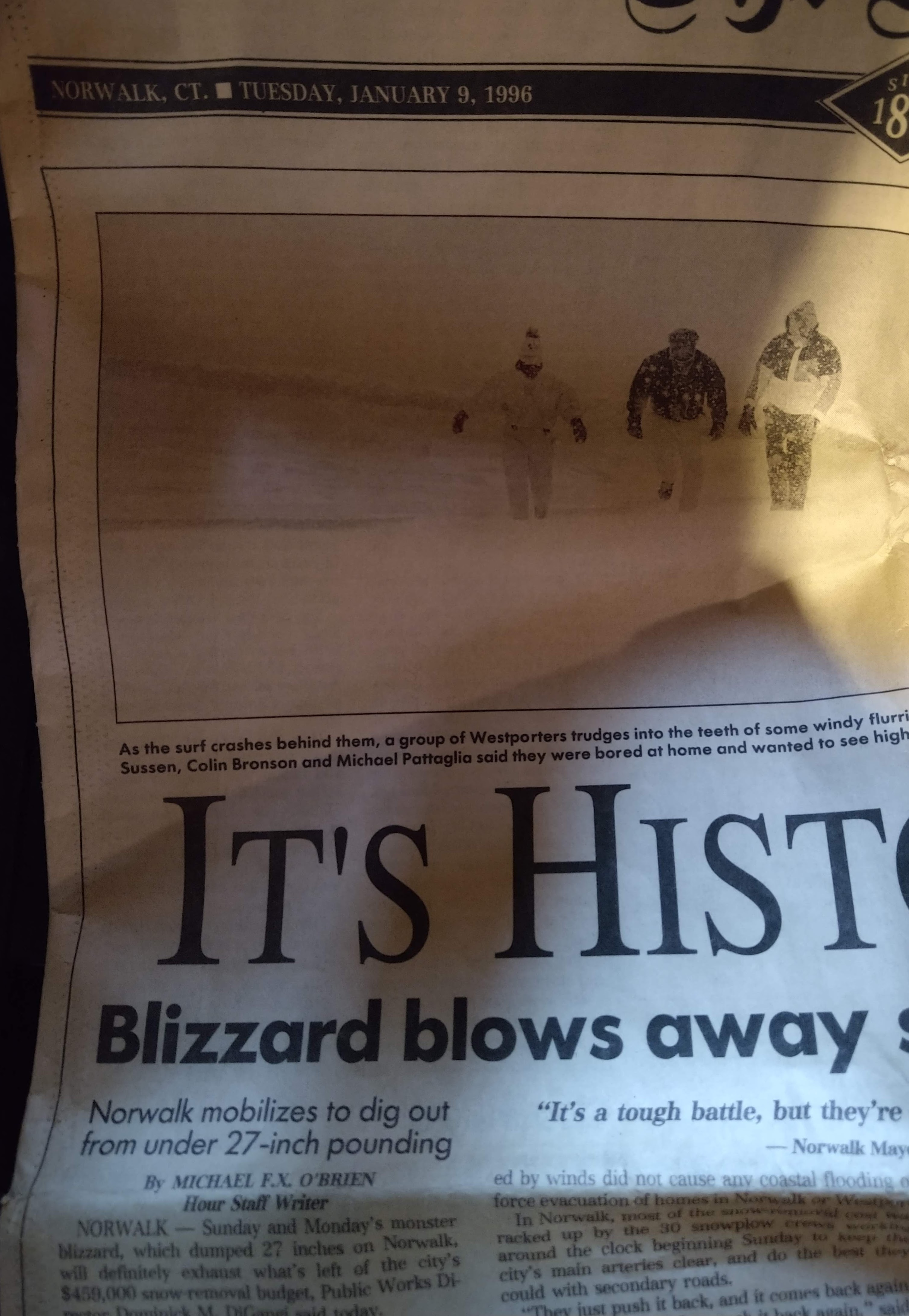
Thanks Don. Its amazing that Providence is only 6 inches away from their all time snowfall record. Pulling for them as well as NYC.
-
-
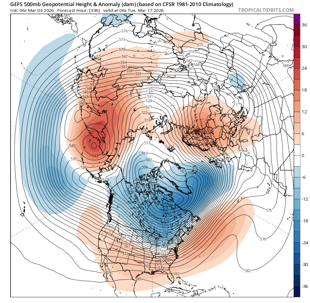
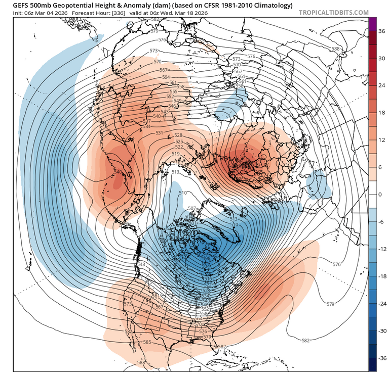
EPS would work as there would be enough cold air with the depth of the trough and the PV on our side of the globe. The GEFS depiction would be tough.
-
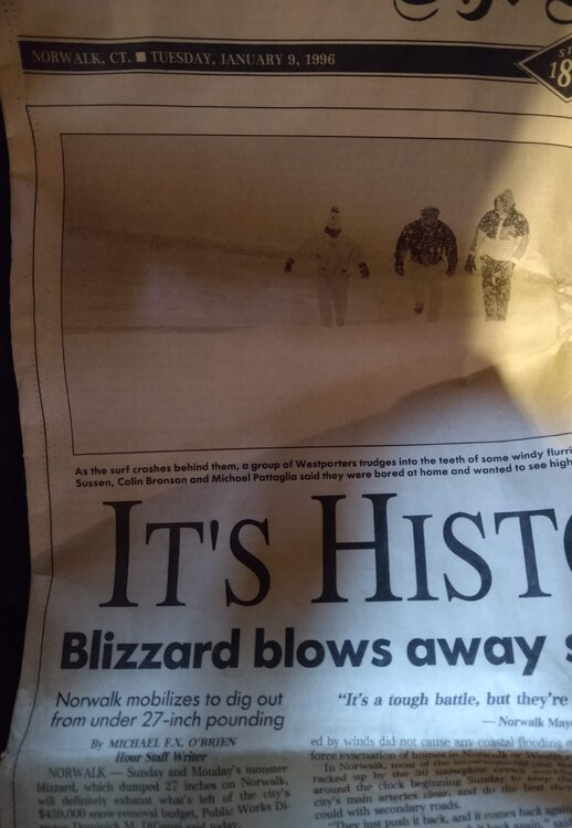
It would take a lot to have it happen but I wouldn't go as far to say a freak event. The blizzard of 1888 was a freak event.
-
60 inches!!!!
-
52 foot drift lol.
-
What is wouldn't pay for a radar loop of that storm lol. I think BDR reported 18 while HVN reported 45.
-
Yup GEFS is weaker in 8 therefore not AS cold but definitely below normal.
-
Quot from history. Com which was such a crazy temp swing a long long time ago. Blizzard of 1888 "March 10, temperatures in the Northeast hovered in the mid-50s. But on March 11, cold Arctic air from Canada collided with Gulf air from the south and temperatures plunged. Rain turned to snow and winds reached hurricane-strength levels. By midnight on March 11, gusts were recorded at 85 miles per hour in New York City. Along with heavy snow, there was a complete whiteout in the city when the residents awoke the next morning."
-
Ensembles are now picking up on the last window. 6 inches for Providence to record their snowiest winter on record!! First northeast record since Boston 2015?

-
COD
-
Providence had it second snowiest winter in history! If they are to challenge the highest it will have to occur after mid month. They only need 6 inches.
-
Problem is only 4 days hit 60 and 2 are rain and 1 cloudy lol. This is the extended TWC forecast.
-
52.7 so far.
-
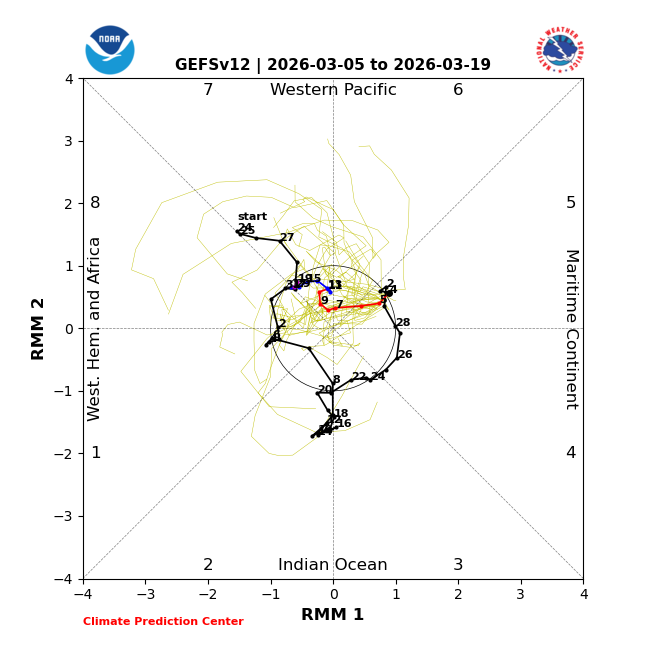
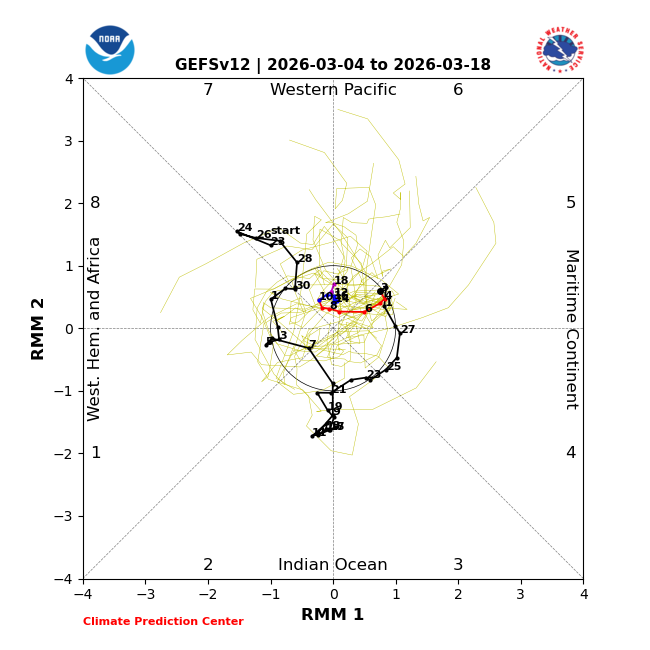
Yup timing is my concern with the MJO. Hitting 8 on the 20th is a bit late and everything would have to line up for snowfall. That being said it has to be monitored. If the forecast is off by a few days and its earlier we can increase snowfall chances.
-
The trough set up too far east for east St. Louis this year. If the trough was a little further west our snowfall COULD have been MUCH higher.