LakeEffectKing
-
Posts
4,476 -
Joined
-
Last visited
Content Type
Profiles
Blogs
Forums
American Weather
Media Demo
Store
Gallery
Everything posted by LakeEffectKing
-
 We should take this to the banter thread....but wow!!!
 -
It's basically because you have closed lows all away from the surface to at least h500, already established in the deep south... Warm air at many of these levels basically circulates around the storm, And transfers that warmth northward. Most East Coast storms that provide the goods for us in the northeast, start closing off around around the Mid Atlantic States.
-
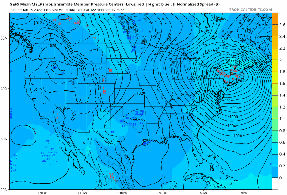
06Z GEFS shifted considerably east...
-
Mid levels just continue to warm further west on each successive run.
-
Did you pay a recent visit to Cazenovia @TugHillMatt?
-
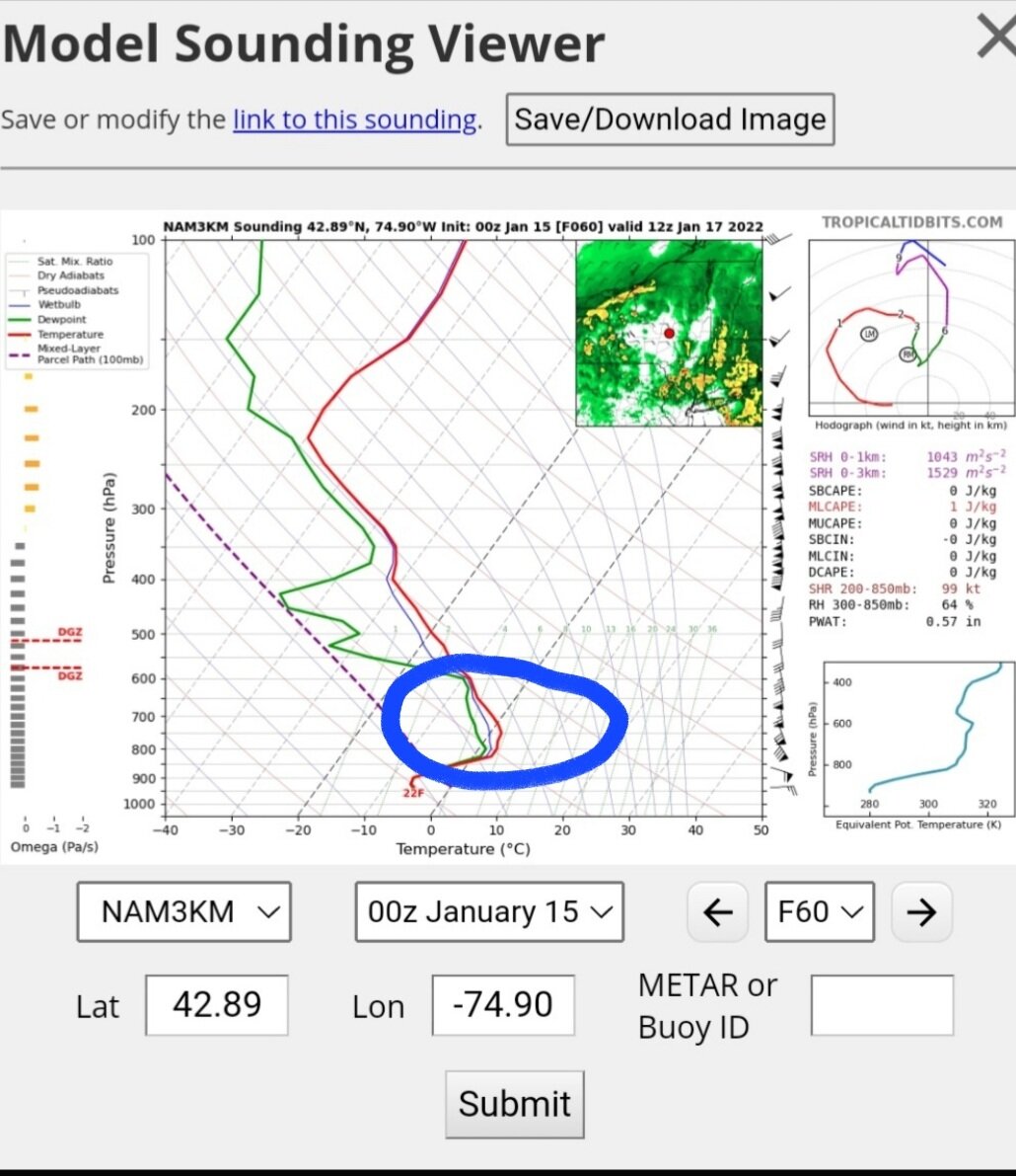
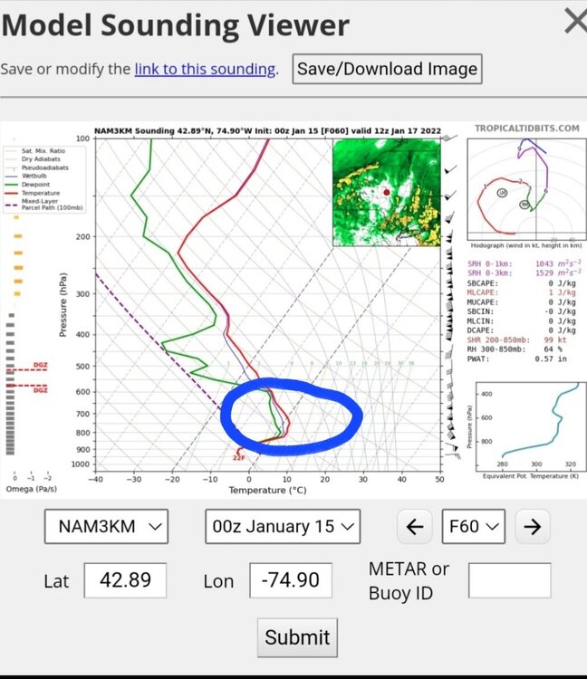
Typical sounding of dry slotting....
-
Next two runs will either provide a surprise or two, or solidify the sleetfest/slotfest for CNY,....at least....kicker wave will be fully sampled.
-
Let's see if the crazy Uncle scores a coup... It's happened before....
-
T+240 (h500 and surface) looks NICE on 12z Euro....
-
Focus is too much on a broad LP....FOCUS on the mid level temps....this is NOT a rapidly deepening lp (at least for now, as depicted by models)...so there is not really a mechanism (dynamic cooling) to potentially overcome the warm air intruding from the Atlantic in the mid levels...
-
The kicker wave will be key...look at the changes already...

-
Not sure you'll see much lake enhancement during the storm.. maybe at the very end.... ... The " No pulse recorded band" you see depicted on the models, is basically basically an occluded front from the old primary, where the deformation band forms....ie...mid levels... You won't have a ton of instability at the lowest levels with 850 millibar temperatures only -4 at best... Until we can sample that kicker impulse over the Pacific better, (like tonight and tomorrow's runs), we could potentially see some significant changes, especially in the mid level set up.
-
Anyone have the 18z runs for cmc and euro?
-
On the New England forum, I just read the euro ensemble mean for 6z has lp over NYC
-
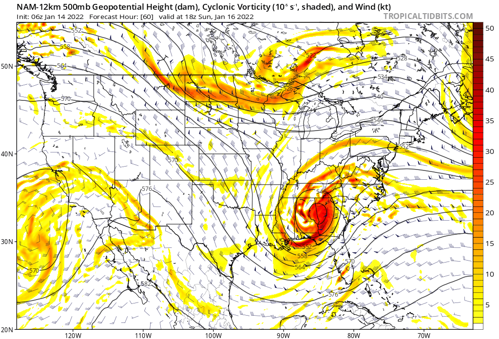
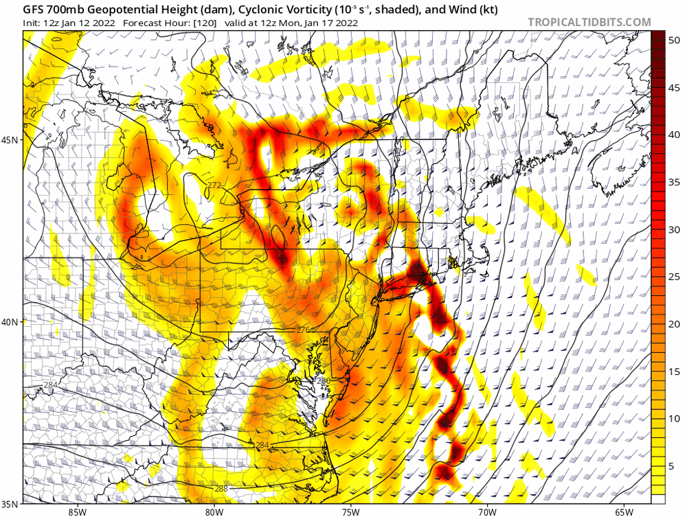
One key feature that we many times overlook, is the H 700 closed low position (Tombo mentioned it awhile back). It has been trending southeastward over the last 4 runs.....
-
18z Gfs a touch east from 12z....
-
Honestly, the 06z Euro ensembles from yesterday, sniffed/hinted at this first.... ....But of all operational models, GFS was first.... ... But, kudos to be held until verification.
-
Lol... I deleted my other post when I noticed it was 00z
-
That's 00z run...
-
Anyone with the 06Z Canadian and euro?
-
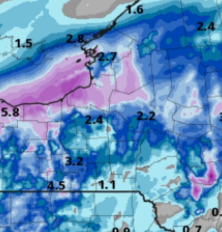
Lol.... All of us went more and more snow! For the record, our region has not had a blockbuster snow event (for our entire region) in years...we get our localized LES from time to time for most of us, but a true EC, eastern NY runner, has been sorrowly lacking for the better part of a decade. Last year in Dec., was close (myself and folks toward BGM did quite well) but our northern and western buddies were pretty much spectators... ....so your above, bolded request is denied....
-
Thanks Blizz... I know sometimes you post these when everybody's sleeping. But they are a much appreciated! Can get to the meat of the bone faster!!!!
-
Na....gonna be a bomb.