LakeEffectKing
-
Posts
4,476 -
Joined
-
Last visited
Content Type
Profiles
Blogs
Forums
American Weather
Media Demo
Store
Gallery
Everything posted by LakeEffectKing
-
Oh yeah...duh!!! Thanks
-
I lost my link to track.. Do you have one?
-
....writing was on the wall yesterday afternoon.....NOLA needs a miracle....
-
Been working a lot. Also closing on a new house. Yes, even under ideal conditions shins it takes a while for is for the centers to align. Most of the hurricane models didn't have this deepening rapidly until this evening, through tomorrow morning. It really should have no issues obtaining 140.... Quickly. Really don't like the trends of the Hurricane models going east at this late stage.
-
If dry air doesn't come in to play, probably 150
-
This will be 140mph+ by morning, if not sooner...
-

Upstate/Eastern New York
LakeEffectKing replied to BuffaloWeather's topic in Upstate New York/Pennsylvania
The elevation has certainly helped quite a bit for a good chunk of the difference, But I was also closer to a couple of synoptic events in December and January.....and I'm not too close to your house, lol!!!:p -
Upstate/Eastern New York
LakeEffectKing replied to BuffaloWeather's topic in Upstate New York/Pennsylvania
3/4"....all but gone now. -
Upstate/Eastern New York
LakeEffectKing replied to BuffaloWeather's topic in Upstate New York/Pennsylvania
20210508_065222.mp4 -
Upstate/Eastern New York
LakeEffectKing replied to BuffaloWeather's topic in Upstate New York/Pennsylvania
Just flipped to parachutes in Caz. (1200') 20210508_062612.mp4 -
Upstate/Eastern New York
LakeEffectKing replied to BuffaloWeather's topic in Upstate New York/Pennsylvania
Elevation made a huge difference this year , more so than in years past... Plus we were closer to that big storm in December. -
Upstate/Eastern New York
LakeEffectKing replied to BuffaloWeather's topic in Upstate New York/Pennsylvania
Caz picked up a half inch of snow overnight... calling the season...107" total.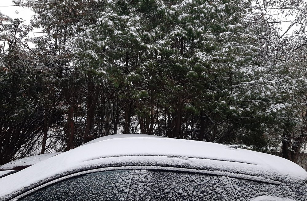
-
Upstate/Eastern New York
LakeEffectKing replied to BuffaloWeather's topic in Upstate New York/Pennsylvania
On the drive into work, rates are what I would estimate to be 2" per hour.
-
Upstate/Eastern New York
LakeEffectKing replied to BuffaloWeather's topic in Upstate New York/Pennsylvania
Ripping again!!!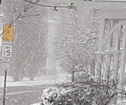
-
Upstate/Eastern New York
LakeEffectKing replied to BuffaloWeather's topic in Upstate New York/Pennsylvania
And also there was no residual salt. That is an often overlooked fact by drivers, whether it be a long period of time between snowfall events or the 1st snow of the season. -
Upstate/Eastern New York
LakeEffectKing replied to BuffaloWeather's topic in Upstate New York/Pennsylvania
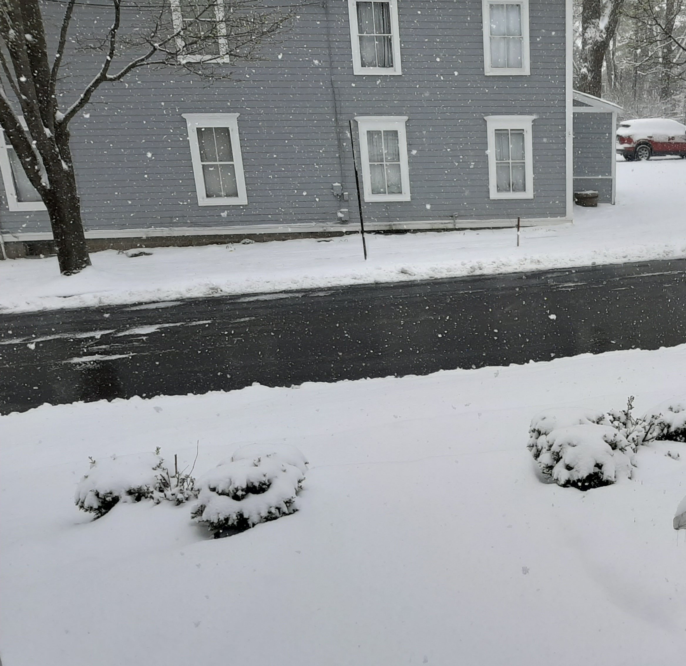
Another moderate squall moving through. A total of about 4.5" since last night.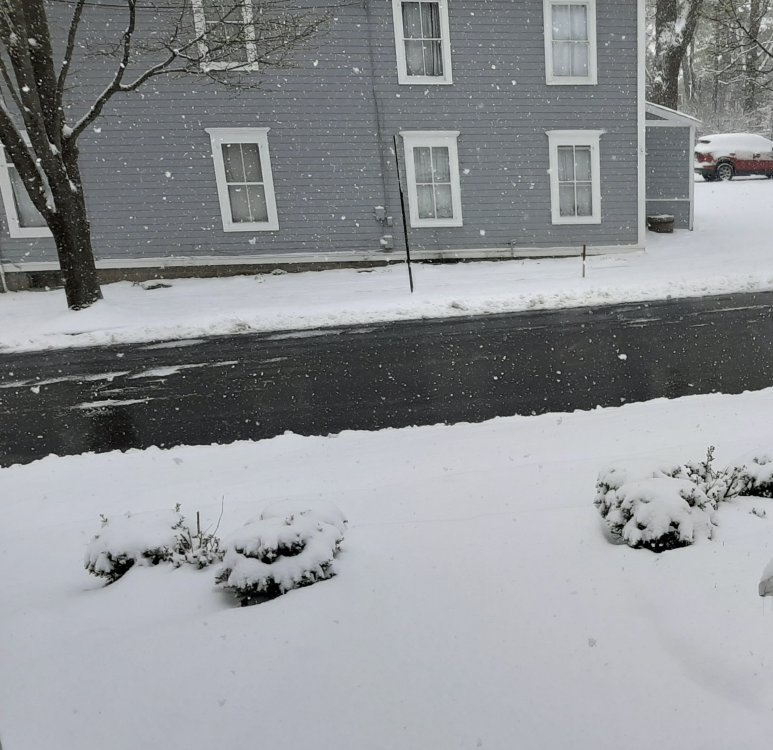
-
Upstate/Eastern New York
LakeEffectKing replied to BuffaloWeather's topic in Upstate New York/Pennsylvania
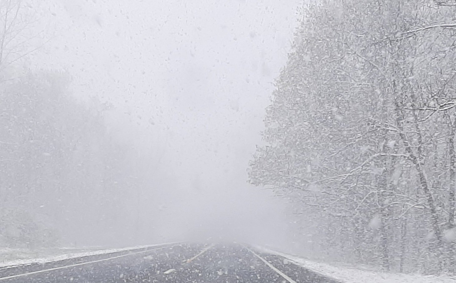
Been ripping for the last 2 hrs. Up to 4". -
Upstate/Eastern New York
LakeEffectKing replied to BuffaloWeather's topic in Upstate New York/Pennsylvania
2" in Caz. overnight. Still light snow. Roads covered. 27°. -
Upstate/Eastern New York
LakeEffectKing replied to BuffaloWeather's topic in Upstate New York/Pennsylvania
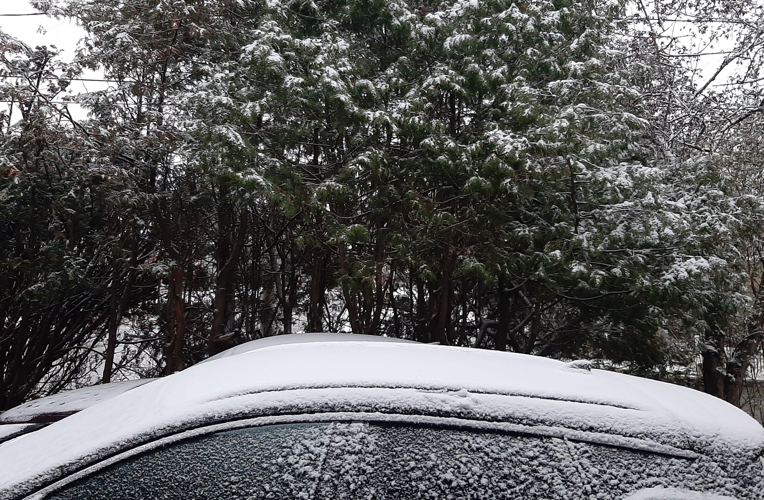
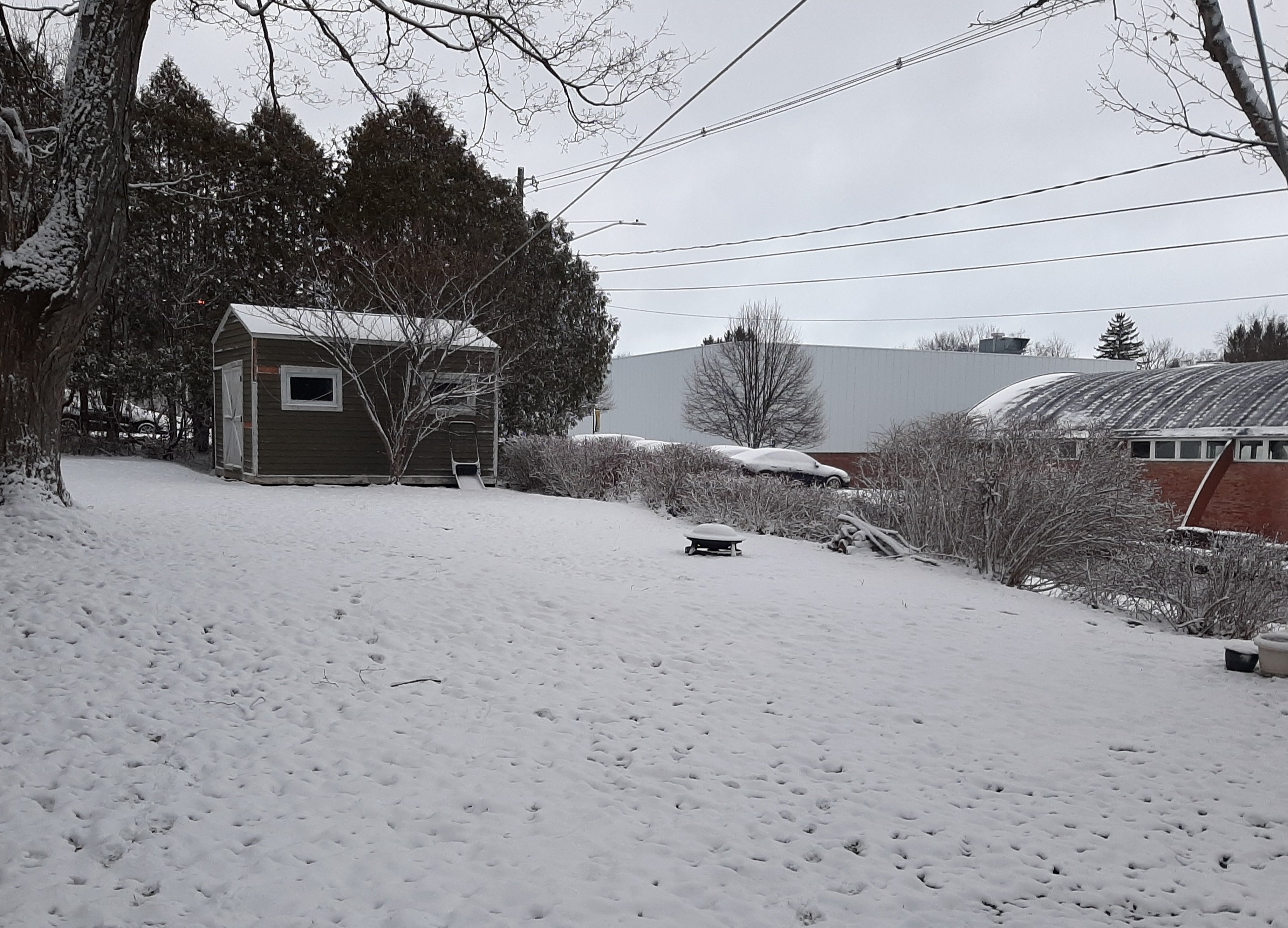
2" this morning in Caz. Another 1" today...still light snow. Pic taken this morning.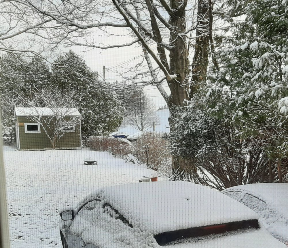
-
Upstate/Eastern New York
LakeEffectKing replied to BuffaloWeather's topic in Upstate New York/Pennsylvania
I'm with you Dave...we've pretty much all been bitten hard by the models this past winter season at some point. But, much like a punched-drunk boxer, getting up just before the ref calls the fight, we go one last time! With the bulk of the snow falling overnight Wed, and temperatures (for a lot of areas) most of Thurs below freezing on pretty strong CAA, the totals that many of the models are putting out look somewhat reasonable.... ...and maybe some stout LES early Thurs night to boot!!!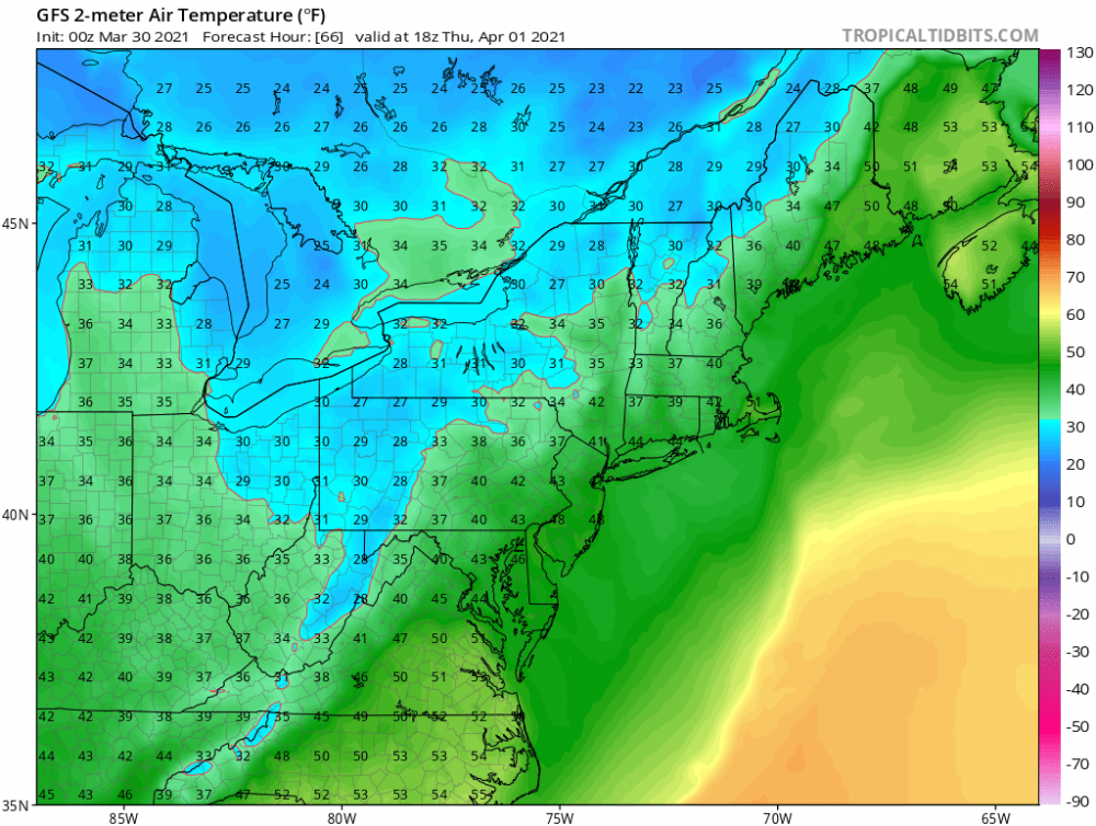

-
Upstate/Eastern New York
LakeEffectKing replied to BuffaloWeather's topic in Upstate New York/Pennsylvania
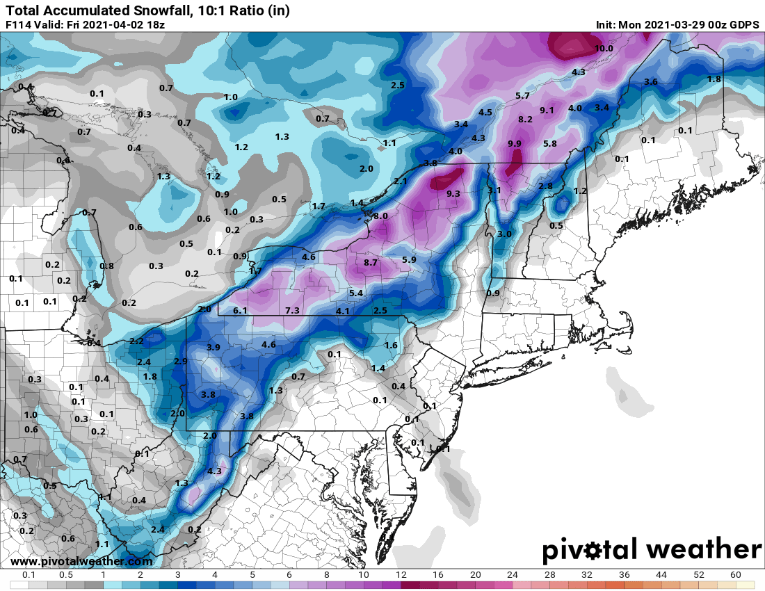
06z GFS, ups the potential tally for MBY....
-
Upstate/Eastern New York
LakeEffectKing replied to BuffaloWeather's topic in Upstate New York/Pennsylvania
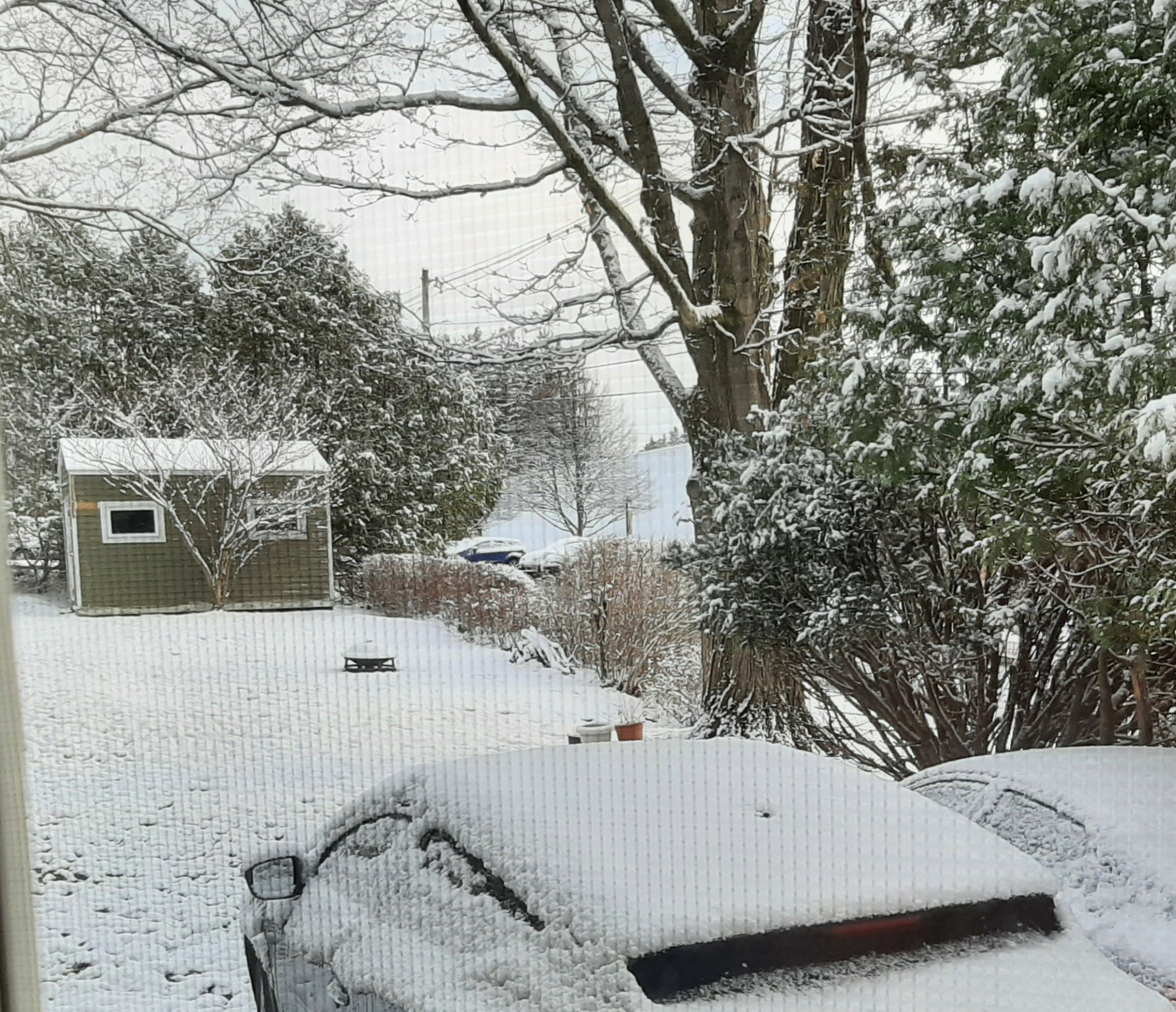
Couple inches overnight...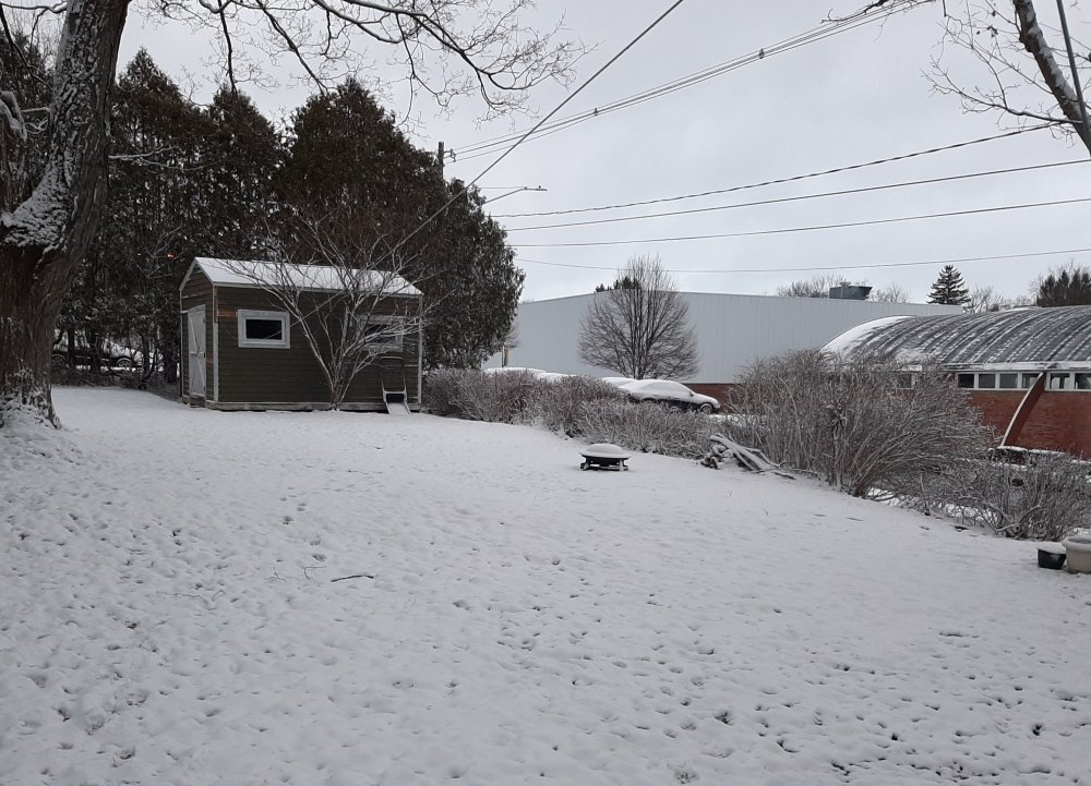
-
Upstate/Eastern New York
LakeEffectKing replied to BuffaloWeather's topic in Upstate New York/Pennsylvania
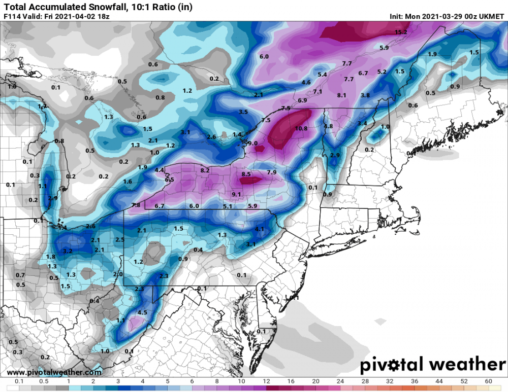
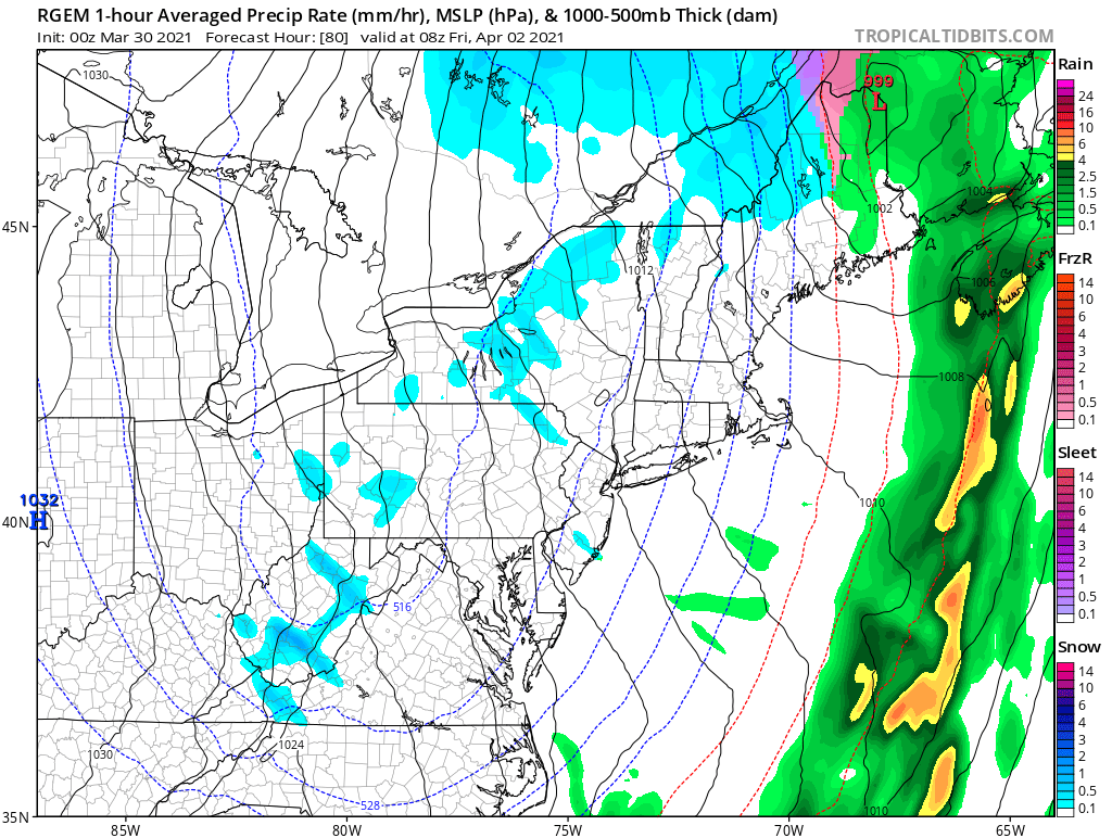
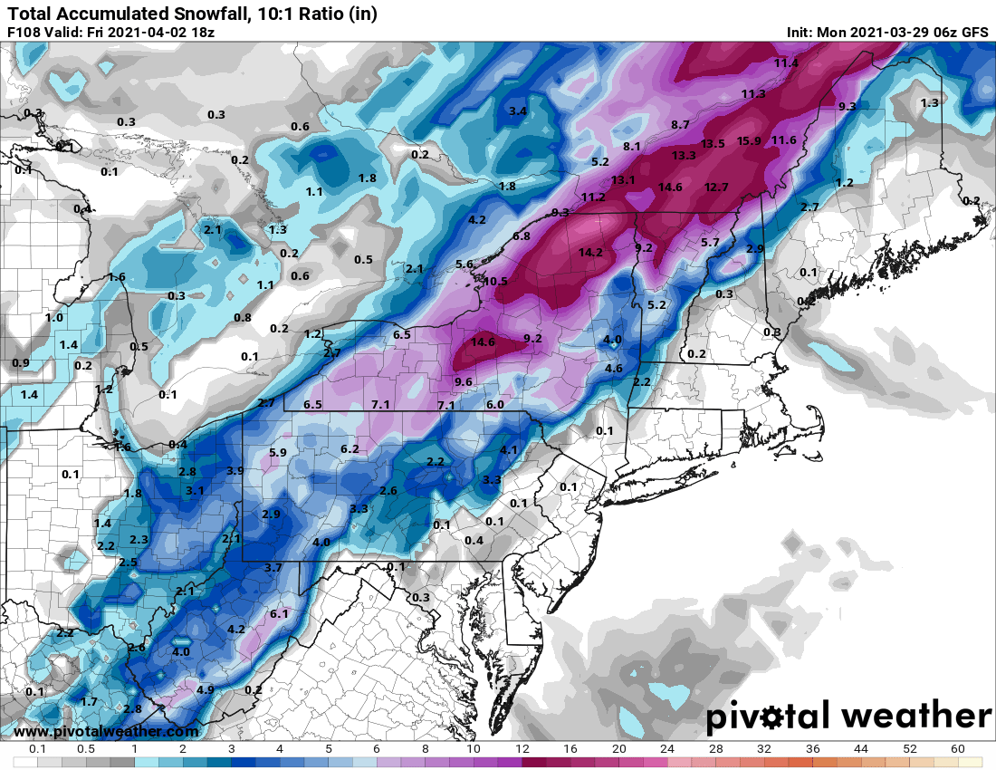
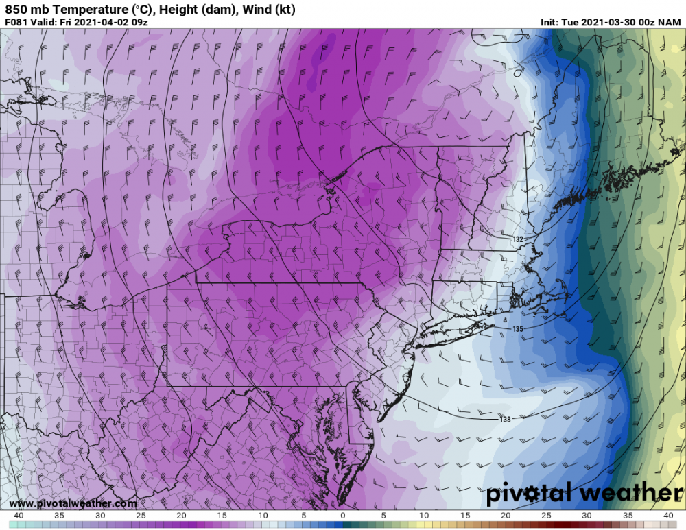
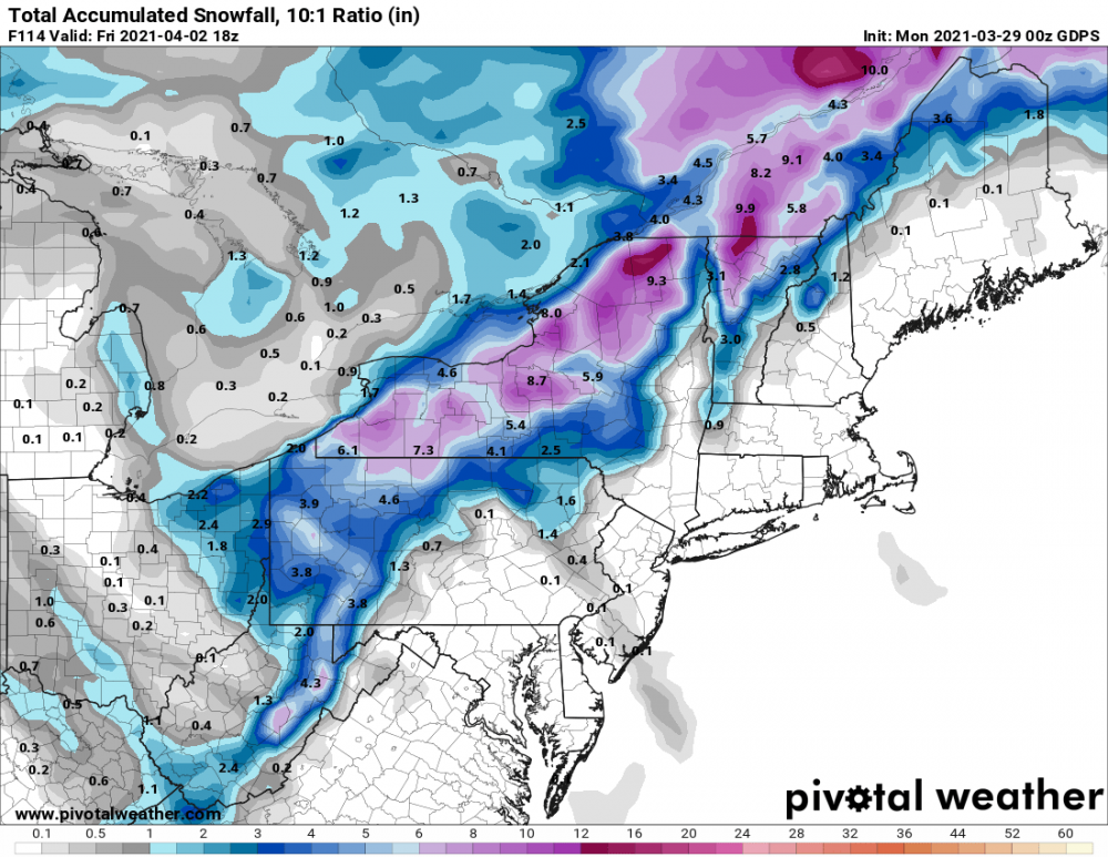
KBGM... LONG TERM /WEDNESDAY NIGHT THROUGH SUNDAY/... 300 pm update... The major concern with this period continues to be the transition over to snow Wednesday night as temperatures quickly fall through the 30s behind the cold front. Precipitation remains likely even after the front passes through with a surface low deepening over New England, helping to reinforce cold air advection over our region, and another shortwave rippling through. Guidance continues to agree on a potential for a few inches of snow especially southeast of Lake ontario, where there will be some lake enhancement as snow showers continue through Thursday. The previous discussion continues below. 330 am update... By Wednesday evening temperatures will fall into the 30s. This drop in surface temperatures will be accompanied by rapidly falling temperatures aloft, which is should allow the rain showers to mix with and change to snow showers during the evening hours. The changeover will continue into ne PA during the overnight hours, with the entire area cold enough for snow by late Wed night/early Thur morning. The challenge with the cold side of this storm system will be attempting to determine how much precipitation develops post- frontal as a surface low forms and deepens over New England. At this time there is a signal on the latest ECMWF and CMC...and has been there consistently through the past several runs...showing an enhanced band of snow aligned with an area of Q-vector convergence, strong PVA ahead of a sharp embedded short wave, and an area of strong divergence aloft in the entrance region of a 130 kt jet. There is also support from several EC ensemble runs as well...which increases confidence in accumulating snow across portions of the forecast area on Thursday. Will need to keep a close eye on the evolution of this system as it could have some significant impacts...mainly snow. We are also watching the potential for a short period cold blast Thursday night through Friday night with overnight lows bottoming out in the teens and highs on Fri afternoon only into the lower to mid 30s. The combination of gusty northwest winds and cold temperatures will make it feel even cold...and a lot more like January than April. The cold air pouring into the region will be Canadian in origin and relatively dry, but still be cold enough to interact with the warm lake waters and trigger lake effect snow showers through this period. There is a concern for additional accumulating lake effect snow southeast of Lake Ontario through Friday night. The amounts may be limited by the warm surface temperatures and potentially some sun during the day. But, still cannot completely rule out accumulations during the overnight hours. Any lake effect snow showers should be ending Saturday morning and conditions remaining dry through most of the day. However, there is the potential for a weak wave to move in from the w/nw later Saturday with another shot of very light rain with temperatures climbing into the 40s and lower 50s by the afternoon. -
Upstate/Eastern New York
LakeEffectKing replied to BuffaloWeather's topic in Upstate New York/Pennsylvania
-
Upstate/Eastern New York
LakeEffectKing replied to BuffaloWeather's topic in Upstate New York/Pennsylvania