LakeEffectKing
-
Posts
4,476 -
Joined
-
Last visited
Content Type
Profiles
Blogs
Forums
American Weather
Media Demo
Store
Gallery
Everything posted by LakeEffectKing
-

Back to Back Major Synoptic Snowstorms!
LakeEffectKing replied to BuffaloWeather's topic in Upstate New York/Pennsylvania
Total for both UK:
-
Upstate/Eastern New York
LakeEffectKing replied to BuffaloWeather's topic in Upstate New York/Pennsylvania
How does that compare to previous runs? -
Upstate/Eastern New York
LakeEffectKing replied to BuffaloWeather's topic in Upstate New York/Pennsylvania
I don't think they're concerned with ratios, When they only mention a "few inches" for Tuesday... -
Upstate/Eastern New York
LakeEffectKing replied to BuffaloWeather's topic in Upstate New York/Pennsylvania
06z Nam is quite a bit faster than the 00z run.... But also more QPF. -
Upstate/Eastern New York
LakeEffectKing replied to BuffaloWeather's topic in Upstate New York/Pennsylvania
Yeah Tim, looks like the south shore will really cash in! -
Upstate/Eastern New York
LakeEffectKing replied to BuffaloWeather's topic in Upstate New York/Pennsylvania
I exceeded Kuchera during the 2/2 - 2/3 event...albeit with some LES at the end.... We'll definitely have to see how the profiles look... When you're close to the sleet line, you never know how the ratios will end up... Could be wide ranging over a county or 2. -
Upstate/Eastern New York
LakeEffectKing replied to BuffaloWeather's topic in Upstate New York/Pennsylvania
Quasi-stationary surface Arcticu high to the north... the depth of cold air is shallower as you get further from the HP...and the llv cold can't go anywhere except drain to the south, because it is trapped to the west by the mountains. -
Upstate/Eastern New York
LakeEffectKing replied to BuffaloWeather's topic in Upstate New York/Pennsylvania
Weak lp over West Virgina.....but one could make a case that it is overrunning on steroids a wavy juiced up front... But I believe there will definitely be a break in between 2 separate significanct snowfalls...Monday..a lull Mon eve..then the main storm Tue.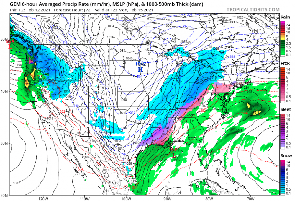
-
Upstate/Eastern New York
LakeEffectKing replied to BuffaloWeather's topic in Upstate New York/Pennsylvania
4 systems...Sat night 1-3...Monday ( I think that will surprise us as overachieving)... Quickly followed by Tuesday and Tuesday evening's system... Then Thursday and Thursday night's storm) -
Upstate/Eastern New York
LakeEffectKing replied to BuffaloWeather's topic in Upstate New York/Pennsylvania
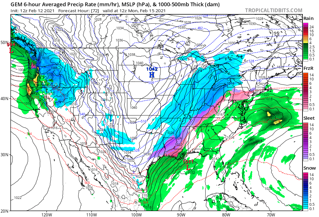
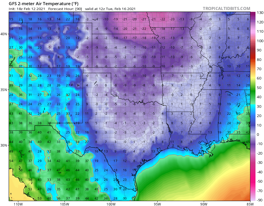
While we await the 00 runs, a tangent story will be the cold that is progged for the deep southern plains/Mississippi Valley.... Once in a century event. Along with the snow, sleet, and freezing rain, this will be a huge national story.
-
Upstate/Eastern New York
LakeEffectKing replied to BuffaloWeather's topic in Upstate New York/Pennsylvania
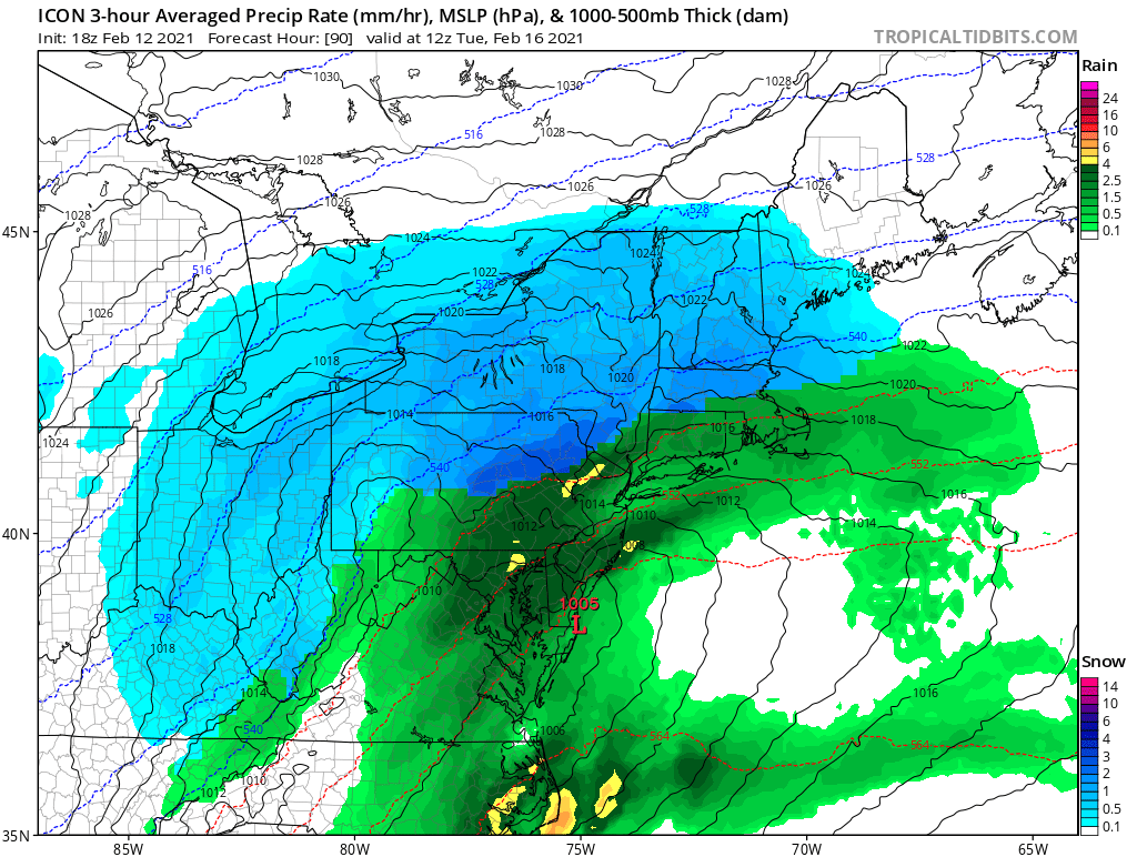
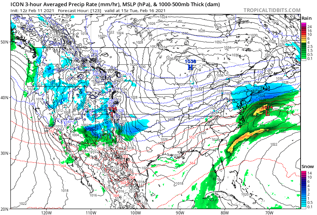
Icon with a deeper/closer lp...
-
Upstate/Eastern New York
LakeEffectKing replied to BuffaloWeather's topic in Upstate New York/Pennsylvania
That's a pretty tepid discussion by the folks in Buffalo... -
Upstate/Eastern New York
LakeEffectKing replied to BuffaloWeather's topic in Upstate New York/Pennsylvania
Thanks again BGM Blizzard for the maps! -
Upstate/Eastern New York
LakeEffectKing replied to BuffaloWeather's topic in Upstate New York/Pennsylvania
Icon whiff Tue.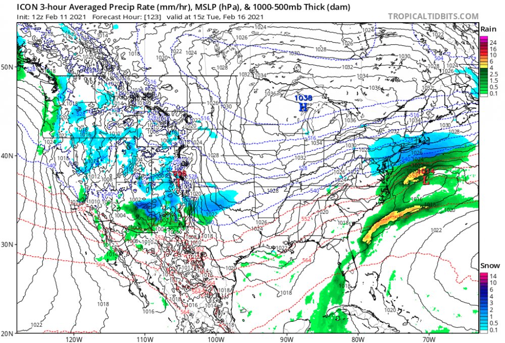
-
Upstate/Eastern New York
LakeEffectKing replied to BuffaloWeather's topic in Upstate New York/Pennsylvania
And she looks impressive out in the Pacific.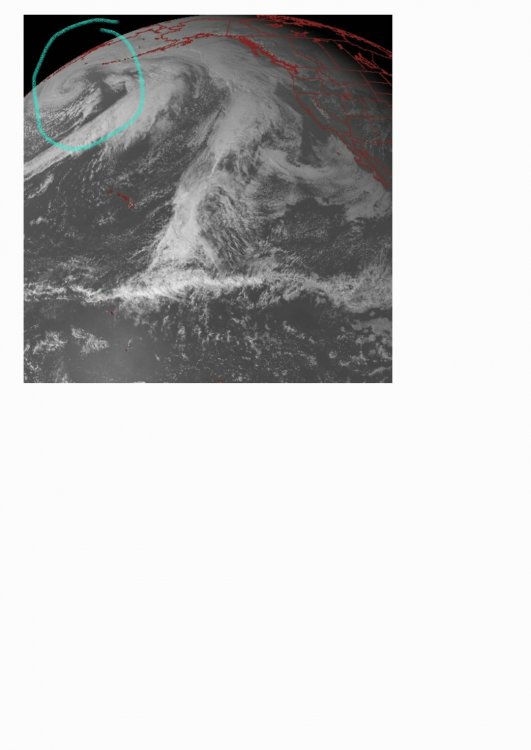
-
Upstate/Eastern New York
LakeEffectKing replied to BuffaloWeather's topic in Upstate New York/Pennsylvania
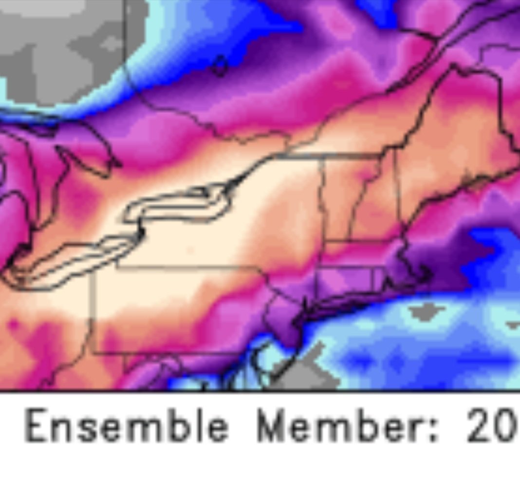
I want to overachive on member #20.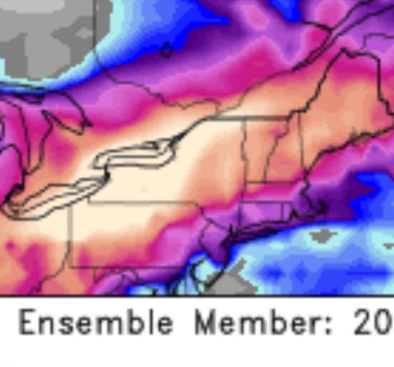
-
Major LES Events- Feb 5-?
LakeEffectKing replied to BuffaloWeather's topic in Upstate New York/Pennsylvania
Ugh....really thought the band would have been a touch stronger and about 7 miles south. I guess it boiled down to shear, and my invalidated thoughts that the weaker winds would have favored more of a shoreline convergence zone...i.e....further south.. Oh well on to the next! -
Upstate/Eastern New York
LakeEffectKing replied to BuffaloWeather's topic in Upstate New York/Pennsylvania
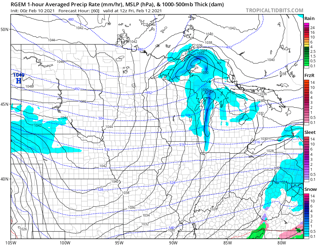
Yeah, and as a tangent, check out the meso lp that forms over L. Superior on the 00z rgem and 12km nam. Best seen on TT with north-central US region selected. Then use the slider bar to loop it. Super cool, especially on the rgem.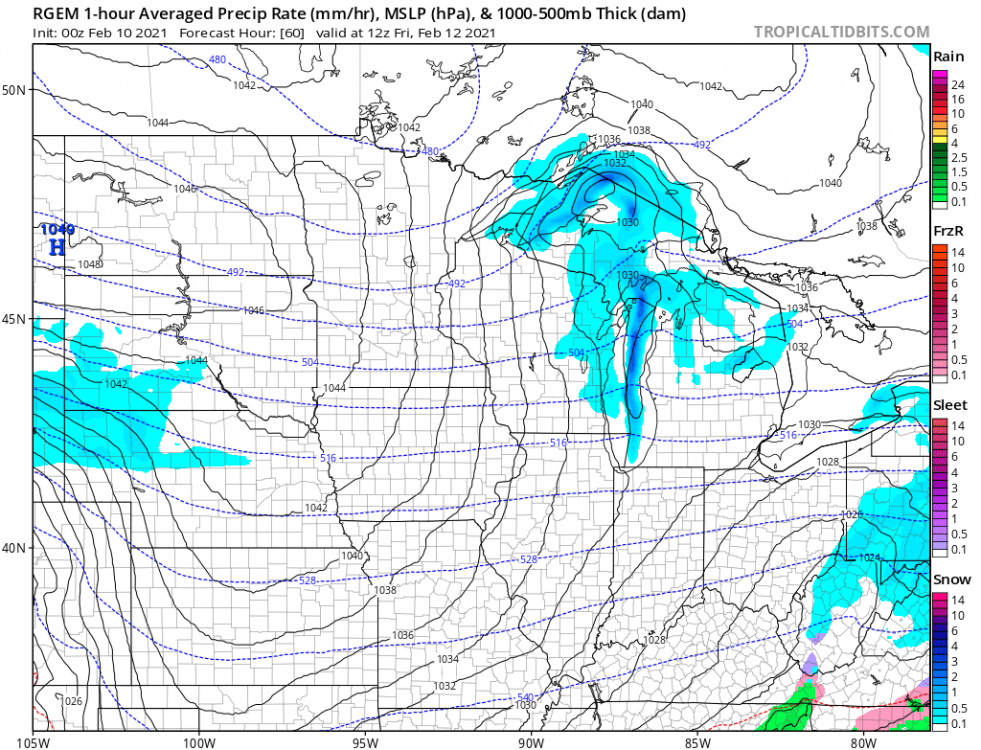
-
Major LES Events- Feb 5-?
LakeEffectKing replied to BuffaloWeather's topic in Upstate New York/Pennsylvania
Guessing a decent amount of shear.... -
Upstate/Eastern New York
LakeEffectKing replied to BuffaloWeather's topic in Upstate New York/Pennsylvania
I fully expect Binghamton to pull the trigger on Onondaga County... So knowing them, probably an advisory at 1st and then a warning later as the event unfolds. -
Upstate/Eastern New York
LakeEffectKing replied to BuffaloWeather's topic in Upstate New York/Pennsylvania
If I could choose a place were to be, it would be Hannibal. -
Upstate/Eastern New York
LakeEffectKing replied to BuffaloWeather's topic in Upstate New York/Pennsylvania
Yep... I think the initial band will start as a shoreline convergence band which makes all the difference in the world as to whether it sets up over central Oswego Co. or Along the border of Onondaga and Oswego Cos. I still think there will be another smaller band trying to form early up near the Pulaski/Parish area, but I think the shoreline band will take over late this evening or early tonight. I also think this band will have a right hook to it so as it moves inland it heads southeastward towards Chittenango or even my area in Cazenovia. Probably just clipping the airport. -
Upstate/Eastern New York
LakeEffectKing replied to BuffaloWeather's topic in Upstate New York/Pennsylvania
Anybody want to tell me how to embed a gif? Anyways, the RGEM trended about 10 miles South on the latest run with respect to the placement of the band off Ontario.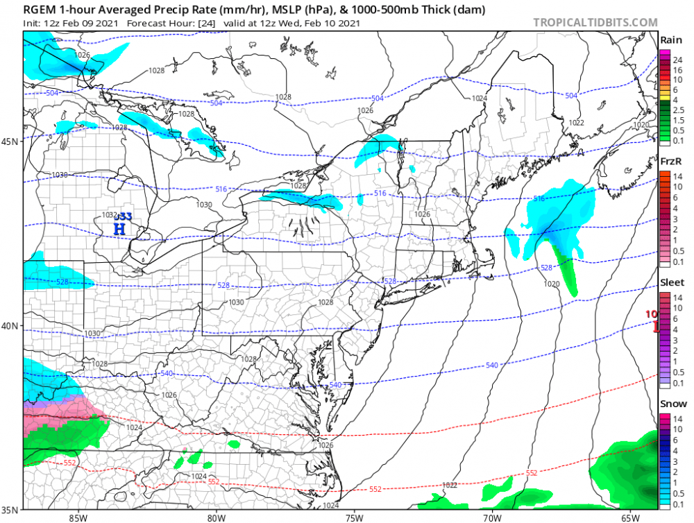
-
Upstate/Eastern New York
LakeEffectKing replied to BuffaloWeather's topic in Upstate New York/Pennsylvania
The band will start out near Wolfie around 7-8 tonight, then there should be a subtle wind shift, which imo, (unlike last event 2 nights ago) will be more NAM like in placement vs. the Canadian counterparts (RGEM/HRDPS) i.e...a more southerly placement. S. Oswego Co. and N. Onondaga Co. are my targets for jackpots, and not Central Oswego Co. what RGEM is showing. Kinda like this for mean placement overnight into tomorrow morning, before lifting north.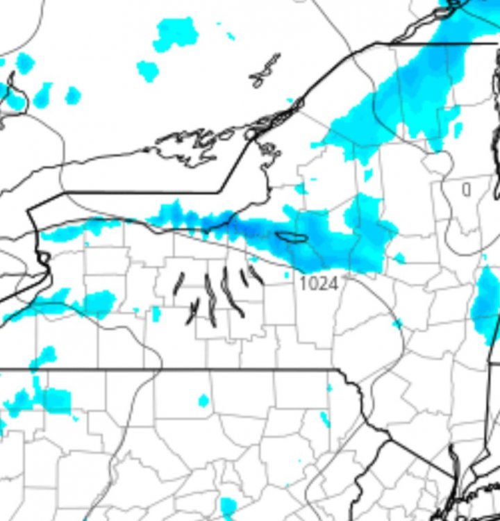
-
Upstate/Eastern New York
LakeEffectKing replied to BuffaloWeather's topic in Upstate New York/Pennsylvania
I think Syrmax, Freak and Matt are in the game tomorrow night....and Some scraps for me too! And don't count out some influences from Geo Bay.