LakeEffectKing
-
Posts
4,476 -
Joined
-
Last visited
Content Type
Profiles
Blogs
Forums
American Weather
Media Demo
Store
Gallery
Everything posted by LakeEffectKing
-

Upstate/Eastern New York
LakeEffectKing replied to BuffaloWeather's topic in Upstate New York/Pennsylvania
2007.....It was about 7-10 days after the huge les event we all chased. -
Upstate/Eastern New York
LakeEffectKing replied to BuffaloWeather's topic in Upstate New York/Pennsylvania
Talked to family in Parish... They got about a foot last night. -
Upstate/Eastern New York
LakeEffectKing replied to BuffaloWeather's topic in Upstate New York/Pennsylvania
Yeah... this one doesn't look to be significant for S.Oswego Co./N. Onondaga Co....I think this may get into your area for a couple hours later tonight... -
Upstate/Eastern New York
LakeEffectKing replied to BuffaloWeather's topic in Upstate New York/Pennsylvania
Someone is going to see 12-16"....most likely within Parish, Palermo, C. Square triangle.. -
Upstate/Eastern New York
LakeEffectKing replied to BuffaloWeather's topic in Upstate New York/Pennsylvania
I wouldn't say that...if a shoreline convergence can take over (hard to do once a center lake band forms, but can happen) then N. Onondaga Co. can jackpot...it happened many times when I was in Liverpool. -
Upstate/Eastern New York
LakeEffectKing replied to BuffaloWeather's topic in Upstate New York/Pennsylvania
The models this morning were having a tough time trying to figure out if the band's southern extent would halt at the Parish/Central Square area, or the Phoenix/Clay area. The 2 camps were being driven by whether the genesis of the lake effect was shoreline or major axis convergence. It looks like right now the major axis convergence zone is setting up as we speak....which MAY indicate Central Oswego Co. as tonight's target zone for max. totals. -
Upstate/Eastern New York
LakeEffectKing replied to BuffaloWeather's topic in Upstate New York/Pennsylvania
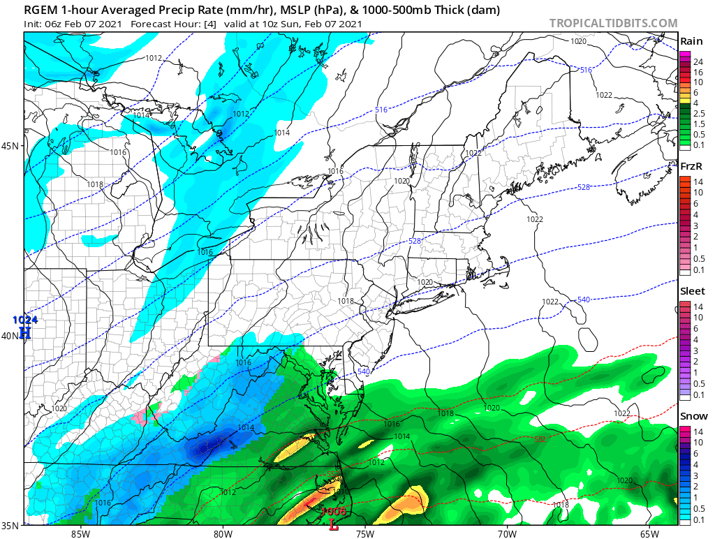
As well as the RGEM
-
Upstate/Eastern New York
LakeEffectKing replied to BuffaloWeather's topic in Upstate New York/Pennsylvania
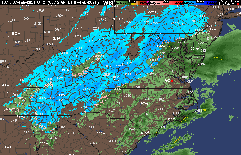
06 NAM off with western extent of qpf...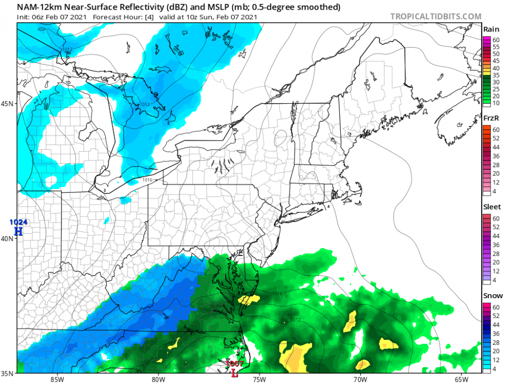
-
Upstate/Eastern New York
LakeEffectKing replied to BuffaloWeather's topic in Upstate New York/Pennsylvania
Most of the season the teleconnections have probably played a decent role. Our best opportunities are when the MS River Valley/East Coast has an established longwave trough, and we have not had that for a few seasons at least. -
Major LES Events- Feb 5-?
LakeEffectKing replied to BuffaloWeather's topic in Upstate New York/Pennsylvania
Great videos BW! That wind! I prefer the 3-5"/hr. with no wind, but certainly appreciate the harshness the wind adds. Yeah. Not much for Erie folks the next few days, but off Ontario, C/S Oswego Co. into Oneida Co. should have a decent window (8-14 hours) for 1-3"/hr. stuff. At this time it doesn't look like there will be any connection (circulation nor seeding) off Georgian Bay. -
Upstate/Eastern New York
LakeEffectKing replied to BuffaloWeather's topic in Upstate New York/Pennsylvania
UK for Mon. Night/Tue. Event...few inches...
-
Major LES Events- Feb 5-?
LakeEffectKing replied to BuffaloWeather's topic in Upstate New York/Pennsylvania
The orientation of the bands look to be backing, north of Cleveland. -
Upstate/Eastern New York
LakeEffectKing replied to BuffaloWeather's topic in Upstate New York/Pennsylvania
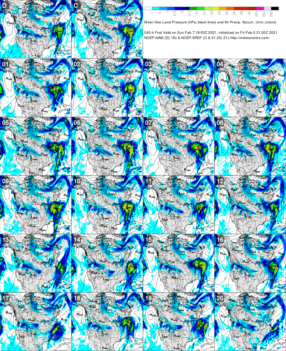
Lots of crazy solutions...
-
Major LES Events- Feb 5-?
LakeEffectKing replied to BuffaloWeather's topic in Upstate New York/Pennsylvania
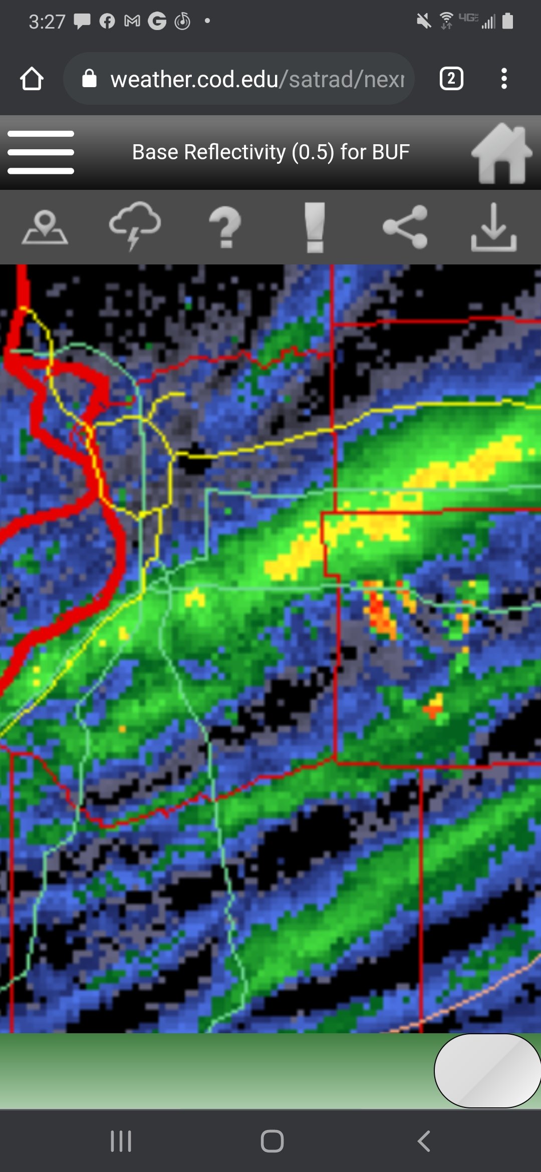
Yeah looks like 3"/hr. type stuff... i.e. rippage!!!!
-
Upstate/Eastern New York
LakeEffectKing replied to BuffaloWeather's topic in Upstate New York/Pennsylvania
UK for Sunday....
-
Upstate/Eastern New York
LakeEffectKing replied to BuffaloWeather's topic in Upstate New York/Pennsylvania
Let's see if the NW trend continues. I have a hunch!! -
Upstate/Eastern New York
LakeEffectKing replied to BuffaloWeather's topic in Upstate New York/Pennsylvania
Yep. If you look at the 6z GFS at h500, You will see a sharper vort max vs 00z. Let's see if that trend continues in today's runs. -
Upstate/Eastern New York
LakeEffectKing replied to BuffaloWeather's topic in Upstate New York/Pennsylvania
FWIW, 06 GFS shifted Sunday's LP on the coast northwest ward about 100 miles vs. 00z...brings synoptic snow to se NYS.
-
Synoptic Snowstorm 2/1-2/4
LakeEffectKing replied to BuffaloWeather's topic in Upstate New York/Pennsylvania
Well, all in all, my call wasn't too bad. Busted pretty low for MBY, but I'm not too bummed! -
Synoptic Snowstorm 2/1-2/4
LakeEffectKing replied to BuffaloWeather's topic in Upstate New York/Pennsylvania
All elevation driven...I drive to work going through Chittenango (a much lower elevation (450' vs 1250') 9 miles between and they had about a foot less visually, and that is what was reported...18". -
Synoptic Snowstorm 2/1-2/4
LakeEffectKing replied to BuffaloWeather's topic in Upstate New York/Pennsylvania
Good call.. That was certainly a local max within the upstate region. The hills s and se of SYR above 1000', were right there with the Ithica area. -
Synoptic Snowstorm 2/1-2/4
LakeEffectKing replied to BuffaloWeather's topic in Upstate New York/Pennsylvania
Was that the total for the whole storm are just from yesterday for BUF? I thought they got a couple inches Monday. -
Synoptic Snowstorm 2/1-2/4
LakeEffectKing replied to BuffaloWeather's topic in Upstate New York/Pennsylvania
So do we have the official#'s from SYR, ROC, ALB, BGM, BUF?? Haven't had time to look up. -
Synoptic Snowstorm 2/1-2/4
LakeEffectKing replied to BuffaloWeather's topic in Upstate New York/Pennsylvania
Well, someone else reported the 30" in Caz. But it was very close to my final tally with 4" new today after 6am...total of 29. -
Major LES Events- Feb 5-?
LakeEffectKing replied to BuffaloWeather's topic in Upstate New York/Pennsylvania
Under the convergence zone there typically is very little wind And you can still get decent sized dendrites. Western and northern New York's time to shine!!!