LakeEffectKing
-
Posts
4,476 -
Joined
-
Last visited
Content Type
Profiles
Blogs
Forums
American Weather
Media Demo
Store
Gallery
Everything posted by LakeEffectKing
-
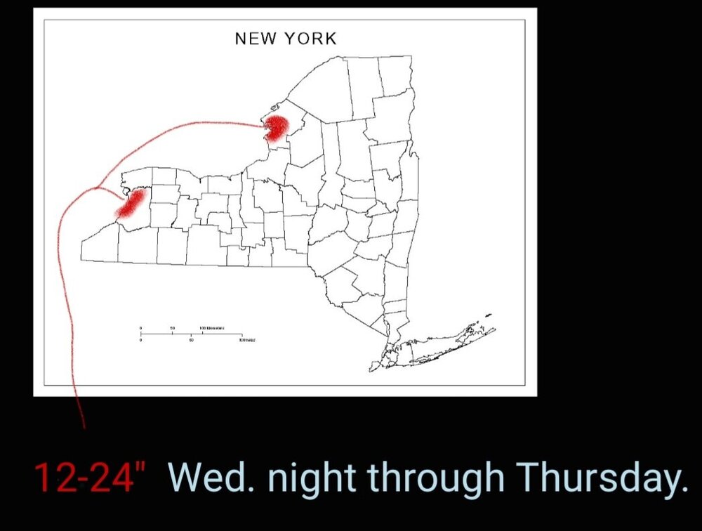
 Upping my call for lollies to 30+"...somewhere 8 miles either side of KBUF....
 -
Good luck Western New York crew! The rest of us will have our turn very soon.. Is verification exceed your expectations!
-
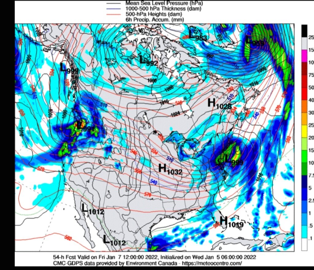
On this board at least, I would default to Delta... As he probably knows more of the intricacies of lake effect snow off Erie... For what it's worth, my opinion is that metro Buffalo is ground Zero.... Within 10 miles either side of of the metro in play for the heaviest snow fall. I still believe there will be A 20 mile swath of 12 to 18" with some lollipops of 2'+. Off Ontario this looks to be between Watertown and Adams... I'd expect the same amounts in that area with maybe 24" somewhere and the central/northern Tug.
-
Not really...there is a lot of new data that goes into the "off hour" runs...satellite, bouy, ship, etc....just not balloons...
-
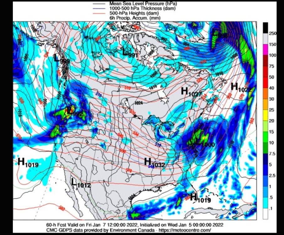
06z Canadian shifted west considerably..

-
Big change!

-
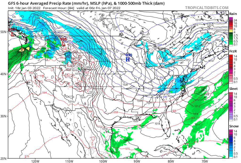
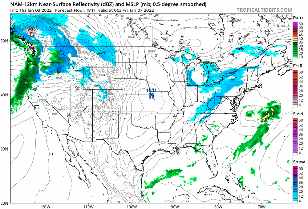
Last two runs...wave off coast is much weaker....which is good...let's see if something has been incorporated into the entire 00z suite.
-
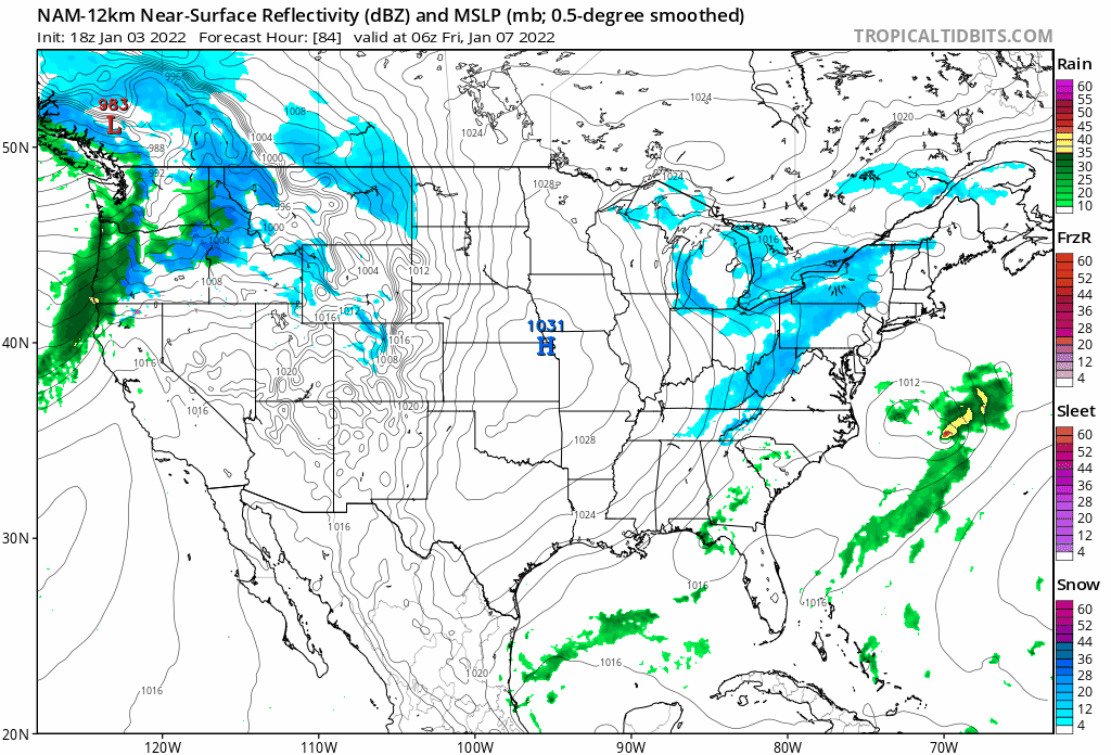
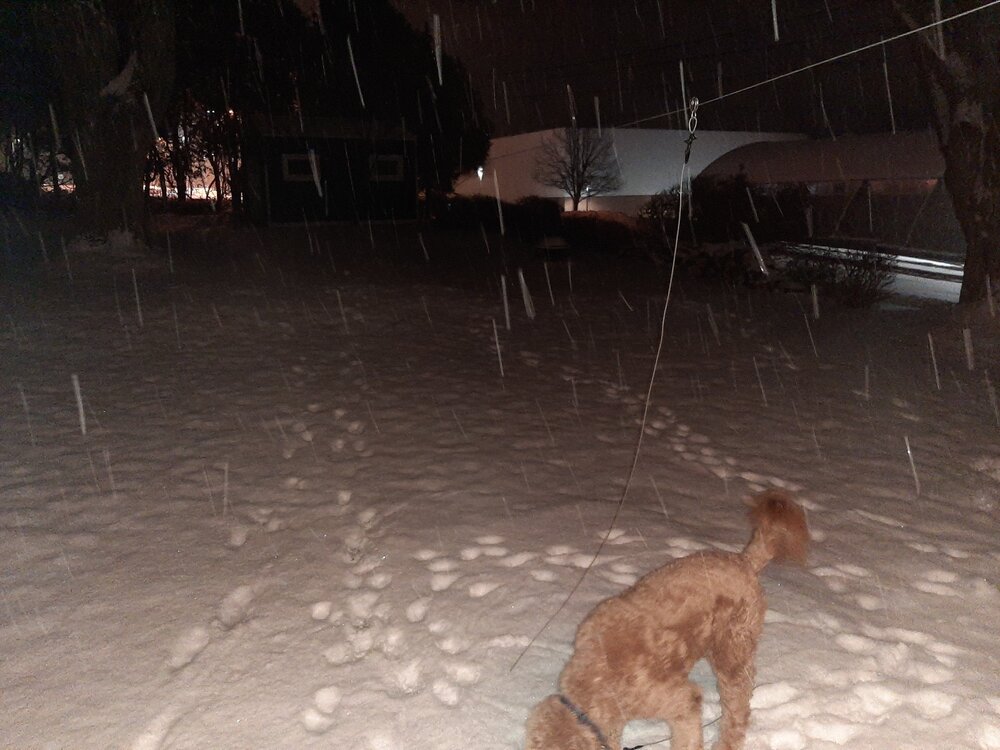
9 degrees in Caz. Picked up an inch last night/this morning... Maybe the models forgot how to incorporate radiational cooling into their outputs.. Still thinking Buffalo metro will see over a foot... And probably some jackpots of near 2'.
-
Definitely hints at the upslope potential.... I would not be surprised to see a double band structure off of lake Ontario with the Southern one being weaker.... And near you.
-
This should be an excellent setup.
-
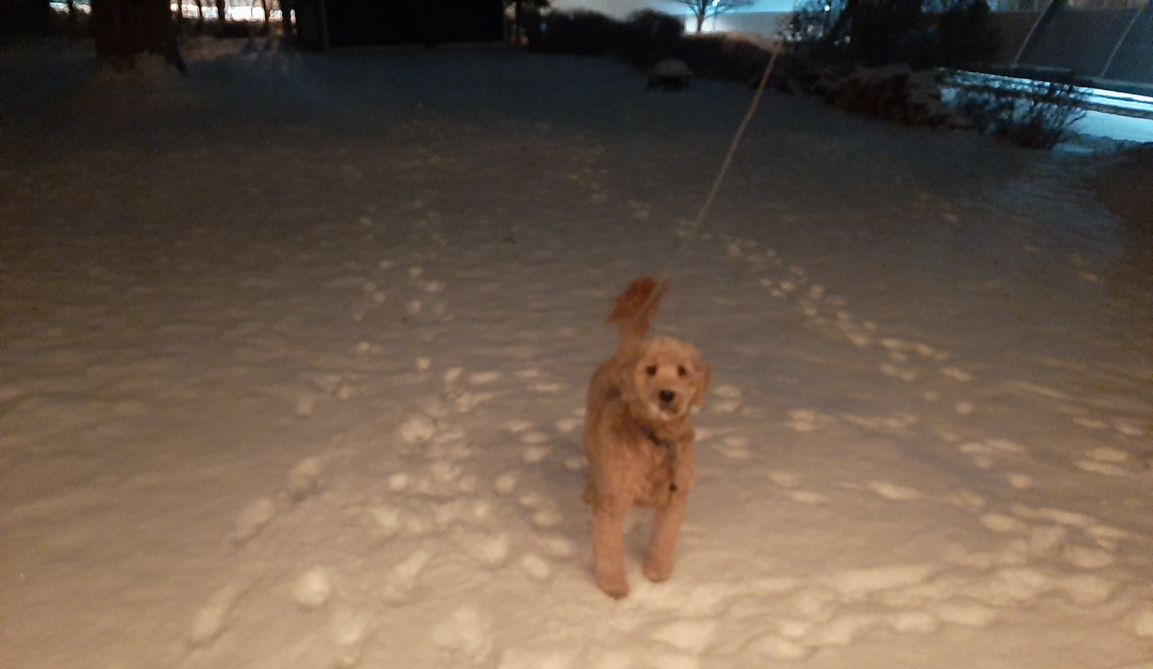
Total snowfall in Caz... 0 point 0
-
Upstate/Eastern New York-Into Winter!
LakeEffectKing replied to BuffaloWeather's topic in Upstate New York/Pennsylvania
Jamison? -
Upstate/Eastern New York-Into Winter!
LakeEffectKing replied to BuffaloWeather's topic in Upstate New York/Pennsylvania
Do we dare?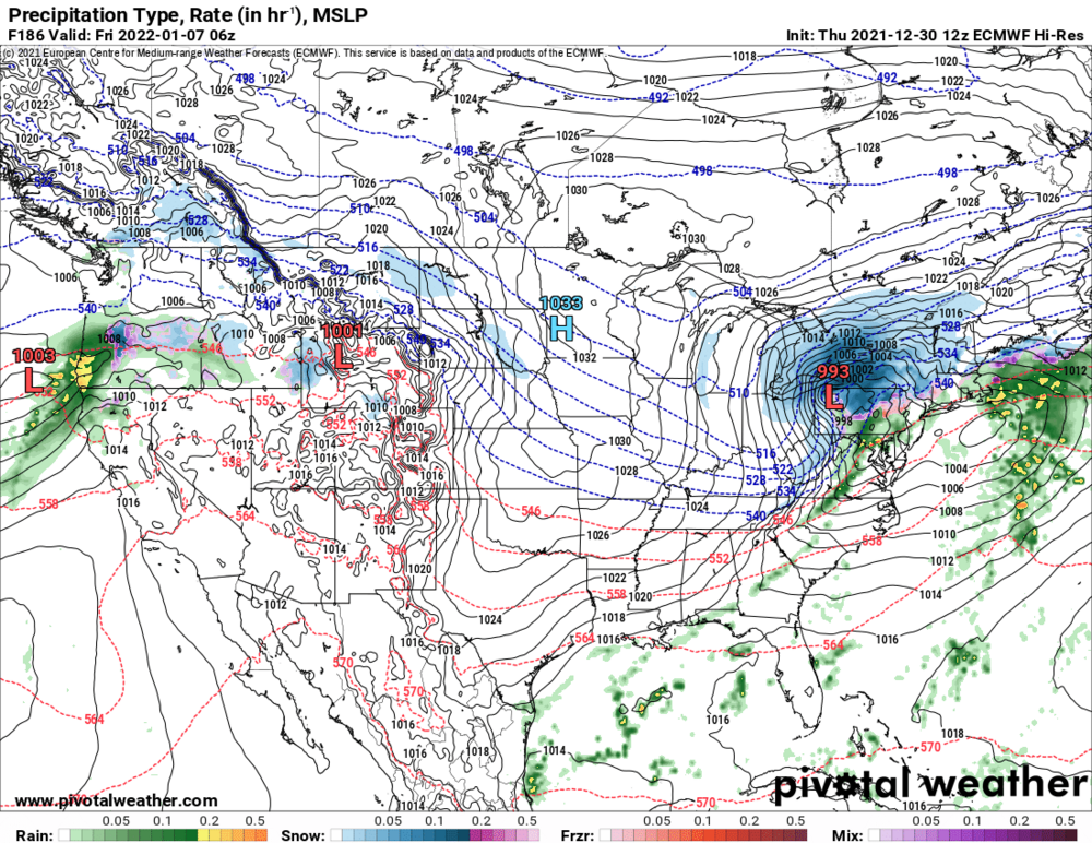

-
Upstate/Eastern New York-Into Winter!
LakeEffectKing replied to BuffaloWeather's topic in Upstate New York/Pennsylvania
There really is no hope. It seems to me that the GFS is just an unstable model, especially with fast flow setups....even at T+60. -
Upstate/Eastern New York-Into Winter!
LakeEffectKing replied to BuffaloWeather's topic in Upstate New York/Pennsylvania
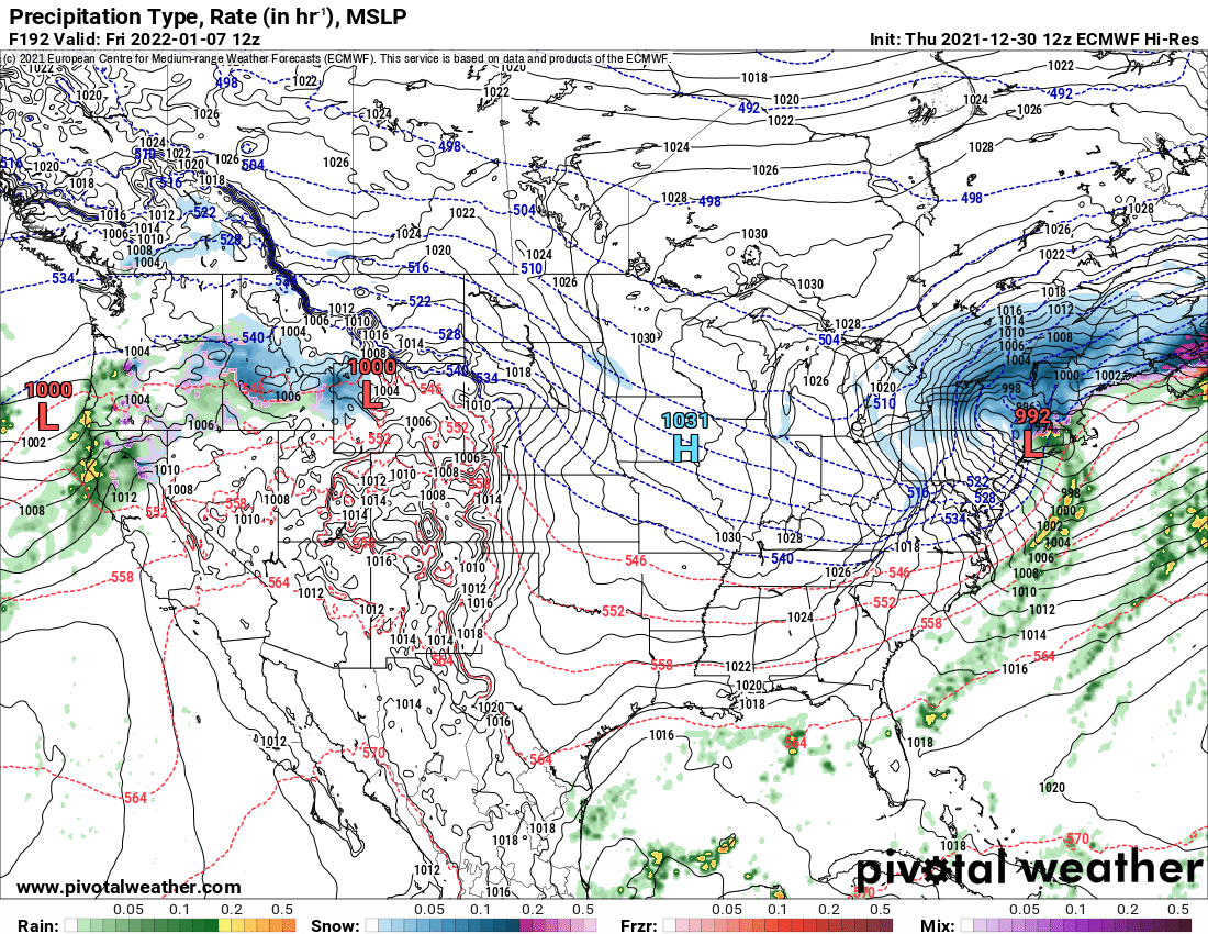
An old professor of mine back in the eighties, once told me that when the northern hemispheric H500 pattern looks like Africa, it's a nice active, cold and stable pattern for the NE..... .....I give you Africa in 2 weeks.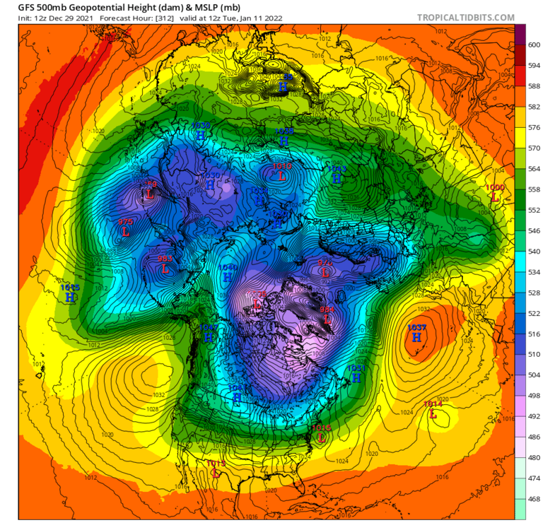
-
Upstate/Eastern New York-Into Winter!
LakeEffectKing replied to BuffaloWeather's topic in Upstate New York/Pennsylvania
Superfast flow in the northern jet is causing the models to flop around... Along with lots of small short waves embedded in the flow. -
Upstate/Eastern New York-Into Winter!
LakeEffectKing replied to BuffaloWeather's topic in Upstate New York/Pennsylvania
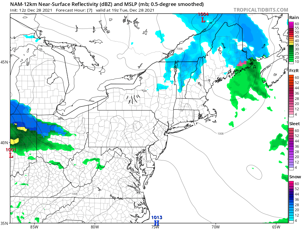
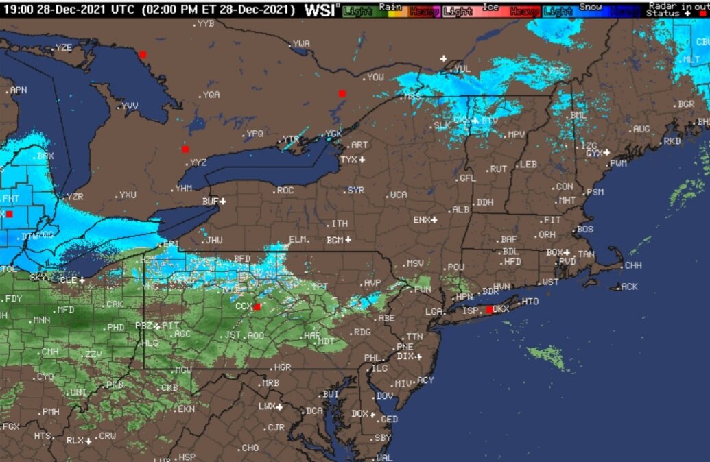
Looks like radar returns are out pacing the nam's model output...
-
Upstate/Eastern New York-Into Winter!
LakeEffectKing replied to BuffaloWeather's topic in Upstate New York/Pennsylvania
@150...euro looks improved from 00z -
Upstate/Eastern New York-Into Winter!
LakeEffectKing replied to BuffaloWeather's topic in Upstate New York/Pennsylvania
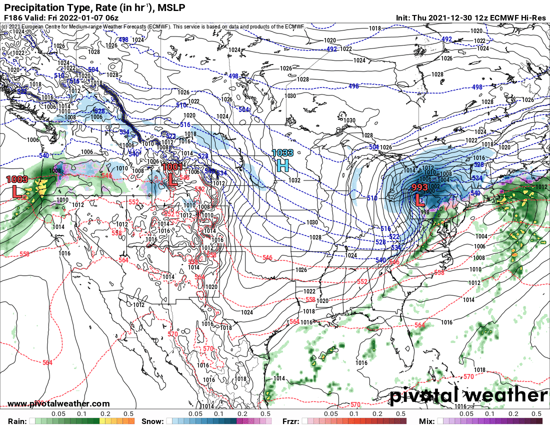
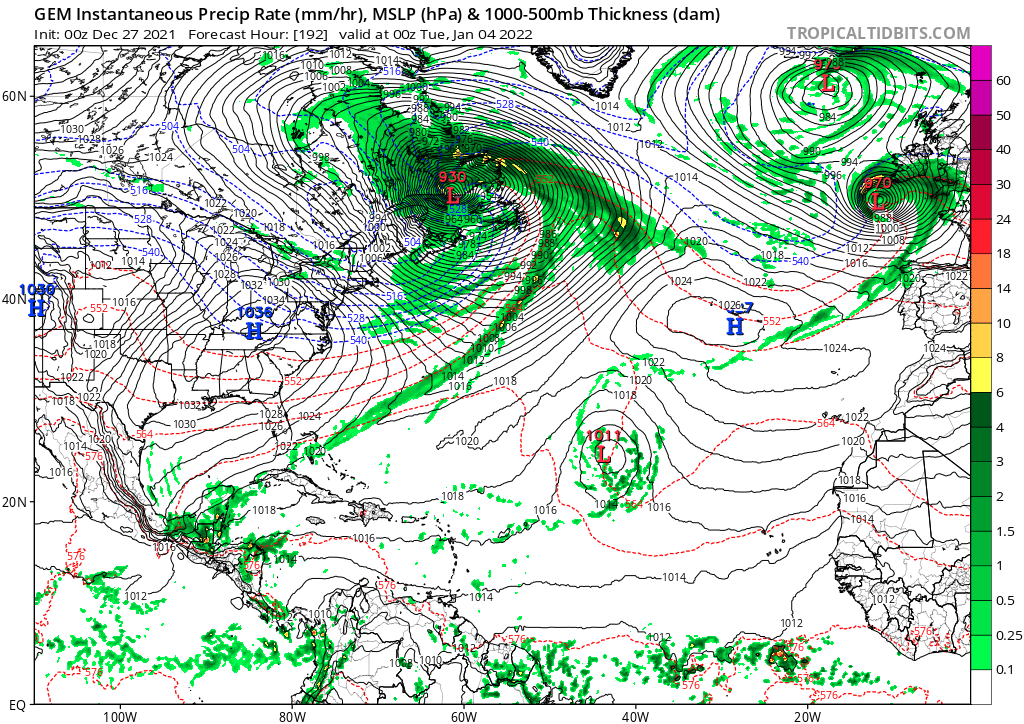
GGEM goes ape sh!t with that second wave next week. 930mb would break some sort of record in N. Atlantic (at that latitude) for non tropical system.
-
Upstate/Eastern New York-Into Winter!
LakeEffectKing replied to BuffaloWeather's topic in Upstate New York/Pennsylvania
Merry Christmas all! My 3 and 1/2 inches of snow from yesterday came and went as quick as Santa. -
Upstate/Eastern New York-Into Winter!
LakeEffectKing replied to BuffaloWeather's topic in Upstate New York/Pennsylvania
Final event total....3.25"....can it last til tomorrow @ 1200'??? We shall see! 19" on the season....:/ -
Upstate/Eastern New York-Into Winter!
LakeEffectKing replied to BuffaloWeather's topic in Upstate New York/Pennsylvania
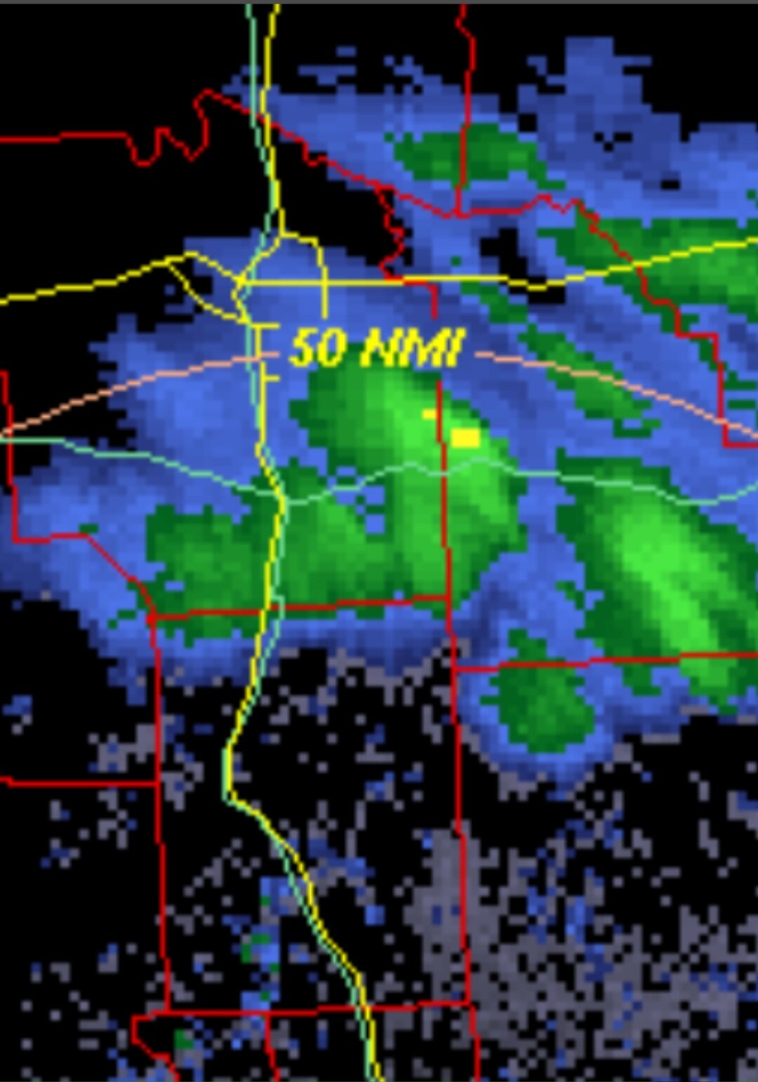
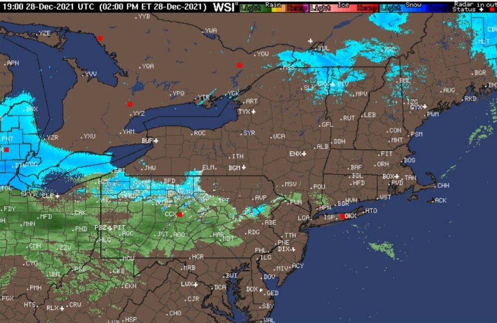
Wrapping up with a bang! 2.75" I'm located right on the yellow returns.

-
Upstate/Eastern New York-Into Winter!
LakeEffectKing replied to BuffaloWeather's topic in Upstate New York/Pennsylvania
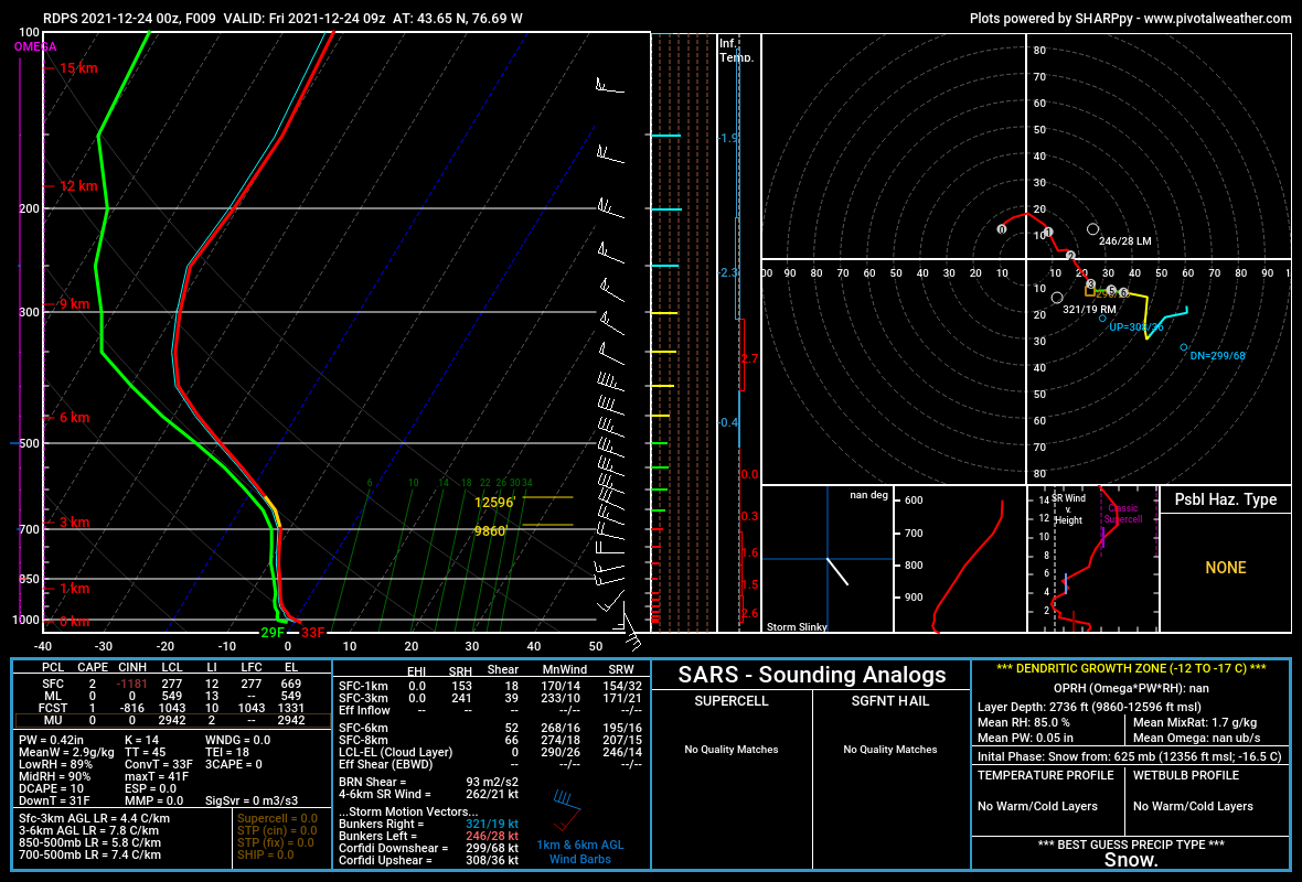
Not really...might be throwing a touch of added moisture to the lower levels...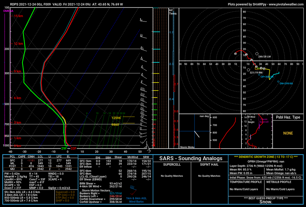
-
Upstate/Eastern New York-Into Winter!
LakeEffectKing replied to BuffaloWeather's topic in Upstate New York/Pennsylvania
Ripping in Caz.....2" and counting... -
Upstate/Eastern New York-Into Winter!
LakeEffectKing replied to BuffaloWeather's topic in Upstate New York/Pennsylvania
Connections being made.