LakeEffectKing
-
Posts
4,476 -
Joined
-
Last visited
Content Type
Profiles
Blogs
Forums
American Weather
Media Demo
Store
Gallery
Everything posted by LakeEffectKing
-
 Been pursuing the NE subforum.....it seems that they encourage the use of the term "death band"... ...so juvenile....
 -
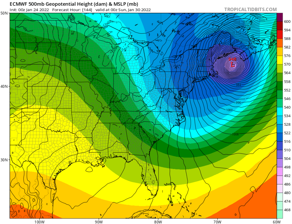
OBS/DISCO - The Historic James Blizzard of 2022
LakeEffectKing replied to TalcottWx's topic in New England
Hyannis Harbor webcam https://www.anchorin.com/hyannis-harbor-cam.asp -
Congrats to our forum brethren! Looks historic to me. One cautionary note, with the wind and liquid equivalents of 2+ inches, roofs of structures, especially weakened ones, will be taxed.. The wind will cause unequal distribution of snowfall and pack it down to become more dense. Enjoy fellow snow lovers!
-
It is epic...
-
Pattern is too progressive...this is the coast's storm....
-
GEFS amped a bit and more west solutions...
-
Upstate NY Banter and General Discussion..
LakeEffectKing replied to wolfie09's topic in Upstate New York/Pennsylvania
Steelers beat both Titans and Bills....so give us our 7th ring!! -
Upstate NY Banter and General Discussion..
LakeEffectKing replied to wolfie09's topic in Upstate New York/Pennsylvania
Not squib....kick it normal to about the 8yd. line, and make them field it. -
Rates 2"/hr....????
-
You guys need some pretty specific conditions to cash in...drove 177 many times...going into town passed the wind farm, snowfall rates just dry up....everytime.
-
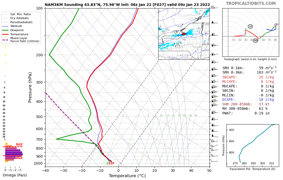
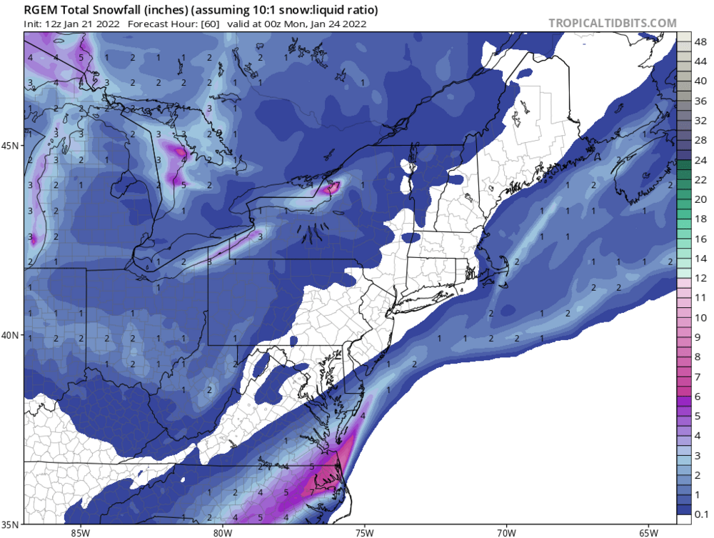
Yeah...I probably picked a run too early for the Euro to demonstrate the differences....but going back several model runs, RGEM consistently had max totals about 10-12 mi. north of apparent verification, while Euro was more or less closer to verification.
-
As Tombo noted earlier, the Euro actually nailed the Ontario band a bit better than the RGEM, at a day or so leads.
-
Man.... turn the heat up a bit inside!!!! Lol!
-
Ratios will be quite high.... And I expect a few, much weaker, bands to form Sun. eve. behind the main band that sweeps through Sunday afternoon.
-
Wow!
-
-13 in Caz....
-
This place would be hoppin' over over the next 2 weeks if this verifies.
-
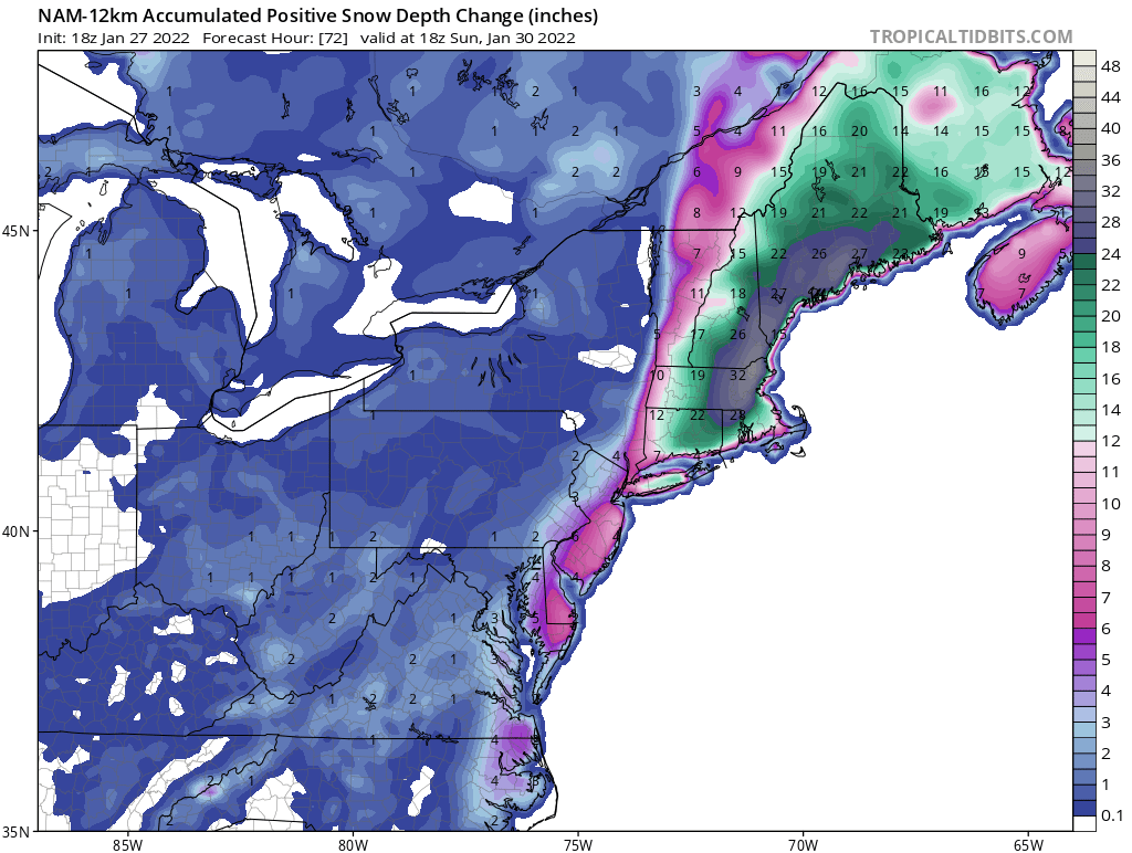
For E and SE of L. Ontario, it looks like Sunday's LES event will be a relatively short/transient event (a few hours?), south of ART. That said, rates will be stout, based on 3k and RGEM depictions ATT. Thick DGZ and Omega intersect almost perfectly. (see below) Ratios should be well north of 20:1 with rates, at times, approaching 4"/hr. when near ART. As the band settles southward through Oswego county Sunday, rates should subside some and then lower substantially as it moves south of the Oswego/Onondaga Co. border. I see Watertown area (+/- 7mi. North or south) getting 10-14+"...5-10" in Oswego Co. and 2-5" south of there.

-
Monster storm is back on GFS.... Actually throws central New York a bone.
-
This pattern could very well produce something (pop out in the models) that we can track with in the next week.
-
2.5" Sun night 3" Yesterday 3.5" overnight...still light snow... 9" Total in Cazenovia Great pics/videos from our WNY posters!!!
-
You/we will... Should be a pretty nice back 1/4 of the storm for us.