
BlueRidgeFolklore
-
Posts
725 -
Joined
-
Last visited
Content Type
Profiles
Blogs
Forums
American Weather
Media Demo
Store
Gallery
Posts posted by BlueRidgeFolklore
-
-
33 minutes ago, cold air aloft said:
It's really too bad that the airport is used as the official weather station for Asheville. The difference between downtown Asheville and Fletcher can be huge, especially in the Winter.
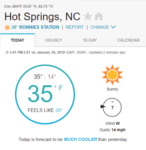
IMO it's not the difference in latitude between Fletcher and Downtown that causes the larger descrepecy but the fact that the airport weather station resides along the largest body of moving water in WNC. Same could be said for an area along the French Broad well north of Downtown. This a weather station reading in Hot Springs. The river simply has too much influence.
Just east of Fletcher atop Bearwallow Mtn, they are reporting a temperature of 20 degrees. Nearly a 20 degree difference in about 7 short miles.
-
 2
2
-
-
8 minutes ago, Moonhowl said:
Back when I worked downtown and had a view to the south; frequently during NWF snow you could see that the sun was shinning to the south in the direction of the airport. That certainly could cause significant discrepancies. However, it has been mostly sunny here today and didn't expect such a large discrepancy.
True, but then look at snow events like December where when storms come from the South, the difference between downtown and Fletcher was a few inches. All in all, I think it averages out.
-
Pingers all the way down to Hendersonville.
-
1
-
-
30 minutes ago, ncjoaquin said:

Is that additional snow tonight?
-
1
-
-
2 minutes ago, HurricaneTracker said:
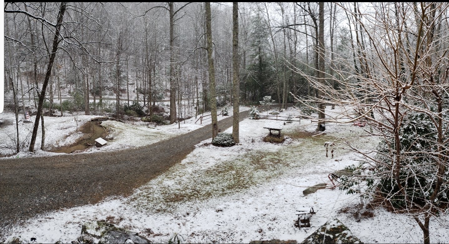
Yes finally! About 1.7" down so far
Absolutely ripping here.
Think we can stave off that warm nose?
-
3 minutes ago, HurricaneTracker said:

Trying to hang on!
-
Just now, ncjoaquin said:
Very nice! My daughter lives in Pisgah Forest, though she is staying with us tonight. It is just now starting to stick here.
This is actually Bat Cave. Staying with family this weekend.
-
1
-
-
Looking good my way!

-
1
-
-
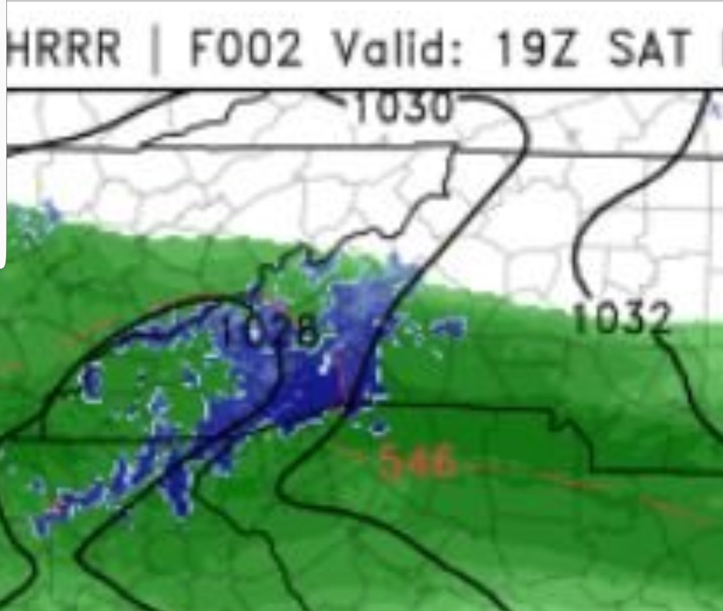
HRRR aligns with reports we're seeing right now. Snow along southern escarpment, AVL and points north struggling to cool down.

-
Drove out to the continental divide in Edneyville. 33 degrees and dumping.
Seems AVL proper and north may fall victim to the French Broad River valley letting in too much warm air from Tennessee.
-
5 minutes ago, HurricaneTracker said:
So it’s elevation dependent at the moment. Looks like 3000’+ is where you need to be to see snow. French Broad Valley just too warm at the moment. Low 40s! Supports rain as HRRR indicated. Problem is, HRRR keeps AVL all rain until 9pm. Further cuts snow totals. GSP afternoon update will be difficult to say the least. But really need to think about reducing totals...perhaps dramatically.
Hendersonville is dumping which isn't dependent on elevation. Could it be it's closer proximity to the escapement and the wedge?
-
1
-
-
2 minutes ago, HurricaneTracker said:
39/36 here in Candler (southwest Buncombe). Nothing but solid rain
The snow is coming down good in Hendersonville
-
1
-
-
1 minute ago, strongwxnc said:
And this needs to be watched...
NAM has been horrible but the RGEM is showing the warm nose too.
-
HT is a professional. Let's make sure not to discount his contributions simply because it's not what we want to here.
I do want to remain hopeful however.
-
3
-
 1
1
-
-
Just now, chapelhillwx said:
Still undecided on where to go. I think Fletcher/Hendersonville is a safe bet for at least 10" but GSP's probability maps favor places like Brevard or Morganton. My gut tells me Brevard could end up too far west and lose CAD. Thoughts?
I can assure you that Brevard and Hendersonville rarely end up far off from one another with these setups. Orographic Lifting will do work on both.
-
2
-
-
11 minutes ago, HurricaneTracker said:
All systems go.
-
 1
1
-
-
6 minutes ago, BretWheatley said:
The 3k NAM is beautiful.
Edit: Y’all let me know if I’m posting too much, lol.. The hype has kicked in
This is the mountain thread. We're all one big family here. lol
Post away!
-
4
-
-
2 minutes ago, The Alchemist said:
Am I correct in thinking that with the upslope effect and the storm possibly tracking a little to the south that Saluda/Flat Rock/ Hendersonville might be the sweet spot?
.Oh yea, that area will do really good.
-
1
-
-
6 minutes ago, Met1985 said:
My same sentiments. I think most of WNC is looking great. This is looking like a great storm for sure. The good snowman making kind.
Exactly. It's getting tough to track in the main threads. It's either too far north for some folks, too far south for others, too warm for many, then I realize it's just right for WNC. Lol.
I think I'll just hang out here and see what HT has to say.
-
2
-
-
8 minutes ago, NC_WX10 said:
Really getting worried about this southern trend. A few more jogs south and the northern mountains totals really go down. The press of the cold, dry air is really pushing the heavier precip south.
GFS looks good for the northern mtns. I think in general, all of WNC will do great.
-
1
-
-
-
2 minutes ago, HurricaneTracker said:
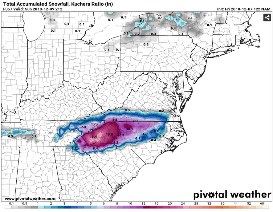
NAM is HUGE!!!! ALL SNOW SOUNDINGS for just about the entire event. Closing in on 20-25" across Henderson, Transylvania, Buncombe, and McDowell counties.
I'm not sure I have enough milk sandwich supplies for this. Insane numbers!
-
1
-
-
1 minute ago, localyokelweather said:
Hope you didn't read those totals as estimated amounts but more so the example of extending the range for the snow map. You're in a prime spot as well!
My comment was a general response to the discussion not a counter to any specifics.

-
2 minutes ago, localyokelweather said:
Yea, the Southern Highlands Plateau is a safe bet for us. Franklin is a tough call with Bryson a close second. Our final map comes out later this morning but I think we'll push a larger than usual snow total range (instead of the usual 1 - 2", go with 1 - 4" for example) to show the uncertainty as it relates to distance between totals, location and elevation. A fun storm to track no doubt and I'm curious to see what Lake Toxaway reports when its all said and done. Have a safe and fun time bud!
From Highlands to Hendersonville are going to get lambasted.
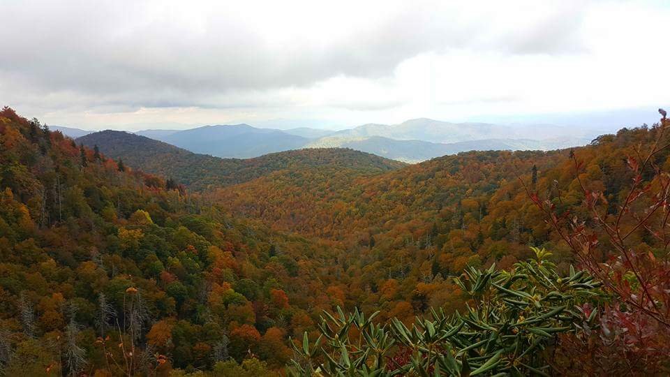
2018/2019 Mountains and Foothills Fall/Winter Thread
in Southeastern States
Posted
Yea during those CAD setups with cold air coming from the east and warm air to the northwest, it seeps down that French Broad River valley to the from Tennessee and can cut down total in and around Asheville. That's what I was alluding to. All depends on the setup. You definitely do better with NWF that points south.