
BlueRidgeFolklore
-
Posts
725 -
Joined
-
Last visited
Content Type
Profiles
Blogs
Forums
American Weather
Media Demo
Store
Gallery
Posts posted by BlueRidgeFolklore
-
-
The Euro ensembles are simply beautiful for the immediate Asheville/Hendersonville area.
-
Forget the NWS, we're officially under a winter weather watch in WNC.


-
 4
4
-
-
4 minutes ago, BretWheatley said:
FV3 with the low in central Alabama... Hope we don't lose it now!
![[âIMG]](https://www.tropicaltidbits.com/analysis/models/fv3p/2018120512/fv3p_ref_frzn_eus_16.png)
-
6 minutes ago, HurricaneTracker said:
Absolutely. Though it is the lowest on QPF...but has been dry on every event this season....sometimes by a factor of 2 or 3. So look at thermal profiles and just how STOUT that wedge has become on the GFS. This is a big deal folks. Be prepared.
What's you thoughts on the CMC despite it being on it's own?
-
2 minutes ago, Queencitywx said:
I think I'd be much more worried if it was the UKMET.
That's exactly my thought. I wouldn't put too much stock into the CMC at this point.
It's on an island.

-
3 minutes ago, mackerel_sky said:
It’s rasy to say when your sitting in a spot that a bad run only gets you a foot! Everyone on the edges, don’t have much wiggle room for N shifts or noise!
You should have learned from experience not to get your hopes up in first place, when you're sitting in those areas. Lol.
-
 1
1
-
 1
1
-
-
1 minute ago, UpstateSCBud said:
A "storm" that will live in infamy around these parts and one I will remember forever. Biggest forcast fail I can remember for this area. Even Chris Justus and John C were on air on WYFF for that day guaranteeing 8-12" of snow. Then we end up with sleet and freezing rain.
They both nailed the forecast in WNC when IIRC, Jason Boyer was very conservative. However, I think that storm is where Chris became really gun shy of the I-85 corridor and still is today.
-
1
-
-
2 minutes ago, Iceagewhereartthou said:
That's the most realistic map I've seen yet. I-40 north with best chance, Wake gets some fun, upstate gets blanked. Does Vegas take weather bets?

That's a 24hr snow map, initializing Tuesday at 2p (so from Monday 2p to Tuesday 2p). By that time, the storm is leaving WNC/Upstate and heading Northeast. That's why it looks the way it does.
-
 1
1
-
-
2 minutes ago, Upstatescweather said:
Love when news 4 Chris justice says mainly north of 85 but models show it south on his screen then says models show it south but not likely not even 5 miles south of it. Classic, just keep ticking a little south to give me a realistic shot at some white stuff
He's basing it off of climo telling him the 85 corridor is nearly always the freezing despite what the models say.
-
3 minutes ago, BIG FROSTY said:
Cray cray run!! no HP @120 We Toss! lol
Did it just disappear? Lol.
-
Just now, AsheCounty48 said:
 Just popped up on my facebook that someone shared. People are going nuts. Rightfully so I guess, but basing everything off of an automated forecast is a recipe for disaster.
If only there were a sponsored Ingles banner at the top of these weather app forecasts.
-
1
-
1
-
-
6 minutes ago, Met1985 said:
I will definitely be back fellas! Looking forward to getting into the game. I would hedge on the side of caution just because we are several days out. This does look "historical" but we have all see small changes and adjustments to the tracks of lows that make a big difference in snow totals.
I just got to thinking that a winter storm thread just doesn't seem right without Met.
Welcome back!
-
1
-
-
1 minute ago, griteater said:
12z EPS Clown....similar largescale footprint as previous run, but higher totals (more consistency I would assume)

Hot spot still continues to be along the escarpment, esepcially where the east/west escarpment meet north/south there in the Saluda, Hendersonville, Bat Cave, Gerton area. I can see that area getting rocked!
-
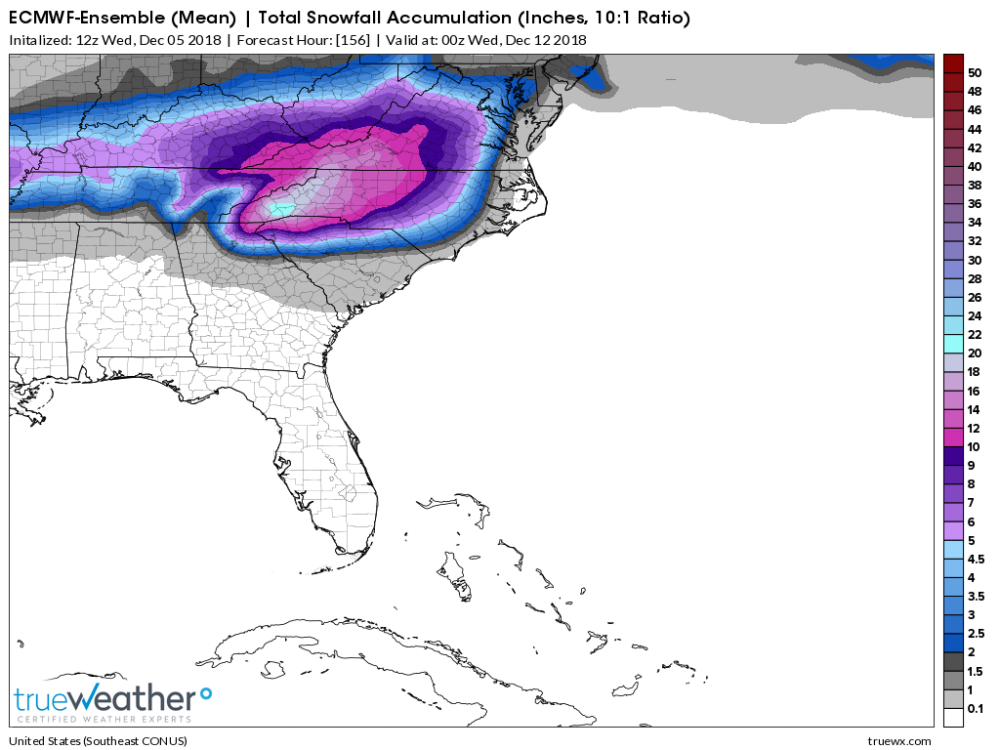
Even the EPS has over a foot for KAVL.
-
10 minutes ago, cold air aloft said:
I'm really curious about this afternoon's discussion from GSP. Obviously they don't want to create a panic when the potential event is still several days away and of course the models will change. But holy smokes, if anything close to what the models are saying verifies, folks need to be prepared.
They're going to have to cave at some point. It won't be today or even tomorrow, but nearly every model consensus is pointing at a big storm in WNC.
-
-
4 minutes ago, franklin NCwx said:
Pants tent after the euro run!
My weather weenie definitely has a euro chubby after that run.
-
1
-
-
-
2 minutes ago, AsheCounty48 said:
NAVGEM barely gets moisture into Boone
") lol
lol
Yea, um, about that tendency to for over-suppression.
All in all, we're sitting pretty no matter which model you look at.
-
1 minute ago, AsheCounty48 said:
CMC, although a different solution, still throwing out a foot and a half. I'll take it to.
At this point, is there any model not giving us a good thump?
-
1
-
-
1 minute ago, Moonhowl said:
I'll be splitting firewood this afternoon; now how many times is said that firewood warms you...
Twice.
3x if you have to stack it.
Now get to splittin'......
-
1
-
-
2 minutes ago, snowbird1230 said:
Hard to believe that ever since this storm showed up on the models that Cherokee and Graham Counties has been shown to get nothing.
That's pretty typical with CAD storms. The higher mountains simply block the cold air from reaching that far SW corner of NC.
-
1
-
-
Guys, piggy backing on HT, and I wouldn't dare post this in the storm thread, but us mountain folk need to start making preparations NOW! Especially if you live along the escarpment from Highlands to Hendersonville and on up through Old Fort to Blowing Rock, etc. This could be a monster.
-
4
-
-
5 minutes ago, HurricaneTracker said:
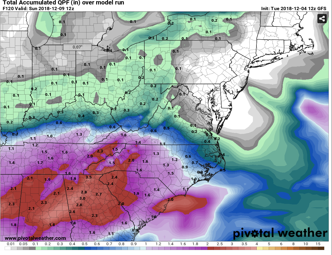
Um...this latest GFS run was incredible. And VERY VERY wet!! CAD wedge was intense. Throw out the snow maps because they are useless at this range...but focus on the QPF. MANY AREAS ARE WELL OVER 2.00" of liquid and there is a good portion of the mountains nearing 3.00" of liquid. You do the math...
If this continues to be the forecast...y'all better start preparing. Get your winter kits set up and stocked. And your chainsaws ready.
That is incredible. Absolutely incredible.

.png.1623f0dfc82840e789e1ffca4b1f55d8.png)
.png.2e89caff82b88beaf766c8a3183eb013.png)
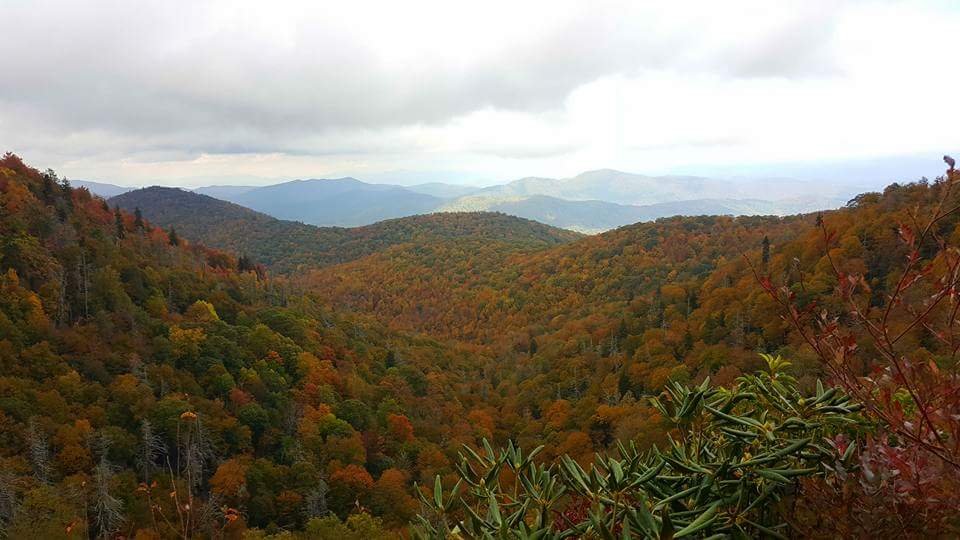
2018/2019 Mountains and Foothills Fall/Winter Thread
in Southeastern States
Posted
This is a good setup for the central and northern mountains. Things can still go wrong but I wouldn't be so reserved.