Spartman
-
Posts
1,219 -
Joined
-
Last visited
Content Type
Profiles
Blogs
Forums
American Weather
Media Demo
Store
Gallery
Everything posted by Spartman
-
First completely dry weekend of 2023.
-
The first sunshine of the year.
-
Winter 2022/23 Medium/Long Range Discussion
Spartman replied to Chicago Storm's topic in Lakes/Ohio Valley
-
-0.4 for the month
-
Definitely wasted a dry New Year's Day with wall-to-wall overcast skies.
-
Today is not only the end of 2022, but it begins with what looks to be a long overcast stretch that looks to be around by at least near the end of the first work of the new year.
-
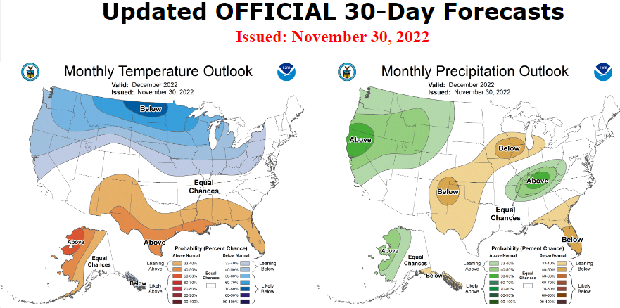
CPC stuck a fork in January.
-
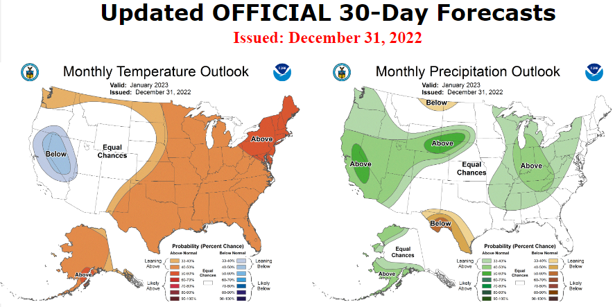
Absolute trainwreck ahead, abandon all hope. Very warm open to the month similar to January '98.
-
The constant cloud cover much of this month pretty much killed this December. Shades of December '14. This will be one of those weeks we'll be lucky to have one day of sun (besides Christmas), particularly Wednesday. Suicide weather expected tomorrow. We are to get a long crappy New Year's weekend afterwards.
-
Only got a tenth of an inch of snow. Some "screamer."
-
Pre-Christmas (Dec 21-23rd) Winter Storm
Spartman replied to Chicago Storm's topic in Lakes/Ohio Valley
Don't look at today's 12z UK run. -
Pre-Christmas (Dec 21-23rd) Winter Storm
Spartman replied to Chicago Storm's topic in Lakes/Ohio Valley
Those past two GFS runs must be screaming for a 2004 redux. -
Winter 2022/23 Medium/Long Range Discussion
Spartman replied to Chicago Storm's topic in Lakes/Ohio Valley
Damn, a torch before Christmas Eve. -
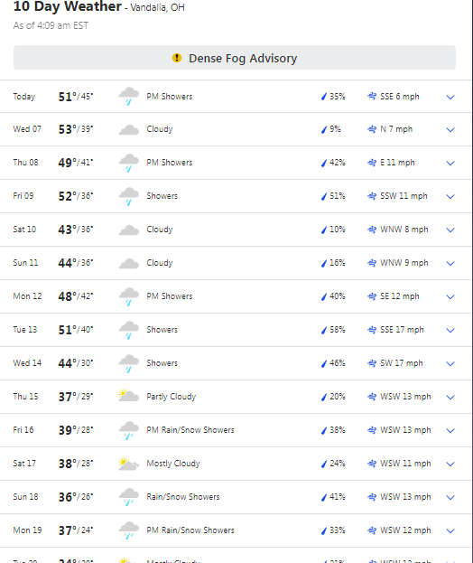
Well, if it weren't for the few hours of sunshine on Friday morning, this crappy weekend would have counted as the 5th and 6th consecutive days of no sun. More of the same tomorrow and much of this week before the pattern change is finally ready.
-
Winter 2022/23 Medium/Long Range Discussion
Spartman replied to Chicago Storm's topic in Lakes/Ohio Valley
No wonder people don't call the GFS the GooFuS for nothing. Don't look at today's 18z GFS unless you are really expecting the "pattern change" to really occur on Christmas Eve. -
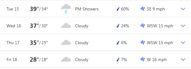
After one of those weeks of not much sun, time for suicide weather weekend.
-
Enough to help go for the top 10 worst Decembers. We'll be pushing for the longest overcast stretch of the season that starts soon.
-
What about 2014-2015? Mild and literally almost no measurable snowfall during December 2014. Wonder if we're here for a December 2014 redux. This month is shot.
-
Going to be one of those weeks, especially with day after day of the mercury barely budging.
-
At least we didn't have to wait until February for the first 1+" snow like last Winter.
-
Underperformed with the remnants of Nicole. Only got 0.39" of rain from it. Going to be a long cold crappy Veteran's Day weekend.
-
One degree shy of tying the record and only got a trace, so far today.
-
-
We narrowly escaped the top 10 driest Octobers.