Kaner88
-
Posts
312 -
Joined
-
Last visited
Content Type
Profiles
Blogs
Forums
American Weather
Media Demo
Store
Gallery
Everything posted by Kaner88
-

Nov 28-30th Post Turkey Day Winter Storm
Kaner88 replied to Chicago Storm's topic in Lakes/Ohio Valley
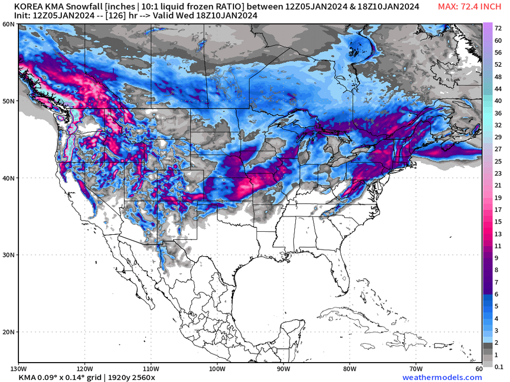
Averaging 5.75" here just north of ORD... if the HRRR is to be trusted there's another ~7" or so left to come from now onwards -
Nov 28-30th Post Turkey Day Winter Storm
Kaner88 replied to Chicago Storm's topic in Lakes/Ohio Valley
Imagine it's a byproduct of LOT's probability percentages, has a ~50% chance of >18" in a large part of the CWA -
Nov 28-30th Post Turkey Day Winter Storm
Kaner88 replied to Chicago Storm's topic in Lakes/Ohio Valley
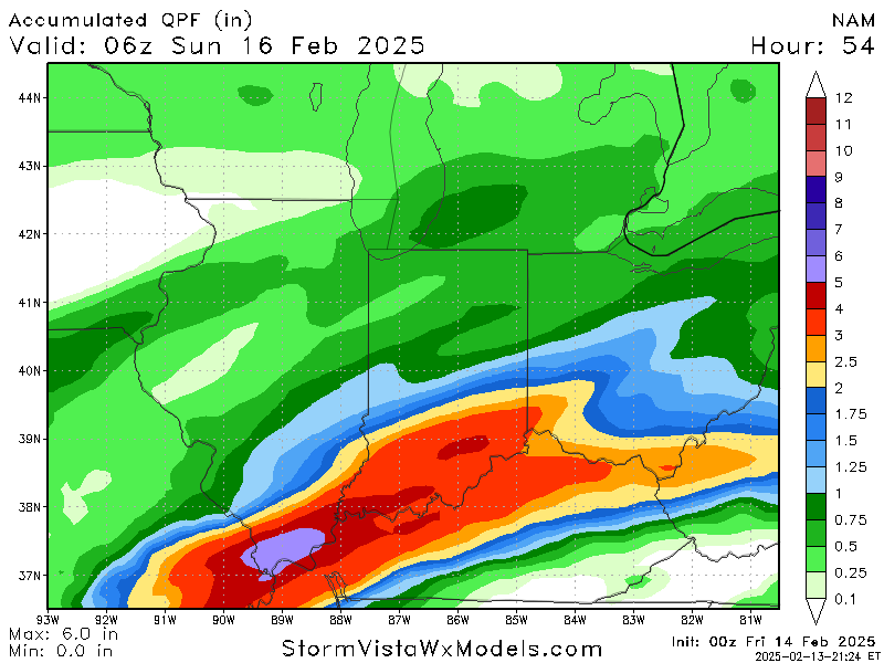
00z AIFS Op will be wetter in northern IL, upping total QPF above 0.75" compared to sub-0.75" the prior runs -
Nov 28-30th Post Turkey Day Winter Storm
Kaner88 replied to Chicago Storm's topic in Lakes/Ohio Valley
48hr QPF for those more concerned about ratios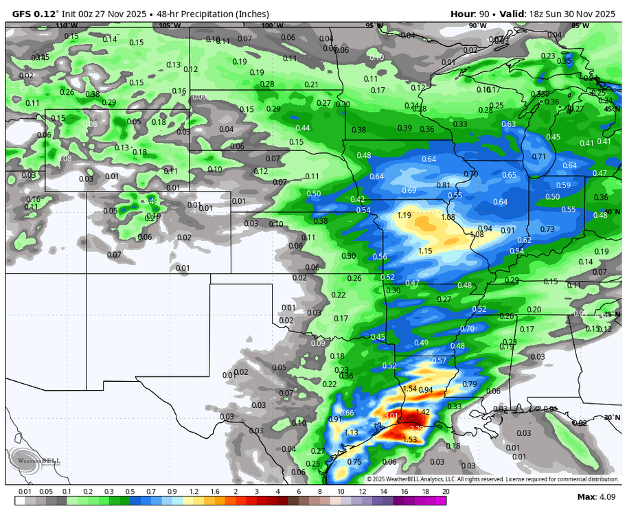
-
Nov 28-30th Post Turkey Day Winter Storm
Kaner88 replied to Chicago Storm's topic in Lakes/Ohio Valley
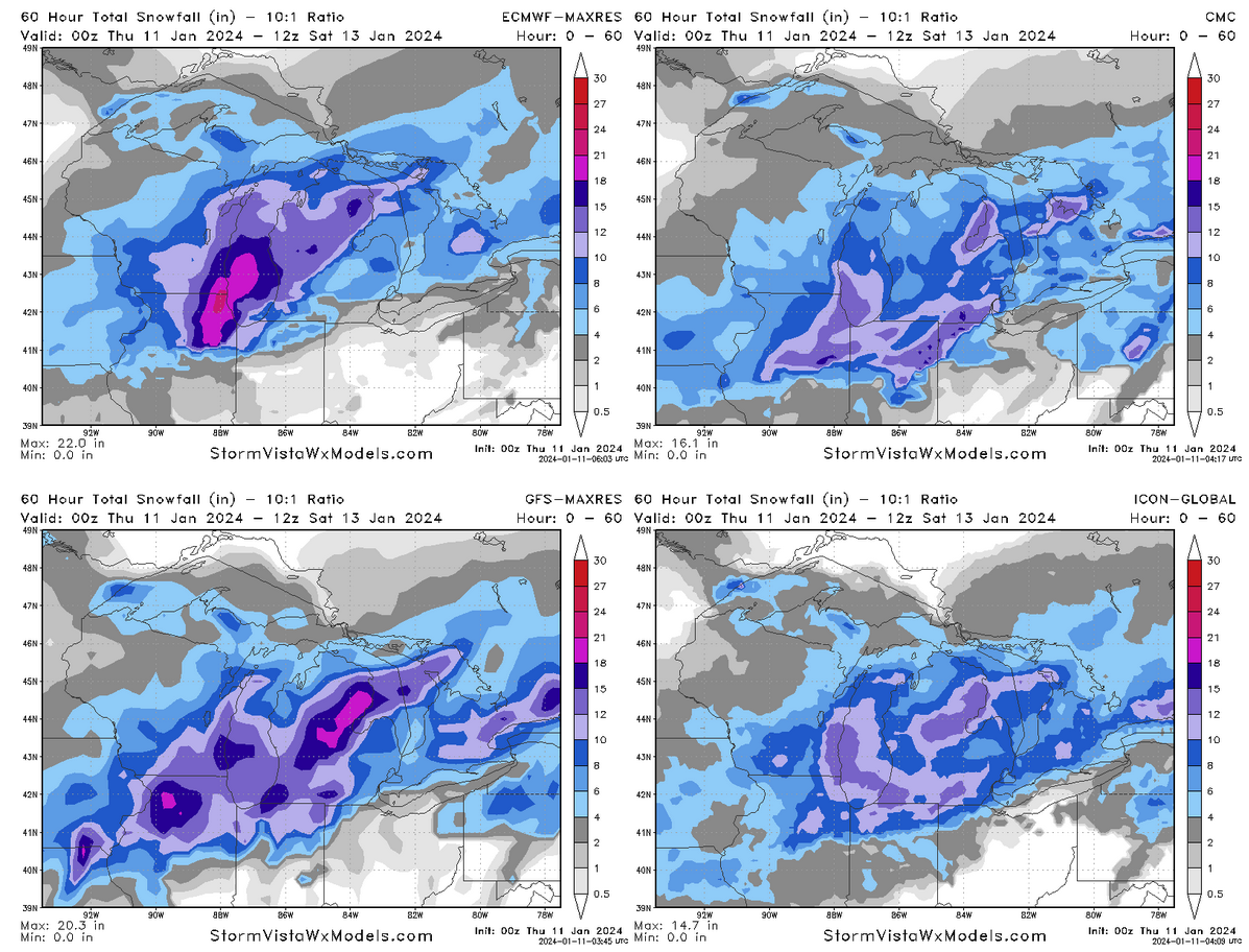
coming back to this forum for another year, high on Kuchera maps & "weenie bands"
-
They'll be getting the boats out in Paducah
-
silly level of disagreement on snow across the GL region with less than 72 hours before things are rockin'

-
Euro going gangbusters on Chicago
-
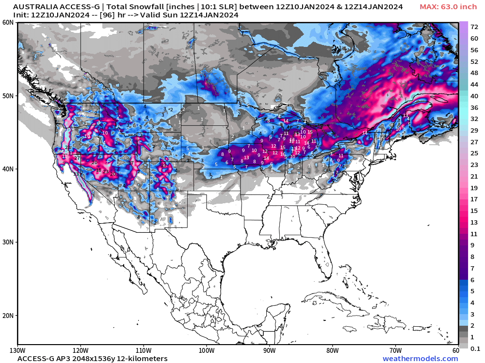
how can you ignore an ironclad Korean/Aussie/Chinese consensus
-
don't worry, i've got all the esoteric models you could want the australians are all in
-
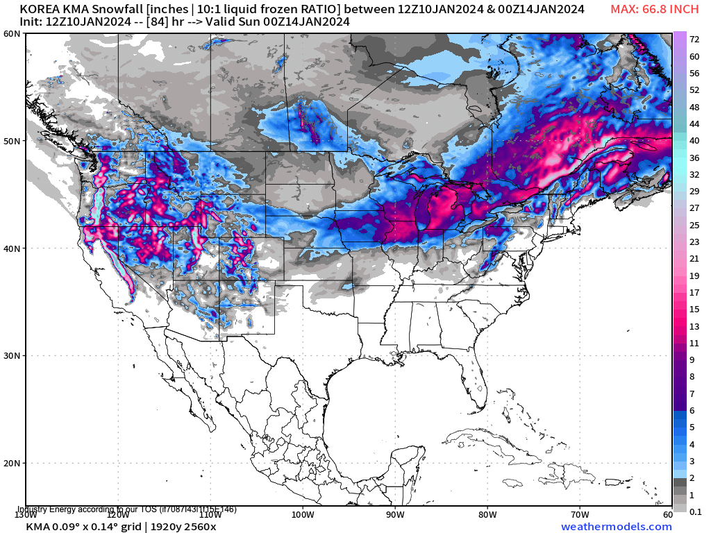
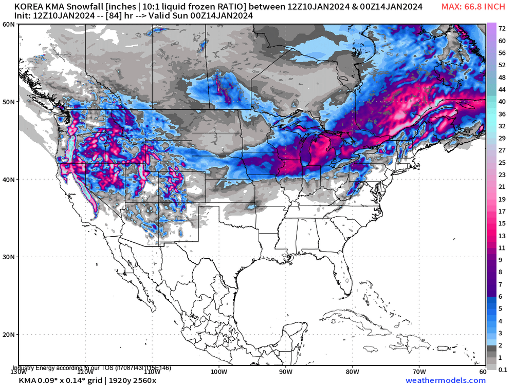
The Korean is not impressed
-
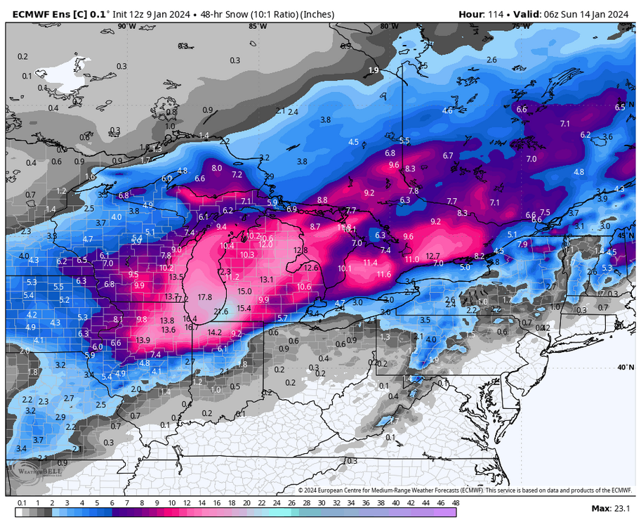
Not to be outdone, Euro ENS control attempts to fully bury the region
-
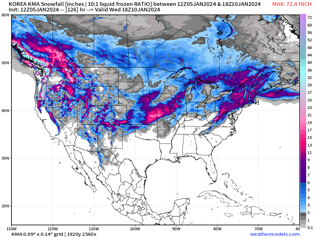
Korean model no longer on friendly terms with Alek's call

-
I dunno, one of the best parts of winter storm tracking is the eye-watering snow totals put out by a few choice models. DGEX was always reliable for a good 36"+ somewhere in its forecast timeframe. RIP
-
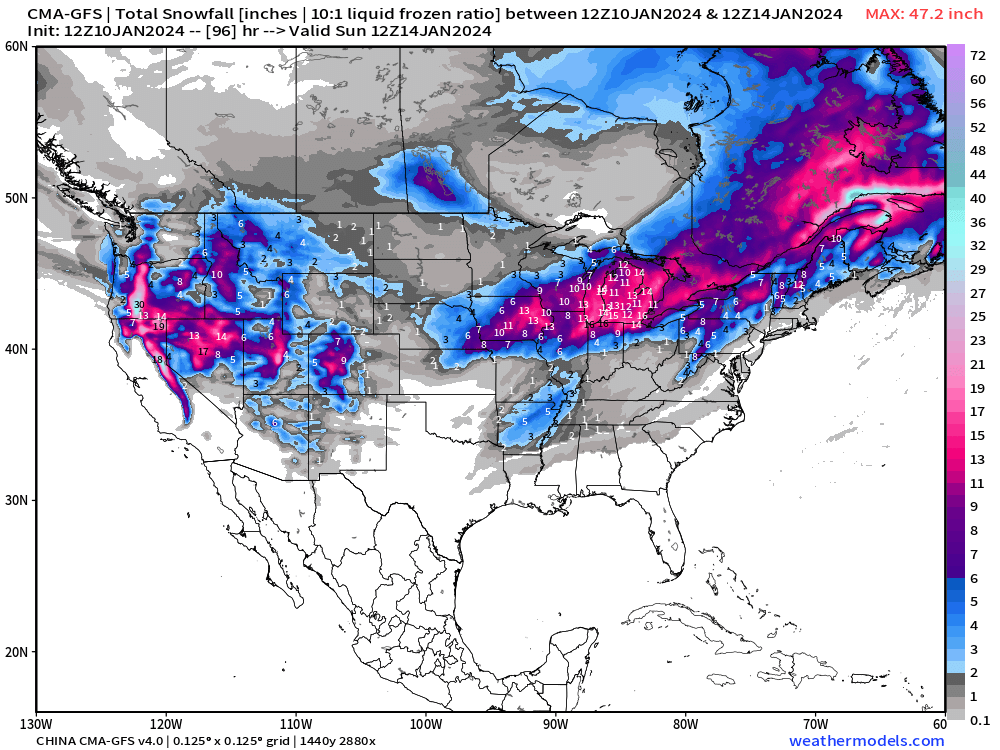
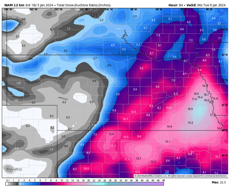
NAM going nuclear on the Huskers, guess they have to win something once in a while
-
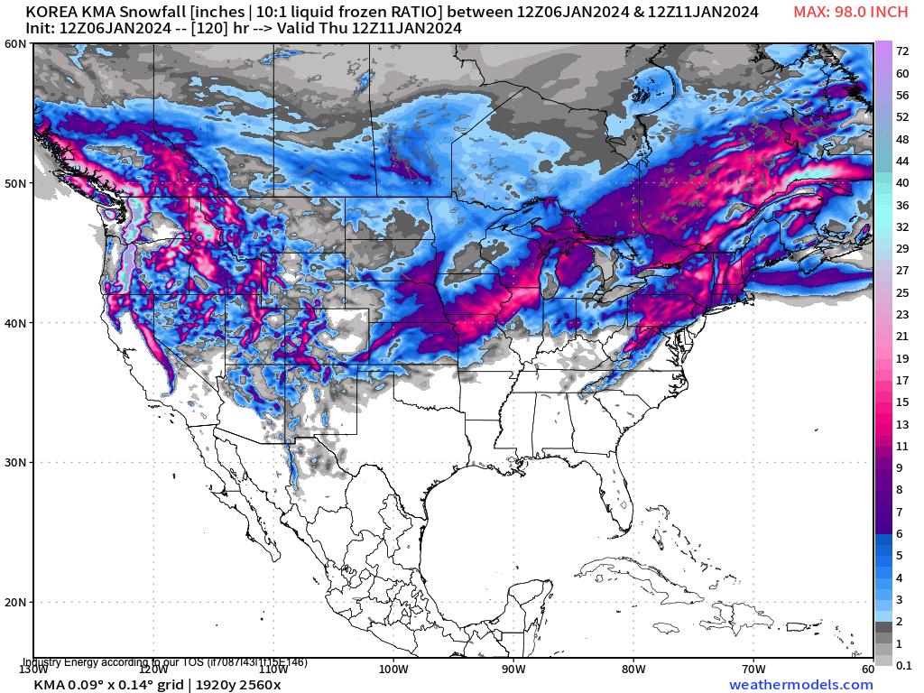
King KMA takes it into Milwaukee
-
Really enjoyed LOT's morning AFD, gets into some of the juicy modeling stuff:
-
Best part of the storm came after the front, winds strong enough to shoot up a transformer flash in the distance but that's about it
-
Yeah whole part of the line is under a blanket tornado warning; kinematics must be kicking up, looks scary for the chicago metro if it holds together
-
Line in northern Illinois starting to bow out.
-
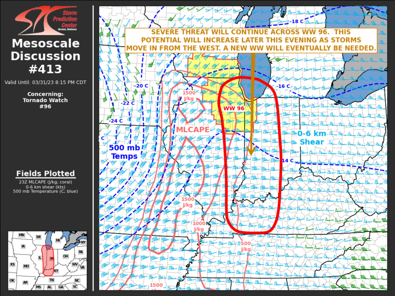
Mesoscale Discussion 0413 NWS Storm Prediction Center Norman OK 0620 PM CDT Fri Mar 31 2023 Areas affected...Eastern Illinois...Far Southeast Wisconsin...Western and Central Indiana...Far Southwestern Lower Michigan Concerning...Tornado Watch 96... Valid 312320Z - 010115Z The severe weather threat for Tornado Watch 96 continues. SUMMARY...A severe threat is expected to be maintained across WW 96 over the next few hours, and will increase later this evening as storms move into the watch from the west. New WW issuance will eventually be needed to the east and south of WW 96, from eastern Illinois into west-central Indiana southward into western and central Kentucky. DISCUSSION...The latest WSR-88D radar from Chicago shows scattered strong to severe storms located from the central part of WW 96 eastward into far northern Indiana. This east-to-west corridor is located along a warm front extending east-southeastward from a 996 mb low. Rotating storms that interact with the warm front could become tornadic. Otherwise, a wind-damage and large hail threat will continue with the stronger cells along and near the front. As the exit region of a 90 to 110 knot mid-level jet approaches from the southwest early this evening, large-scale ascent and deep-layer shear will increase across the lower Ohio Valley. This will make conditions increasingly favorable for severe storms. In response, intense storm development will become widespread, especially as severe line segments move into the area from the west. Tornadoes, wind damage and large hail will be likely with the more intense cells. The severe threat will increase to the east and south of WW 96 later this evening, necessitating WW issuance across parts of southeast Illinois into western/central Indiana and Kentucky. ..Broyles.. 03/31/2023
-
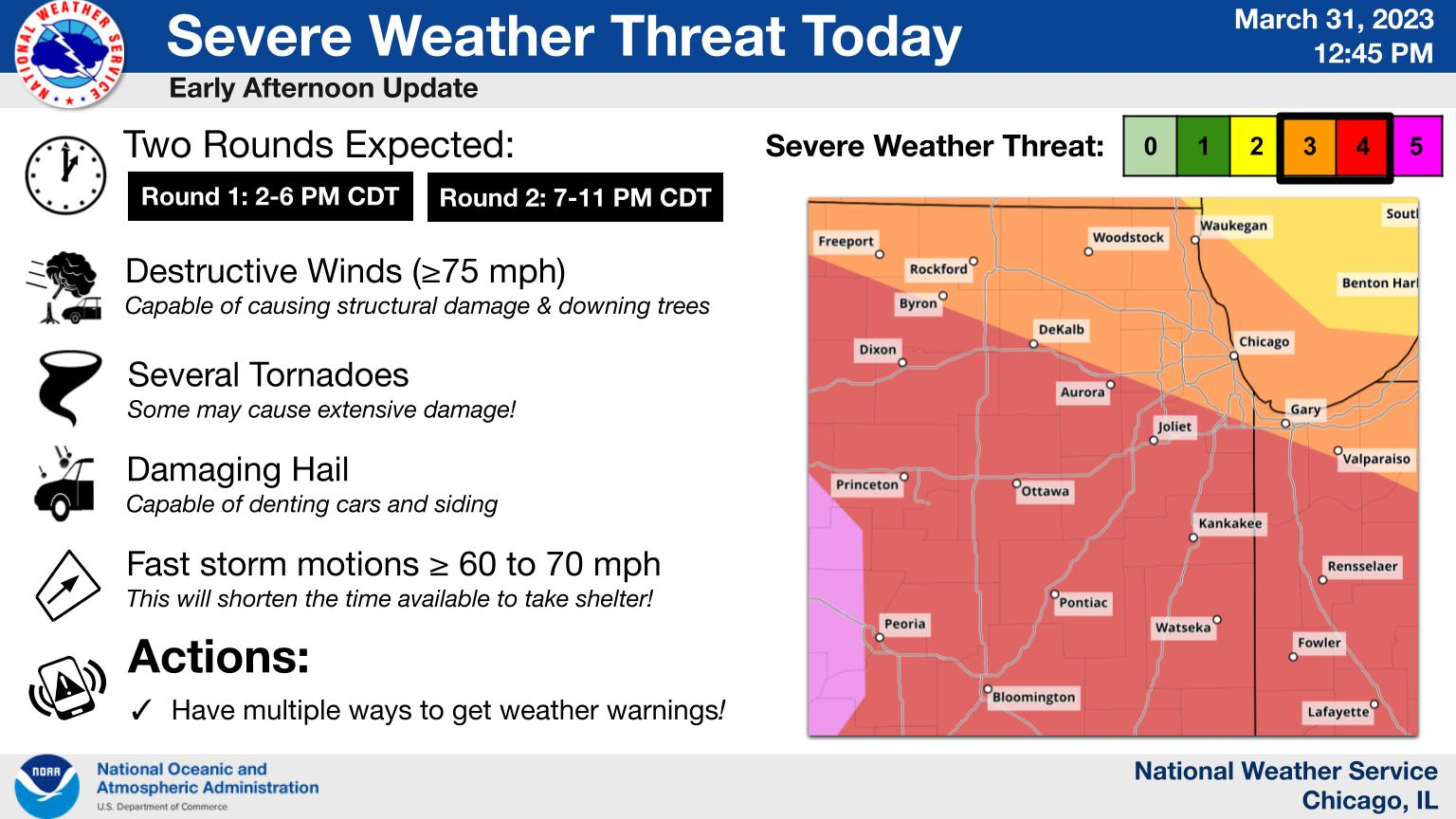
Latest NWS LOT summary graphic, for those intrigued:

-
We continue to see SBCAPE outperformance relative to HRRR 1hr forecasts, this time in northern Illinois (over 1500 j/kg near Rockford currently per SPC mesoanalysis, 17z HRRR forecast for 18z had ~1100 to 1200 at most). Undoubtedly thanks to the aforementioned less aggressive cloud cover.
-
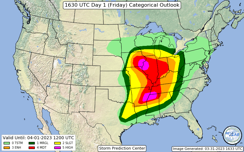
MDT moved eastwards
-
For what it may be worth, appears the latest HRRR is underdoing instability in northern Missouri considerably: latest SPC mesoanalysis shows a pocket of 3000+ j/kg SBCAPE across the area, whereas the HRRR (15z run, showing 16z forecast CAPE) only has it at about 2500 j/kg. Feels like a bit of an abyss.