Kaner88
-
Posts
312 -
Joined
-
Last visited


.thumb.jpg.ad3a2e31d30aff035044689b311a0540.jpg)


-

Nov 28-30th Post Turkey Day Winter Storm
Kaner88 replied to Chicago Storm's topic in Lakes/Ohio Valley
Averaging 5.75" here just north of ORD... if the HRRR is to be trusted there's another ~7" or so left to come from now onwards -
Nov 28-30th Post Turkey Day Winter Storm
Kaner88 replied to Chicago Storm's topic in Lakes/Ohio Valley
Imagine it's a byproduct of LOT's probability percentages, has a ~50% chance of >18" in a large part of the CWA -
Nov 28-30th Post Turkey Day Winter Storm
Kaner88 replied to Chicago Storm's topic in Lakes/Ohio Valley
00z AIFS Op will be wetter in northern IL, upping total QPF above 0.75" compared to sub-0.75" the prior runs -
Nov 28-30th Post Turkey Day Winter Storm
Kaner88 replied to Chicago Storm's topic in Lakes/Ohio Valley
48hr QPF for those more concerned about ratios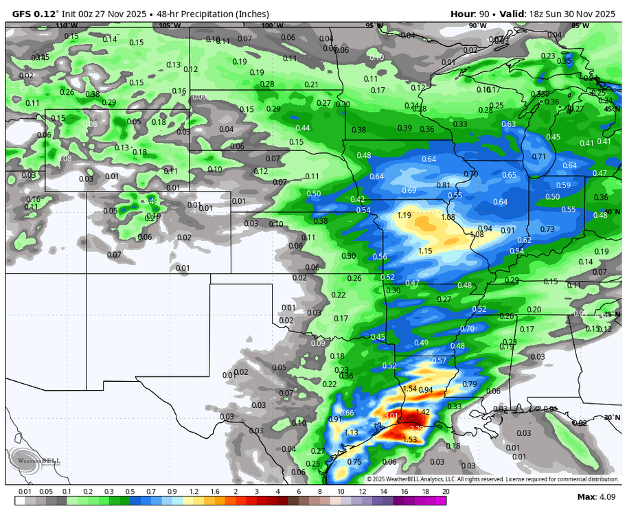
-
Nov 28-30th Post Turkey Day Winter Storm
Kaner88 replied to Chicago Storm's topic in Lakes/Ohio Valley
coming back to this forum for another year, high on Kuchera maps & "weenie bands"
-
They'll be getting the boats out in Paducah
-
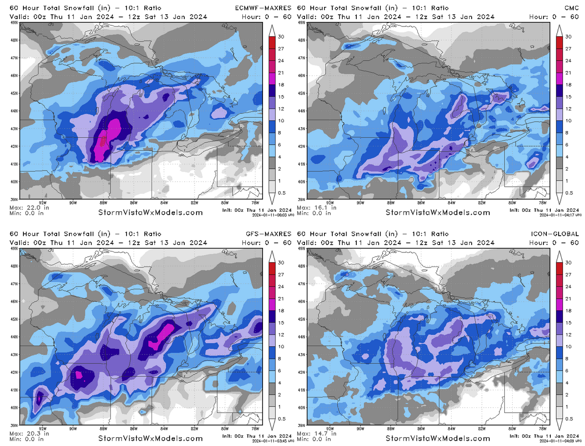
silly level of disagreement on snow across the GL region with less than 72 hours before things are rockin'

-
Euro going gangbusters on Chicago
-
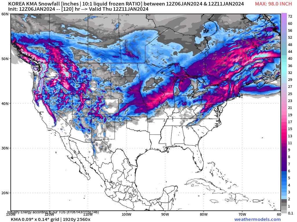
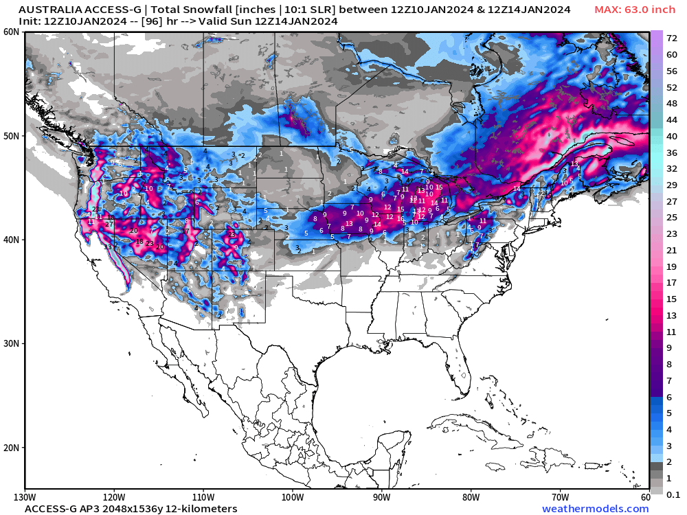
how can you ignore an ironclad Korean/Aussie/Chinese consensus
-
don't worry, i've got all the esoteric models you could want the australians are all in
-
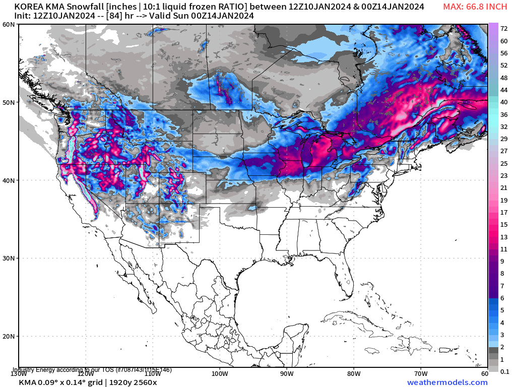
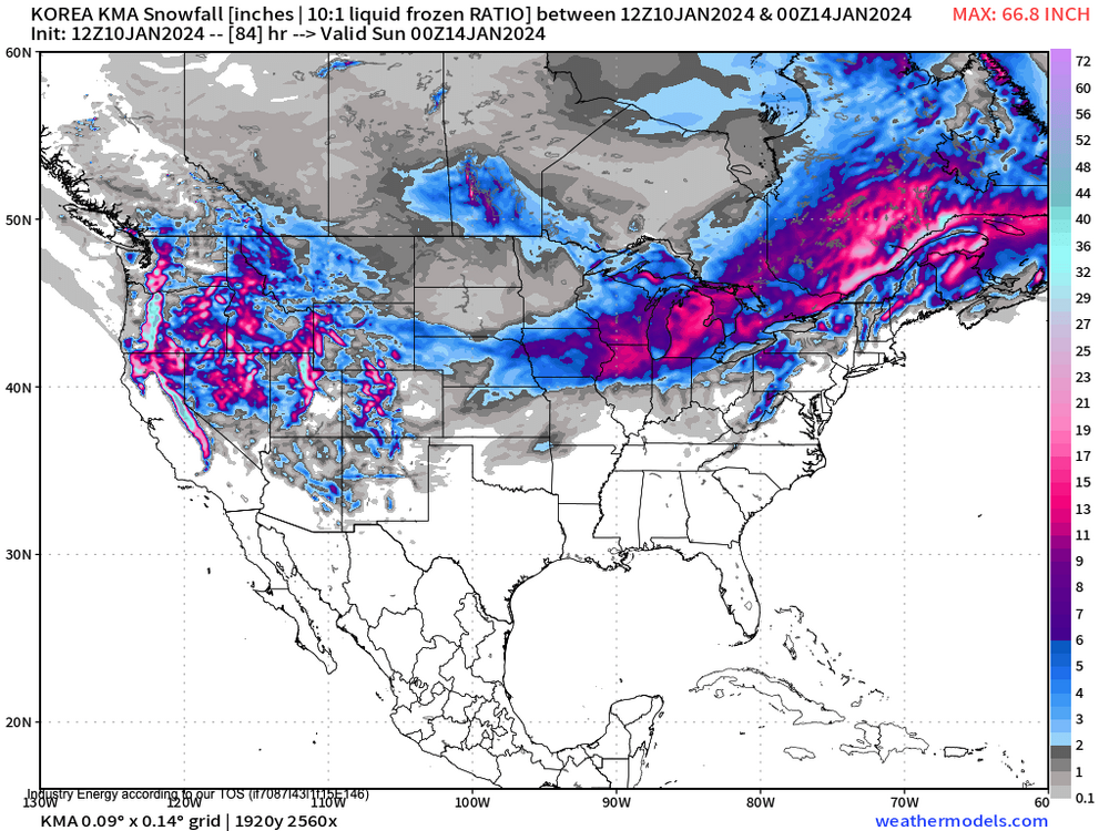
The Korean is not impressed
-
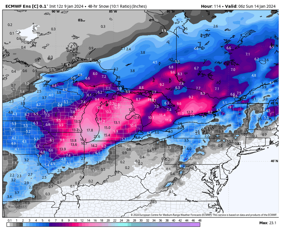
Not to be outdone, Euro ENS control attempts to fully bury the region
-
Korean model no longer on friendly terms with Alek's call

-
I dunno, one of the best parts of winter storm tracking is the eye-watering snow totals put out by a few choice models. DGEX was always reliable for a good 36"+ somewhere in its forecast timeframe. RIP
-
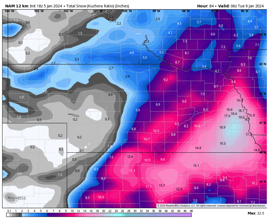
NAM going nuclear on the Huskers, guess they have to win something once in a while