Kaner88
-
Posts
312 -
Joined
-
Last visited
Content Type
Profiles
Blogs
Forums
American Weather
Media Demo
Store
Gallery
Everything posted by Kaner88
-

Pre-Christmas (Dec 21-23rd) Winter Storm
Kaner88 replied to Chicago Storm's topic in Lakes/Ohio Valley
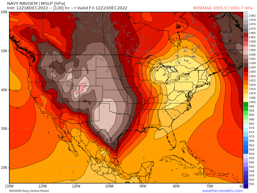
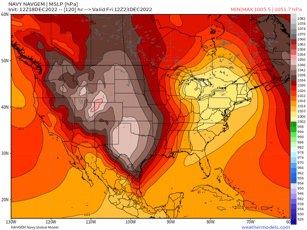
It wouldn't be a real snowstorm threat without running the gamut of highest-quality models... I can't buy into this until the NAVGEM comes into alignment with the Korean and JMA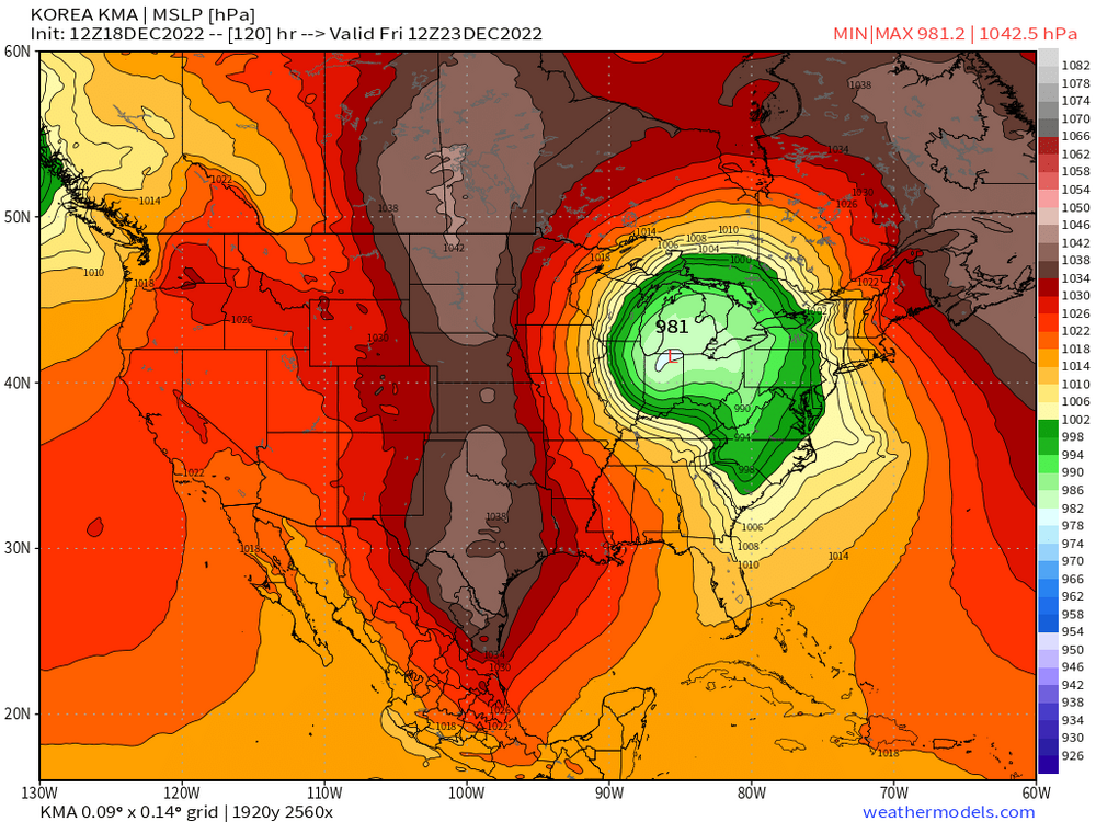
-
Pre-Christmas (Dec 21-23rd) Winter Storm
Kaner88 replied to Chicago Storm's topic in Lakes/Ohio Valley
Back in Chicago for the holidays, looking forward to the landcane -
Liking the timing for the miss south?
-
Already flew home once for a storm & look how that turned out Can't go thru this again, rooting hard for a shift away from Chicago so I don't have to stare at these wild numbers lol
-
Not sure I would even want to imagine half an inch of ice followed by 15" of snow in Chicago; city shutdown for dayz
-
LOT updates WWA & WSW text at 8:00pm. Extended WWA north into Lake County.
-
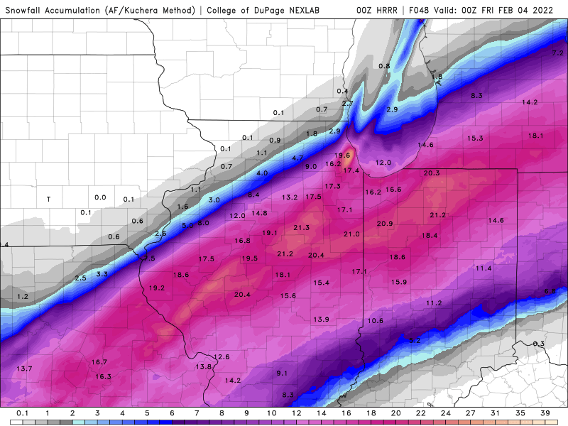
Total 00z HRRR snows.
-
00z HRRR also delivering some killer lake-effect snow to Cook County, spots of nearly 20" with the run not over yet. A true weenie's paradise.
-
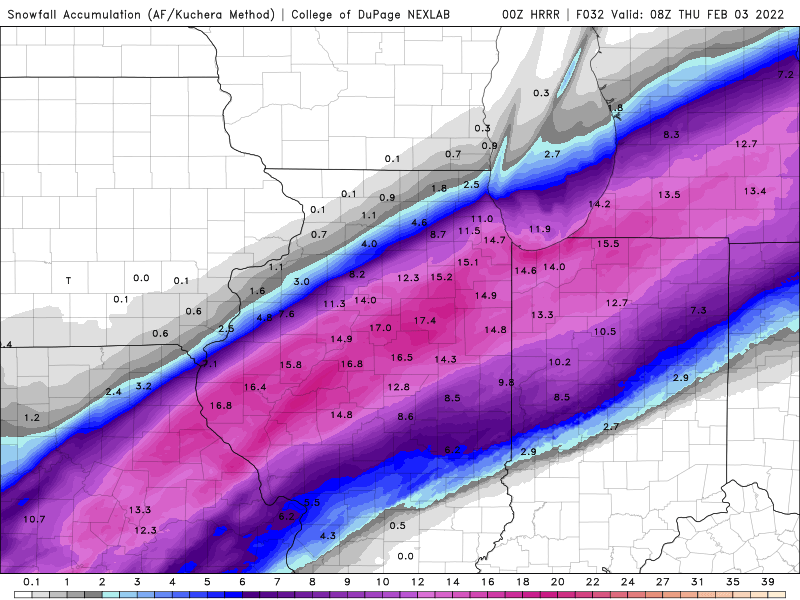
Sorry, posted wrong image the first time. 00z HRRR snows through early Thursday AM. Some lighter snows still ongoing.
-
Valid. My straw-grasping tendencies are winning out...
-
00z HRRR will tick northwest again for Chicagoland folks...
-
-
Will say the Canadian HP looks a couple millibars weaker & southeast HP looks a couple millibars stronger than what zero-hour RAP shows. Ultimate weenie comment, sure, but so it goes... https://www.spc.noaa.gov/exper/mesoanalysis/new/viewsector.php?sector=20
-
I've already reached the acceptance stage of this storm, need the RAP & company to stop their shenanigans
-
We may be in nowcasting territory but the 18z NAM has a fascinating band now in place Hours 18-24 across N. MO / S. IA -ish area that the 12z didn't have before. Could lend some credence to the higher amounts north of Chicago a la the HRRR/RAP/etc. Anyways...
-
Looks like the rest of the day will be spent comparing the zero-hour observed SLP charts with the zero-hour 'forecast' charts from the RAP on the SPC mesoanalysis pages, latching on to every pixel looking for a northward trend... Horrendous (and yet somewhat fond) memories of doing this same thing years ago, only to find out (surprise surprise) the most-realistic weather models were right all along
-
Didn't expect the band to start out this far north (I swear that isn't a straw-grab comment)
-
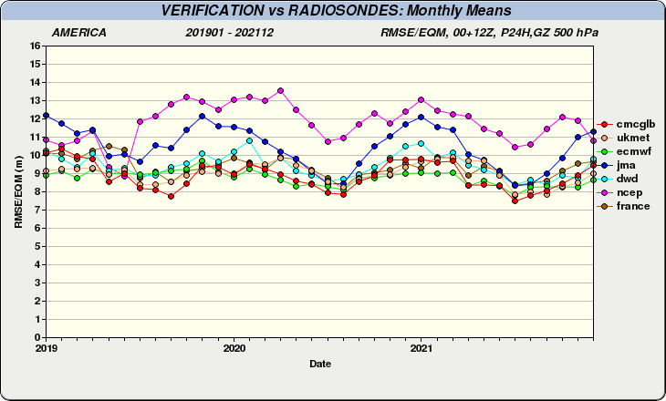
This got me thinking & poring over a bit of data, only to find a fascinating quirk in the data. Per Environment Canada, the GFS is, by far, the worst performer of all models in the 24-hour timeframe - even worse than the JMA (monthly RMSE over North America, 500mb GPH). ... Which seems really strange, so here's the webpage for anyone who wants to spot-check https://weather.gc.ca/verification/index_e.html
-
And up we go on the rollercoaster
-
Strange way to type "bump south"
-
Already checked the other day, tough to find one that covers this sub.
-
Waiting to hear those two magic words as the 18z ECMWF comes in... "bumped south"
-
Desperate times call for desperate measures (in this case, a RAP/RGEM blend)
-
-
I'll get an RGEM tattoo if it verifies