The 4 Seasons
-
Posts
7,985 -
Joined
-
Last visited
Content Type
Profiles
Blogs
Forums
American Weather
Media Demo
Store
Gallery
Everything posted by The 4 Seasons
-
I think you're thinking of 2002, there wasnt an xmas storm in the 90s that gave alb 3 feet. And xmas 02 was around a 20"er for them But i dont think its that storm either way, Looks like jan 26-27 15 to me
-
Hold this
-
And if it wasn't for their biggest snowfall in history, it would have been one of the worst winters ever for snowfall, probably top 5 with just 5.4"
-
Horrible, feel dirty evening having to do this but here's your snowfall totals for Wednesday the 25th. Ultster and Sullivan were under a warning for 5-8 and "heavy mixed precipitation". They got 1-3 then rain..
-
What a temperature gradient...low 50s near the shore and mid 30s at 84, and rain everywhere. Impressive
-
48 and Heavy Rain. This f.ucking winter.
-
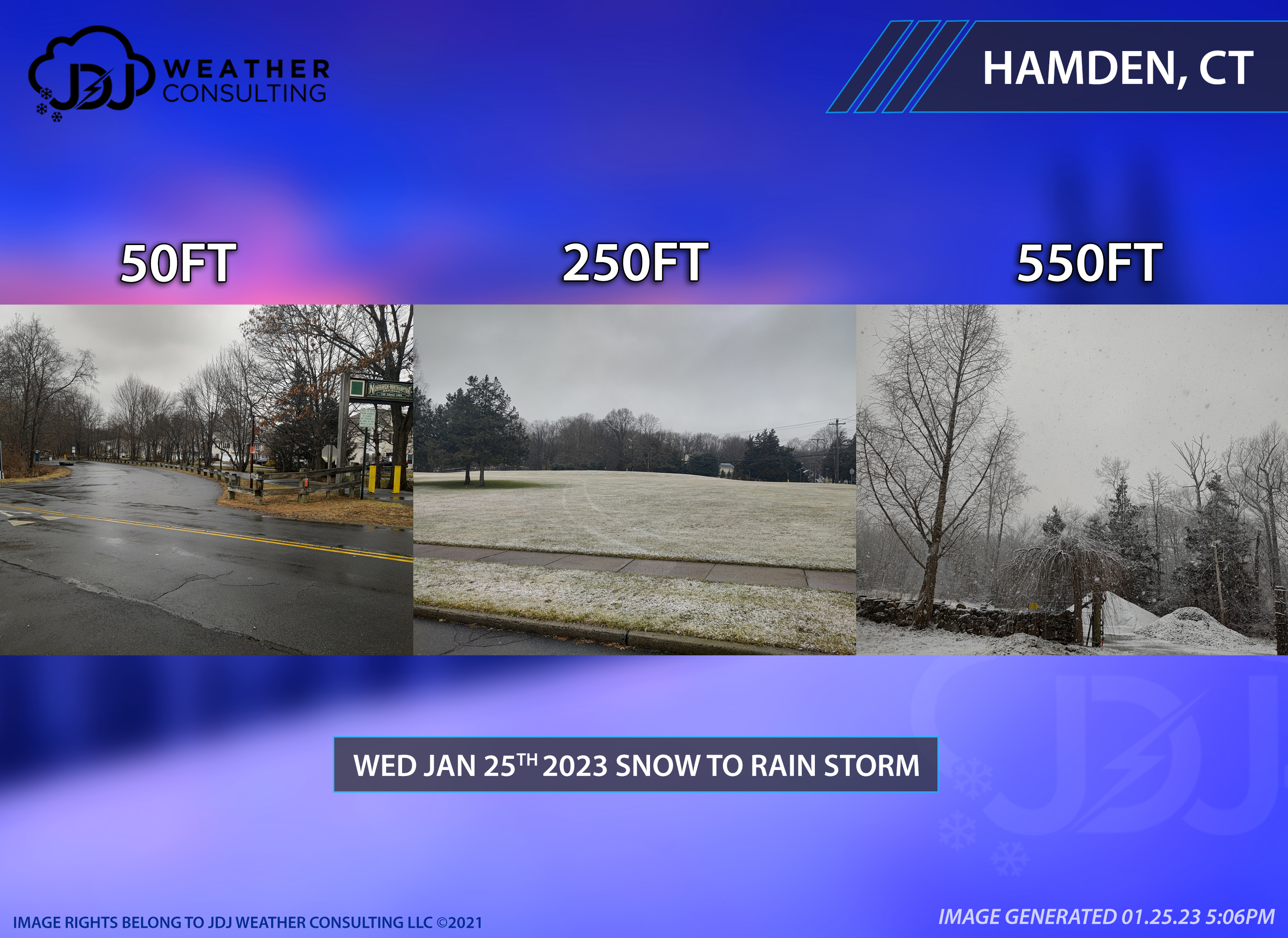
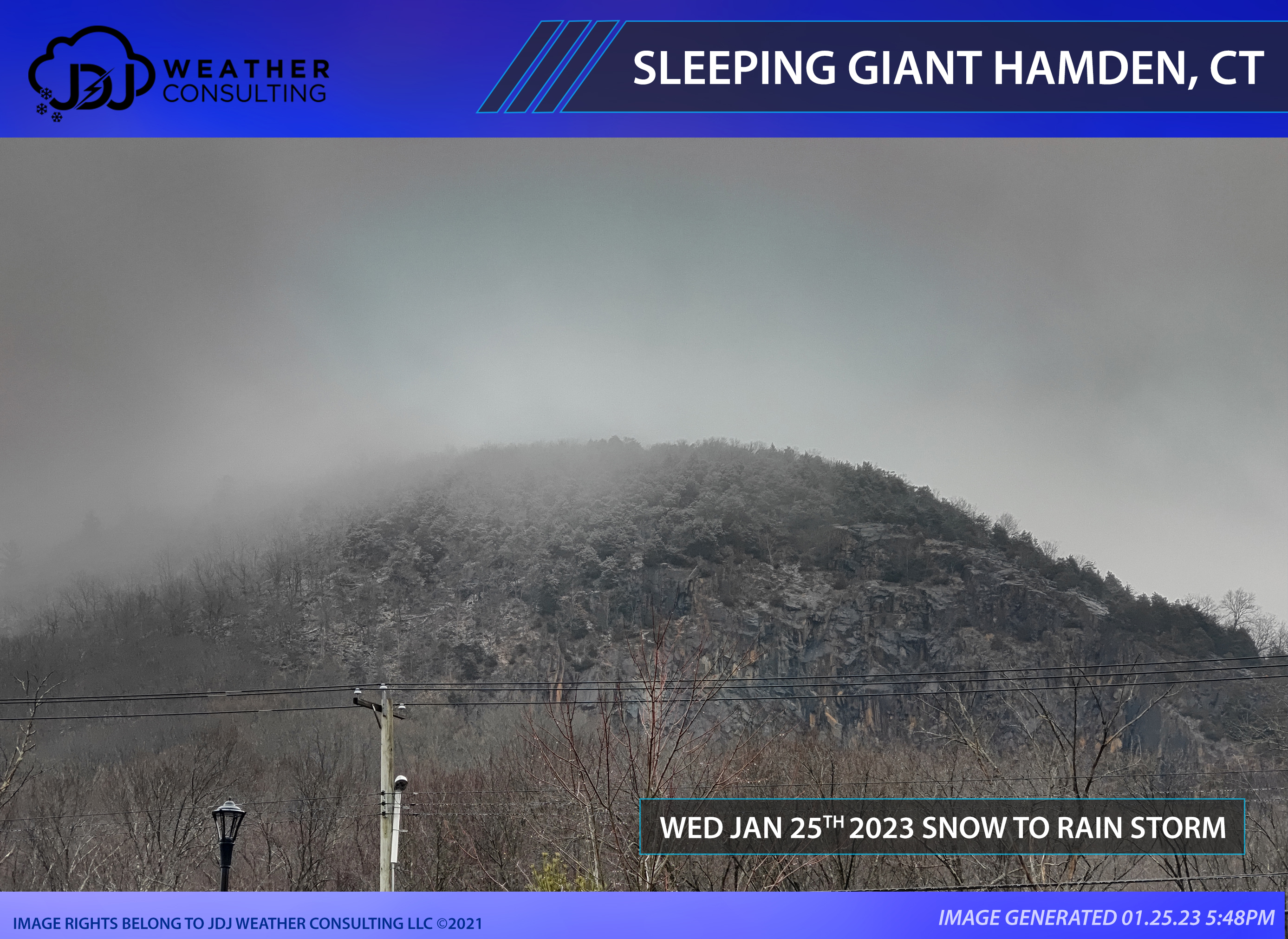
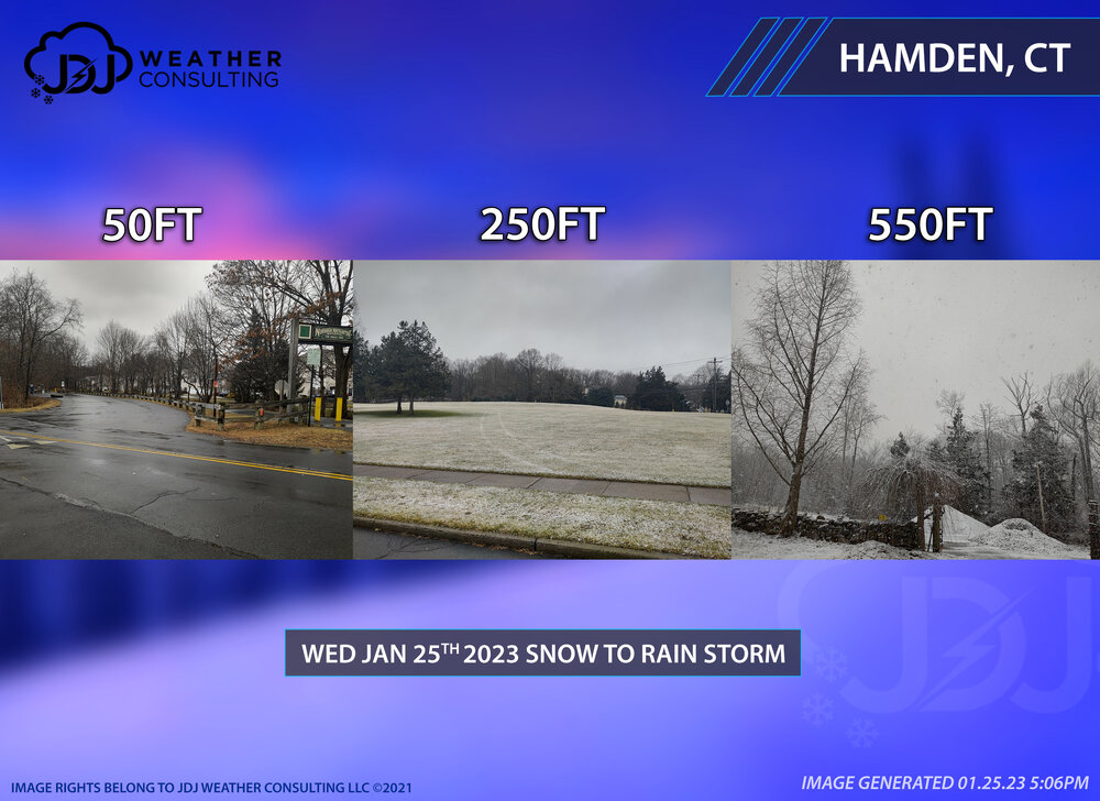
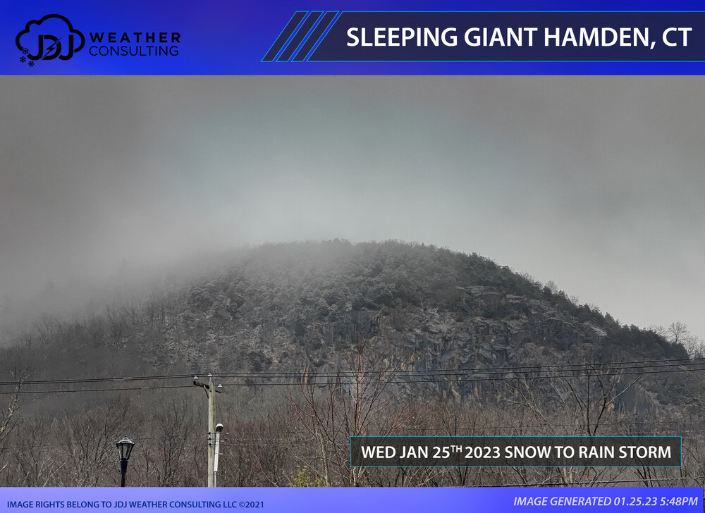
Couldn't even get it to snow today, let alone a coating or anything above 0.1. Best we had was mainly rain with wet snow mixed in at 37F. Took a drive up the hill in Hamden from 0FT to 650FT. The temperature and sensible weather impact was pretty extreme today going up in elevation. At 0-100FT it was mostly rain with some snow mixed in at 37F. Dropped to 35F at 200-300FT with mostly snow with the roads wet and grass starting to get coated. Temps fell off to 32 above 500FT with heavy snow, roads getting white everything else heavily coated...looked to me about a half inch more or less. Took some pics to highlight the change. Looks like i'll end up with the entire month of January with no measurable snowfall. Probably hasn't happened since the 90s. Any snowfall reports from CT i will gladly take em. This second pic is from Sleeping Giant mountain aka Mount Carmel in Hamden. The peak is at 739FT. It was pretty cool to see the snow line on such a low elevation event a few hundred feet below the peak and the fog developing over it.
-
Light rain has begun 41
-
Sun's coming out here, 37. Time for some outdoor activities, maybe go for a walk
-
Enjoy the advisory, it's the only advisory you got.
-
 Final snow totals for the rain to snow event yesterday. Thanks to everyone who submitted a report. Cut back on the NE hills for the final call which was a mistake. Ranges ended up working well as well as most of the region. Overall it was OK. Grade: B-
 -
Excited for NYC to break their all time record. Hopefully they don't get 0.1 tomorrow, that would suck.
-
0.0 3.9" on the season.
-
Sorry for your loss.
-
Any final snow totals for CT, big or small, a couple or nothing, trace or a tenth, ill take em TIA
-
No thread for Wednesday?
-
Just flipped to snow. White rain, 36
-
37 and light
-
3AM radar
-
Our latest forecast from last night, hedging on the conservative side.
-
Heavy Rain. 35F. Doesn't get worse than this
-
We'd definitely take the HERPES round here
-
I think 06-07, 14-15 and 15-16 were about as bad too date, little too nothing here anyways. 01-02 had the one Jan 19th storm
-
Not to mention a 6-12" snowstorm 2 days from now. By 1/21 i had about 20" here. 11-12 was epic compared to this shi*t
- 203 replies
-
- 2
-

-

-
- ratter
- regression
- (and 1 more)
-
Sun comin out here. Windy and 32. Had a nice snow shower last night with a dusting but thats long gone.