

thunderbolt
-
Posts
821 -
Joined
-
Last visited
Content Type
Profiles
Blogs
Forums
American Weather
Media Demo
Store
Gallery
Posts posted by thunderbolt
-
-
1 hour ago, bluewave said:
It will all come down to how much blocking we get. Unfortunately, the seasonal models have very little skill at forecasting the correct phase of the AO and NAO. When the ENSO is coupled, they do much better with the North Pacific pattern.
Darker oranges more skill

Since 2010, the stronger La Ninas had more snow. During other periods, the weaker years had more snow. So there may not be much correlation between snowfall and La Niña strength. It really comes down to how much blocking we get
I’m Starting to keep my eye on the stratosphere at this present time some of the models that I saw have The stratosphere relatively week until roughly the beginning of December and then have it strengthening which if it does come to fruition would not be good for blocking down the road if the PNA is negative you could keep your shorts out in the middle of January
-
4 hours ago, Rjay said:
According to you every month has been dead but somehow we're up to W in the alphabet. I'm very close to getting rid of you.
Please do
-
 1
1
-
-
36 minutes ago, StormchaserChuck! said:
Before an +EPO Winter (this Winter's going to be +EPO)
-2019 had 7 storms here on out.-
2018(-EPO) had 3 storms
2017(-EPO) had 3 storms
Ok
-
44 minutes ago, NorthHillsWx said:
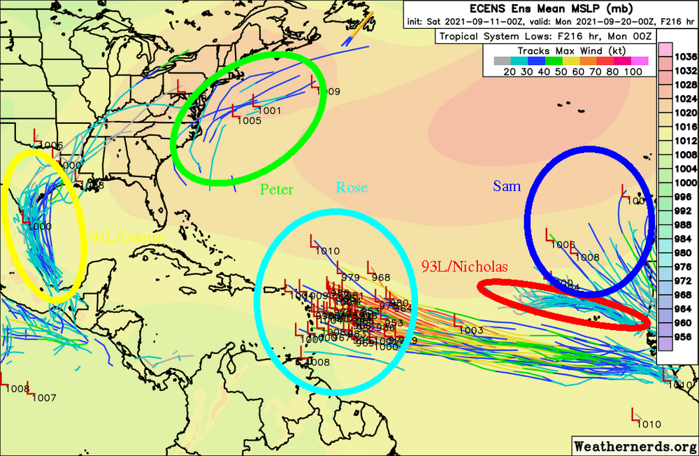
For those tracking seasonal ACE we will be exceeding the typical year end value for the Atlantic overnight. With two likely areas of development and Sam ongoing as a major hurricane for the next couple of days, we are likely to end up well above the average by next week. Knowing the frequency of strong October storms in recent years, the 2021 ACE value could be incredibly high by seasons end. Sam is likely to exceed 30 units, as Larry did earlier this year, making these exceptionally high ACE producing storms
I believe we are at 105.2 for the north Atlantic
-
1 minute ago, Windspeed said:
Yeah, and just as you would have it, as reconnaissance leaves, a strong CB encircles the eyewall. That's the way it goes. lol...

Just by looking at the animation if I were to guess A hi end cat 4 possibly cat 5
-
Sam is definitely going to be bumping up the ace that’s for sure
-
2
-
-
Just now, thunderbolt said:
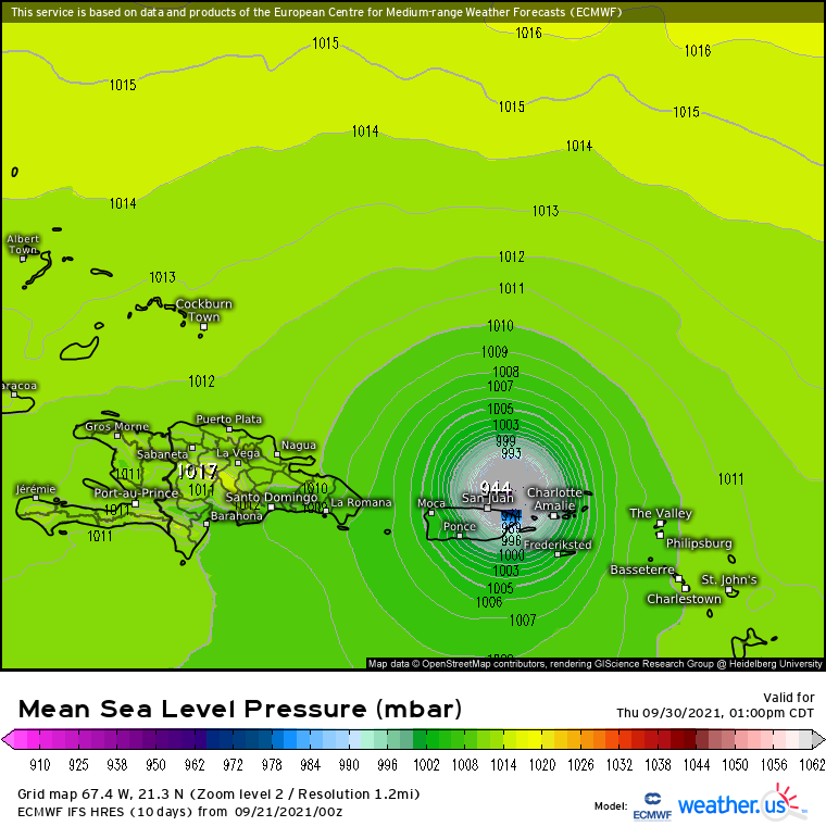
TROPICAL STORM SAM FORECAST/ADVISORY NUMBER 4
NWS NATIONAL HURRICANE CENTER MIAMI FL AL182021
1500 UTC THU SEP 23 2021
THERE ARE NO COASTAL WATCHES OR WARNINGS IN EFFECT.
TROPICAL STORM CENTER LOCATED NEAR 10.9N 38.1W AT 23/1500Z
POSITION ACCURATE WITHIN 20 NM
PRESENT MOVEMENT TOWARD THE WEST OR 280 DEGREES AT 14 KT
ESTIMATED MINIMUM CENTRAL PRESSURE 1003 MB
MAX SUSTAINED WINDS 45 KT WITH GUSTS TO 55 KT. TROPICAL STORM SAM FORECAST/ADVISORY NUMBER 4
NWS NATIONAL HURRICANE CENTER MIAMI FL AL182021
1500 UTC THU SEP 23 2021
THERE ARE NO COASTAL WATCHES OR WARNINGS IN EFFECT.
TROPICAL STORM CENTER LOCATED NEAR 10.9N 38.1W AT 23/1500Z
POSITION ACCURATE WITHIN 20 NM
Can one of the moderators please change the title to a Tropical storm Sam
-
1
-
-
TROPICAL STORM SAM FORECAST/ADVISORY NUMBER 4
NWS NATIONAL HURRICANE CENTER MIAMI FL AL182021
1500 UTC THU SEP 23 2021
THERE ARE NO COASTAL WATCHES OR WARNINGS IN EFFECT.
TROPICAL STORM CENTER LOCATED NEAR 10.9N 38.1W AT 23/1500Z
POSITION ACCURATE WITHIN 20 NM
PRESENT MOVEMENT TOWARD THE WEST OR 280 DEGREES AT 14 KT
ESTIMATED MINIMUM CENTRAL PRESSURE 1003 MB
MAX SUSTAINED WINDS 45 KT WITH GUSTS TO 55 KT. TROPICAL STORM SAM FORECAST/ADVISORY NUMBER 4
NWS NATIONAL HURRICANE CENTER MIAMI FL AL182021
1500 UTC THU SEP 23 2021
THERE ARE NO COASTAL WATCHES OR WARNINGS IN EFFECT.
TROPICAL STORM CENTER LOCATED NEAR 10.9N 38.1W AT 23/1500Z
POSITION ACCURATE WITHIN 20 NM
-
8 minutes ago, MJO812 said:
Gfs would be the last model I would use if the blocking is right. It struggles so bad even during the winter.
I totally agree with you brother I’m just telling you what the model showed
-
1 minute ago, thunderbolt said:
Looks like GFS at hour 180 is north compared to 18z
And it’s a fish storm
-
Looks like GFS at hour 180 is north compared to 18z
-
-
Well this got interesting overnight
-
2
-
-
-
56 minutes ago, Rtd208 said:
Which is exactly why I blocked him a long time ago.
I’m surprise the moderators still let him post
-
3
-
-
26 minutes ago, MJO812 said:
It's going to get very active soon
Yo MJ didn’t someone say it was going to be a very quiet September This doesn’t look Quiet to me
-
 1
1
-
-
4 hours ago, bluewave said:
The latest Euro seasonal for DJF has a similar 500 mb pattern to 2017-2018.


You would think with that stout ridge over Alaska and the blocking over the pole it would be a little bit colder I guess the south east ridge is flexing his muscles
-
1
-
-
1 hour ago, NorthHillsWx said:
Proud to say that I’m not a snob for sexy Hurricanes, like Ida, and love a big ole fat truck tire like Larry. Last ERC gave us the biggest eye in the Atlantic in recent memory! Storm is a beast, also ACE is going to be through the roof with this one
Well according to One person it’s in Poor shape
-
-
16 hours ago, cptcatz said:
Seeing the catastrophic flooding happening in New Jersey, NYC, and now moving into Long Island, I wouldn't be surprised if the flooding costs in the northeast exceed the wind/surge costs in Louisiana. Reminds me a lot of Floyd.
Don’t forget about Pennsylvania
-
46 minutes ago, StormchaserChuck! said:
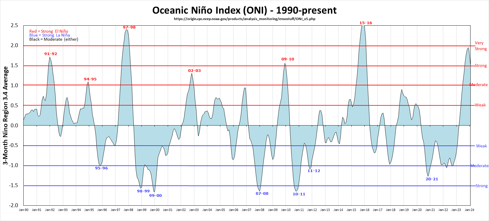
A lot of people don't know this, but 95-96 was not a La Nina as per ENSO subsurface, 0.0. Plus 90-91,91-92,92-93-93-94-94-95,97-98 were all +ENSO 7/8 years. 95-96 was +PNA.
For this it was definitely a moderate La Niña.
El Niño and La Niña Years and Intensities
Based on Oceanic Niño Index (ONI)
Jan Null, CCM
Updated thru May-Jun-Jul 2021
The Oceanic Niño Index (ONI) has become the de-facto standard that NOAA uses for identifying El Niño (warm) and La Niña (cool) events in the tropical Pacific. It is the running 3-month mean SST anomaly for the Niño 3.4 region (i.e., 5oN-5oS, 120o-170oW). Events are defined as 5 consecutive overlapping 3-month periods at or above the +0.5o anomaly for warm (El Niño) events and at or below the -0.5 anomaly for cold (La Niña) events. The threshold is further broken down into Weak (with a 0.5 to 0.9 SST anomaly), Moderate (1.0 to 1.4), Strong (1.5 to 1.9) and Very Strong (≥ 2.0) events. For the purpose of this report for an event to be categorized as weak, moderate, strong or very strong it must have equaled or exceeded the threshold for at least 3 consecutive overlapping 3-month periods. El Niño - 26 La Niña - 23 Weak - 11 Moderate - 7 Strong - 5 Very Strong - 3 Weak - 11 Moderate - 5 Strong - 7 1952-53 1951-52 1957-58 1982-83 1954-55 1955-56 1973-74 1953-54 1963-64 1965-66 1997-98 1964-65 1970-71 1975-76 1958-59 1968-69 1972-73 2015-16 1971-72 1995-96 1988-89 1969-70 1986-87 1987-88 1974-75 2011-12 1998-99 1976-77 1994-95 1991-92 1983-84 2020-21 1999-00 1977-78 2002-03 1984-85 2007-08 1979-80 2009-10 2000-01 2010-11 2004-05 2005-06 2006-07 2008-09 2014-15 2016-17 2018-19 2017-18 -
 1
1
-
-
1 minute ago, RedSky said:
Ida's remnants are booking along should be over by 9pm
Good
-
11 minutes ago, RedSky said:
What happened to today's rain anybody notice? There was nothing anywhere.
I know the Jersey shore got hit pretty good with some storms in fact there was a fatal at Seaside and lifeguard passed away
-
No Major???


October 2021
in New York City Metro
Posted
Conversation