TSG
-
Posts
741 -
Joined
-
Last visited
Content Type
Profiles
Blogs
Forums
American Weather
Media Demo
Store
Gallery
Everything posted by TSG
-
This is about the same amount of lead time before the 1/6 event that the GFS started to get a clue and hone in on the further south solution. We're obviously looking for a different trend here but good to see
-
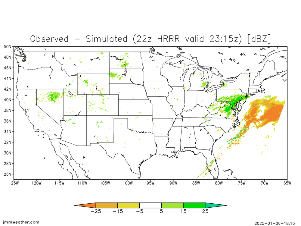
The HRRR is just completely lost with this ULL stuff
-
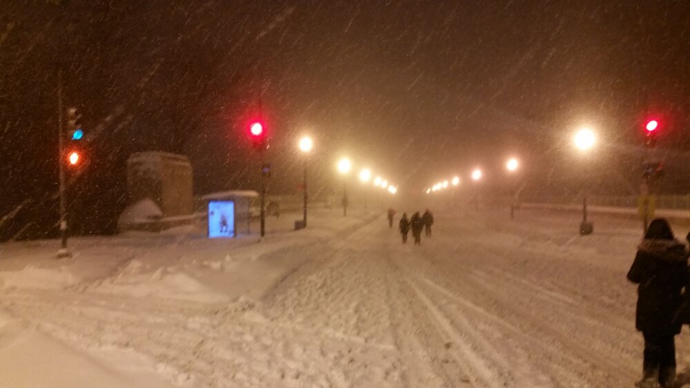
Radar looks incredible
-
Big fluffy flakes coming out of the sky under this I66/Rt50 band. Best I've seen all storm
-
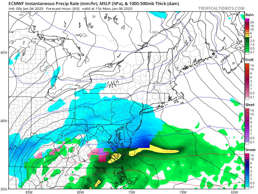
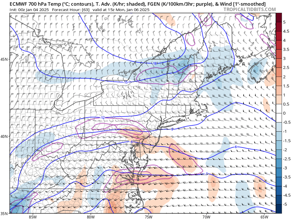
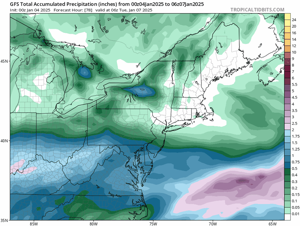
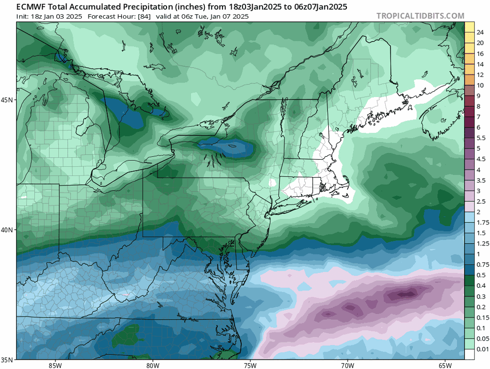
Correct me if I'm totally off base here, but wasn't the Euro kind of showing that 700mb band setting up across central PA back Friday night/Sat? See the Jan 4 00z run below. And then as a compounding factor, perhaps the precipitation depiction was just not as accurate up that way because of how dry the antecedent airmass was?

-
That's exactly the time period I'm talking about. I think some people held onto that and then the ~48hr NAM showed a similar northern track and it was all over for reasonable consideration of the more southern solutions. And yes, it didn't get every detail right, but the end result was closer than what the GFS was advertising. It def nailed the central VA forecast
-
Whatever makes you feel better dude. The GFS had the significant precip way too far north
-
Not trying to make the northern crew feel even worse, I do feel bad for y'all, but this is the result the Euro was showing for days that many posters in here were heavily discounting/tossing. Remember it for the next storm! And don't ride the 48hr NAM!
-
Flake size has increased a bit under these borderline yellows coming through fairfax
-
@stormtracker Hope it looks like this out there for ya tonight or tomorrow. Pic is from the 2016 blizzard looking west across the Calvert Bridge Putting this in banter so I don't get yelled at
-
Snow has started in Lake Barcroft south of Seven Corners. staying with my parents for this one, feels like college again
-
I mean after this weekend lol. a potential big storm #3, snow on snow on snow
-
This is wild. I didn't think we'd see anything close to 2010 again given the ocean anomalies the last ~8 years. I would be so happy to be wrong if this lands and we're looking at another threat 7 days from now
-
You'll sleep a lot better the next few nights with that booked. That alone might be worth it lol
-
I'd use the Snipping Tool if on Windows. It's built in, nothing to download or set up
-
they're monitoring the situation out West for potential downstream effects here
-
It's time to stop talking about JV global models. We're 6 hrs from start.
-
So I guess that's a heated pool your neighbor has
-
It's 5 hours in the winter. 4 in summer
-
The GFS had the mix line into PA 2.5 days ago. It moved to the Euro way more than the other way around
-
The axis of heavy precip to our West was as far North as Cinncinnati into SWPA on the GFS. It's now moved that into central KY and Southern WV. More like a 100 mile shift imo
-
Idk about "meet in the middle". the GFS did about 80% of the movement Last 6 runs.
-
GFS is colder/souther
-
Go check H5 the last few runs of the GFS vs Euro. One has moved a lot more than the other and it's not the foreign model
-
Anyone have the 00Z UKmet kuchera totals?