RIC Airport
-
Posts
2,586 -
Joined
-
Last visited
Content Type
Profiles
Blogs
Forums
American Weather
Media Demo
Store
Gallery
Everything posted by RIC Airport
-
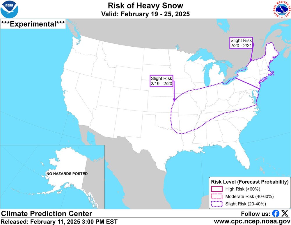
Richmond Metro/Hampton Roads Area Discussion
RIC Airport replied to RIC Airport's topic in Mid Atlantic
-
Richmond Metro/Hampton Roads Area Discussion
RIC Airport replied to RIC Airport's topic in Mid Atlantic
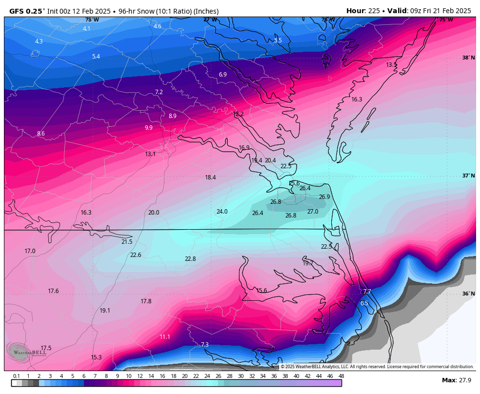
18Z GFS keeps Hampton Roads in play.
-
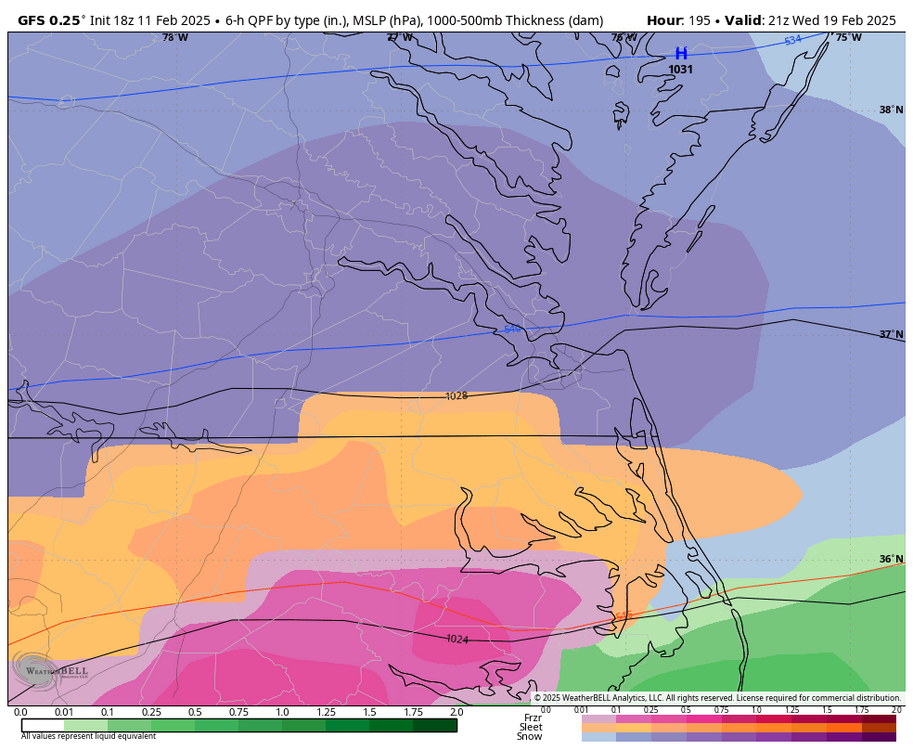
Richmond Metro/Hampton Roads Area Discussion
RIC Airport replied to RIC Airport's topic in Mid Atlantic
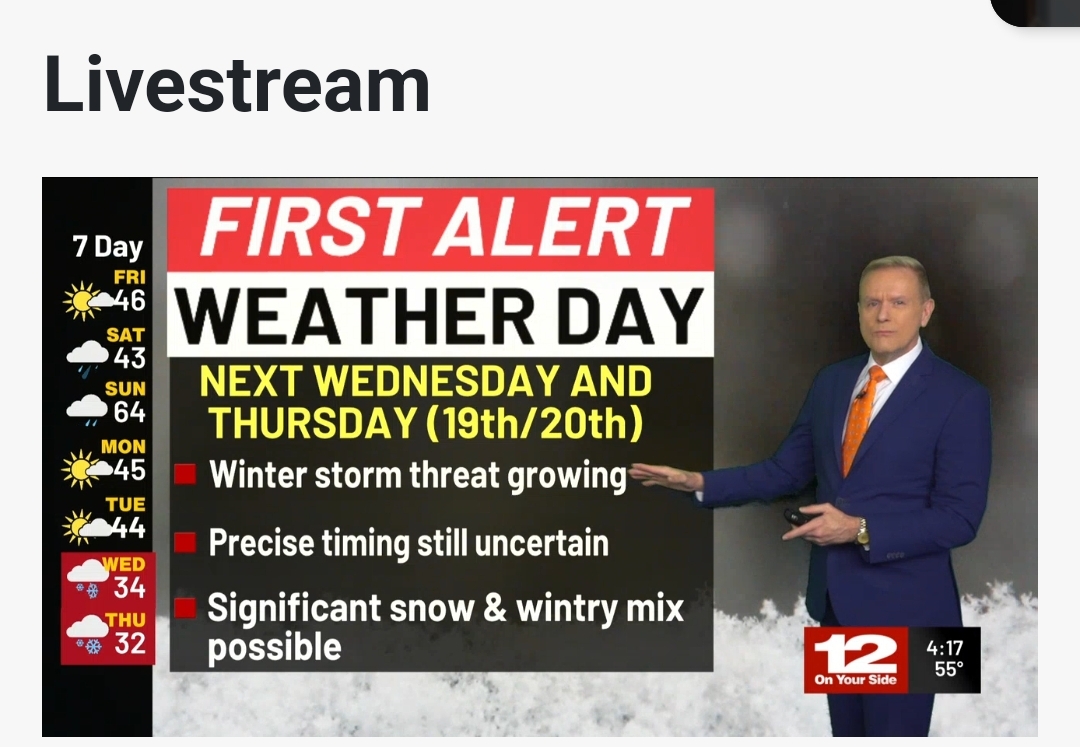
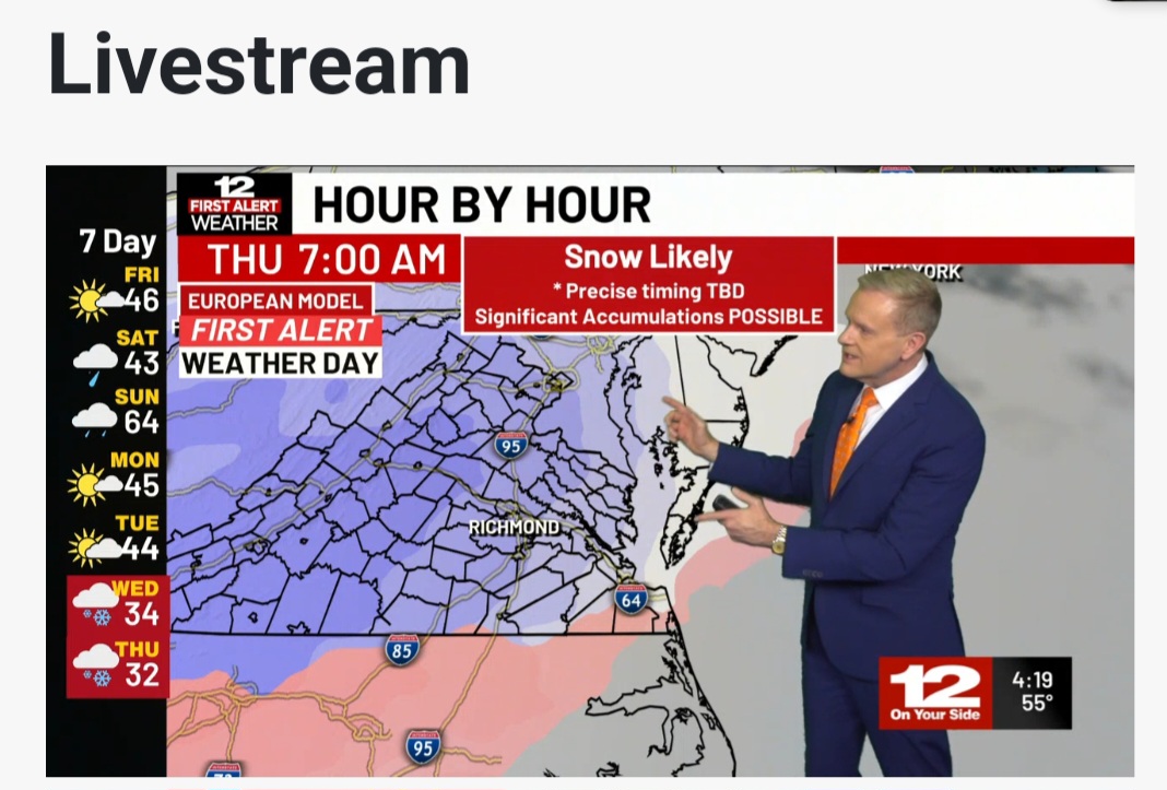
NBC 12 is on board.

-
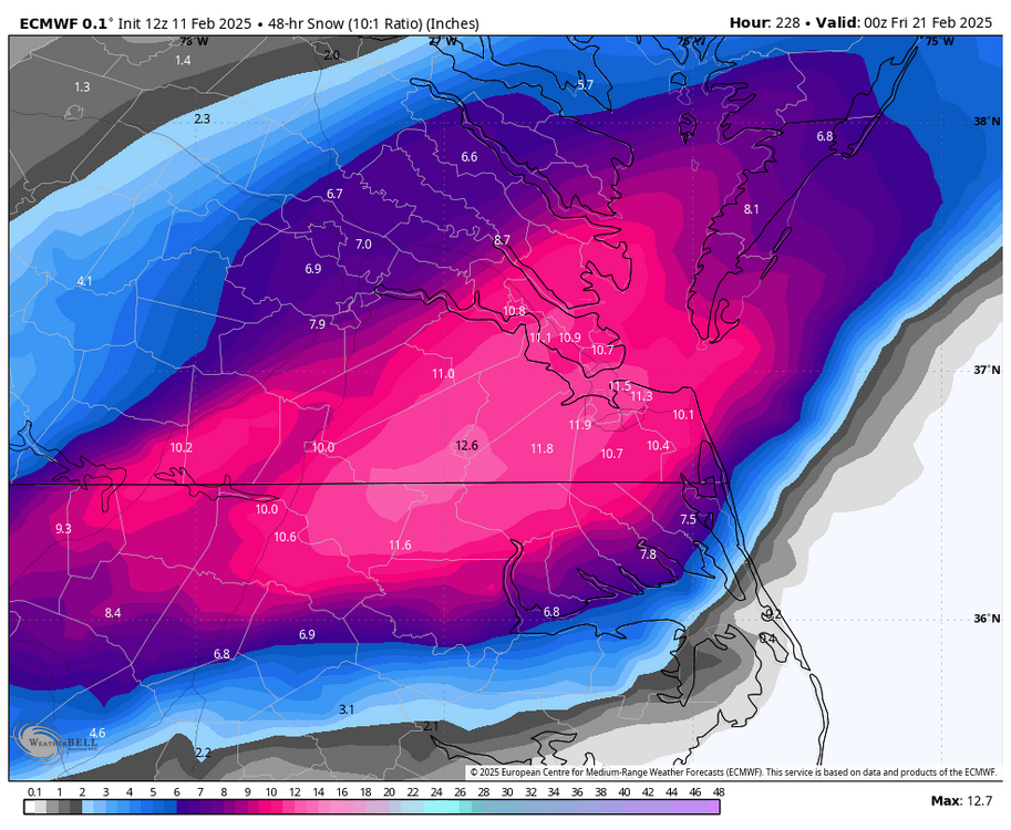
Richmond Metro/Hampton Roads Area Discussion
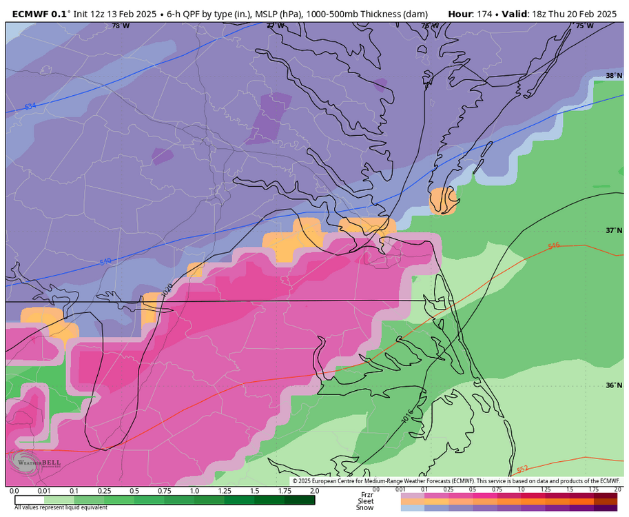
RIC Airport replied to RIC Airport's topic in Mid Atlantic
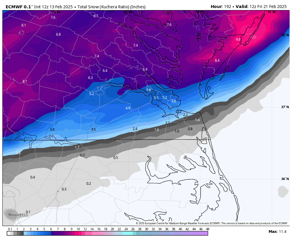
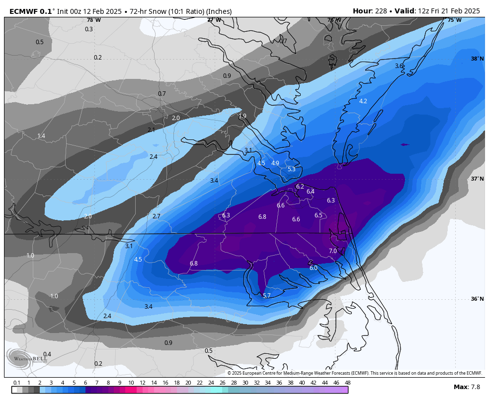
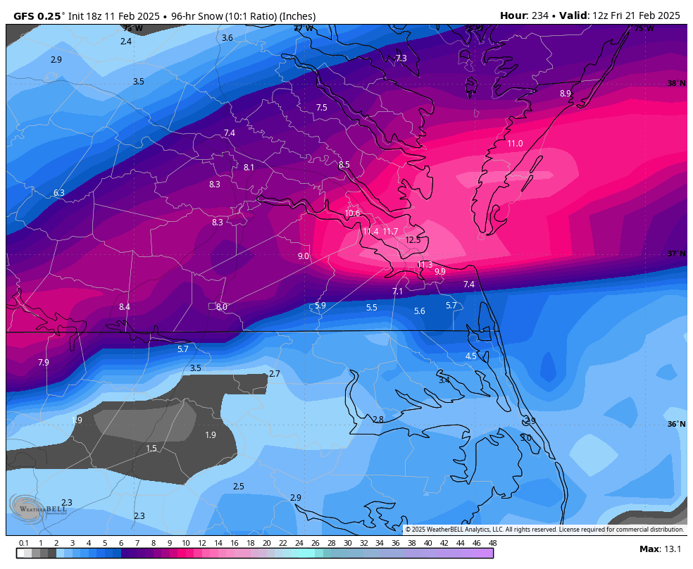
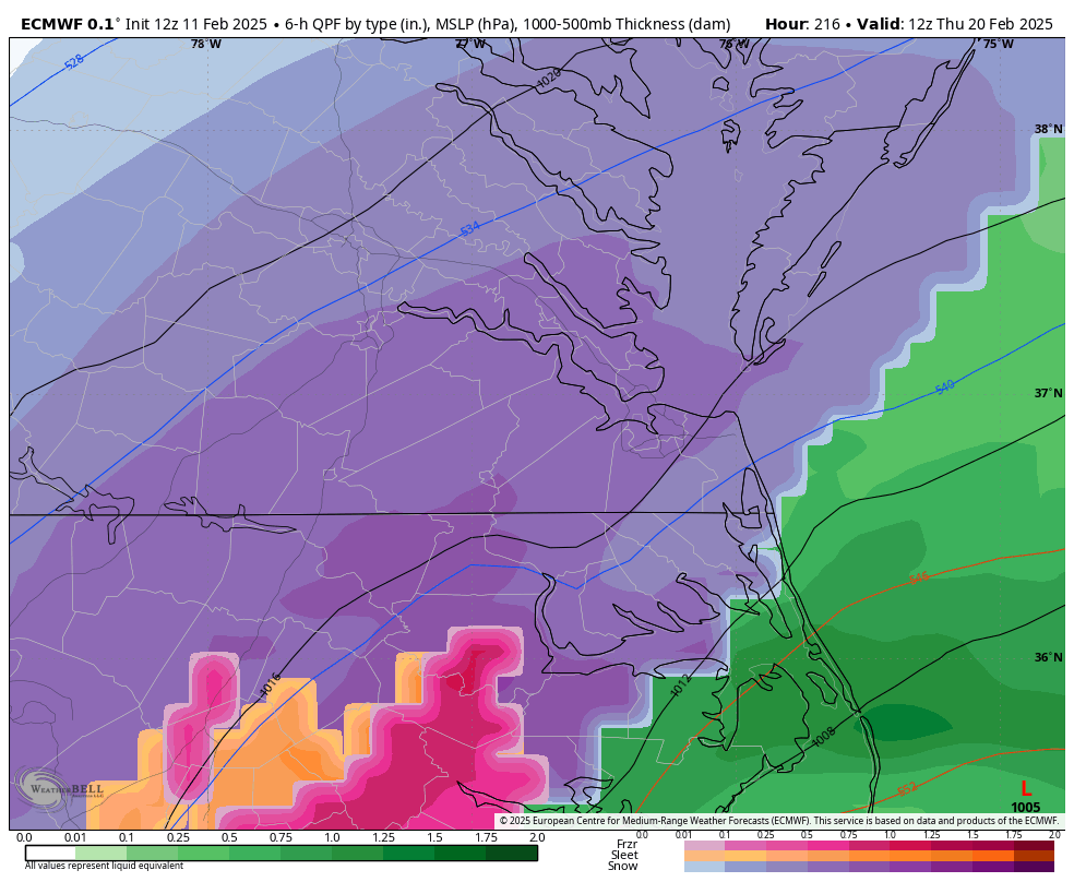
12z Euro AI on board as well. Temps are frigid during the event, lower 20s around RIC.
-
Richmond Metro/Hampton Roads Area Discussion
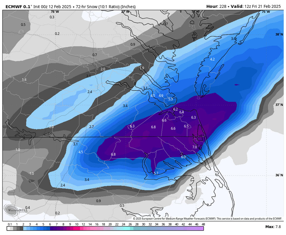
RIC Airport replied to RIC Airport's topic in Mid Atlantic
.thumb.png.086073fab46d46c0218cccd83b16dc30.png)
.thumb.png.6d1f81216b50b5039db5a957bef6dffd.png)
-
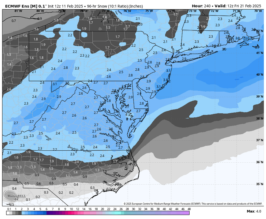
Richmond Metro/Hampton Roads Area Discussion
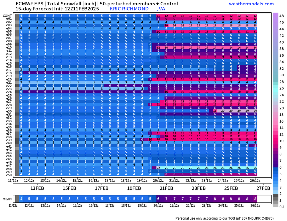
RIC Airport replied to RIC Airport's topic in Mid Atlantic
EPS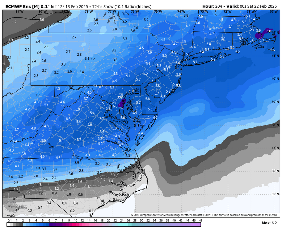
-
Richmond Metro/Hampton Roads Area Discussion
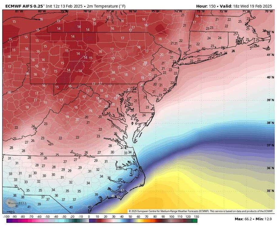
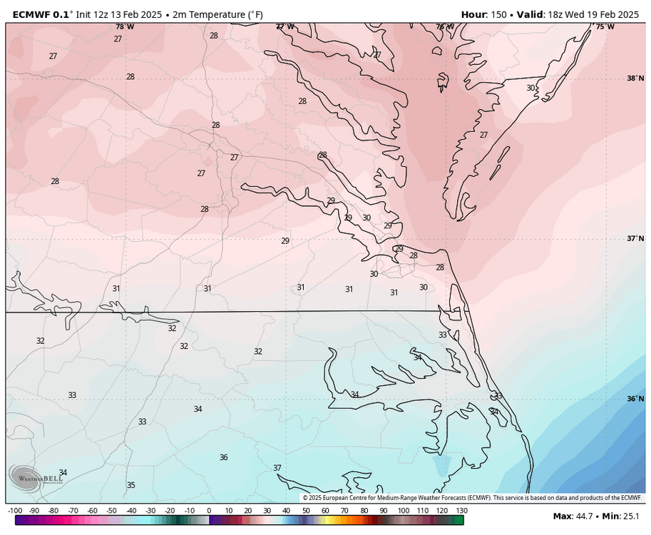
RIC Airport replied to RIC Airport's topic in Mid Atlantic
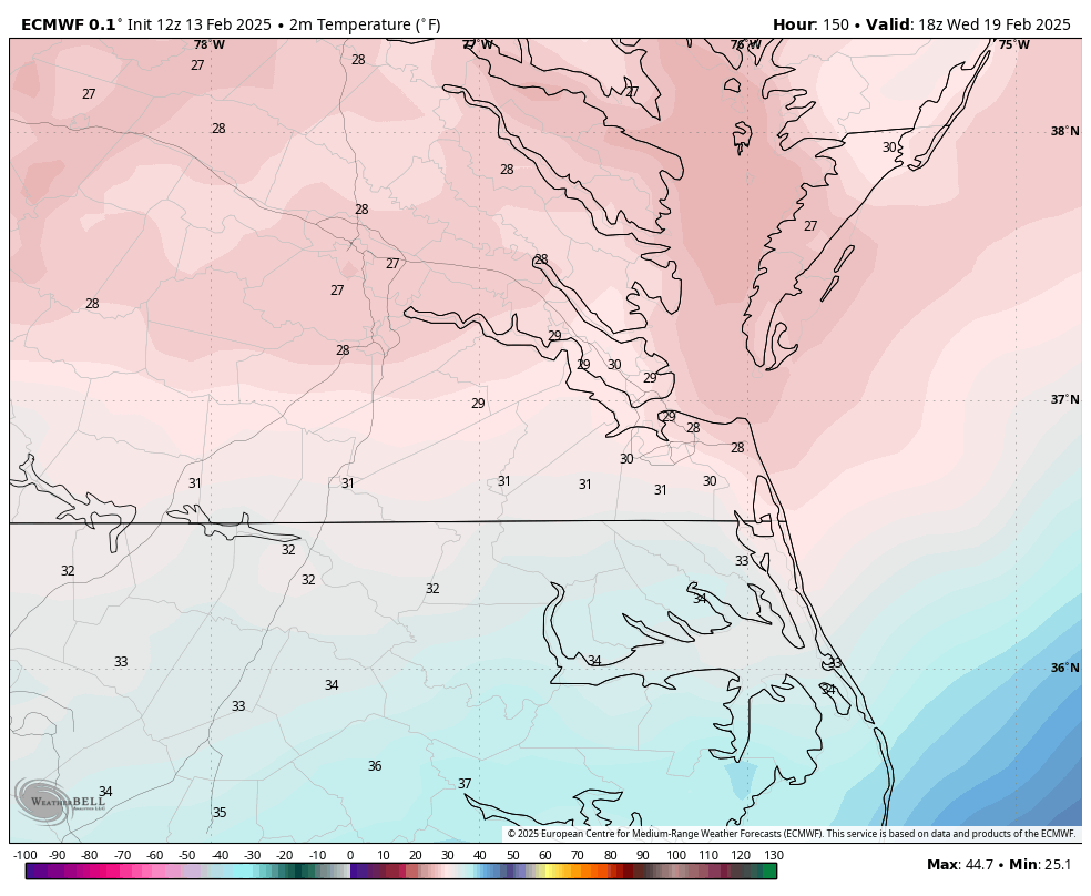
Cold, too! First map are Wednesday's high temps, the day before the storm. Then look at the bottom map for temps during the event.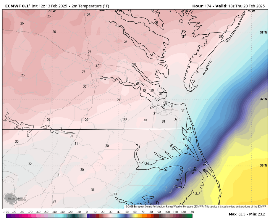
.thumb.png.3875eef87da5b9cfe7230f6d46675550.png)
-
Richmond Metro/Hampton Roads Area Discussion
RIC Airport replied to RIC Airport's topic in Mid Atlantic

-
Richmond Metro/Hampton Roads Area Discussion
RIC Airport replied to RIC Airport's topic in Mid Atlantic
Euro coming in hot! -
Richmond Metro/Hampton Roads Area Discussion
RIC Airport replied to RIC Airport's topic in Mid Atlantic
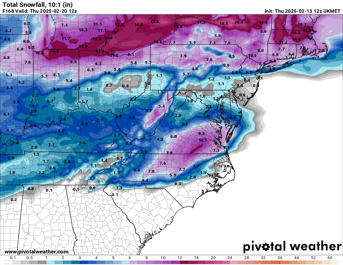
We also have the Ukmet. Could be a sign of what Euro will show. Will know soon.
-
Richmond Metro/Hampton Roads Area Discussion
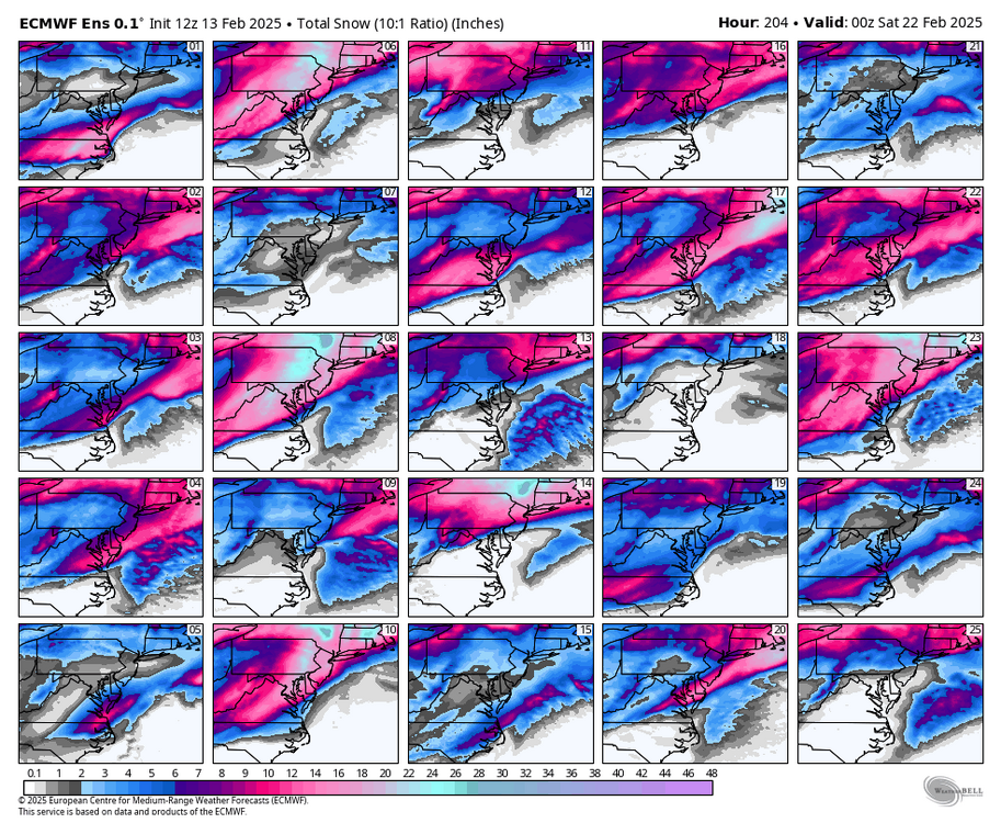
RIC Airport replied to RIC Airport's topic in Mid Atlantic
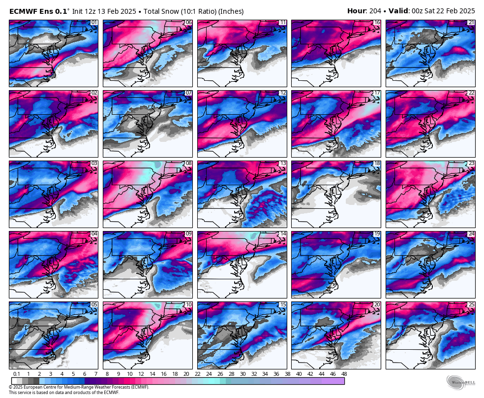
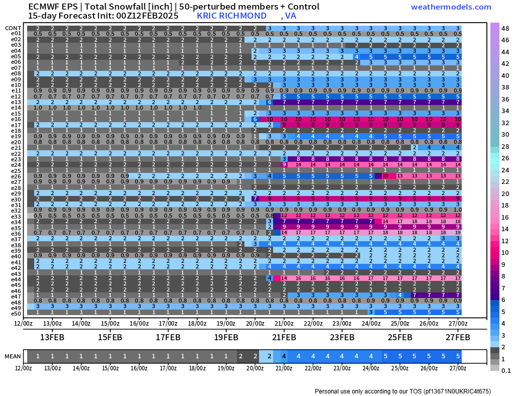
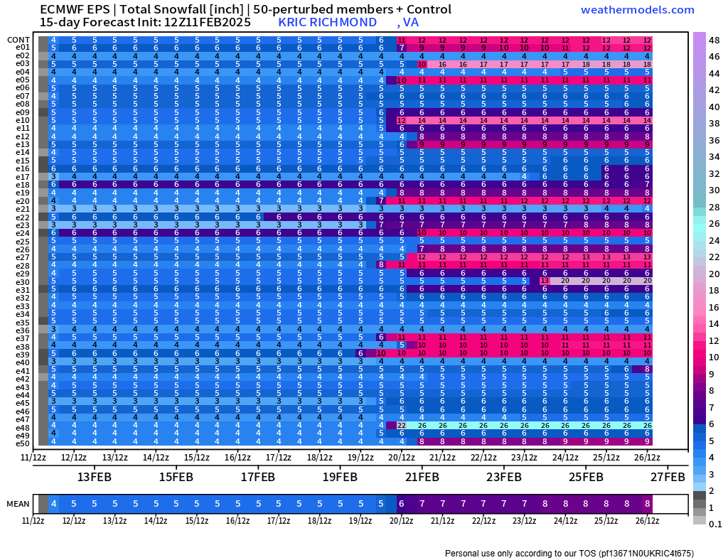
EPS for next week still showing potential.
.thumb.png.f2316b4f481bc34cf1002818908c7f66.png)

-
Richmond Metro/Hampton Roads Area Discussion
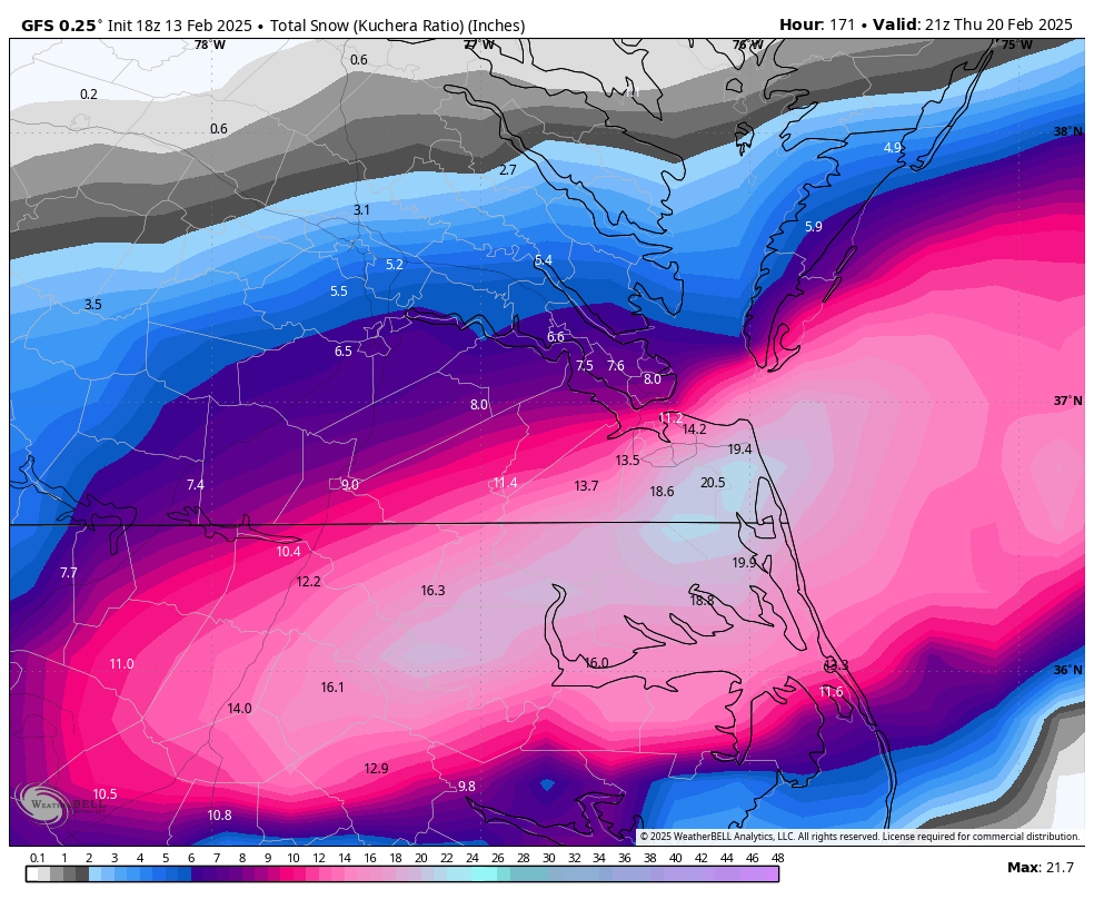
RIC Airport replied to RIC Airport's topic in Mid Atlantic
Euro is on board..thumb.png.8f016b6c922dfd92768d451d79cd3729.png)
-
Richmond Metro/Hampton Roads Area Discussion
RIC Airport replied to RIC Airport's topic in Mid Atlantic
Don't get too much sleep over the next 10 days.
-
Richmond Metro/Hampton Roads Area Discussion
RIC Airport replied to RIC Airport's topic in Mid Atlantic
I'm glad the weenie in you came out. I'm moving to Chicago at the end of next month. PM me to keep in touch. I'll have a place if you need to chase next year. Not that ORD is the best for blizzards, just a lot of 1-3" or 2-4" storms that add up over time with only an occasional 8"+ event depending on the year. -
Richmond Metro/Hampton Roads Area Discussion
RIC Airport replied to RIC Airport's topic in Mid Atlantic
-
Richmond Metro/Hampton Roads Area Discussion
RIC Airport replied to RIC Airport's topic in Mid Atlantic
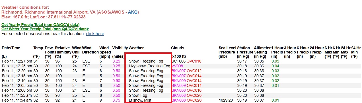
Officially 1.0" at RIC on the preliminary CLI report, not sure whether that will change, I think mixing limited accumulations there since about 1pm. -
Richmond Metro/Hampton Roads Area Discussion
RIC Airport replied to RIC Airport's topic in Mid Atlantic

-
Richmond Metro/Hampton Roads Area Discussion
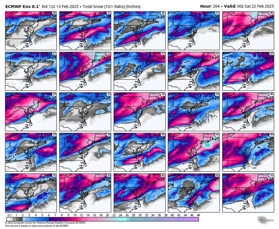
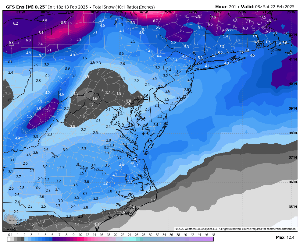
RIC Airport replied to RIC Airport's topic in Mid Atlantic
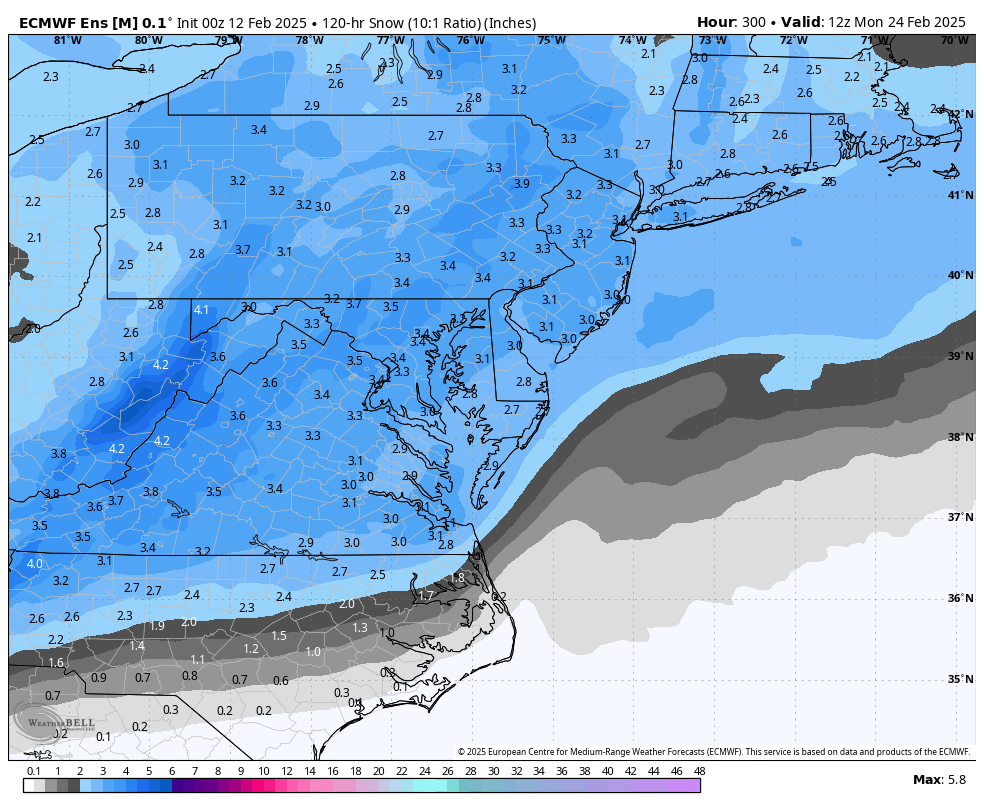
EPS for next week's threat for those that are dissatisfied with today's event.
.thumb.png.8344c7c3fdad3f5863f5f80c53d94a02.png)
-
Richmond Metro/Hampton Roads Area Discussion
RIC Airport replied to RIC Airport's topic in Mid Atlantic
Another shot next week?
-
Richmond Metro/Hampton Roads Area Discussion
RIC Airport replied to RIC Airport's topic in Mid Atlantic
Meanwhile, RIC had a +SN ob about 15 minutes ago.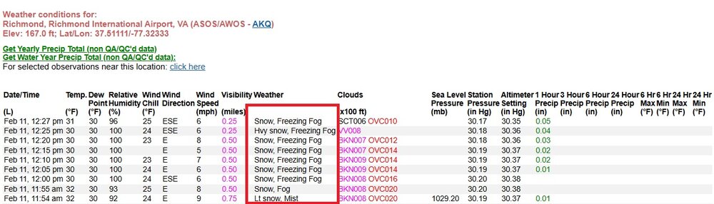
-
Richmond Metro/Hampton Roads Area Discussion
RIC Airport replied to RIC Airport's topic in Mid Atlantic
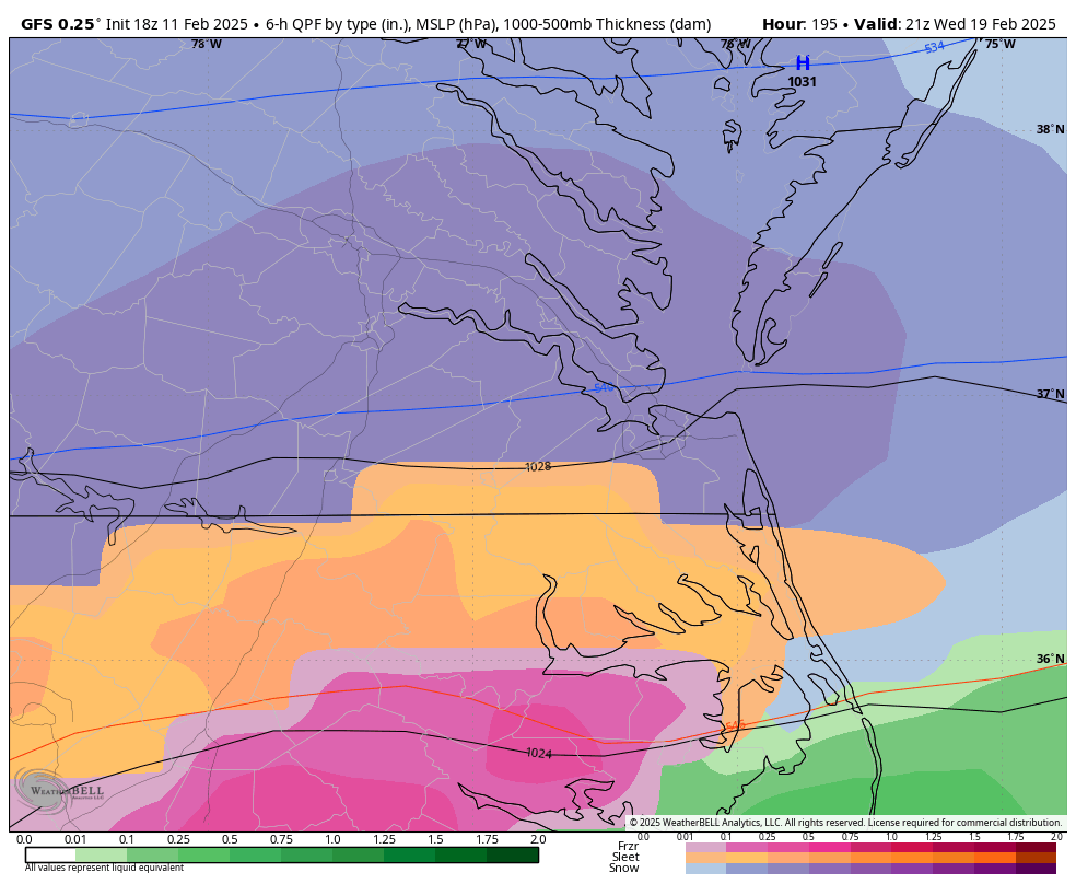
Sleet line is moving in from the south and west. Already reports of sleet in Midlothian. -
Richmond Metro/Hampton Roads Area Discussion
RIC Airport replied to RIC Airport's topic in Mid Atlantic
Yes, I'm up here until Thursday and waiting for the 1-3" to start around 8 p.m. I can browse, but I only occasionally post for the rest of the afternoon. I don't claim to be a moderator and don't think we need one, but I always try to exercise my interpersonal tact when I post. -
Richmond Metro/Hampton Roads Area Discussion
RIC Airport replied to RIC Airport's topic in Mid Atlantic
https://x.com/iembot_akq The AKQ bot is putting out totals as we speak, many so far are in the 1-1.5" ranges. I did see a 2" report around Burkeville. It's also important to look at the times when the measurements were made. -
Richmond Metro/Hampton Roads Area Discussion
RIC Airport replied to RIC Airport's topic in Mid Atlantic
The default size on most phone cameras should meet the standards. I have the ultimate subscription, so I can post unlimited files and gifs here. The other option is to ensure you clear any existing files you've posted to free up storage space. -
Richmond Metro/Hampton Roads Area Discussion
RIC Airport replied to RIC Airport's topic in Mid Atlantic
Unlike other storms this winter, this storm is unfortunate to occur during the day. The February sun angle takes its toll, especially during marginal temperature events. The temps for most of this month have been above freezing, so the roads won't be an issue for the most part unless you're amid heavier snowfall rates and closer to sunset.


.png.97816b7277cc8a797f6432e55d9fa500.png)
.png.4f64932bebd14242485f27fe3abc5849.png)


.png.057df636eb5f2db54bf0c5c52c0833fb.png)

.png.3d602a3b270c55b4d7166d225c5b441b.png)
.png.e128cba5ffbcaed0bc27890ec3587adc.png)


.png.1e4477cdc8faa3e52b1aec001e36bdd2.png)