RIC Airport
-
Posts
2,586 -
Joined
-
Last visited
Content Type
Profiles
Blogs
Forums
American Weather
Media Demo
Store
Gallery
Everything posted by RIC Airport
-
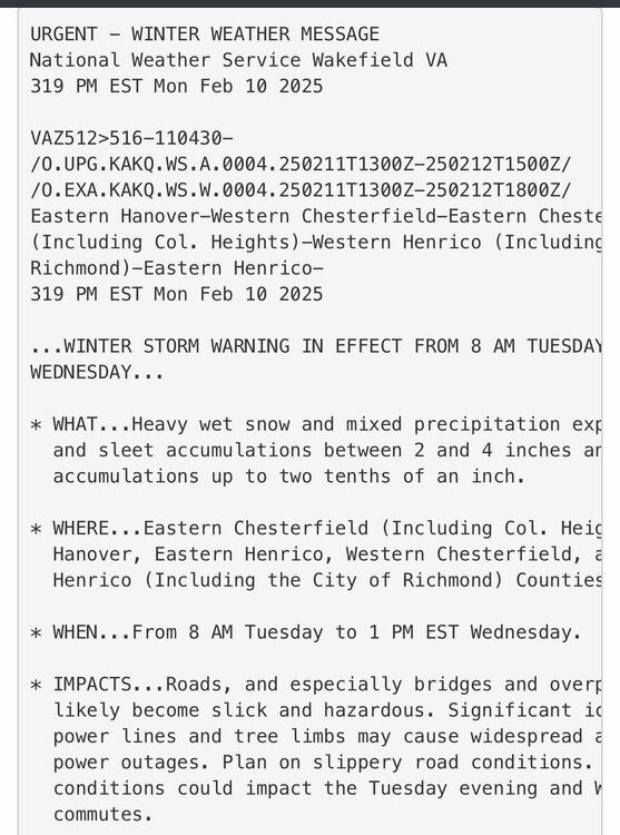
Richmond Metro/Hampton Roads Area Discussion
RIC Airport replied to RIC Airport's topic in Mid Atlantic
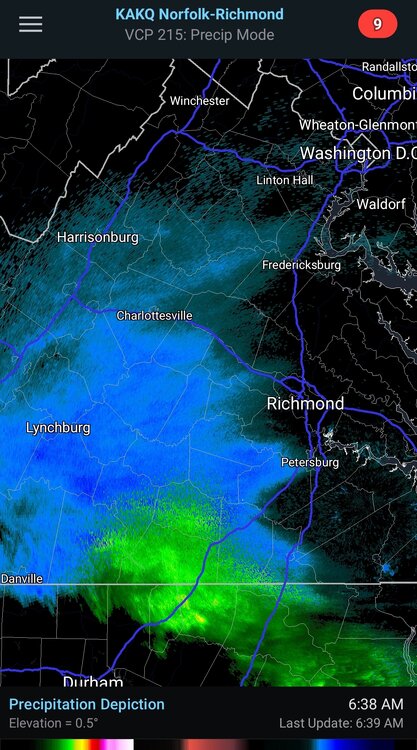
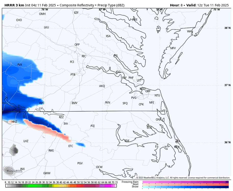
RIC hit freezing just before 10am and is reporting moderate snow.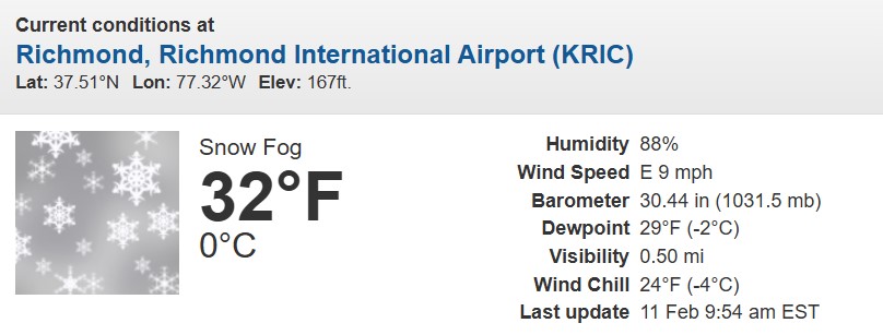
-
Richmond Metro/Hampton Roads Area Discussion
RIC Airport replied to RIC Airport's topic in Mid Atlantic
Temps are also up now that clouds rolled in. RIC now at 33, but precip is on the doorstep.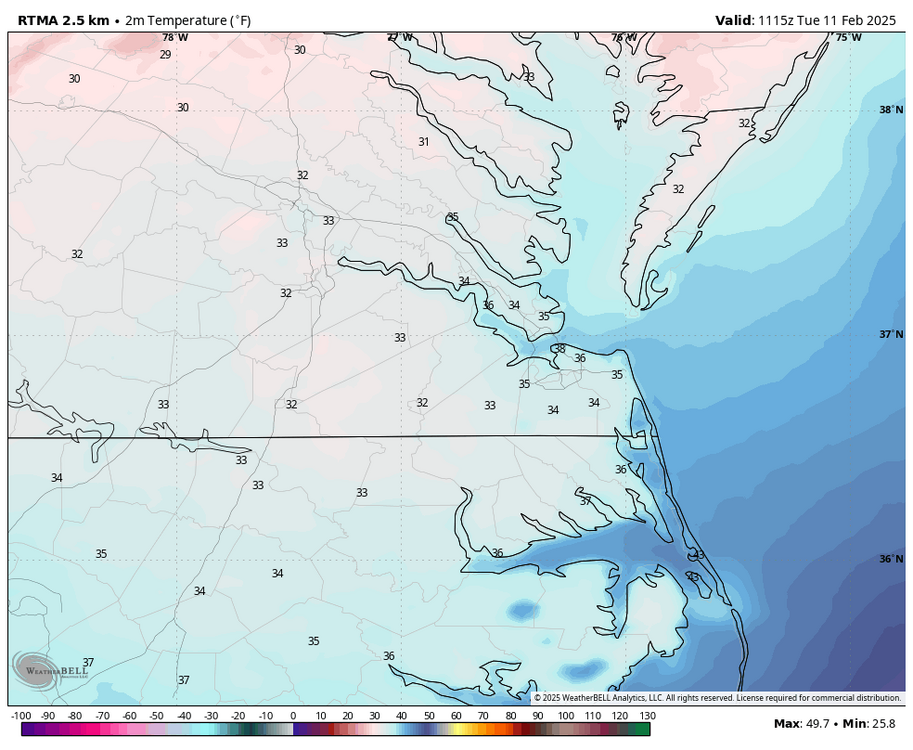
-
Richmond Metro/Hampton Roads Area Discussion
RIC Airport replied to RIC Airport's topic in Mid Atlantic
RIC is down to 28°F, colder than progged, @wasnow215, @RVAman. This could bode well if the models remain 1-2 degrees too warm. If you believe the HRRR and 3K NAM, there could be a nice surprise later this morning and especially in the afternoon. I'd be happy if RIC overperforms and my hunch is too low. -
Richmond Metro/Hampton Roads Area Discussion
RIC Airport replied to RIC Airport's topic in Mid Atlantic
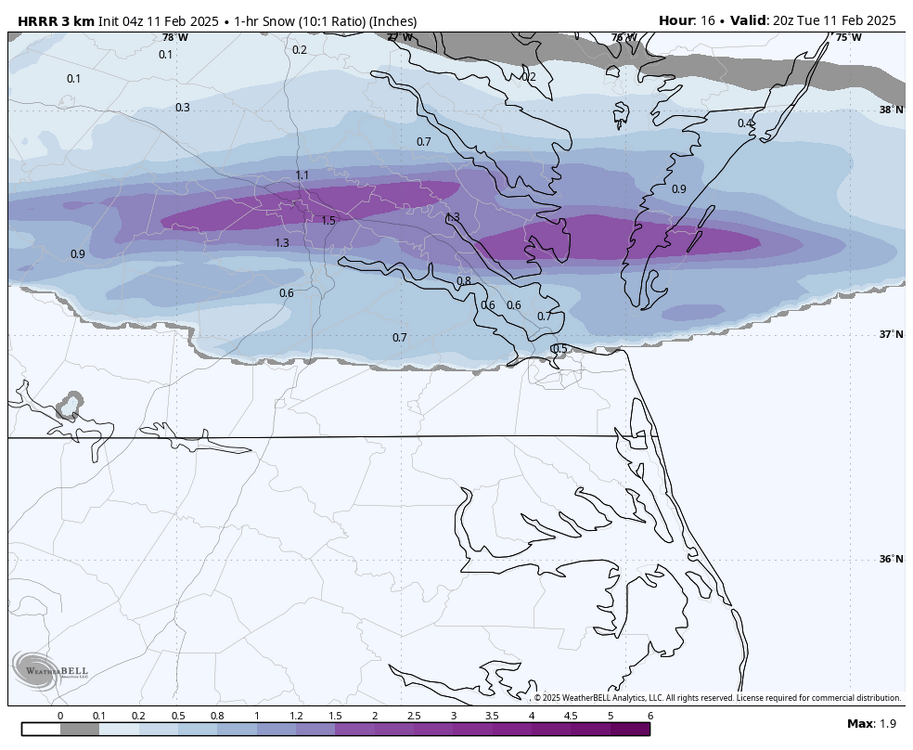
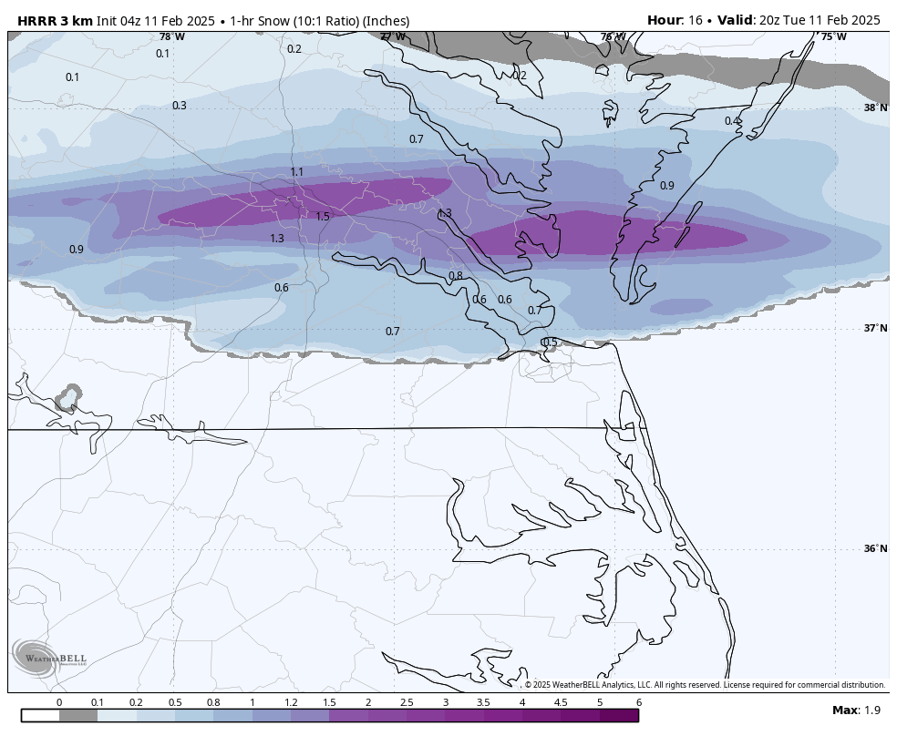
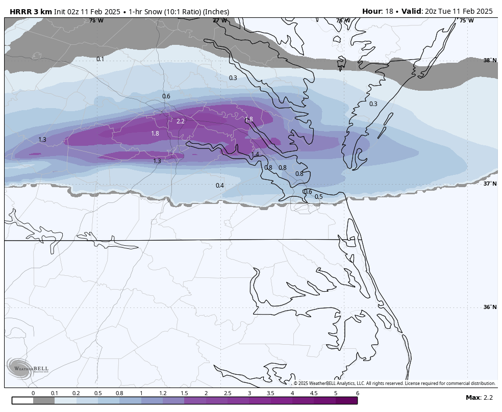
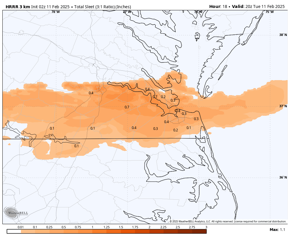
This run only goes out 18 hours, but the the latest HRRR still suggest 1-2" per hour rates (10:1 ratio) starting at about 1pm, @wasnow215. Surface temps during that time hovering just above freezing unfortunately cuts down on ratios.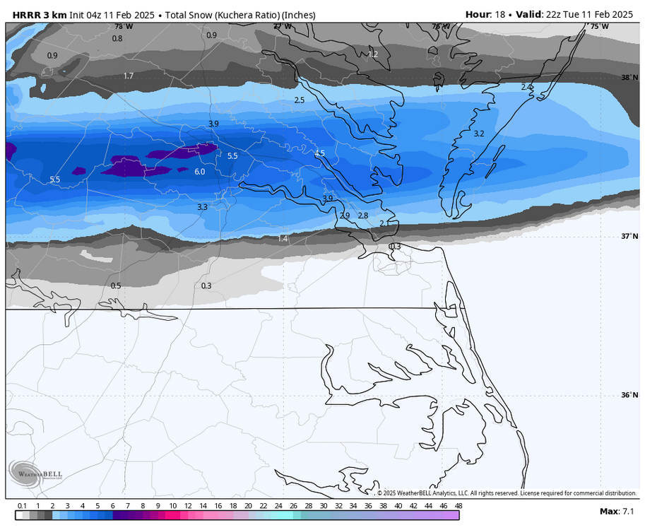


-
Richmond Metro/Hampton Roads Area Discussion
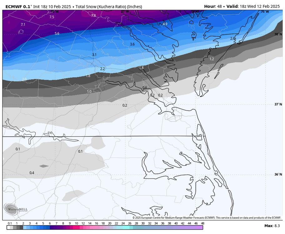
RIC Airport replied to RIC Airport's topic in Mid Atlantic
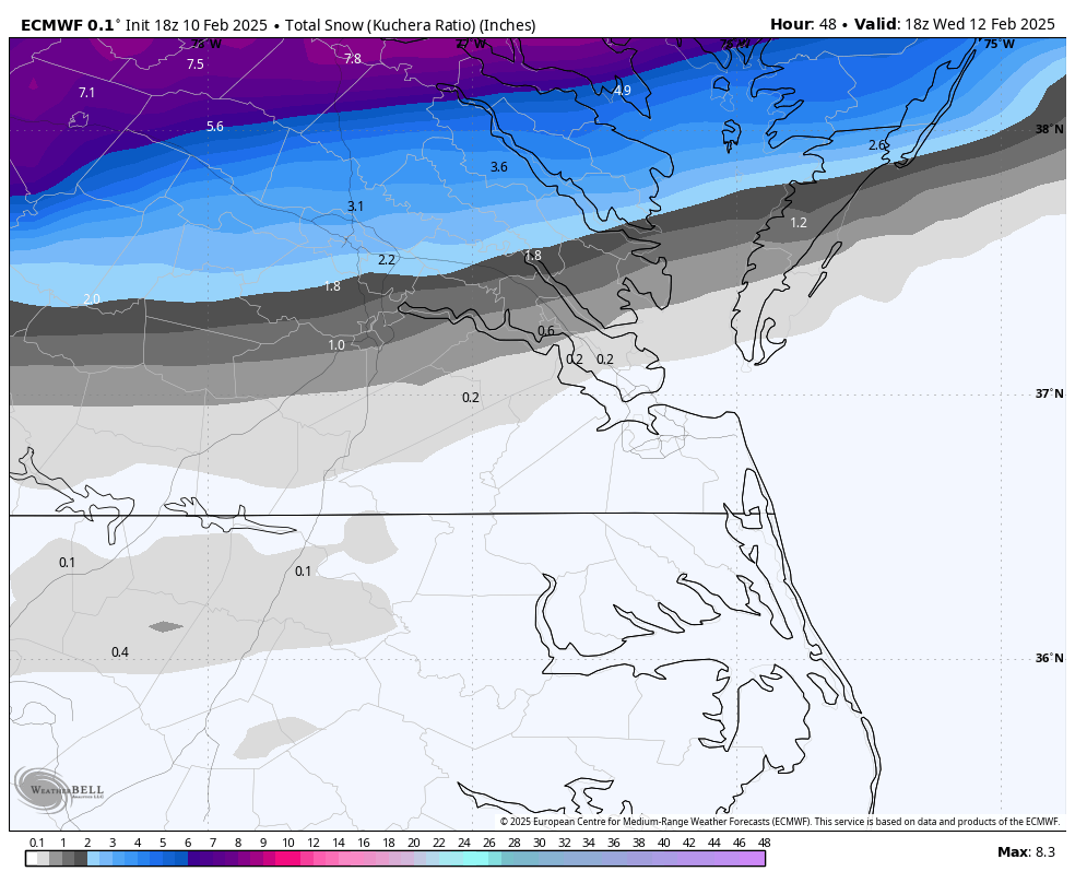
Here is the 00z Euro, there was actually an uptick for RIC from the 18z and 12z runs..thumb.png.f83122ac670ee1ef608b457d559f1605.png)
-
Richmond Metro/Hampton Roads Area Discussion
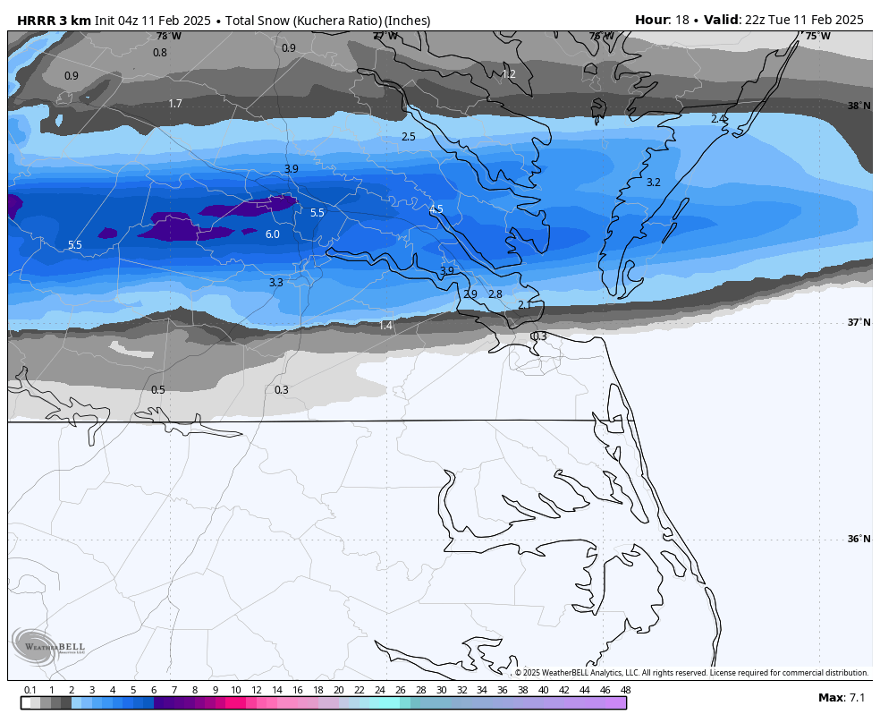
RIC Airport replied to RIC Airport's topic in Mid Atlantic
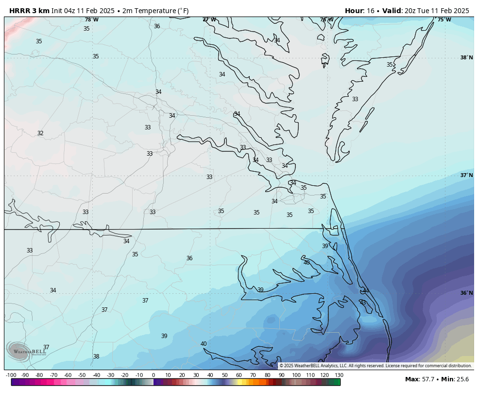
The latest HRRR, which runs every hour, has some intense rates around RIC between 1-3pm tomorrow, but it only has surface temps of about 33-34 degrees. This is only thru 3pm.

-
Richmond Metro/Hampton Roads Area Discussion
RIC Airport replied to RIC Airport's topic in Mid Atlantic
RIC is at 34°F at 9pm. Most models had 29-30 for the low. The colder the better I'd say. But as clouds roll in, temps should stabilize or even rise a bit. 3K NAM was better for the front end, but still shows a transition to a mix. How soon that happens is key to accumulations. -
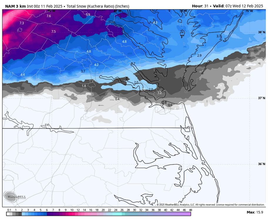
Richmond Metro/Hampton Roads Area Discussion
RIC Airport replied to RIC Airport's topic in Mid Atlantic
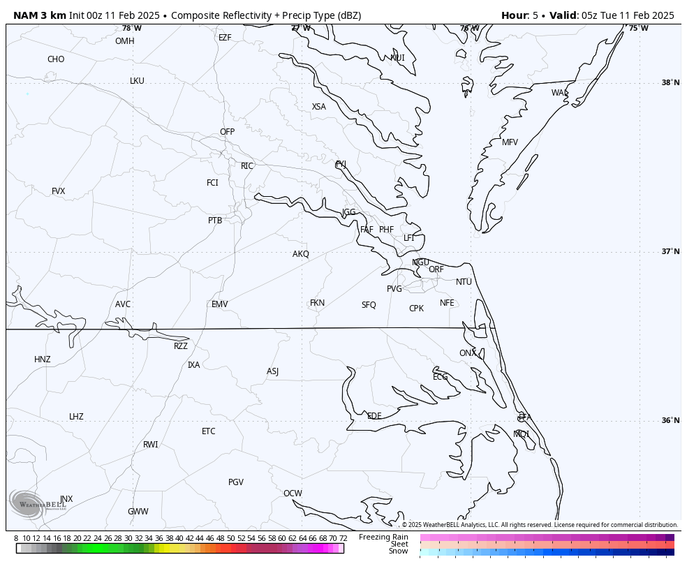
00z 3K NAM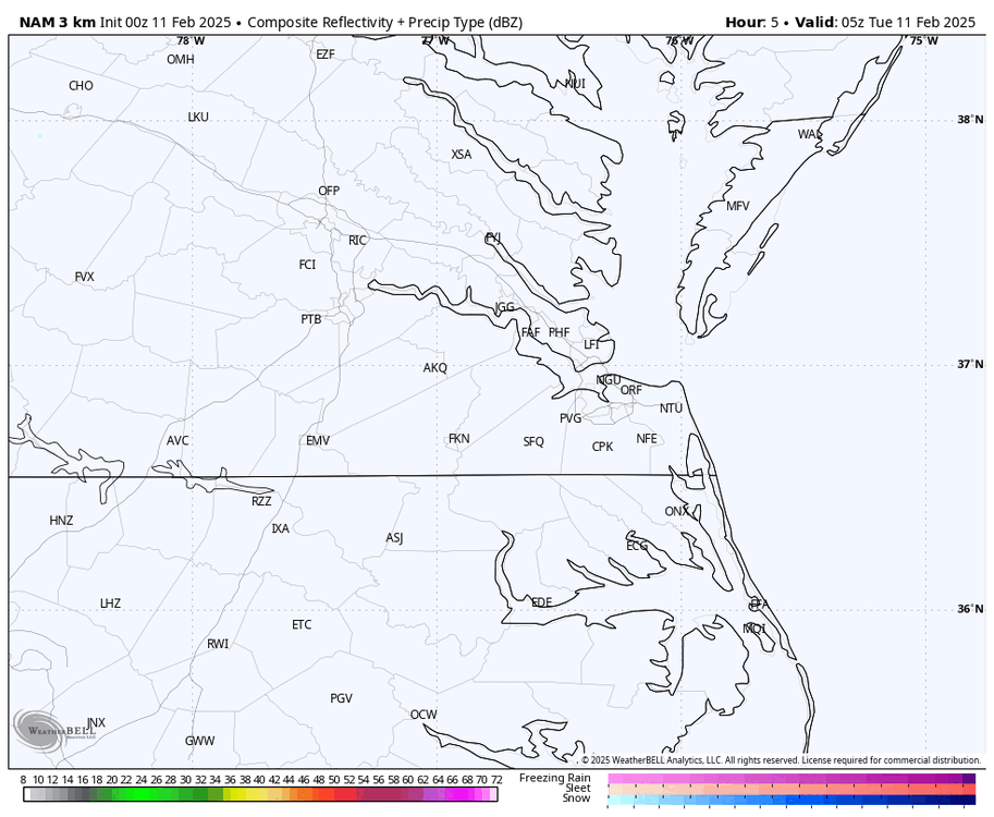
-
Richmond Metro/Hampton Roads Area Discussion
RIC Airport replied to RIC Airport's topic in Mid Atlantic
-
Richmond Metro/Hampton Roads Area Discussion
RIC Airport replied to RIC Airport's topic in Mid Atlantic
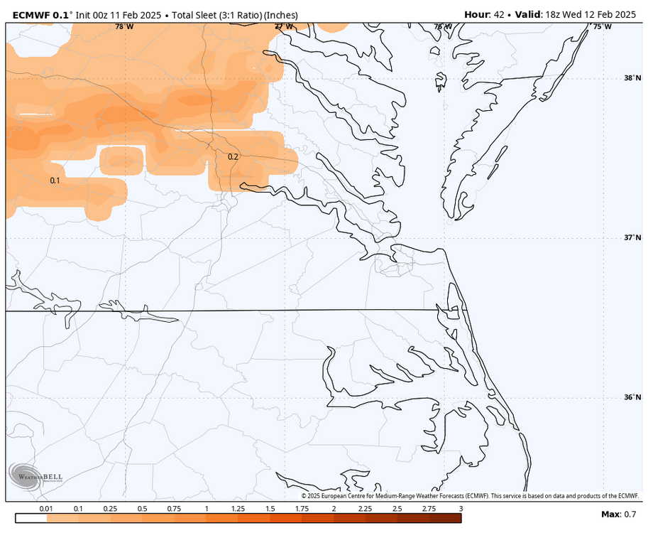
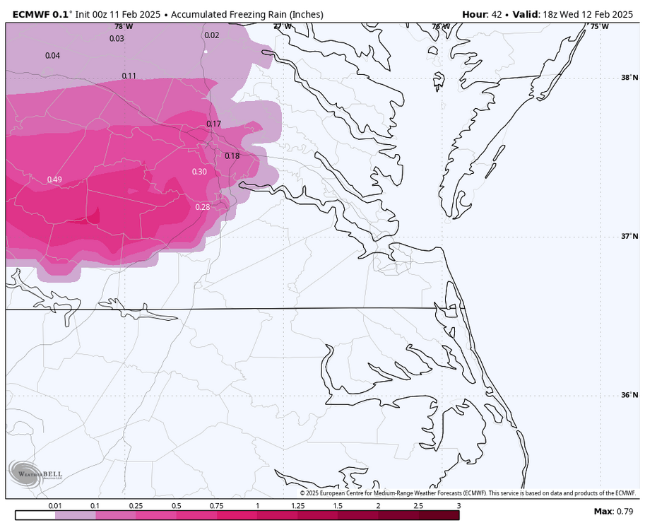
Agreed. Very worried about mixing. Your 1.7" at RIC may be more realistic. Obviously north and west will get colder but that may not translate as much at 850mb unless you're north of I-295 toward Ashland. -
Richmond Metro/Hampton Roads Area Discussion
RIC Airport replied to RIC Airport's topic in Mid Atlantic
GRAF model https://x.com/MikeTFox5/status/1889088318907805707?t=fHfVuSIJemjg5ptqxA-eUg&s=19 -
Richmond Metro/Hampton Roads Area Discussion
RIC Airport replied to RIC Airport's topic in Mid Atlantic
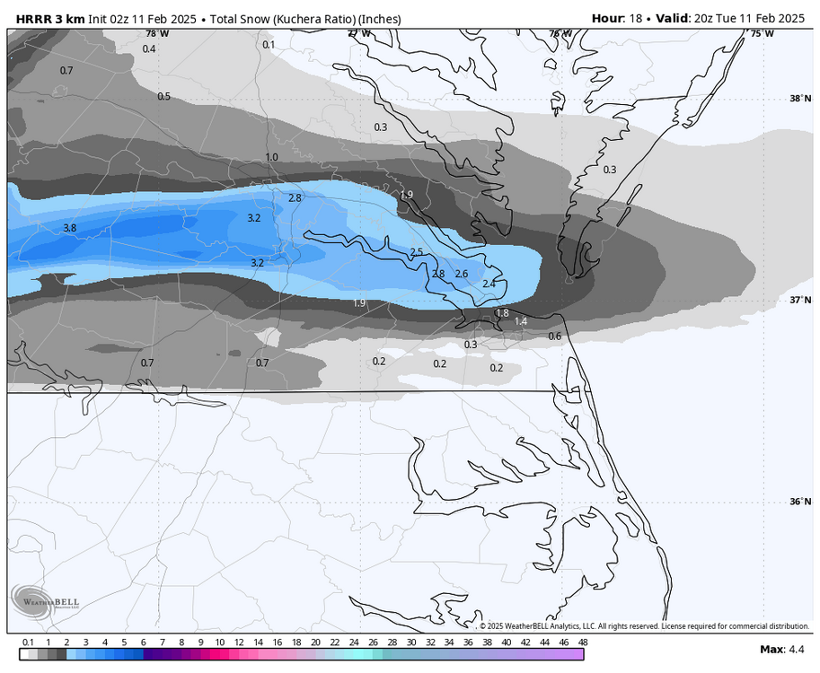
KRIC: 2.3" -
Richmond Metro/Hampton Roads Area Discussion
RIC Airport replied to RIC Airport's topic in Mid Atlantic
-
Richmond Metro/Hampton Roads Area Discussion
RIC Airport replied to RIC Airport's topic in Mid Atlantic
.png.2e09351b8c83d26e4882261ab444ee3a.png)
-
Richmond Metro/Hampton Roads Area Discussion
RIC Airport replied to RIC Airport's topic in Mid Atlantic
.thumb.png.960d5e2b682274327498817cb046e09c.png)
-
Richmond Metro/Hampton Roads Area Discussion
RIC Airport replied to RIC Airport's topic in Mid Atlantic
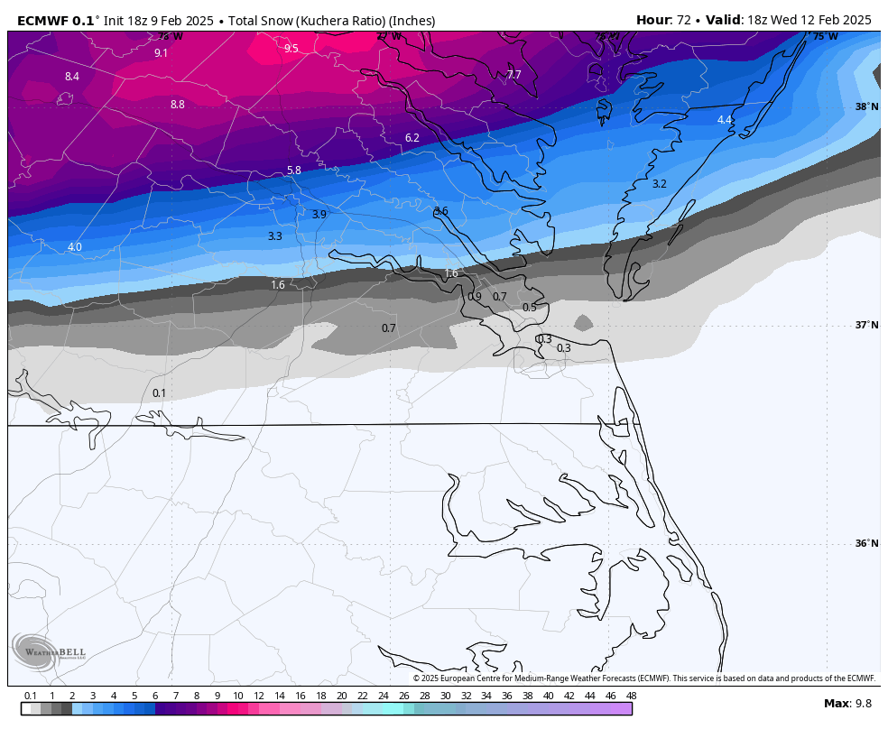
I'm headed up to NYC tomorrow and will enjoy the 1-2" I see from this. I may browse, but may not post much tomorrow. I think the Euro is more right for RIC, I would be concerned about mixing so those totals could be cut in half..thumb.png.38fd6ad3a84a65ca4443fc809a462de8.png)
-
Richmond Metro/Hampton Roads Area Discussion
RIC Airport replied to RIC Airport's topic in Mid Atlantic
00z GFS is about 20-25 miles north with axis of the heaviest hand.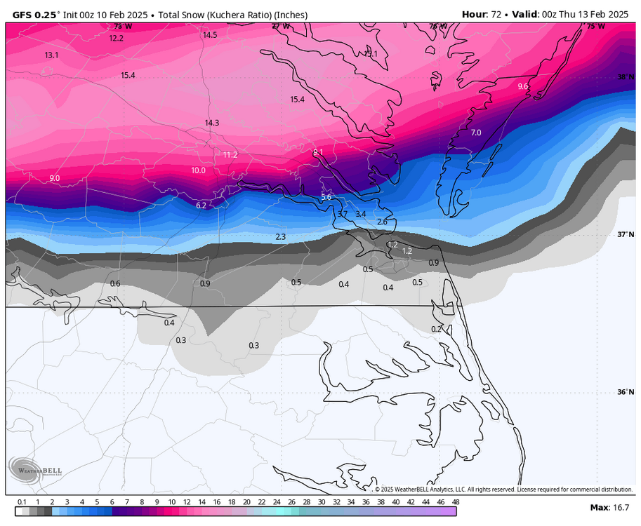
-
Richmond Metro/Hampton Roads Area Discussion
RIC Airport replied to RIC Airport's topic in Mid Atlantic
Yes, there is a little feature arriving early tomorrow morning that's been on and off the models for a 2-3 days now. GFS has been the most bullish with it. -
Richmond Metro/Hampton Roads Area Discussion
RIC Airport replied to RIC Airport's topic in Mid Atlantic
It's basically the same as 12z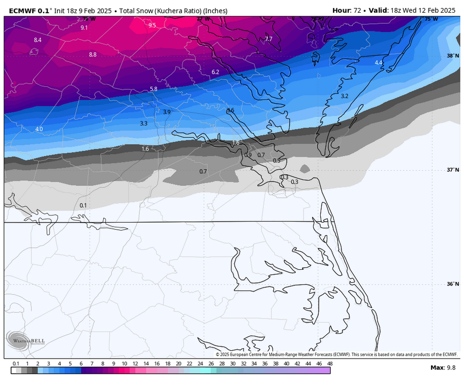
-
Richmond Metro/Hampton Roads Area Discussion
RIC Airport replied to RIC Airport's topic in Mid Atlantic
What is your call? -
Richmond Metro/Hampton Roads Area Discussion
RIC Airport replied to RIC Airport's topic in Mid Atlantic
I should also point out that once RIC hits freezing at 5pm, it stays at 32°F until about 1pm Wednesday. -
Richmond Metro/Hampton Roads Area Discussion
RIC Airport replied to RIC Airport's topic in Mid Atlantic
18z GFS had a slightly earlier arrival. And yes, the surface temps are a few degrees colder because of that, which I alluded to earlier that an earlier arrival would be ideal to keep temps from rising too much Tuesday morning. 18Z GFS has RIC at 33°F when precip arrives around 7-8 am. The 12Z run had temps 36-38°F when the precip arrived around 9-10 am. Nonetheless, looking at the hourly temps, the 18z GFS doesn't have RIC hitting 32°F until around 5 pm. But that doesn't mean it may not hit 32 intrahour under heavy rates. The best rates are from about 10am to 7pm with 1pm to 4pm being the peak. So ratios won't be 10:1 if this is correct.
-
Richmond Metro/Hampton Roads Area Discussion
RIC Airport replied to RIC Airport's topic in Mid Atlantic

-
Richmond Metro/Hampton Roads Area Discussion
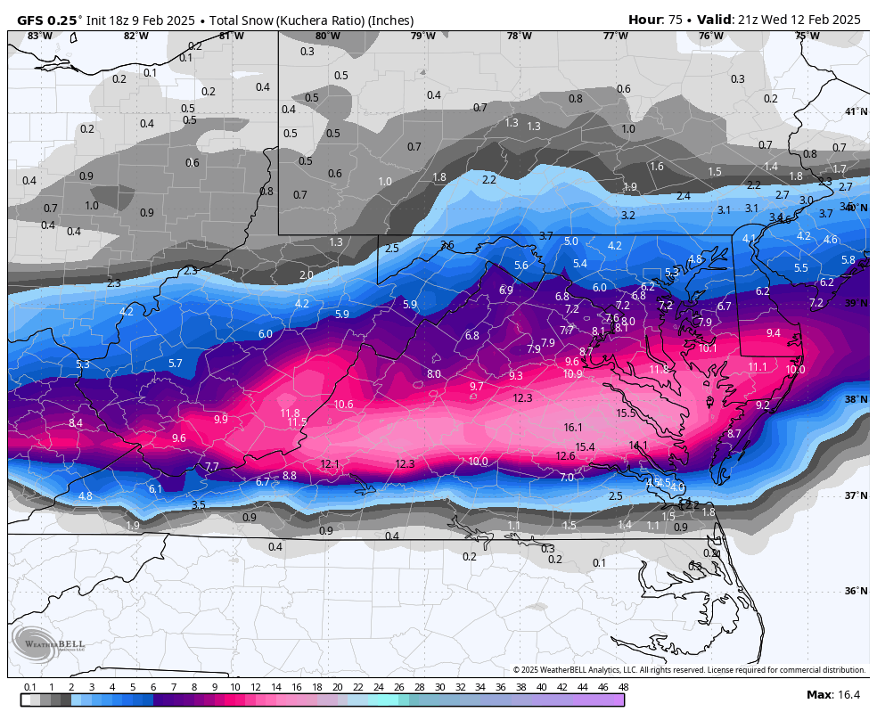
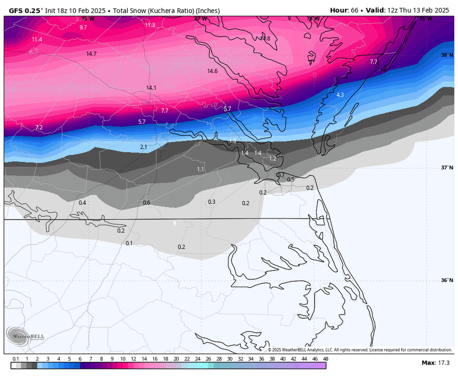
RIC Airport replied to RIC Airport's topic in Mid Atlantic
GFS not backing down -
Richmond Metro/Hampton Roads Area Discussion
RIC Airport replied to RIC Airport's topic in Mid Atlantic
GFS is starting soon, so we'll see if it holds.


.png.5bf720feaaa20e8efcf25e2ec0816ddf.png)


.png.7429a131784c1cf4102f460fbff4fac9.png)
.png.c9d56d4e0738ad2a1ec62cbd2bd53666.png)