RIC Airport
-
Posts
2,586 -
Joined
-
Last visited
Content Type
Profiles
Blogs
Forums
American Weather
Media Demo
Store
Gallery
Everything posted by RIC Airport
-
Richmond Metro/Hampton Roads Area Discussion
RIC Airport replied to RIC Airport's topic in Mid Atlantic

-
Richmond Metro/Hampton Roads Area Discussion
RIC Airport replied to RIC Airport's topic in Mid Atlantic
Looks like they just came in, making a gif. -
Richmond Metro/Hampton Roads Area Discussion
RIC Airport replied to RIC Airport's topic in Mid Atlantic
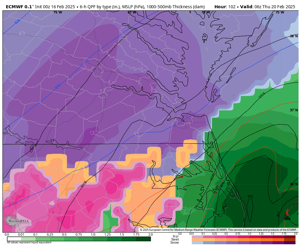
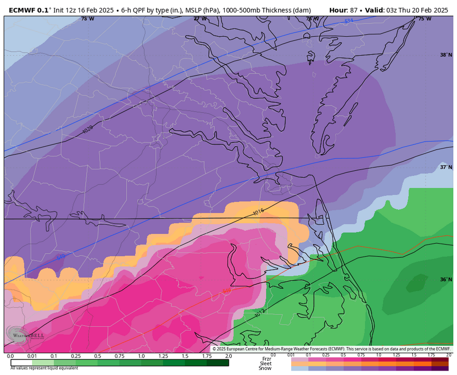
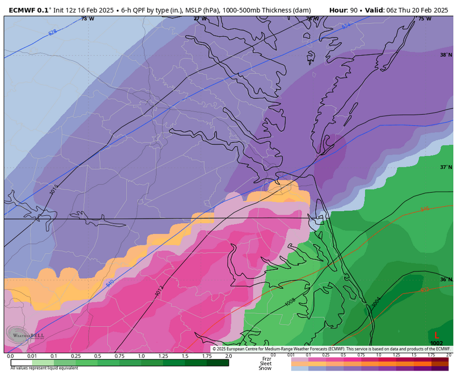
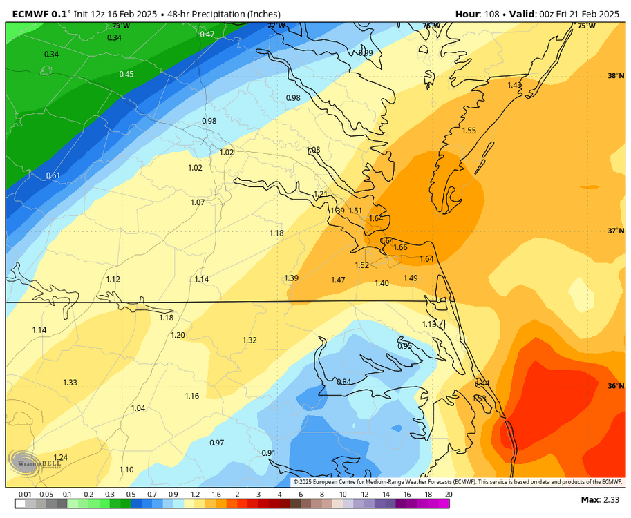
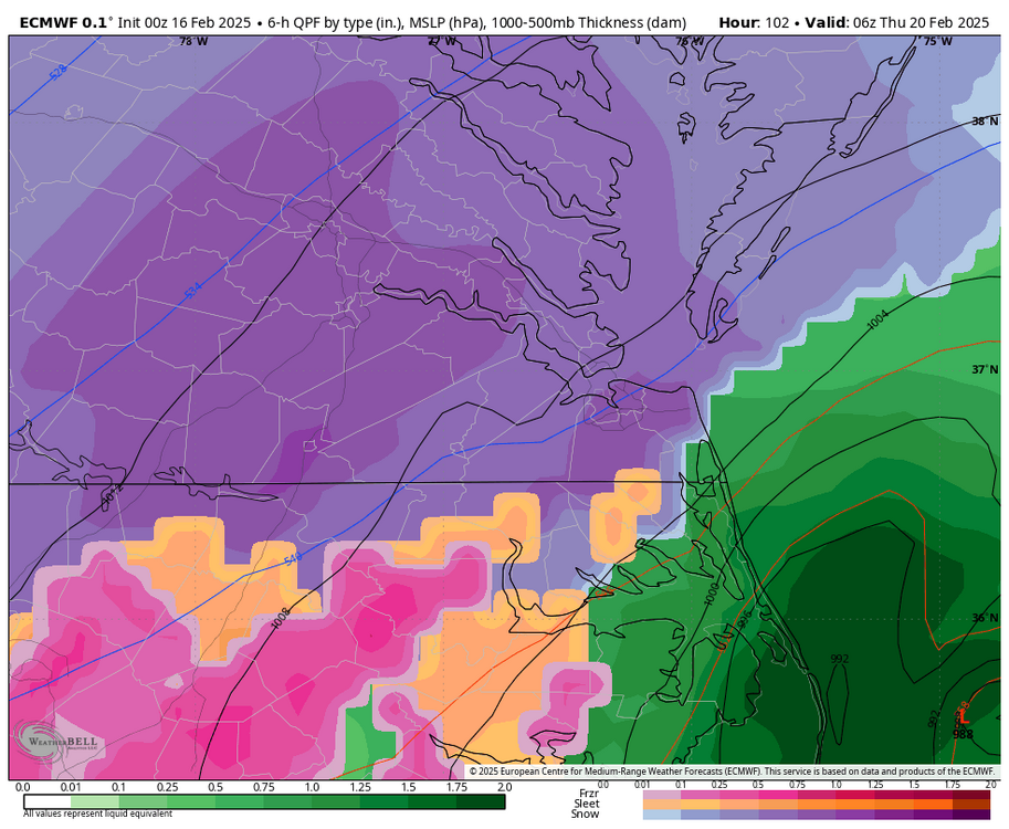
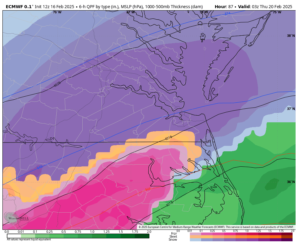
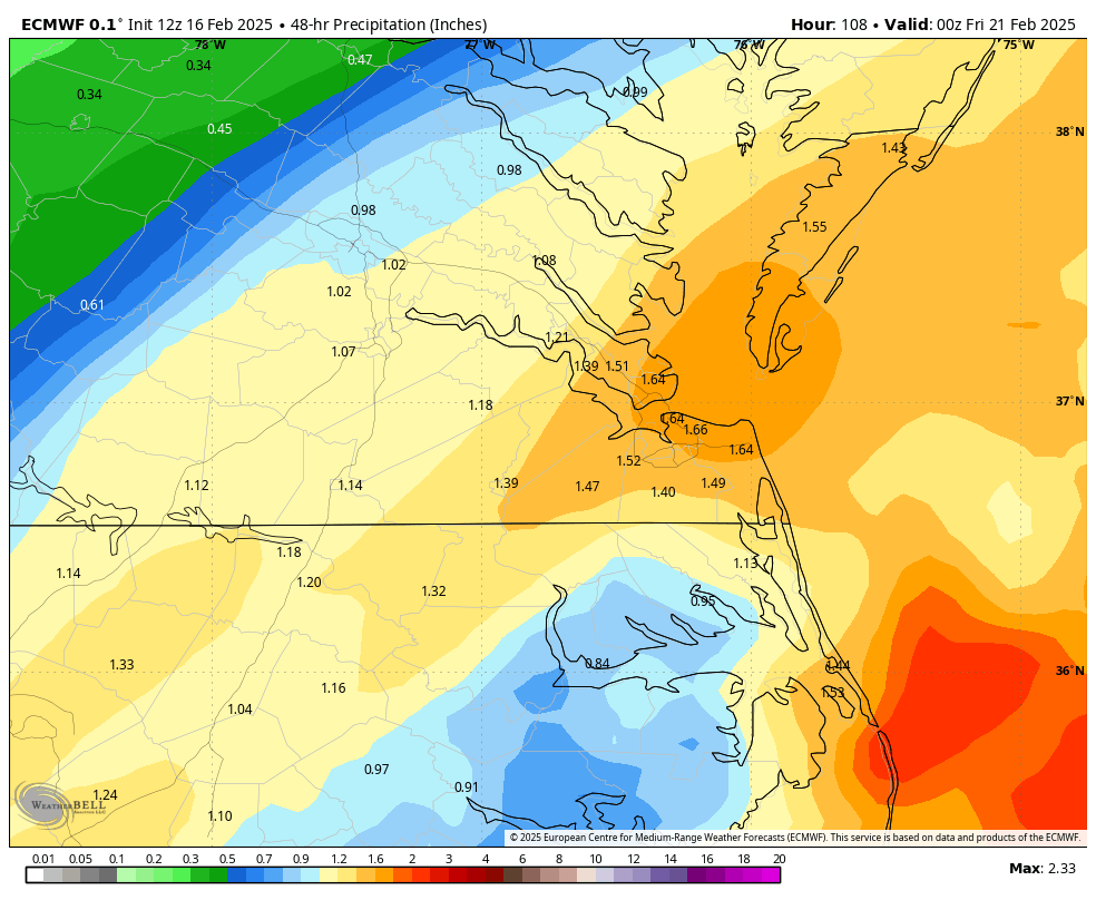
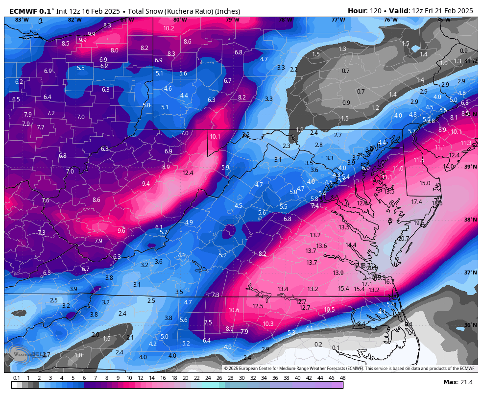
I'm specifically referring to the 6hr precip panels. Snow maps already posted. -
Richmond Metro/Hampton Roads Area Discussion
RIC Airport replied to RIC Airport's topic in Mid Atlantic
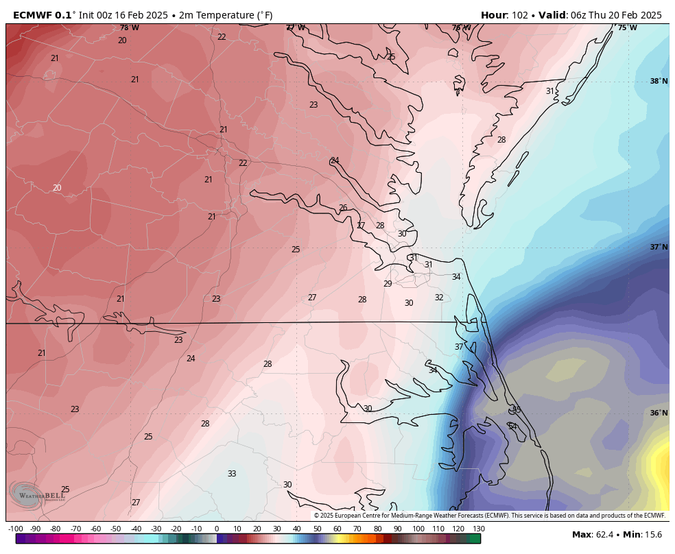
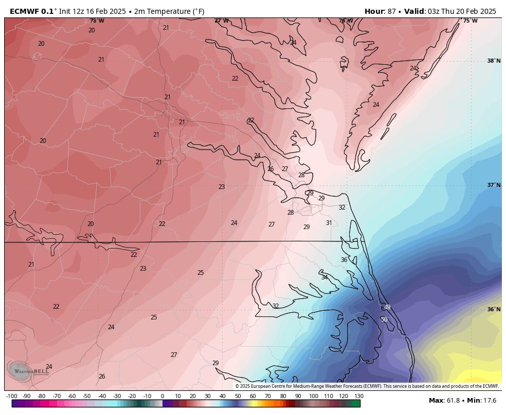
@jlewis1111Somehow the snow maps are finished through hour 360, but for everything else, the Euro on wxbell seems to be stuck around hour 51, so I can't see all the panels. Might have to go on other sites to see whether there is any mixing in Hampton Roads or how close it gets. -
Richmond Metro/Hampton Roads Area Discussion
RIC Airport replied to RIC Airport's topic in Mid Atlantic
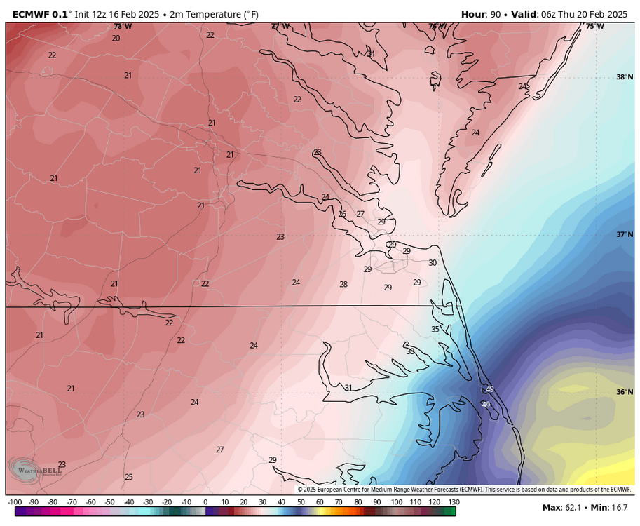
Still looking at a mid/late Wednesday morning arrival. Ending about the same time Thursday. -
Richmond Metro/Hampton Roads Area Discussion
RIC Airport replied to RIC Airport's topic in Mid Atlantic
Might have to increase my totals for Hampton Roads, lol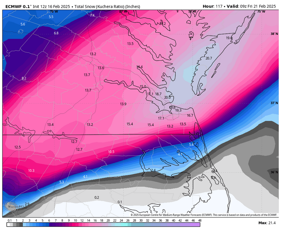
-
Richmond Metro/Hampton Roads Area Discussion
RIC Airport replied to RIC Airport's topic in Mid Atlantic
-
Richmond Metro/Hampton Roads Area Discussion
RIC Airport replied to RIC Airport's topic in Mid Atlantic

-
Richmond Metro/Hampton Roads Area Discussion
RIC Airport replied to RIC Airport's topic in Mid Atlantic
Hopeful -
Richmond Metro/Hampton Roads Area Discussion
RIC Airport replied to RIC Airport's topic in Mid Atlantic
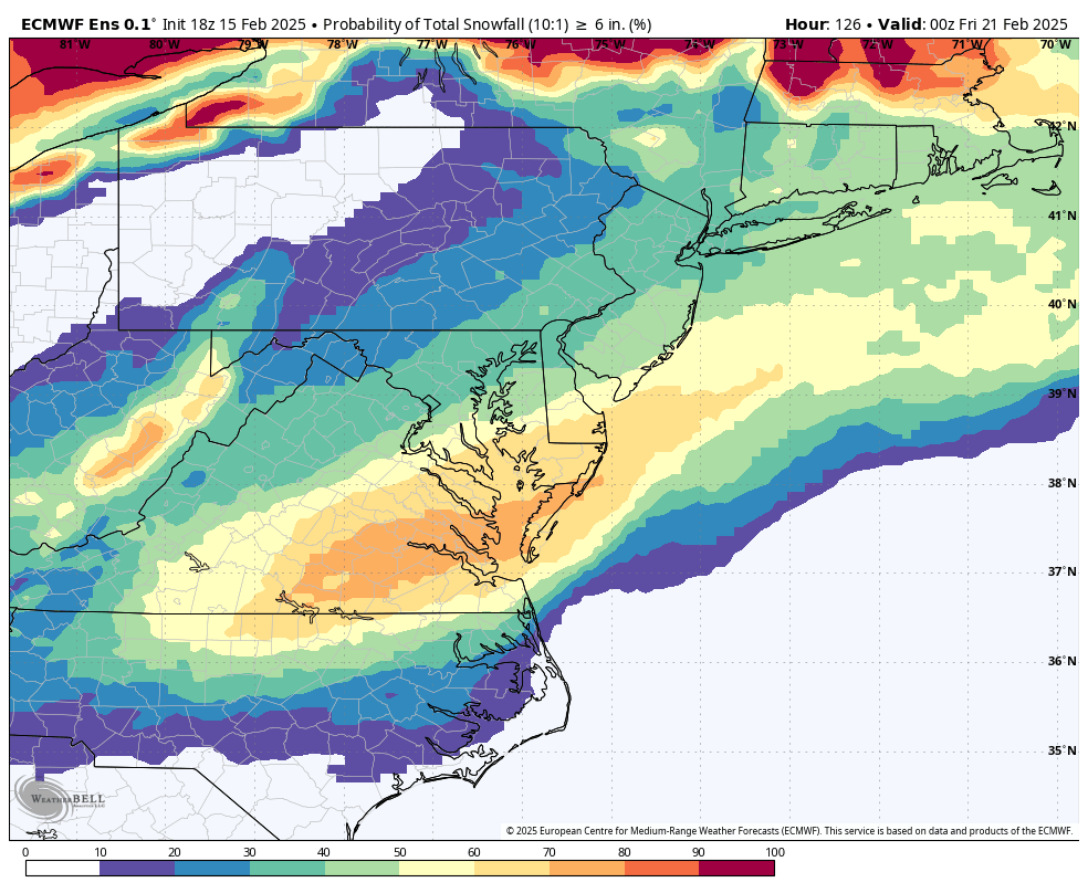
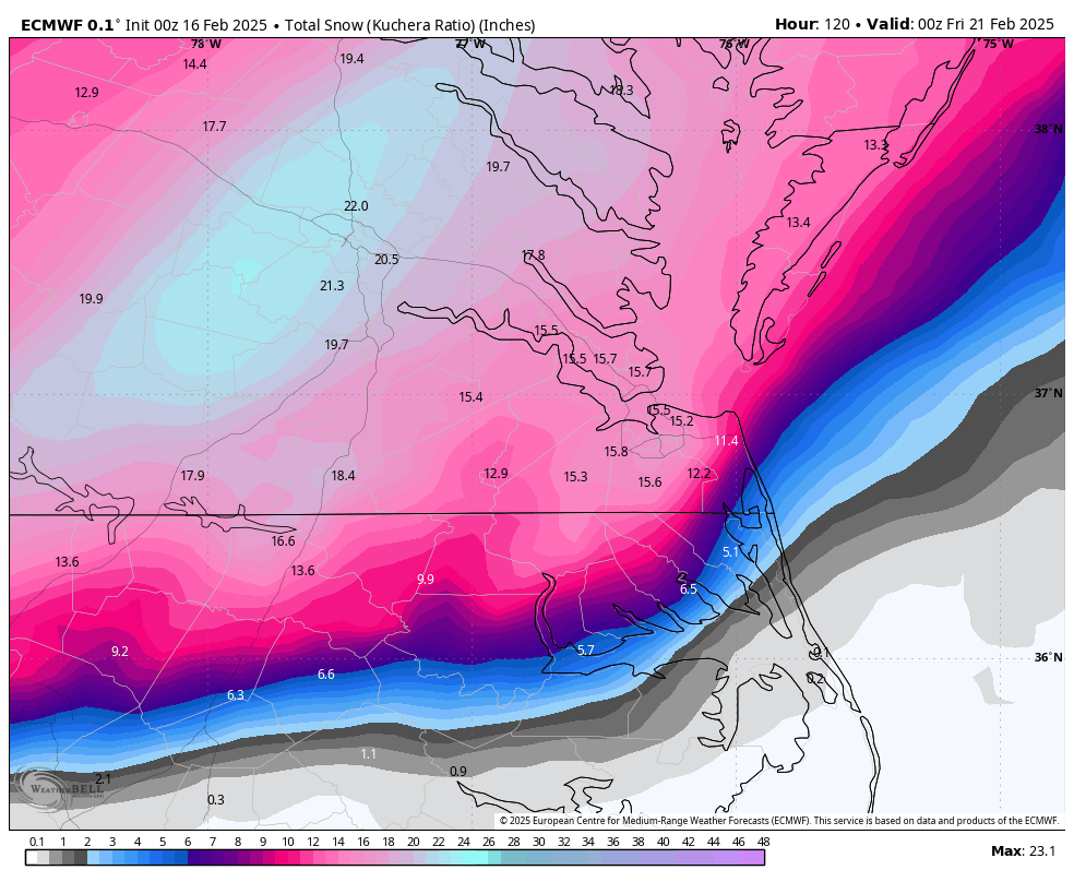
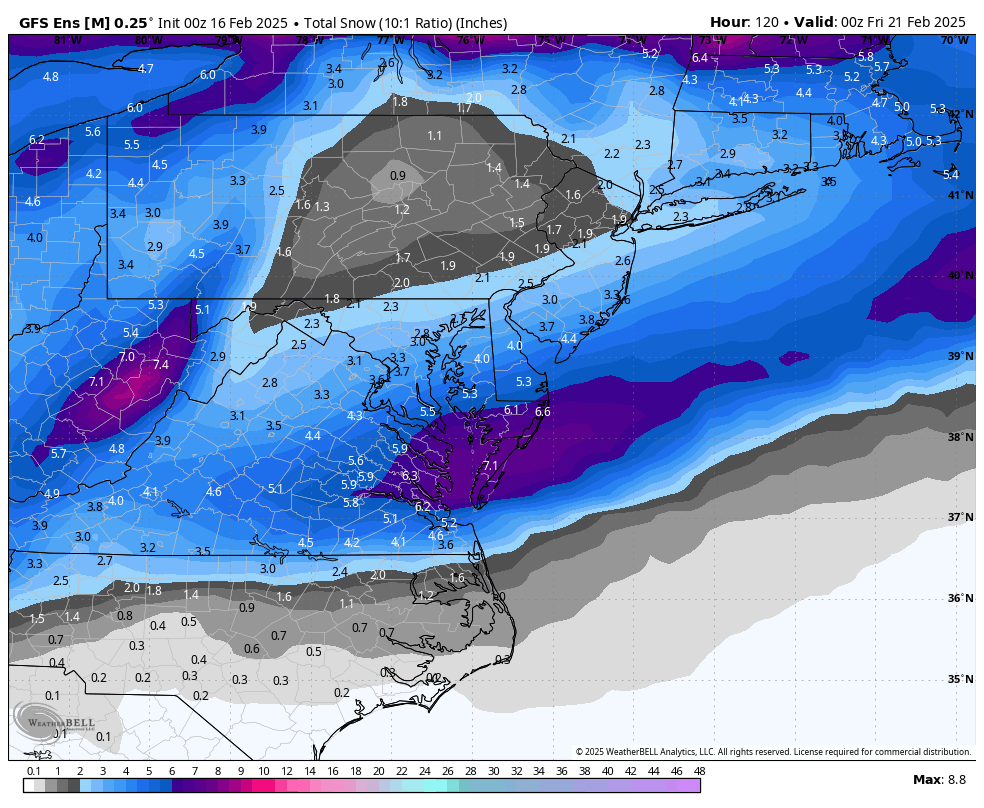
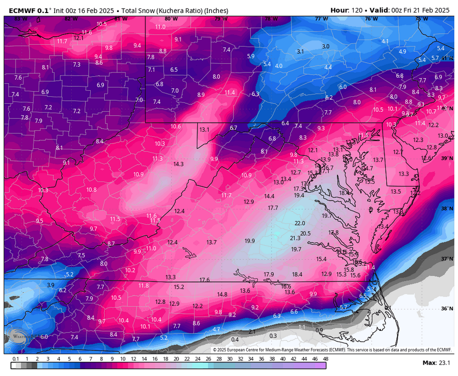
6-10" for RVA Metro 4-8" Peninsula/Interior SE VA 3-6" Southside Although the Euro has fluctuated with this one, I'm also hugging it because I feel it's been the most consistent, even with other storms this year. -
Richmond Metro/Hampton Roads Area Discussion
RIC Airport replied to RIC Airport's topic in Mid Atlantic
.thumb.png.f2fe98739a78a49978b3bbf3e8fa1ae6.png)
-
Richmond Metro/Hampton Roads Area Discussion
RIC Airport replied to RIC Airport's topic in Mid Atlantic

-
Richmond Metro/Hampton Roads Area Discussion
RIC Airport replied to RIC Airport's topic in Mid Atlantic

-
Richmond Metro/Hampton Roads Area Discussion
RIC Airport replied to RIC Airport's topic in Mid Atlantic
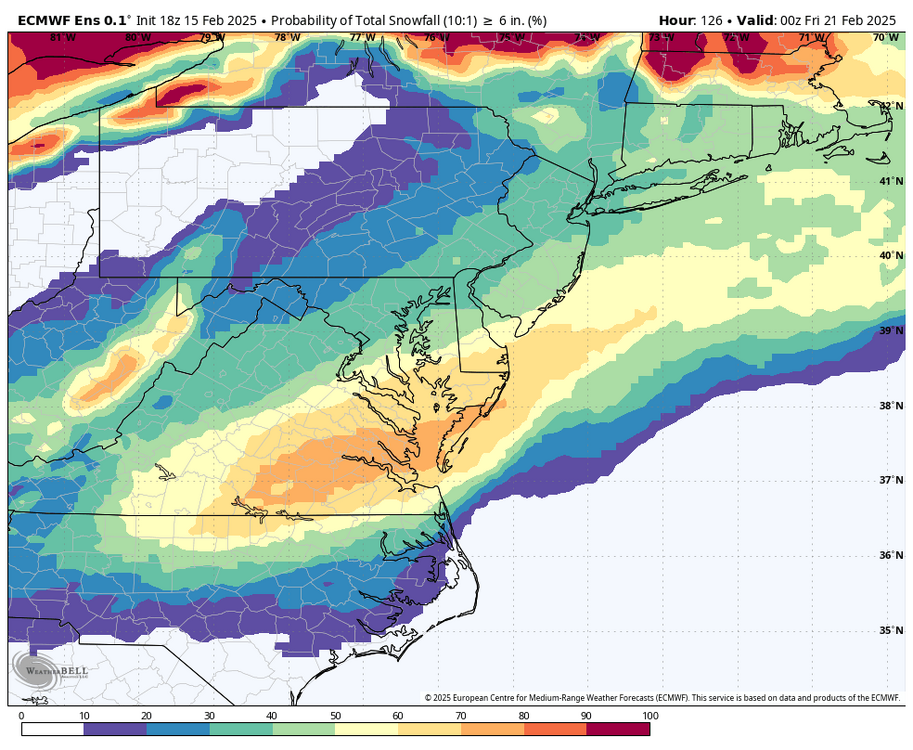
EPS already an uptick since 18z. -
Richmond Metro/Hampton Roads Area Discussion
RIC Airport replied to RIC Airport's topic in Mid Atlantic
Looking roughly like 8-10am Wednesday to 8-10am Thursday. -
Richmond Metro/Hampton Roads Area Discussion
RIC Airport replied to RIC Airport's topic in Mid Atlantic


-
Richmond Metro/Hampton Roads Area Discussion
RIC Airport replied to RIC Airport's topic in Mid Atlantic
Here's a closer view.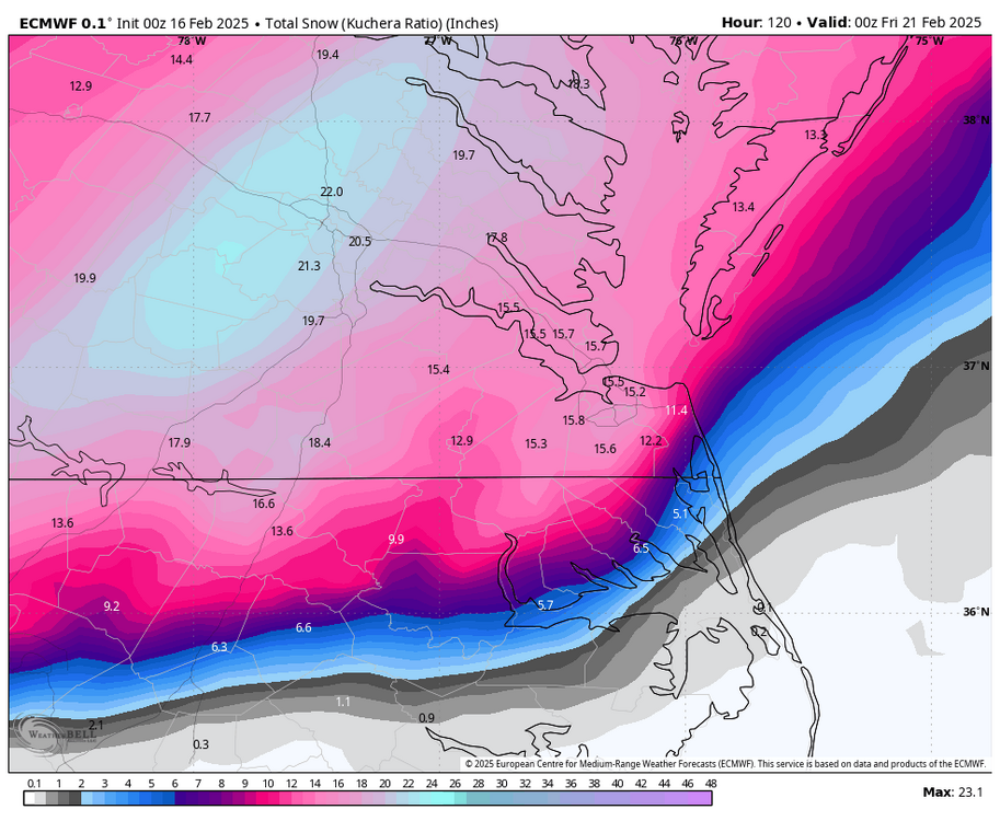
-
Richmond Metro/Hampton Roads Area Discussion
RIC Airport replied to RIC Airport's topic in Mid Atlantic
Time to go to sleep! -
Richmond Metro/Hampton Roads Area Discussion
RIC Airport replied to RIC Airport's topic in Mid Atlantic
-
Richmond Metro/Hampton Roads Area Discussion
RIC Airport replied to RIC Airport's topic in Mid Atlantic

-
Richmond Metro/Hampton Roads Area Discussion
RIC Airport replied to RIC Airport's topic in Mid Atlantic
Looks like a solid hit for Hampton Roads. -
Richmond Metro/Hampton Roads Area Discussion
RIC Airport replied to RIC Airport's topic in Mid Atlantic
Those were huge events from ORF and up the Delmarva. I think ORF got 14-15" from the 12/26/2010 storm. That was my study in college, but somehow got into logistics and supply chain. Then got a MBA because I still had no idea what I wanted to do. -
Richmond Metro/Hampton Roads Area Discussion
RIC Airport replied to RIC Airport's topic in Mid Atlantic
How much did you get from the January 2022 and January 2018 coastal blizzard? -
Richmond Metro/Hampton Roads Area Discussion
RIC Airport replied to RIC Airport's topic in Mid Atlantic
I'm moving to Chicago the end of next month. Thread members need to nominate a new leader for next winter. -
Richmond Metro/Hampton Roads Area Discussion
RIC Airport replied to RIC Airport's topic in Mid Atlantic
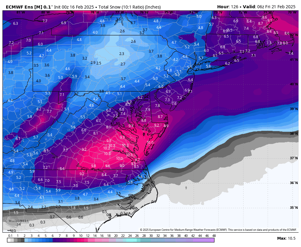
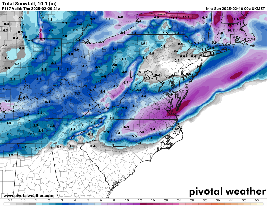
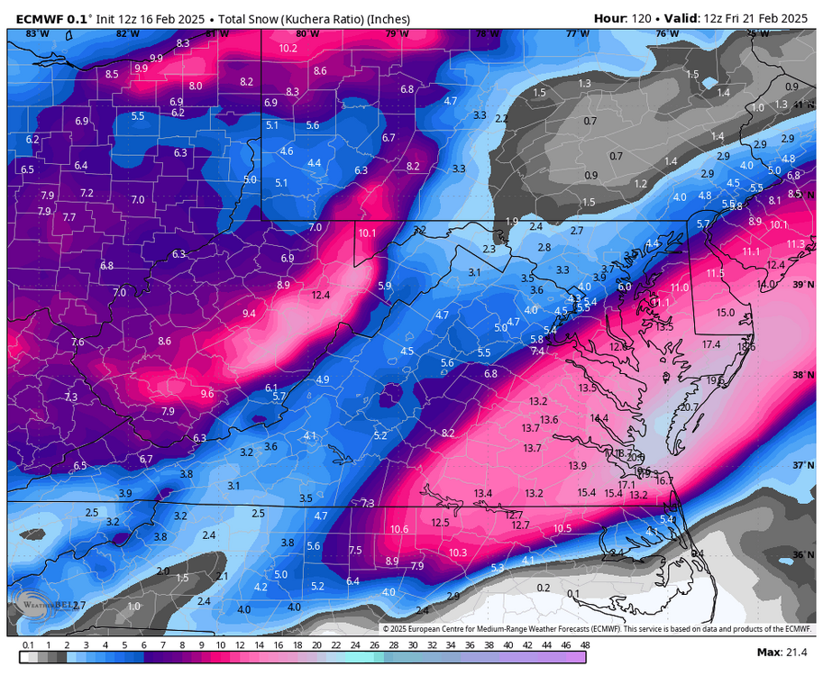
Thank you, @AlexD1990 Here is an updated map, @wasnow215. This should cover the entire event.


.png.5eb5ec0841359f91a9cbfa8d39a2665e.png)