RIC Airport
-
Posts
2,586 -
Joined
-
Last visited
Content Type
Profiles
Blogs
Forums
American Weather
Media Demo
Store
Gallery
Everything posted by RIC Airport
-
Richmond Metro/Hampton Roads Area Discussion
RIC Airport replied to RIC Airport's topic in Mid Atlantic
State of Emergency declared, too. -
Richmond Metro/Hampton Roads Area Discussion
RIC Airport replied to RIC Airport's topic in Mid Atlantic
If the long range GFS is right, we'll be going right back to tracking after this storm. Yes, March is a snow month, too.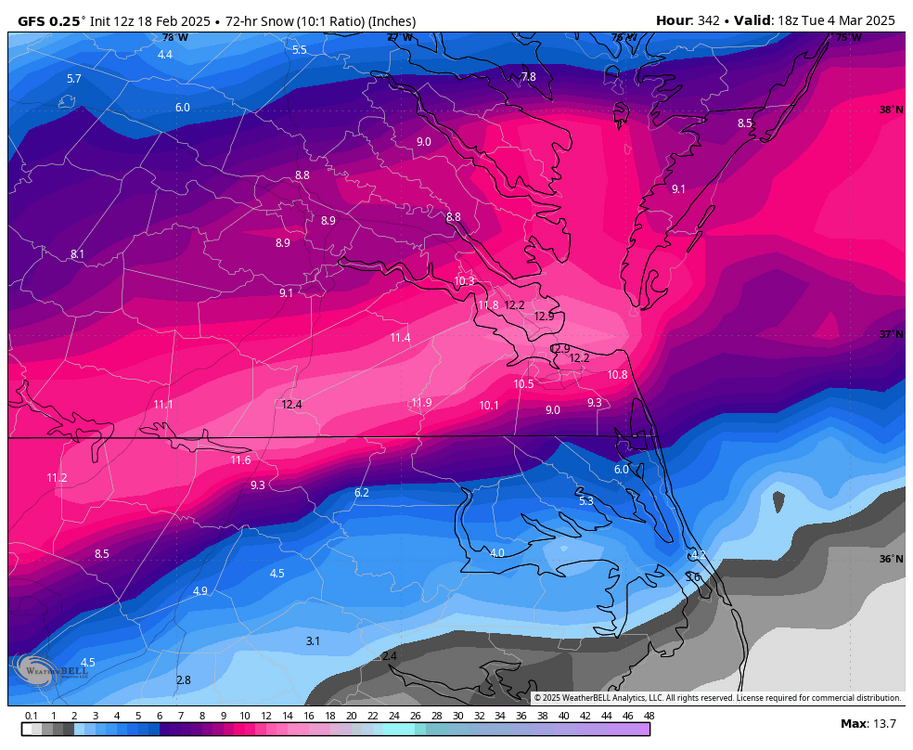
-
Richmond Metro/Hampton Roads Area Discussion
RIC Airport replied to RIC Airport's topic in Mid Atlantic
Very difficult to go against the King. -
Richmond Metro/Hampton Roads Area Discussion
RIC Airport replied to RIC Airport's topic in Mid Atlantic
-
Richmond Metro/Hampton Roads Area Discussion
RIC Airport replied to RIC Airport's topic in Mid Atlantic
Change # what?

-
Richmond Metro/Hampton Roads Area Discussion
RIC Airport replied to RIC Airport's topic in Mid Atlantic
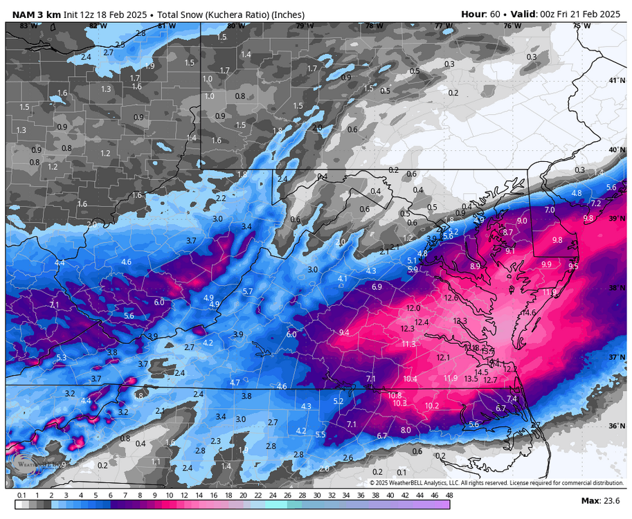
Final 3K NAM run, just amazing!!

-
Richmond Metro/Hampton Roads Area Discussion
RIC Airport replied to RIC Airport's topic in Mid Atlantic
1/25/2000 was a surprise, different set up. That formed off the GA/SC coast. -
Richmond Metro/Hampton Roads Area Discussion
RIC Airport replied to RIC Airport's topic in Mid Atlantic
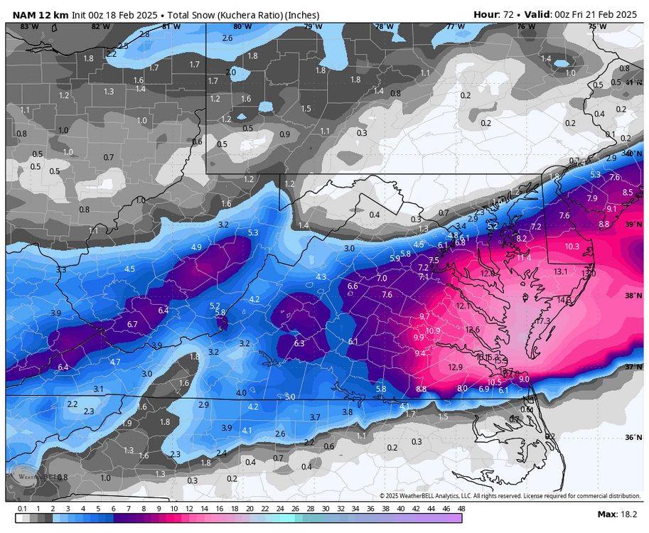
Can't imagine they won't after looking at the NAM. 12K is easily 10-12" around RIC 3k 7-9" so far -
Richmond Metro/Hampton Roads Area Discussion
RIC Airport replied to RIC Airport's topic in Mid Atlantic
should be a weenie run -
Richmond Metro/Hampton Roads Area Discussion
RIC Airport replied to RIC Airport's topic in Mid Atlantic
certainly juicier -
Richmond Metro/Hampton Roads Area Discussion
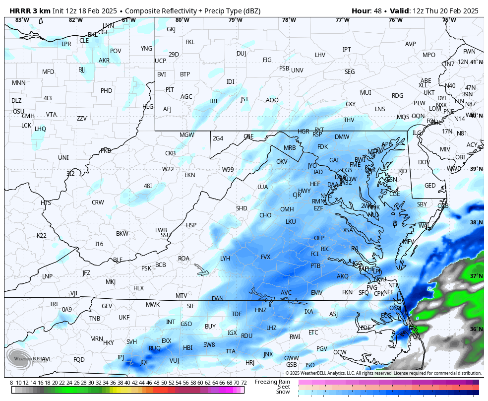
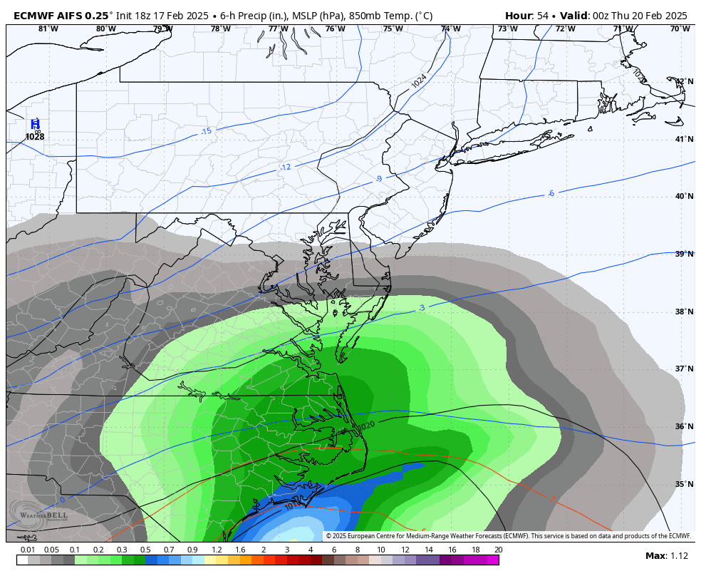
RIC Airport replied to RIC Airport's topic in Mid Atlantic
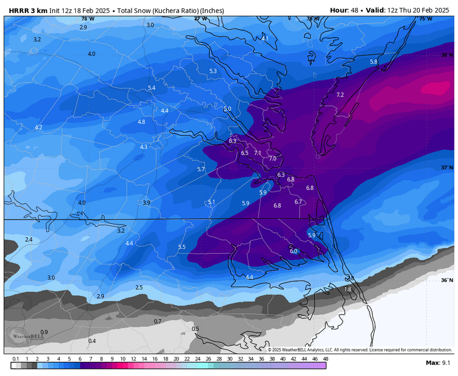
Broader view at hour 48


-
Richmond Metro/Hampton Roads Area Discussion
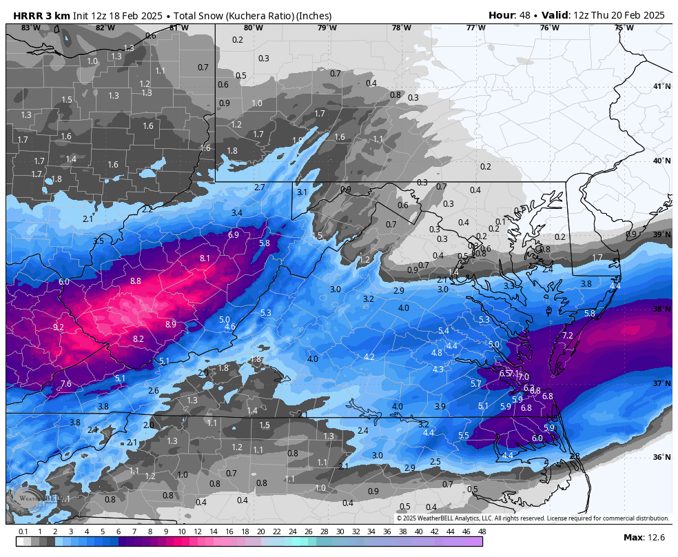
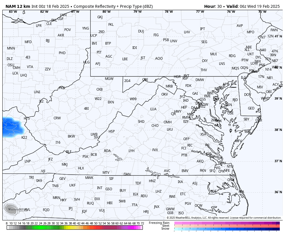
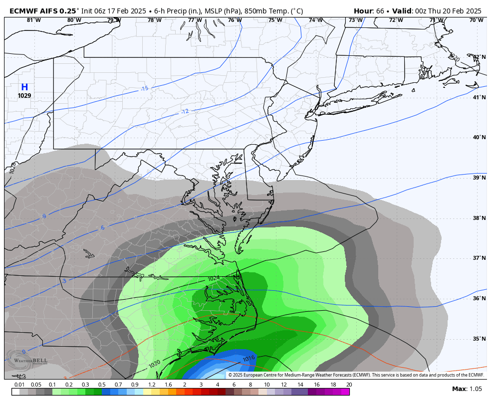
RIC Airport replied to RIC Airport's topic in Mid Atlantic
12Z HRRR thru hour 48. It's still snowing so the map isn't final, you can see that the ULL is rolling through C VA right as this is ending.
-
Richmond Metro/Hampton Roads Area Discussion
RIC Airport replied to RIC Airport's topic in Mid Atlantic
6z Euro AI model was west. Also the 12Z HRRR that's rolling in now, has a considerable increase in totals along the I-95 corridor in VA. -
Richmond Metro/Hampton Roads Area Discussion
RIC Airport replied to RIC Airport's topic in Mid Atlantic
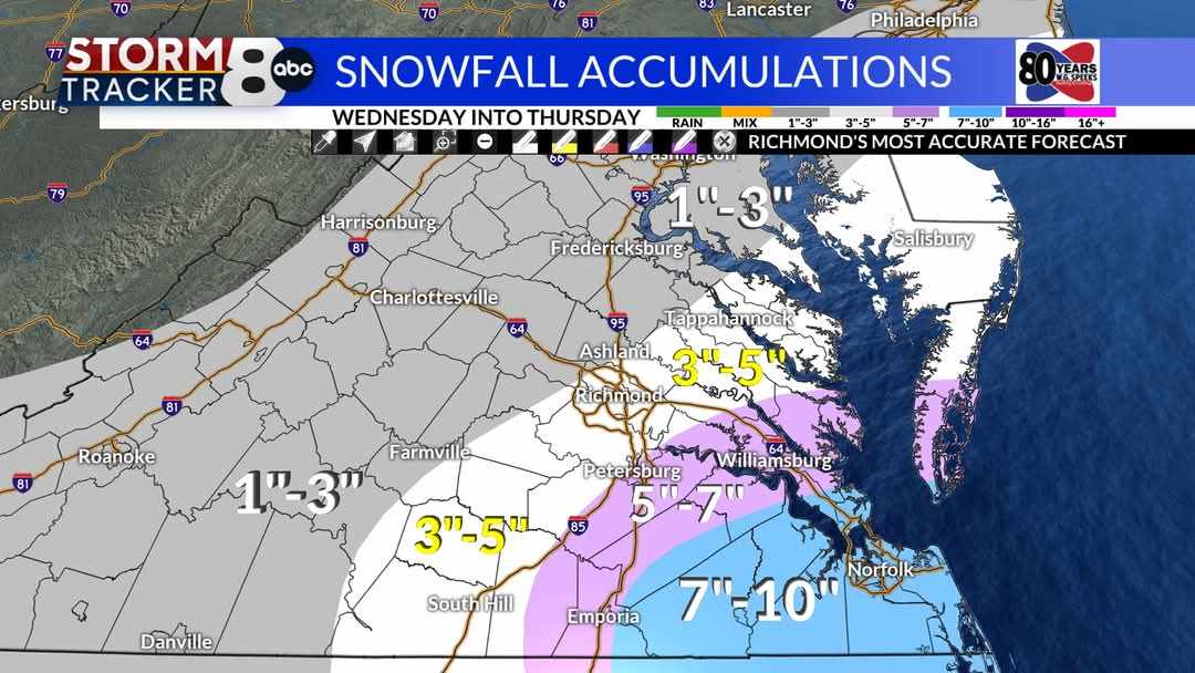
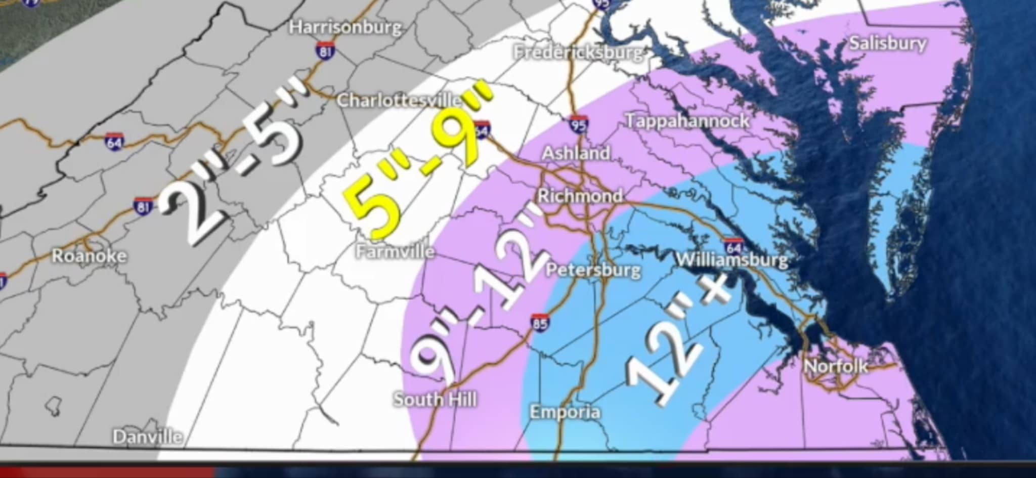
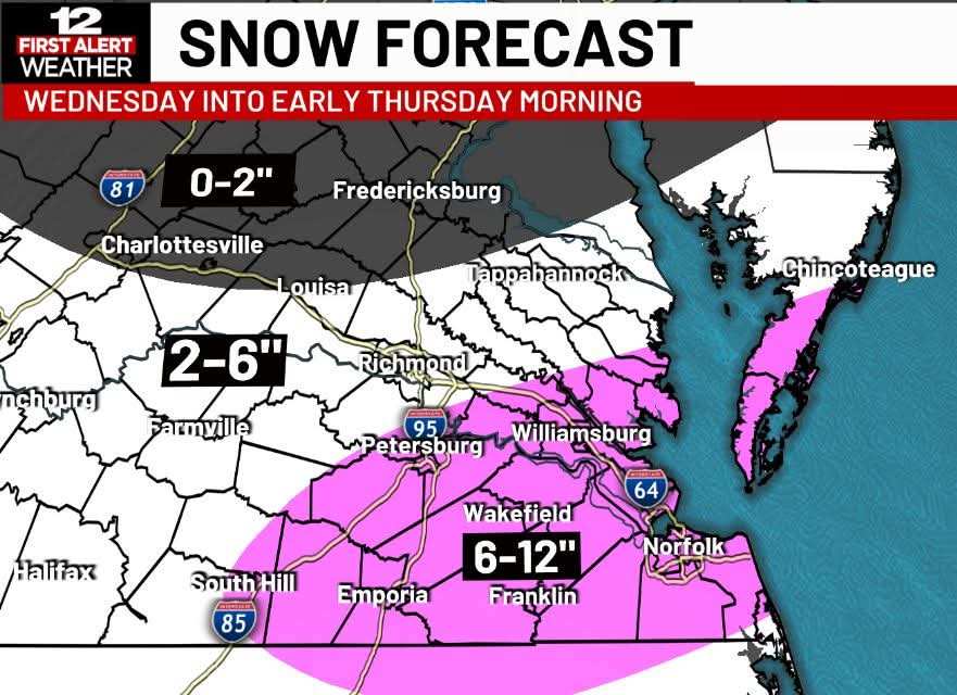
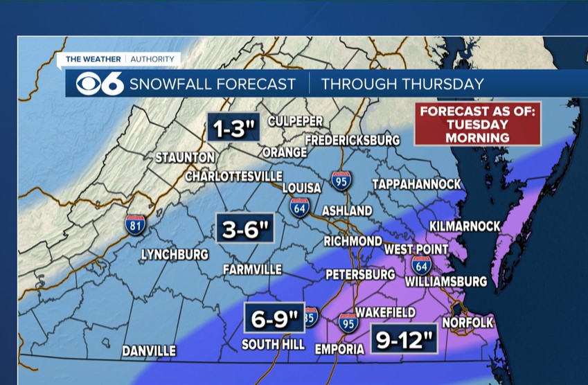
Latest maps from the Richmond stations, some downward adjustments from 8 and 12.
-
Richmond Metro/Hampton Roads Area Discussion
RIC Airport replied to RIC Airport's topic in Mid Atlantic
-
Richmond Metro/Hampton Roads Area Discussion
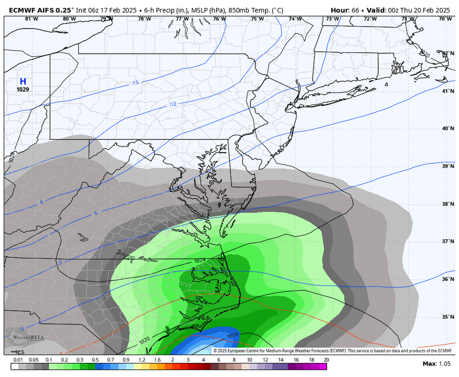
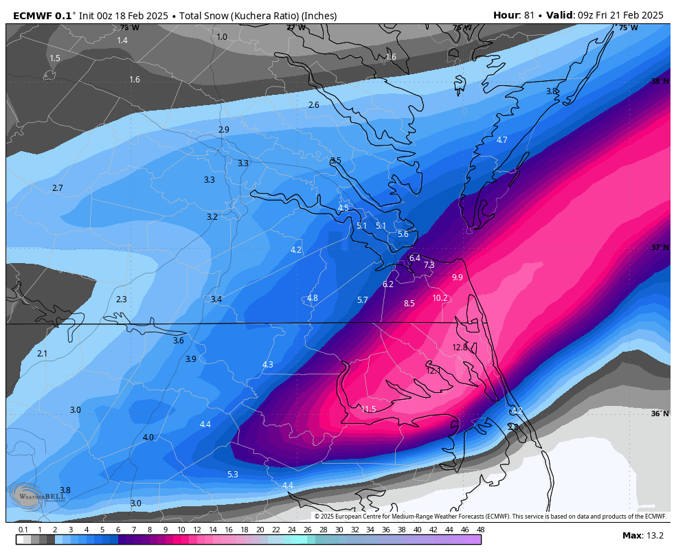
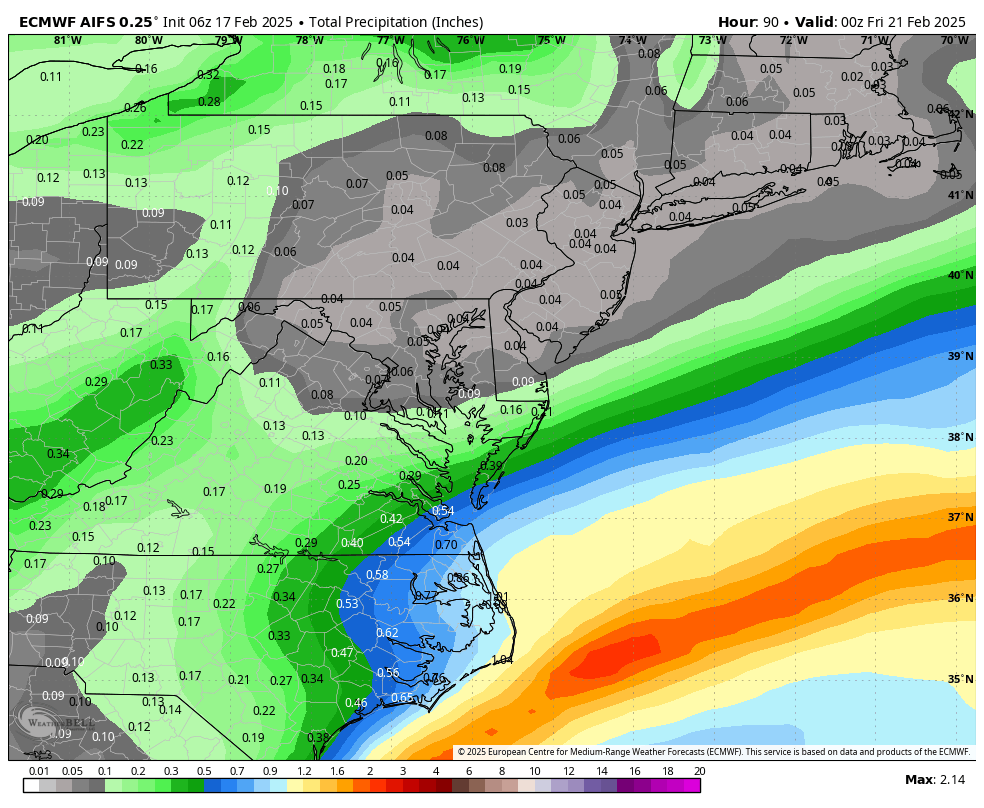
RIC Airport replied to RIC Airport's topic in Mid Atlantic
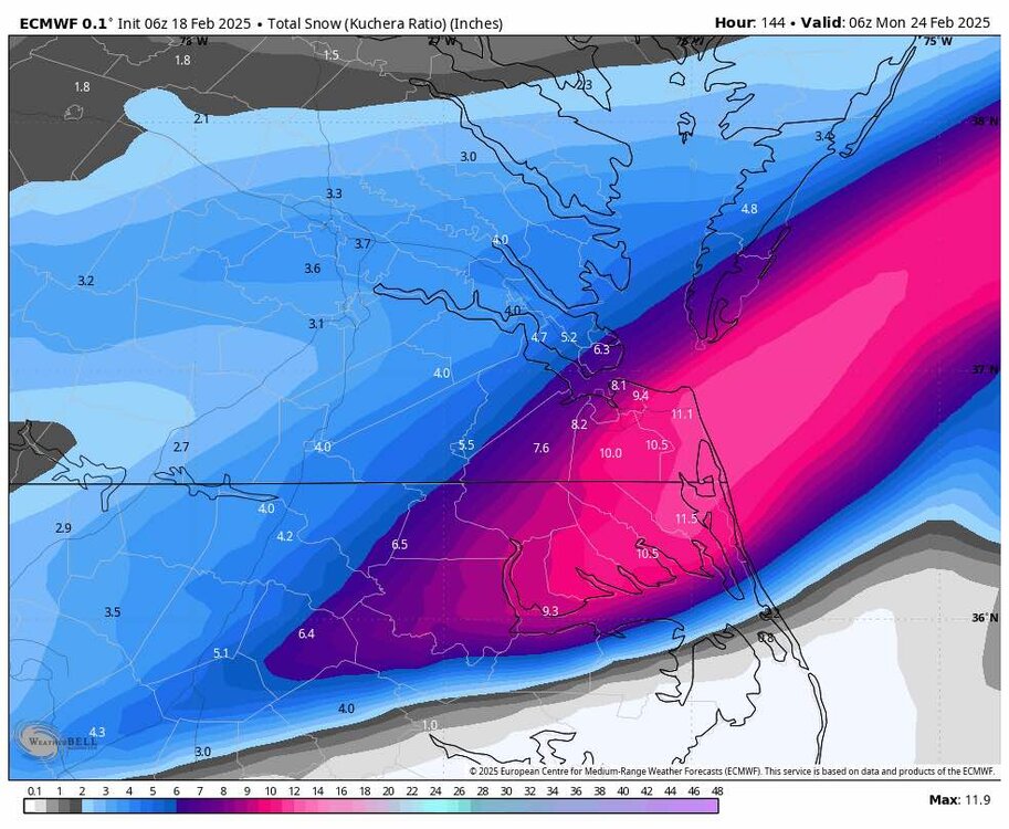
00z Euro is primarily a Hampton Roads and NE NC jackpot but has higher totals overall compared to 18z. The axis of snows did move a tick west, so although it's not the GFS or NAM, it's still an improvement.
-
Richmond Metro/Hampton Roads Area Discussion
RIC Airport replied to RIC Airport's topic in Mid Atlantic
Closer local view
-
Richmond Metro/Hampton Roads Area Discussion
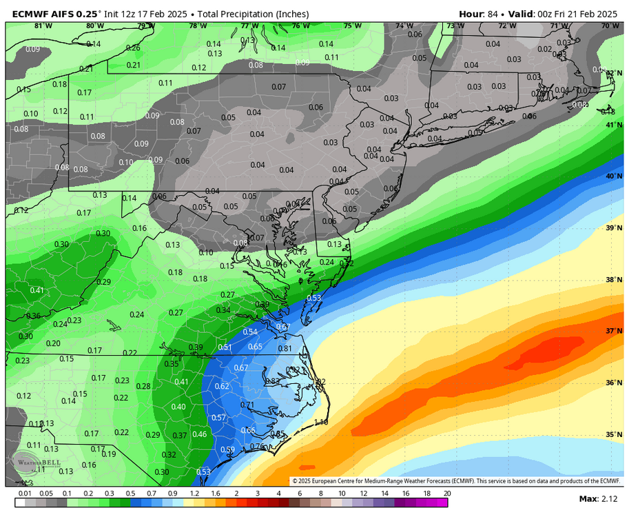
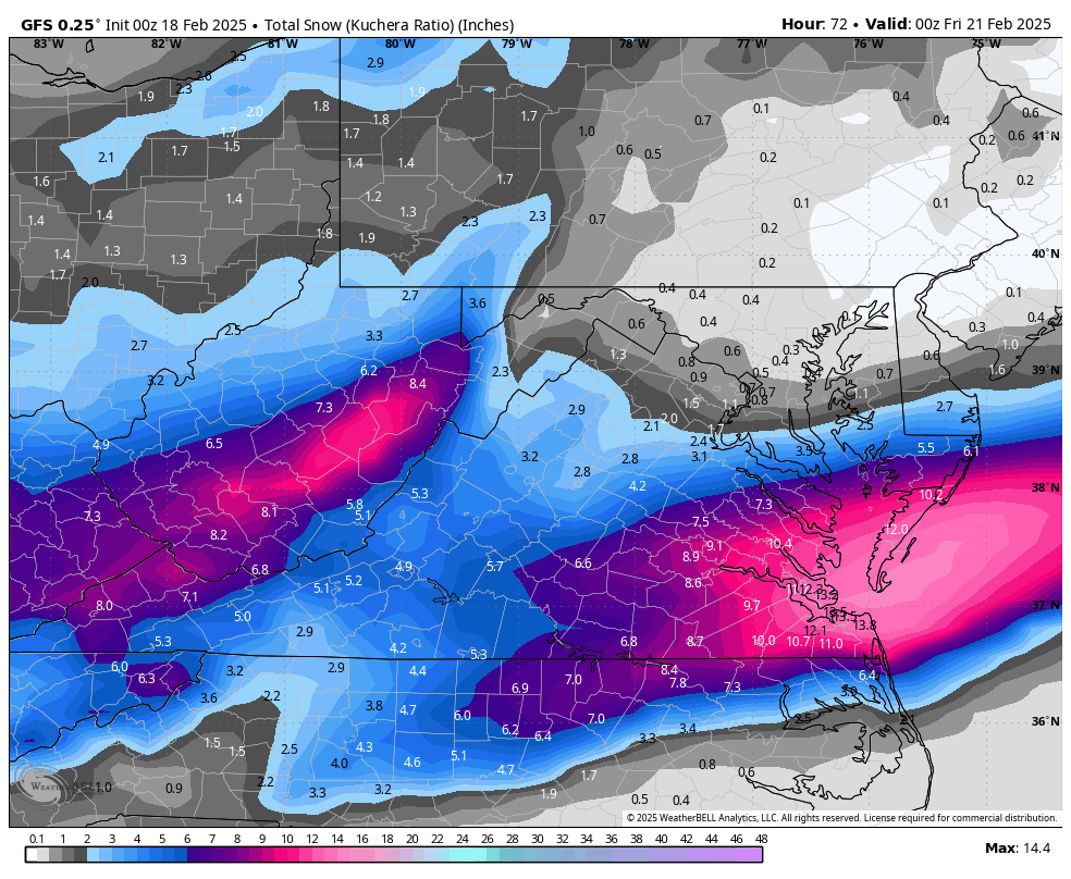
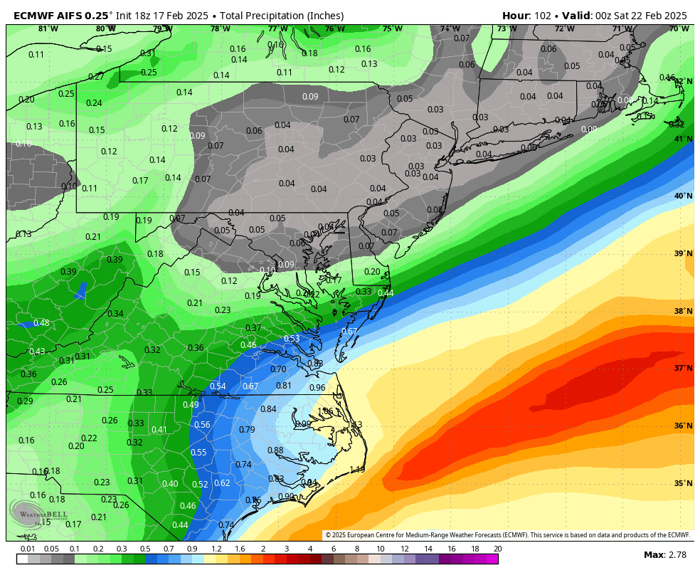
RIC Airport replied to RIC Airport's topic in Mid Atlantic
00z GFS is an improvement, particularly for RIC.

-
Richmond Metro/Hampton Roads Area Discussion
RIC Airport replied to RIC Airport's topic in Mid Atlantic
I posted the 12K and 3K NAM on the last page. -
Richmond Metro/Hampton Roads Area Discussion
RIC Airport replied to RIC Airport's topic in Mid Atlantic
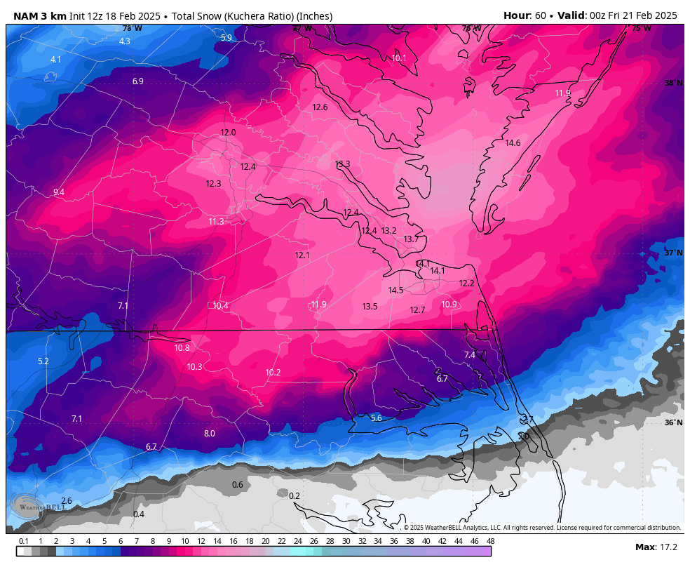
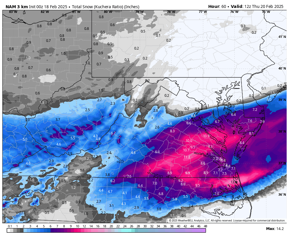
3K NAM
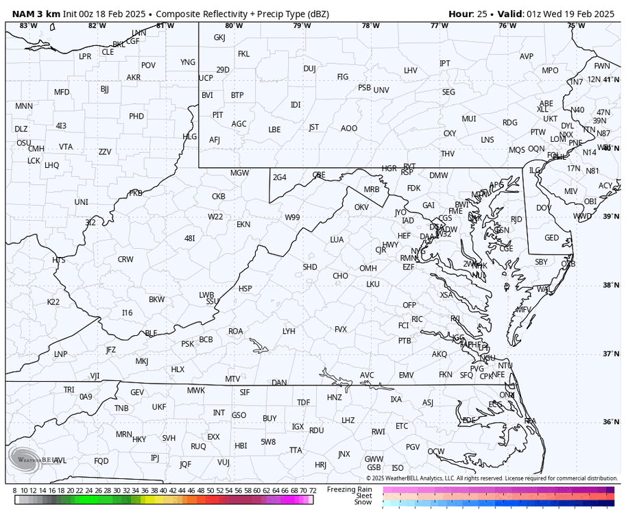
-
Richmond Metro/Hampton Roads Area Discussion
RIC Airport replied to RIC Airport's topic in Mid Atlantic
I believe this is done.
-
Richmond Metro/Hampton Roads Area Discussion
RIC Airport replied to RIC Airport's topic in Mid Atlantic
Still don't think it's quite done yet.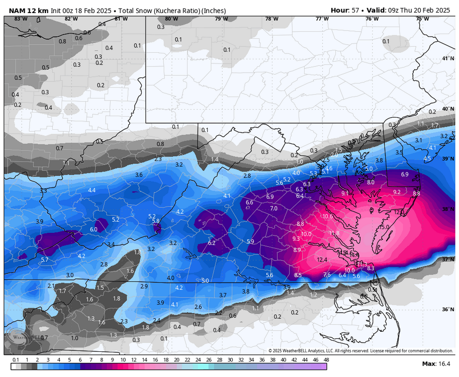
-
Richmond Metro/Hampton Roads Area Discussion
RIC Airport replied to RIC Airport's topic in Mid Atlantic
YES! -
Richmond Metro/Hampton Roads Area Discussion
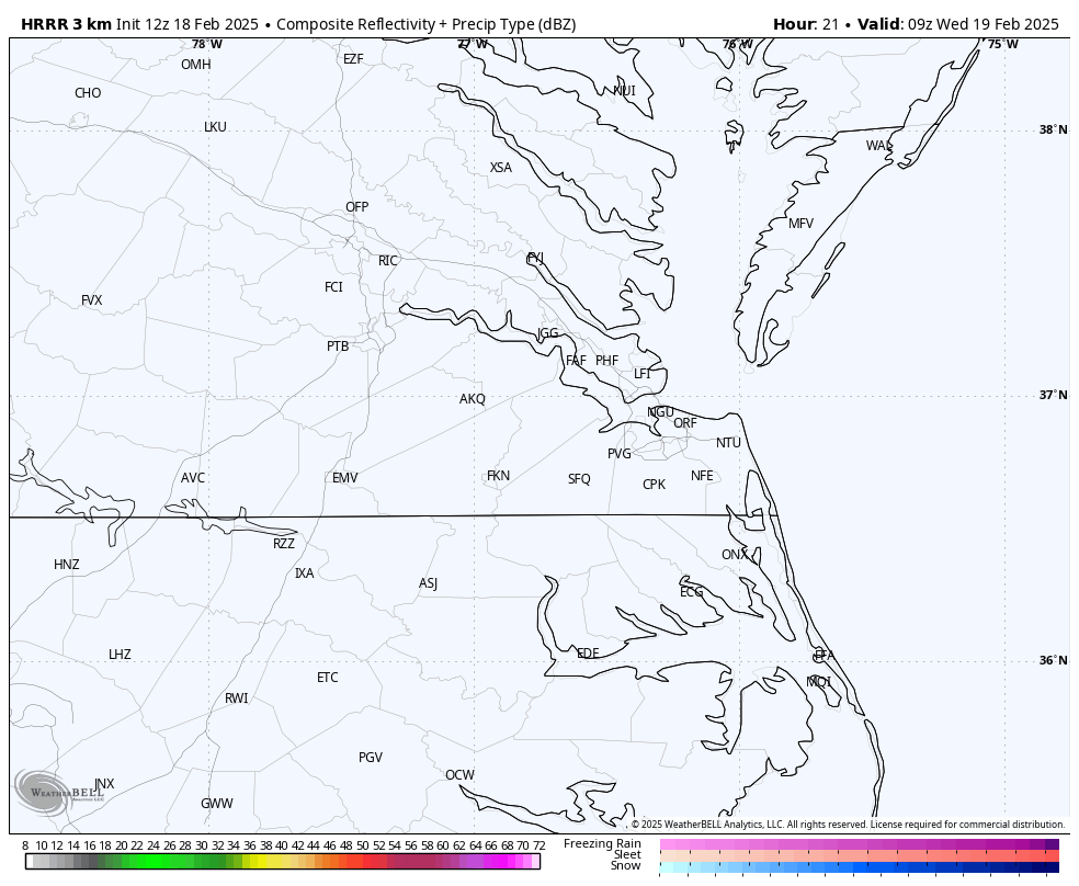
RIC Airport replied to RIC Airport's topic in Mid Atlantic
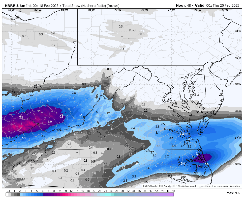
00z HRRR through hour 48.

-
Richmond Metro/Hampton Roads Area Discussion
RIC Airport replied to RIC Airport's topic in Mid Atlantic
18z Euro AI model is also a bit west of the 12z run