RIC Airport
-
Posts
2,586 -
Joined
-
Last visited
Content Type
Profiles
Blogs
Forums
American Weather
Media Demo
Store
Gallery
Everything posted by RIC Airport
-
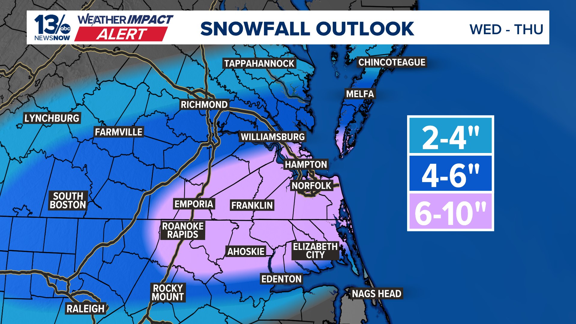
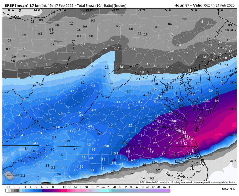
Richmond Metro/Hampton Roads Area Discussion
RIC Airport replied to RIC Airport's topic in Mid Atlantic
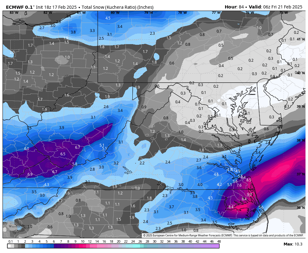
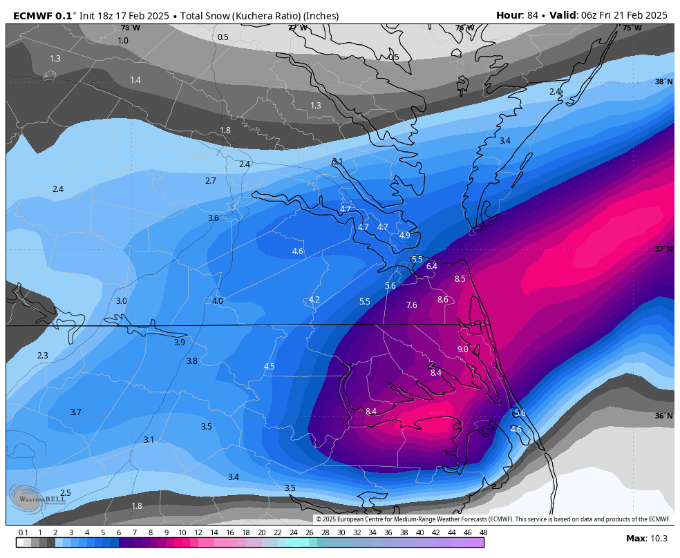
21z SREF mean vs 15z below. I'm guessing this suggest the 00z NAM will be better than the 18z?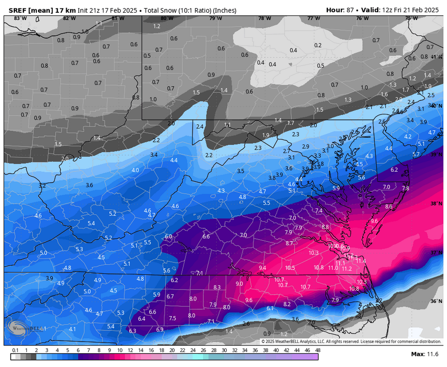
-
Richmond Metro/Hampton Roads Area Discussion
RIC Airport replied to RIC Airport's topic in Mid Atlantic
Right, I'm assuming he referring to December 2018 and not January 2018. -
Richmond Metro/Hampton Roads Area Discussion
RIC Airport replied to RIC Airport's topic in Mid Atlantic
-
Richmond Metro/Hampton Roads Area Discussion
RIC Airport replied to RIC Airport's topic in Mid Atlantic

-
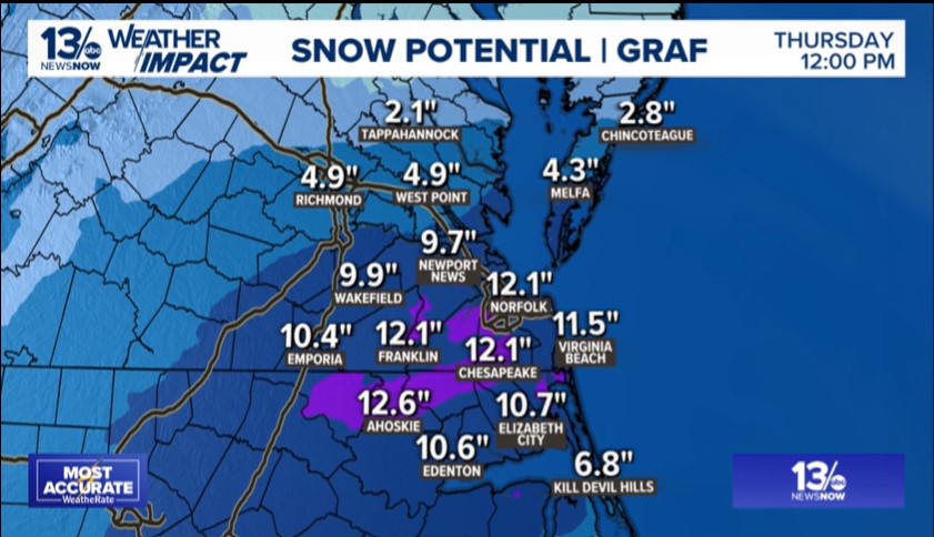
Richmond Metro/Hampton Roads Area Discussion
RIC Airport replied to RIC Airport's topic in Mid Atlantic
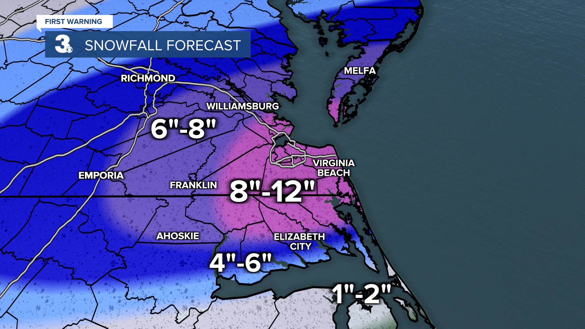
HR Station maps


-
Richmond Metro/Hampton Roads Area Discussion
RIC Airport replied to RIC Airport's topic in Mid Atlantic
Yup, but it's a lagging indicator. -
Richmond Metro/Hampton Roads Area Discussion
RIC Airport replied to RIC Airport's topic in Mid Atlantic

-
Richmond Metro/Hampton Roads Area Discussion
RIC Airport replied to RIC Airport's topic in Mid Atlantic

-
Richmond Metro/Hampton Roads Area Discussion
RIC Airport replied to RIC Airport's topic in Mid Atlantic
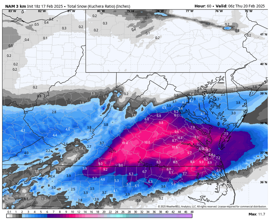
ICON was a step back from 12z. 12z run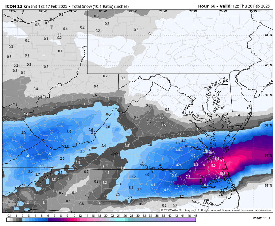
.thumb.png.4e3cb4567a12d8009e5e067a4328cc2f.png)
-
Richmond Metro/Hampton Roads Area Discussion
RIC Airport replied to RIC Airport's topic in Mid Atlantic
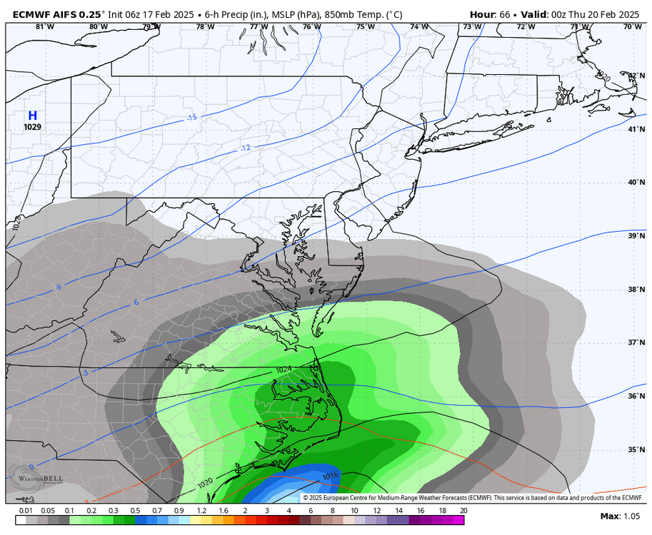
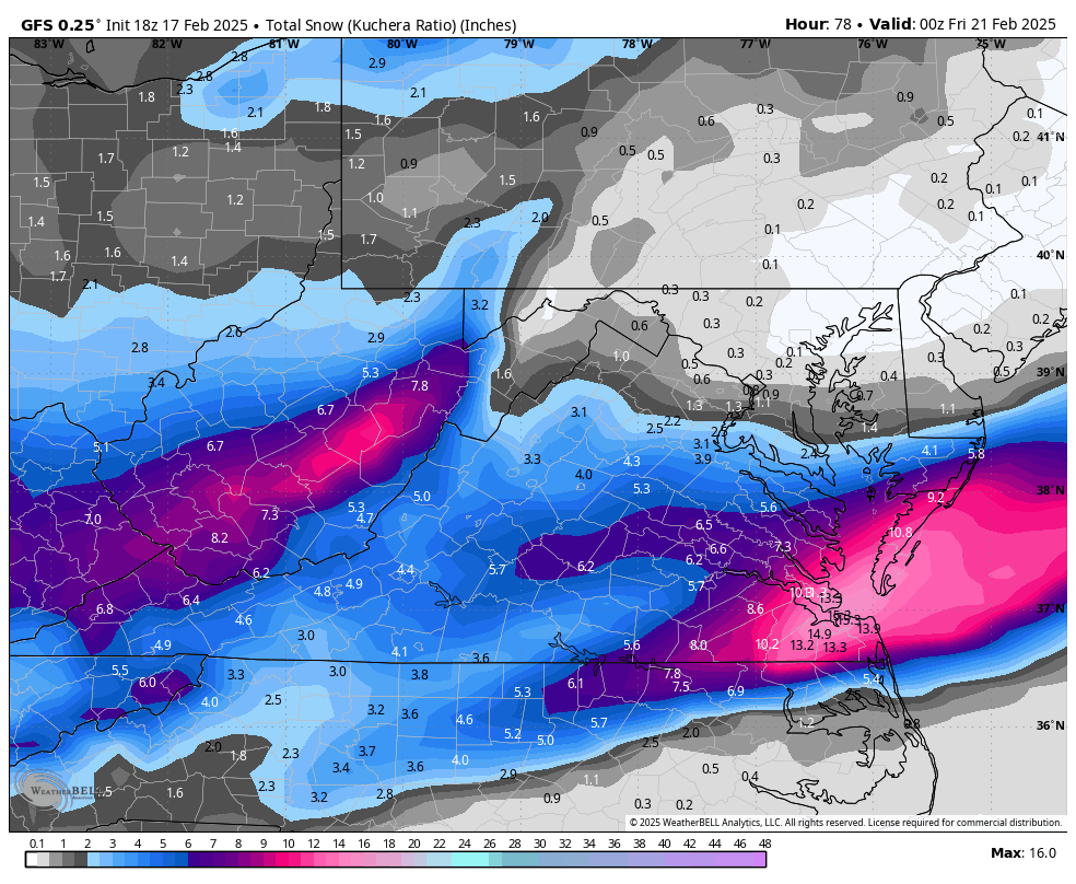
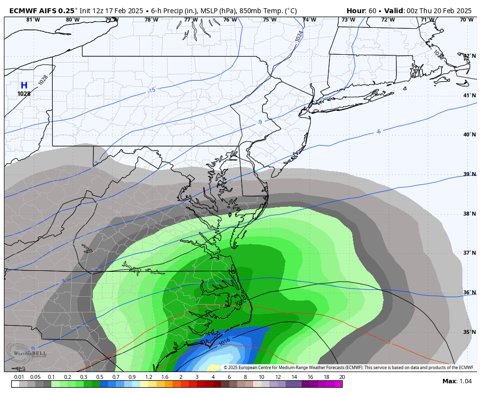
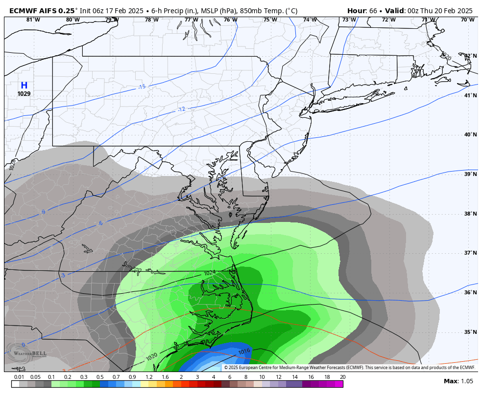
12z Euro AI mode came west a bit, too. We need all the help we can get! First two maps 12z vs 6z below. 6z

-
Richmond Metro/Hampton Roads Area Discussion
RIC Airport replied to RIC Airport's topic in Mid Atlantic


-
Richmond Metro/Hampton Roads Area Discussion
RIC Airport replied to RIC Airport's topic in Mid Atlantic
Yup, I posted it on the previous page. Hard to tell what it's going to do. -
Richmond Metro/Hampton Roads Area Discussion
RIC Airport replied to RIC Airport's topic in Mid Atlantic
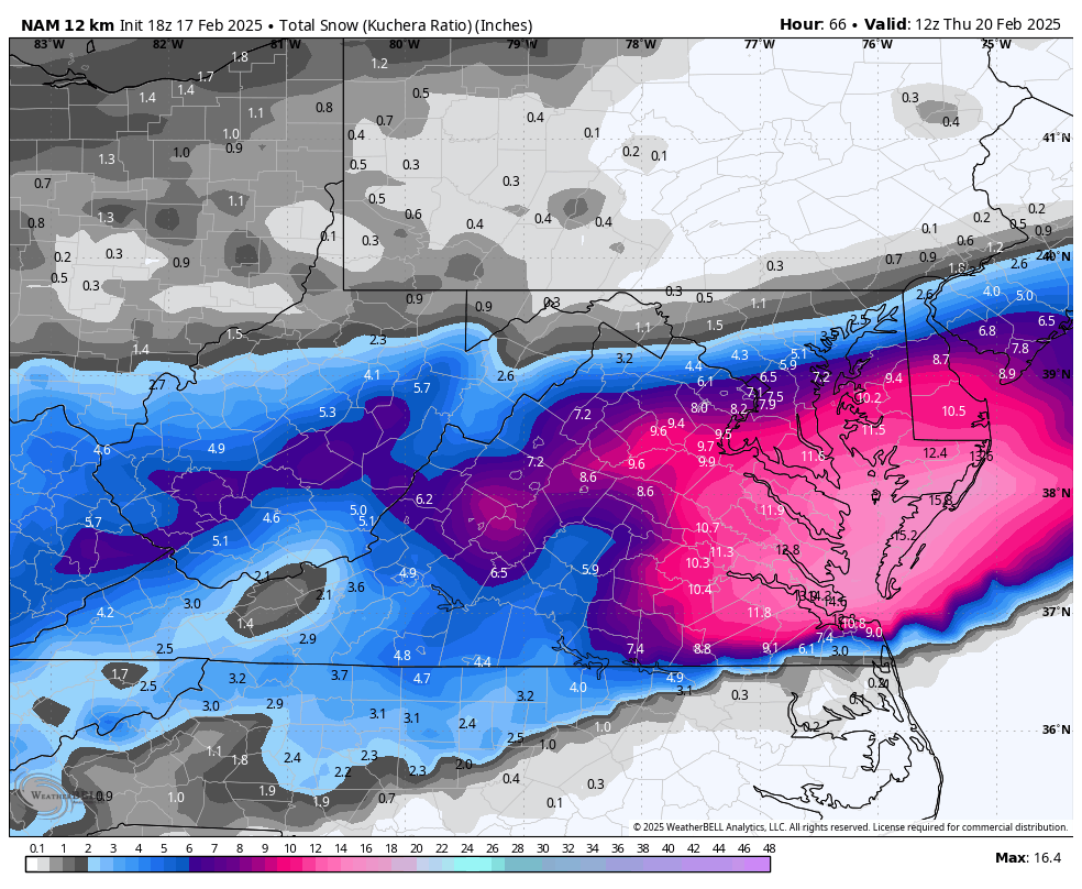
Still snowing at the end of the 3K.

-
Richmond Metro/Hampton Roads Area Discussion
RIC Airport replied to RIC Airport's topic in Mid Atlantic
-
Richmond Metro/Hampton Roads Area Discussion
RIC Airport replied to RIC Airport's topic in Mid Atlantic
-
Richmond Metro/Hampton Roads Area Discussion
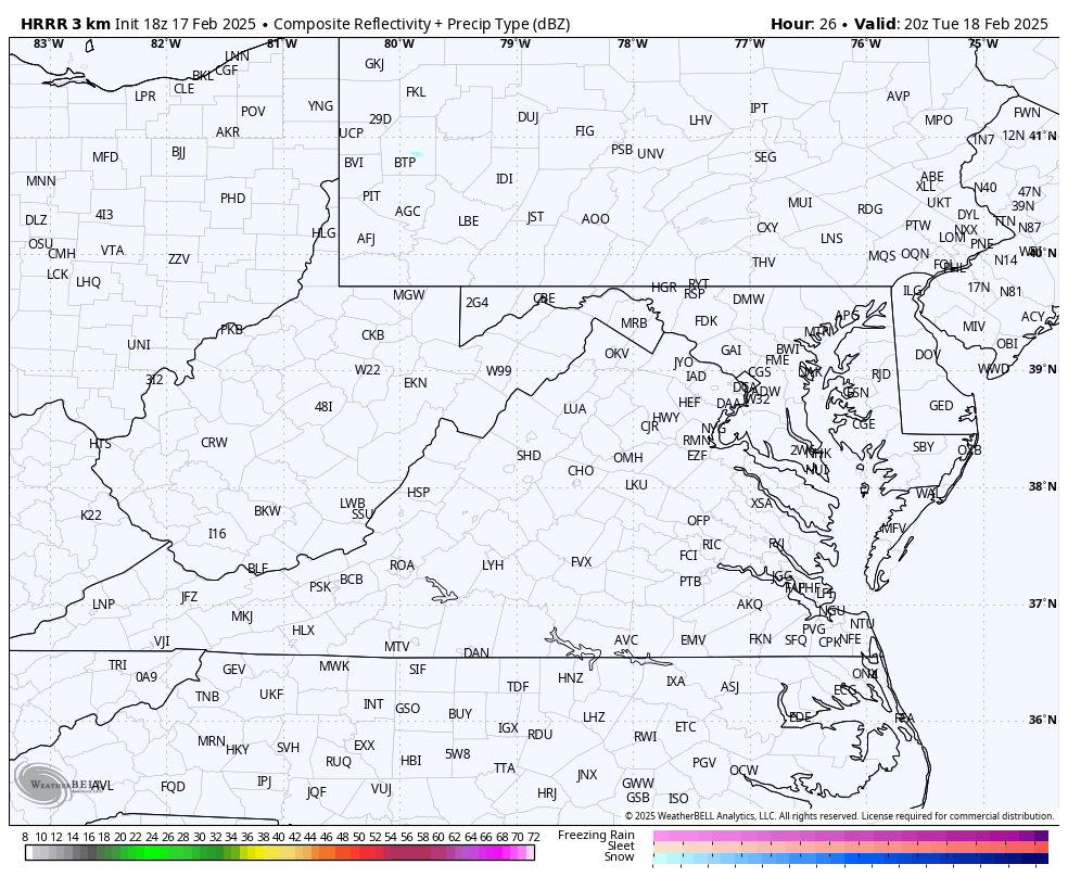
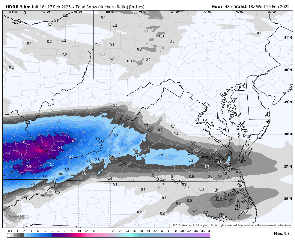
RIC Airport replied to RIC Airport's topic in Mid Atlantic
Way out in time for this model, but HRRR, which only goes out to hour 48, has snow trying to move in as early as 7am. s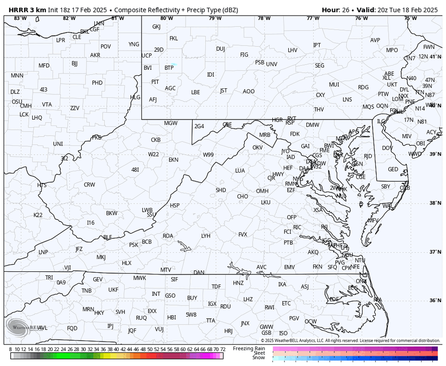

-
Richmond Metro/Hampton Roads Area Discussion
RIC Airport replied to RIC Airport's topic in Mid Atlantic
Crazy difference. I can't find the summary, but yes, a large cut off across RVA metro. Haven't seen anything like it since. -
Richmond Metro/Hampton Roads Area Discussion
RIC Airport replied to RIC Airport's topic in Mid Atlantic
Nice!
-
Richmond Metro/Hampton Roads Area Discussion
RIC Airport replied to RIC Airport's topic in Mid Atlantic
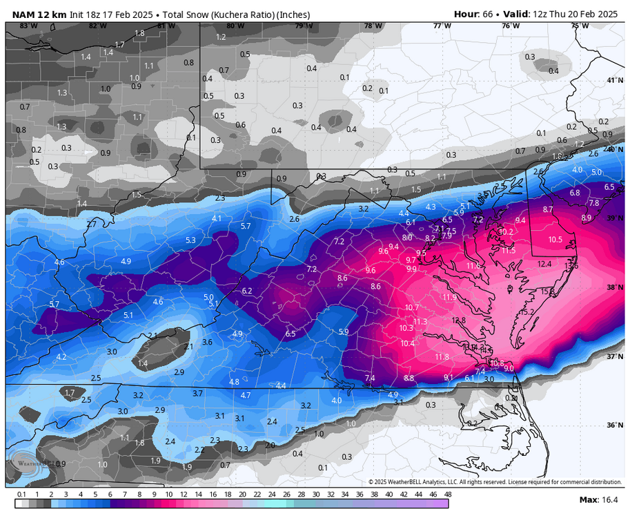
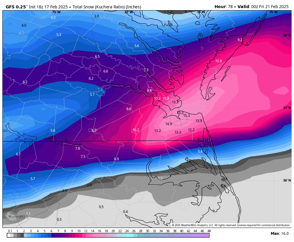
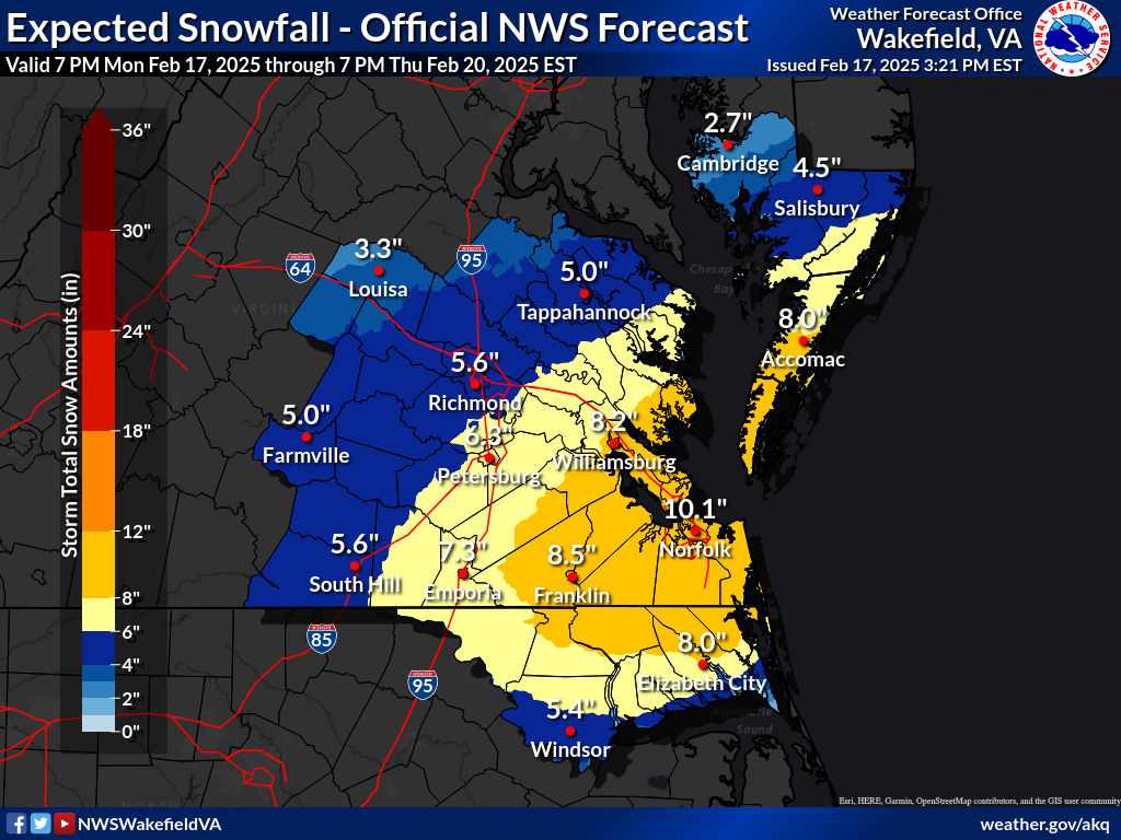
15z, SREF mean. Keep in mind this is a 10:1 map..thumb.png.2310a53752eae0e82ba6ccf2d7646272.png)
-
Richmond Metro/Hampton Roads Area Discussion
RIC Airport replied to RIC Airport's topic in Mid Atlantic
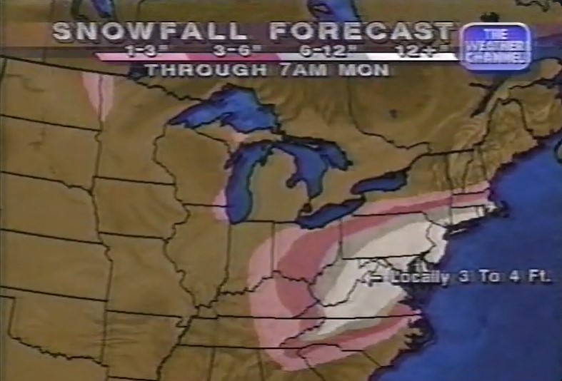
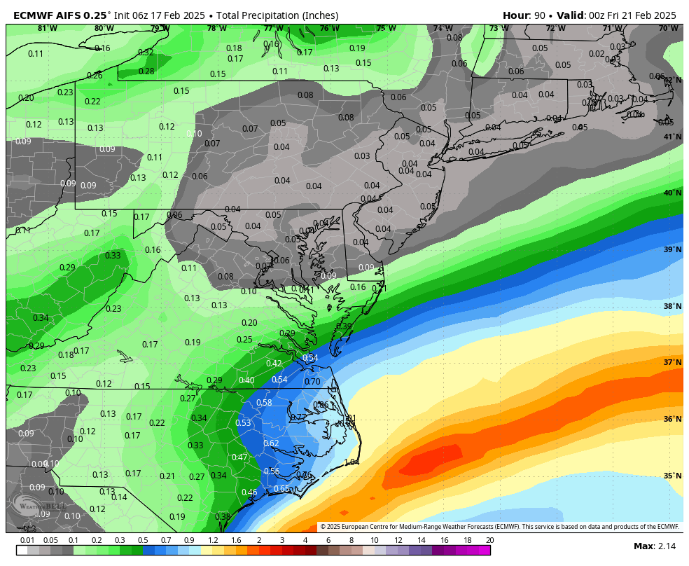
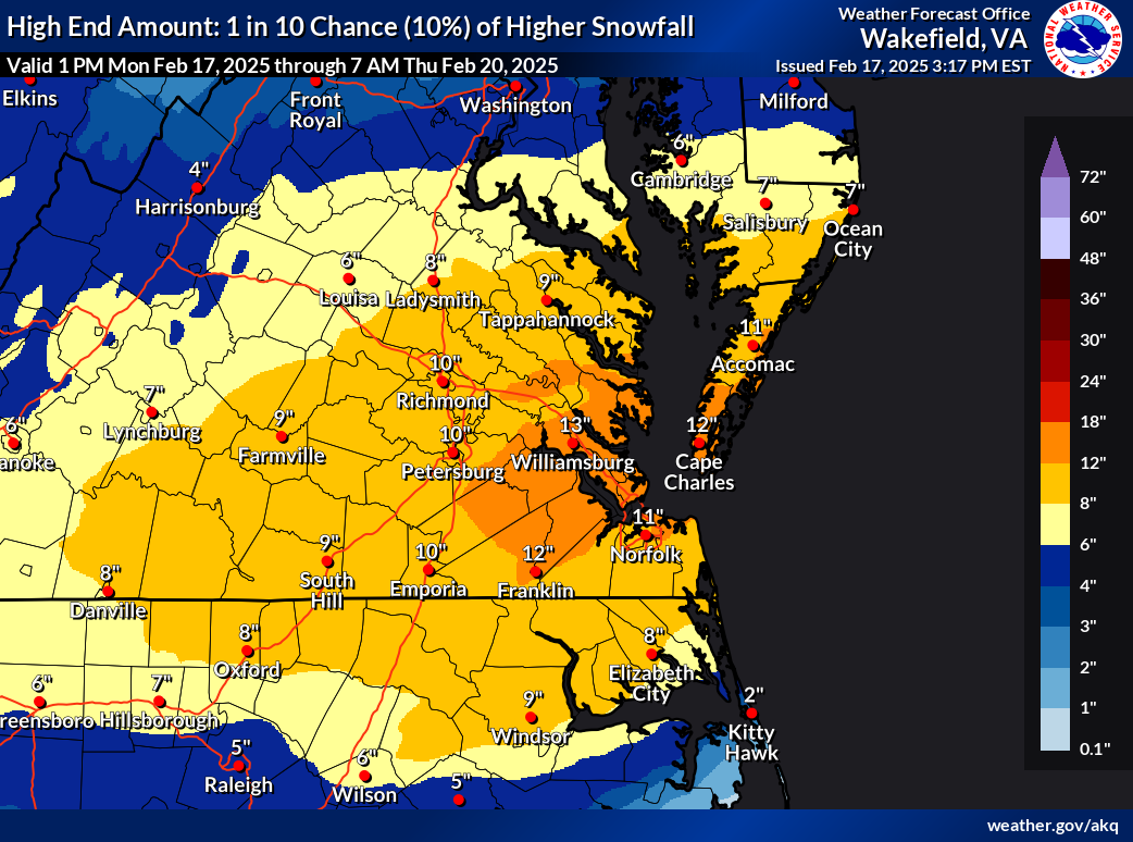
The issue for RIC was IP coming in farther north than progged, even while surface temperatures were only around 20-21 during the height of the event. Was still a good event, but kept most people from reaching 18-24".
-
Richmond Metro/Hampton Roads Area Discussion
RIC Airport replied to RIC Airport's topic in Mid Atlantic
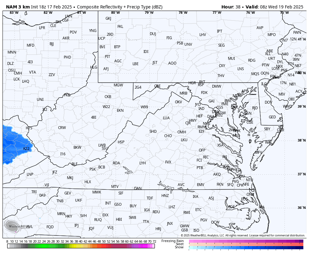
There is a big difference between there and Richmond. RIC got 7.4" of snow, briefly flipped over to rain, and then got dry slotted, while areas to the north cashed in. The below radar is about 2 hours before the rain/snow line crept into the metro area, screwing up the totals from SE to NW. There was a large snowfall accumulation gradient across the metro area, probably one of the largest of any storm I've seen.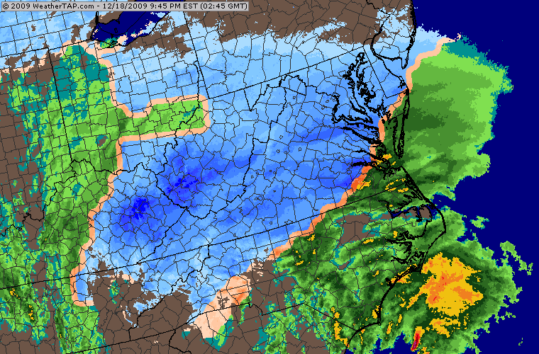
-
Richmond Metro/Hampton Roads Area Discussion
RIC Airport replied to RIC Airport's topic in Mid Atlantic

-
Richmond Metro/Hampton Roads Area Discussion
RIC Airport replied to RIC Airport's topic in Mid Atlantic
Rarely do they go poof this close in. But I feel even in the big ones, our region tends to learn something in the final 36-48hrs that tells us we'll be screwed by something. -
Richmond Metro/Hampton Roads Area Discussion
RIC Airport replied to RIC Airport's topic in Mid Atlantic
Chicago. Move in date is 3/31 Yes a snowier place, but truthfully, they rarely get anything large, just a bunch of 1-3" or 2-4" that add up over time. -
Richmond Metro/Hampton Roads Area Discussion
RIC Airport replied to RIC Airport's topic in Mid Atlantic
I need a break. I have so much stuff to do trying to get ready for my upcoming move.


.png.a2a9fb85335fa3c987817e21355ae911.png)