RIC Airport
-
Posts
2,586 -
Joined
-
Last visited
Content Type
Profiles
Blogs
Forums
American Weather
Media Demo
Store
Gallery
Everything posted by RIC Airport
-
Richmond Metro/Hampton Roads Area Discussion
RIC Airport replied to RIC Airport's topic in Mid Atlantic
Something to watch in later runs, the NAM usually can pick up mixing better than the globals.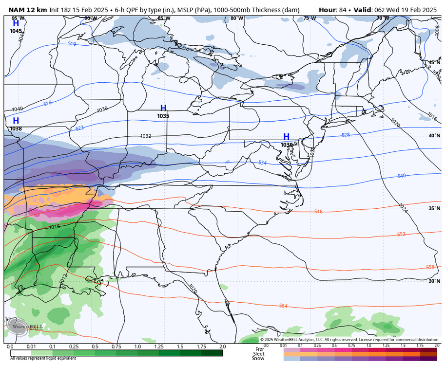
-
Richmond Metro/Hampton Roads Area Discussion
RIC Airport replied to RIC Airport's topic in Mid Atlantic
18z ICON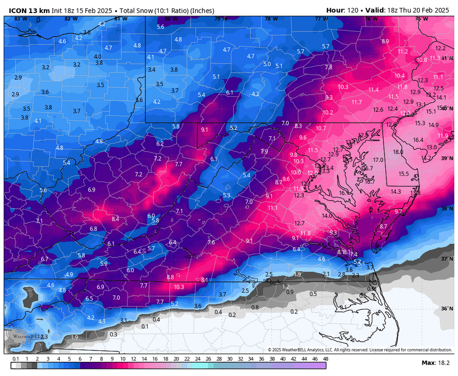
-
Richmond Metro/Hampton Roads Area Discussion
RIC Airport replied to RIC Airport's topic in Mid Atlantic
Although I value some of the content posted by a select few, I rarely go in there. All the good stuff often gets buried so quickly anyway. -
Richmond Metro/Hampton Roads Area Discussion
RIC Airport replied to RIC Airport's topic in Mid Atlantic
Could be some spinners, too.

-
Richmond Metro/Hampton Roads Area Discussion
RIC Airport replied to RIC Airport's topic in Mid Atlantic
A few members indicate additional threats around the 23rd, 27th, and the 1st. Here is e-46, for example, the morning of the 23rd with a 2nd snowstorm. Likely wrong though, the OP Euro has this low, but it's off of Florida.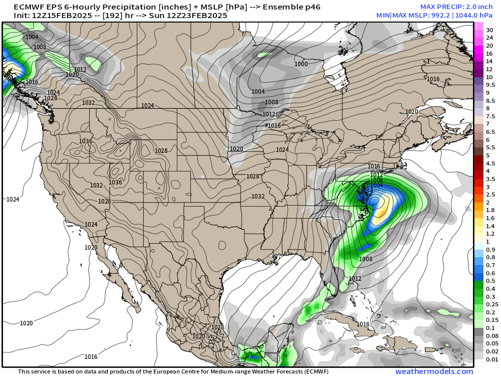
-
Richmond Metro/Hampton Roads Area Discussion
RIC Airport replied to RIC Airport's topic in Mid Atlantic
You're talking about this? This was updated about 2 hours ago.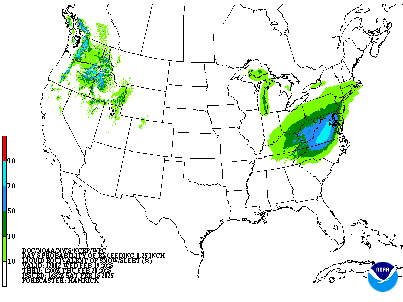
-
Richmond Metro/Hampton Roads Area Discussion
RIC Airport replied to RIC Airport's topic in Mid Atlantic
hopefully even better since there may not be any mixing or a lull in the middle. -
Richmond Metro/Hampton Roads Area Discussion
RIC Airport replied to RIC Airport's topic in Mid Atlantic
Not sure I've seen anything like this.


-
Richmond Metro/Hampton Roads Area Discussion
RIC Airport replied to RIC Airport's topic in Mid Atlantic
It gets even colder. With snowpack, Euro has lots of places dropping to around 0°F or below.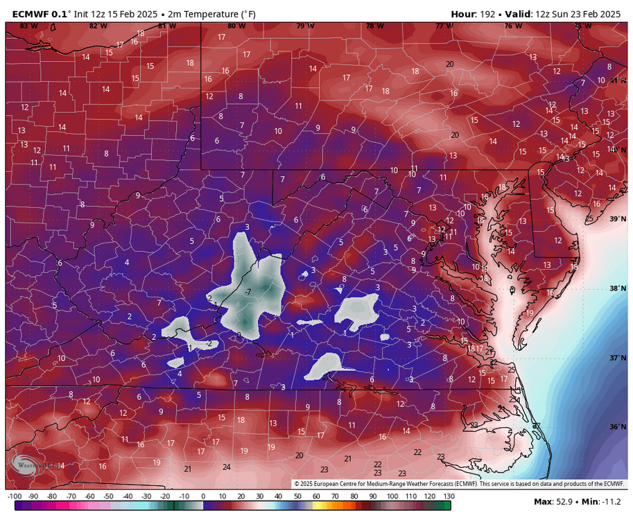
-
Richmond Metro/Hampton Roads Area Discussion
RIC Airport replied to RIC Airport's topic in Mid Atlantic
Very cold after the storm.
-
Richmond Metro/Hampton Roads Area Discussion
RIC Airport replied to RIC Airport's topic in Mid Atlantic
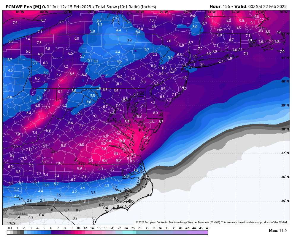
I'm not sure what there is to hate, everyone does well. Even, @ldub23gets 14".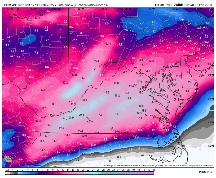
-
Richmond Metro/Hampton Roads Area Discussion
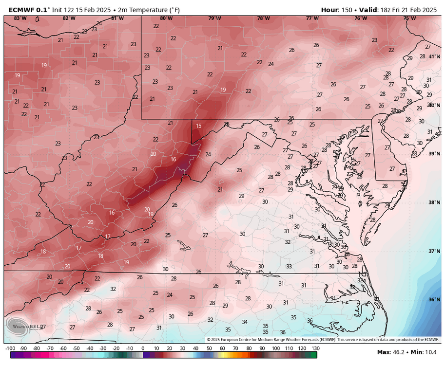
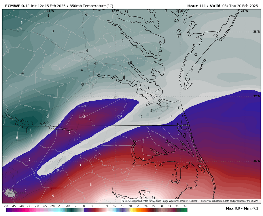
RIC Airport replied to RIC Airport's topic in Mid Atlantic
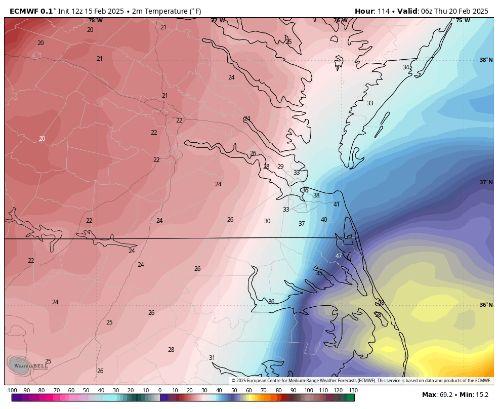
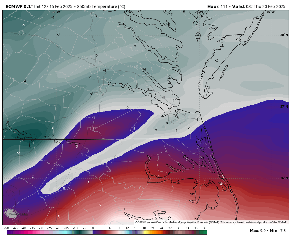
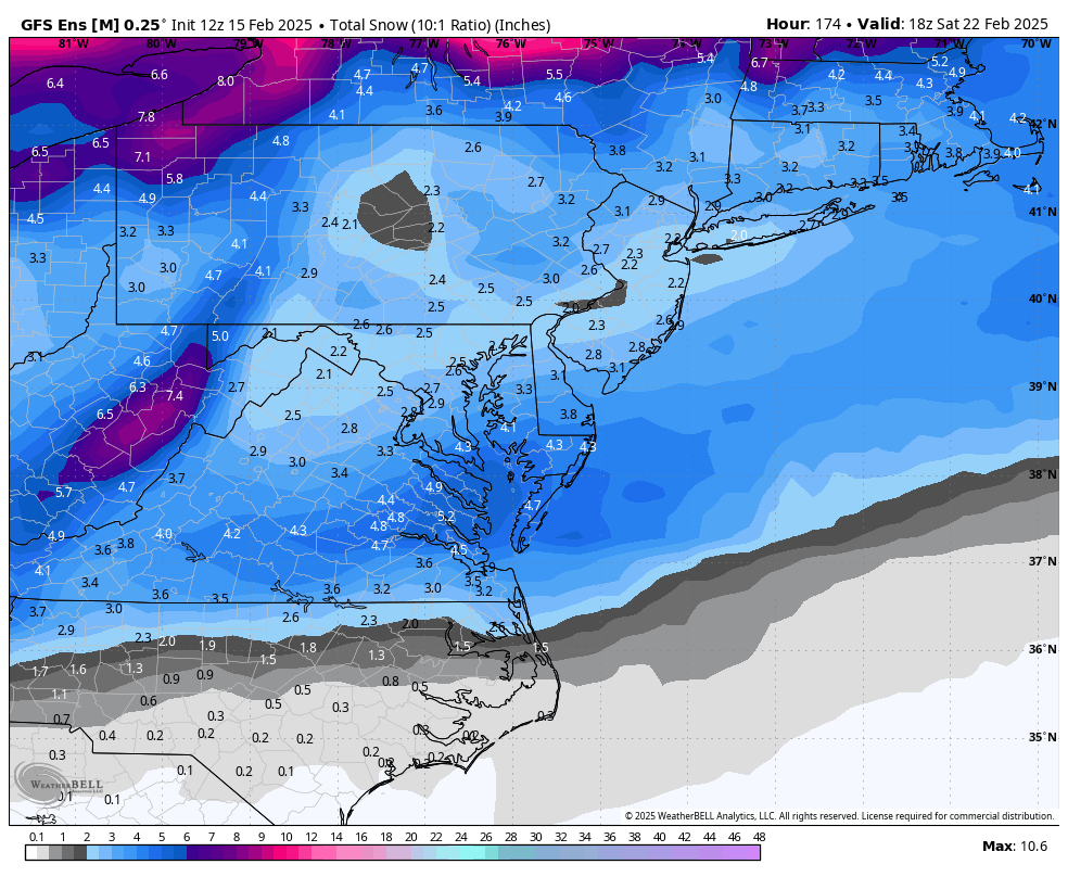
+SN at RIC at 22°F at Hour 114! Also, the bottom map shows that the 850mb 0°C line at its closest approach to RIC, basically stays over interior SE VA.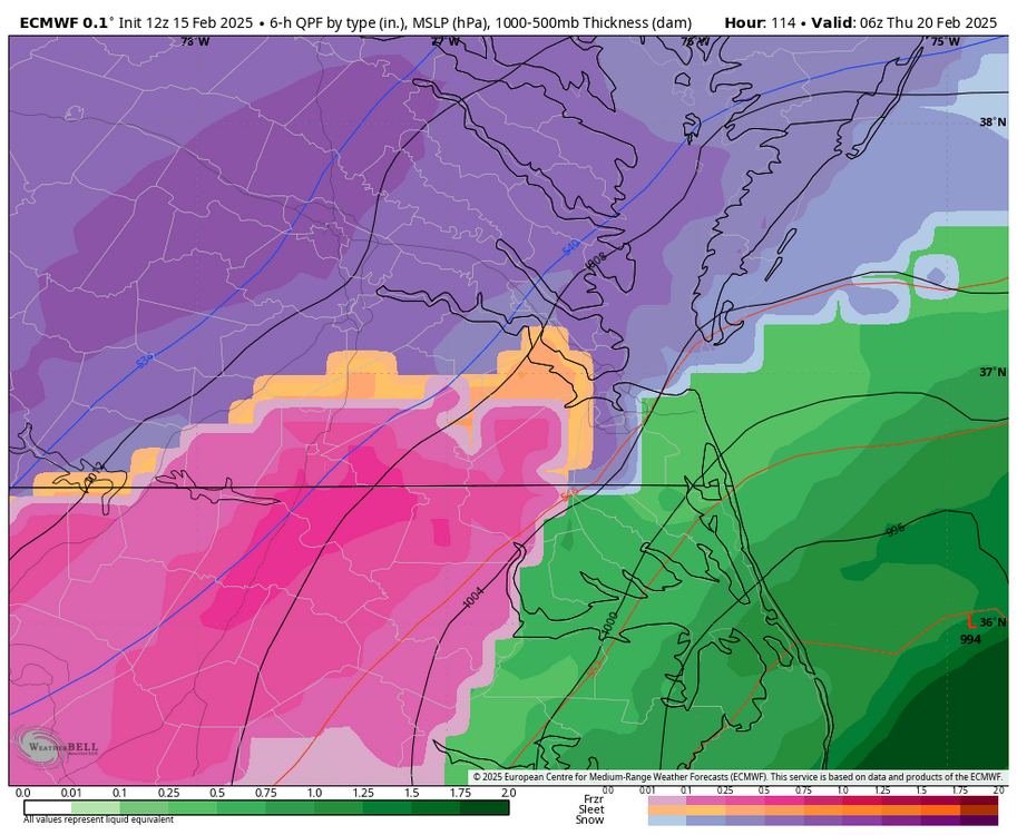

-
Richmond Metro/Hampton Roads Area Discussion
RIC Airport replied to RIC Airport's topic in Mid Atlantic
Just a beautiful run!!!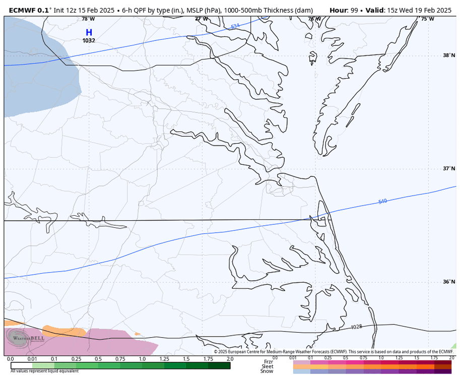

-
Richmond Metro/Hampton Roads Area Discussion
RIC Airport replied to RIC Airport's topic in Mid Atlantic
Euro is a HUGE hit. -
Richmond Metro/Hampton Roads Area Discussion
RIC Airport replied to RIC Airport's topic in Mid Atlantic
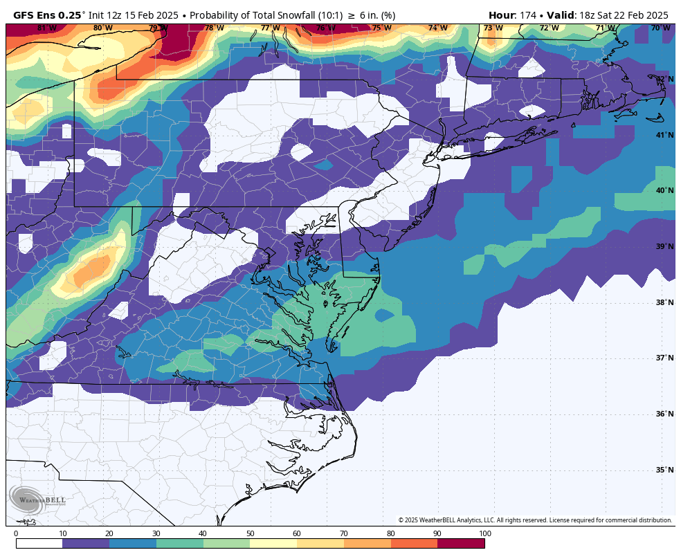
Ukmet was a lot of mixing, hopefully the Euro isn't as bad. Below is the 12z GEFS.

-
Richmond Metro/Hampton Roads Area Discussion
RIC Airport replied to RIC Airport's topic in Mid Atlantic
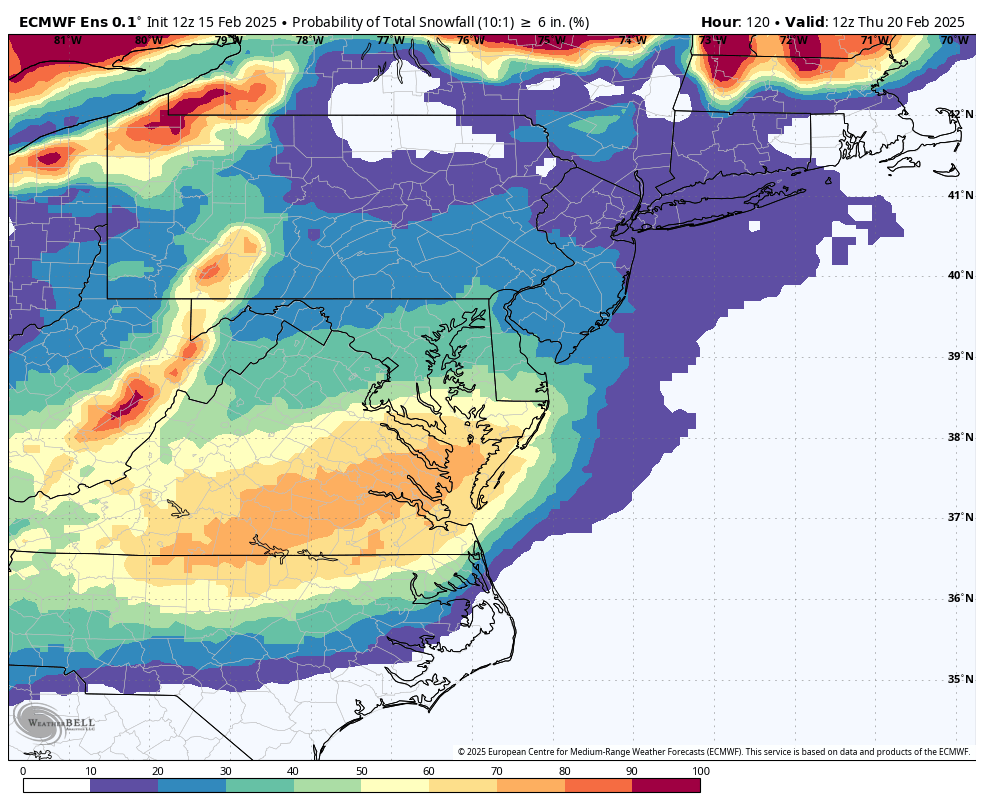
This is the one we want. Can barely even see Richmond on that map. Another reason why this thread exists.
-
Richmond Metro/Hampton Roads Area Discussion
RIC Airport replied to RIC Airport's topic in Mid Atlantic
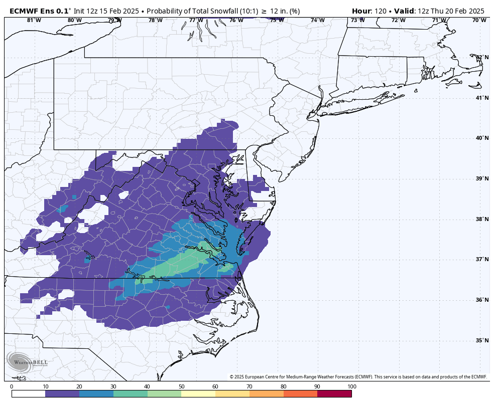
A bit lower for our area, but still I hit I guess.
-
Richmond Metro/Hampton Roads Area Discussion
RIC Airport replied to RIC Airport's topic in Mid Atlantic
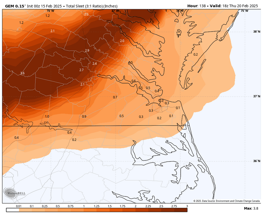
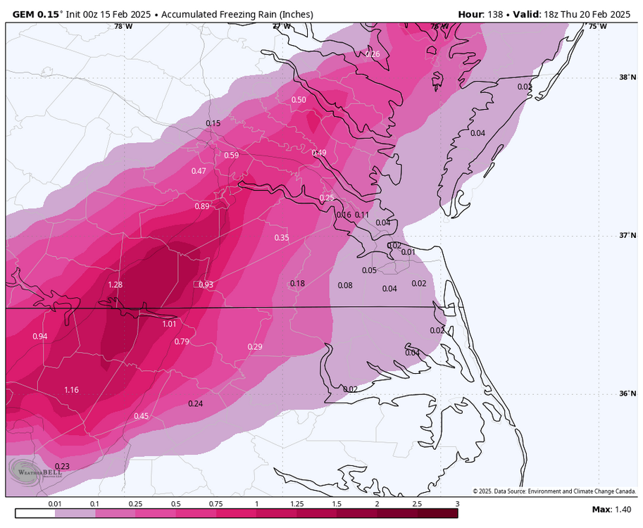
Airport recorded 1.9", but that was all sleet. Storm came in 3 separate waves with 1.41" of QPF, with temps mainly in the 20s. AKQ had 12-18" in the forecast so it was a huge bust down this way, really for everyone south of about a CHO to EZF line. -
Richmond Metro/Hampton Roads Area Discussion
RIC Airport replied to RIC Airport's topic in Mid Atlantic
Truth be told, though, that's exactly what happened during the February 2003 storm. RIC was 21°F, while PHF was 58°F at the height of that event. In fact, February 2003 came up as an analog, along with February 1983, another blizzard that hit the East Coast where 18" was recorded at RIC.
-
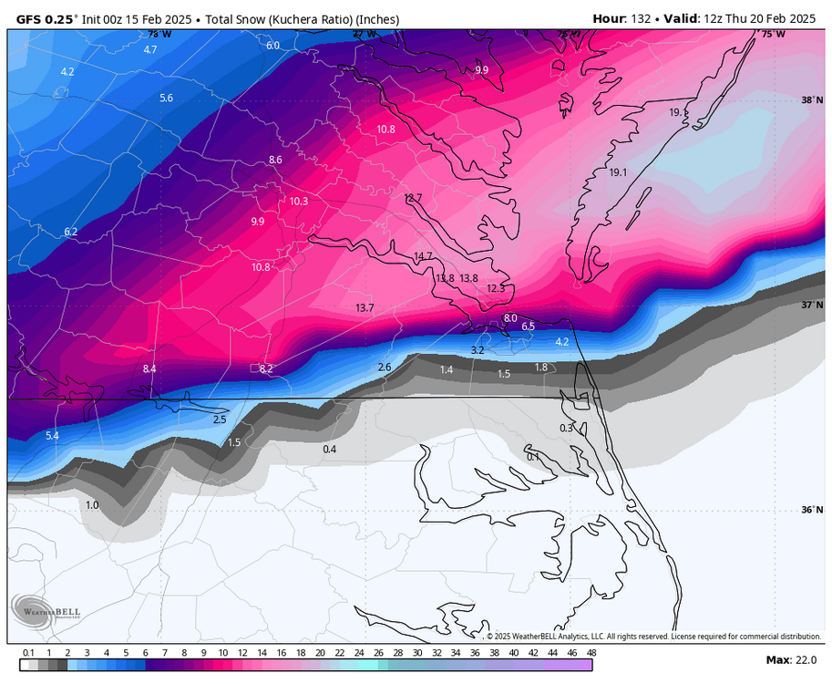
Richmond Metro/Hampton Roads Area Discussion
RIC Airport replied to RIC Airport's topic in Mid Atlantic
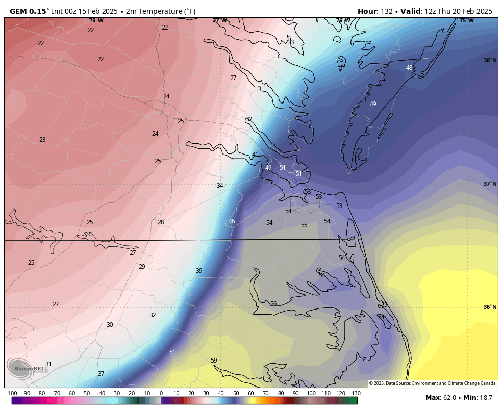
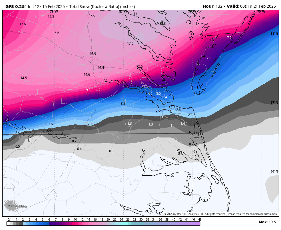
Yeah, look at that temperature gradient at hour 132 while the low is over ORF..thumb.png.289124c8c66869757c0fd890276bf170.png)

-
Richmond Metro/Hampton Roads Area Discussion
RIC Airport replied to RIC Airport's topic in Mid Atlantic
Yup, temps 26-27 most of the time. No mixing. -
Richmond Metro/Hampton Roads Area Discussion
RIC Airport replied to RIC Airport's topic in Mid Atlantic
CMC is basically a sleet storm. Pass. -
Richmond Metro/Hampton Roads Area Discussion
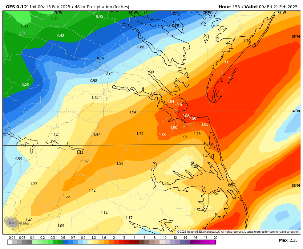
RIC Airport replied to RIC Airport's topic in Mid Atlantic
00Z GFS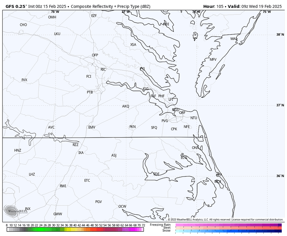

-
Richmond Metro/Hampton Roads Area Discussion
RIC Airport replied to RIC Airport's topic in Mid Atlantic
00z ICON keeps hope alive.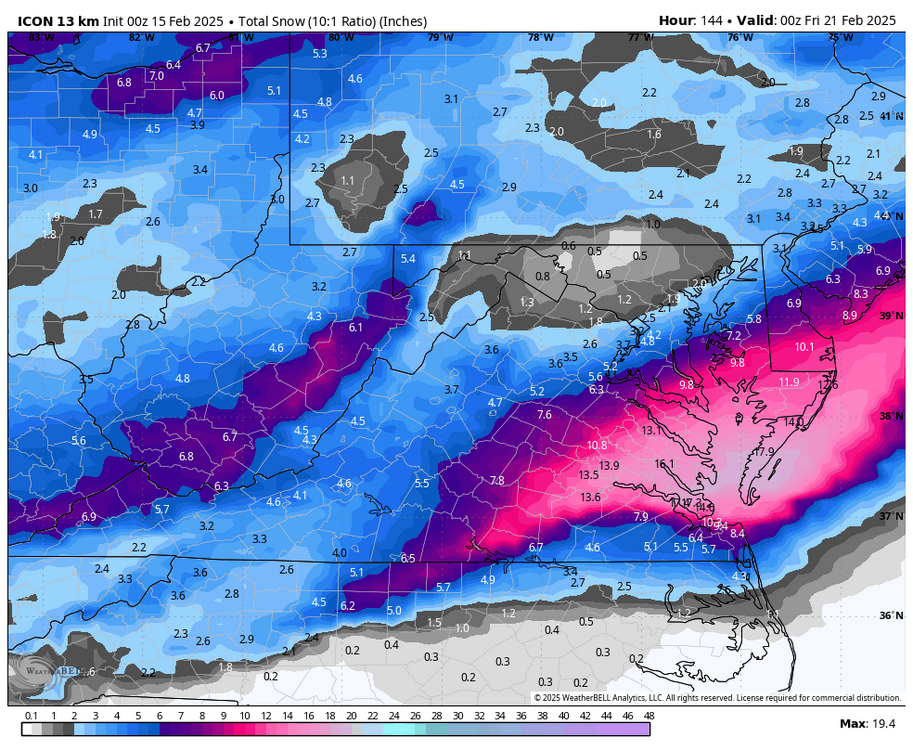
-
Richmond Metro/Hampton Roads Area Discussion
RIC Airport replied to RIC Airport's topic in Mid Atlantic
Good info, probably should've recommended that first. You do start off with some storage, but it can get full.


.png.b3b58acd2d01fc5b7c776a2d0ffc0031.png)