RIC Airport
-
Posts
2,586 -
Joined
-
Last visited
Content Type
Profiles
Blogs
Forums
American Weather
Media Demo
Store
Gallery
Everything posted by RIC Airport
-
Richmond Metro/Hampton Roads Area Discussion
RIC Airport replied to RIC Airport's topic in Mid Atlantic
18z so far is north of 12z. -
Richmond Metro/Hampton Roads Area Discussion
RIC Airport replied to RIC Airport's topic in Mid Atlantic
AKQ is still favoring north. I also remain skeptical of the GFS. -
Richmond Metro/Hampton Roads Area Discussion
RIC Airport replied to RIC Airport's topic in Mid Atlantic
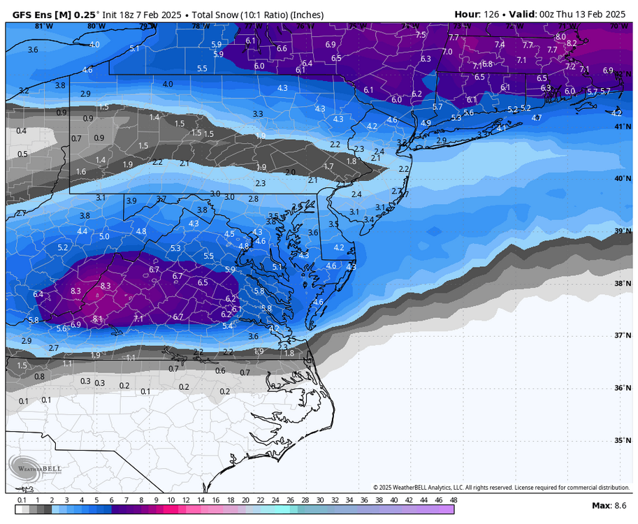
One reason why this thread exists.
-
Richmond Metro/Hampton Roads Area Discussion
RIC Airport replied to RIC Airport's topic in Mid Atlantic


-
Richmond Metro/Hampton Roads Area Discussion
RIC Airport replied to RIC Airport's topic in Mid Atlantic
Holding its course.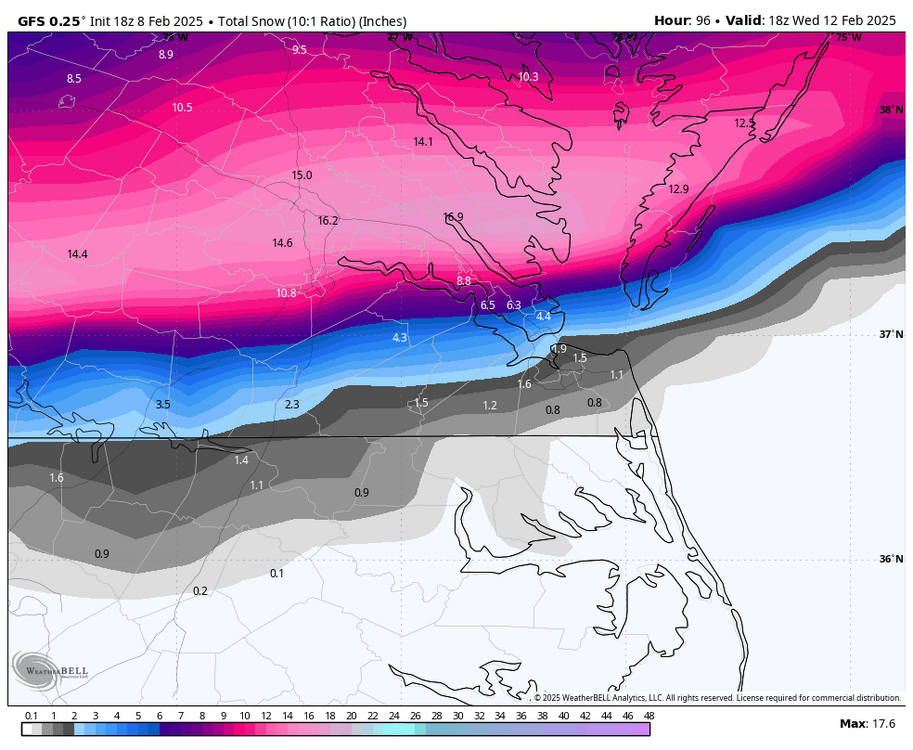
-
Richmond Metro/Hampton Roads Area Discussion
RIC Airport replied to RIC Airport's topic in Mid Atlantic
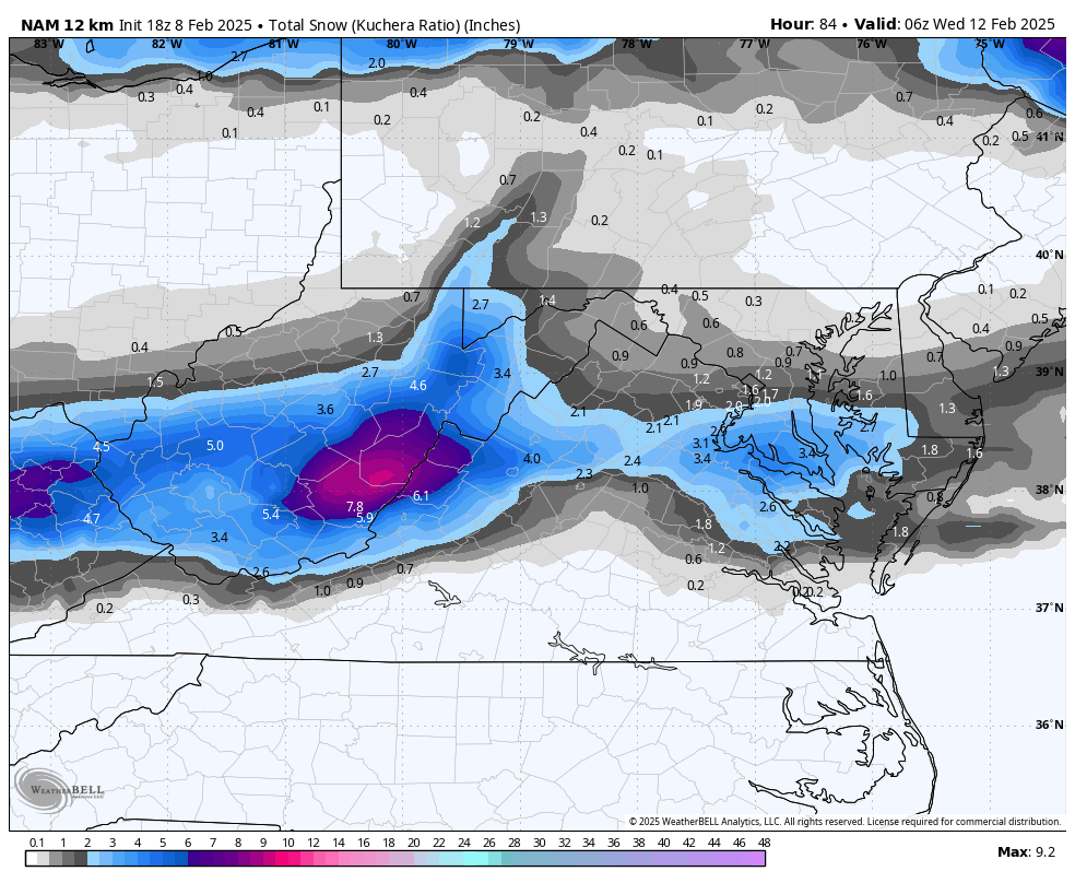
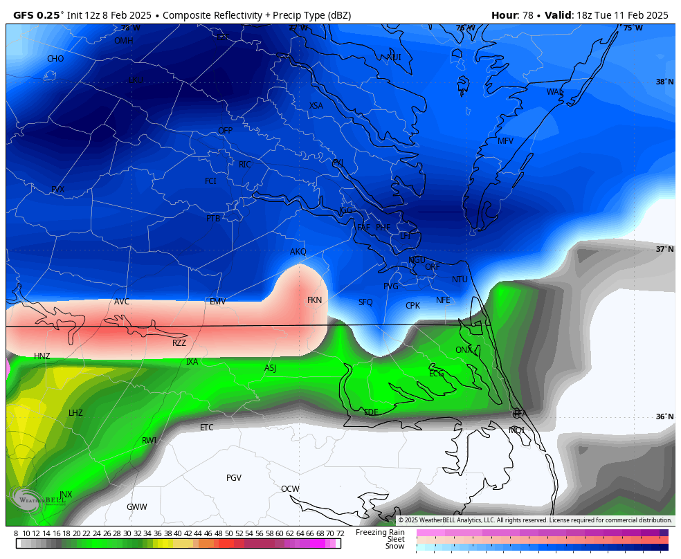
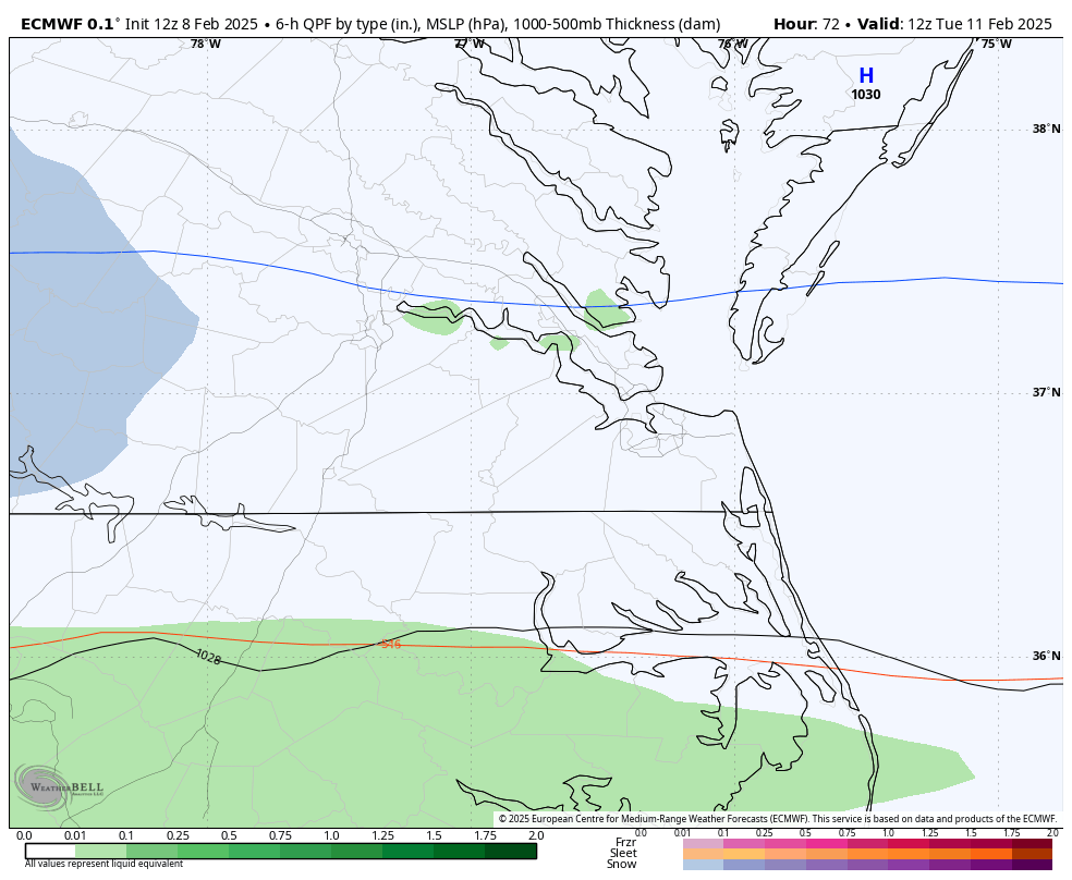
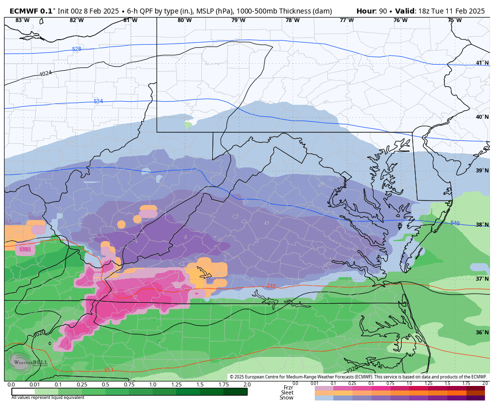
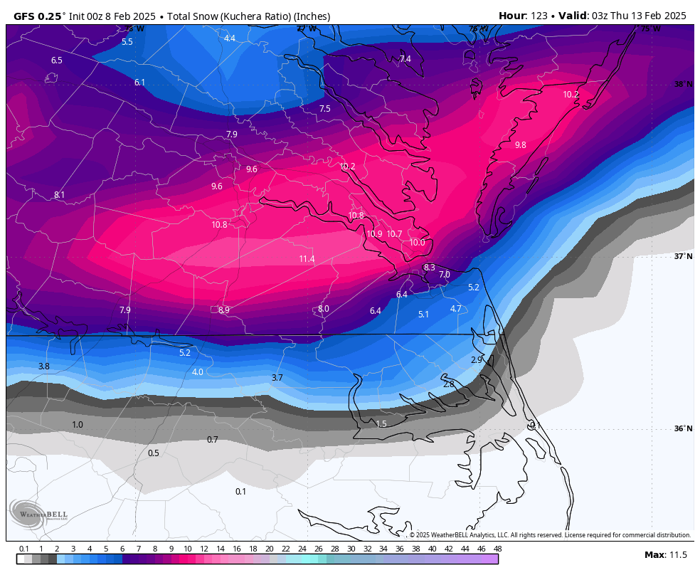
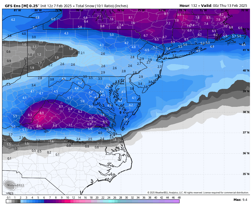
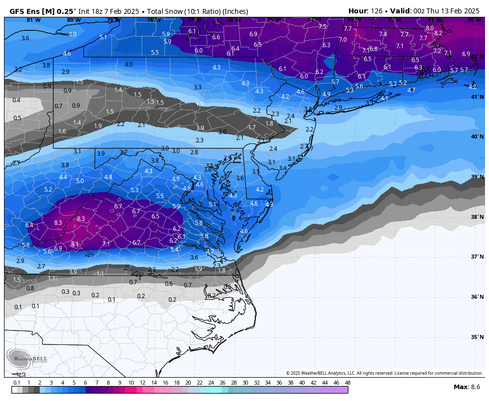
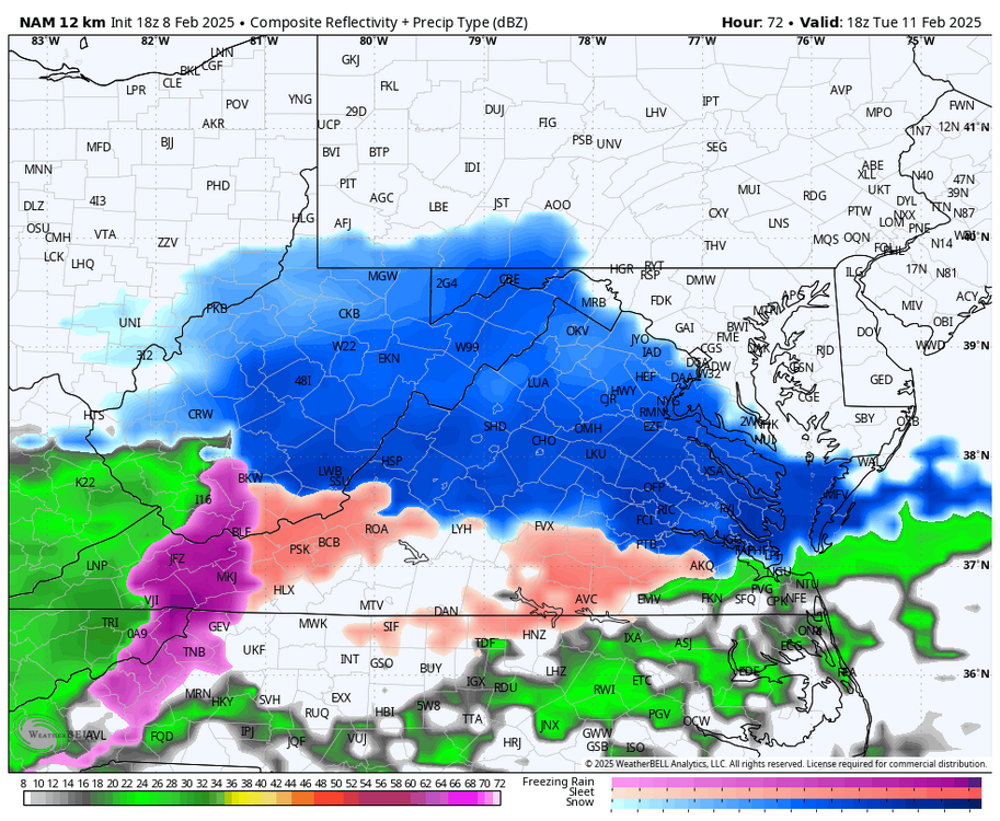
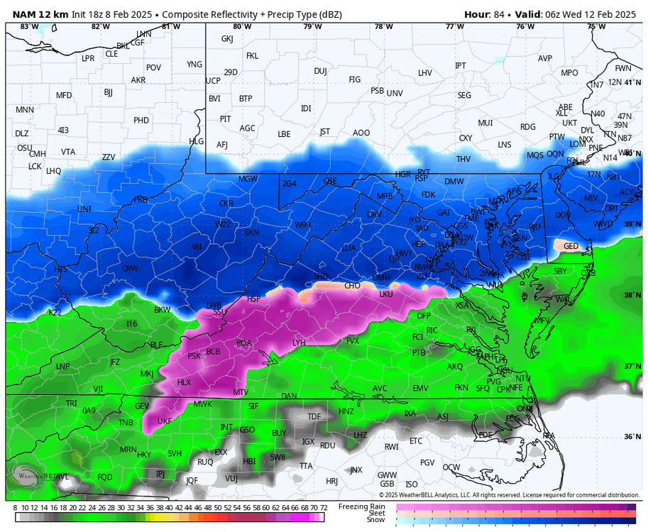
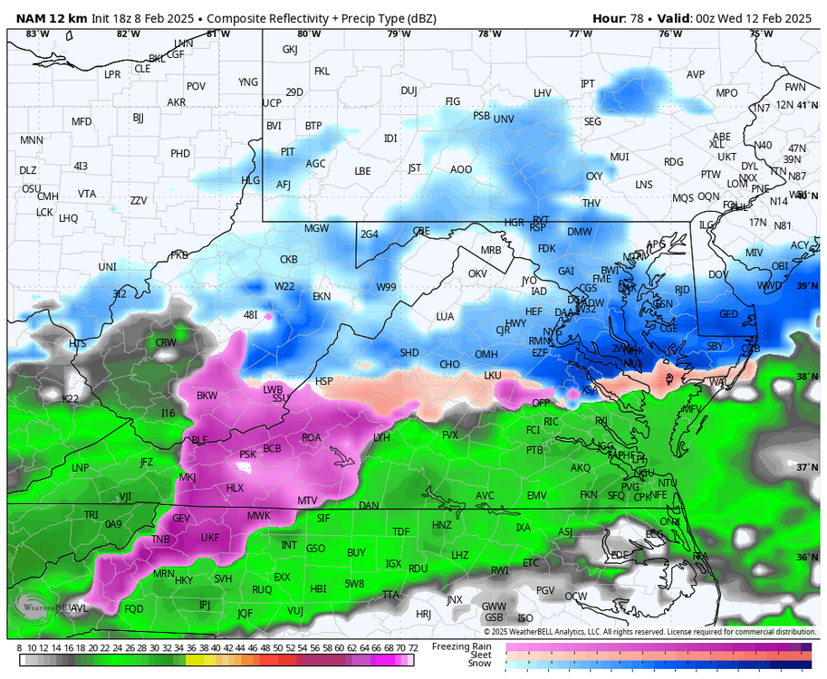
18Z NAM is getting within range and, so far, still favors the heaviest accumulations north of Richmond. Yes, it's the NAM, but I'm just showing another model for expectation management; we need the short term models to get more in line with the globals. Verbatim Richmond starts off as snow, but quickly changes over to rain. Precip arrival is also several hours later on the NAM compared to the 12z GFS, so that could be why it's warmer and less snow.

-
Richmond Metro/Hampton Roads Area Discussion
RIC Airport replied to RIC Airport's topic in Mid Atlantic
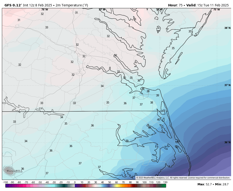
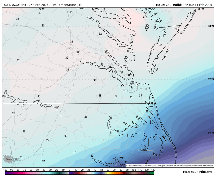
Yup, we also saw that during the 1/6 storm, the forecasted temps were off by about 5 degrees, including after the 2nd snowstorm later that week. 12z GFS has higher snowfall totals, because it has RIC at 32°F during the heaviest rates. Hopefully it's correct.


-
Richmond Metro/Hampton Roads Area Discussion
RIC Airport replied to RIC Airport's topic in Mid Atlantic
There was a nice uptick on the EPS from the 6z and 00z runs.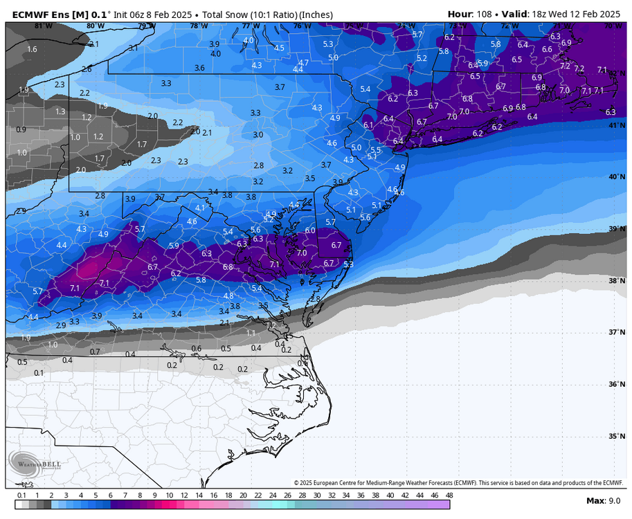

-
Richmond Metro/Hampton Roads Area Discussion
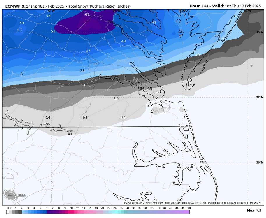
RIC Airport replied to RIC Airport's topic in Mid Atlantic
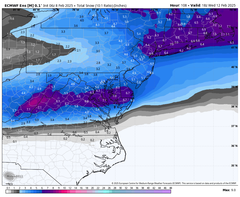
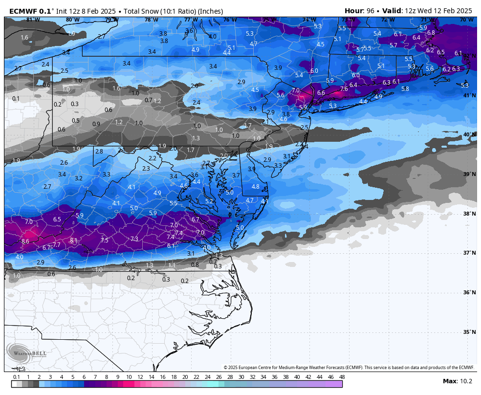
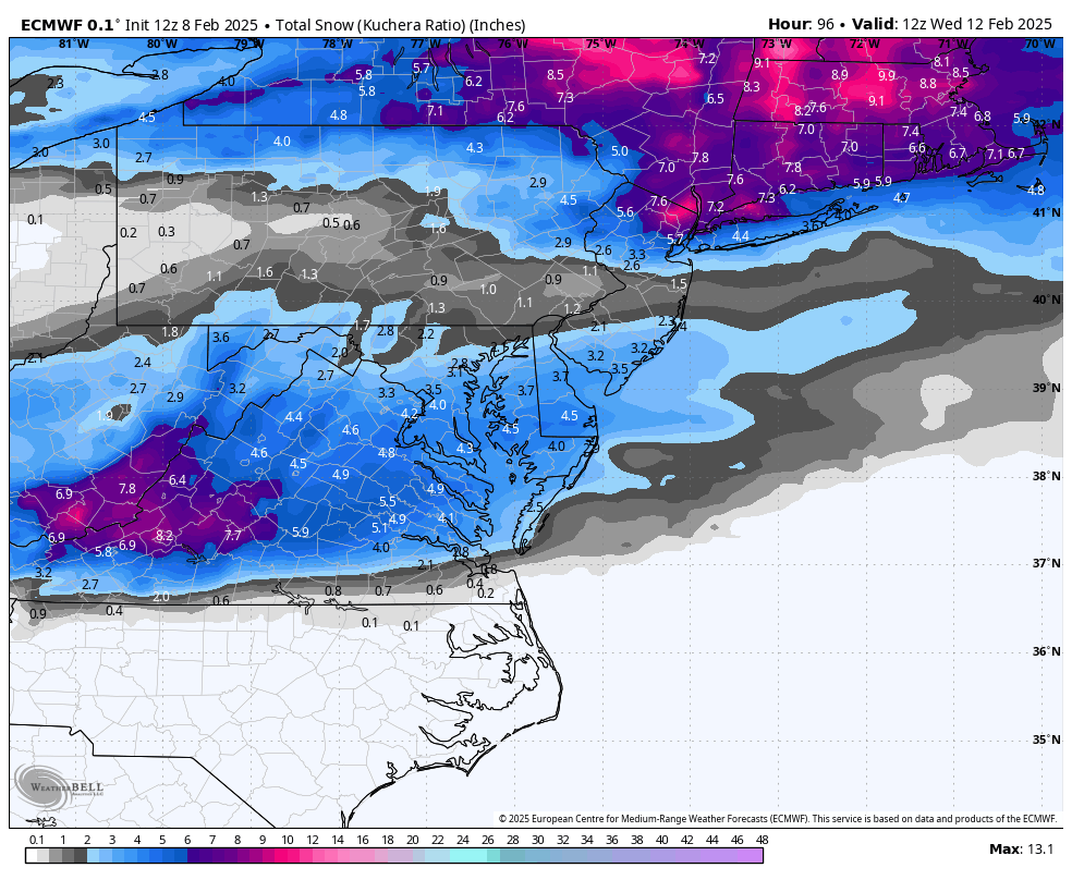
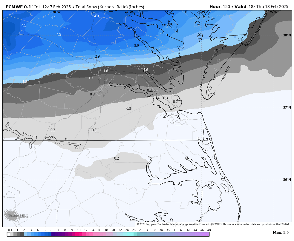
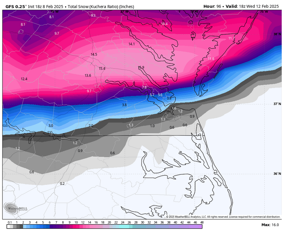
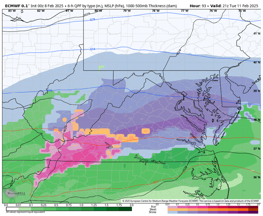
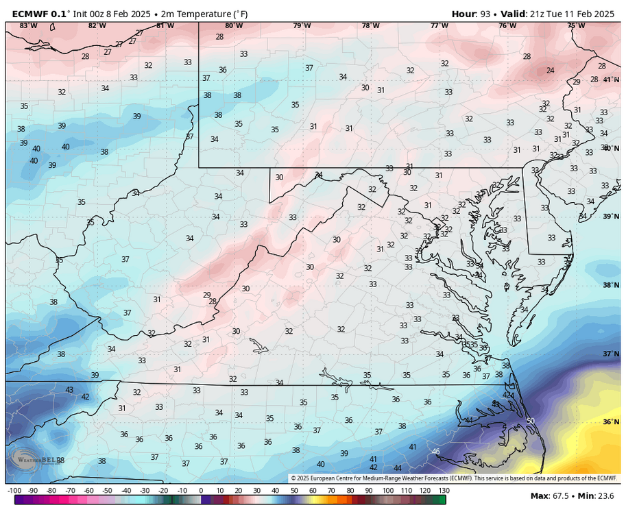
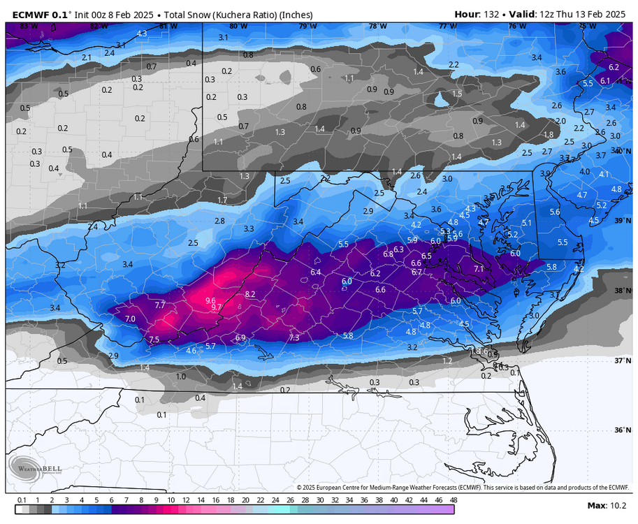
Euro has surface temperatures around 33-34°F during the event, so there won't be an exact 10:1 ratio. Note the difference between 10:1 and the Kuchera map I posted earlier. Hopefully, the heaviest bands will set right up over Richmond Metro, which could help temperatures reach freezing long enough for the snow to pile up in spots. Lighter rates will probably mean 33°Fvs 32°F. The best thing about this is that the precip is starting early in the morning, which should help.
-
Richmond Metro/Hampton Roads Area Discussion
RIC Airport replied to RIC Airport's topic in Mid Atlantic
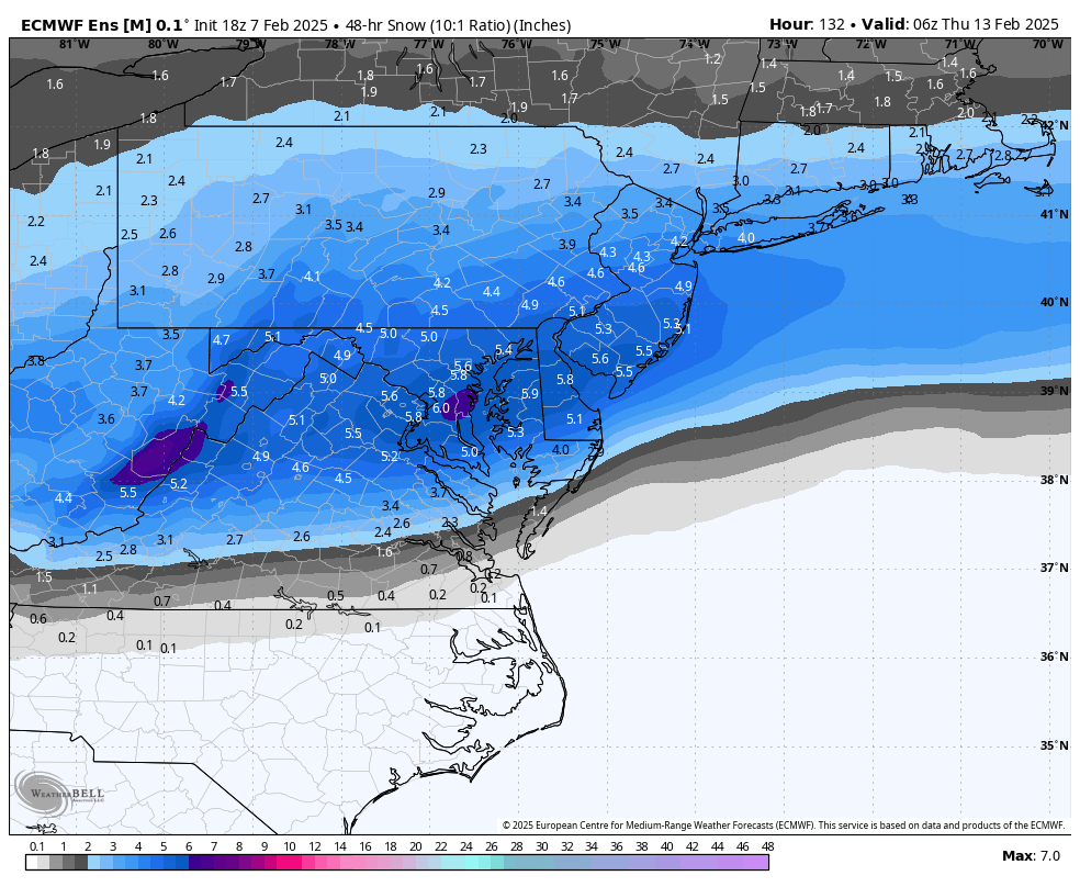
10:1 fwiw
-
Richmond Metro/Hampton Roads Area Discussion
RIC Airport replied to RIC Airport's topic in Mid Atlantic
@jlewis1111, all of that being said, the 12z Euro is farther south.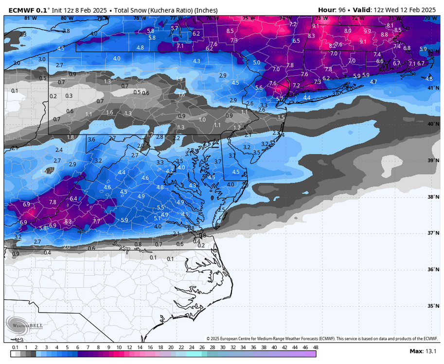
-
Richmond Metro/Hampton Roads Area Discussion
RIC Airport replied to RIC Airport's topic in Mid Atlantic
Also, @jlewis1111, although this is out in range for that model, the NAM, at least as of now, is favoring a north. But, all of this doesnt mean RIC won't see any snow. NBM lags behind a bit, but still has recent data is also favoring the heaviest being north.

-
Richmond Metro/Hampton Roads Area Discussion
RIC Airport replied to RIC Airport's topic in Mid Atlantic
Here is the 12Z GEFS and the 6z EPS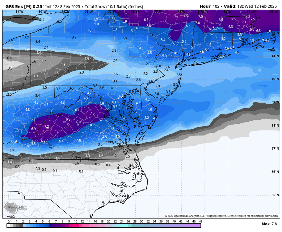
-
Richmond Metro/Hampton Roads Area Discussion
RIC Airport replied to RIC Airport's topic in Mid Atlantic
It is indeed for the Richmond area. Although there are still many signs that the heaviest accumulations will be north of Richmond.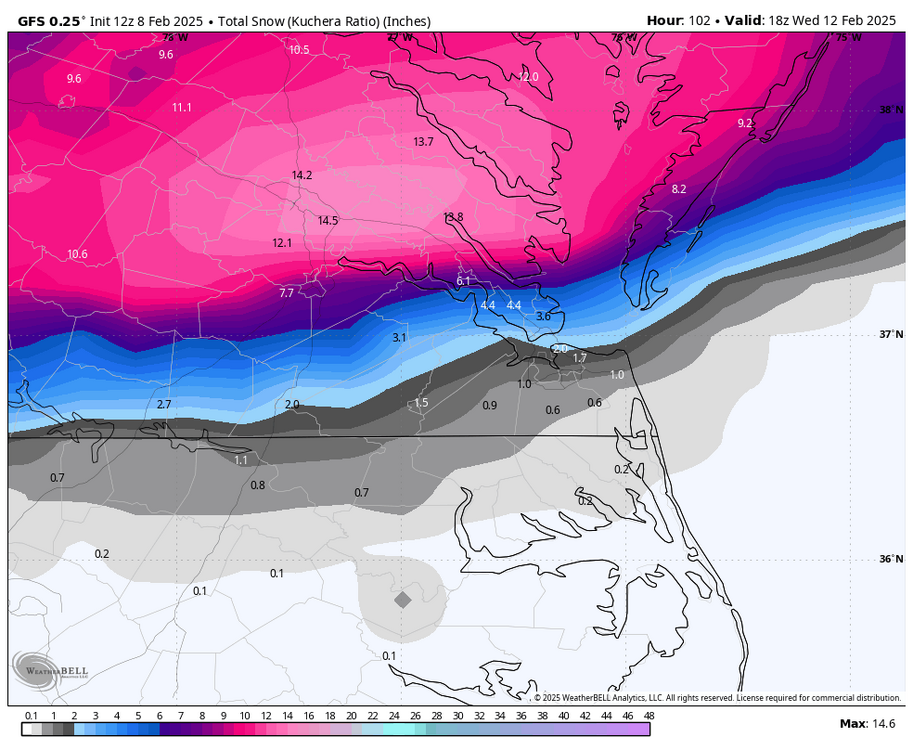
-
Richmond Metro/Hampton Roads Area Discussion
RIC Airport replied to RIC Airport's topic in Mid Atlantic
It's too bad when I get back from NYC Thursday evening, it'll be melted by rain and temperatures in the 50s. But, hopefully the wet snow piles up beforehand.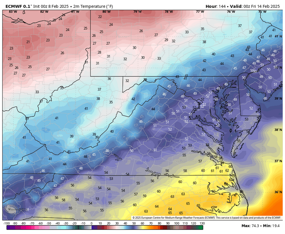
-
Richmond Metro/Hampton Roads Area Discussion
RIC Airport replied to RIC Airport's topic in Mid Atlantic


-
Richmond Metro/Hampton Roads Area Discussion
RIC Airport replied to RIC Airport's topic in Mid Atlantic
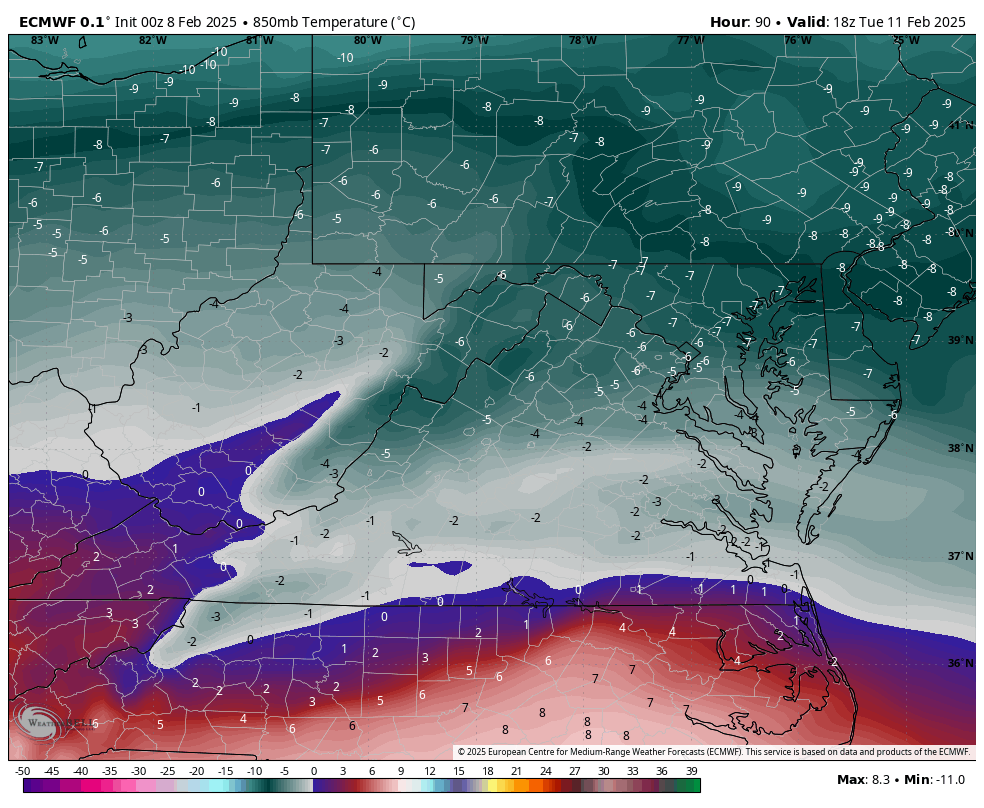
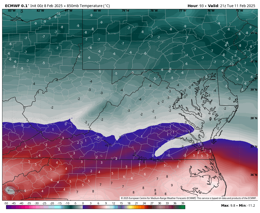
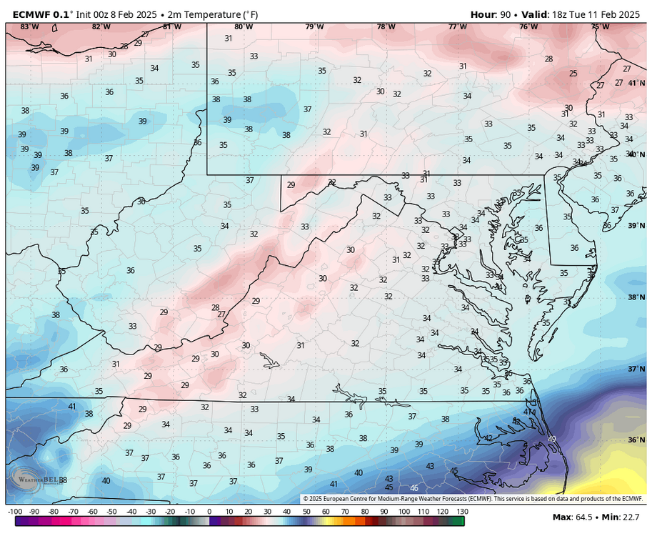
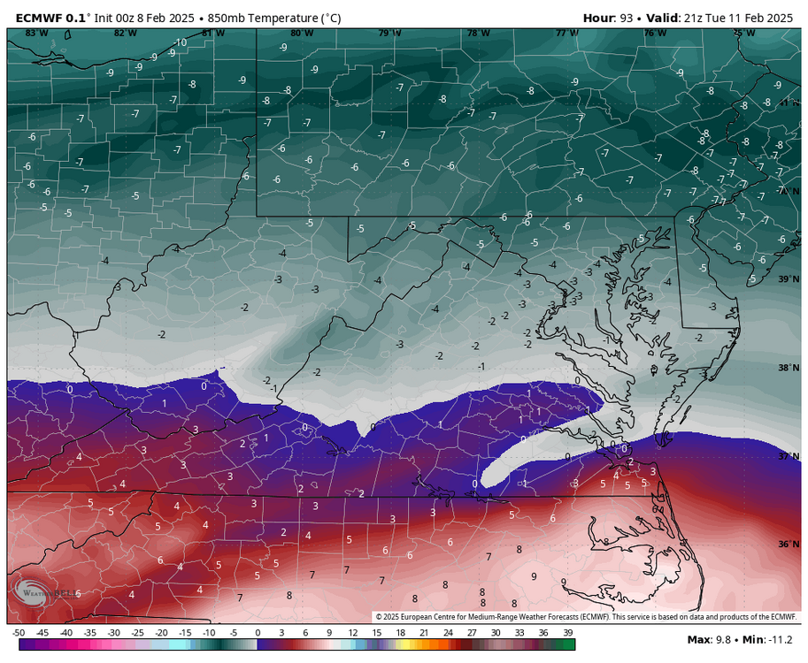
it would be even better is surface temps were colder, RIC is 33-34F for the whole event. Would need to rely on heavy rates before temps at 850mb rise above 0C toward Tuesday evening. -
Richmond Metro/Hampton Roads Area Discussion
RIC Airport replied to RIC Airport's topic in Mid Atlantic
-
Richmond Metro/Hampton Roads Area Discussion
RIC Airport replied to RIC Airport's topic in Mid Atlantic
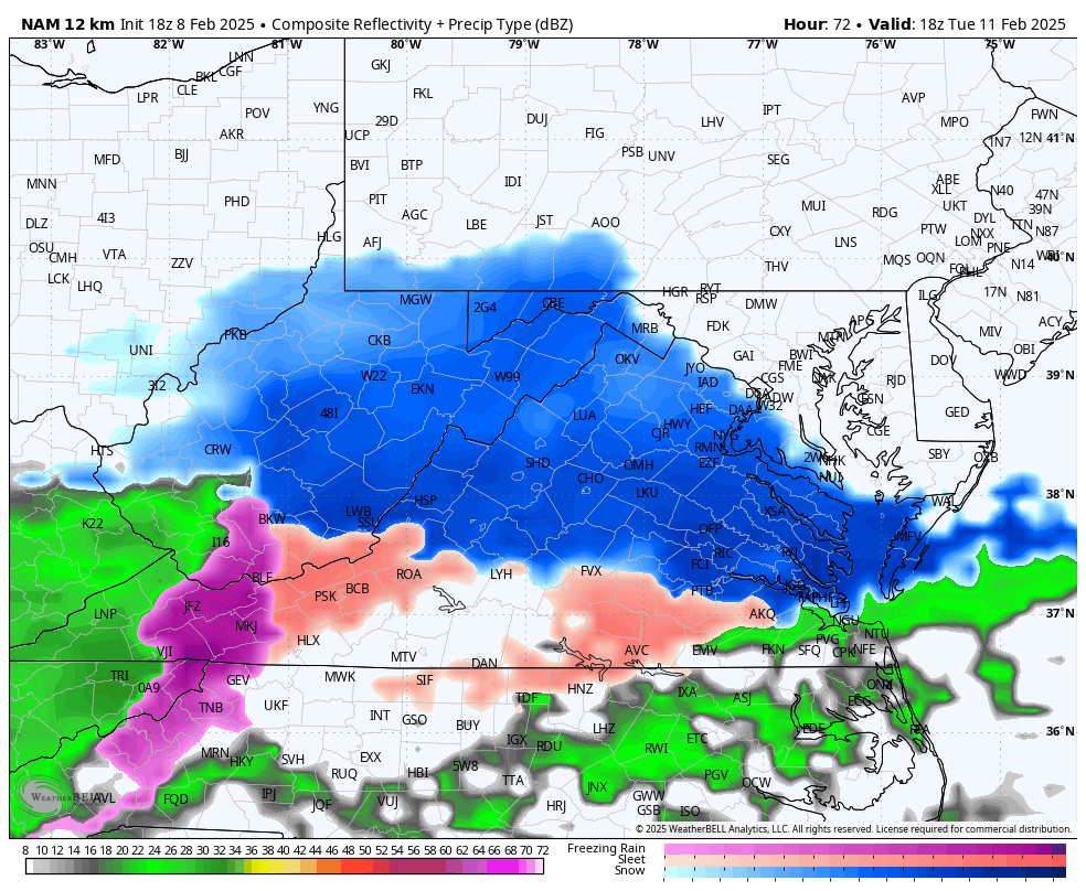
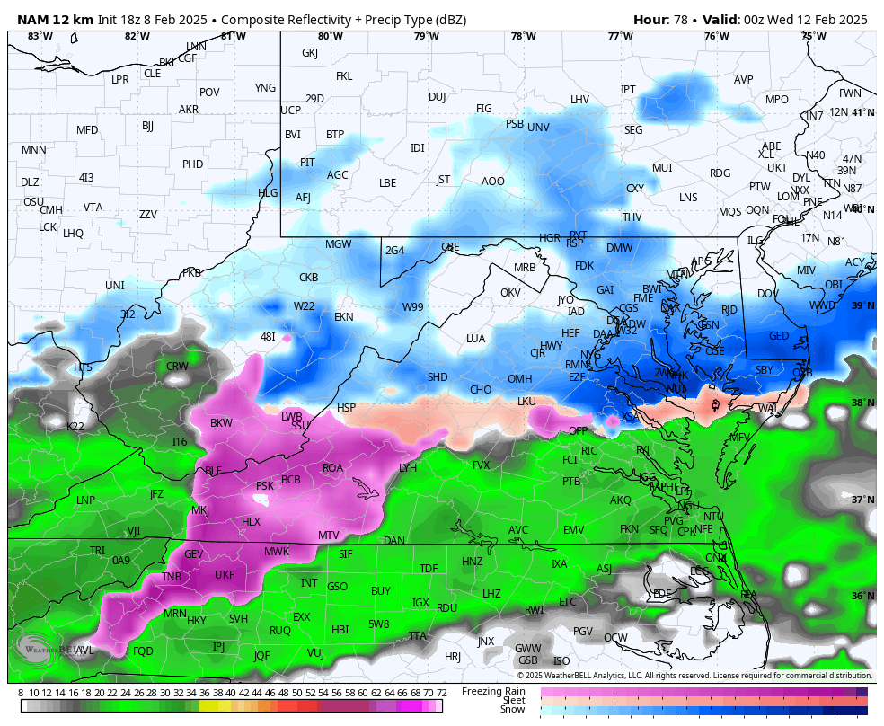
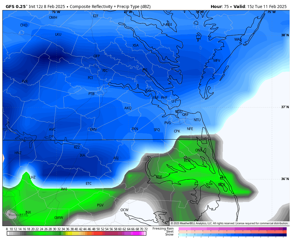
Also looks like 2 separate waves, the first one is warmer with temps around 32-33. However, the 2nd arriving Tuesday night and Wednesday morning is where things really get good.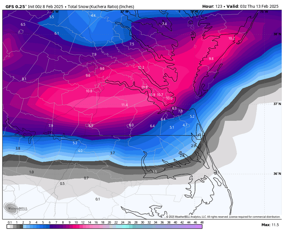
-
Richmond Metro/Hampton Roads Area Discussion
RIC Airport replied to RIC Airport's topic in Mid Atlantic
There was a nice uptick farther south on the 18z EPS compared to the 12z. Time will tell.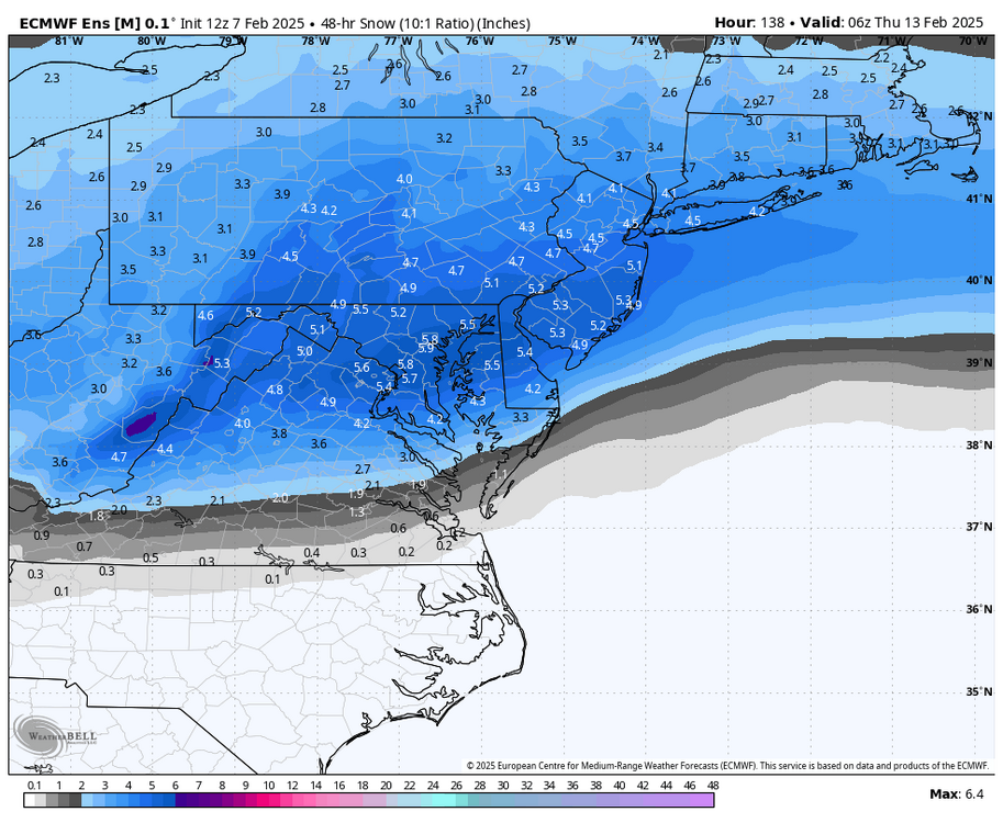
-
Richmond Metro/Hampton Roads Area Discussion
RIC Airport replied to RIC Airport's topic in Mid Atlantic
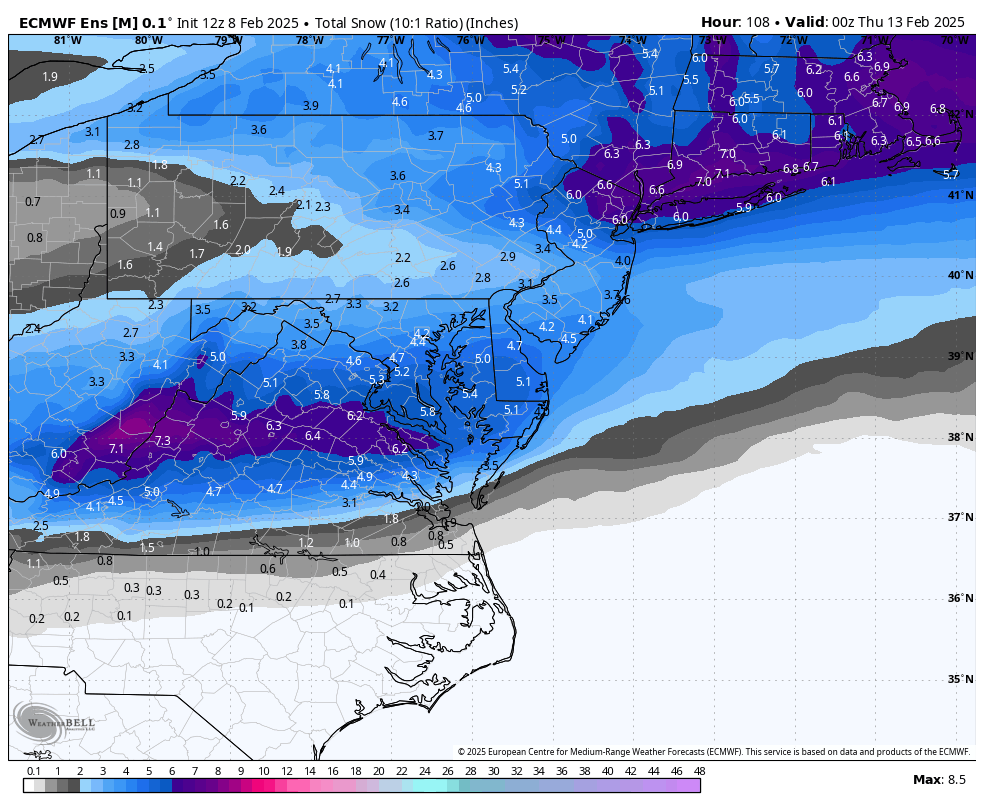
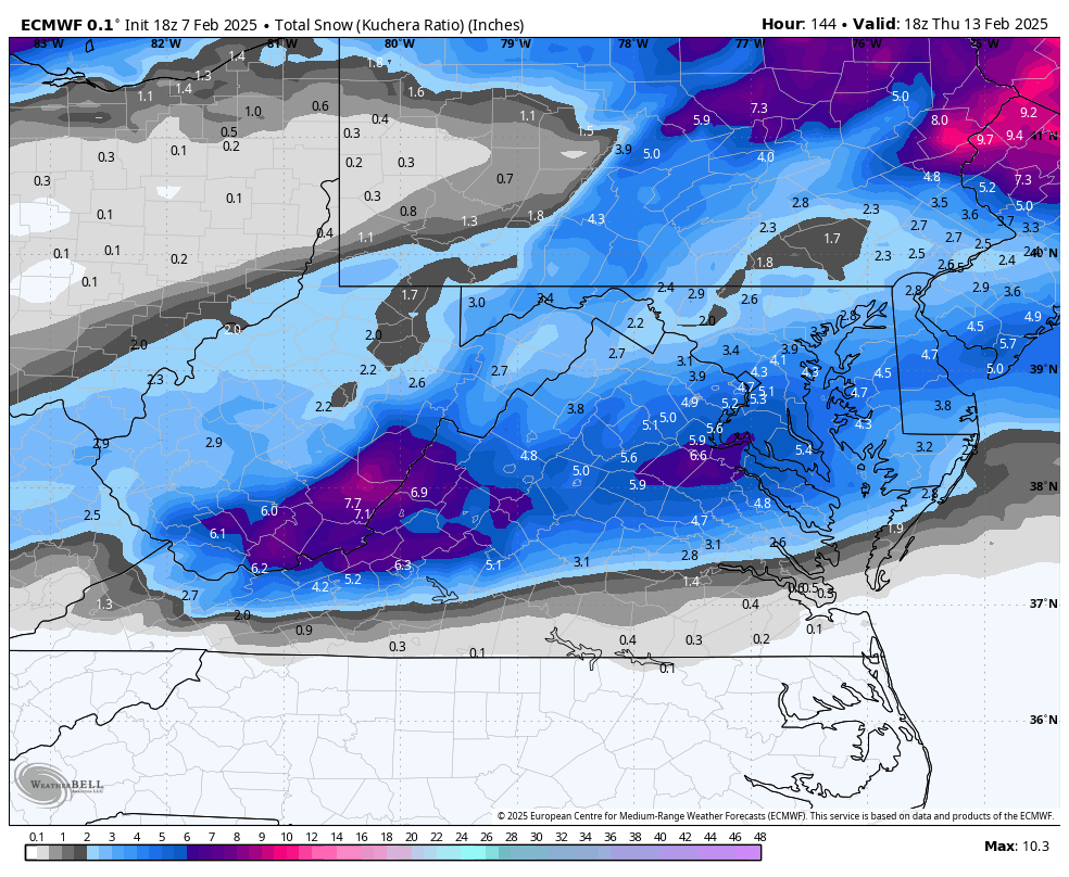
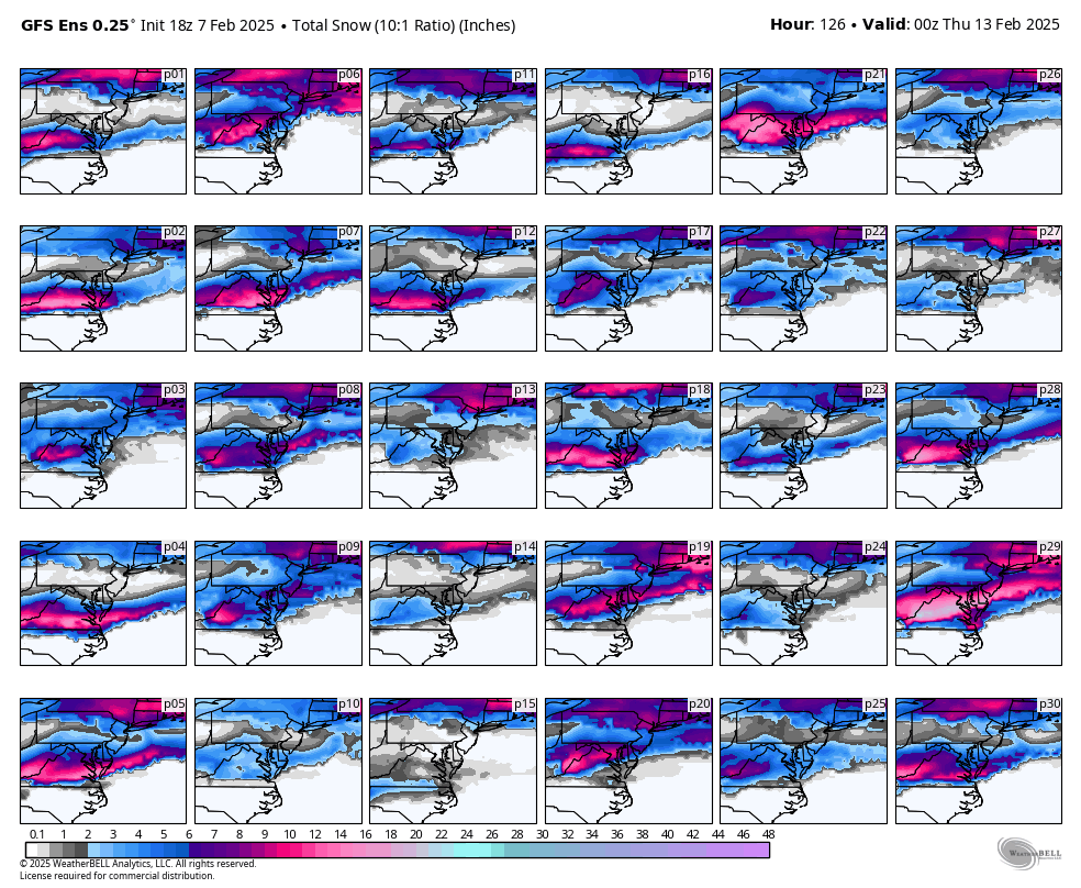
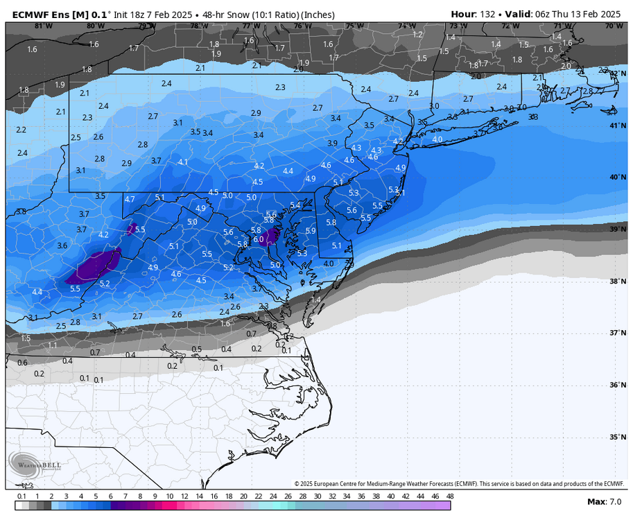
Local map 18z vs 12z, Euro definitely was south this run. Maybe a trend? 12Z EURO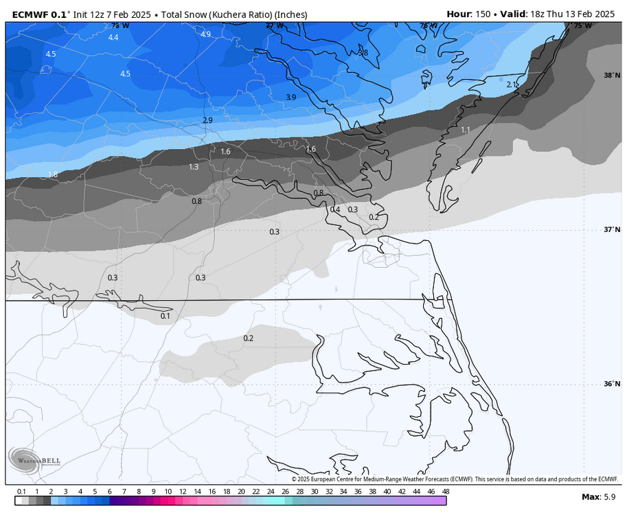
-
Richmond Metro/Hampton Roads Area Discussion
RIC Airport replied to RIC Airport's topic in Mid Atlantic
18z Euro
-
Richmond Metro/Hampton Roads Area Discussion
RIC Airport replied to RIC Airport's topic in Mid Atlantic
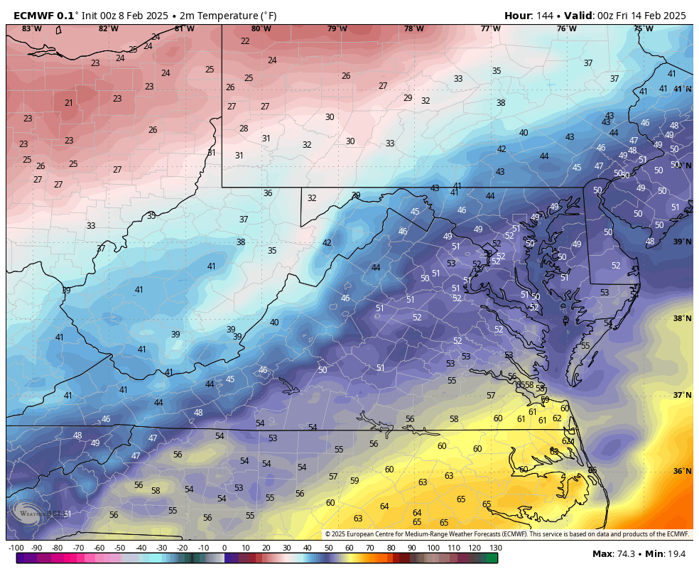
Yup, I joined Easternuswx back in 2004. It's hard to believe it's been that long. Those were the best days. Since we migrated to AMEX, I feel it hasn't been the same. Also, I agree with this, we really do need to see the Euro come around before I become more confident. I also share @RVAman concerns as with this being 5 days out so much can change. The GFS can quickly shift 40-50 miles farther north, as much as we don't like to hear that. And it's not being a debbie downer, we know around here it's best to be cautious given what tends to happen. Historically, DCA has not been that much snowier than RIC, with RIC's annual average trailing behind by 3" for much of the 20th century. However, since about 1990, the gap has widened to about 5" due to a warmer temperature regime. The storms that used to hit NC and VA just don't happen with the regularity that they did from the 1980s and prior. About 60% of RIC's snowstorms correlate with DCA, while the other 40% have a SE connection (RDU/ORF). It's the southern snowstorms that used to only affect NC and VA while sparing the major NE cities that we are falling short on, thus making it more difficult for RIC. -
Richmond Metro/Hampton Roads Area Discussion
RIC Airport replied to RIC Airport's topic in Mid Atlantic

-
Richmond Metro/Hampton Roads Area Discussion
RIC Airport replied to RIC Airport's topic in Mid Atlantic
18z GEFS not much change rom 12z run.