RIC Airport
-
Posts
2,586 -
Joined
-
Last visited
Content Type
Profiles
Blogs
Forums
American Weather
Media Demo
Store
Gallery
Everything posted by RIC Airport
-
Richmond Metro/Hampton Roads Area Discussion
RIC Airport replied to RIC Airport's topic in Mid Atlantic
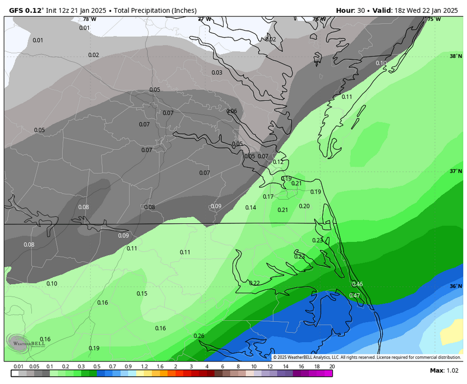
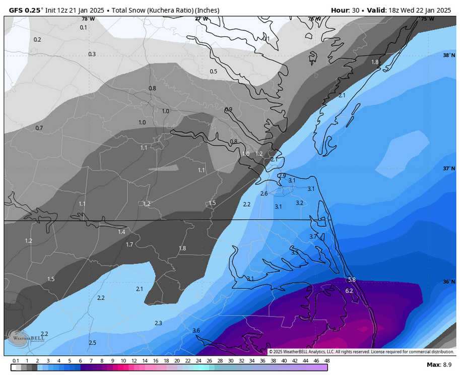
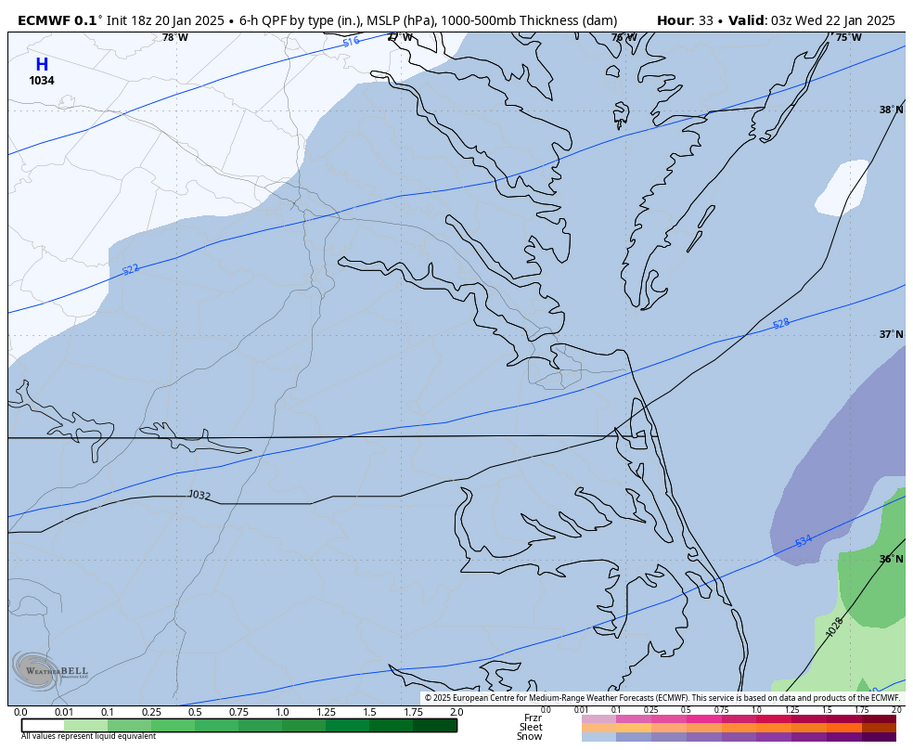
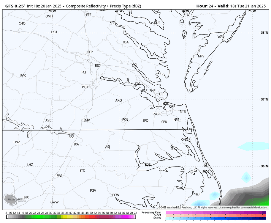
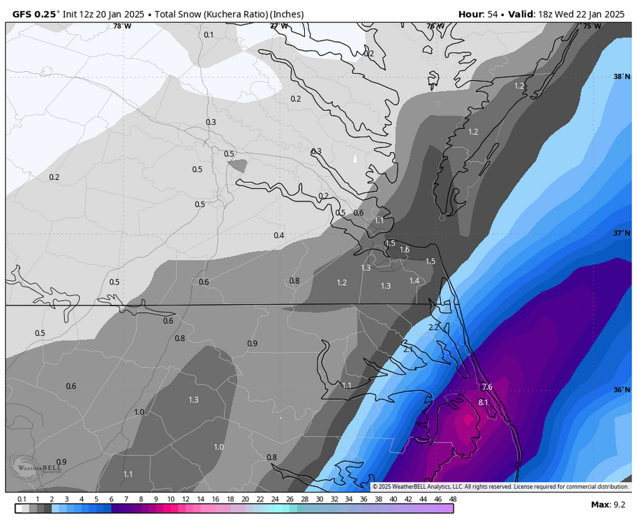
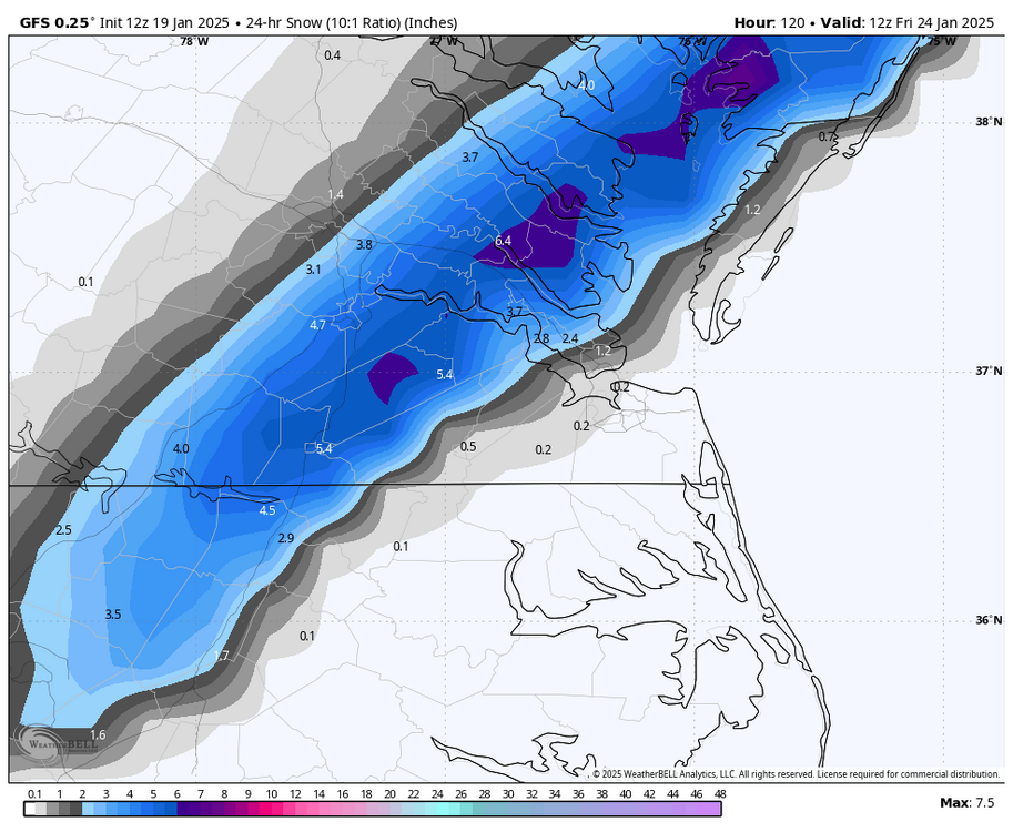
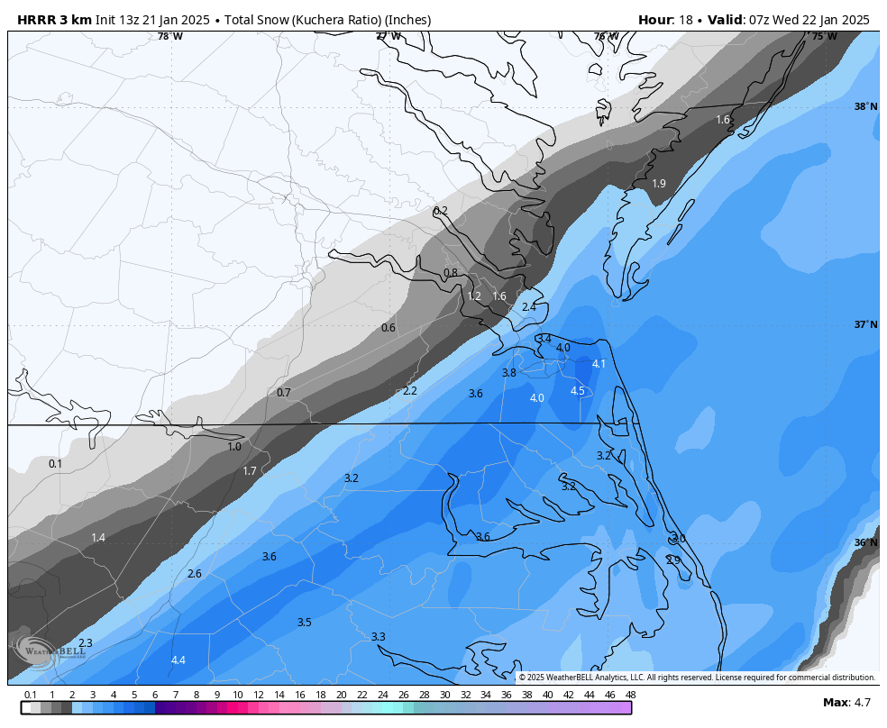
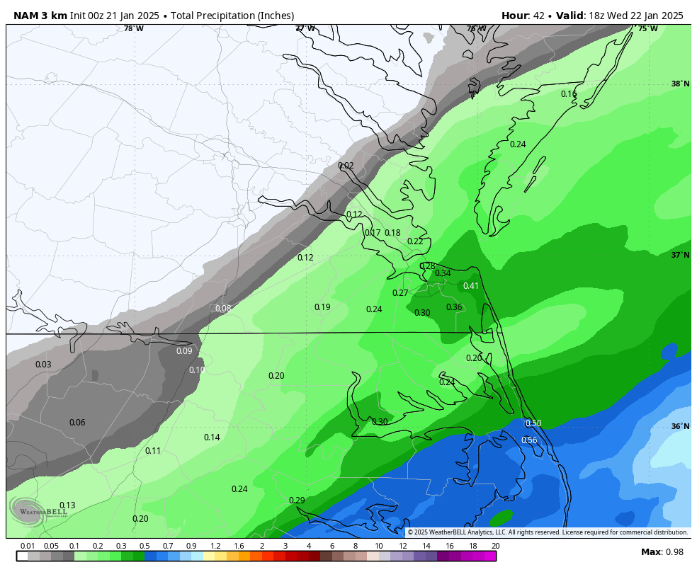
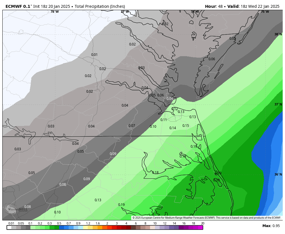
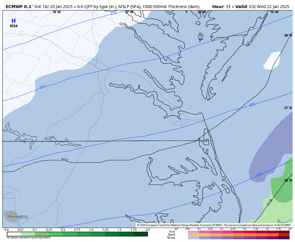
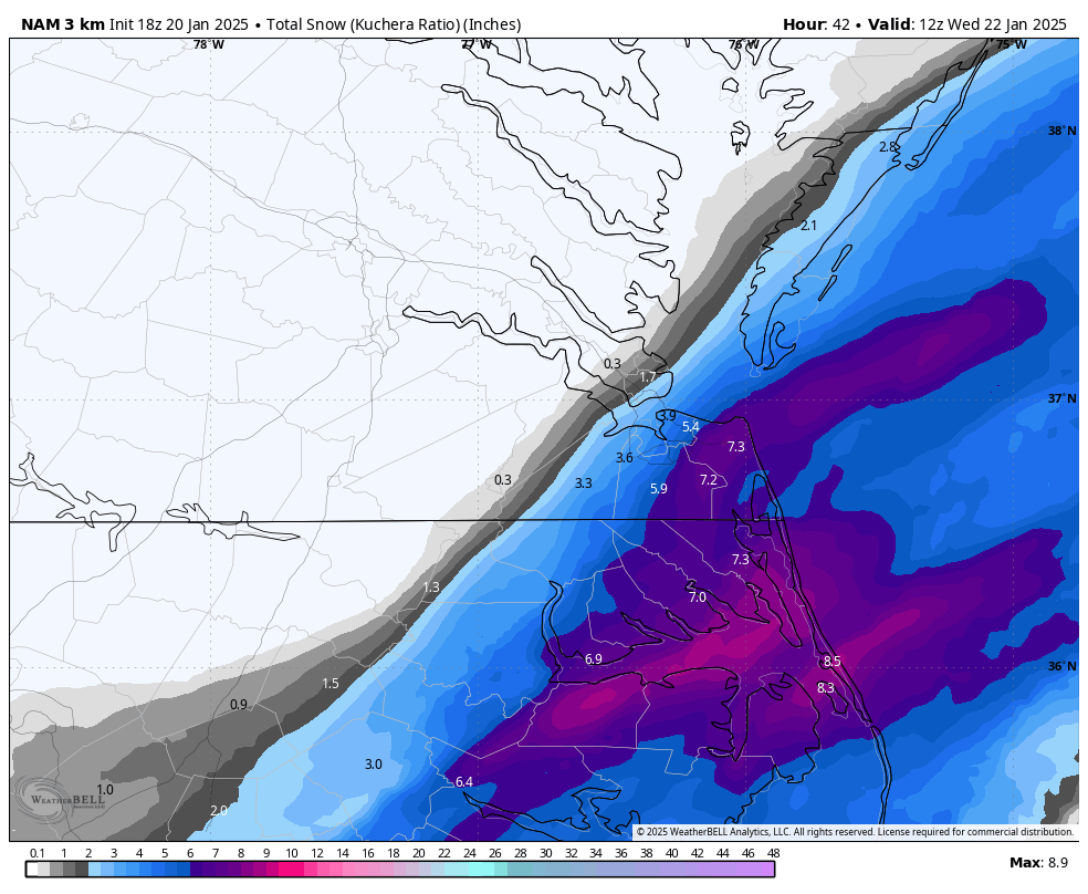
QPF totals on the 12z GFS are virtually the same for Hampton Roads and NE NC as the last 2-3 runs. However, the latest runs have expanded the precip shield farther west into Central VA.
-
Richmond Metro/Hampton Roads Area Discussion
RIC Airport replied to RIC Airport's topic in Mid Atlantic
It's always cool to see that, especially when it benefits northern Virginia Beach during snowstorms. -
Richmond Metro/Hampton Roads Area Discussion
RIC Airport replied to RIC Airport's topic in Mid Atlantic
Yup, the 13z HRRR had a nice uptick, even from the 12z run, over southside and interior parts of NC. I think AKQ's expansion of the advisories was spot on, taken this into account.
-
Richmond Metro/Hampton Roads Area Discussion
RIC Airport replied to RIC Airport's topic in Mid Atlantic
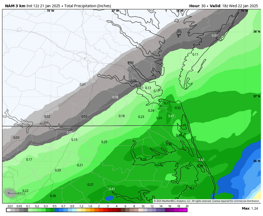
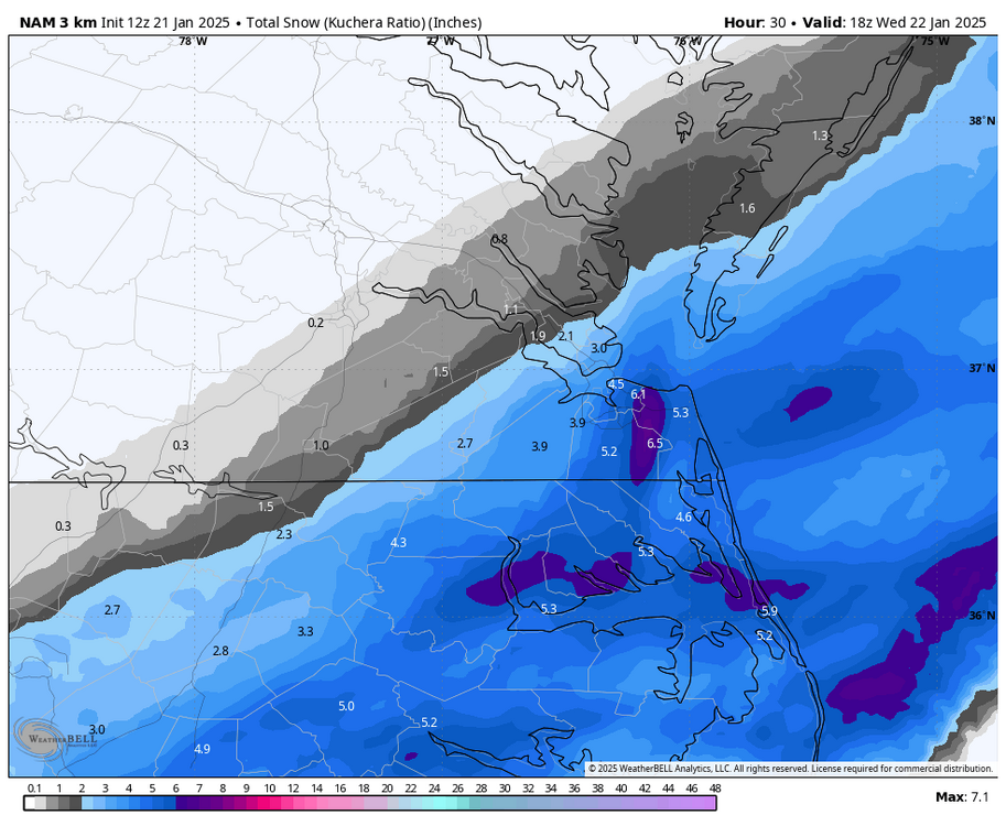
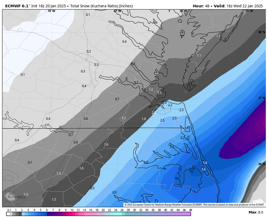
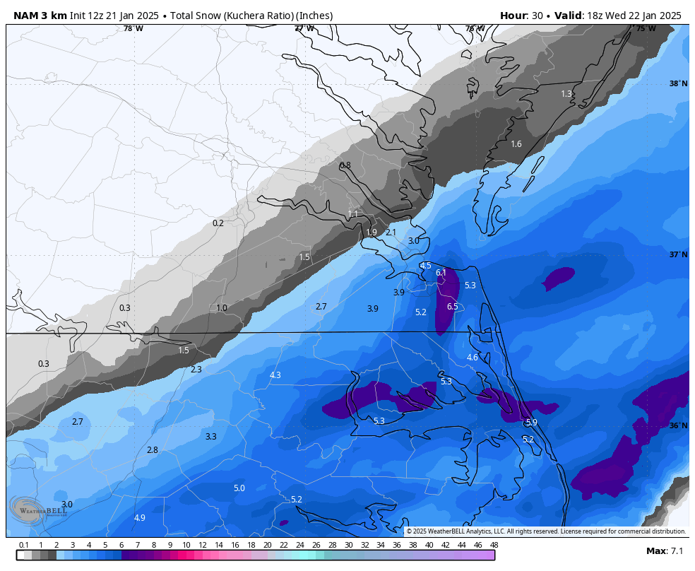
12z 3K NAM just finished, still looking good for Hampton Roads and NE NC. Wakefield issued advisories for southside Hampton Roads early this morning, but then farther west a few hour ago to include Newport News, Hampton, Isle of Wight and Southampton. Also, interior NE NC counties were added.
-
Richmond Metro/Hampton Roads Area Discussion
RIC Airport replied to RIC Airport's topic in Mid Atlantic
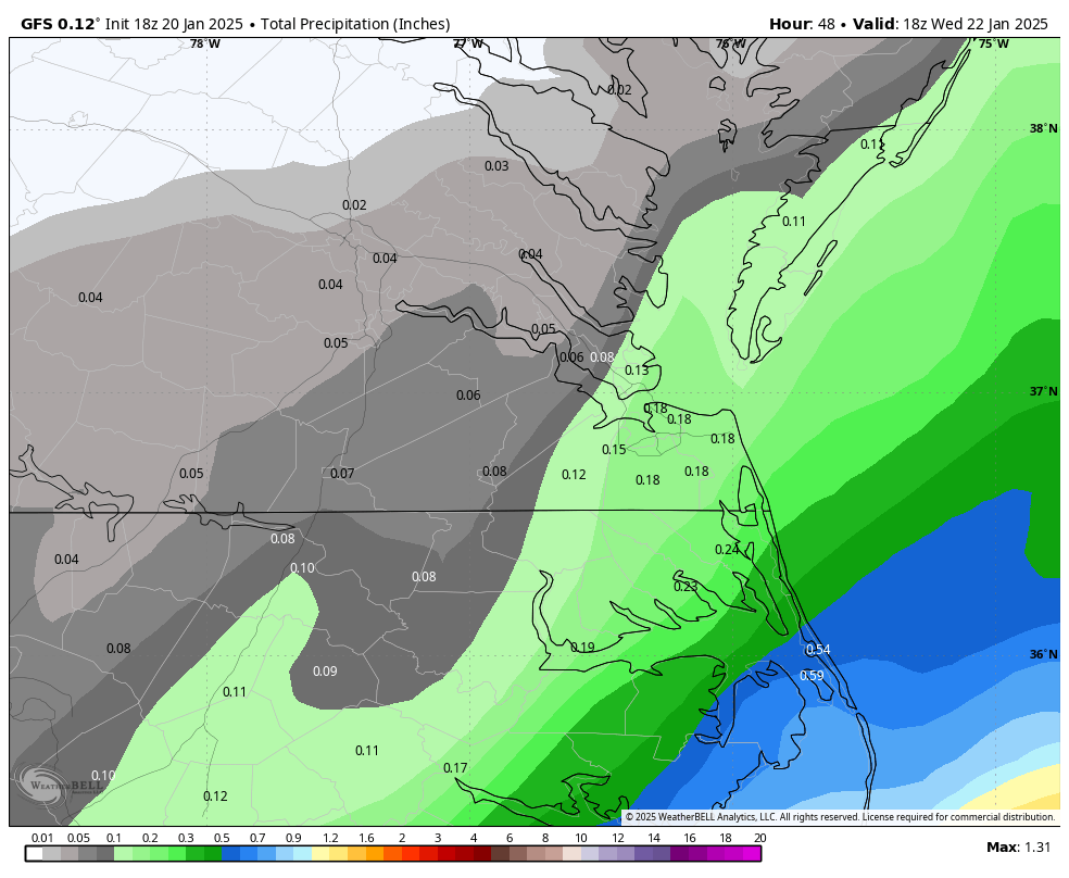
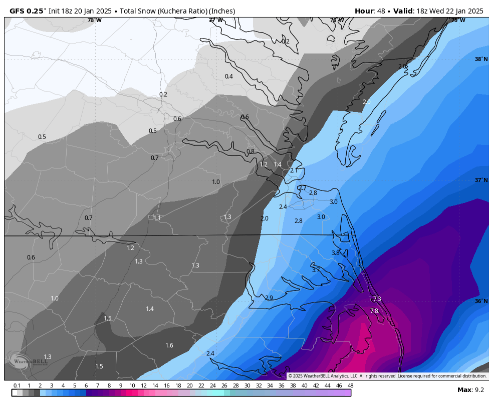
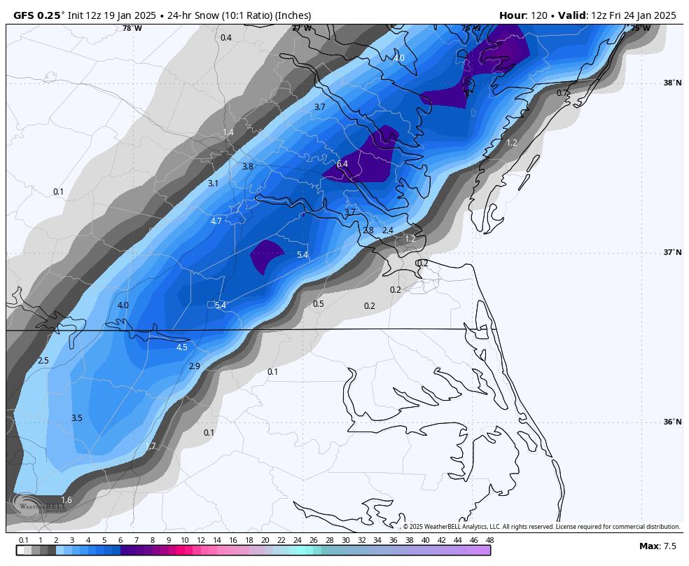
00Z GFS was lower than the 18z run, but still gets 1-2" up for Hampton Roads.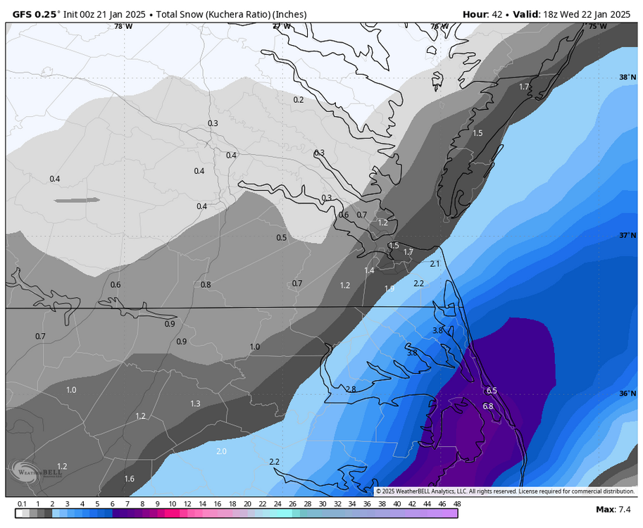

-
Richmond Metro/Hampton Roads Area Discussion
RIC Airport replied to RIC Airport's topic in Mid Atlantic
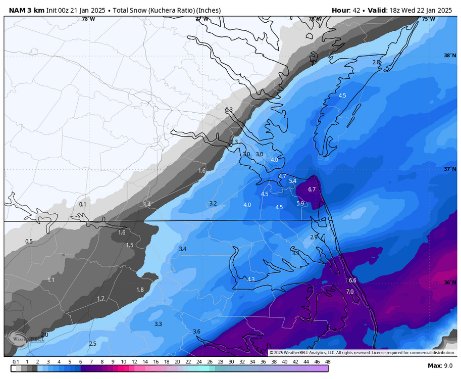
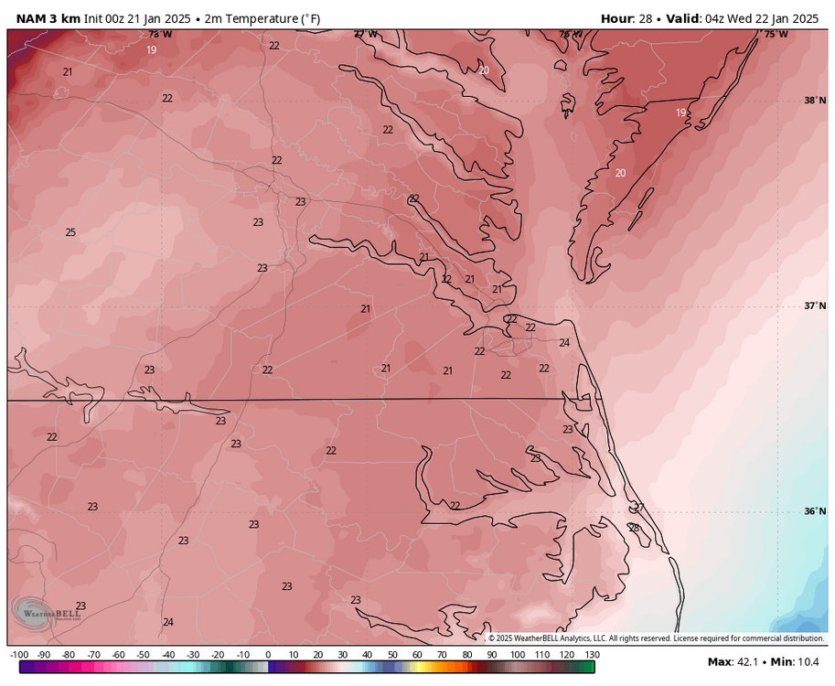
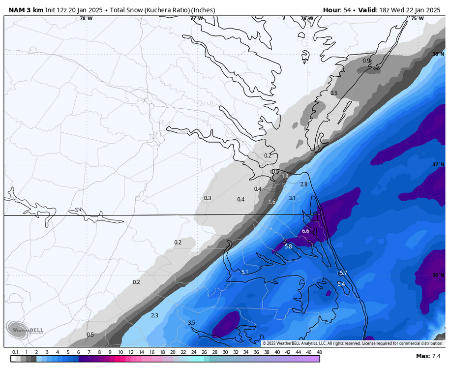
Yup, I did see the watches earlier and meant to mention it here, they may need to consider expanding them north of the border. The 00z 3K NAM had a notable increase in QPF, now 0.30-0.40" as far north as Hampton Roads and even 0.10" as far west as Williamsburg. With air temps in the low 20s, such ratios can easily get you a few inches.

-
Richmond Metro/Hampton Roads Area Discussion
RIC Airport replied to RIC Airport's topic in Mid Atlantic
Yeah, that phenomenon usually doesn't last long enough to produce anything substantial, although there are rare occasions when more occurs. I'll have to do some research. Here is one case of it. https://www.weather.gov/akq/25Dec1999 -
Richmond Metro/Hampton Roads Area Discussion
RIC Airport replied to RIC Airport's topic in Mid Atlantic
Just a smidge.

-
Richmond Metro/Hampton Roads Area Discussion
RIC Airport replied to RIC Airport's topic in Mid Atlantic
Here is the latest GRAF model. You can see the Chesapeake Bay effect enhancement as it pulls away. https://x.com/MikeTFox5/status/1881471384284545259 -
Richmond Metro/Hampton Roads Area Discussion
RIC Airport replied to RIC Airport's topic in Mid Atlantic


-
Richmond Metro/Hampton Roads Area Discussion
RIC Airport replied to RIC Airport's topic in Mid Atlantic
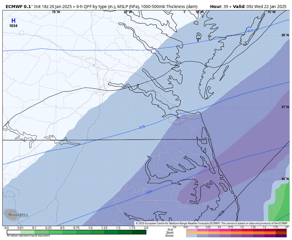
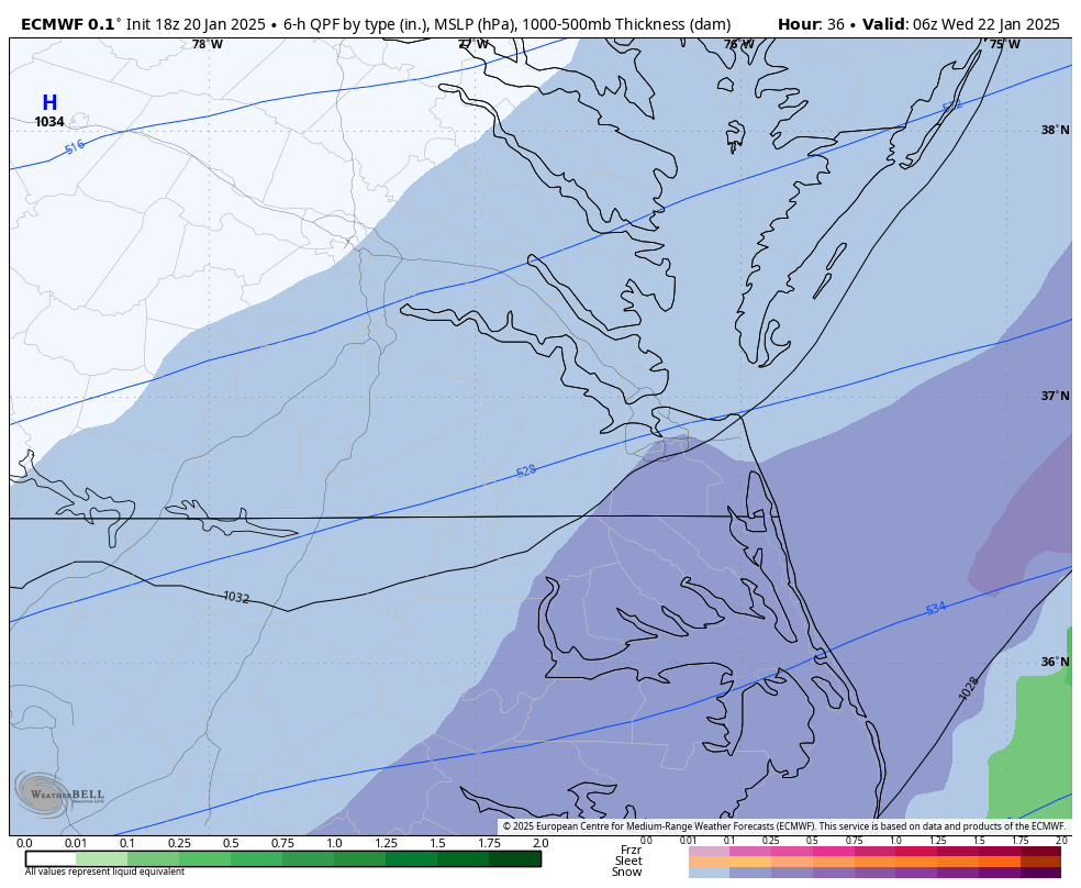
18z 3K NAM feels like the 1/23/2003 storm I mentioned the other day.

-
Richmond Metro/Hampton Roads Area Discussion
RIC Airport replied to RIC Airport's topic in Mid Atlantic
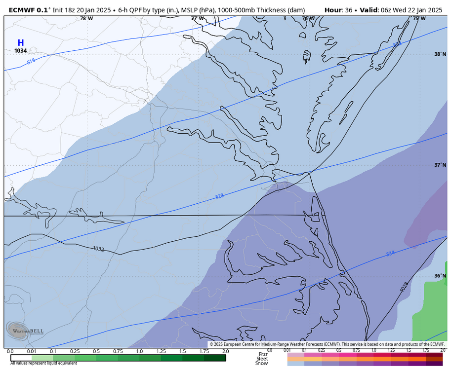
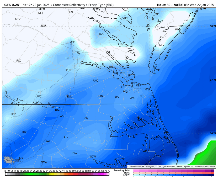
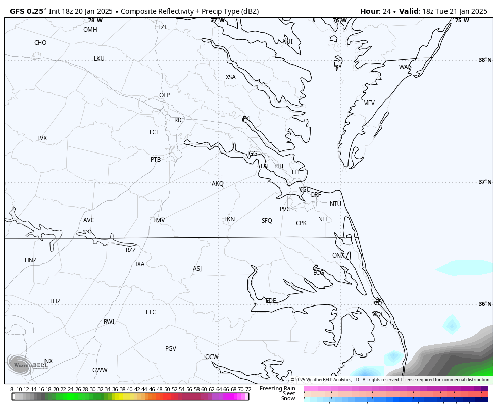
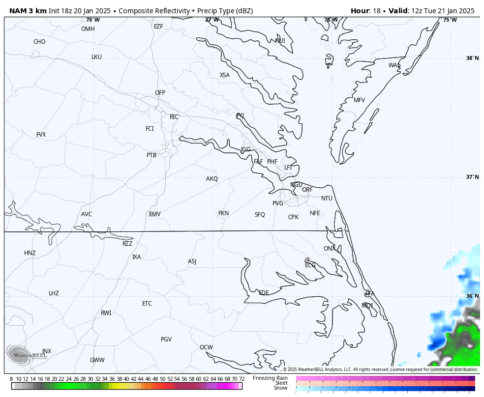
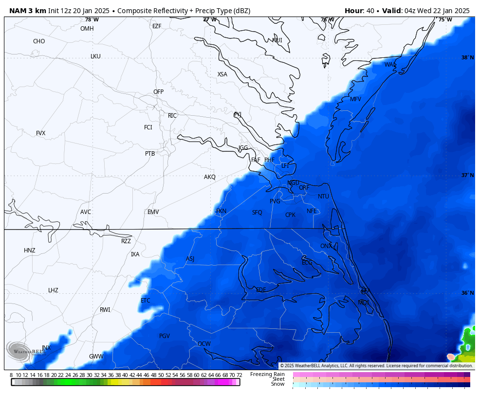
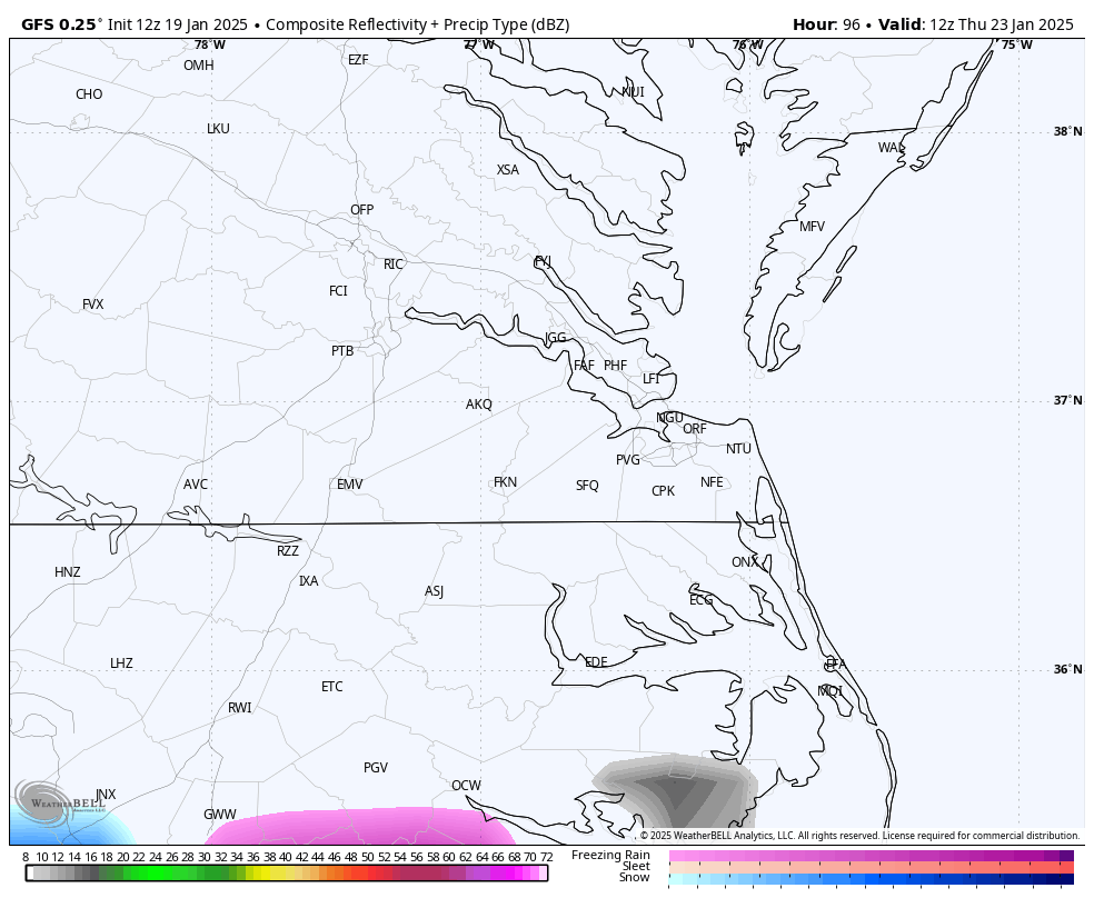
3k NAM has the snow reaching as far north as PHF, but it's very brief, maybe an hour or so at most before precip slides back to the SE. 12z GFS just came in, has a more expansive precip field. This is as far north and west as it gets.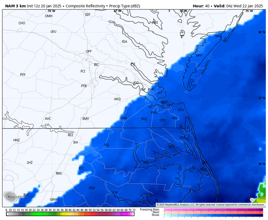
-
Richmond Metro/Hampton Roads Area Discussion
RIC Airport replied to RIC Airport's topic in Mid Atlantic
I paid monthly for a few months last winter and then got an annual this summer. I won't do that again because I didn't start using it routinely until November. I am not here much in the summer, but I'll become active if there is a hurricane threat. Many people track summer storms, but to me, they are too routine and not as interesting. I guess I'll cherish the remains of the small piles of dirty snow in parking lots and along sidewalks during this arctic outbreak. The leftover snow in my backyard took a beating yesterday as about 80% of what lasted for the last 1.5 weeks melted. As of this morning, only a tiny amount remained, but that melted today. Seems like our next possible threat is not until around 1/30 - 2/1. -
Richmond Metro/Hampton Roads Area Discussion
RIC Airport replied to RIC Airport's topic in Mid Atlantic
I'm either back in NYC or possibly Chicago. I haven't decided yet. @Conway7305@wasnow215, @Stormpc, or @chris624wxwill have to take the reins for this thread next winter. Although I could participate from afar as I did in the past, I still have a soft spot for winter weather in this area having lived in Richmond and HR at different times in my life. I'm definitely taking a break, at least for the next few days. I may just check once or twice a day. I need to get caught up on a lot, and tracking has been too much wasted effort. -
Richmond Metro/Hampton Roads Area Discussion
RIC Airport replied to RIC Airport's topic in Mid Atlantic
Tim Pandajis has been really active and transparent with the changing information. Wish more were like him. I remember when he worked in Richmond maybe 10-12 years ago. -
Richmond Metro/Hampton Roads Area Discussion
RIC Airport replied to RIC Airport's topic in Mid Atlantic
This is also my last winter here, I'll be out by the the beginning of April. Had hoped to go out with a winter bang, but we'll see. -
Richmond Metro/Hampton Roads Area Discussion
RIC Airport replied to RIC Airport's topic in Mid Atlantic
Might be time to take a break.
-
Richmond Metro/Hampton Roads Area Discussion
RIC Airport replied to RIC Airport's topic in Mid Atlantic
Seems worth monitoring. Euro and GFS have had it, although last couple runs of the Euro essentially took it away, keeping it well offshore.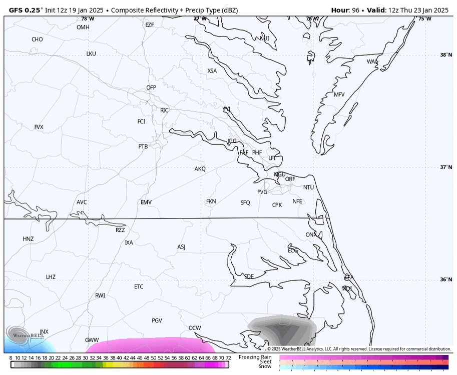
-
Richmond Metro/Hampton Roads Area Discussion
RIC Airport replied to RIC Airport's topic in Mid Atlantic
It's much warmer all over, including to the north of us. Not sure those high end snowfall totals will verify around DCA (still 38°F), could be on the low end the way things are going.
-
Richmond Metro/Hampton Roads Area Discussion
RIC Airport replied to RIC Airport's topic in Mid Atlantic
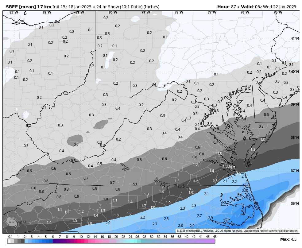
I don't usually pay attention to the SREFS, but I noticed a decent increase from the 15Z run to the current 21Z run, particularly for the Hampton Roads area regarding the event from Tuesday night into Wednesday. Since it's at the tail end of the run, it's difficult to make a true comparison, so take it FWIW. 21Z run vs 15Z
.thumb.png.96a347d8605c2690f83bdc7e8d8c5346.png)
-
Richmond Metro/Hampton Roads Area Discussion
RIC Airport replied to RIC Airport's topic in Mid Atlantic
Looks like they also increased the probability of reaching warning criteria to 50% as far west as Williamsburg and parts of Prince George.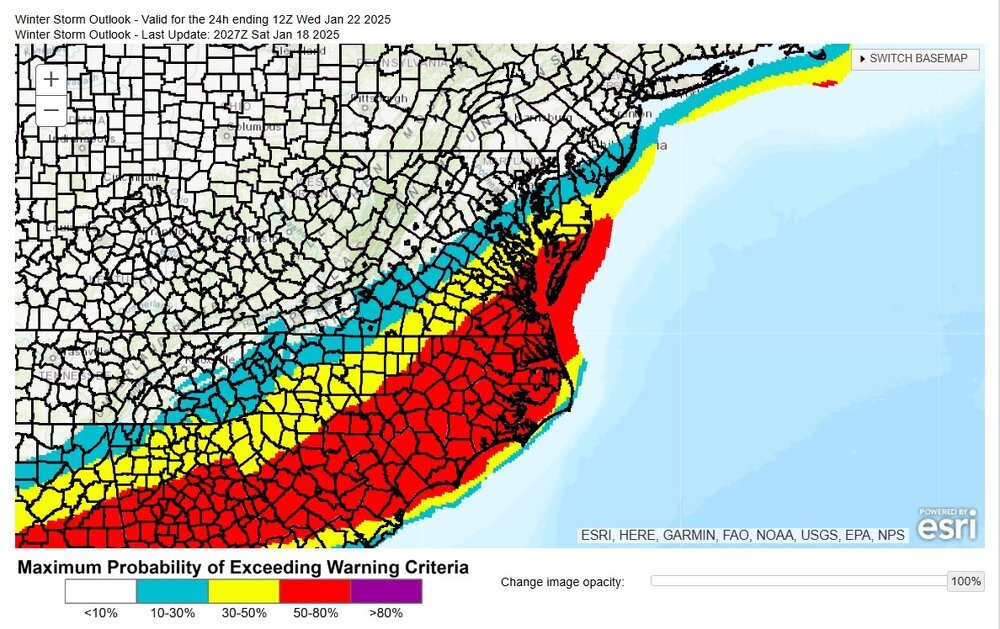
-
Richmond Metro/Hampton Roads Area Discussion
RIC Airport replied to RIC Airport's topic in Mid Atlantic
Yeah, clearly the Tuesday night into Wednesday threat has the greatest momentum. The Friday threat is at the end of the run while that storm is still going so I wouldn't read into those numbers as much. It'll be interesting to see how the Euro and the GFS, since they both see the Friday system, handle that threat. We certainly have an interesting week ahead of us. -
Richmond Metro/Hampton Roads Area Discussion
RIC Airport replied to RIC Airport's topic in Mid Atlantic
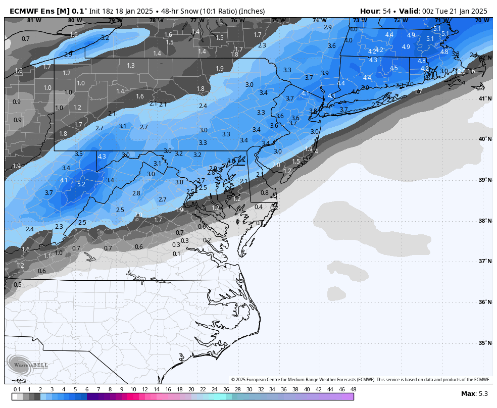
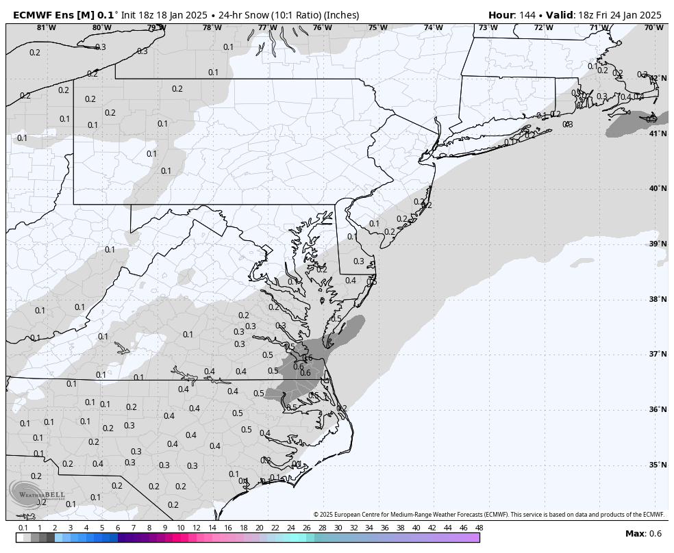
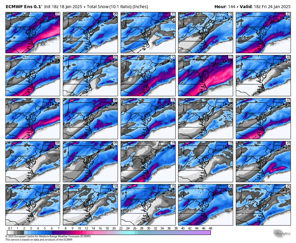
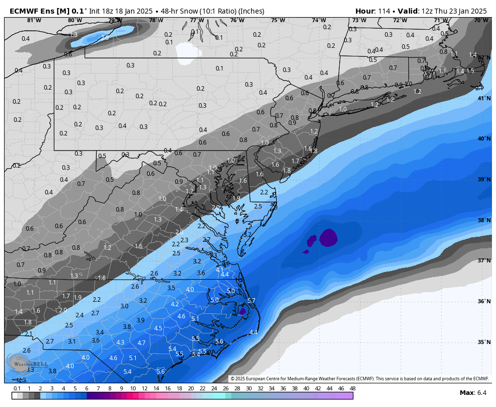
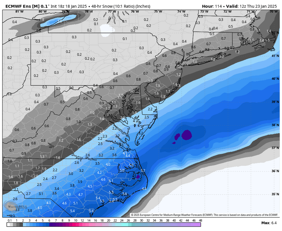
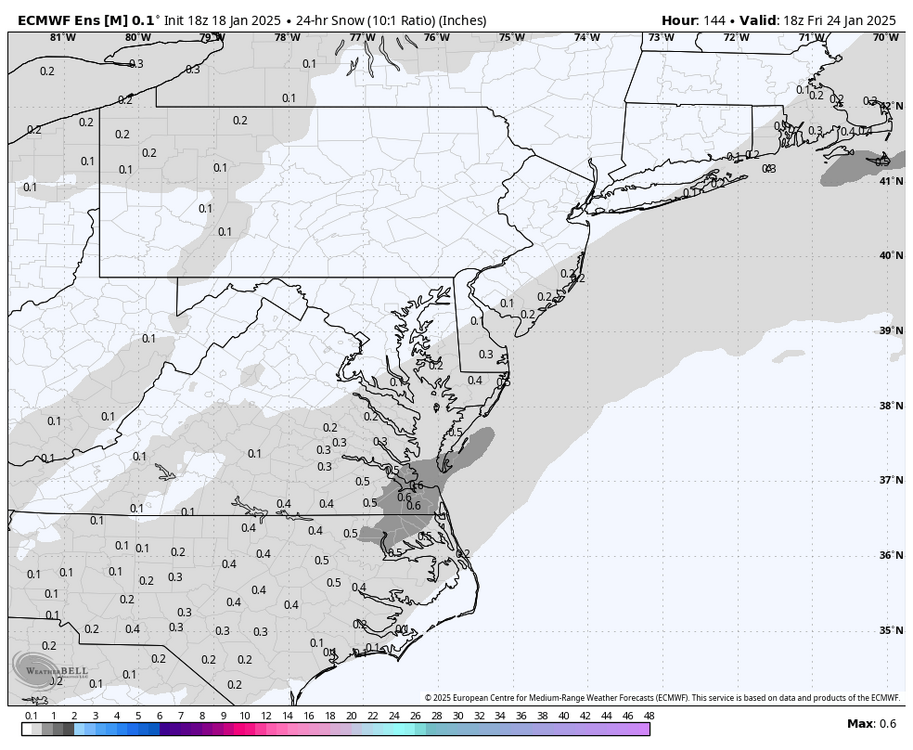
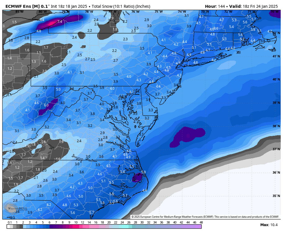
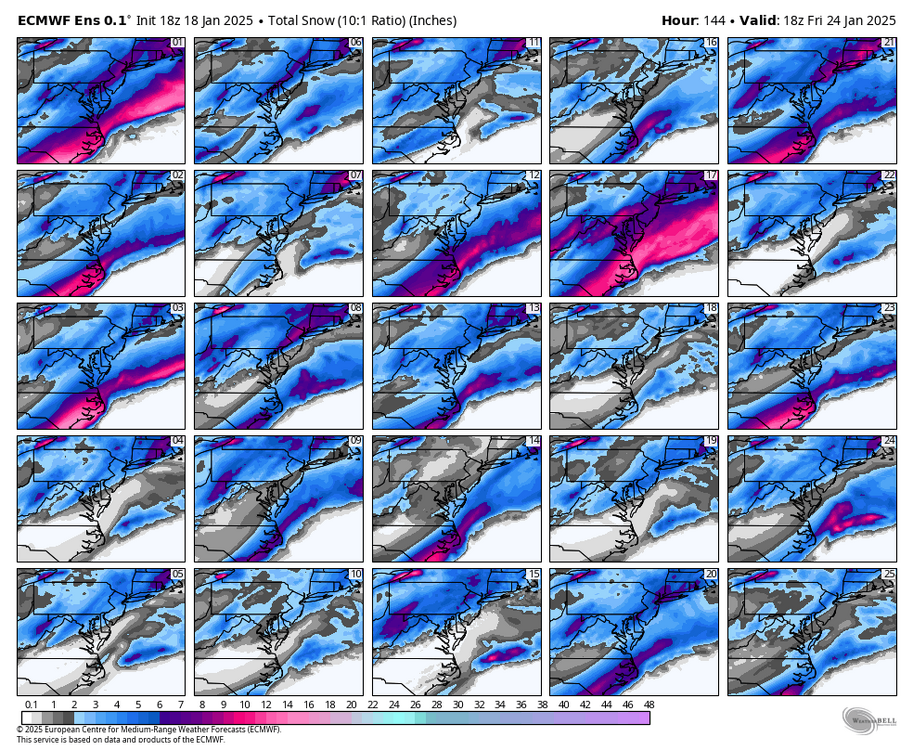
The bottom three maps were an attempt to separate the mean among the 3 threats. -
Richmond Metro/Hampton Roads Area Discussion
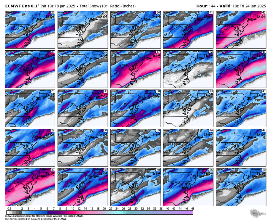
RIC Airport replied to RIC Airport's topic in Mid Atlantic
I tried to separate the three events, but 18z only goes out to 144 and the Friday threat is still going at the end of the run.
-
Richmond Metro/Hampton Roads Area Discussion
RIC Airport replied to RIC Airport's topic in Mid Atlantic
18z EPS still seems pretty aggressive with mid week threat.


.png.8cd27981ca4fc19928fecfa299f1e213.png)