RIC Airport
-
Posts
2,586 -
Joined
-
Last visited
Content Type
Profiles
Blogs
Forums
American Weather
Media Demo
Store
Gallery
Everything posted by RIC Airport
-
Richmond Metro/Hampton Roads Area Discussion
RIC Airport replied to RIC Airport's topic in Mid Atlantic
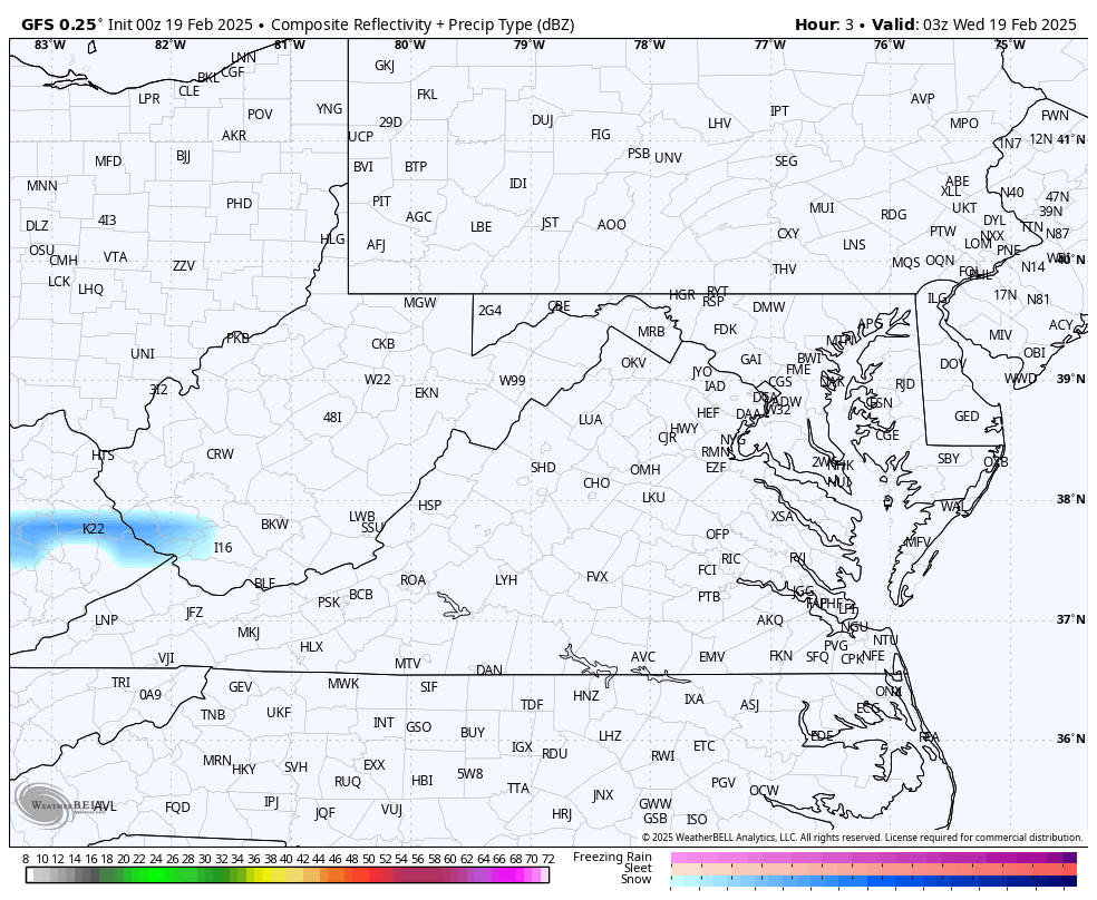
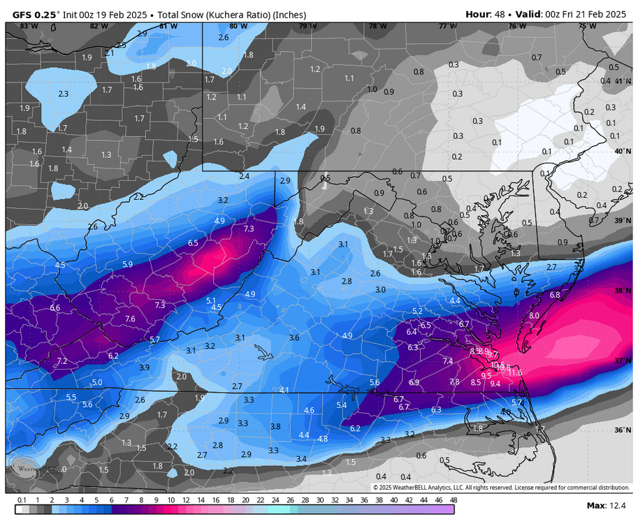
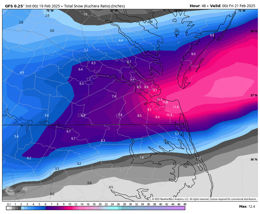
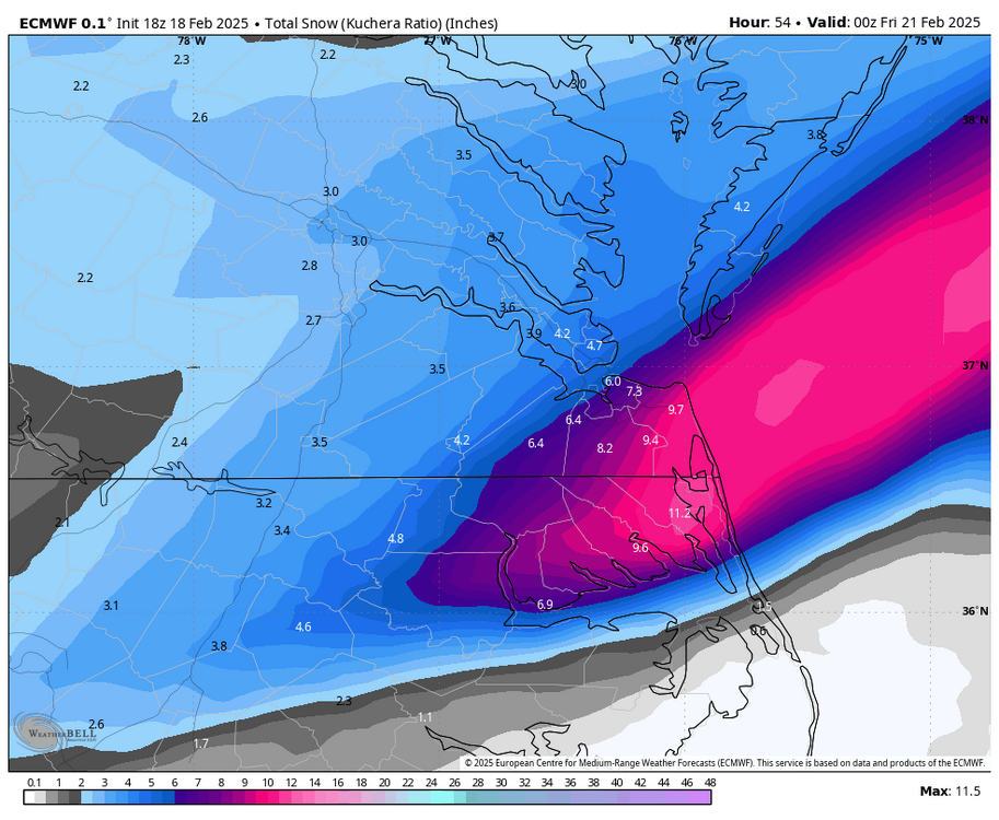
00Z GFS below, virtually unchanged from previous 4 runs.
-
Richmond Metro/Hampton Roads Area Discussion
RIC Airport replied to RIC Airport's topic in Mid Atlantic
Right, just looking at 12k. I haven’t looked at 3K, and phone is about to die. -
Richmond Metro/Hampton Roads Area Discussion
RIC Airport replied to RIC Airport's topic in Mid Atlantic
NAM is better than 18z -
Richmond Metro/Hampton Roads Area Discussion
RIC Airport replied to RIC Airport's topic in Mid Atlantic
-
Richmond Metro/Hampton Roads Area Discussion
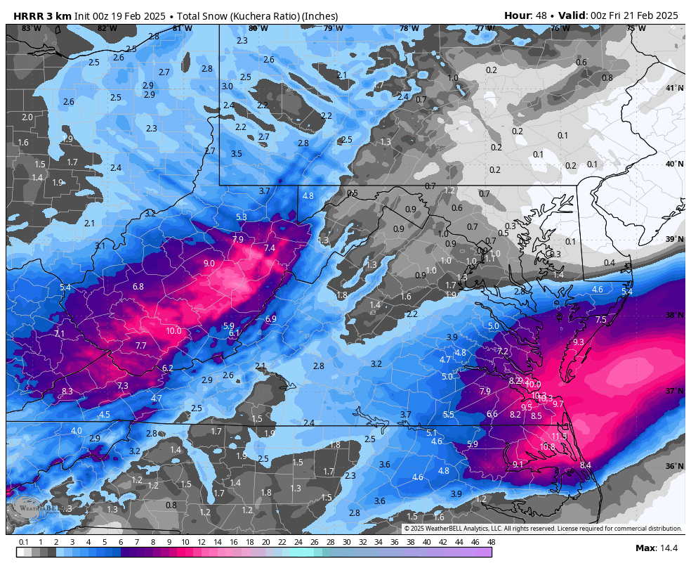
RIC Airport replied to RIC Airport's topic in Mid Atlantic
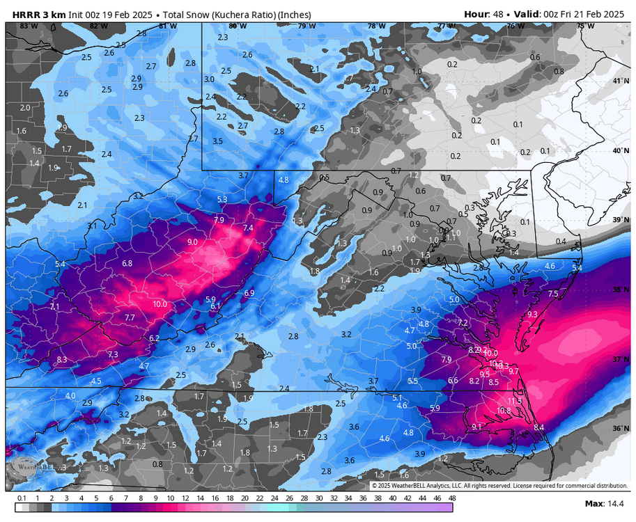
Some slight improvements on the 00z HRRR from the 18z. 4-5" around RIC 8-12" across Hampton Roads -
Richmond Metro/Hampton Roads Area Discussion
RIC Airport replied to RIC Airport's topic in Mid Atlantic
Hard to go against the King. This is going to be a major lesson for us all when all is done. Can't wait to see which models win. -
Richmond Metro/Hampton Roads Area Discussion
RIC Airport replied to RIC Airport's topic in Mid Atlantic
-
Richmond Metro/Hampton Roads Area Discussion
RIC Airport replied to RIC Airport's topic in Mid Atlantic
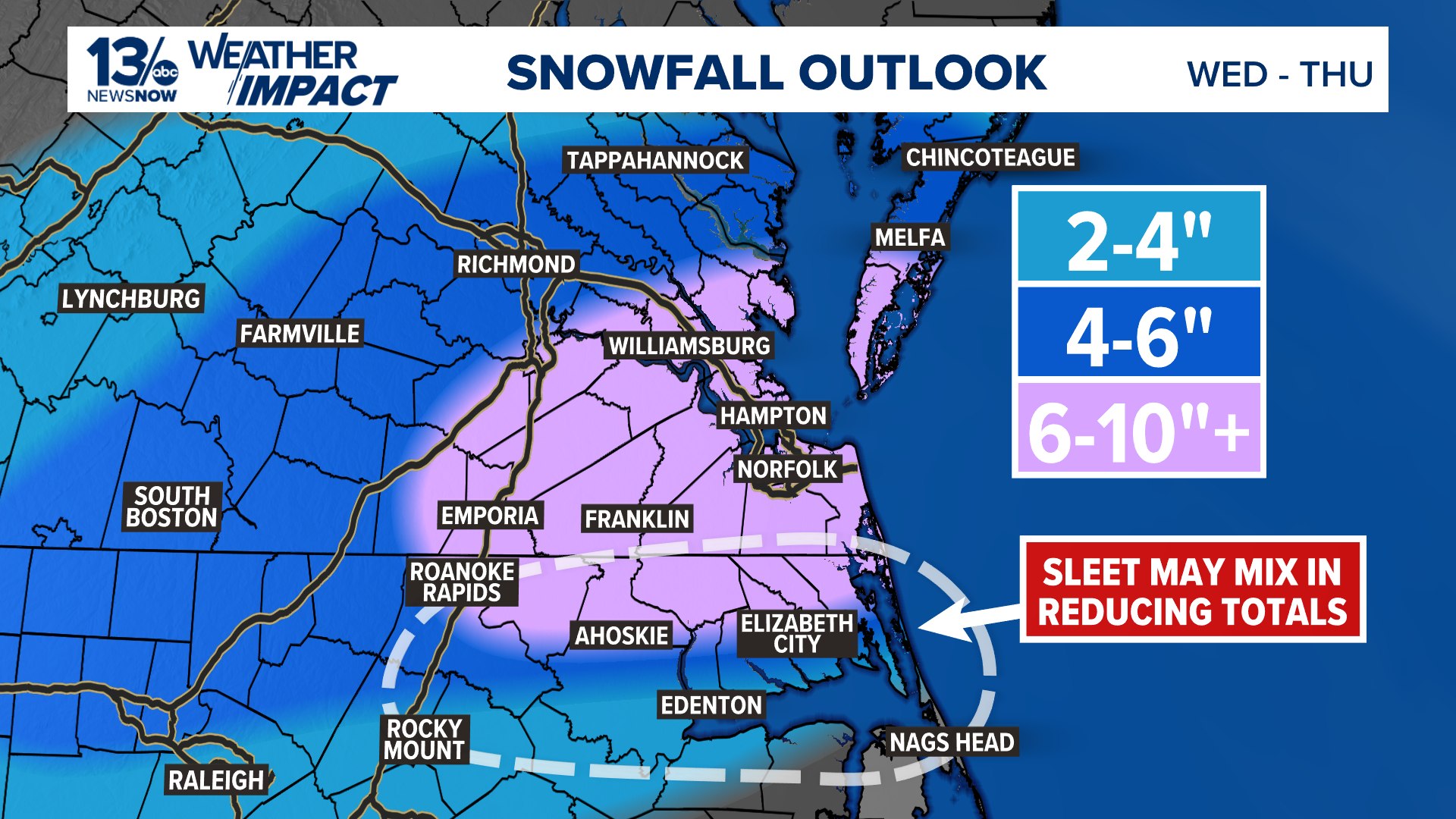
Saw an update for WTKR.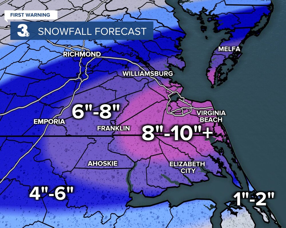
-
Richmond Metro/Hampton Roads Area Discussion
RIC Airport replied to RIC Airport's topic in Mid Atlantic
Almost identical to 12z, maybe not as high in Hampton Roads, but probably noise.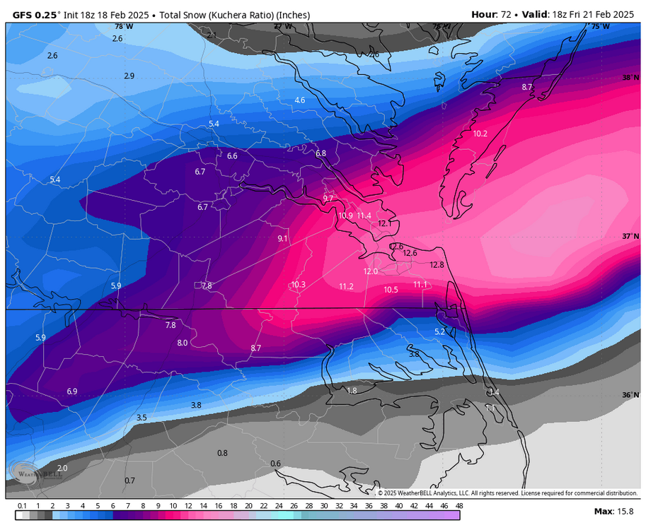
-
Richmond Metro/Hampton Roads Area Discussion
RIC Airport replied to RIC Airport's topic in Mid Atlantic
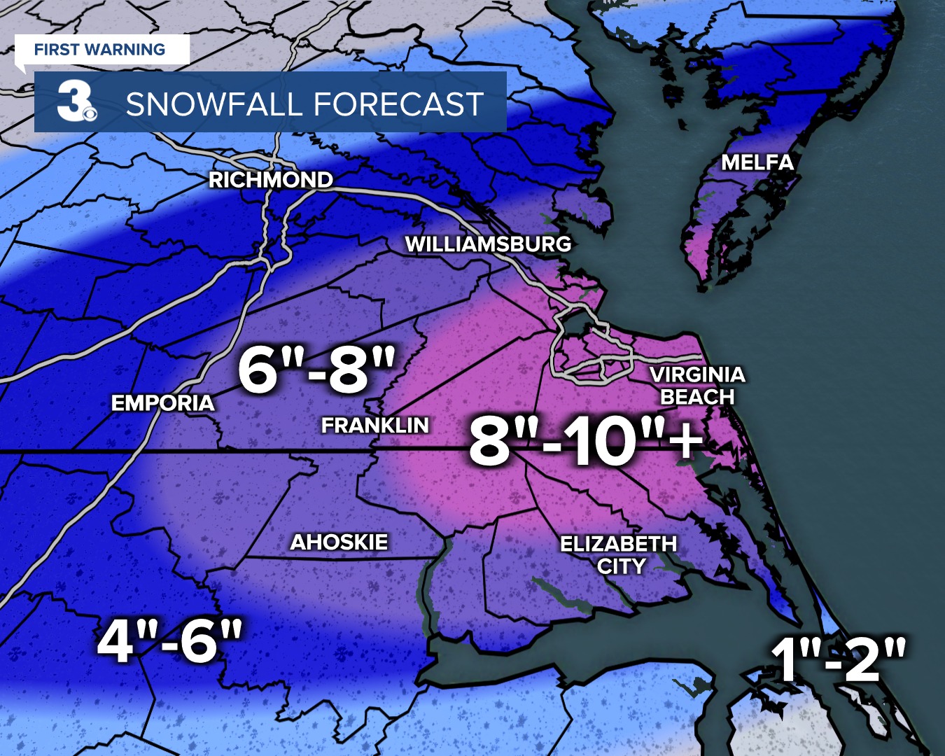
Tim Pandajis has an updated map. Will @Stormpcmix?
-
Richmond Metro/Hampton Roads Area Discussion
RIC Airport replied to RIC Airport's topic in Mid Atlantic
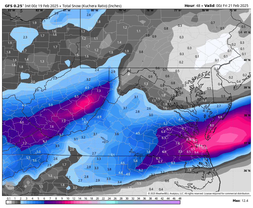
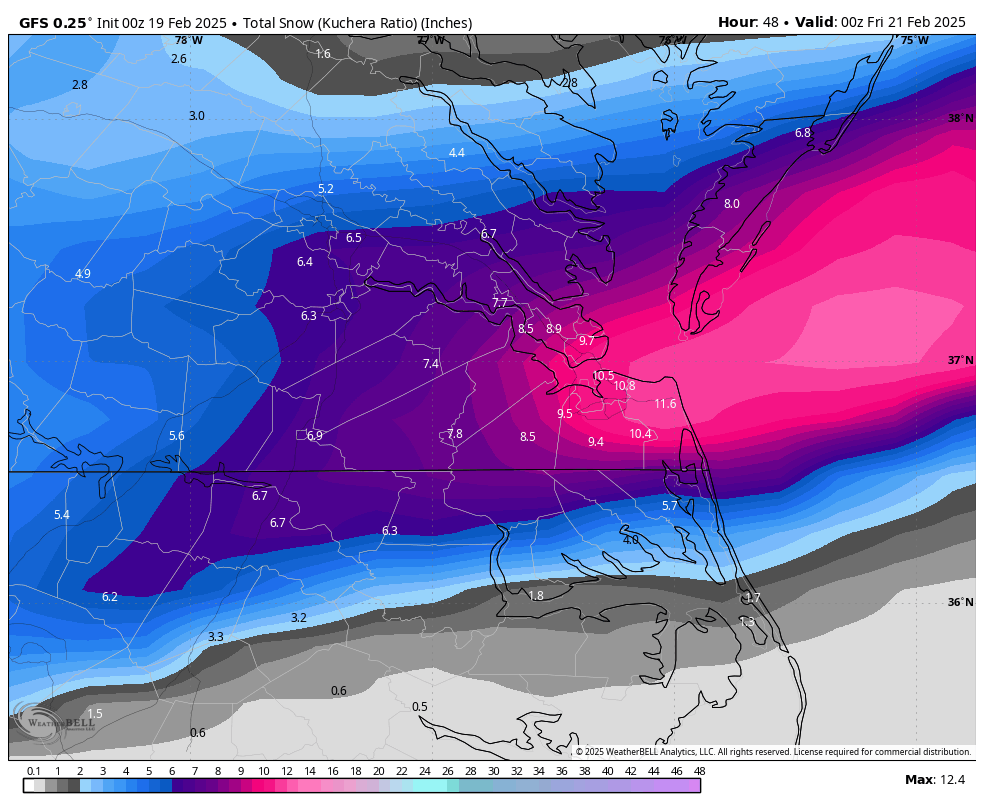
Updated Bernier's Best Bet Map is 5-10"?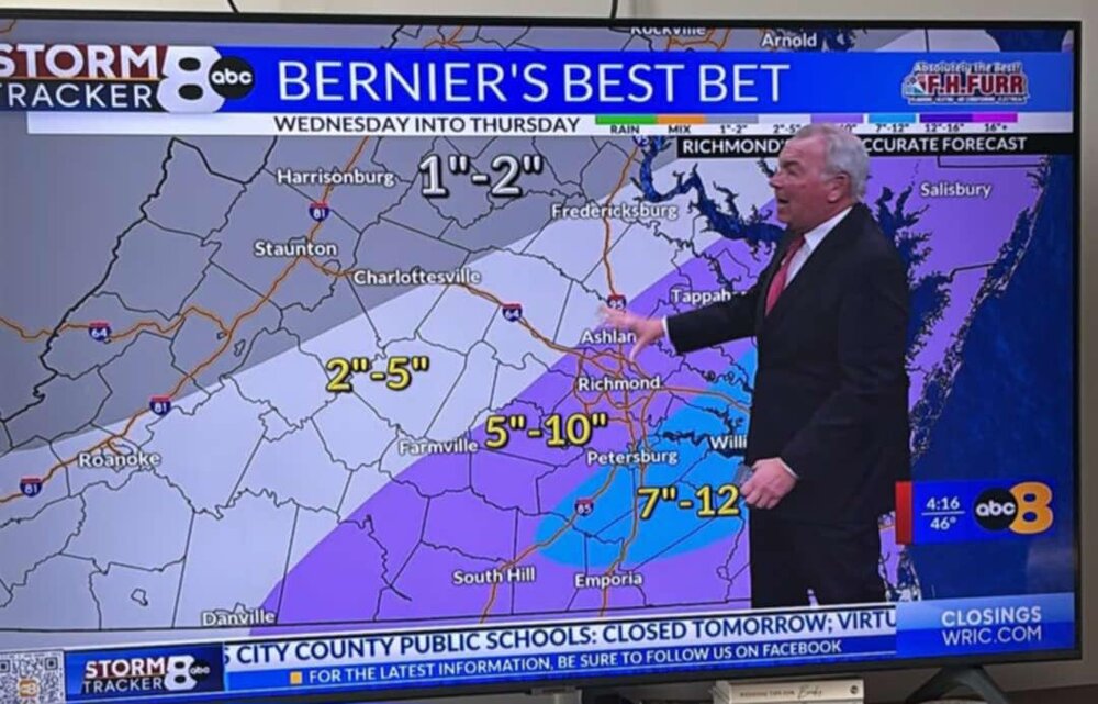
-
Richmond Metro/Hampton Roads Area Discussion
RIC Airport replied to RIC Airport's topic in Mid Atlantic
Taking words out of my mouth. At a minimum, lets do BETTER than anything we've already had this year. We have the potential. -
Richmond Metro/Hampton Roads Area Discussion
RIC Airport replied to RIC Airport's topic in Mid Atlantic
I'm actually thinking this way. Hopeful that Richmond officially gets 6", been way too long. But, I have a feeling that once again, things will fall short and 3-4" is probably achieved. -
Richmond Metro/Hampton Roads Area Discussion
RIC Airport replied to RIC Airport's topic in Mid Atlantic
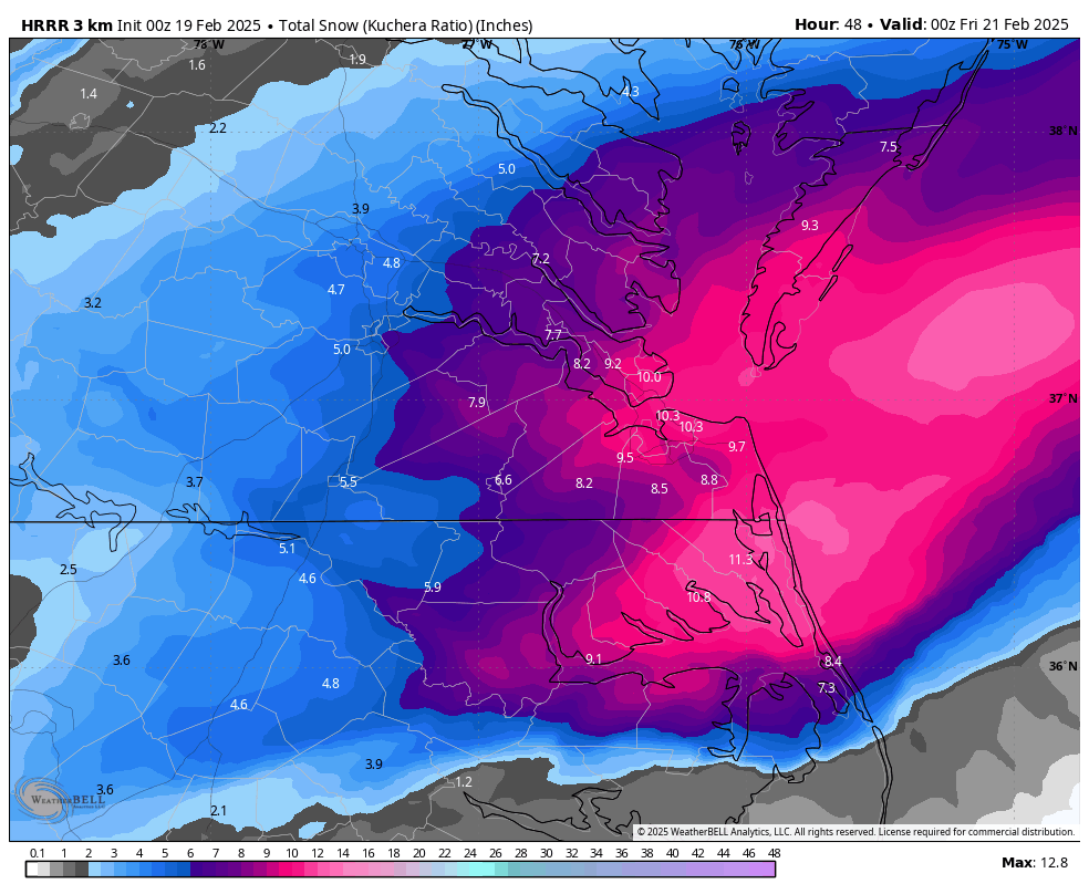
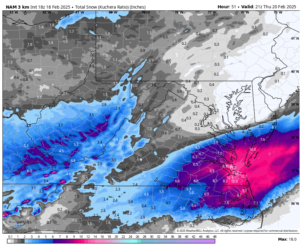
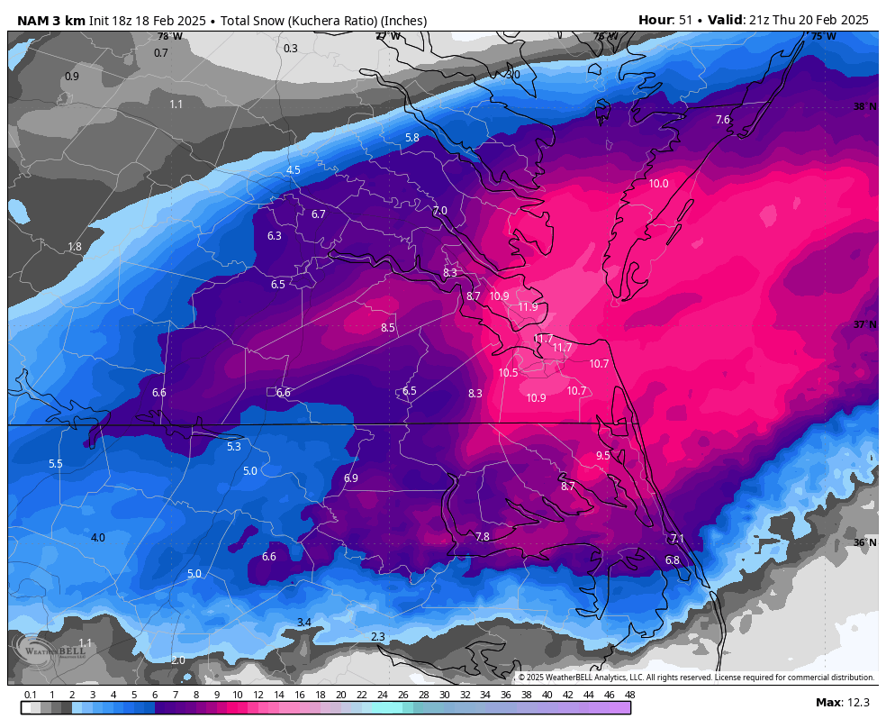
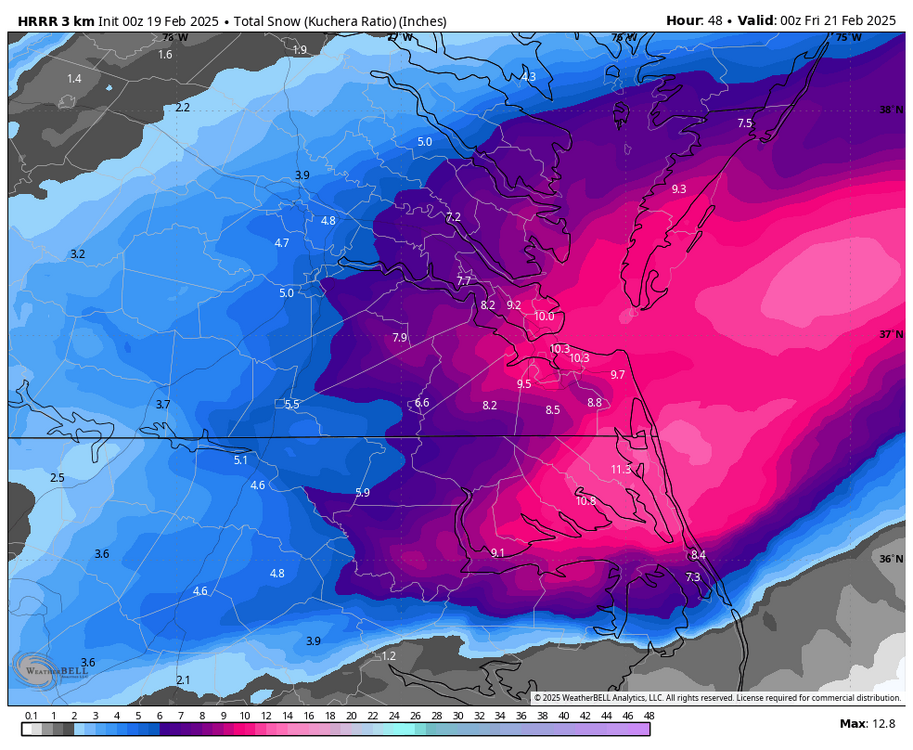
Here is the final 18z 3K map, still a solid hit for most if verified.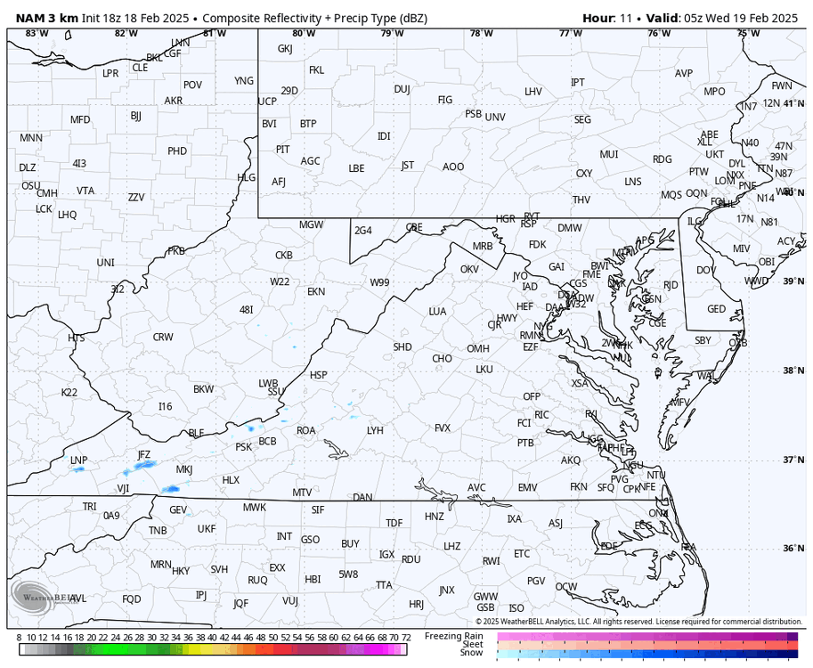


-
Richmond Metro/Hampton Roads Area Discussion
RIC Airport replied to RIC Airport's topic in Mid Atlantic
Both 12z 3K and 12K had over a foot for RIC so that drew a lot of emotion and hope. -
Richmond Metro/Hampton Roads Area Discussion
RIC Airport replied to RIC Airport's topic in Mid Atlantic
18z 3K and 12K still gives over 6" as far west as RIC. -
Richmond Metro/Hampton Roads Area Discussion
RIC Airport replied to RIC Airport's topic in Mid Atlantic
Well, 15z SREFS gave a heads up as I indicated earlier -
Richmond Metro/Hampton Roads Area Discussion
RIC Airport replied to RIC Airport's topic in Mid Atlantic
Someone shared this with me. TWC definitely needs to be contacted and tell them how inaccurate this is. There have been multiple 6"+ snowstorms at ORF since 2010. OTTMH in 2022, 2018, 2017, 2014?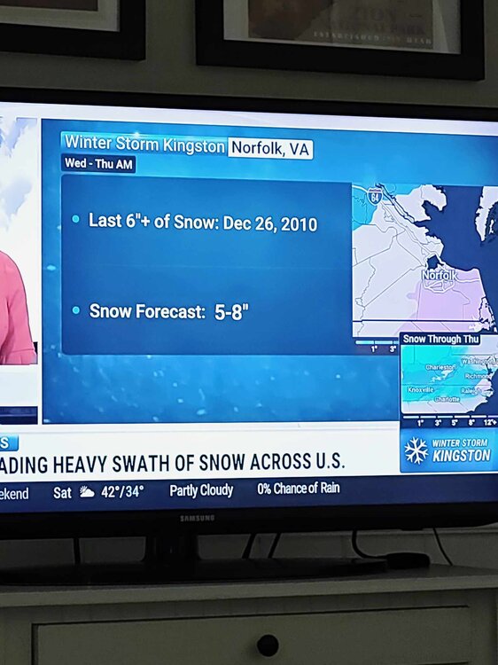
-
Richmond Metro/Hampton Roads Area Discussion
RIC Airport replied to RIC Airport's topic in Mid Atlantic
Chesterfield Schools will be closing is now the word on the street. -
Richmond Metro/Hampton Roads Area Discussion
RIC Airport replied to RIC Airport's topic in Mid Atlantic
The ULL seems to save us. -
Richmond Metro/Hampton Roads Area Discussion
RIC Airport replied to RIC Airport's topic in Mid Atlantic
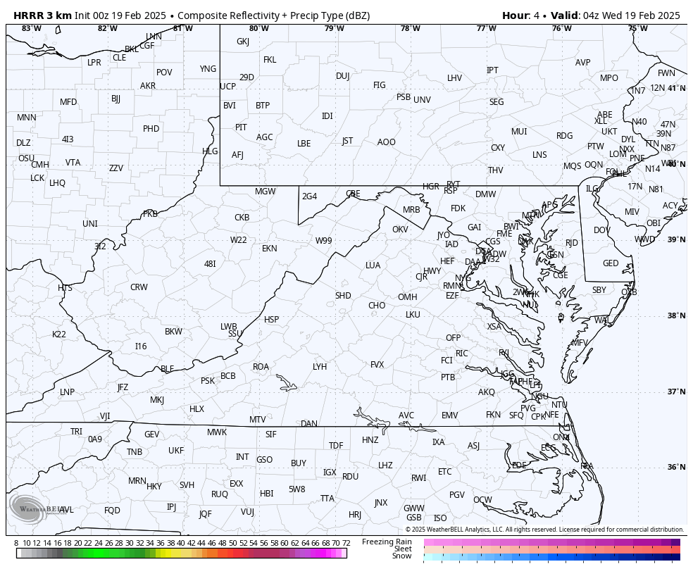
Don't think the 18z HRRR will make as many fans. -
Richmond Metro/Hampton Roads Area Discussion
RIC Airport replied to RIC Airport's topic in Mid Atlantic
Warnings out for RIC Metro now. URGENT - WINTER WEATHER MESSAGE National Weather Service Wakefield VA 222 PM EST Tue Feb 18 2025 VAZ061-062-068-069-082-083-512>520-190330- /O.UPG.KAKQ.WS.A.0005.250219T1100Z-250220T2300Z/ /O.EXA.KAKQ.WS.W.0005.250219T1100Z-250220T2300Z/ Cumberland-Goochland-Amelia-Powhatan-Charles City-New Kent- Eastern Hanover-Western Chesterfield-Eastern Chesterfield (Including Col. Heights)-Western Henrico (Including the City of Richmond)-Eastern Henrico-Western King William-Eastern King William-Western King and Queen-Eastern King and Queen- 222 PM EST Tue Feb 18 2025 ...WINTER STORM WARNING IN EFFECT FROM 6 AM WEDNESDAY TO 6 PM EST THURSDAY... * WHAT...Heavy snow expected. Total snow accumulations between 3 and 6 inches. * WHERE...Portions of central and east central Virginia. * WHEN...From 6 AM Wednesday to 6 PM EST Thursday. * IMPACTS...Plan on slippery road conditions. The hazardous conditions will impact the Wednesday morning and evening commutes. PRECAUTIONARY/PREPAREDNESS ACTIONS... If you must travel, keep an extra flashlight, food, and water in your vehicle in case of an emergency. Call 511 for road information. && $$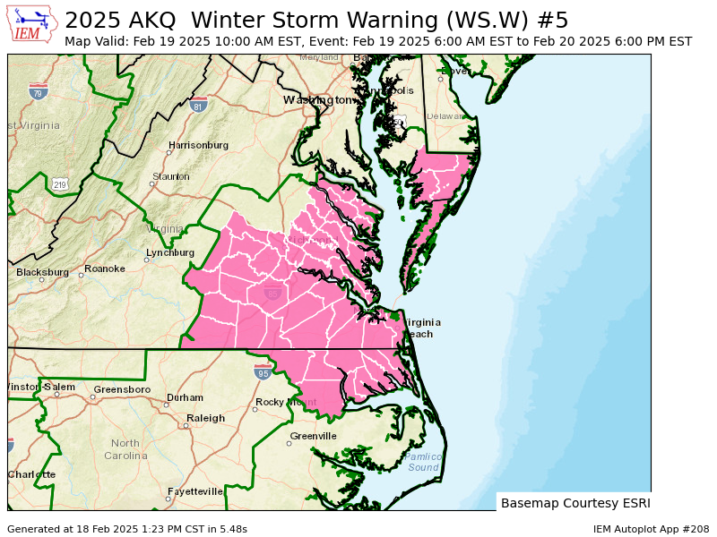
-
Richmond Metro/Hampton Roads Area Discussion
RIC Airport replied to RIC Airport's topic in Mid Atlantic
Right, I don't disagree, just highlighting it's not as high as the 9z. Would still be a terrific event in that RIC has not had an official 6"+ storm since December 2018. -
Richmond Metro/Hampton Roads Area Discussion
RIC Airport replied to RIC Airport's topic in Mid Atlantic
There was roughly a 0.20" QPF drop around RIC compared to the 9z run mean. -
Richmond Metro/Hampton Roads Area Discussion
RIC Airport replied to RIC Airport's topic in Mid Atlantic
15z SREFs is a step back from 9z. I am guessing the 18z NAM won't be as good for the Richmond area, but Hampton Roads still in good shape.