backedgeapproaching
-
Posts
3,818 -
Joined
-
Last visited
Content Type
Profiles
Blogs
Forums
American Weather
Media Demo
Store
Gallery
Everything posted by backedgeapproaching
-

December 2025 regional war/obs/disco thread
backedgeapproaching replied to Torch Tiger's topic in New England
I think its the only stretch of road on the East Coast with a chain up requirement for Big Rigs. -
December 2025 regional war/obs/disco thread
backedgeapproaching replied to Torch Tiger's topic in New England
Gotcha- yea, I don't think they will hit warning there TBH. -
December 2025 regional war/obs/disco thread
backedgeapproaching replied to Torch Tiger's topic in New England
What town is she in? -
NNE Cold Season Thread 2025-2026
backedgeapproaching replied to Boston Bulldog's topic in New England
I think SVT should be reasonably well with this. It's a poor man's bread and butter here with the SW flow upsloping into the Taconic's and Greens from the Hudson Valley. Well see I guess. -
Not home, but looks to be hammering pretty good from that lake band into SVT https://video.nest.com/clip/b21d5e083d6447f59b8e9ecb69b36a00.mp4
-
December 2025 regional war/obs/disco thread
backedgeapproaching replied to Torch Tiger's topic in New England


-
NNE Cold Season Thread 2025-2026
backedgeapproaching replied to Boston Bulldog's topic in New England
100%. I dont have them, just crushed rock around the base for drainage for roof runoff. If your house has perfect insulation, than it should not be an issue with gutters, but most houses are older around here and that's not the case. Definitely have seen gutters hanging on by a thread mid/late winter after ice dams take them down. -
NNE Cold Season Thread 2025-2026
backedgeapproaching replied to Boston Bulldog's topic in New England
A Trace is just snow falling and either melting on contact or less than anything measurable. So yes, you had that, but nothing measurable yet. -
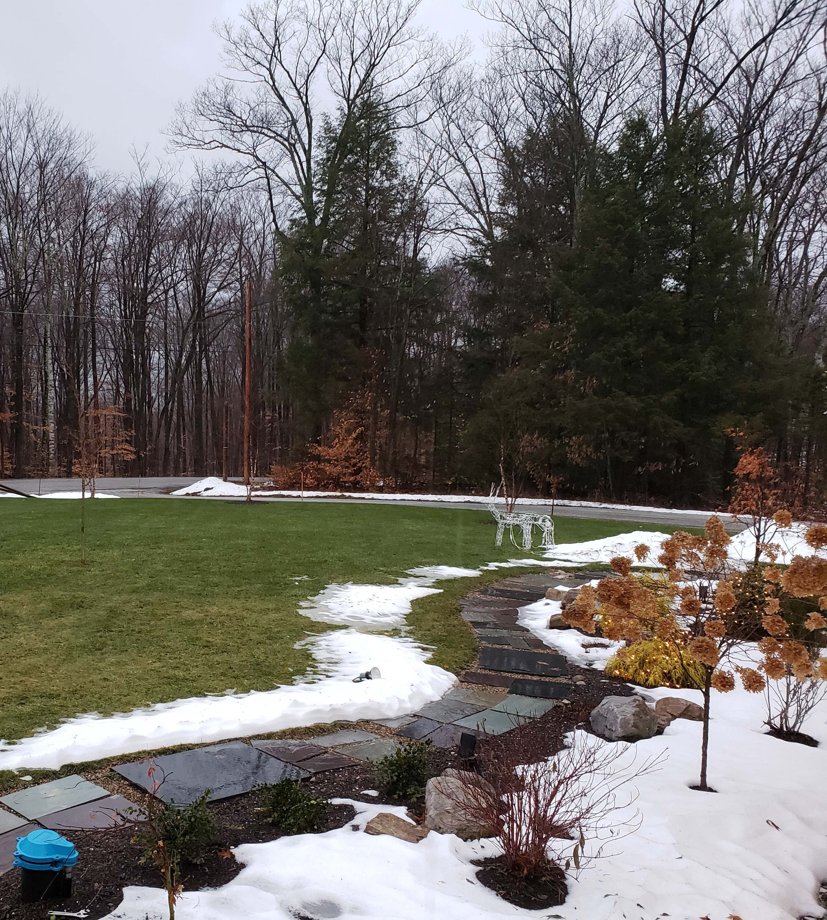
First flakes and first accum of the season down here as well hiding the oak leaves for now..
_compress91.thumb.jpg.04562dc65aebefc7aa0e0de53fb286c0.jpg)
-
New England 2025 Warm Season Banter
backedgeapproaching replied to bristolri_wx's topic in New England
I have more left on my Oaks here than you do. I was in Saratoga a few days ago and Oaks were 80% full still(all brown, no green). Im guessing your hilltop microclimate matters in some way. I have been in below 32 many many times. -
Spooky Season (October Disco Thread)
backedgeapproaching replied to Prismshine Productions's topic in New England
It was gusting to 50mph yesterday here and it probably took 60% of Oak leaves only, stubborn suckers. At least those that did drop are now blown into NY with that wicked east wind...lol. -
Spooky Season (October Disco Thread)
backedgeapproaching replied to Prismshine Productions's topic in New England
SVT, but no definitely not. I know 2 people total I think that have them. -
Spooky Season (October Disco Thread)
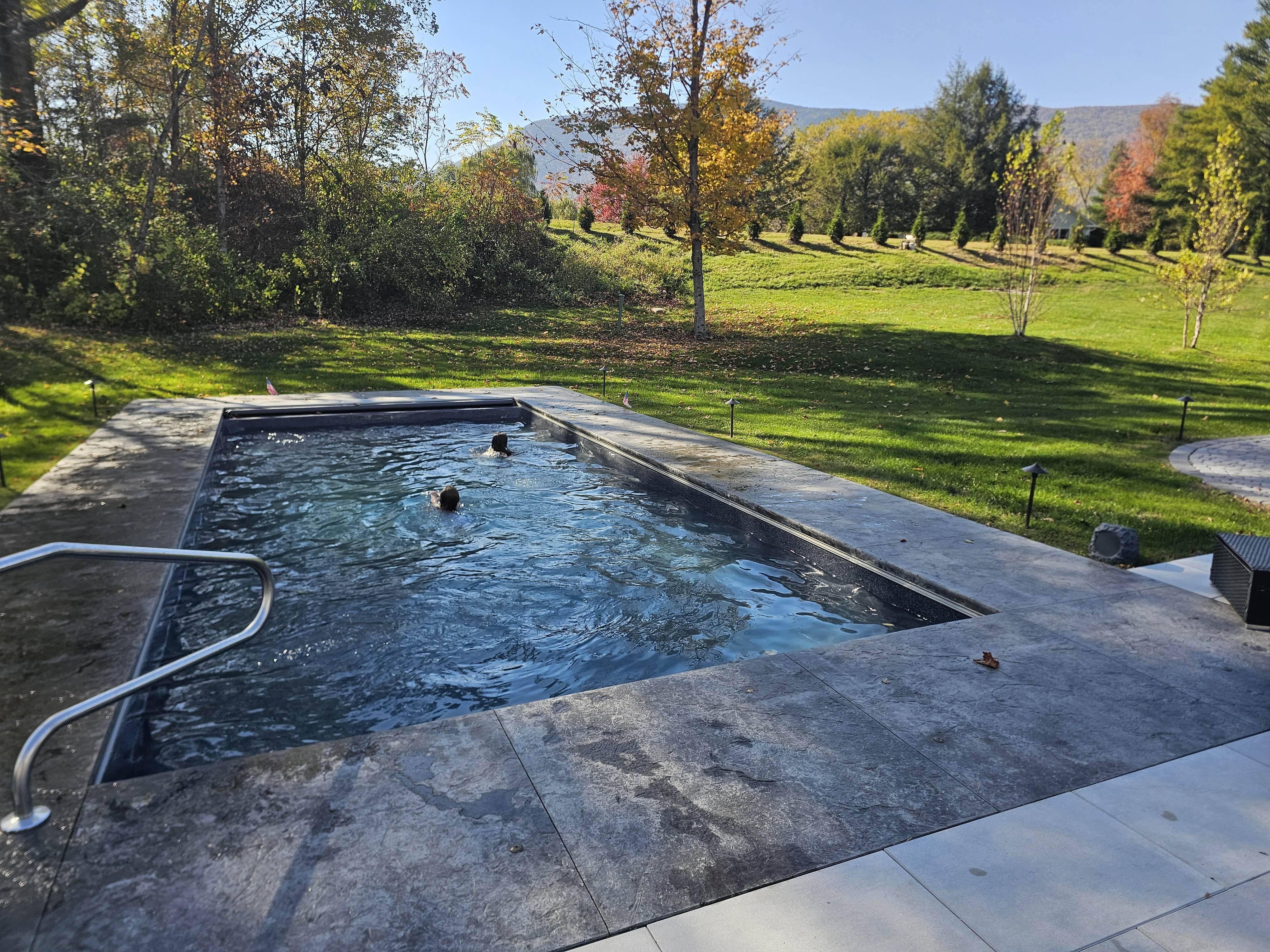
backedgeapproaching replied to Prismshine Productions's topic in New England
We pool in VT in OCT..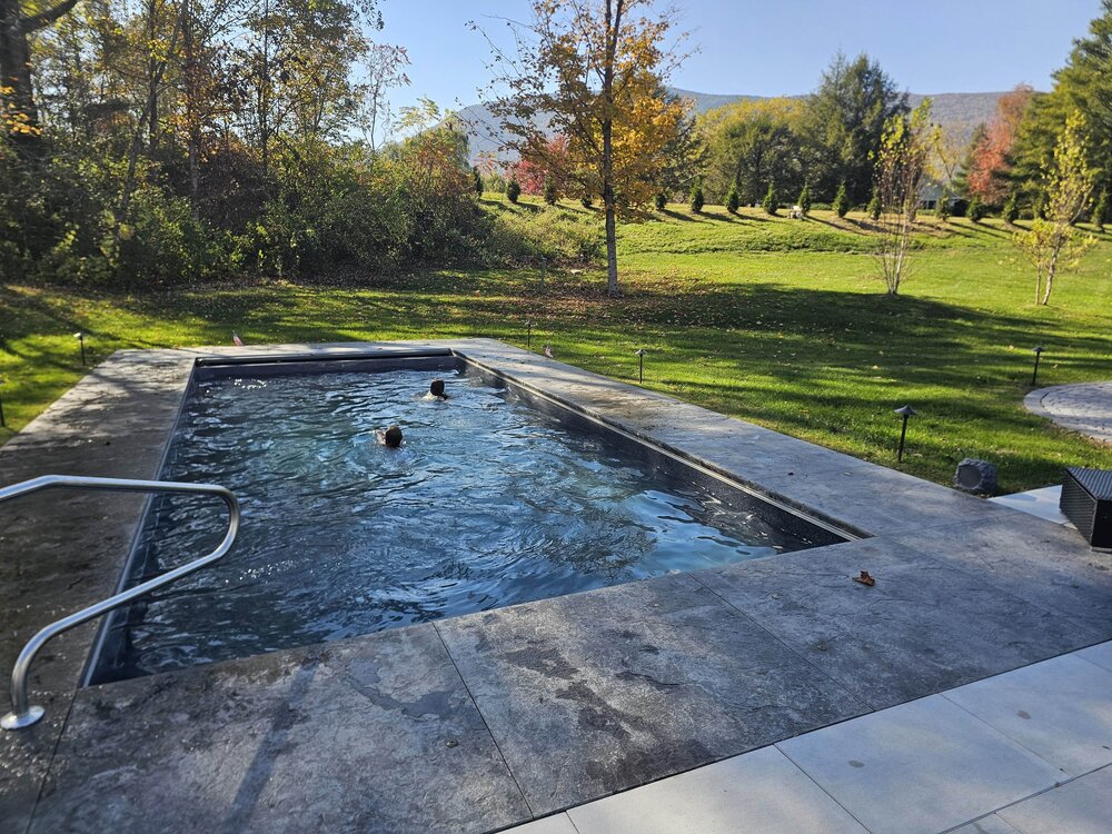
-
Oh, its 100% drought induced. The Taconic range on the west side of Manchester looks half decent, they had some half decent rain comparably speaking.
-
Was in Ludlow today, looks like NOV in spots on the drive over. Okemo 50% Leaf drop the rest brownish some yellow. Still some rogue patches of color, but I would avoid that area if your looking at leaf peeping this weekend and certainly Columbus day.
-
2025 Lawns & Gardens Thread. Making Lawns Great Again
backedgeapproaching replied to Damage In Tolland's topic in New England
In case anyone was thinking about planting a willow tree anywhere but an open field https://www.mynbc5.com/article/holy-moley-rutland-dpw-going-viral-after-pulling-100-feet-of-roots-from-pipe/67951864 -
Yea, drought turned it quickly this year. Ludlow/Okemo area had some color early Sept, they will almost certainly be past peak by then.
-
Over 3", kicking Stein to curb finally. Foliage borderline peak this weekend in a bunch areas around here.
-
2025 Lawns & Gardens Thread. Making Lawns Great Again
backedgeapproaching replied to Damage In Tolland's topic in New England
I think you have to be ready for it still to go brown under similar conditions in the upcoming years. It may be heat tolerant to 100F which means less chance of it actually dying,not necessarily staying green without irrigation. It will still go dormant. I think they are marketing this for areas in the south of here where 95-100 happens every summer for long periods of time, and where they actually will have die off because of high temps/humidity. Like you mentioned, its getting warmer here, so i think the choice makes sense, just rain or supplemental irrigation will still be needed. -
Im guessing the NAM is completely lost regarding Wed? Has a soaker CNE and parts of SNE.
-
Saw 2 trees down on houses right down the street from me, power out, pretty nasty. Debris everywhere. TL and torrential downpours as well.
-
Might have been a little thicker last week, but still total crap and pretty smokey, let's get this out of here. Almost forget what clean air looks like looking at a somewhat recent smoke free pic.

-
New England 2025 Warm Season Banter
backedgeapproaching replied to bristolri_wx's topic in New England
Yea, I saw that..oof. I took mine apart as much as I could and did a bleach cleaning and let it dry. I think every window AC prob has some type of issue with water and some mold, but yea looks like a design flaw. -
2025 Lawns & Gardens Thread. Making Lawns Great Again
backedgeapproaching replied to Damage In Tolland's topic in New England
Would need pics to make any educated guess. -
2025 Lawns & Gardens Thread. Making Lawns Great Again
backedgeapproaching replied to Damage In Tolland's topic in New England
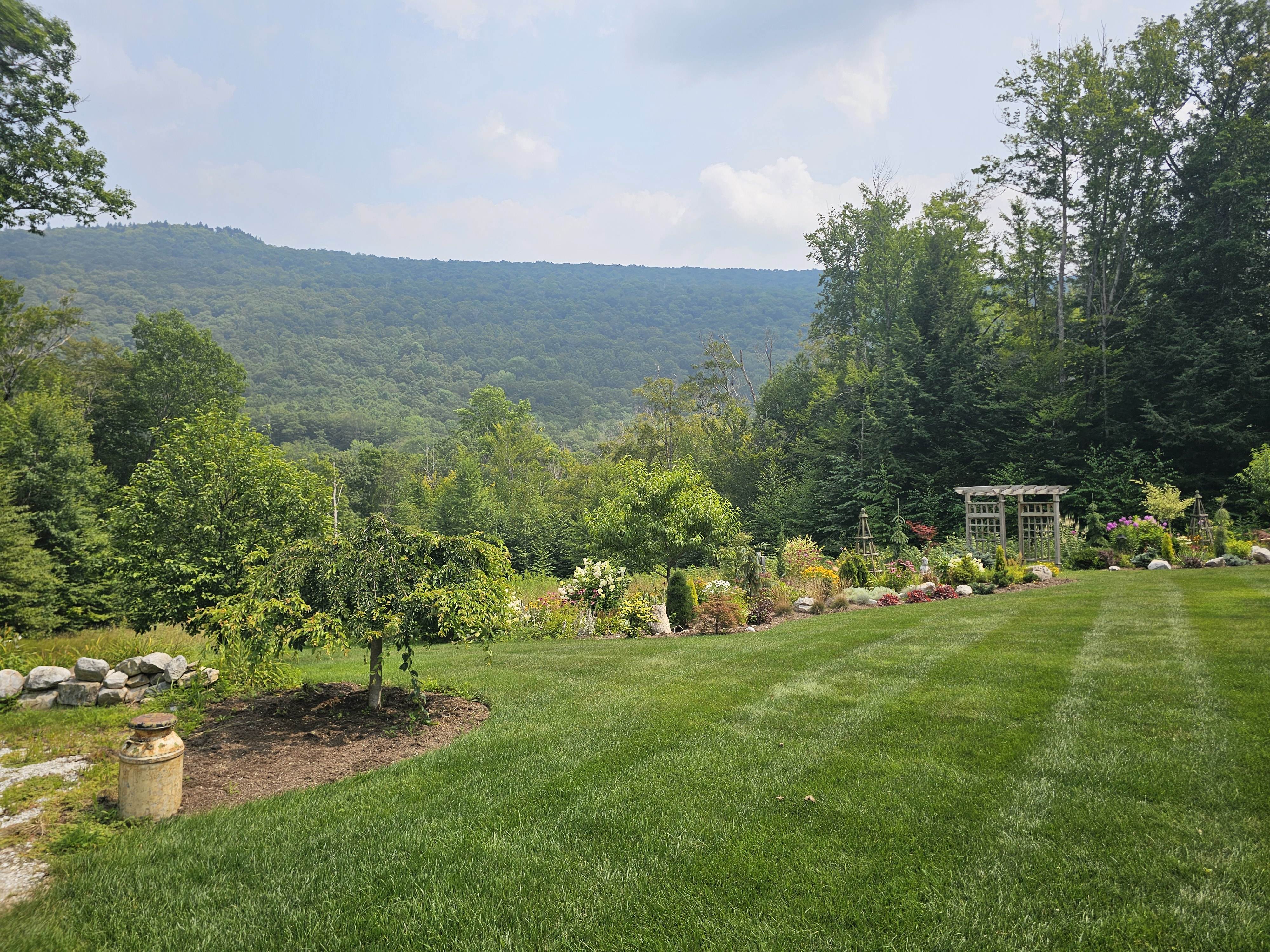
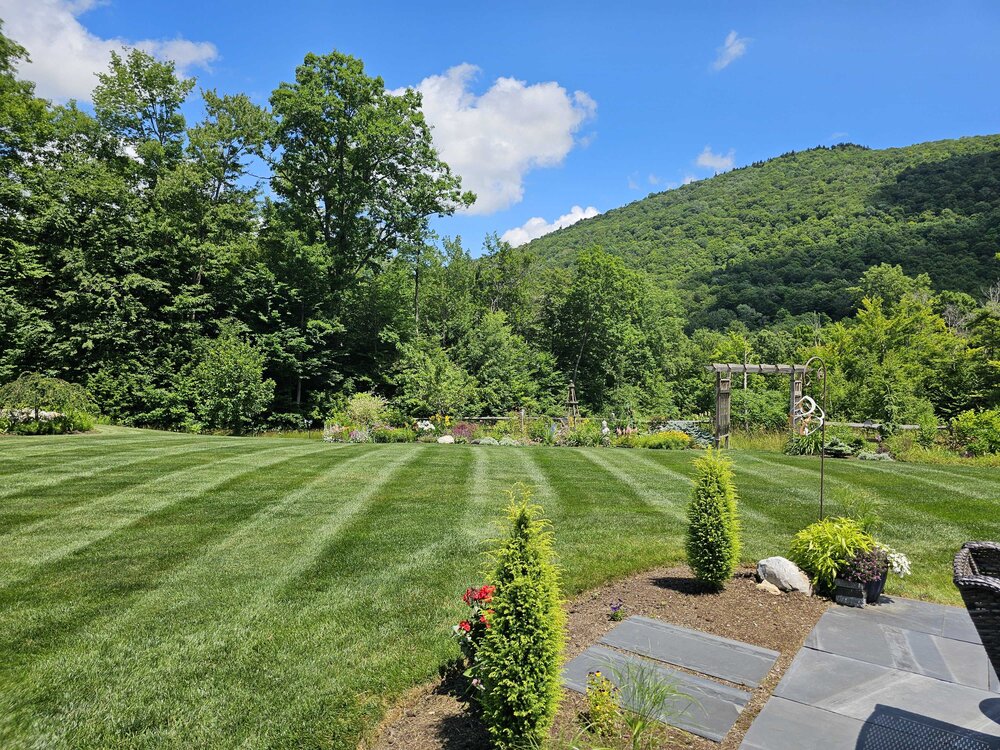
Speaking for myself- I enjoy it. I probably mow every 3-4 days. Lawncare and landscaping are a hobby and are actually enjoyable. Many dread having to cut the lawn on weekends, so they can't imagine why someone would do it more than once a week AT most. I dont do it to "keep up with the Joneses" or one up my neighbor with a meticulous lawn or landscape, I don't have any neighbors--lol. I get a lot of us have different views on what is or isn't a waste of time, resource, money when it comes to this. I do spend a good amount of money(mainly on perennials plants/trees/conifers/etc) and like the yard overall looking nice. Part of that is the lawn too, which I also like freshly cut in combination with all the landscape beds. Certainly get that many on here could not give two craps about it this stuff. I really try to keep the lawn stuff as organic as possible, but will also do soil tests to see what is needed for lawn and plants and make amendments based on that so Im not just throwing stuff down that is not needed. With all that said, maybe your neighbor is bored out of his mind or hates his wife

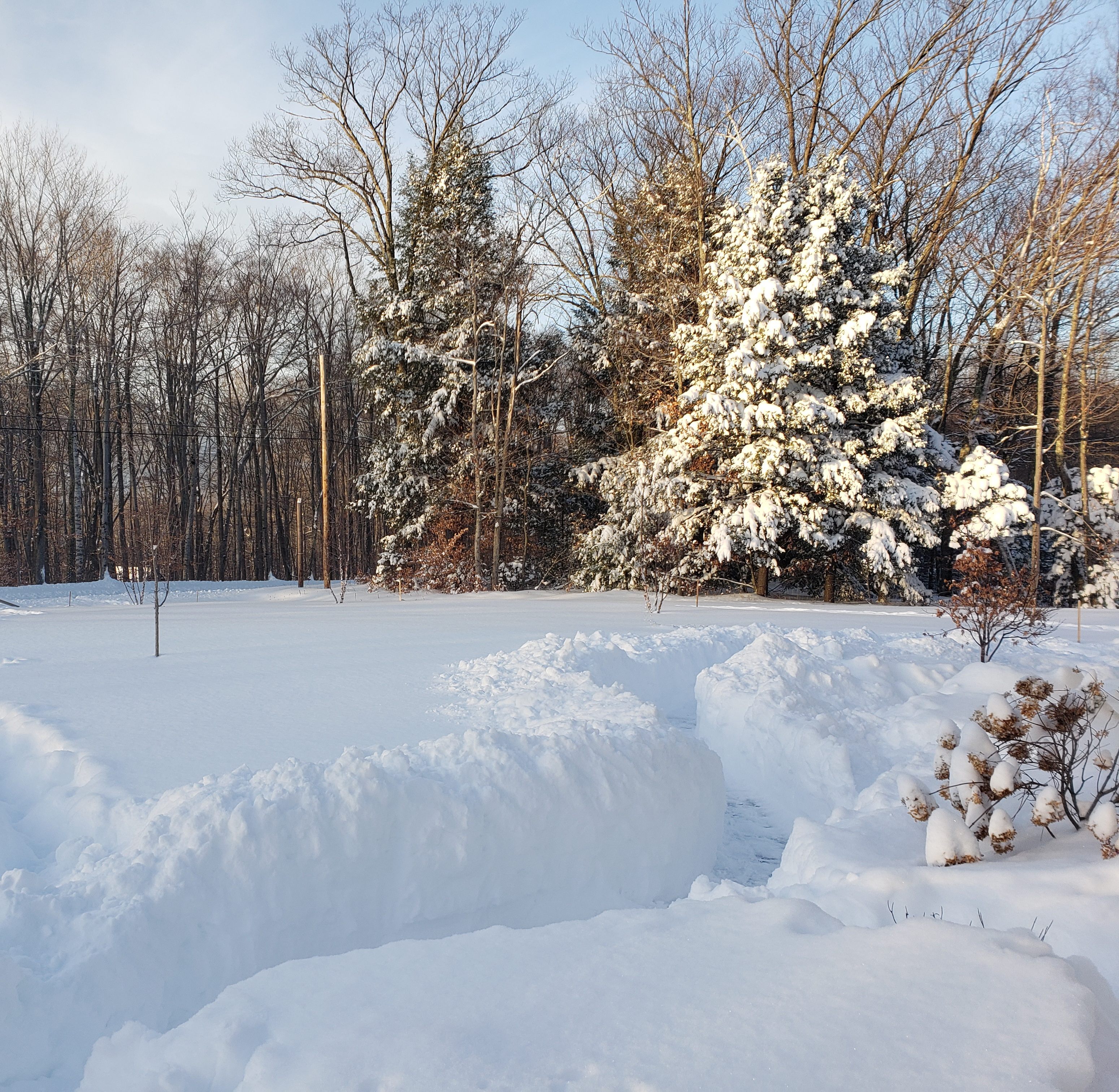


_compress91.jpg.2221fcb96cdc96c624bfa4cee7d86e66.jpg)