

ILSNOW
-
Posts
1,513 -
Joined
-
Last visited
Content Type
Profiles
Blogs
Forums
American Weather
Media Demo
Store
Gallery
Everything posted by ILSNOW
-
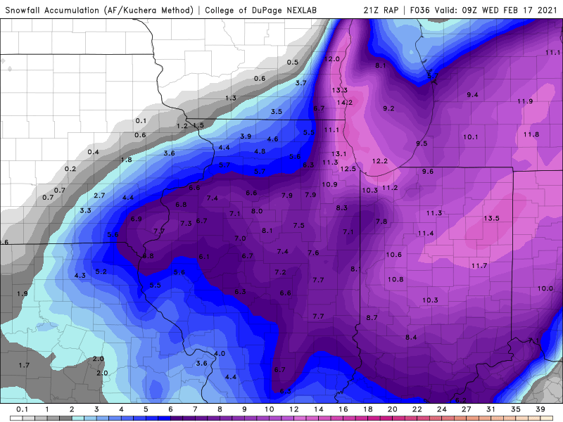
21z RAP still bringing the goods with an additional 14 inches for eastern lake and northern cook county
-
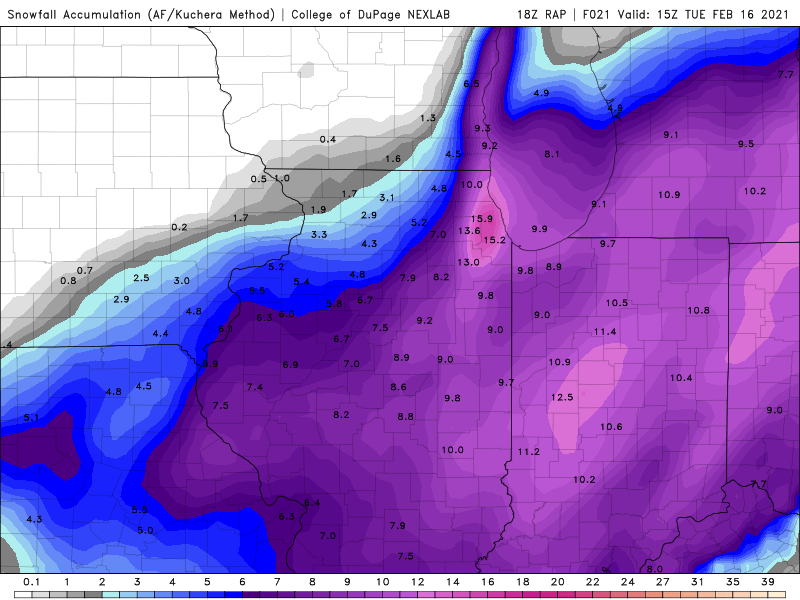
18z rap is ok for you
-
-
Was just going to comment that the main band appears to becoming stationary just north of Evanston those towns under that band are going to get slammed
-
12z HRRR thru 28 hrs
-
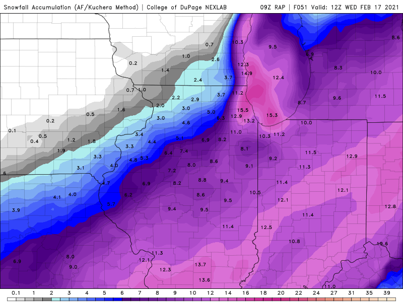
9z RAP
-
thanks for the correction
-
plumes at ORD up to 13 edit includes snow from later in the week as purduewx80 was kind enough to point out ORD is at 9 for this storm.
-
ukie gonna be good for Hoosier
-
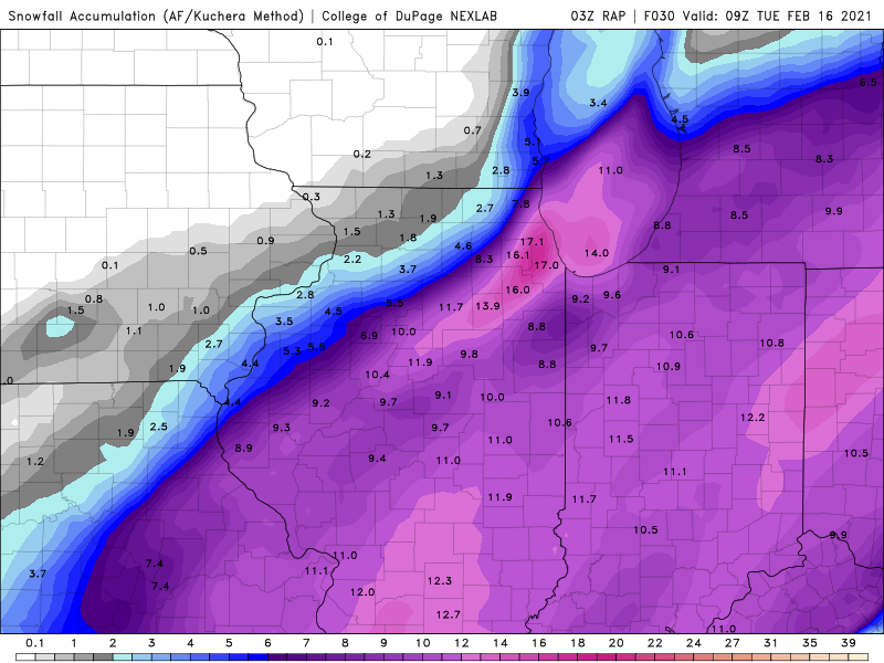
3z RAP still bringing the goods with additional LE ongoing
-
KLOT update (great writeup) https://forecast.weather.gov/product.php?site=LOT&issuedby=LOT&product=AFD&format=CI&version=1&glossary=1
-
I buy
-
i am going 4-8 with less in McHenry county
-
What about the GFS v16 with about 5 for you, are u not buying it?
-
yes but the 18z GFS doubled your snowfall and the 18z GFSV16 stayed the same so nice trends for you if u ignore the NAM
-
yes i am a little confused as I am under an advisory for 2-5 but my forecast is for 2-4 tomorrow and and 4-7 tomorrow night
-
KLOT update great read https://forecast.weather.gov/product.php?site=LOT&issuedby=LOT&product=AFD&format=CI&version=2&glossary=1
-
the 18z NAM moved back east (McHenry Snow is correct) and according to this model run he will bust high on his 1-2 inch prediction. The 3K NAM is slightly better.
-
LOL all the the same for my backyard and all show more then 1-2 inches for u. The next time u r optimistic about a storm will be your first time. Enjoy your afternoon.
-
Question why are they outliers when u have the GFSv16,GEM, RGEM , UKMET and both NAMS pretty much in agreement? They could all be wrong but please back up your statement.
-
12z HRW WRF-ARW Destroys northern cook county that small orange dot representing 30 inches of snow
-
NAM 54 hrs
-
yep its over
-
Enjoy ALEK


