
Jim Martin
-
Posts
2,469 -
Joined
-
Last visited
Content Type
Profiles
Blogs
Forums
American Weather
Media Demo
Store
Gallery
Everything posted by Jim Martin
-
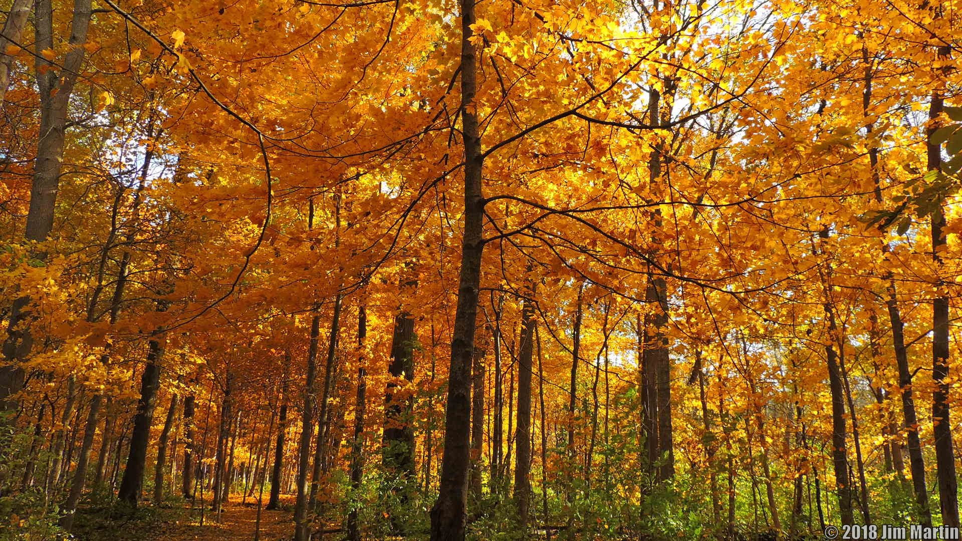
Another beauty.
-
From last weekend.

-
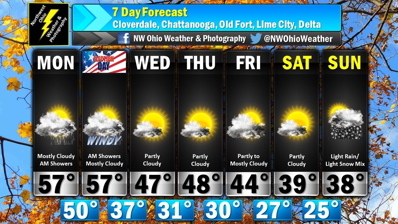
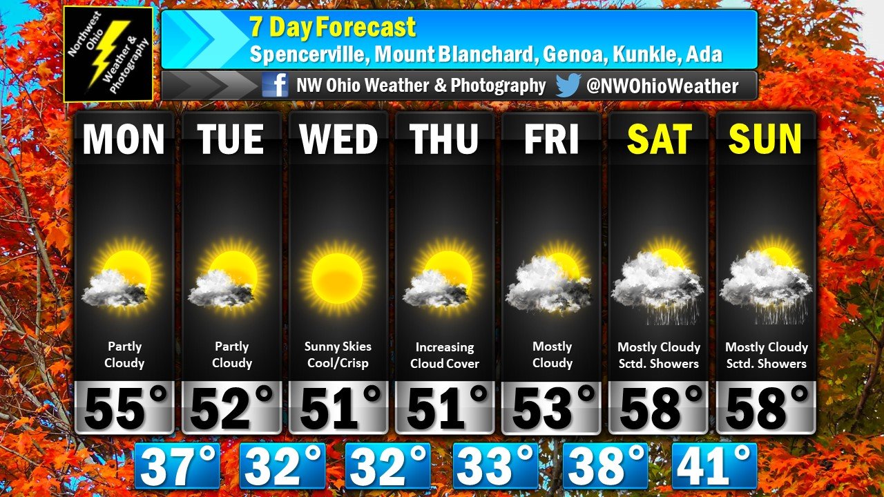
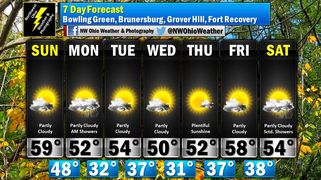
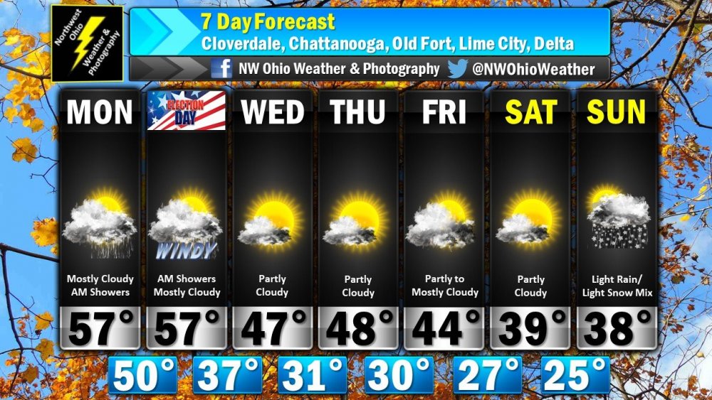
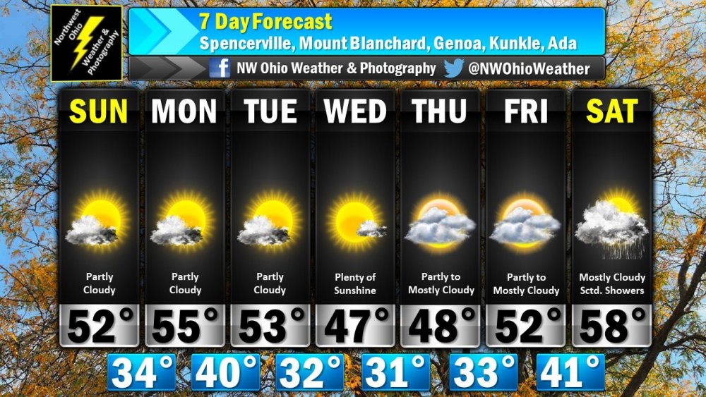
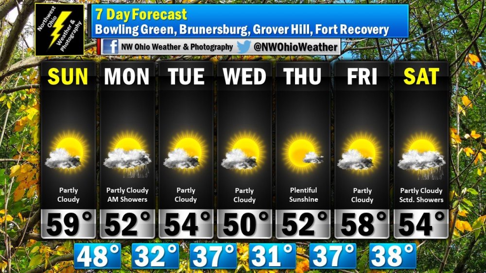
As advertised, below normal temperatures for the next seven days in #NWOhioWx.
-
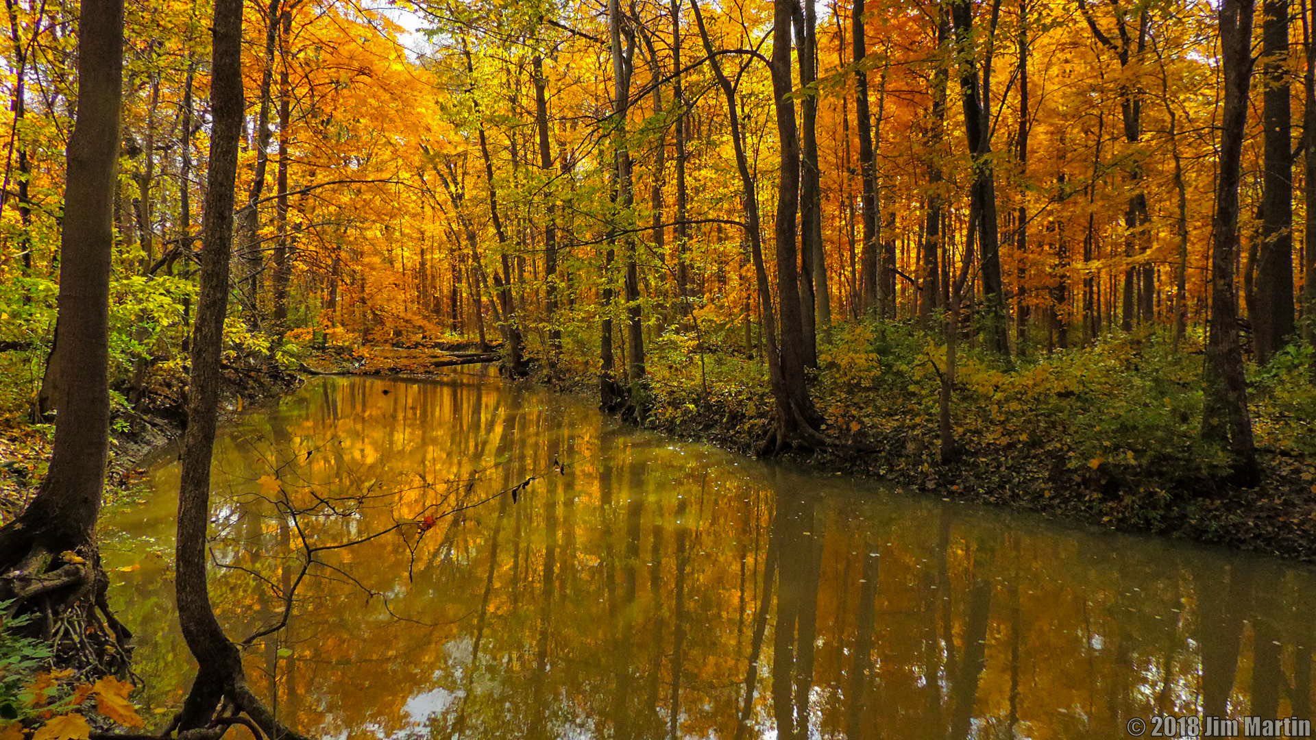
Another classic here. Oakwoods Nature Preserve just outside of Findlay. It is located near Interstate 75.
-
-
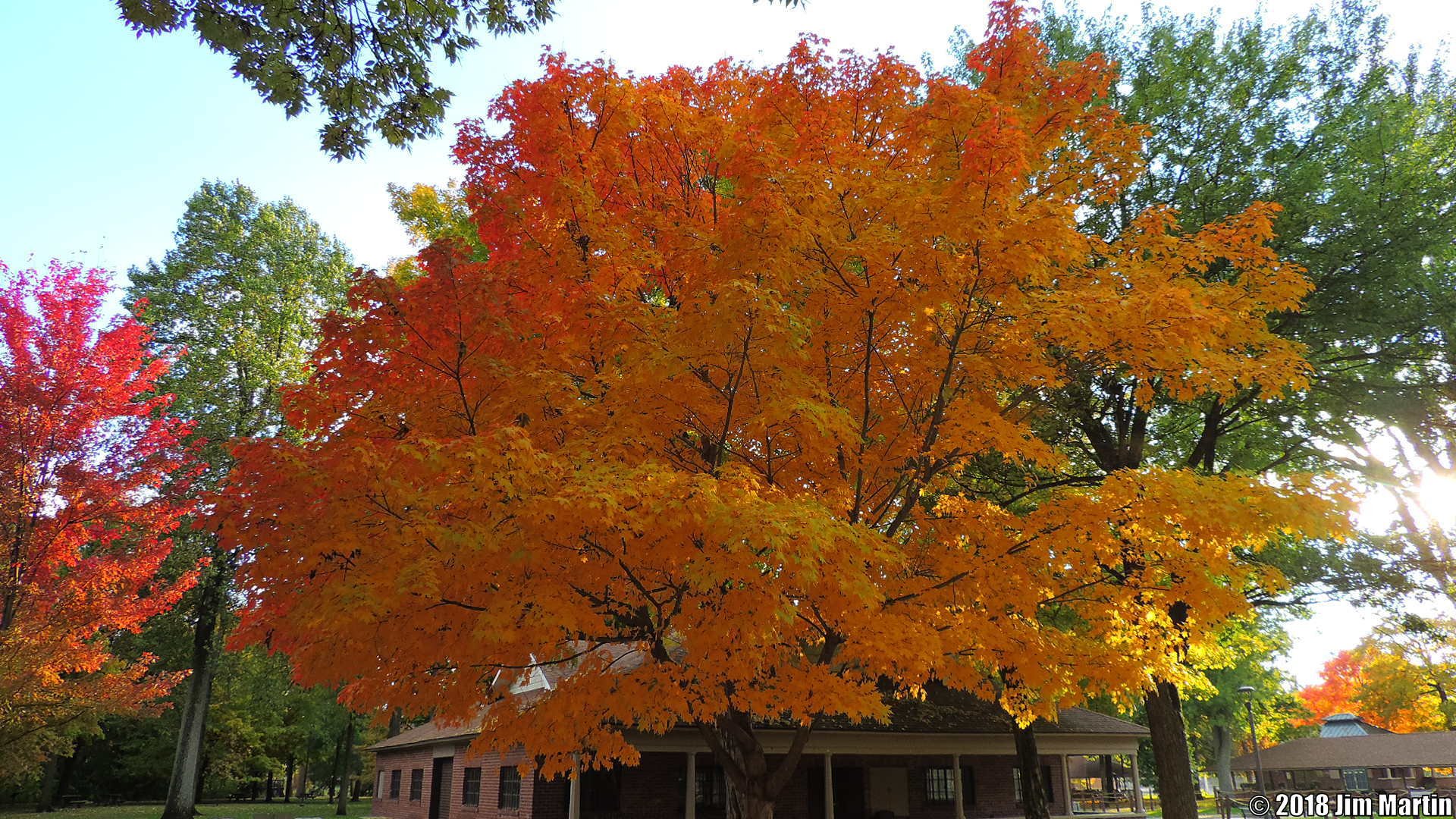
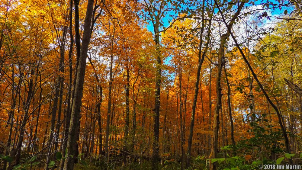
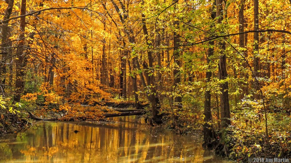
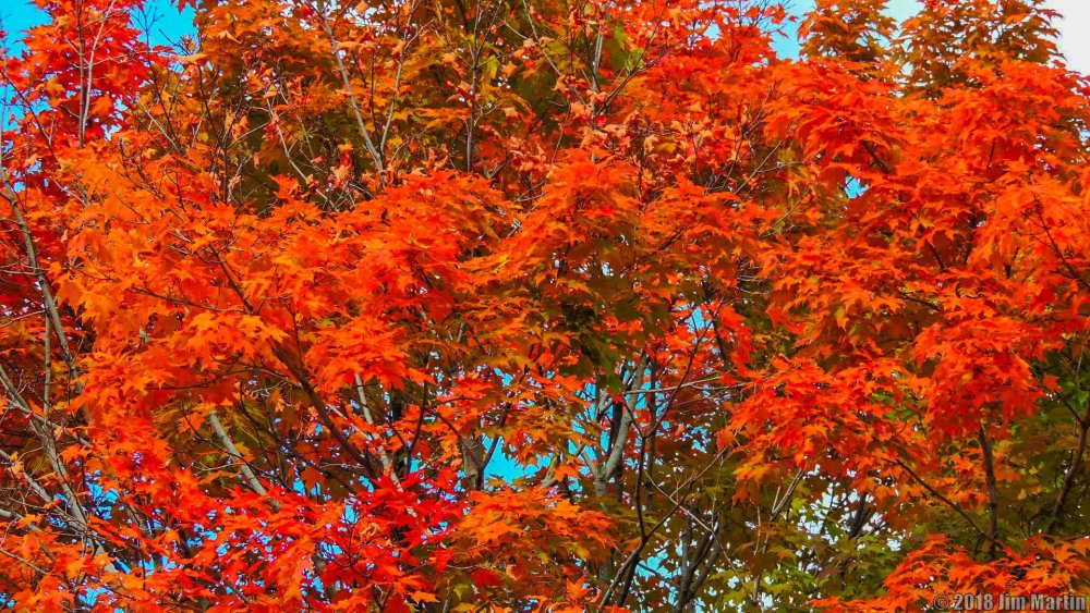
More Fall Colors from yesterday.

-

Severe Weather Event 11-5-18 & 11-6-18
Jim Martin replied to cheese007's topic in Central/Western States
Day 3 Outlook still has significant risk in Dixie Alley for Monday Night..png.d3e0c12222285731686ccffce7e6bb51.png)
-
Today.


-
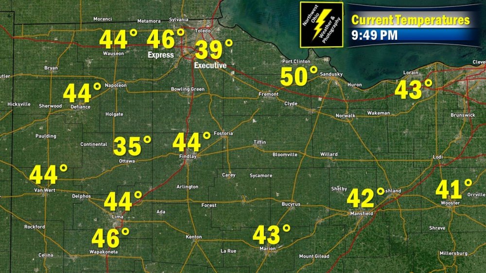
Mainly clear skies tonight in #NWOhioWx. Not a "one number" place tonight in the region.
-
-
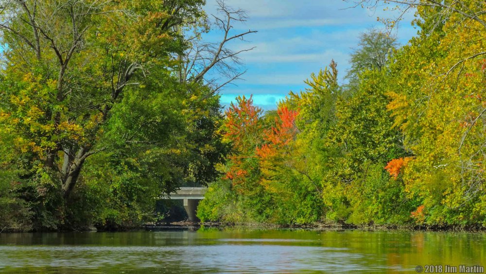
Fall colors here in Findlay at the lunch hour.
-
-
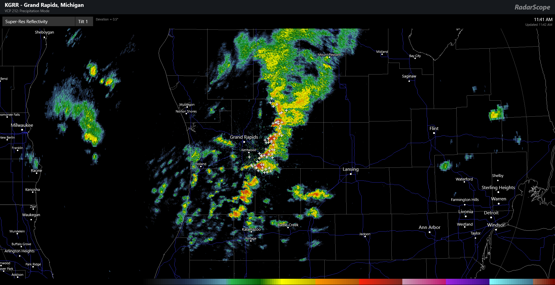
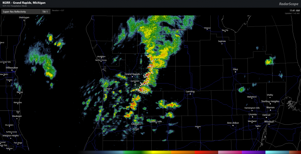
Very convective look to the showers/storms so far today near Grand Rapids, Michigan.
-
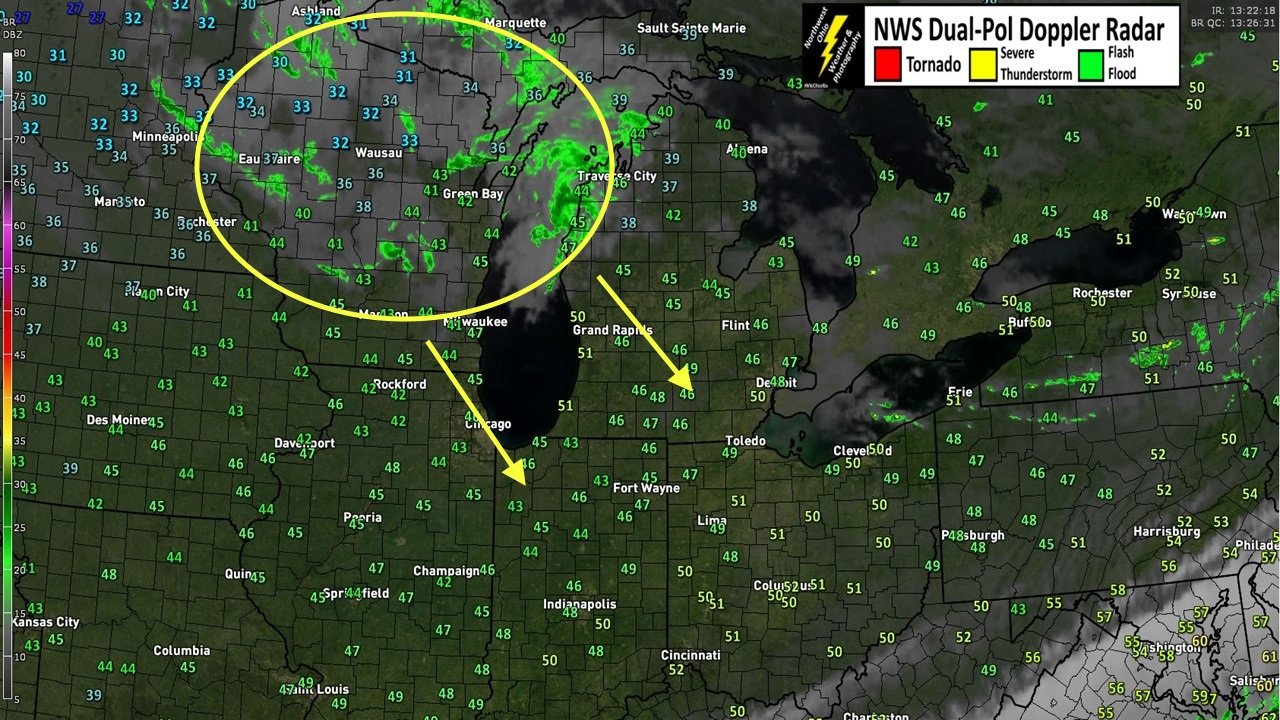
Some of that will be moving southeast towards Northwest Ohio by this afternoon and evening. Expecting a few snowflakes here as well.

-
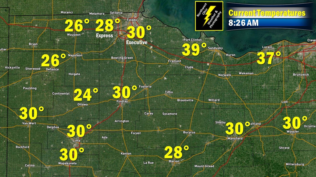
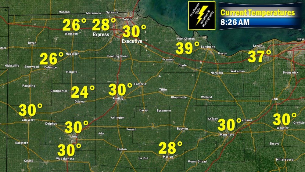
Temperatures here in Northwest Ohio have plunged several degrees below freezing this morning.
-
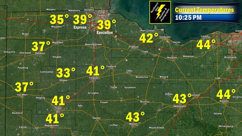
When compared to the actual air temperatures tonight, tonight's short term forecast models are not handling the cold that well. Fully expect a widespread frost, with a higher risk of freezing conditions before sunrise Tuesday.
-
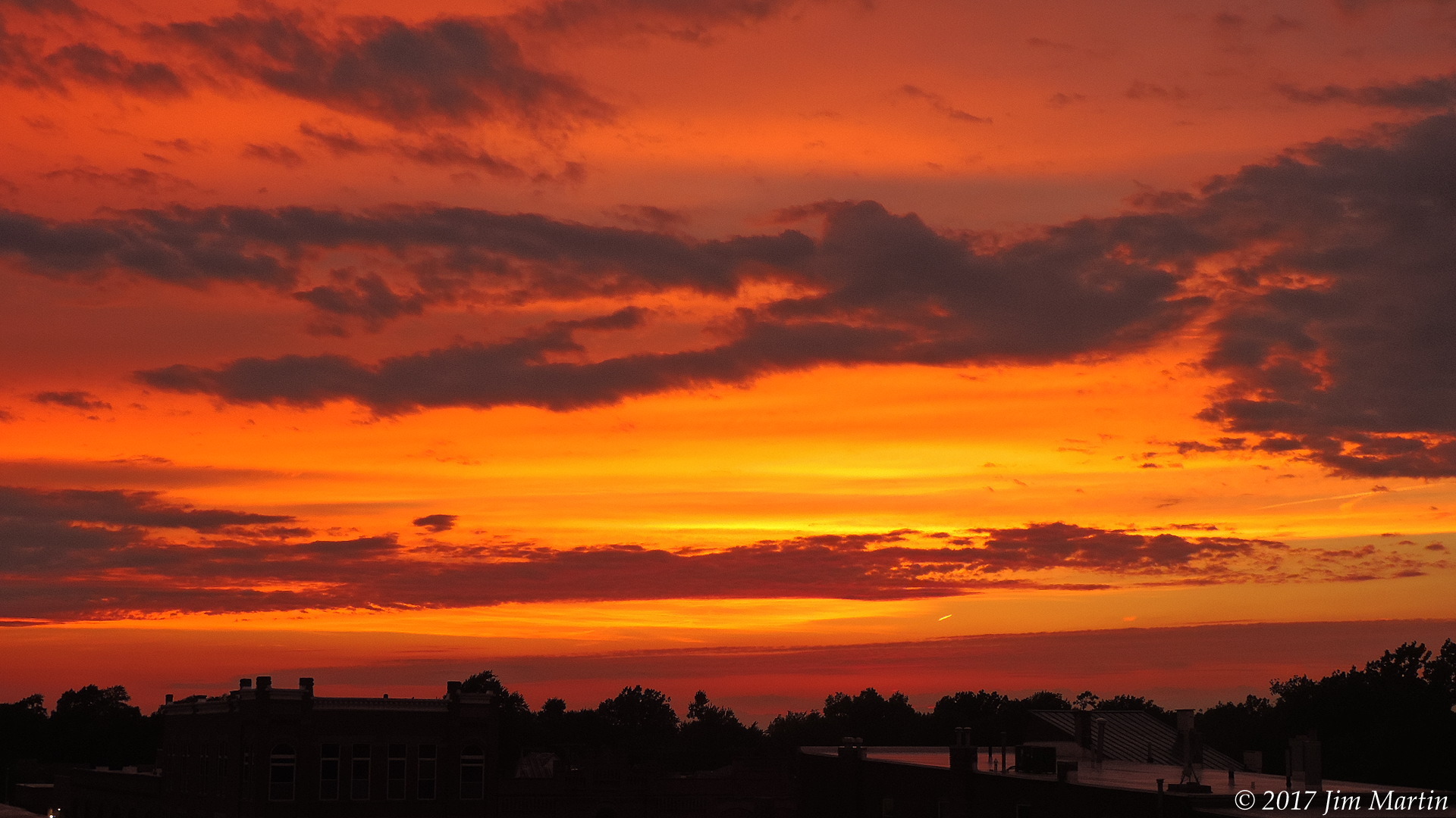
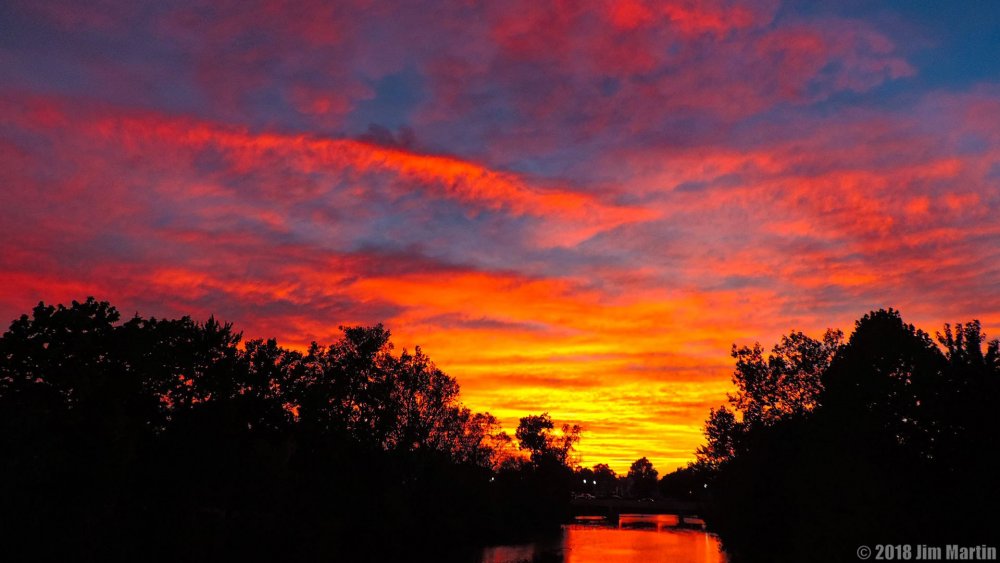
Vibrant sunset tonight.
-
Looking at potential for multiple frost(s)/freeze(s) here in Northwest Ohio tomorrow night, along with Wednesday Night as well.
-
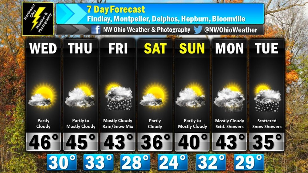
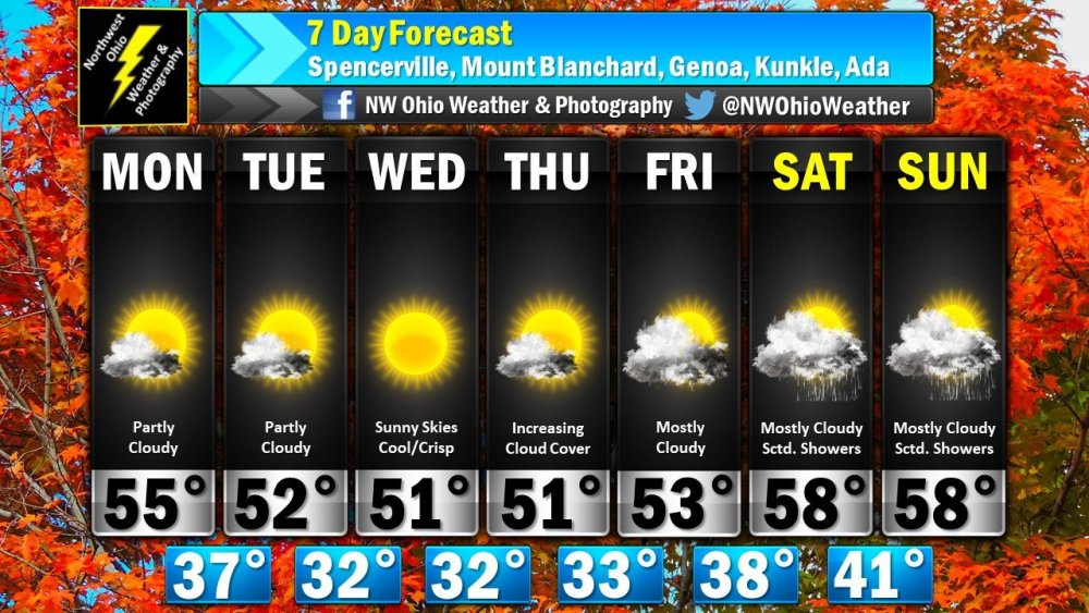
Looking uneventful as well for the next seven days here. However, frost(s)/freeze(s) looking more likely for NW Ohio the next several days.
-
Fall colors beginning to pop here in Findlay.

-
Sept-Oct heavy rain and Flooding threat
Jim Martin replied to janetjanet998's topic in Lakes/Ohio Valley
Models so far shifting a tad south. Still a flood risk for much of Northwest Ohio. -
Sept-Oct heavy rain and Flooding threat
Jim Martin replied to janetjanet998's topic in Lakes/Ohio Valley
The European Ensemble is similar to this map too. -
Sept-Oct heavy rain and Flooding threat
Jim Martin replied to janetjanet998's topic in Lakes/Ohio Valley
18z NAM shifting north too this afternoon. -
2018 Short to Medium Range Severe Thread
Jim Martin replied to tornadohunter's topic in Lakes/Ohio Valley
Looking like Gordon will have a big say in the amount of rainfall/possible severe weather later this week in the lower Great Lakes. -
Sept-Oct heavy rain and Flooding threat
Jim Martin replied to janetjanet998's topic in Lakes/Ohio Valley
From the National Weather Service in Cleveland in their Area Forecast Discussion this evening... The frontal boundary may slow down or try to stall somewhere in the region by the end of the week. We will have to watch closely what is going on down near Florida currently with a potential tropical system developing. Models show this area of tropical moisture and system coming around the ridge of high pressure into the Midwest and Great Lakes Region by Friday and Saturday. If that is the case and we have a stalled out front in the region, we will potentially have a very wet and stormy weather pattern. It is way to early to get specific but definitely something to be weather aware.