
Jim Martin
-
Posts
2,469 -
Joined
-
Last visited
Content Type
Profiles
Blogs
Forums
American Weather
Media Demo
Store
Gallery
Everything posted by Jim Martin
-

Short-Term Severe/Flooding Discussion
Jim Martin replied to Quincy's topic in Central/Western States
-
Short-Term Severe/Flooding Discussion
Jim Martin replied to Quincy's topic in Central/Western States
Rotation already north of Ardmore.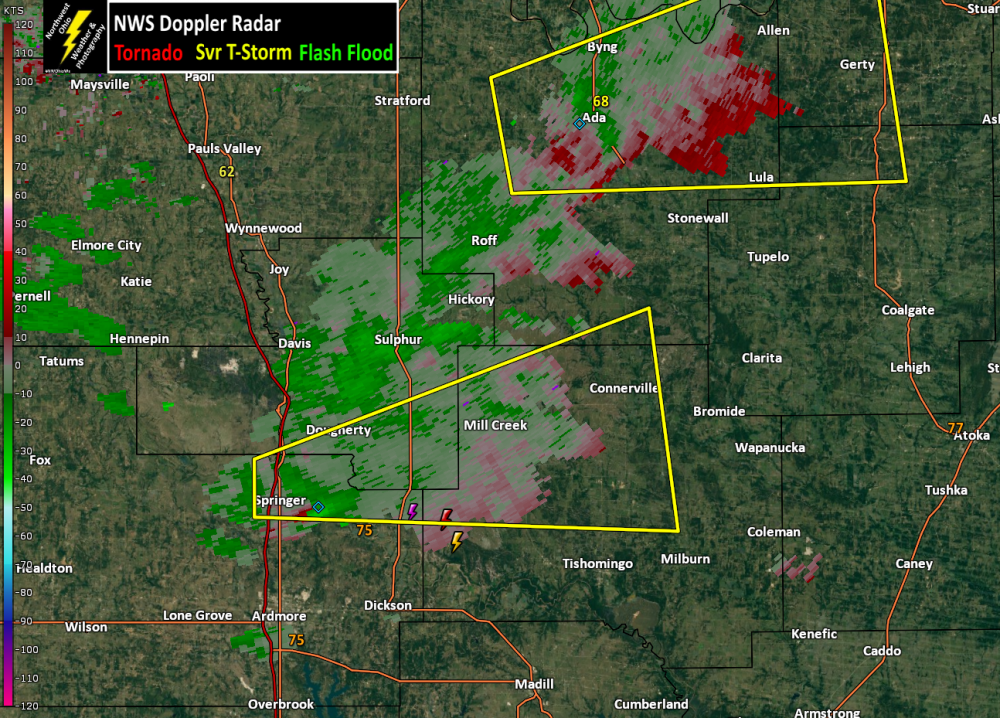
-
Short-Term Severe/Flooding Discussion
Jim Martin replied to Quincy's topic in Central/Western States
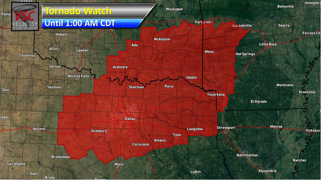
Enhanced Risk shifted back into the Dallas/Fort Worth Metroplex.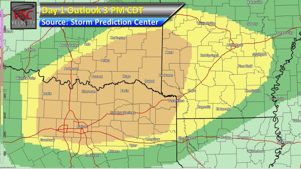
-
Short-Term Severe/Flooding Discussion
Jim Martin replied to Quincy's topic in Central/Western States
Sounding for this evening in Northeast Texas along the Red River.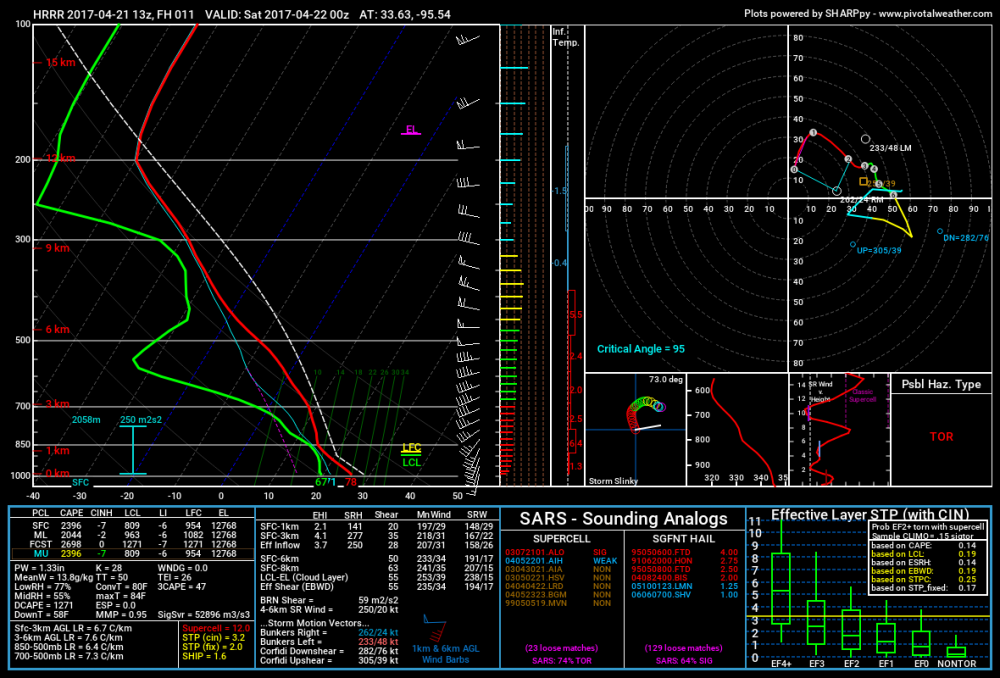
-
Short-Term Severe/Flooding Discussion
Jim Martin replied to Quincy's topic in Central/Western States
-
Short-Term Severe/Flooding Discussion
Jim Martin replied to Quincy's topic in Central/Western States
-
Short-Term Severe/Flooding Discussion
Jim Martin replied to Quincy's topic in Central/Western States
No true storm motion tonight. Storms going east, west, north, and south tonight. -
Short-Term Severe/Flooding Discussion
Jim Martin replied to Quincy's topic in Central/Western States
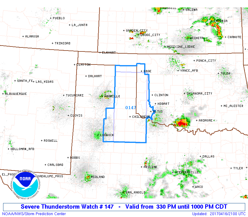
Fun is just beginning in western Oklahoma.
-
Short-Term Severe/Flooding Discussion
Jim Martin replied to Quincy's topic in Central/Western States
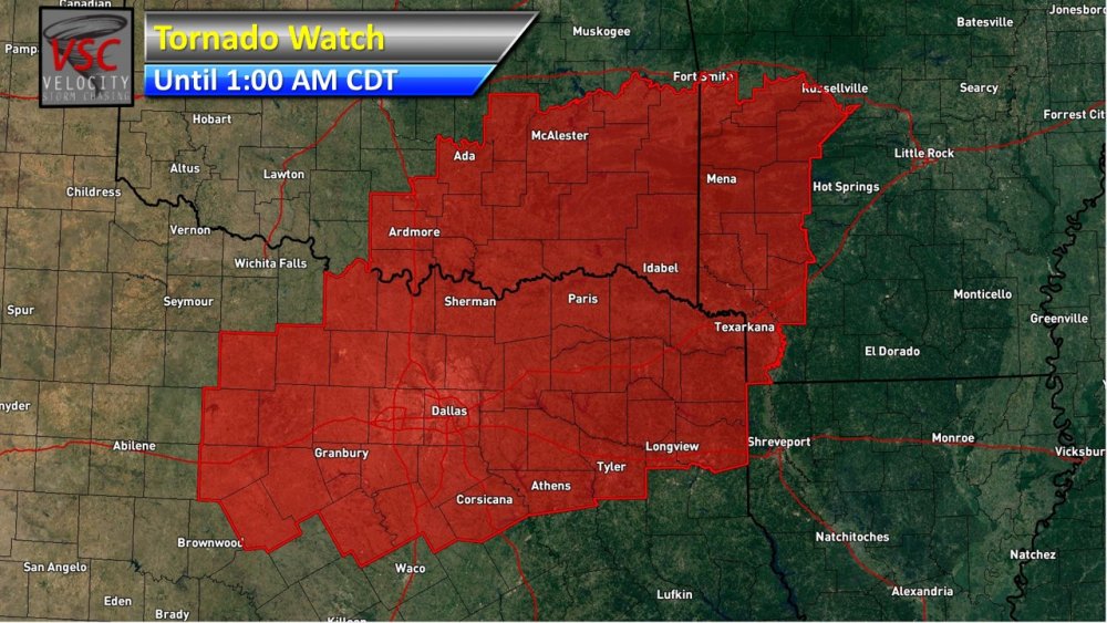
Interesting tidbit from the Storm Prediction Center... However, strengthening southerly winds across the southern Plains this evening, combined with surface vorticity in vicinity of the cold front in northern OK to the stationary front extending from the eastern TX Panhandle to west TX suggest some increase for a tornado threat will be possible this evening. 23Z RAP analysis indicated large 0-3 km CAPE juxtaposed with the greater surface vorticity in the TX Panhandle to west TX, suggesting a tornado threat, at least for early this evening. -
Short-Term Severe/Flooding Discussion
Jim Martin replied to Quincy's topic in Central/Western States
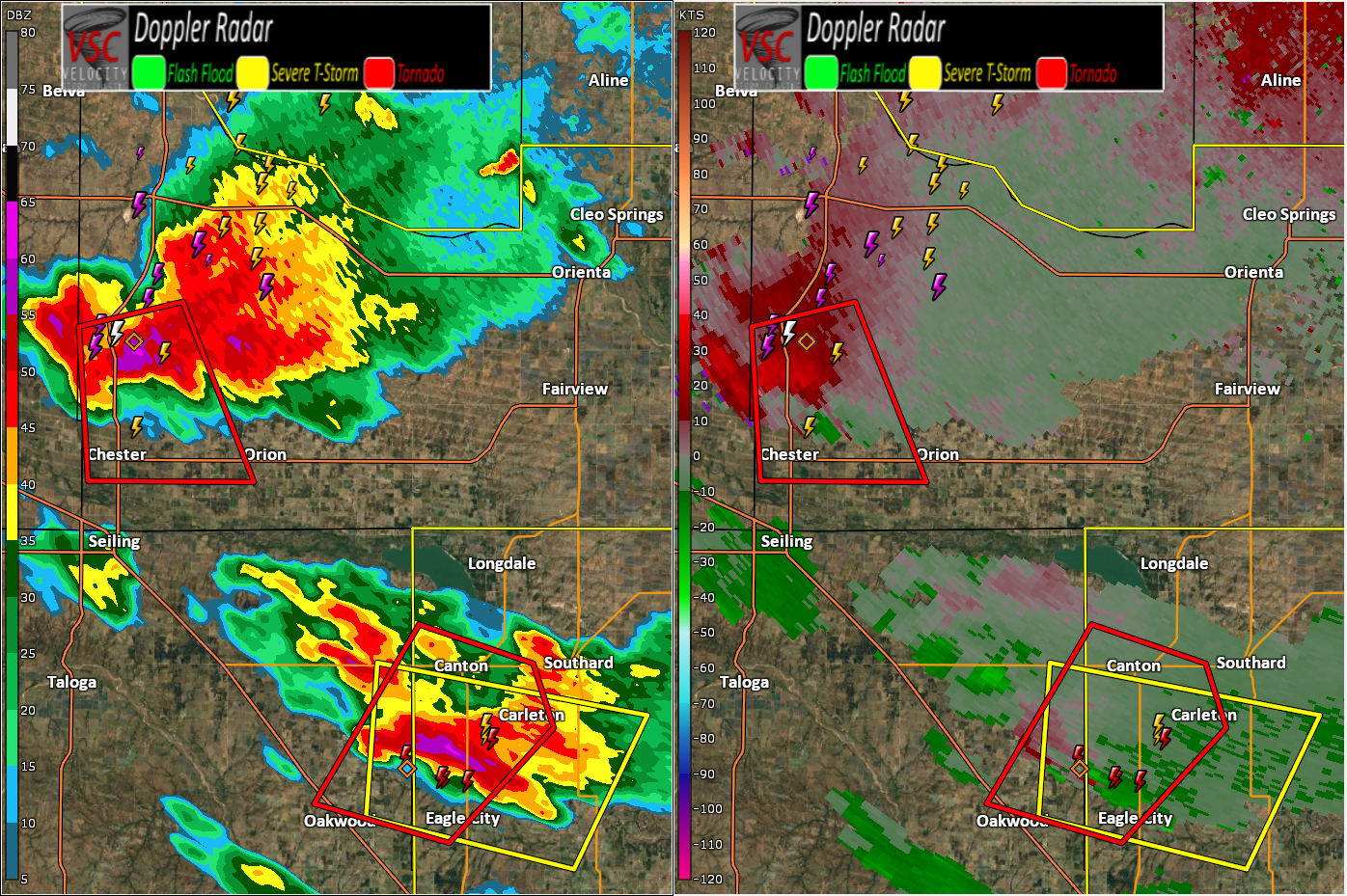
Possible tornado north of Chester, Oklahoma, moving east.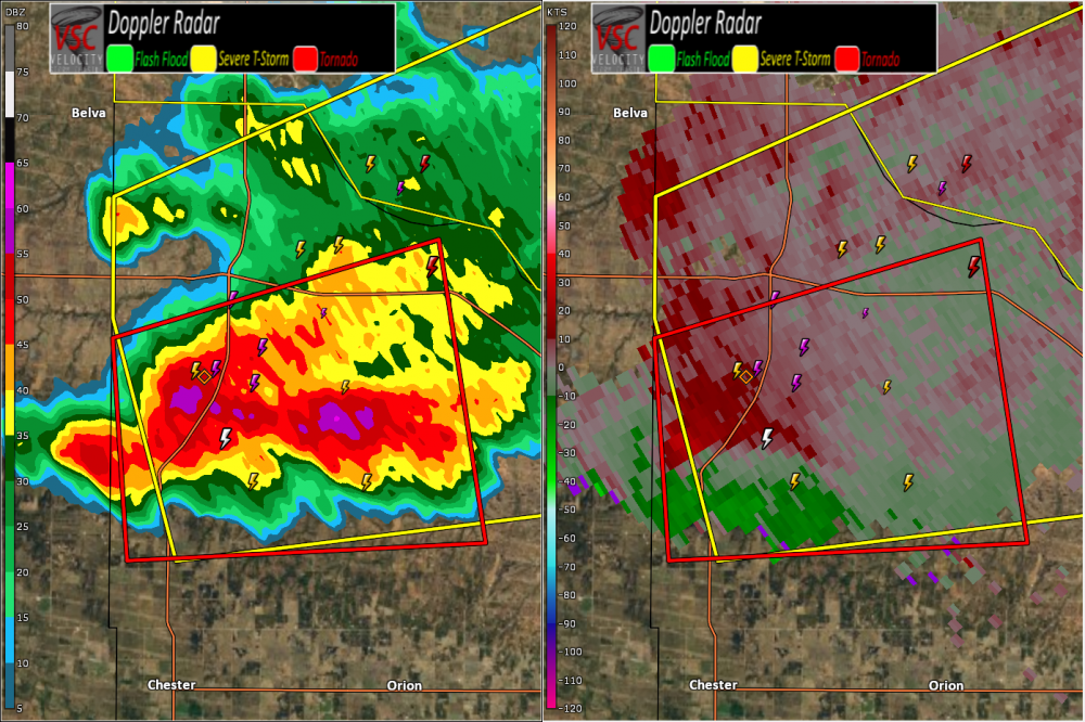
-
Short-Term Severe/Flooding Discussion
Jim Martin replied to Quincy's topic in Central/Western States
Possible tornado NE of Groom, Texas currently.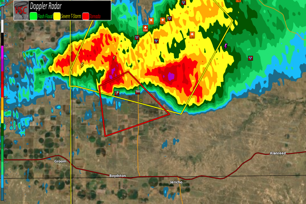
-
Short-Term Severe/Flooding Discussion
Jim Martin replied to Quincy's topic in Central/Western States
Two inch hail reported with this storm. Not much movement to this supercell, yet. -
Short-Term Severe/Flooding Discussion
Jim Martin replied to Quincy's topic in Central/Western States
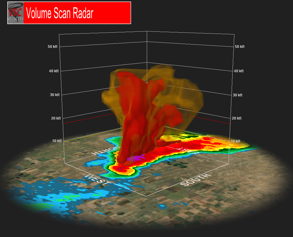
3D look at this storm.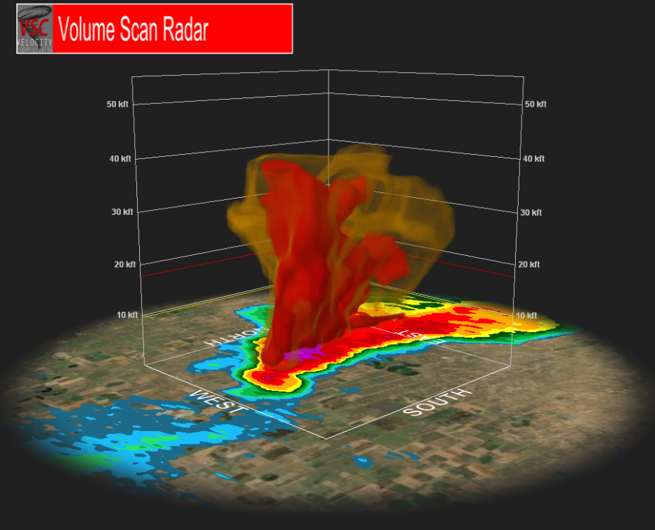
-
Short-Term Severe/Flooding Discussion
Jim Martin replied to Quincy's topic in Central/Western States
Starting to get that look to it.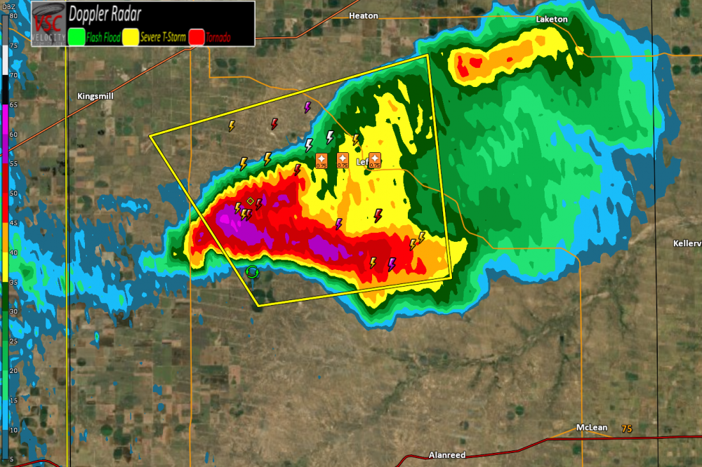
-
Short-Term Severe/Flooding Discussion
Jim Martin replied to Quincy's topic in Central/Western States
Storm is already beginning to split. -
Short-Term Severe/Flooding Discussion
Jim Martin replied to Quincy's topic in Central/Western States
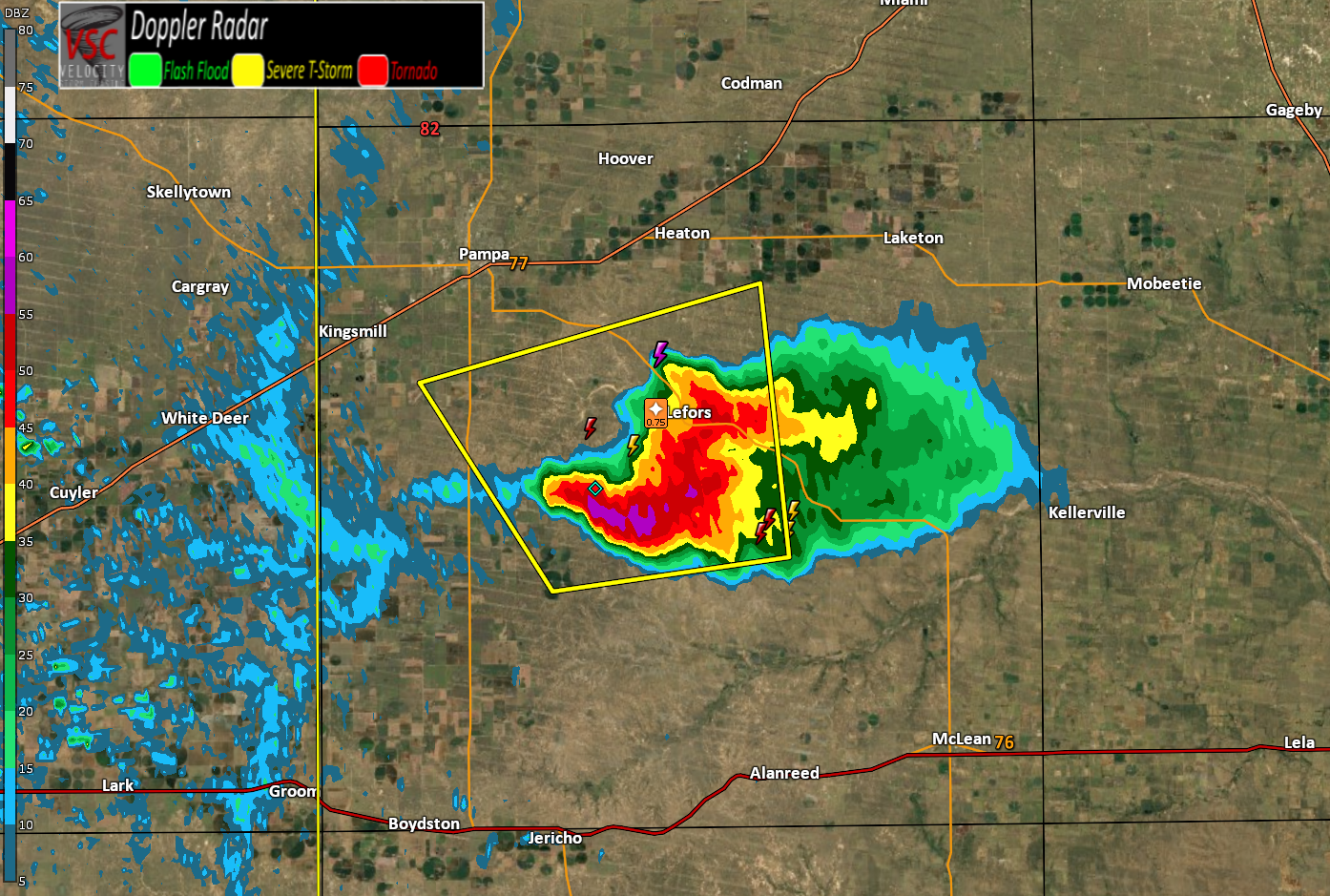
First storm of the day near Lefors, Texas currently. Warned for half dollar size hail and 60 MPH wind.
-
Short-Term Severe/Flooding Discussion
Jim Martin replied to Quincy's topic in Central/Western States
Wind direction today is a bit more favorable. South to southeast. -
Short-Term Severe/Flooding Discussion
Jim Martin replied to Quincy's topic in Central/Western States
-
Short-Term Severe/Flooding Discussion
Jim Martin replied to Quincy's topic in Central/Western States
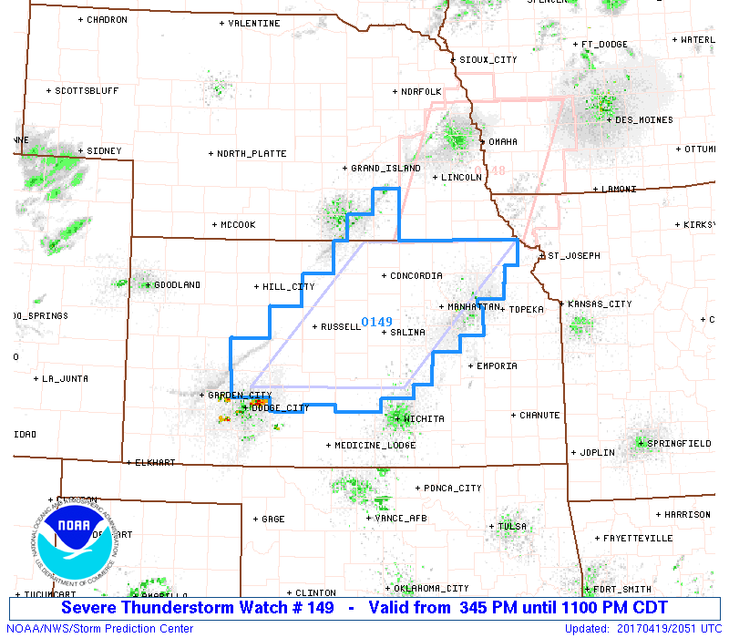
South of Coldwater, Kansas currently.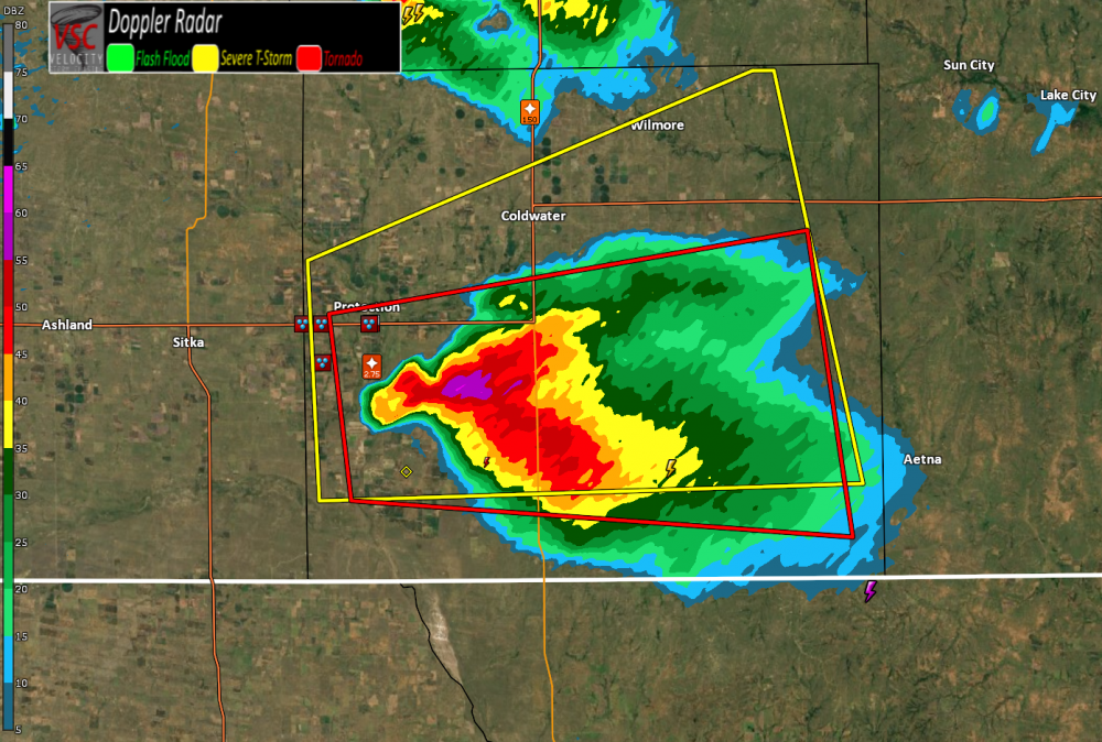
-
Short-Term Severe/Flooding Discussion
Jim Martin replied to Quincy's topic in Central/Western States
Behold.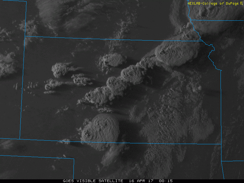
-
Short-Term Severe/Flooding Discussion
Jim Martin replied to Quincy's topic in Central/Western States
Wall cloud being reported with the storm in Comanche County, KS. -
Short-Term Severe/Flooding Discussion
Jim Martin replied to Quincy's topic in Central/Western States
Possible tornado near Watson, Missouri. Storm moving east. Storms are also taking off in S Central KS.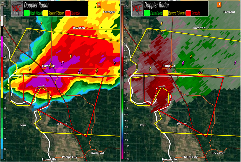
-
Short-Term Severe/Flooding Discussion
Jim Martin replied to Quincy's topic in Central/Western States
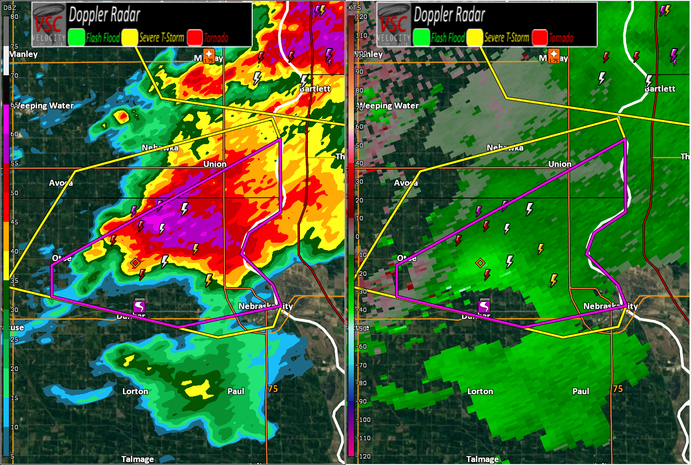
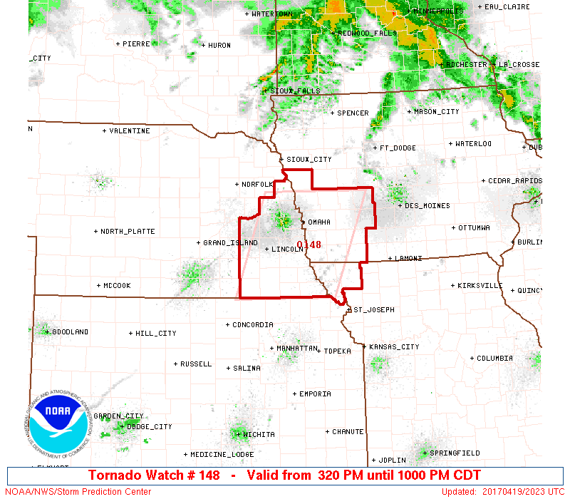
Confirmed tornado (first of the day) near Otoe, Nebraska a short time ago.
-
Short-Term Severe/Flooding Discussion
Jim Martin replied to Quincy's topic in Central/Western States
Some rotation indicated on radar currently near Otoe, Nebraska, south of Omaha. Spotter Network report too of rapidly developing wall cloud with this storm near Otoe.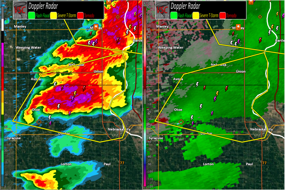
-
Short-Term Severe/Flooding Discussion
Jim Martin replied to Quincy's topic in Central/Western States
Fair enough.